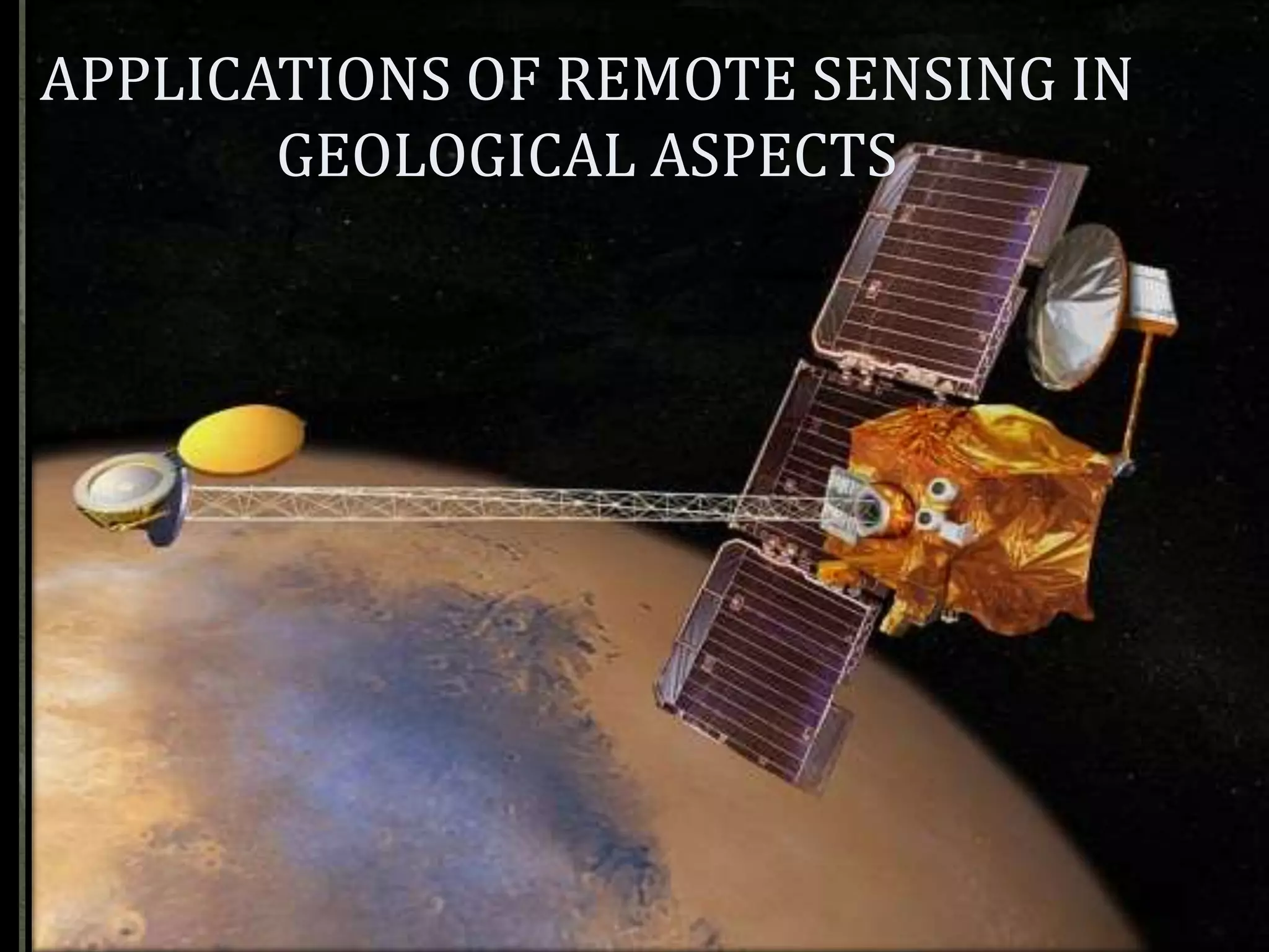
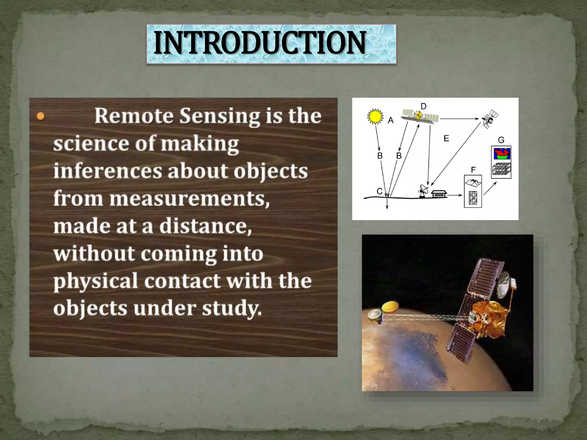
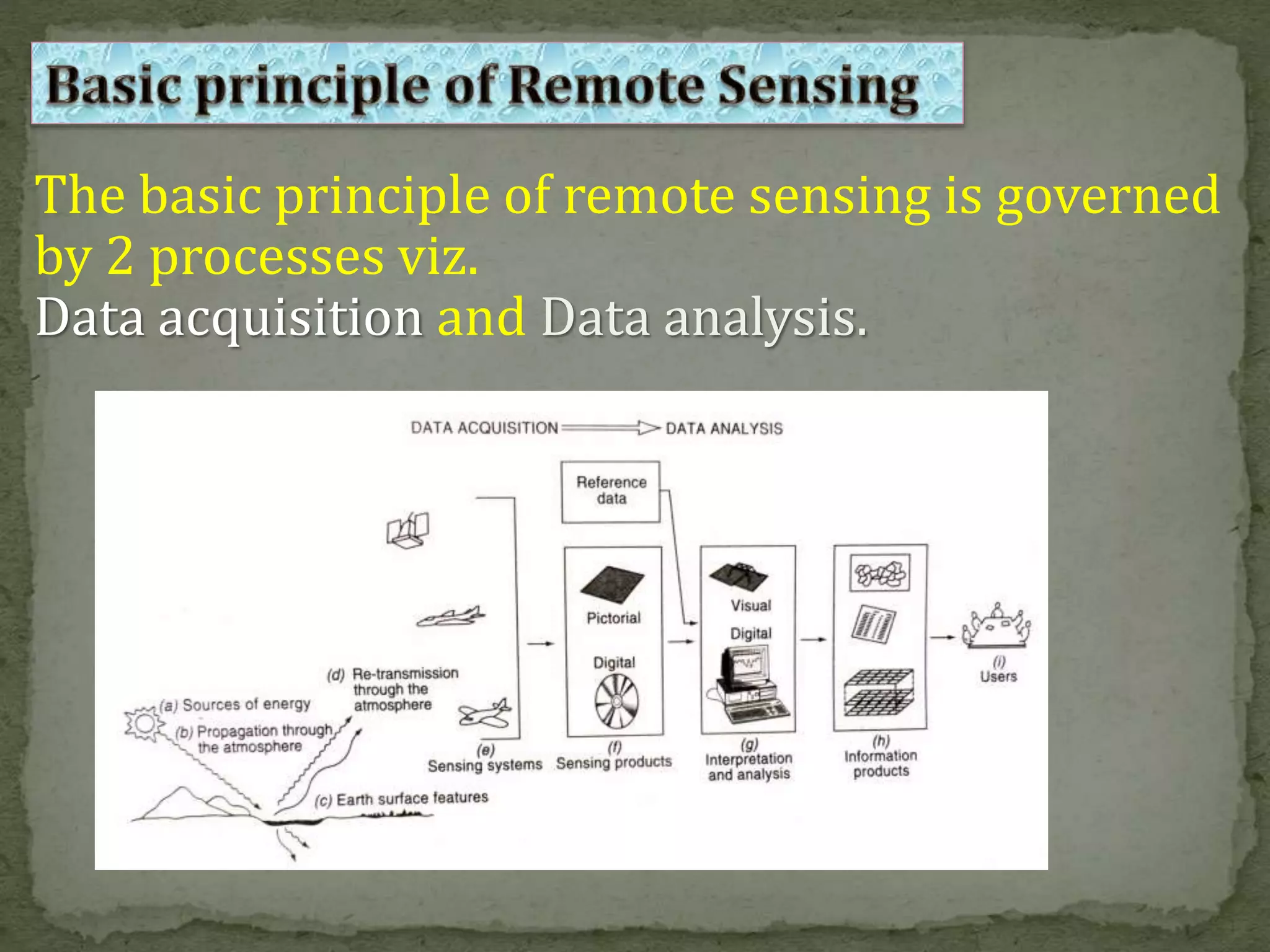
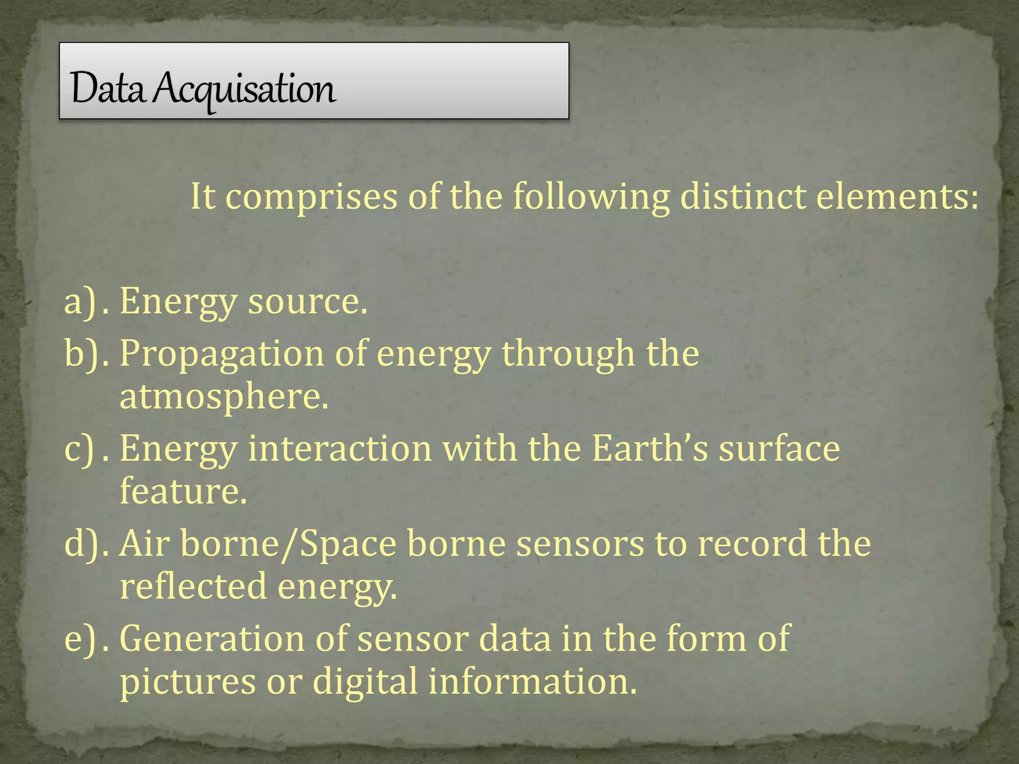
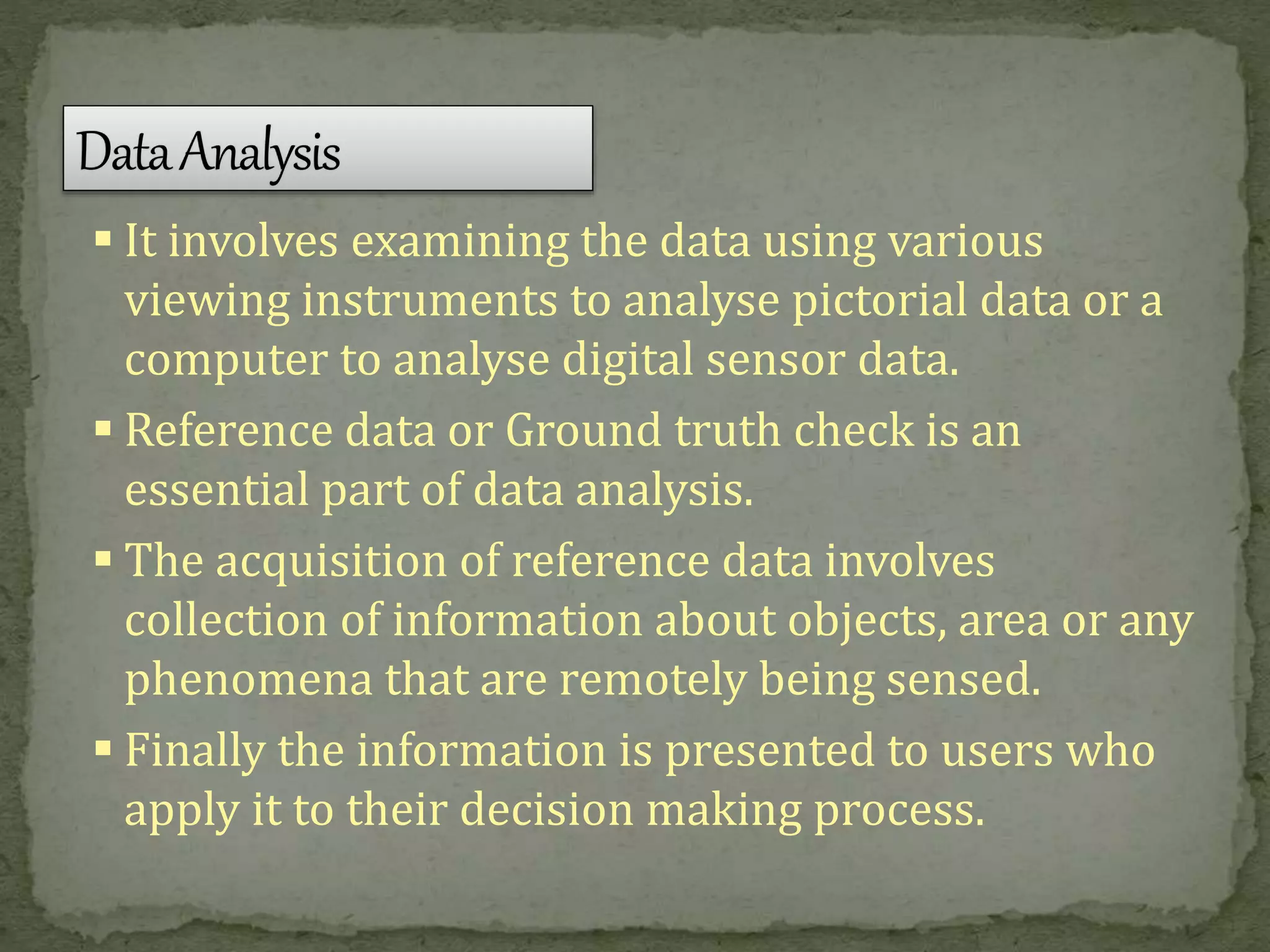
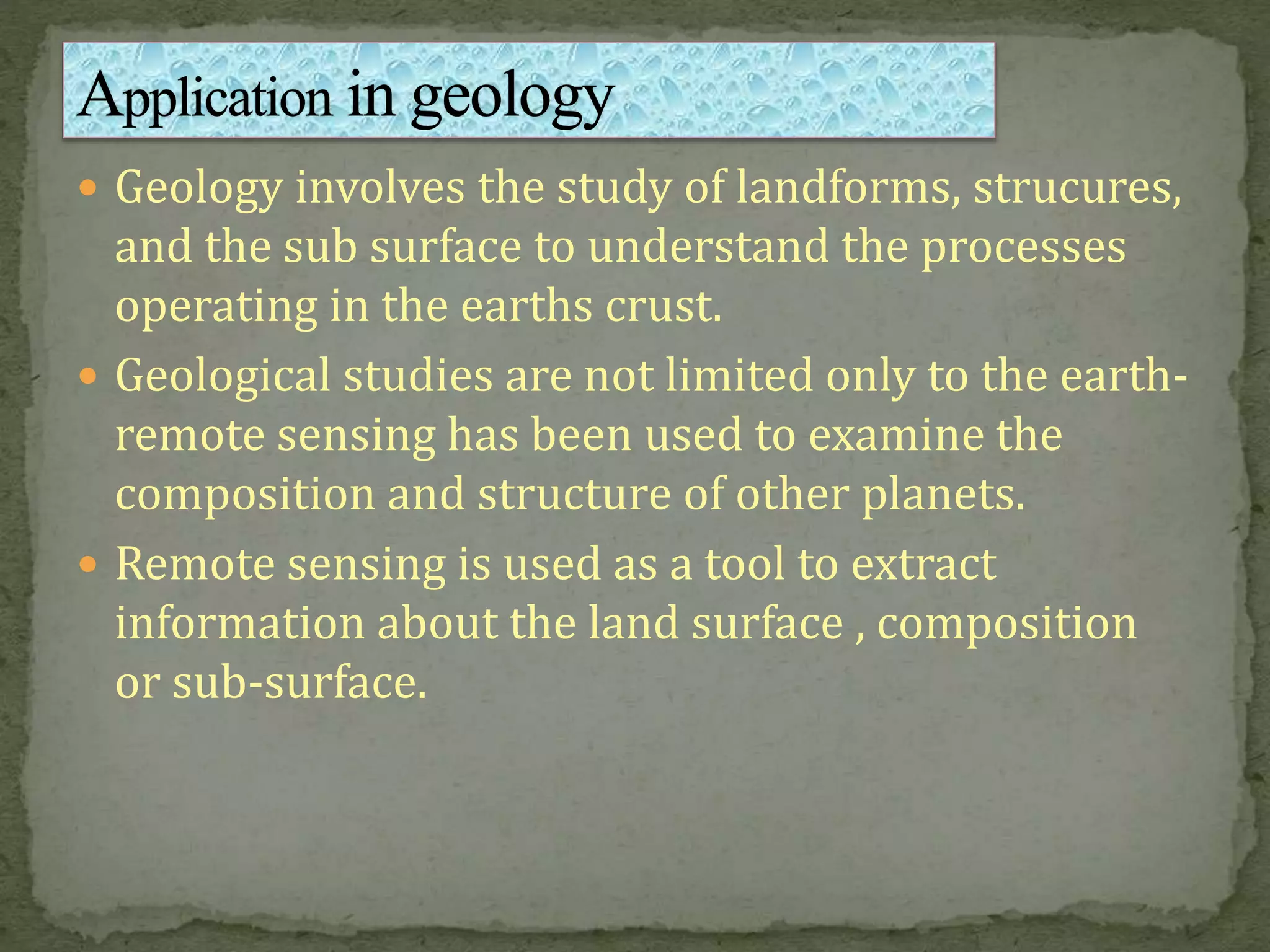
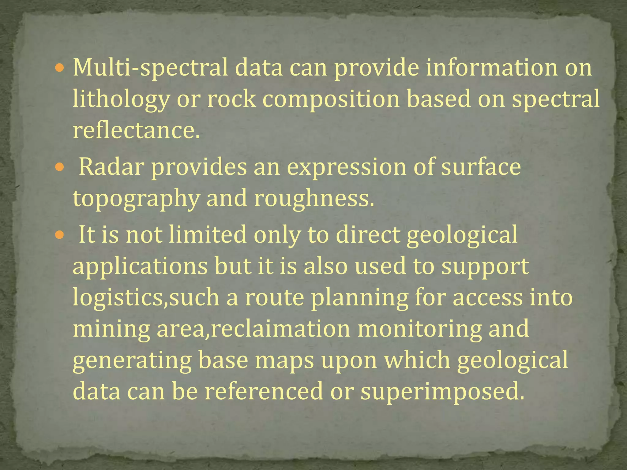
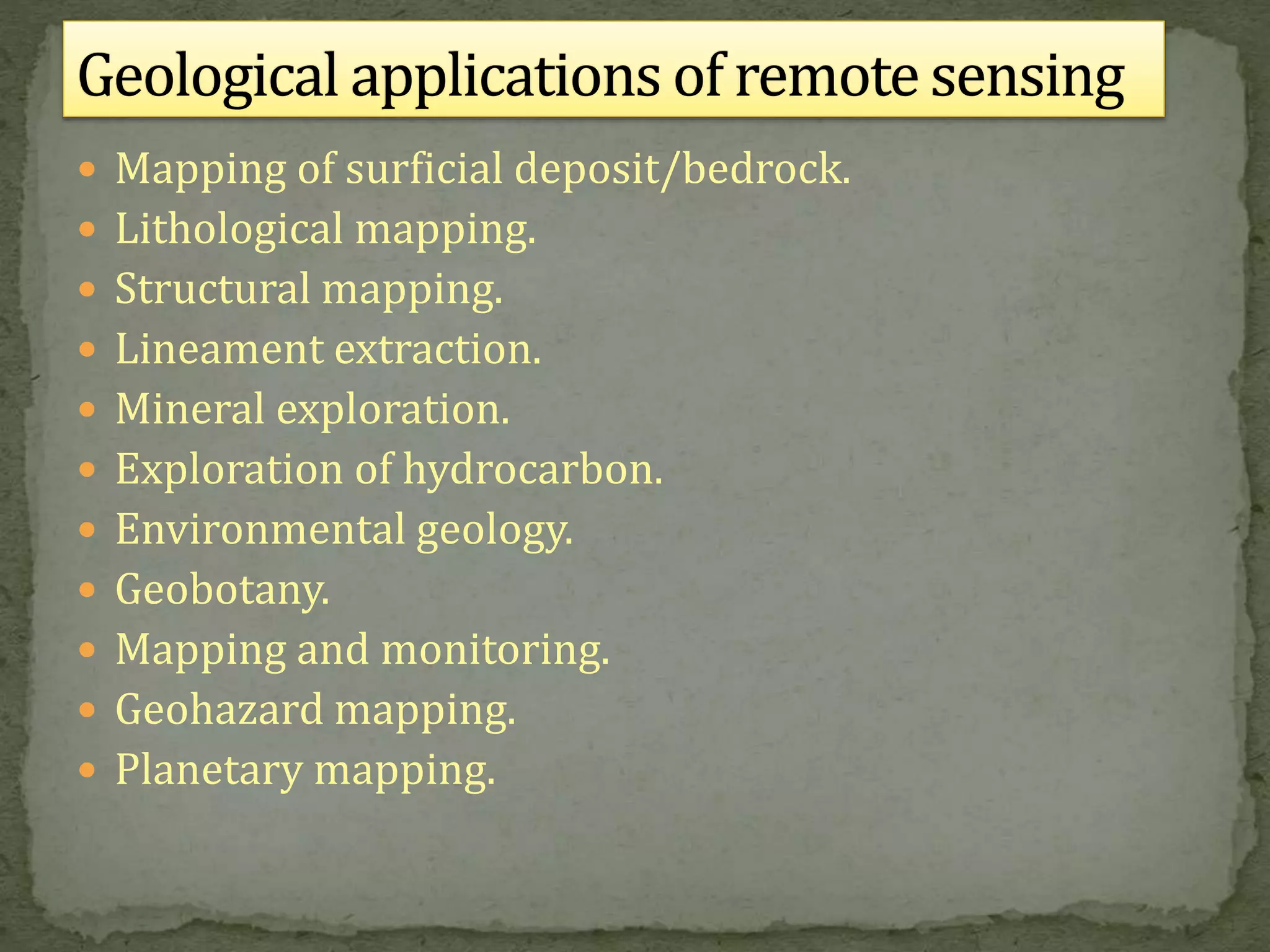
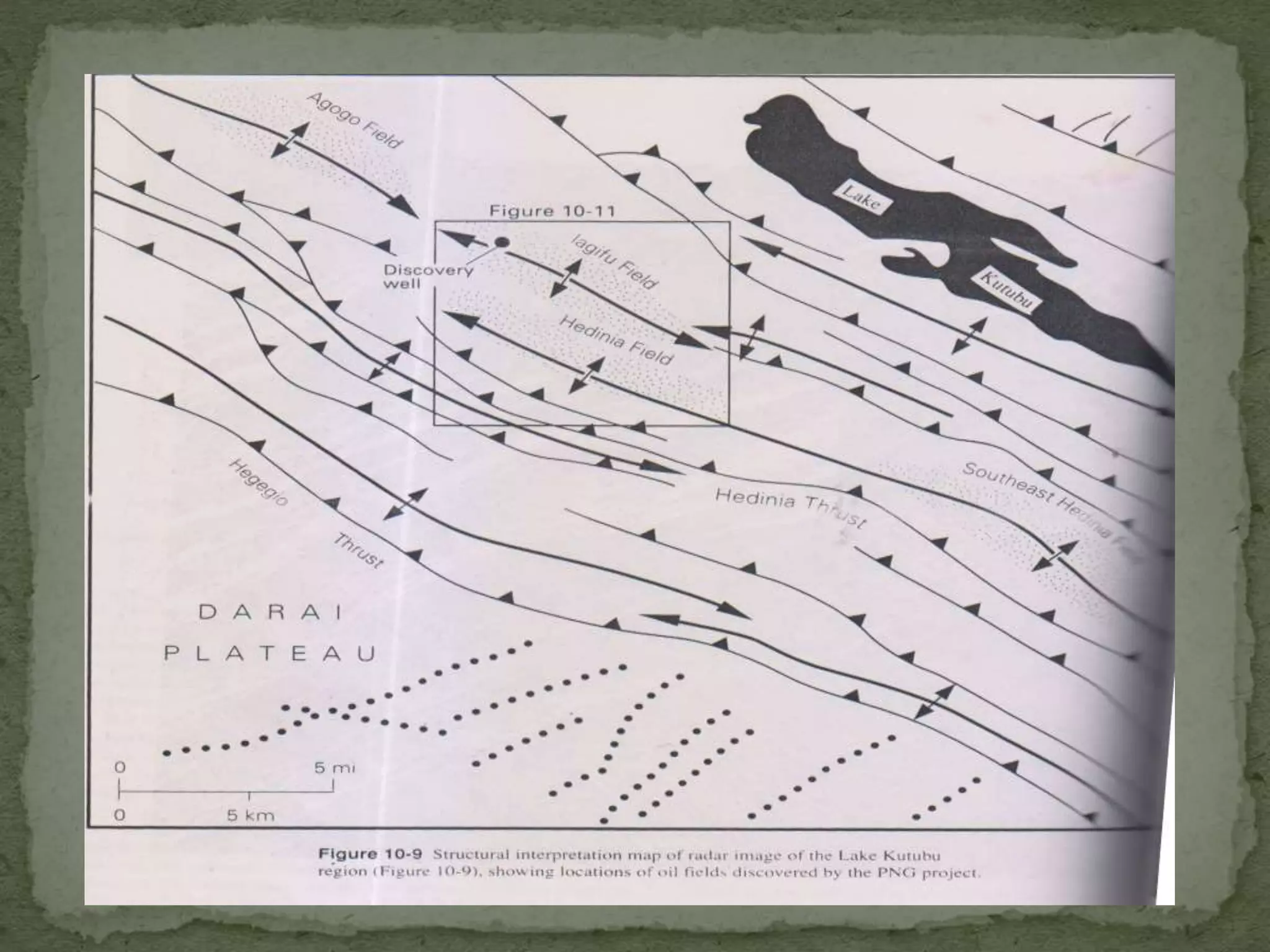
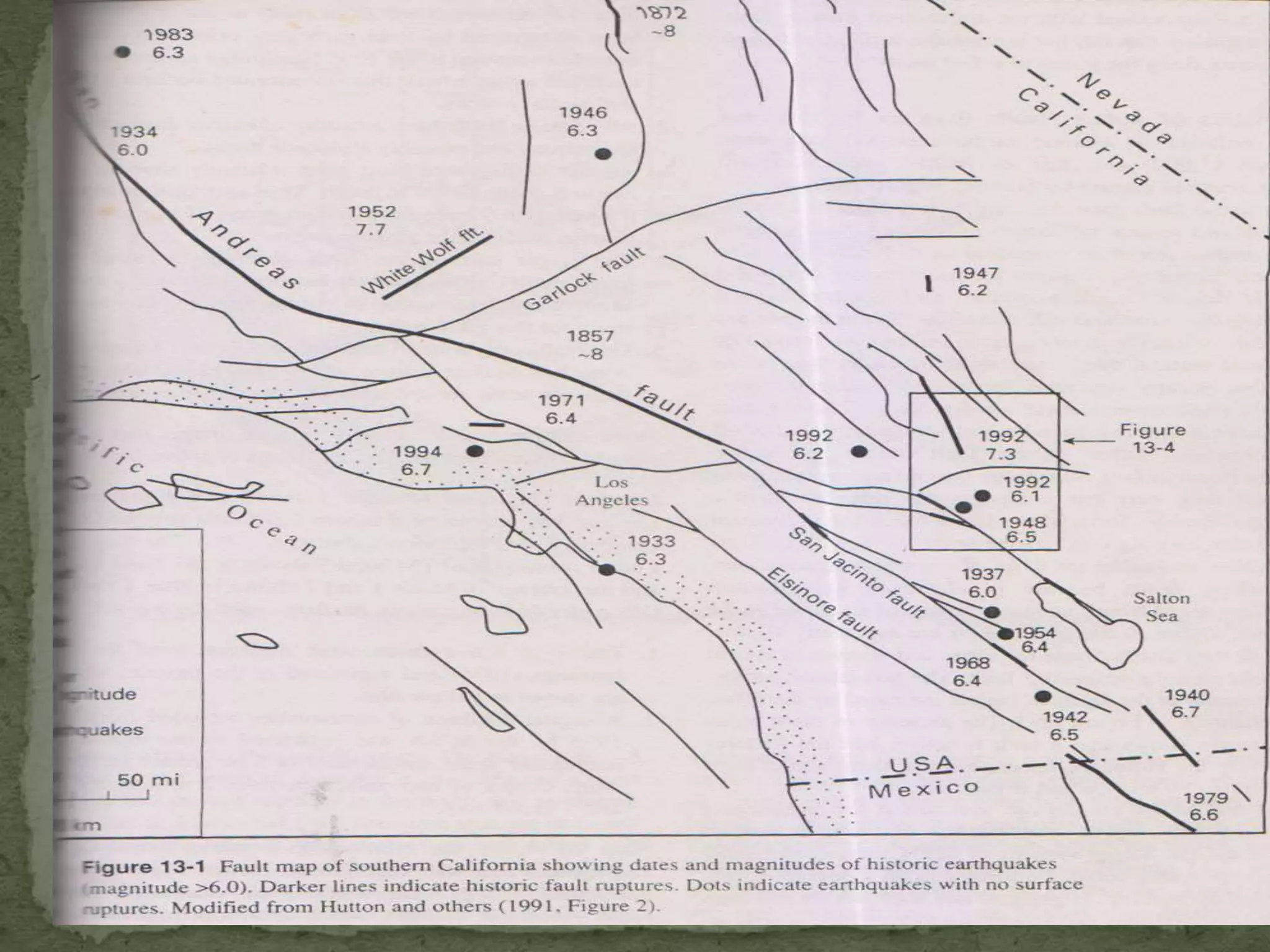
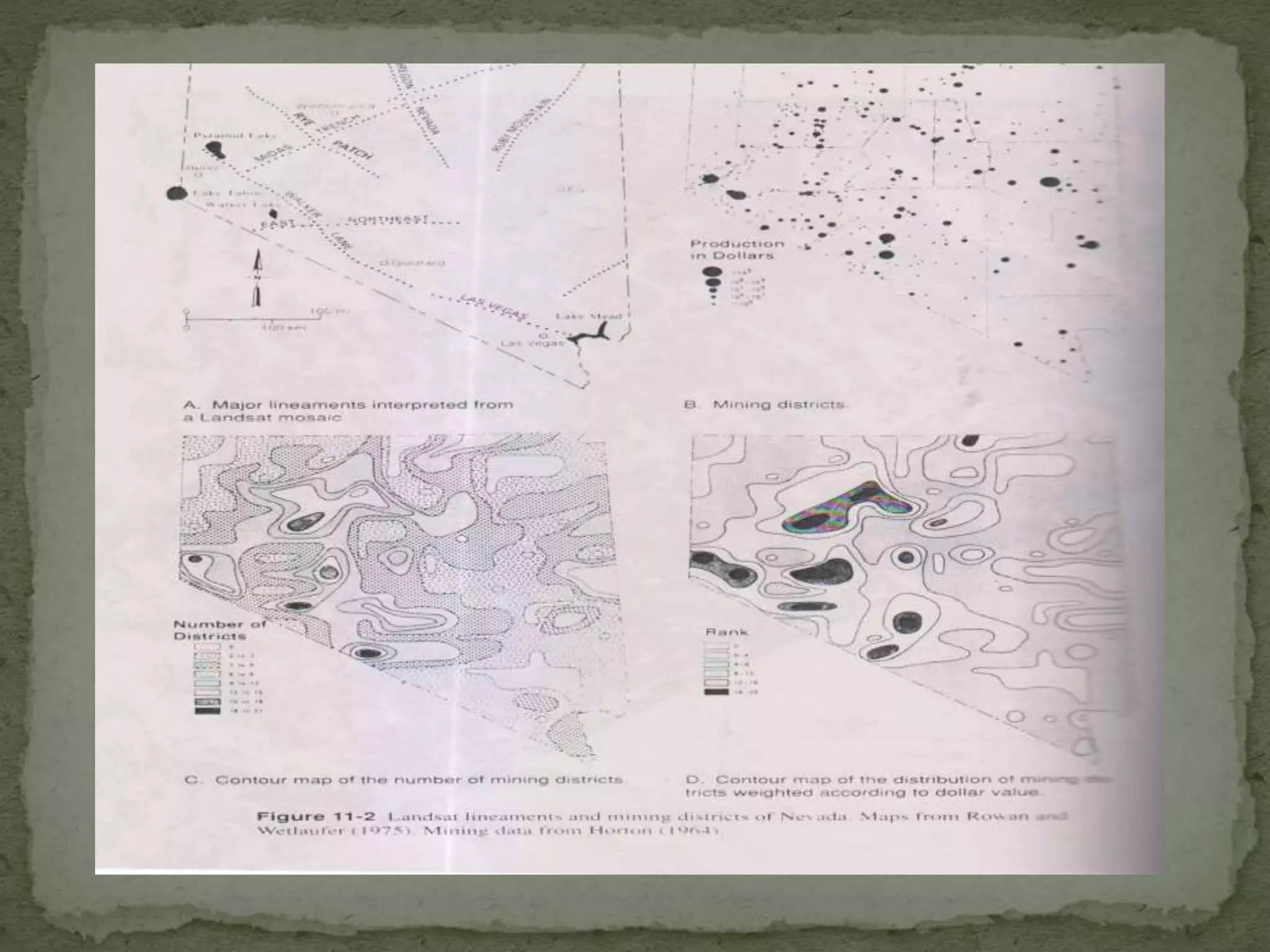
SlideShare a Scribd company logo
1 of 34
Download to read offline
APPLICATIONS OF REMOTE SENSING IN
GEOLOGICAL ASPECTS
Introduction.
Types of Remote Sensing
Basic Principles of Remote
Sensing
Applications in geology
Conclusion
References
INTRODUCTION
 It is defined as the science of:
Acquiring images refers to the technology employed eg
electro-optical scanning system.
Processing refers to the procedures that convert raw
data into images.
Interpreting converts an image information that is useful
for human use
cont…
Remote Sensors are mechanical
devices where informations are stored
or recorded about the object or scene
under study.
They are classified as
Active or Passive
Image or Non-Image forming
Commercial or Military
 Passive Remote Sensing:
 If the observation is made based on the
electromagnetic radiation from the sun or self-
emitted radiance.
 E.g. Photography during daytime with the help of
Sunlight.
 Active Remote Sensing:
It is also possible to produce electromagnetic
radiation of a specific wavelength or band of
wavelength to illuminate the object or terrain. The
interaction of this radiation can then be studied by
sensing the scattered radiance from the target.
E.g. Photography at night with the help of Flash
Light.
 “The vehicle or carrier for remote sensor
is borne is called the Platform.”
 The typical platforms are satellite and
aircraft, but they can also include radio
controlled airplanes, balloons, and kites for low
altitude remote sensing, as well as ladder and
cherry pickers for ground investigation.
 Air borne plat form
 Space borne plat form
 Ground borne plat form
(Cherry-picker with passive microwave
radiometer)
The basic principle of remote sensing is governed
by 2 processes viz.
Data acquisition and Data analysis.
It comprises of the following distinct elements:
a). Energy source.
b). Propagation of energy through the
atmosphere.
c). Energy interaction with the Earth’s surface
feature.
d). Air borne/Space borne sensors to record the
reflected energy.
e). Generation of sensor data in the form of
pictures or digital information.
 It involves examining the data using various
viewing instruments to analyse pictorial data or a
computer to analyse digital sensor data.
 Reference data or Ground truth check is an
essential part of data analysis.
 The acquisition of reference data involves
collection of information about objects, area or any
phenomena that are remotely being sensed.
 Finally the information is presented to users who
apply it to their decision making process.
A. Radiation and the
atmosphere
B. Interaction with target
C. Energy recorded and converted by
sensor
D.Reception and
processing
E.Interpretation and
analysis
A
A
B
D
E
C
12
65
28
33
76
Process of Remote Sensing
The Electromagnetic Spectrum ranges from the shorter
wavelengths (including gamma and x-rays) to the longer
wavelengths (including microwaves and broadcast radio
waves). There are several regions of the electromagnetic
spectrum which are useful for remote sensing.
The light which our eyes can detect is part of the visible
spectrum (small)
There is a lot of radiation around us which is "invisible" to our
eyes, but can be detected by other remote sensing
instruments and used to our advantage
The visible wavelengths cover a range from approximately 0.4
to 0.7 micro meter (violet to red)
There are four forms of interaction that can take place
when energy strikes, or is incident upon the surface:
•Transmission (T): radiation passes through a target
•Reflection (R): radiation "bounces" off the target and is
redirected
•Scattering (S): scattering occurs when incident
electromagnetic radiation is dispersed in all
directions from a rough surface.
•Absorption (A): radiation is absorbed into the target
The proportions of each interaction will depend on
the wavelength of the energy and the material and
condition of the feature.
 Agriculture
 Geology
 Archeology
 Oceanography
 Architecture
 Forestry
 Land-cover and land-use
 Geology involves the study of landforms, strucures,
and the sub surface to understand the processes
operating in the earths crust.
 Geological studies are not limited only to the earth-
remote sensing has been used to examine the
composition and structure of other planets.
 Remote sensing is used as a tool to extract
information about the land surface , composition
or sub-surface.
 Multi-spectral data can provide information on
lithology or rock composition based on spectral
reflectance.
 Radar provides an expression of surface
topography and roughness.
 It is not limited only to direct geological
applications but it is also used to support
logistics,such a route planning for access into
mining area,reclaimation monitoring and
generating base maps upon which geological
data can be referenced or superimposed.
 Mapping of surficial deposit/bedrock.
 Lithological mapping.
 Structural mapping.
 Lineament extraction.
 Mineral exploration.
 Exploration of hydrocarbon.
 Environmental geology.
 Geobotany.
 Mapping and monitoring.
 Geohazard mapping.
 Planetary mapping.
 Structural geology plays an important role in mineral
and hydrocarbon exploration and potential hazard
identification and monitoring.
 Structural mapping is the identification and
characterization of structural expressions.
 Structures can indicate potential location for oil and gas
reserve and provide clues to potential hazards such as
earthquakes landslides and volcanic activities.
 Aerial photos can be used in temperate areas where
large scale imagery is used, particularly to map
potential geohazards.
 Geological Unit Mapping consists primarily identifying
physiographic units and determining the rock lithology
or coarse stratigraphy of exposed units.
 Remote sensing can be used to describe the lithology
by the color, weathering and erosion characteristics,
drainage patterns and thickness of bedding.
 Unit Mapping is useful in oil and mineral exploration
since this resource are often associated with specific
lithologies.
 Regional lineaments and structural trends
along which groups of mining districts may
occur.
 Mapping local fracture patterns that may
control individual ore deposits.
 Detecting hydrothermally altered rocks
associated with ore deposits.
 Providing basic geologic data.
 It deals with different landforms that characterize the
earth’s topography, origin, sequence of evolution,
present status and their future trend.
 Until space age, scientists conducted most geomorphic
analysis by mapping (generally topographic and
geologic) and by field observation and measurements.
 Eventually, aerial photographs became a prime tool for
mapping and interpreting.
 Modern macro-geomorphology makes extensive use of
global observation from space crafts that employs a
variety of imaging and sensing systems. Eg: Vidicon
imaging, multi spectral scanning, radiometers and
Radars.
 Hydrology is inherently related to many other
applications of remote sensing, particularly forestry,
agriculture and land cover.
 Most hydrological processes are dynamic and require
frequent observation.
 Remote Sensing offers a synoptic view of the spatial
distribution and dynamics of hydrological phenomena,
often unattainable by traditional ground surveys
Examples of Hydrological applications:
 Flood delineation and mapping
Remote sensing techniques are used to measure and
monitor the real extent of the flooded areas to
efficiently target rescue efforts and to provide
quantifiable estimates of the amount of land affected.
Incorporating remotely sensed data into a GIS allows
for quick calculation and assessment of water levels,
damage, and areas facing potential flood danger
 Remote Sensing based groundwater prospect zone
map serve as a base for further exploration using
hydrogeological and geophysical methods to locate
well sites.
 If remote sensing data are used at first level to
delineate prospective zones and further follow up by
hydrogeological and geophysical surveys, higher
success could be achieved besides saving in terms of
cost, time and work.
 Remote Sensing data helps in identifying suitable areas
for recharging groundwater.
 Remote Sensing means acquiring information
about an object or phenomenon from a distance,
without actually coming in contact with the object
under study.
 The quantity most frequently used in present day
remote sensing systems is the Electromagnetic
Energy emanating from the object of interest.
 Principally, there are two types of Remote Sensing
viz. Active and Passive Remote sensing.
 It has two phases: Data acquisition phase and Data
analysis phase.
 The underlying principle on which the whole
Remote Sensing technique is developed is that all
objects on the Earth’s surface have characteristic
spectral signatures.
 The applications of Remote Sensing in the Earth’s
science as a whole, especially in Geology is
manifold.
BOOKS:
 A.N. Patel and Surendra Singh, “Principles of Remote
Sensing” Edition-1999, Page No. 1, 27, 113.
Scientific Publishers (India), Jodhpur.
 Basuded bhatta, ”remote sensing and
GIS”2008,2011,oxford university press.
 Flyod F .Sabins, “ remote sensing,principles and
interpretation,1996.3rd edition .
applicationsofremotesensingingeologicalaspects-170606133459.pdf

More Related Content

Similar to applicationsofremotesensingingeologicalaspects-170606133459.pdf

Similar to applicationsofremotesensingingeologicalaspects-170606133459.pdf (20)

G044044249
G044044249G044044249
G044044249
 
APPLICATION OF REMOTE SENSING AND GIS IN AGRICULTURE
APPLICATION OF REMOTE SENSING AND GIS IN AGRICULTUREAPPLICATION OF REMOTE SENSING AND GIS IN AGRICULTURE
APPLICATION OF REMOTE SENSING AND GIS IN AGRICULTURE
 
Remote sensing and tunneling.pptx
Remote sensing and tunneling.pptxRemote sensing and tunneling.pptx
Remote sensing and tunneling.pptx
 
Geoinformatics ppt
Geoinformatics pptGeoinformatics ppt
Geoinformatics ppt
 
Remote sensing 1
Remote sensing 1Remote sensing 1
Remote sensing 1
 
Remote sensing ppt
Remote sensing pptRemote sensing ppt
Remote sensing ppt
 
intro.pptx
intro.pptxintro.pptx
intro.pptx
 
Lec 5, Techniques for data collection.pptx
Lec 5, Techniques for data collection.pptxLec 5, Techniques for data collection.pptx
Lec 5, Techniques for data collection.pptx
 
REMOTE SENSING A VERY USEFUL TECHNOLOGY TO MANKIND
REMOTE SENSING A VERY USEFUL TECHNOLOGY TO MANKINDREMOTE SENSING A VERY USEFUL TECHNOLOGY TO MANKIND
REMOTE SENSING A VERY USEFUL TECHNOLOGY TO MANKIND
 
remote sensing ppt.pptx
remote sensing ppt.pptxremote sensing ppt.pptx
remote sensing ppt.pptx
 
2014_Remote Sensing.pptx
2014_Remote Sensing.pptx2014_Remote Sensing.pptx
2014_Remote Sensing.pptx
 
remote sensing
remote sensingremote sensing
remote sensing
 
GIS VIMAL SUBBU.17.08.2022.pptx
GIS VIMAL SUBBU.17.08.2022.pptxGIS VIMAL SUBBU.17.08.2022.pptx
GIS VIMAL SUBBU.17.08.2022.pptx
 
Remote sensing
Remote sensingRemote sensing
Remote sensing
 
Ch 5 b remote sensing
Ch 5 b remote sensingCh 5 b remote sensing
Ch 5 b remote sensing
 
Remote sensing
Remote sensingRemote sensing
Remote sensing
 
Remote sensing by Priyanshu kumar, 9608684800
Remote sensing by Priyanshu kumar, 9608684800Remote sensing by Priyanshu kumar, 9608684800
Remote sensing by Priyanshu kumar, 9608684800
 
remote sensing
remote sensingremote sensing
remote sensing
 
35001320006_Saraswati Mahato_Remote sensing and gis_ca 1_2024_even.pdf
35001320006_Saraswati Mahato_Remote sensing and gis_ca 1_2024_even.pdf35001320006_Saraswati Mahato_Remote sensing and gis_ca 1_2024_even.pdf
35001320006_Saraswati Mahato_Remote sensing and gis_ca 1_2024_even.pdf
 
Remort sensing
Remort sensingRemort sensing
Remort sensing
 

Recently uploaded

Software Development Life Cycle By Team Orange (Dept. of Pharmacy)
Software Development Life Cycle By  Team Orange (Dept. of Pharmacy)Software Development Life Cycle By  Team Orange (Dept. of Pharmacy)
Software Development Life Cycle By Team Orange (Dept. of Pharmacy)Suman Mia
 
OSVC_Meta-Data based Simulation Automation to overcome Verification Challenge...
OSVC_Meta-Data based Simulation Automation to overcome Verification Challenge...OSVC_Meta-Data based Simulation Automation to overcome Verification Challenge...
OSVC_Meta-Data based Simulation Automation to overcome Verification Challenge...Soham Mondal
 
(ANVI) Koregaon Park Call Girls Just Call 7001035870 [ Cash on Delivery ] Pun...
(ANVI) Koregaon Park Call Girls Just Call 7001035870 [ Cash on Delivery ] Pun...(ANVI) Koregaon Park Call Girls Just Call 7001035870 [ Cash on Delivery ] Pun...
(ANVI) Koregaon Park Call Girls Just Call 7001035870 [ Cash on Delivery ] Pun...ranjana rawat
 
(SHREYA) Chakan Call Girls Just Call 7001035870 [ Cash on Delivery ] Pune Esc...
(SHREYA) Chakan Call Girls Just Call 7001035870 [ Cash on Delivery ] Pune Esc...(SHREYA) Chakan Call Girls Just Call 7001035870 [ Cash on Delivery ] Pune Esc...
(SHREYA) Chakan Call Girls Just Call 7001035870 [ Cash on Delivery ] Pune Esc...ranjana rawat
 
Gfe Mayur Vihar Call Girls Service WhatsApp -> 9999965857 Available 24x7 ^ De...
Gfe Mayur Vihar Call Girls Service WhatsApp -> 9999965857 Available 24x7 ^ De...Gfe Mayur Vihar Call Girls Service WhatsApp -> 9999965857 Available 24x7 ^ De...
Gfe Mayur Vihar Call Girls Service WhatsApp -> 9999965857 Available 24x7 ^ De...srsj9000
 
The Most Attractive Pune Call Girls Budhwar Peth 8250192130 Will You Miss Thi...
The Most Attractive Pune Call Girls Budhwar Peth 8250192130 Will You Miss Thi...The Most Attractive Pune Call Girls Budhwar Peth 8250192130 Will You Miss Thi...
The Most Attractive Pune Call Girls Budhwar Peth 8250192130 Will You Miss Thi...ranjana rawat
 
Call Girls Service Nagpur Tanvi Call 7001035870 Meet With Nagpur Escorts
Call Girls Service Nagpur Tanvi Call 7001035870 Meet With Nagpur EscortsCall Girls Service Nagpur Tanvi Call 7001035870 Meet With Nagpur Escorts
Call Girls Service Nagpur Tanvi Call 7001035870 Meet With Nagpur EscortsCall Girls in Nagpur High Profile
 
GDSC ASEB Gen AI study jams presentation
GDSC ASEB Gen AI study jams presentationGDSC ASEB Gen AI study jams presentation
GDSC ASEB Gen AI study jams presentationGDSCAESB
 
the ladakh protest in leh ladakh 2024 sonam wangchuk.pptx
the ladakh protest in leh ladakh 2024 sonam wangchuk.pptxthe ladakh protest in leh ladakh 2024 sonam wangchuk.pptx
the ladakh protest in leh ladakh 2024 sonam wangchuk.pptxhumanexperienceaaa
 
VIP Call Girls Service Kondapur Hyderabad Call +91-8250192130
VIP Call Girls Service Kondapur Hyderabad Call +91-8250192130VIP Call Girls Service Kondapur Hyderabad Call +91-8250192130
VIP Call Girls Service Kondapur Hyderabad Call +91-8250192130Suhani Kapoor
 
High Profile Call Girls Nagpur Meera Call 7001035870 Meet With Nagpur Escorts
High Profile Call Girls Nagpur Meera Call 7001035870 Meet With Nagpur EscortsHigh Profile Call Girls Nagpur Meera Call 7001035870 Meet With Nagpur Escorts
High Profile Call Girls Nagpur Meera Call 7001035870 Meet With Nagpur EscortsCall Girls in Nagpur High Profile
 
Extrusion Processes and Their Limitations
Extrusion Processes and Their LimitationsExtrusion Processes and Their Limitations
Extrusion Processes and Their Limitations120cr0395
 
Coefficient of Thermal Expansion and their Importance.pptx
Coefficient of Thermal Expansion and their Importance.pptxCoefficient of Thermal Expansion and their Importance.pptx
Coefficient of Thermal Expansion and their Importance.pptxAsutosh Ranjan
 
Model Call Girl in Narela Delhi reach out to us at 🔝8264348440🔝
Model Call Girl in Narela Delhi reach out to us at 🔝8264348440🔝Model Call Girl in Narela Delhi reach out to us at 🔝8264348440🔝
Model Call Girl in Narela Delhi reach out to us at 🔝8264348440🔝soniya singh
 
Porous Ceramics seminar and technical writing
Porous Ceramics seminar and technical writingPorous Ceramics seminar and technical writing
Porous Ceramics seminar and technical writingrakeshbaidya232001
 
APPLICATIONS-AC/DC DRIVES-OPERATING CHARACTERISTICS
APPLICATIONS-AC/DC DRIVES-OPERATING CHARACTERISTICSAPPLICATIONS-AC/DC DRIVES-OPERATING CHARACTERISTICS
APPLICATIONS-AC/DC DRIVES-OPERATING CHARACTERISTICSKurinjimalarL3
 
(MEERA) Dapodi Call Girls Just Call 7001035870 [ Cash on Delivery ] Pune Escorts
(MEERA) Dapodi Call Girls Just Call 7001035870 [ Cash on Delivery ] Pune Escorts(MEERA) Dapodi Call Girls Just Call 7001035870 [ Cash on Delivery ] Pune Escorts
(MEERA) Dapodi Call Girls Just Call 7001035870 [ Cash on Delivery ] Pune Escortsranjana rawat
 
Processing & Properties of Floor and Wall Tiles.pptx
Processing & Properties of Floor and Wall Tiles.pptxProcessing & Properties of Floor and Wall Tiles.pptx
Processing & Properties of Floor and Wall Tiles.pptxpranjaldaimarysona
 
(RIA) Call Girls Bhosari ( 7001035870 ) HI-Fi Pune Escorts Service
(RIA) Call Girls Bhosari ( 7001035870 ) HI-Fi Pune Escorts Service(RIA) Call Girls Bhosari ( 7001035870 ) HI-Fi Pune Escorts Service
(RIA) Call Girls Bhosari ( 7001035870 ) HI-Fi Pune Escorts Serviceranjana rawat
 
(PRIYA) Rajgurunagar Call Girls Just Call 7001035870 [ Cash on Delivery ] Pun...
(PRIYA) Rajgurunagar Call Girls Just Call 7001035870 [ Cash on Delivery ] Pun...(PRIYA) Rajgurunagar Call Girls Just Call 7001035870 [ Cash on Delivery ] Pun...
(PRIYA) Rajgurunagar Call Girls Just Call 7001035870 [ Cash on Delivery ] Pun...ranjana rawat
 

Recently uploaded (20)

Software Development Life Cycle By Team Orange (Dept. of Pharmacy)
Software Development Life Cycle By  Team Orange (Dept. of Pharmacy)Software Development Life Cycle By  Team Orange (Dept. of Pharmacy)
Software Development Life Cycle By Team Orange (Dept. of Pharmacy)
 
OSVC_Meta-Data based Simulation Automation to overcome Verification Challenge...
OSVC_Meta-Data based Simulation Automation to overcome Verification Challenge...OSVC_Meta-Data based Simulation Automation to overcome Verification Challenge...
OSVC_Meta-Data based Simulation Automation to overcome Verification Challenge...
 
(ANVI) Koregaon Park Call Girls Just Call 7001035870 [ Cash on Delivery ] Pun...
(ANVI) Koregaon Park Call Girls Just Call 7001035870 [ Cash on Delivery ] Pun...(ANVI) Koregaon Park Call Girls Just Call 7001035870 [ Cash on Delivery ] Pun...
(ANVI) Koregaon Park Call Girls Just Call 7001035870 [ Cash on Delivery ] Pun...
 
(SHREYA) Chakan Call Girls Just Call 7001035870 [ Cash on Delivery ] Pune Esc...
(SHREYA) Chakan Call Girls Just Call 7001035870 [ Cash on Delivery ] Pune Esc...(SHREYA) Chakan Call Girls Just Call 7001035870 [ Cash on Delivery ] Pune Esc...
(SHREYA) Chakan Call Girls Just Call 7001035870 [ Cash on Delivery ] Pune Esc...
 
Gfe Mayur Vihar Call Girls Service WhatsApp -> 9999965857 Available 24x7 ^ De...
Gfe Mayur Vihar Call Girls Service WhatsApp -> 9999965857 Available 24x7 ^ De...Gfe Mayur Vihar Call Girls Service WhatsApp -> 9999965857 Available 24x7 ^ De...
Gfe Mayur Vihar Call Girls Service WhatsApp -> 9999965857 Available 24x7 ^ De...
 
The Most Attractive Pune Call Girls Budhwar Peth 8250192130 Will You Miss Thi...
The Most Attractive Pune Call Girls Budhwar Peth 8250192130 Will You Miss Thi...The Most Attractive Pune Call Girls Budhwar Peth 8250192130 Will You Miss Thi...
The Most Attractive Pune Call Girls Budhwar Peth 8250192130 Will You Miss Thi...
 
Call Girls Service Nagpur Tanvi Call 7001035870 Meet With Nagpur Escorts
Call Girls Service Nagpur Tanvi Call 7001035870 Meet With Nagpur EscortsCall Girls Service Nagpur Tanvi Call 7001035870 Meet With Nagpur Escorts
Call Girls Service Nagpur Tanvi Call 7001035870 Meet With Nagpur Escorts
 
GDSC ASEB Gen AI study jams presentation
GDSC ASEB Gen AI study jams presentationGDSC ASEB Gen AI study jams presentation
GDSC ASEB Gen AI study jams presentation
 
the ladakh protest in leh ladakh 2024 sonam wangchuk.pptx
the ladakh protest in leh ladakh 2024 sonam wangchuk.pptxthe ladakh protest in leh ladakh 2024 sonam wangchuk.pptx
the ladakh protest in leh ladakh 2024 sonam wangchuk.pptx
 
VIP Call Girls Service Kondapur Hyderabad Call +91-8250192130
VIP Call Girls Service Kondapur Hyderabad Call +91-8250192130VIP Call Girls Service Kondapur Hyderabad Call +91-8250192130
VIP Call Girls Service Kondapur Hyderabad Call +91-8250192130
 
High Profile Call Girls Nagpur Meera Call 7001035870 Meet With Nagpur Escorts
High Profile Call Girls Nagpur Meera Call 7001035870 Meet With Nagpur EscortsHigh Profile Call Girls Nagpur Meera Call 7001035870 Meet With Nagpur Escorts
High Profile Call Girls Nagpur Meera Call 7001035870 Meet With Nagpur Escorts
 
Extrusion Processes and Their Limitations
Extrusion Processes and Their LimitationsExtrusion Processes and Their Limitations
Extrusion Processes and Their Limitations
 
Coefficient of Thermal Expansion and their Importance.pptx
Coefficient of Thermal Expansion and their Importance.pptxCoefficient of Thermal Expansion and their Importance.pptx
Coefficient of Thermal Expansion and their Importance.pptx
 
Model Call Girl in Narela Delhi reach out to us at 🔝8264348440🔝
Model Call Girl in Narela Delhi reach out to us at 🔝8264348440🔝Model Call Girl in Narela Delhi reach out to us at 🔝8264348440🔝
Model Call Girl in Narela Delhi reach out to us at 🔝8264348440🔝
 
Porous Ceramics seminar and technical writing
Porous Ceramics seminar and technical writingPorous Ceramics seminar and technical writing
Porous Ceramics seminar and technical writing
 
APPLICATIONS-AC/DC DRIVES-OPERATING CHARACTERISTICS
APPLICATIONS-AC/DC DRIVES-OPERATING CHARACTERISTICSAPPLICATIONS-AC/DC DRIVES-OPERATING CHARACTERISTICS
APPLICATIONS-AC/DC DRIVES-OPERATING CHARACTERISTICS
 
(MEERA) Dapodi Call Girls Just Call 7001035870 [ Cash on Delivery ] Pune Escorts
(MEERA) Dapodi Call Girls Just Call 7001035870 [ Cash on Delivery ] Pune Escorts(MEERA) Dapodi Call Girls Just Call 7001035870 [ Cash on Delivery ] Pune Escorts
(MEERA) Dapodi Call Girls Just Call 7001035870 [ Cash on Delivery ] Pune Escorts
 
Processing & Properties of Floor and Wall Tiles.pptx
Processing & Properties of Floor and Wall Tiles.pptxProcessing & Properties of Floor and Wall Tiles.pptx
Processing & Properties of Floor and Wall Tiles.pptx
 
(RIA) Call Girls Bhosari ( 7001035870 ) HI-Fi Pune Escorts Service
(RIA) Call Girls Bhosari ( 7001035870 ) HI-Fi Pune Escorts Service(RIA) Call Girls Bhosari ( 7001035870 ) HI-Fi Pune Escorts Service
(RIA) Call Girls Bhosari ( 7001035870 ) HI-Fi Pune Escorts Service
 
(PRIYA) Rajgurunagar Call Girls Just Call 7001035870 [ Cash on Delivery ] Pun...
(PRIYA) Rajgurunagar Call Girls Just Call 7001035870 [ Cash on Delivery ] Pun...(PRIYA) Rajgurunagar Call Girls Just Call 7001035870 [ Cash on Delivery ] Pun...
(PRIYA) Rajgurunagar Call Girls Just Call 7001035870 [ Cash on Delivery ] Pun...
 

applicationsofremotesensingingeologicalaspects-170606133459.pdf

  • 1. APPLICATIONS OF REMOTE SENSING IN GEOLOGICAL ASPECTS
  • 2. Introduction. Types of Remote Sensing Basic Principles of Remote Sensing Applications in geology Conclusion References
  • 4.  It is defined as the science of: Acquiring images refers to the technology employed eg electro-optical scanning system. Processing refers to the procedures that convert raw data into images. Interpreting converts an image information that is useful for human use cont…
  • 5. Remote Sensors are mechanical devices where informations are stored or recorded about the object or scene under study. They are classified as Active or Passive Image or Non-Image forming Commercial or Military
  • 6.  Passive Remote Sensing:  If the observation is made based on the electromagnetic radiation from the sun or self- emitted radiance.  E.g. Photography during daytime with the help of Sunlight.
  • 7.  Active Remote Sensing: It is also possible to produce electromagnetic radiation of a specific wavelength or band of wavelength to illuminate the object or terrain. The interaction of this radiation can then be studied by sensing the scattered radiance from the target. E.g. Photography at night with the help of Flash Light.
  • 8.  “The vehicle or carrier for remote sensor is borne is called the Platform.”  The typical platforms are satellite and aircraft, but they can also include radio controlled airplanes, balloons, and kites for low altitude remote sensing, as well as ladder and cherry pickers for ground investigation.
  • 9.  Air borne plat form  Space borne plat form  Ground borne plat form (Cherry-picker with passive microwave radiometer)
  • 10. The basic principle of remote sensing is governed by 2 processes viz. Data acquisition and Data analysis.
  • 11. It comprises of the following distinct elements: a). Energy source. b). Propagation of energy through the atmosphere. c). Energy interaction with the Earth’s surface feature. d). Air borne/Space borne sensors to record the reflected energy. e). Generation of sensor data in the form of pictures or digital information.
  • 12.  It involves examining the data using various viewing instruments to analyse pictorial data or a computer to analyse digital sensor data.  Reference data or Ground truth check is an essential part of data analysis.  The acquisition of reference data involves collection of information about objects, area or any phenomena that are remotely being sensed.  Finally the information is presented to users who apply it to their decision making process.
  • 13. A. Radiation and the atmosphere B. Interaction with target C. Energy recorded and converted by sensor D.Reception and processing E.Interpretation and analysis A A B D E C 12 65 28 33 76 Process of Remote Sensing
  • 14. The Electromagnetic Spectrum ranges from the shorter wavelengths (including gamma and x-rays) to the longer wavelengths (including microwaves and broadcast radio waves). There are several regions of the electromagnetic spectrum which are useful for remote sensing. The light which our eyes can detect is part of the visible spectrum (small) There is a lot of radiation around us which is "invisible" to our eyes, but can be detected by other remote sensing instruments and used to our advantage The visible wavelengths cover a range from approximately 0.4 to 0.7 micro meter (violet to red)
  • 15.
  • 16. There are four forms of interaction that can take place when energy strikes, or is incident upon the surface: •Transmission (T): radiation passes through a target •Reflection (R): radiation "bounces" off the target and is redirected •Scattering (S): scattering occurs when incident electromagnetic radiation is dispersed in all directions from a rough surface. •Absorption (A): radiation is absorbed into the target The proportions of each interaction will depend on the wavelength of the energy and the material and condition of the feature.
  • 17.  Agriculture  Geology  Archeology  Oceanography  Architecture  Forestry  Land-cover and land-use
  • 18.  Geology involves the study of landforms, strucures, and the sub surface to understand the processes operating in the earths crust.  Geological studies are not limited only to the earth- remote sensing has been used to examine the composition and structure of other planets.  Remote sensing is used as a tool to extract information about the land surface , composition or sub-surface.
  • 19.  Multi-spectral data can provide information on lithology or rock composition based on spectral reflectance.  Radar provides an expression of surface topography and roughness.  It is not limited only to direct geological applications but it is also used to support logistics,such a route planning for access into mining area,reclaimation monitoring and generating base maps upon which geological data can be referenced or superimposed.
  • 20.  Mapping of surficial deposit/bedrock.  Lithological mapping.  Structural mapping.  Lineament extraction.  Mineral exploration.  Exploration of hydrocarbon.  Environmental geology.  Geobotany.  Mapping and monitoring.  Geohazard mapping.  Planetary mapping.
  • 21.  Structural geology plays an important role in mineral and hydrocarbon exploration and potential hazard identification and monitoring.  Structural mapping is the identification and characterization of structural expressions.  Structures can indicate potential location for oil and gas reserve and provide clues to potential hazards such as earthquakes landslides and volcanic activities.  Aerial photos can be used in temperate areas where large scale imagery is used, particularly to map potential geohazards.
  • 22.
  • 23.
  • 24.  Geological Unit Mapping consists primarily identifying physiographic units and determining the rock lithology or coarse stratigraphy of exposed units.  Remote sensing can be used to describe the lithology by the color, weathering and erosion characteristics, drainage patterns and thickness of bedding.  Unit Mapping is useful in oil and mineral exploration since this resource are often associated with specific lithologies.
  • 25.  Regional lineaments and structural trends along which groups of mining districts may occur.  Mapping local fracture patterns that may control individual ore deposits.  Detecting hydrothermally altered rocks associated with ore deposits.  Providing basic geologic data.
  • 26.
  • 27.  It deals with different landforms that characterize the earth’s topography, origin, sequence of evolution, present status and their future trend.  Until space age, scientists conducted most geomorphic analysis by mapping (generally topographic and geologic) and by field observation and measurements.  Eventually, aerial photographs became a prime tool for mapping and interpreting.  Modern macro-geomorphology makes extensive use of global observation from space crafts that employs a variety of imaging and sensing systems. Eg: Vidicon imaging, multi spectral scanning, radiometers and Radars.
  • 28.  Hydrology is inherently related to many other applications of remote sensing, particularly forestry, agriculture and land cover.  Most hydrological processes are dynamic and require frequent observation.  Remote Sensing offers a synoptic view of the spatial distribution and dynamics of hydrological phenomena, often unattainable by traditional ground surveys
  • 29. Examples of Hydrological applications:  Flood delineation and mapping Remote sensing techniques are used to measure and monitor the real extent of the flooded areas to efficiently target rescue efforts and to provide quantifiable estimates of the amount of land affected. Incorporating remotely sensed data into a GIS allows for quick calculation and assessment of water levels, damage, and areas facing potential flood danger
  • 30.  Remote Sensing based groundwater prospect zone map serve as a base for further exploration using hydrogeological and geophysical methods to locate well sites.  If remote sensing data are used at first level to delineate prospective zones and further follow up by hydrogeological and geophysical surveys, higher success could be achieved besides saving in terms of cost, time and work.  Remote Sensing data helps in identifying suitable areas for recharging groundwater.
  • 31.  Remote Sensing means acquiring information about an object or phenomenon from a distance, without actually coming in contact with the object under study.  The quantity most frequently used in present day remote sensing systems is the Electromagnetic Energy emanating from the object of interest.  Principally, there are two types of Remote Sensing viz. Active and Passive Remote sensing.
  • 32.  It has two phases: Data acquisition phase and Data analysis phase.  The underlying principle on which the whole Remote Sensing technique is developed is that all objects on the Earth’s surface have characteristic spectral signatures.  The applications of Remote Sensing in the Earth’s science as a whole, especially in Geology is manifold.
  • 33. BOOKS:  A.N. Patel and Surendra Singh, “Principles of Remote Sensing” Edition-1999, Page No. 1, 27, 113. Scientific Publishers (India), Jodhpur.  Basuded bhatta, ”remote sensing and GIS”2008,2011,oxford university press.  Flyod F .Sabins, “ remote sensing,principles and interpretation,1996.3rd edition .