Download to read offline
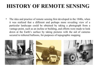

🌍 Remote Sensing (RS) is the science of obtaining information about objects or areas from a distance, typically from aircraft or satellites. This presentation provides a foundational understanding of Remote Sensing, its types, components, satellite data, sensors, and wide-ranging applications in GIS, environmental studies, agriculture, forestry, disaster management, urban planning, and climate monitoring. In this presentation, you will learn: The basic principles of Remote Sensing Different types of remote sensing platforms (active & passive) Satellite sensors and spectral bands Image interpretation techniques Importance of spatial, spectral, radiometric, and temporal resolution Overview of satellite data sources (Landsat, Sentinel, IRS, MODIS, etc.) Real-world applications of RS in land use/land cover (LULC) analysis, water resource mapping, vegetation monitoring, and more The slides are ideal for: Students and professionals in Geology, Geography, Civil Engineering, Environmental Science, and Urban Planning Individuals preparing for exams or careers in GIS, Remote Sensing, or Geoinformatics Institutions and educators delivering foundational RS training 🧠 Whether you're just starting in GIS or want to deepen your understanding of satellite imagery analysis, this presentation is crafted to help you build strong conceptual knowledge in Remote Sensing. 🎓 Presented by: Geospatial Mission Institute – A dedicated platform offering online training in GIS, Remote Sensing, LiDAR, CAD, and Geospatial Applications. We provide: 📚 Live instructor-led online classes ✅ Practical hands-on training using ArcGIS, QGIS, Google Earth, Global Mapper, MicroStation, and CAD tools 🎯 Remote Sensing & GIS Projects, Data Analysis, and Interpretation 🤝 Placement assistance for eligible candidates 🧾 Certificate upon course completion Follow us for more training presentations, course updates, and GIS tips. #RemoteSensing #GIS #GeospatialMission #ArcGIS #QGIS #SatelliteImagery #Geoinformatics #LULC #RSApplications #RemoteSensingTraining #EarthObservation #SpatialData #GeospatialAnalysis #GlobalMapper #GoogleEarth #LiDAR #DigitalMapping #EnvironmentalMonitoring #OnlineGISCourse #GeospatialInstitute


