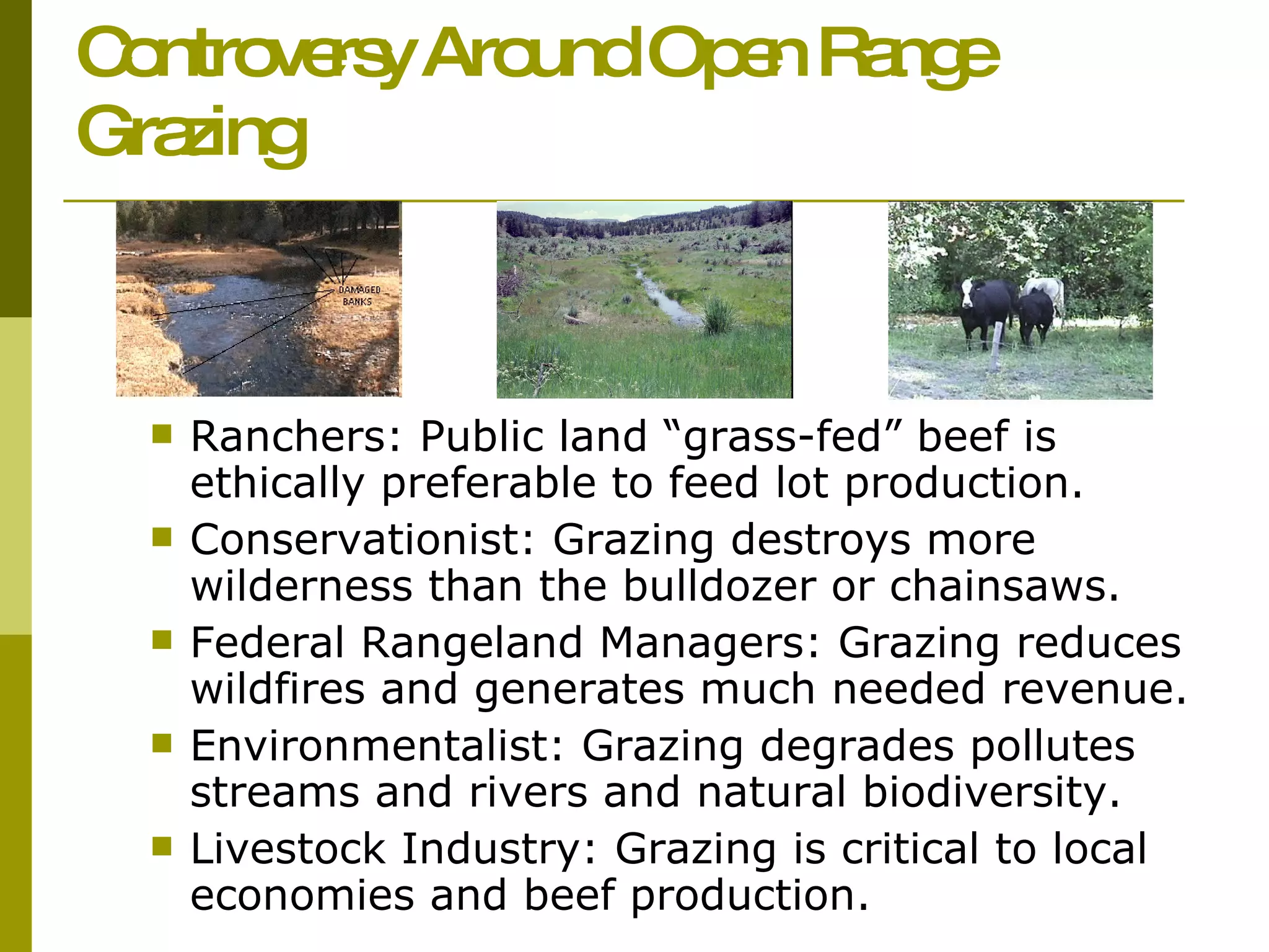
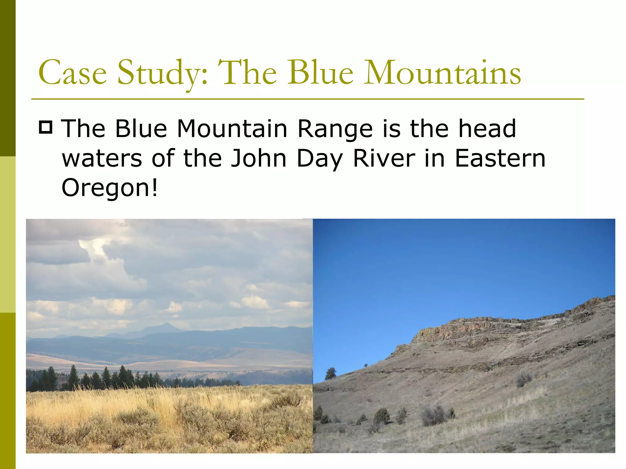
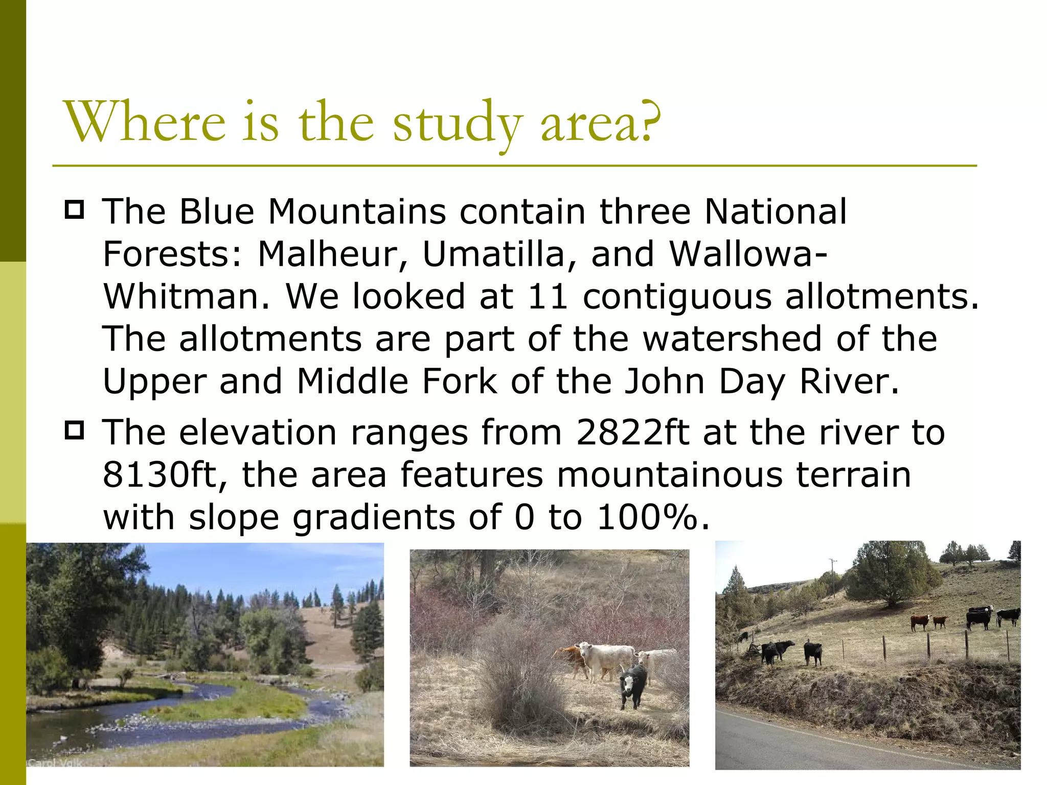
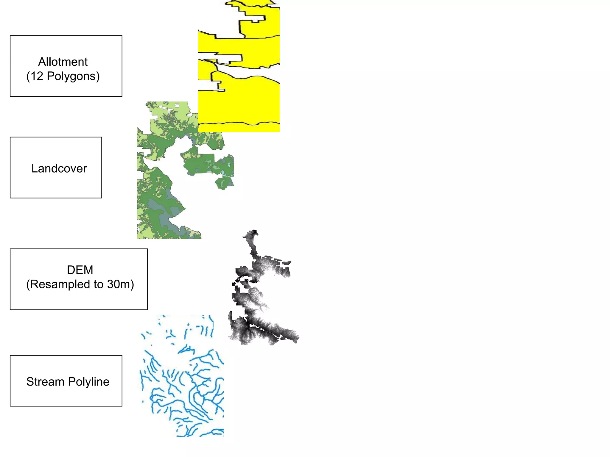
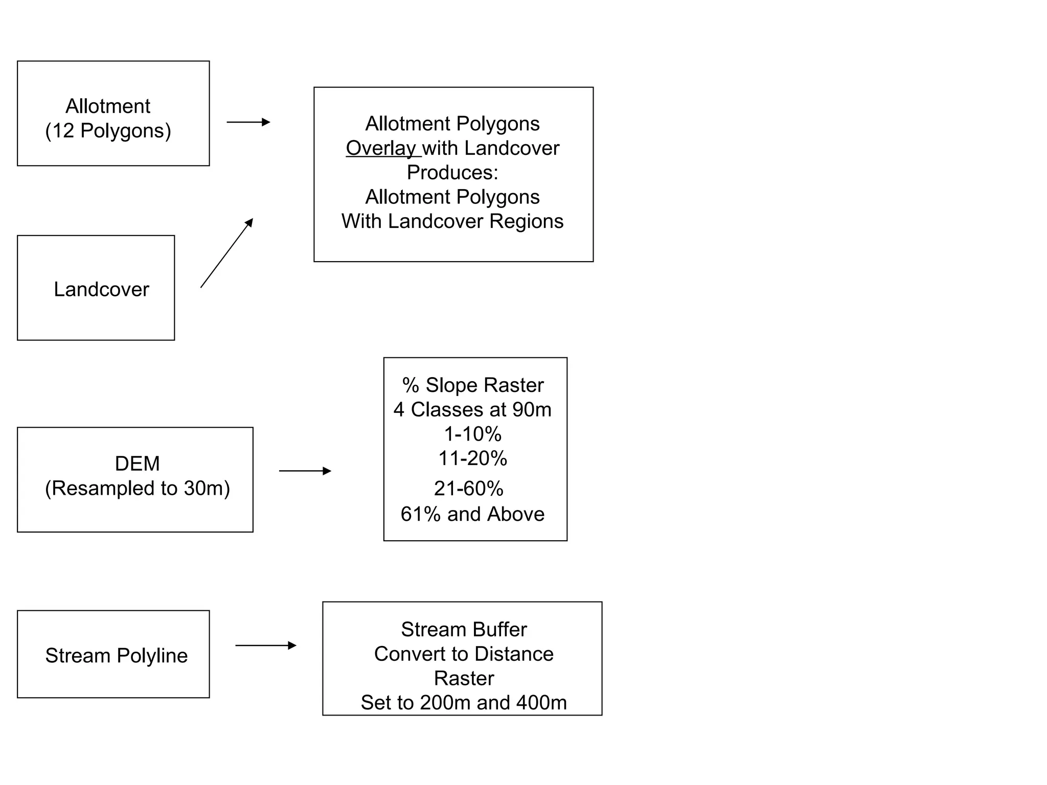
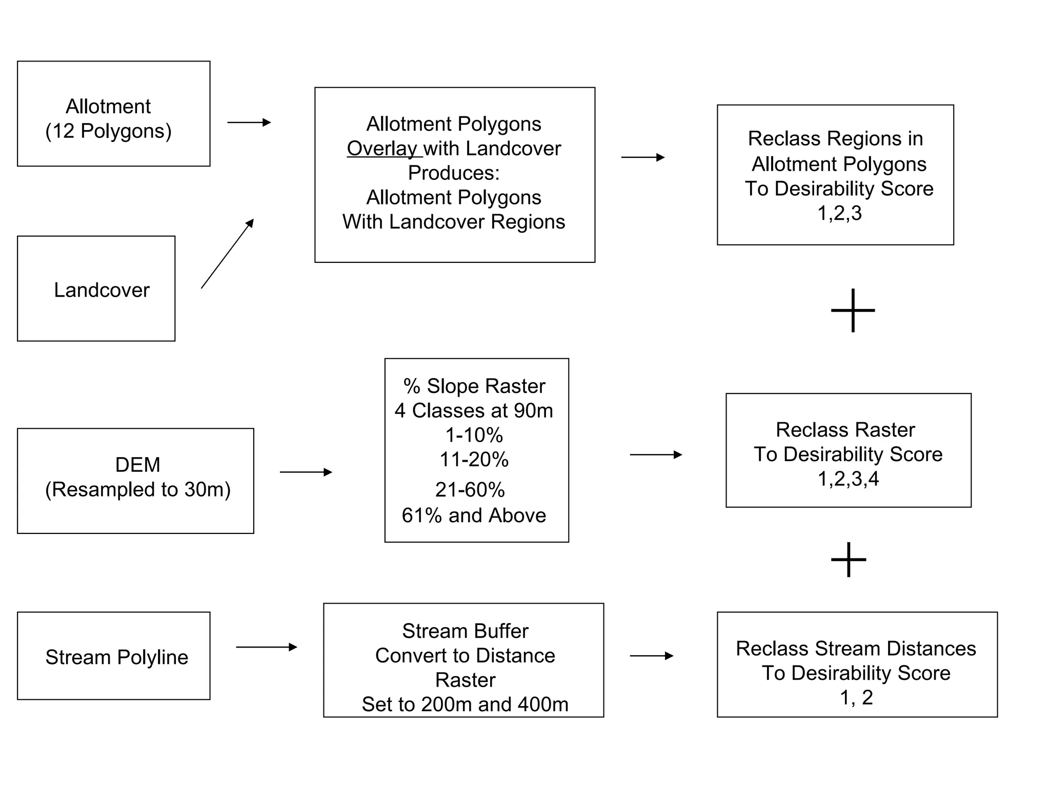
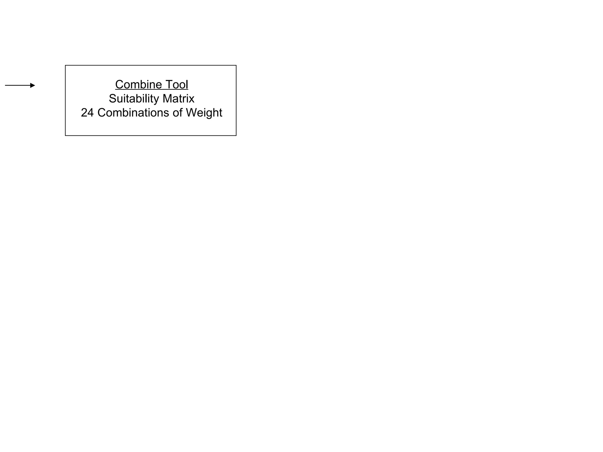
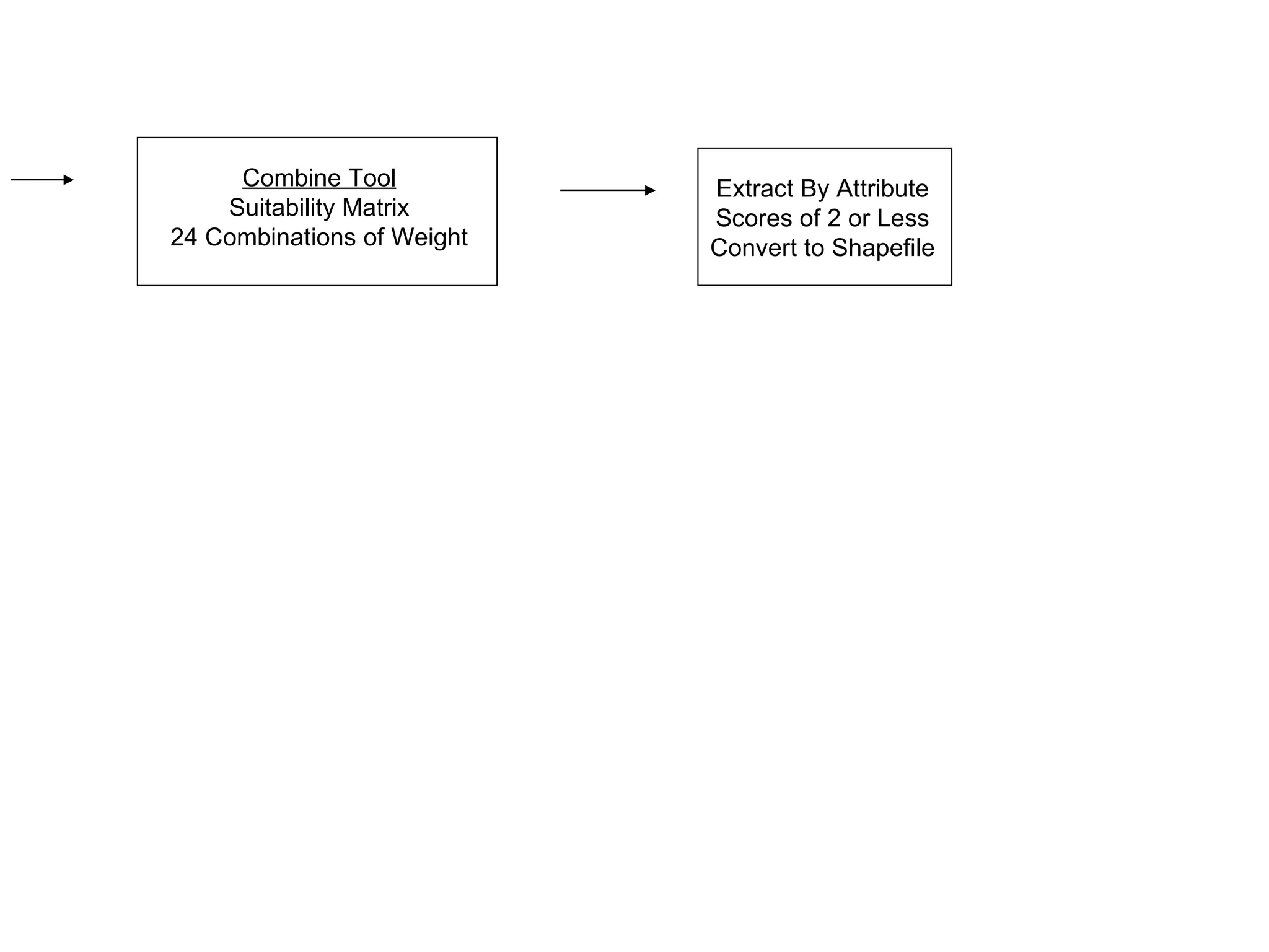
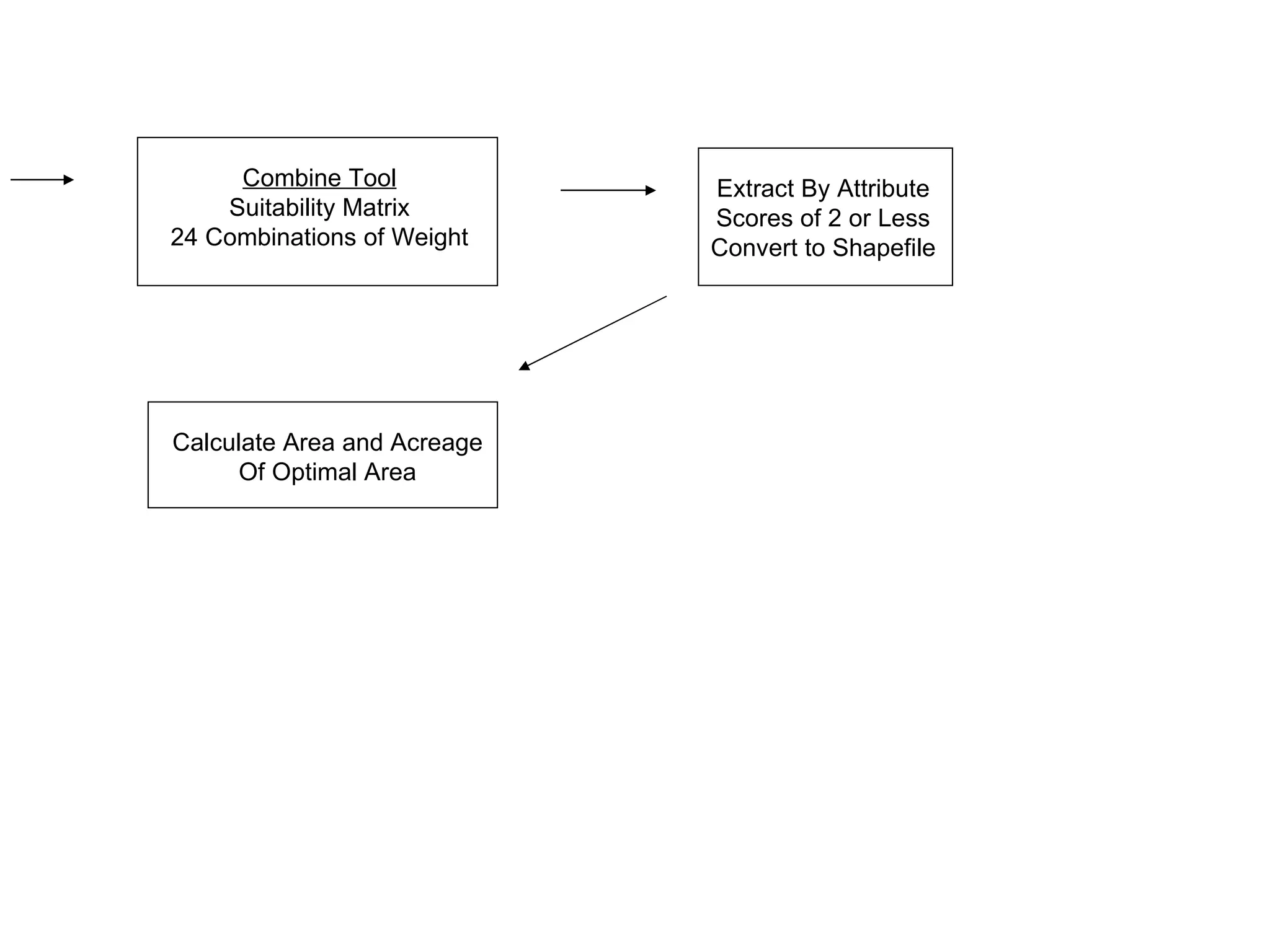
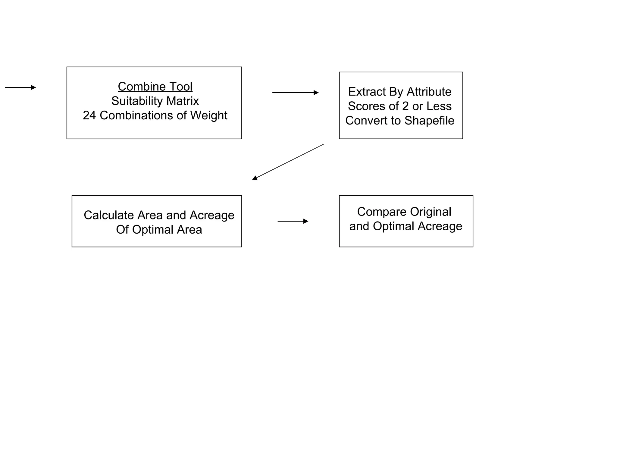
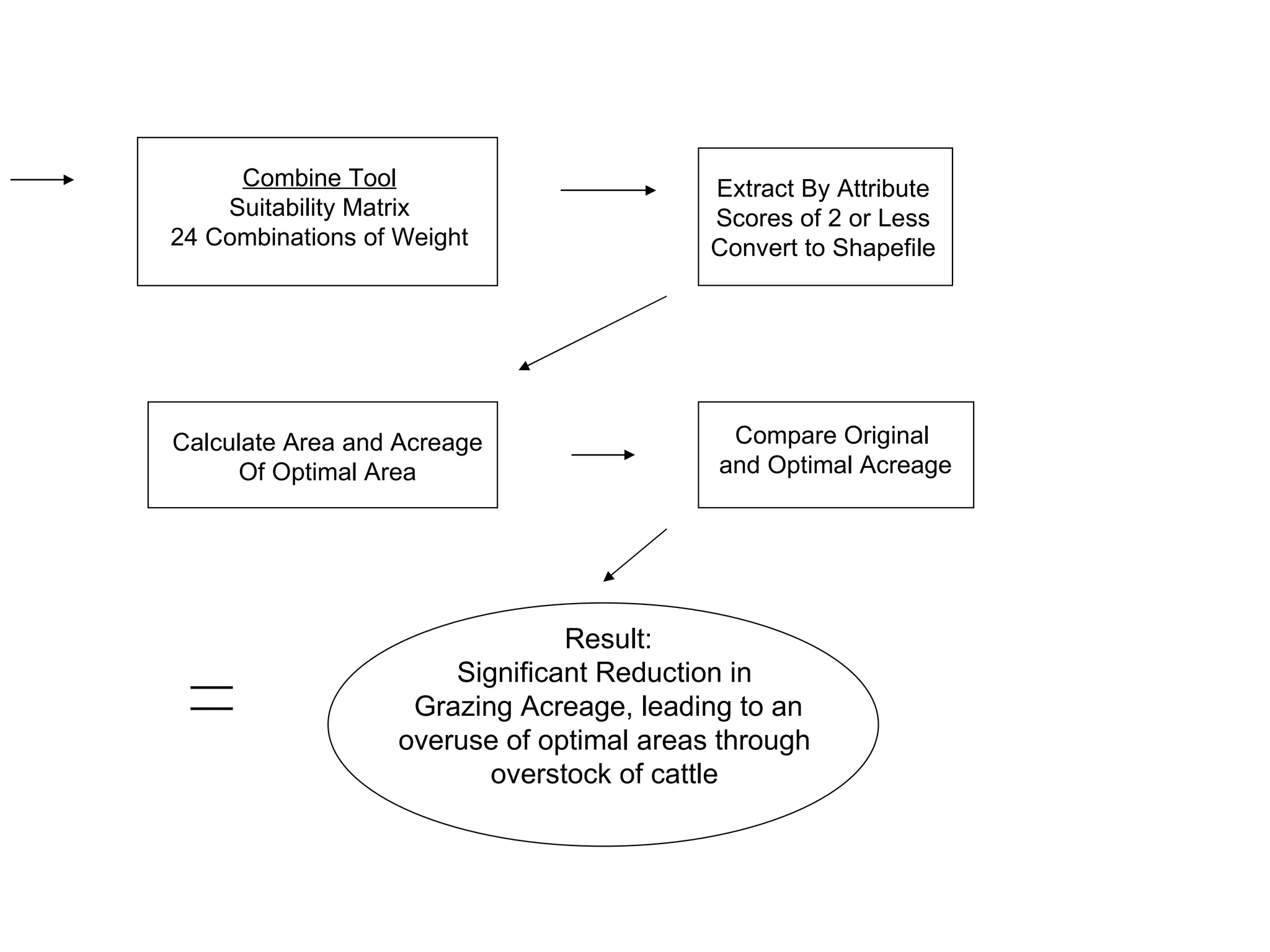
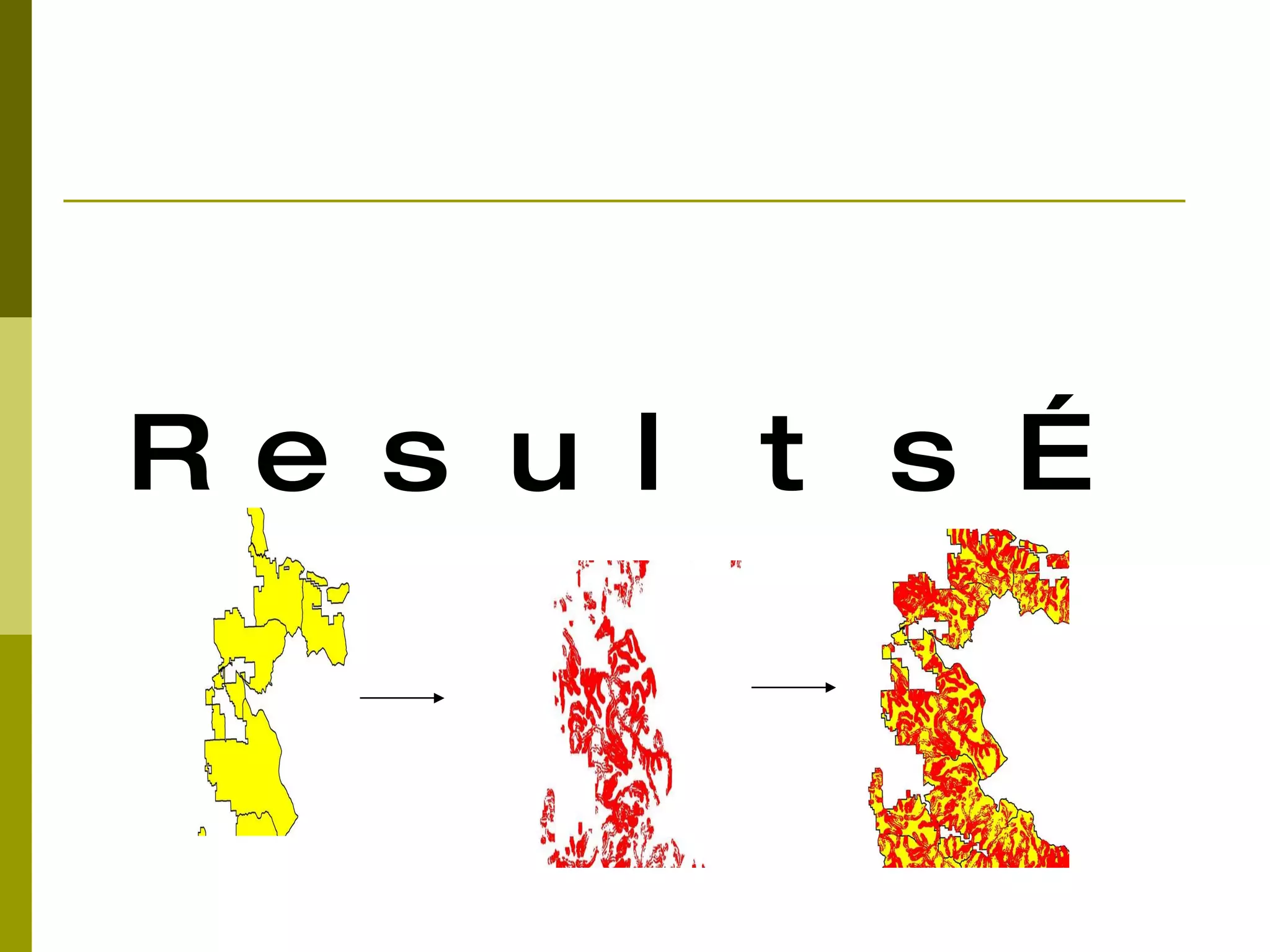
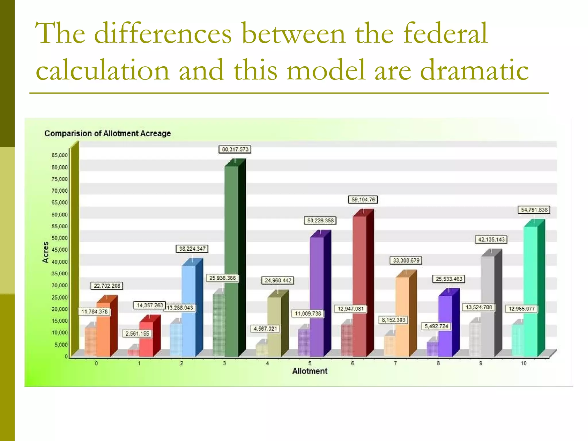
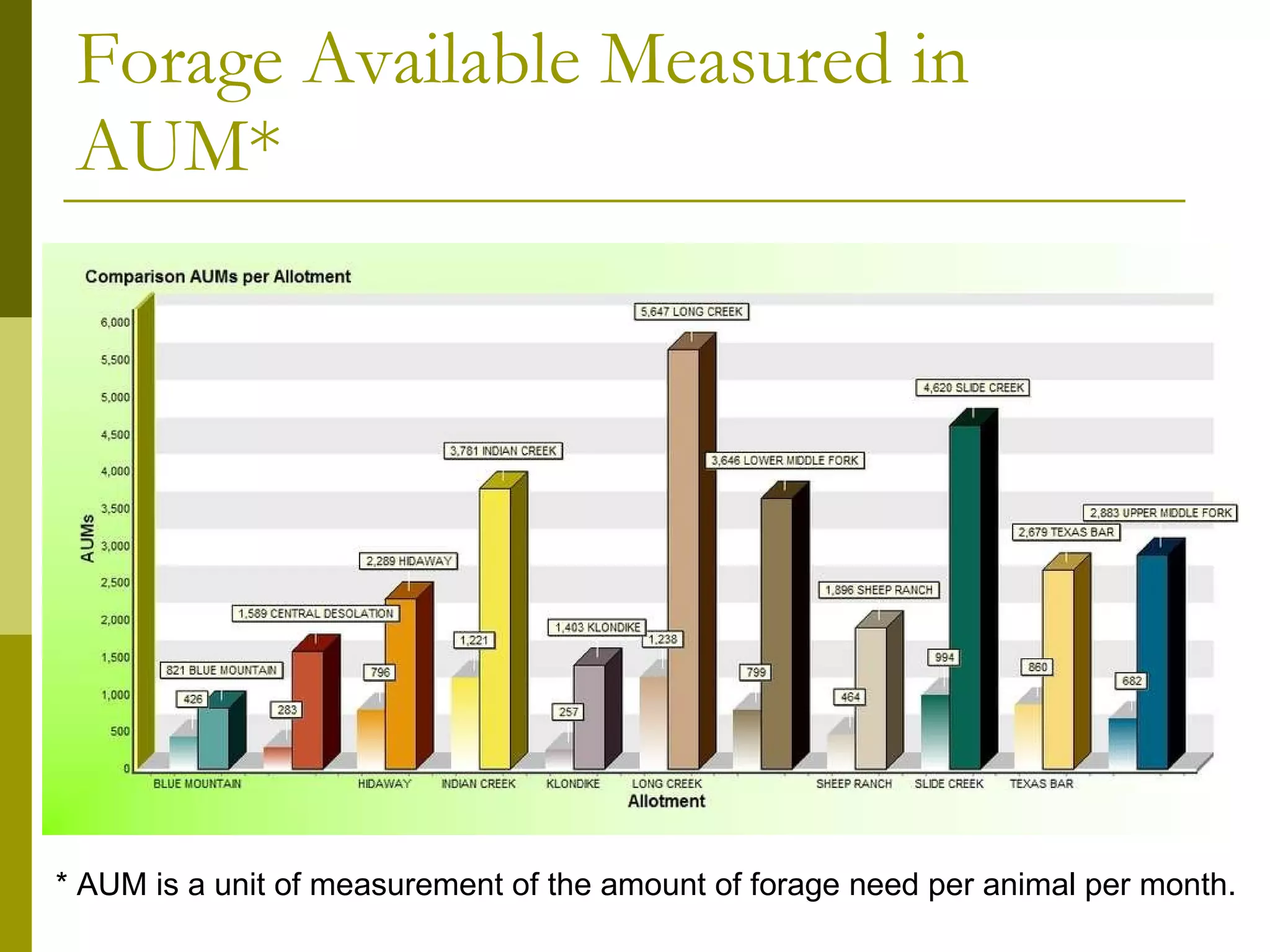
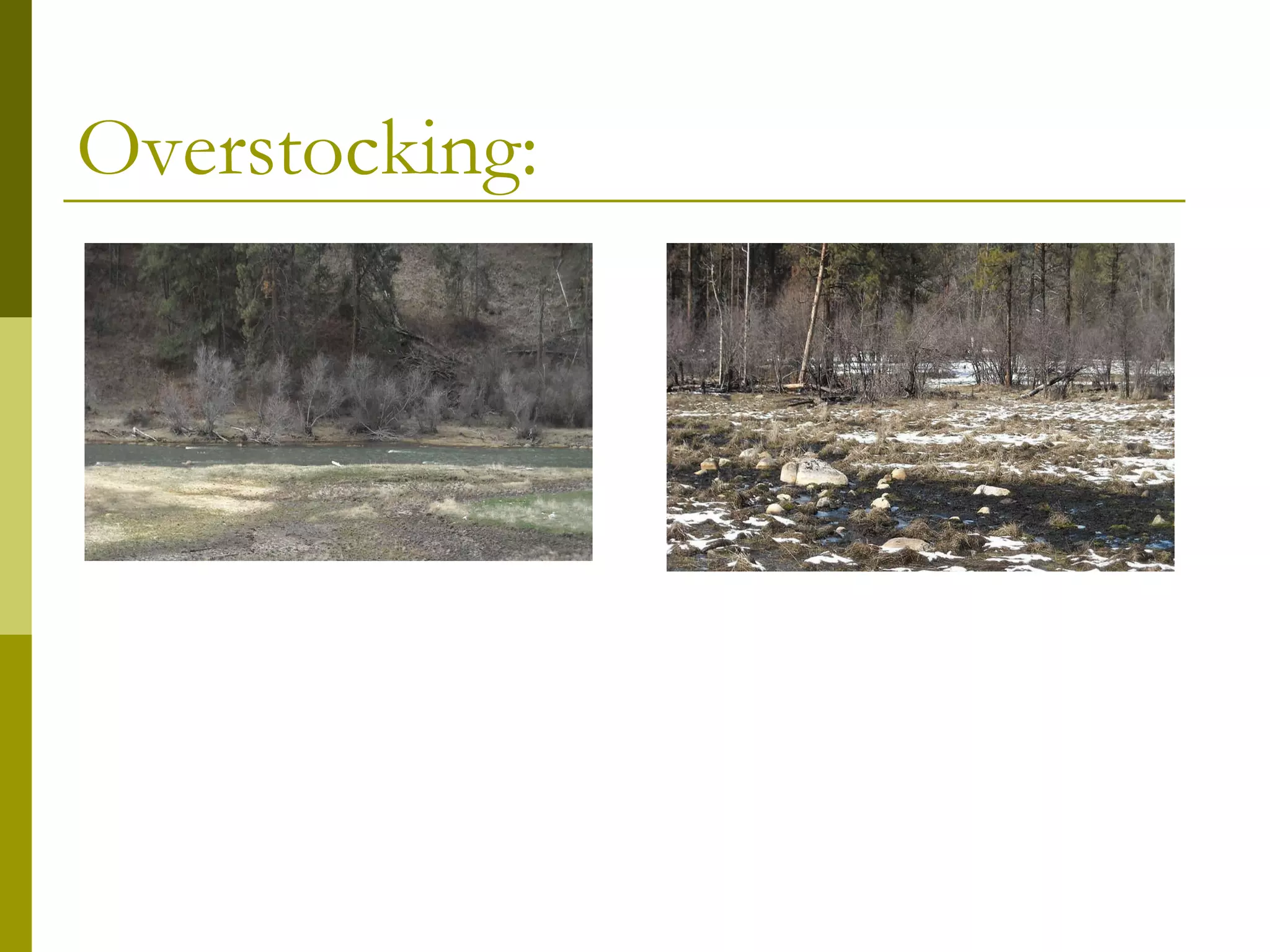
The present study focuses on the nature and pattern of urban expansion of Madurai city over its surrounding region during the period from 2003 to 2008. Based on its proximity to the Madurai city, Preparation of various thematic data such Land use and Land cover using Land sat data. Create a land use land cover map from satellite imagery using supervised classification. Find out the areas from the classified data. The study is based on secondary data, the satellite imagery has downloaded from GLCF (Global Land Cover Facility) web site, for the study area (path101 row 67), the downloaded imagery subset using Imagery software to clip the study area. The clipped satellite imagery has used to prepare the land use and land cover map using supervised classification.
Applications of remote sensing and geographic information systems technologie...ILRI
Presentation by Olatoye T. A. (FRIN, Nigeria) and Odularu G. O. (FARA, Ghana) for the Agrifood chain toolkit conference: Livestock and fish value chains in East Africa, Kampala, 9-11 September 2013.
Land Use Land Cover Change Detection of Gulbarga City Using Remote Sensing an...ijsrd.com
Land use and land cover(LULC) recently these days became a major component to handle natural resources and managing changes occurring in the environment.which is due to expansion of the urban area it has lead to critical losses of agriculture land,vegetation land and water bodies.followed by this the urban sprawl created a environmental issues. For example :decreased air quality and increase in the temperature etc. Land use and land cover change is driven by human actions and also drives changes that limit availability of products and services for human and animals, and it can undermine ecological wellbeing also. Land use and land cover is an important component in understanding various interactions of the human activities with the environment and thus it is necessary to be able to simulate changes. Therefore, this study was aimed at understanding land use and land cover change in Gulbarga city. In this work we took Gulbarga city to study the urban expansion and LULC change that took place in 2001 and 2012 to know the changes happened in the year 2012 by comparing with data of 2001.remote sensing methodology is used in this study which provides major coverage mapping & classification of land cover features such as vegetation,soil,water,forest etc. A wide range of environmental parameters can be measured including the land use, vegetation types, surface temperatures , soil types, precipitation, phytoplankton, turbidity, surface elevation and geology.satellite images of two different years i.e 2001 and 2012 are taken in to consideration.after image processing classification is done so as to classify images in to various different land use categories.
GIS Applications for Smart Agriculture-Case Studies & Research Prospects.AdityaAllamraju1
My special webinar talk about 'GIS Applications for Smart Agriculture-Case Studies & Research Prospects’ is a part of the webinar series on October 31st, 2020 organized by the TGISlab, a GIS Consultancy that is an initiative to fill the gap in GIS/Remote Sensing field to aware people about space technology for Earth Science & its applications. TGISLab works on different GIS Applications work and offers training/webinars/workshops to a wider community. It is based at Ahmedabad in Gujarat, India.
LAND USE /LAND COVER CLASSIFICATION AND CHANGE DETECTION USING GEOGRAPHICAL I...IAEME Publication
Land use and land cover change has become a central component in current strategies for managing natural resources and monitoring environmental changes. Geographical information system and image processing techniques used for the analysis of land use/land cover and change detection of Sukhana Basin of Aurangabad District, Maharashtra state. The tools used ArcGIS10.1 and ERDAS IMAGINE9.1, landsat images of 1996, 2003and 2014. From land use / land cover change detection it is found that during 1996-2014, water bodies cover have loss of 4 Sq. Km. Barren land have 146 Sq.Km. loss and forest area with 96 Sq.Km. loss. It is found that urbanization area has gain of 51 Sq.Km. and agricultural land cover also have gain of 195 Sq.Km.
Remote sensing is the acquiring of information from a distance and also the art and science of making measurements of the earth using airborne- or satellite-based sensors, is used in GIS. GIS is a collection of computer-based tools for organizing information from a variety of data sources to map and examine changes on Earth. Global Positioning System or GPS is a space-based radio navigation system that helps pinpoint a three-dimensional position to about a meter of accuracy (for example latitude, longitude and altitude) and provide nano-second precise time anywhere on Earth.
Precision agriculture is an art and science of utilizing innovative, site-specific techniques for management of spatial and temporal variability using affordable technologies… for enhancing output, efficiency, and profitability of agricultural production in an environmentally responsible manner
Remote sensing based water management from the watershed to the field levelCIMMYT
Remote sensing –Beyond images
Mexico 14-15 December 2013
The workshop was organized by CIMMYT Global Conservation Agriculture Program (GCAP) and funded by the Bill & Melinda Gates Foundation (BMGF), the Mexican Secretariat of Agriculture, Livestock, Rural Development, Fisheries and Food (SAGARPA), the International Maize and Wheat Improvement Center (CIMMYT), CGIAR Research Program on Maize, the Cereal System Initiative for South Asia (CSISA) and the Sustainable Modernization of the Traditional Agriculture (MasAgro)
Geo-spatial analysis for effective technology targetingICRISAT
Mapping and monitoring of biophysical and socio economic characteristics of dryland cereals and grain legumes producing areas is key for developing effective targeting strategies, dissemination of new technologies and sustainable crop management and diversification options. This can help in the allocation of limited resources to achieve potential benefits and provide actionable information for decision makers.
Forage diversity – an essential resource to support forage developmentILRI
Forage diversity is an essential resource for selection and breeding of superior forages for use in smallholder farming to alleviate these constraints. The forages collection maintained at the International Livestock Research Institute (ILRI) includes about 19,000 accessions of forages from over 1400 species of forage grasses, legumes, fodder trees and shrubs as a global public good, held in trust under the International Treaty on Plant Genetic Resources for Food and Agriculture.
Eirin Hongslo - Carrying capacity and stock limitations in Namaqualand, South...STEPS Centre
Presentation at the STEPS Conference 2010 - Pathways to Sustainability: Agendas for a new politics of environment, development and social justice
http://www.steps-centre.org/events/stepsconference2010.html
Alan Nicol - Institutions and convergence: Initial thoughts on river basins a...STEPS Centre
Presentation at the STEPS Conference 2010 - Pathways to Sustainability: Agendas for a new politics of environment, development and social justice
http://www.steps-centre.org/events/stepsconference2010.html
Adrian Ely: Introduction - "Innovation, Sustainability, Development: A New Ma...STEPS Centre
Dr Adrian Ely, STEPS Centre - Convenor of the Manifesto project.
Presentation to the UK-China Innovation Workshop for Sustainable and Equitable Development, Tsinghua University, 19 March 2010, co-organised by China Institute for Science and Technology Policy (CISTP) at Tsinghua University and the STEPS Centre.
http://anewmanifesto.org/news/china-workshop-presentationschina-workshop-presentations/
Presented by Alan Robertson at the Workshop on Forage and Fodder Tree Selection for Future Challenges—Linking Genebanks to Forage Use, ILRI, Addis Ababa, 16-20 March 2015
Pravin is a scientist and manager with over thirty nine years’ research, teaching and extension experience. His expertise is natural resources management, forage crops production and quality and farming of agricultural crops and land development and improves soil fertility. It also includes soil, water and plant analysis, recommendation of crop production technologies to farmers, waste management through biochar, sustainability, management and reporting.
CSA Symposium 2016 - Khalil Brown - Day 2 Session 1BACDI/VOCA
"Bodles Fodder Pellets": Developing a Feed Supplementation Strategy to Enhance Livestock Production under prolonged drought conditions, in the humid tropics
Maass - Using the 'livestock ladder' to exit poverty CIALCA
Presentation delivered at the CIALCA international conference 'Challenges and Opportunities to the agricultural intensification of the humid highland systems of sub-Saharan Africa'. Kigali, Rwanda, October 24-27 2011.
Forages and the gradual shift towards more intensive managementILRI
Presented by Alan Robertson at the Workshop on Forage and Fodder Tree Selection for Future Challenges—Linking Genebanks to Forage Use, ILRI, Addis Ababa, 16-20 March 2015
Ms. Brenna Grant - Assessing the Sustainability of the Canadian Beef IndustryJohn Blue
Assessing the Sustainability of the Canadian Beef Industry - Ms. Brenna Grant, Manager, Canfax Research Services, from the 2016 Global Roundtable for Sustainable Beef (GRSB), October 5 - 6, 2016, Banff, Alberta, Canada.
More presentations at http://trufflemedia.com/agmedia/conference/2016-global-roundtable-sustainable-beef
Understanding Climate Change Resiliency of Oklahoma Forests using FVS and Con...Bijesh Mishra
The forest-grassland ecotone in the southcentral US is the tension zone between two major biomes and provides a number of important ecosystem services. Active management in the region using prescribed fire, forest thinning/harvesting, grazing, and herbicides can optimize desired benefits for landowners with a variety of management objectives. However, periodic severe droughts that plague this area and increasing climate variability have profoundly affected the productivity, resilience, and stability of ecosystems. We aim to facilitate sustainable
management of the forest-grassland ecotone for different combinations of objectives such as timber, grazing, and wildlife habitat based on recent conditions and to adapt management to mitigate the negative effects of future drought and potential climate change. To this end, we are assessing the value of timber, cattle forage, and deer habitat. Input and output variables involved in valuation of timber, wildlife and cattle
forage will be discussed. Tailoring research findings with the
appropriate outreach materials will help educate traditional and nontraditional forest stewards in the region.
International Journal of Research in Engineering and Science is an open access peer-reviewed international forum for scientists involved in research to publish quality and refereed papers. Papers reporting original research or experimentally proved review work are welcome. Papers for publication are selected through peer review to ensure originality, relevance, and readability.
at the 3rd Global Science Conference on Climate-Smart Agriculture in Montpellier.
Read more: http://ccafs.cgiar.org/3rd-global-science-conference-%E2%80%9Cclimate-smart-agriculture-2015%E2%80%9D#.VRurLUesXX4
The Global Yield Gap Atlas for targeting sustainable intensification options for smallholders in Sub-Saharan Africa
Poster presented at the 3rd Global Science Conference on Climate-Smart Agriculture in Montpellier.
Read more: http://ccafs.cgiar.org/3rd-global-science-conference-%E2%80%9Cclimate-smart-agriculture-2015%E2%80%9D#.VRurLUesXX4
Modelling FMD vaccine requirements for multi-country FMD outbreaks in Europe ...EuFMD
The 2018 Open Session of the EuFMD Standing Technical Committee was held in Borgo Egnazia - Italy, 29-31 October 2018 . The session theme surrounded increasing the supply of effective FMD vaccines.
The European Commission for the Control of Foot-and-Mouth Disease (EuFMD), one of FAO’s oldest Commissions, came into being on the 12th June 1954, with the pledge of the sixth founding member state to the principles of a coordinated and common action against Foot-and-mouth Disease.
Livestock, human welfare, and sustainability: The challenge of harmonizing fa...ILRI
Presented by James Hammond, Léo Gorman, Simon Fraval, Mark van Wijk at the 9th Multi-Stakeholder Partnership Meeting of the Global Agenda for Sustainable Livestock, Manhattan, Kansas, 9-13 September 2019
Conservation in an Amazonian tri national frontier livelihoods and forest cle...CIFOR-ICRAF
Amy E. Duchelle, A. Almeyda, N. Hoyos, M. Marsik, E. Broadbent, Karen A. Kainer
Presentation for the conference on
Taking stock of smallholders and community forestry
Montpellier France
March 24-26, 2010
1. Comparing Federal Range Land Management Forage Capability Versus an Animal Centric Forage Capability Model: A GIS Approach Donnych Diaz Amber Gladieux Sarah Thompson GIS II Spring 2009 June 2, 2009
11. Allotment (12 Polygons) DEM (Resampled to 30m) Landcover Stream Polyline Stream Buffer Convert to Distance Raster Set to 200m and 400m % Slope Raster 4 Classes at 90m 1-10% 11-20% 21-60% 61% and Above Allotment Polygons Overlay with Landcover Produces: Allotment Polygons With Landcover Regions
12. Allotment (12 Polygons) DEM (Resampled to 30m) Landcover Stream Polyline Stream Buffer Convert to Distance Raster Set to 200m and 400m % Slope Raster 4 Classes at 90m 1-10% 11-20% 21-60% 61% and Above Allotment Polygons Overlay with Landcover Produces: Allotment Polygons With Landcover Regions Reclass Regions in Allotment Polygons To Desirability Score 1,2,3 Reclass Raster To Desirability Score 1,2,3,4 Reclass Stream Distances To Desirability Score 1, 2
14. Combine Tool Suitability Matrix 24 Combinations of Weight Extract By Attribute Scores of 2 or Less Convert to Shapefile
15. Combine Tool Suitability Matrix 24 Combinations of Weight Extract By Attribute Scores of 2 or Less Convert to Shapefile Calculate Area and Acreage Of Optimal Area
16. Combine Tool Suitability Matrix 24 Combinations of Weight Extract By Attribute Scores of 2 or Less Convert to Shapefile Calculate Area and Acreage Of Optimal Area Compare Original and Optimal Acreage
17. Combine Tool Suitability Matrix 24 Combinations of Weight Extract By Attribute Scores of 2 or Less Convert to Shapefile Calculate Area and Acreage Of Optimal Area Compare Original and Optimal Acreage Result: Significant Reduction in Grazing Acreage, leading to an overuse of optimal areas through overstock of cattle