Download as PDF, PPTX


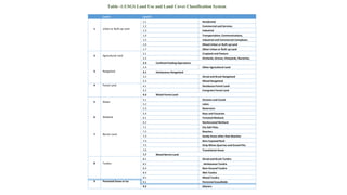
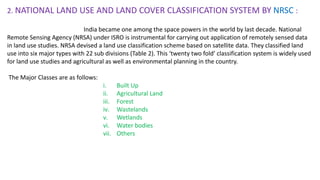
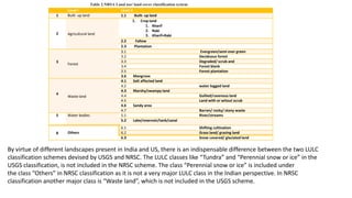

The document discusses the differences between land use and land cover. Land use refers to how humans use the land, such as for agriculture, settlements, or mining. Land cover refers to the physical attributes of the land surface, such as vegetation, water, or bare soil. The United States Geological Survey developed a widely used land use and land cover classification system in the 1970s that categorizes land into classes such as urban, agricultural, forest, water, and wetlands. The system was designed to be applied using remote sensing data and aims to achieve consistent land classifications.


