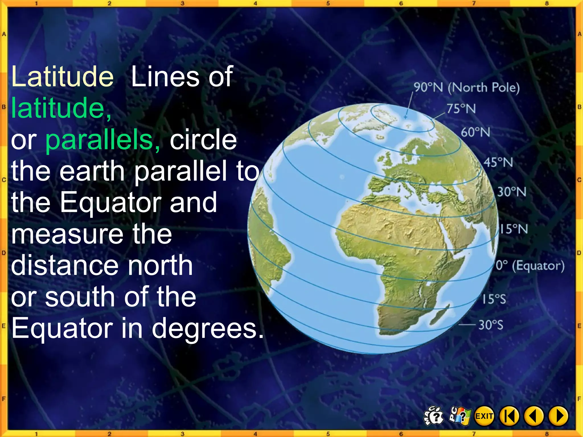
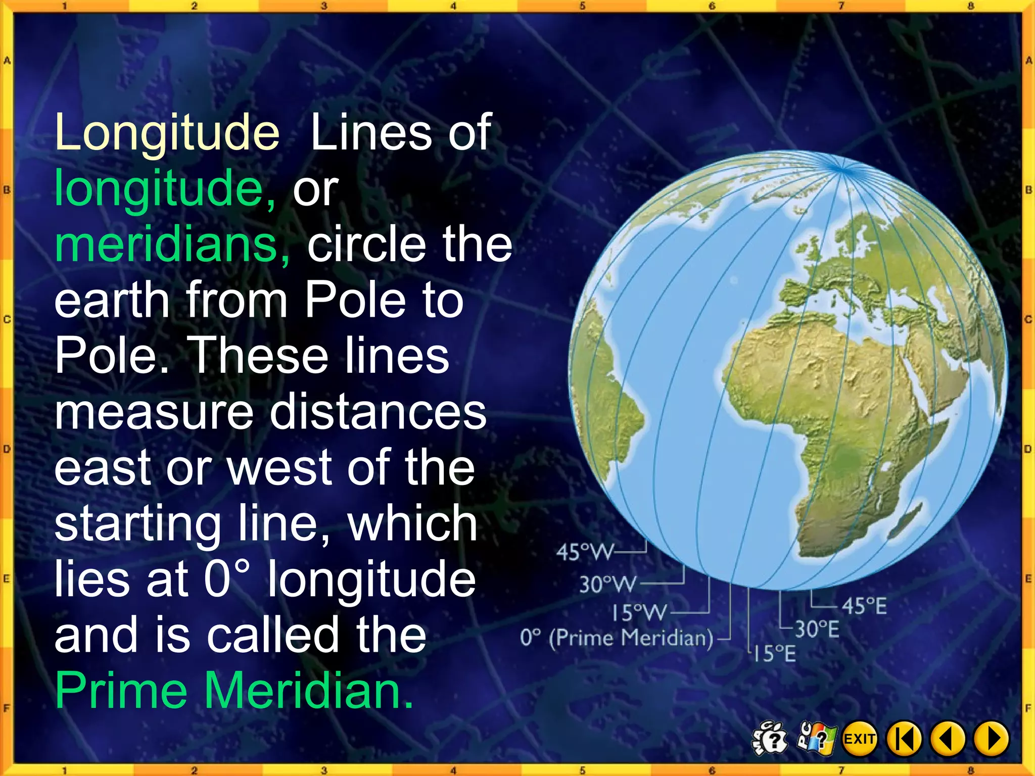
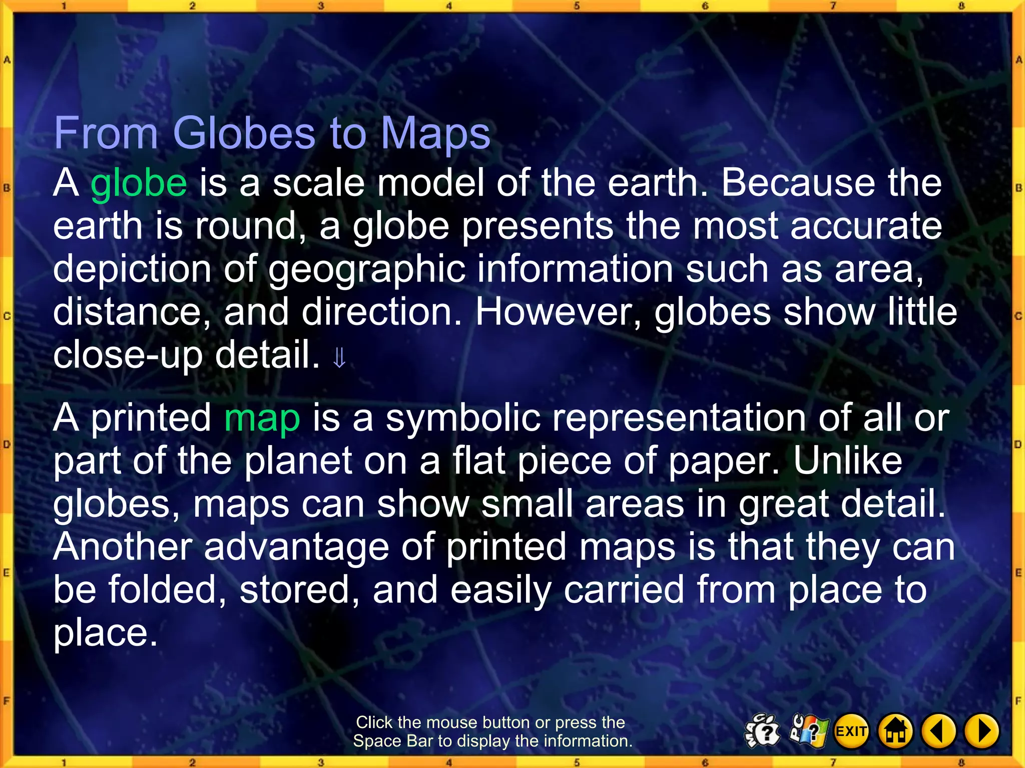
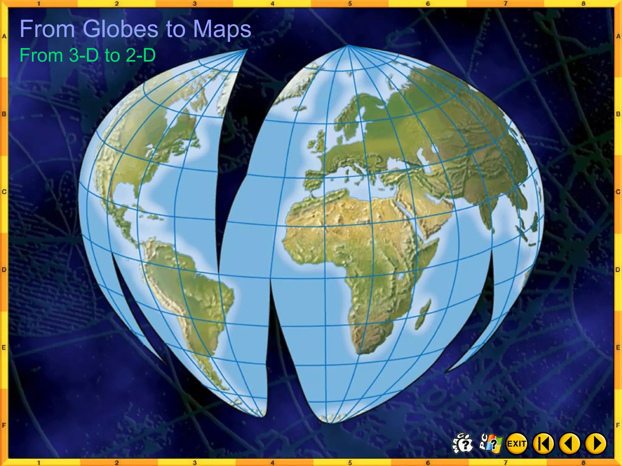
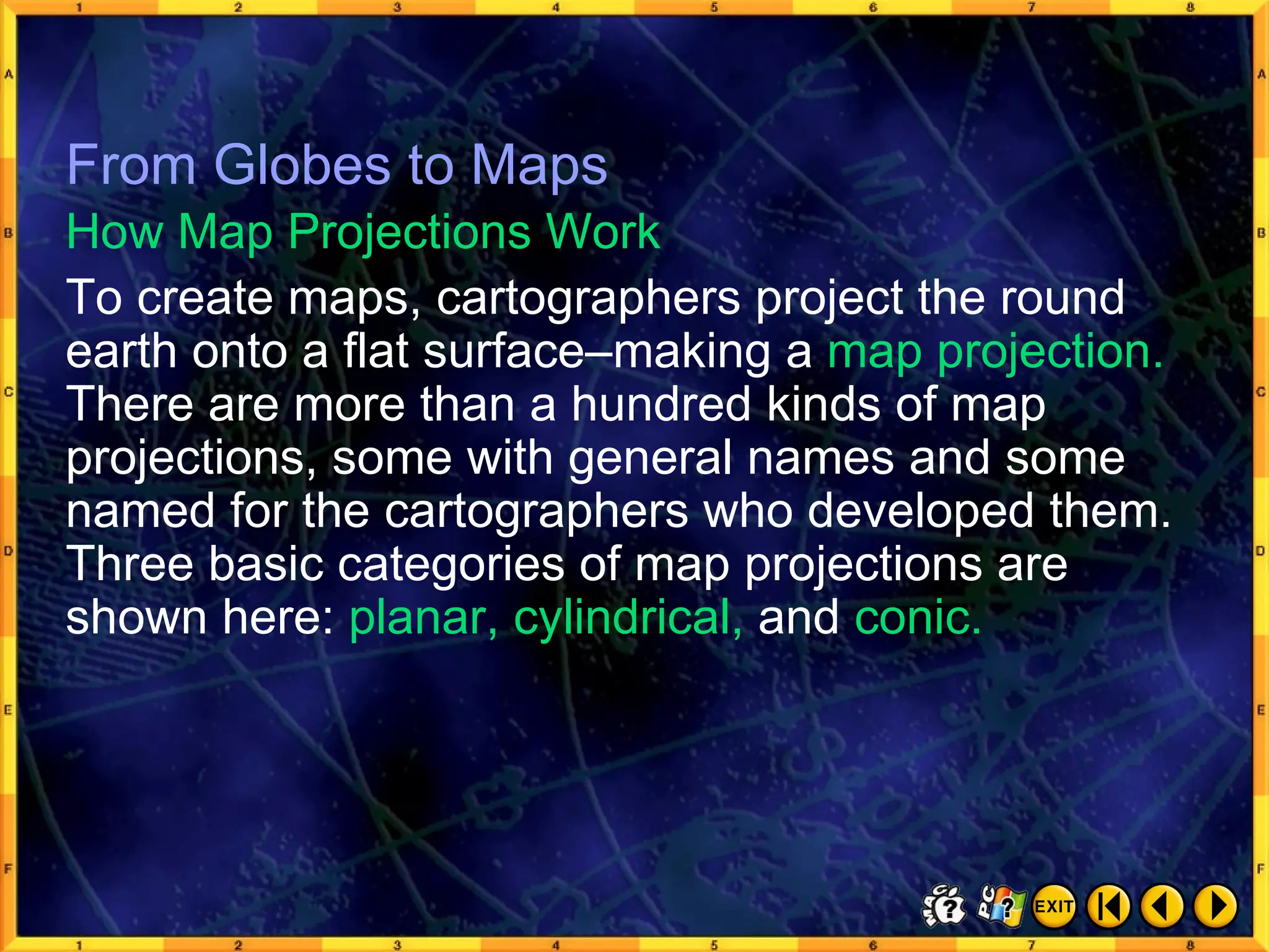
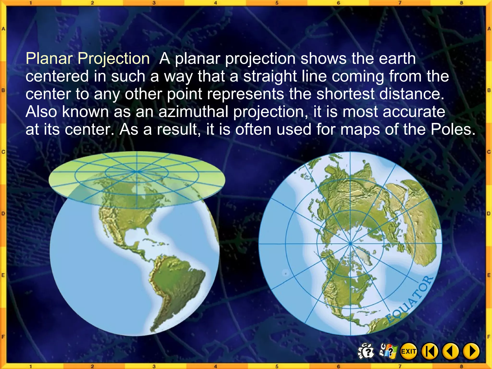
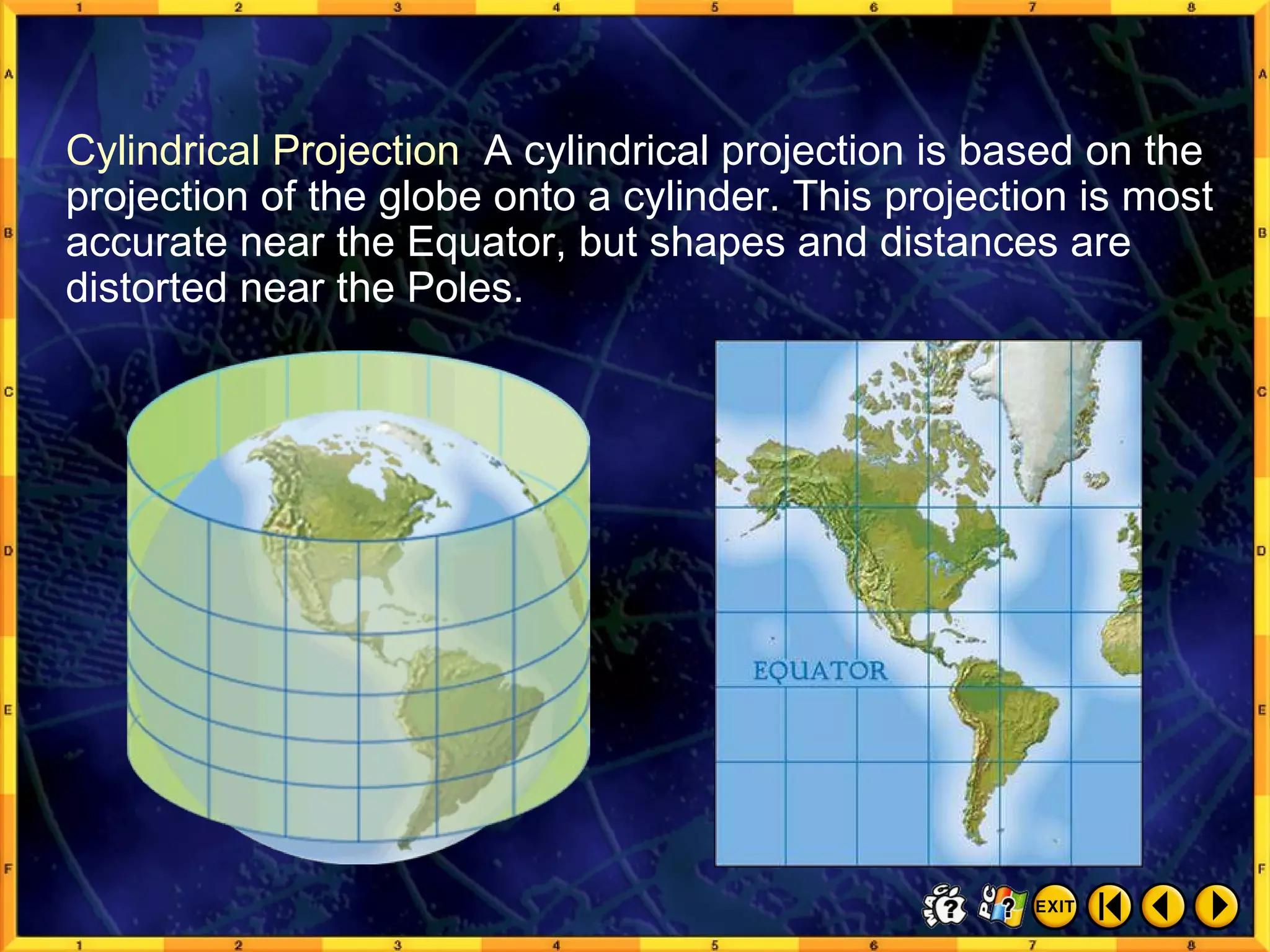
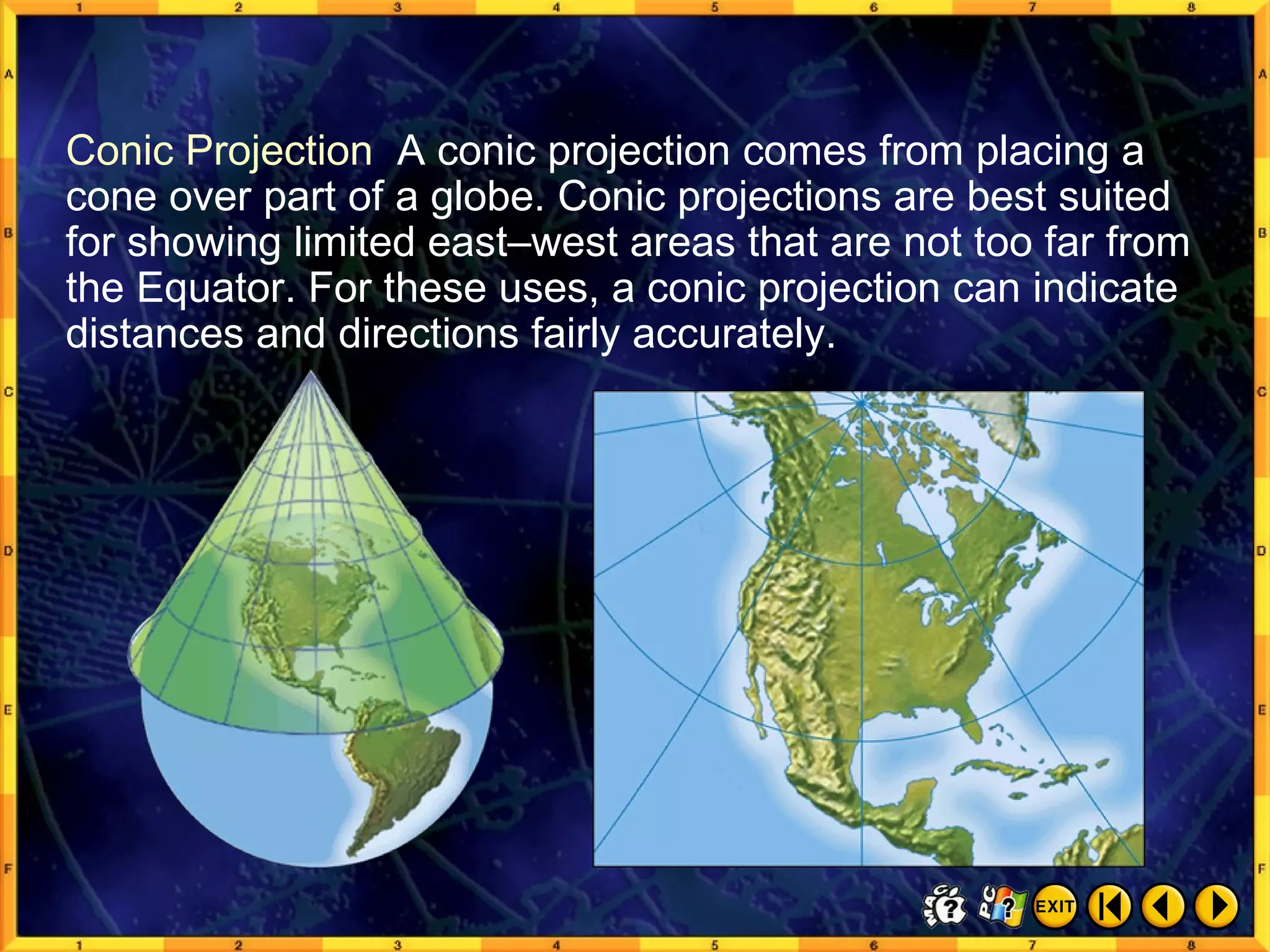
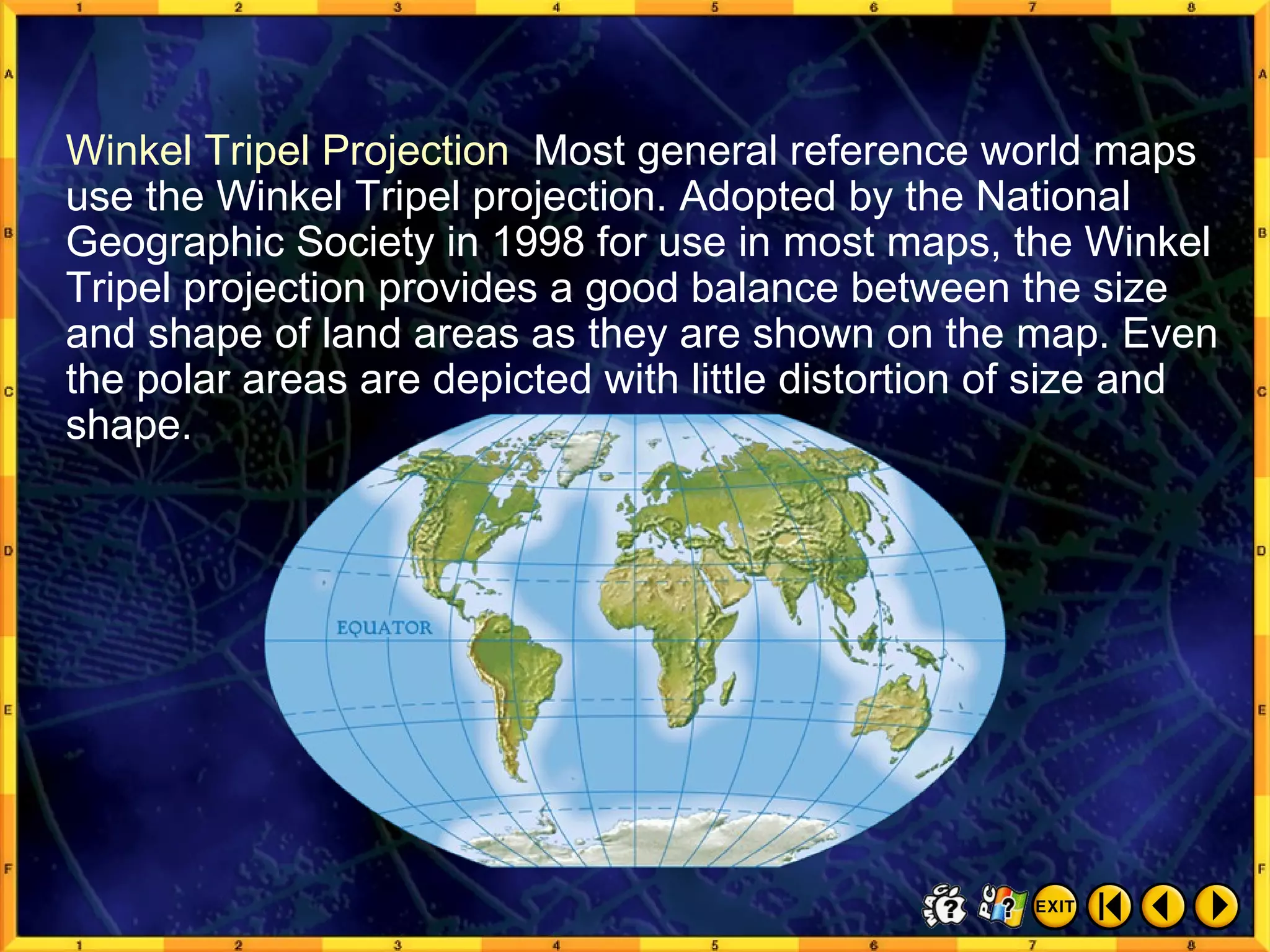
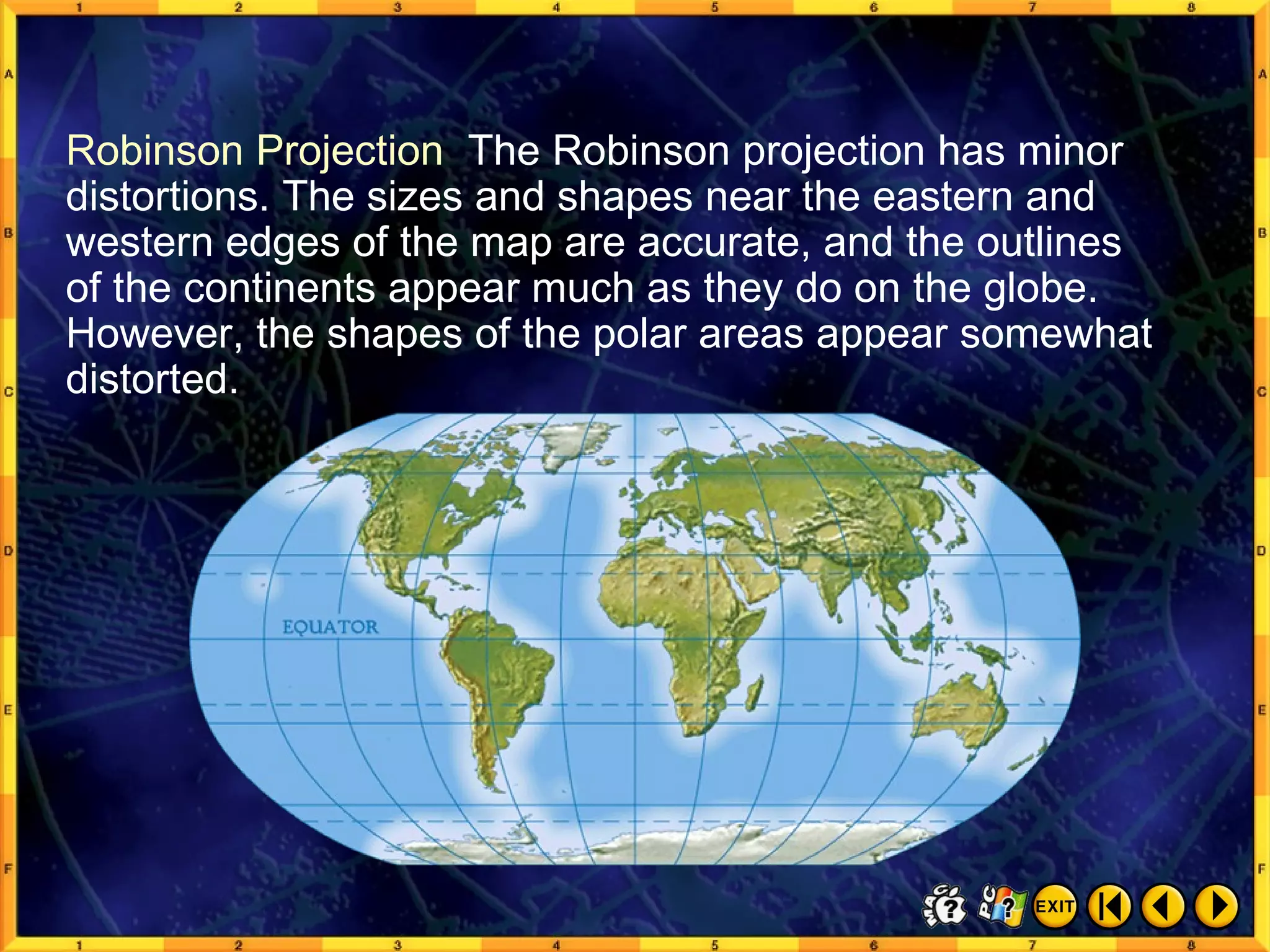
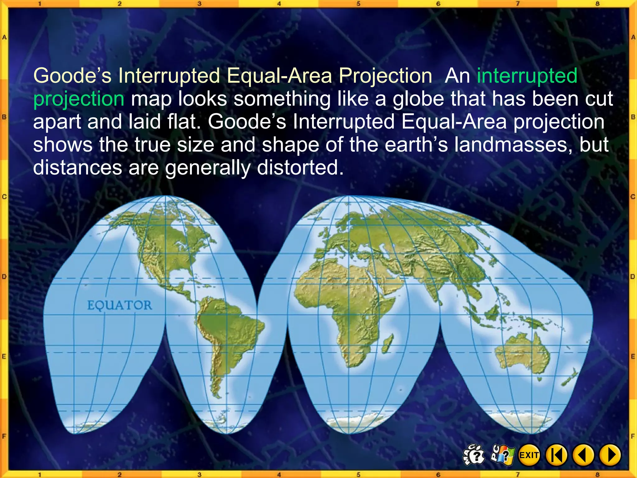
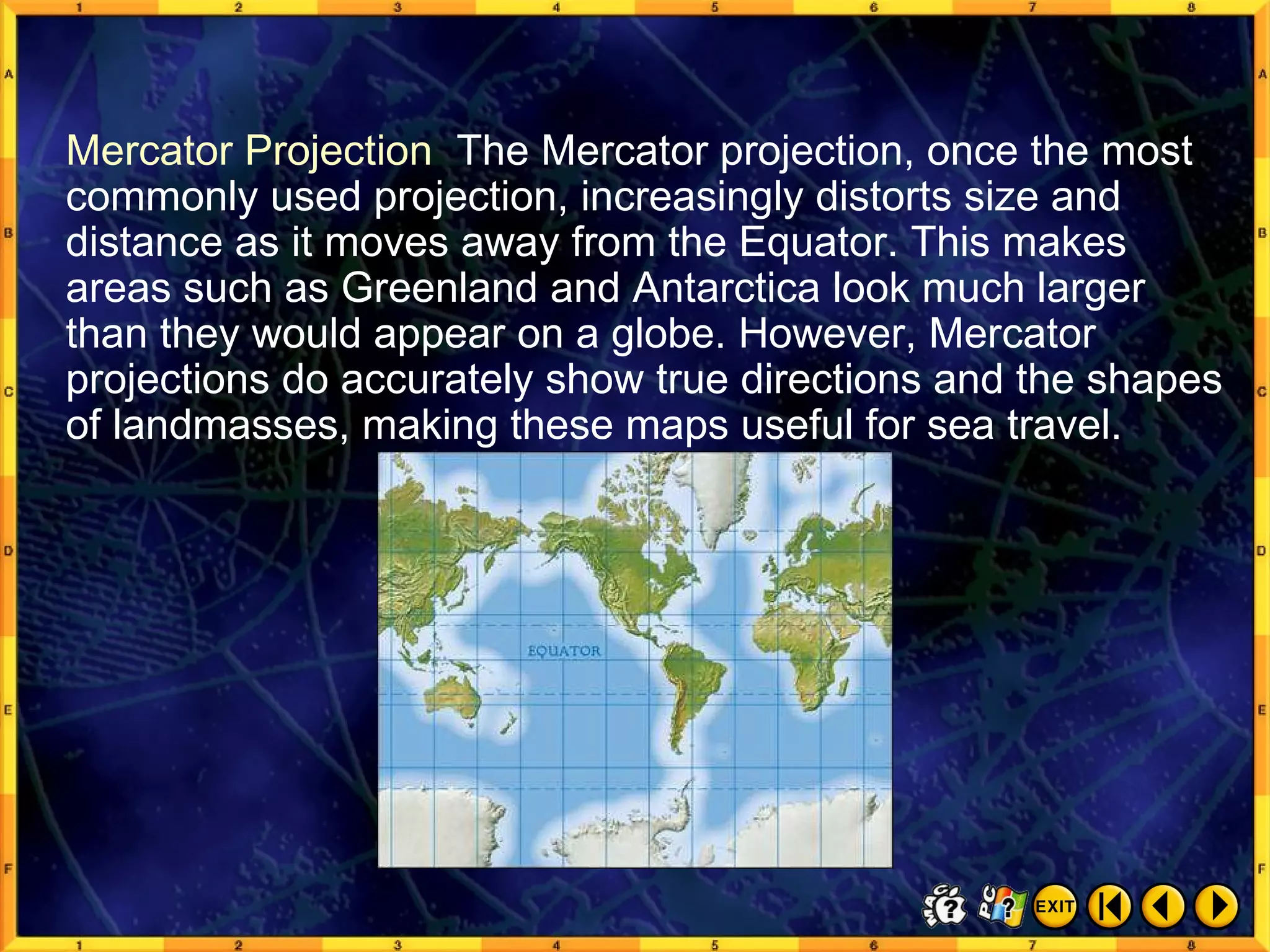
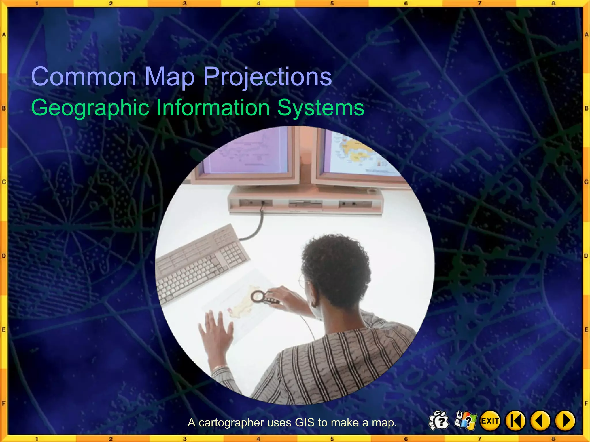
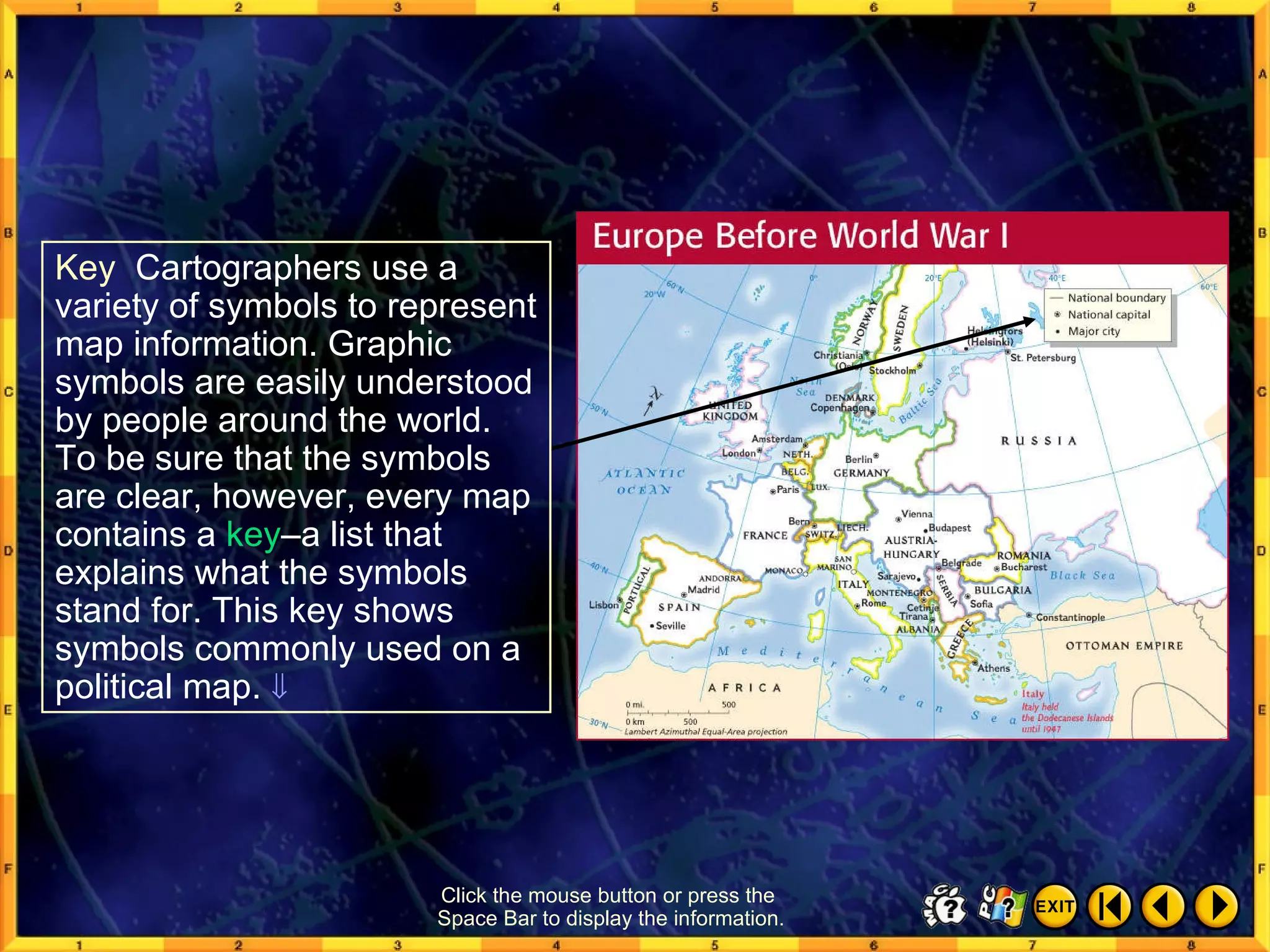
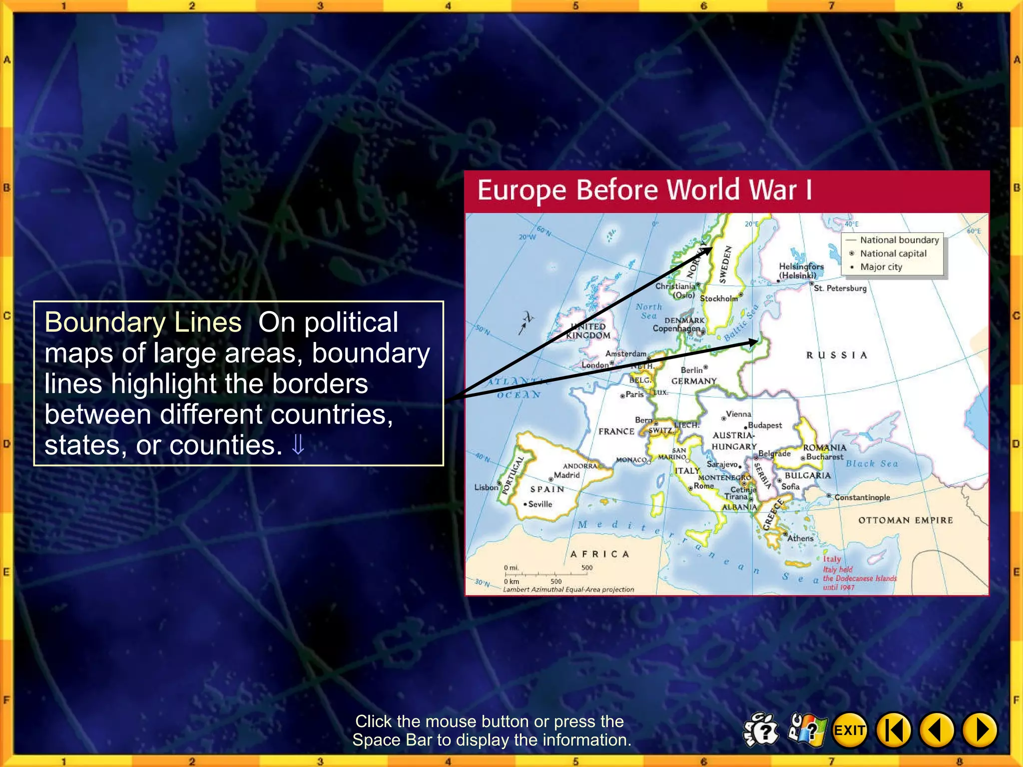
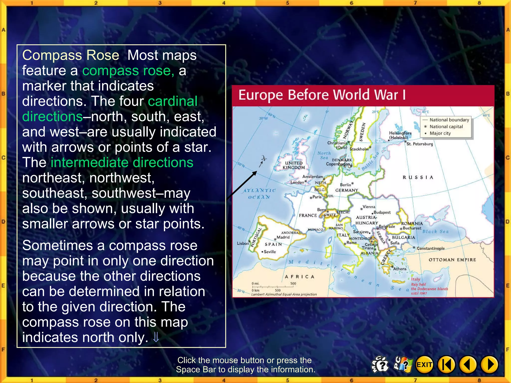
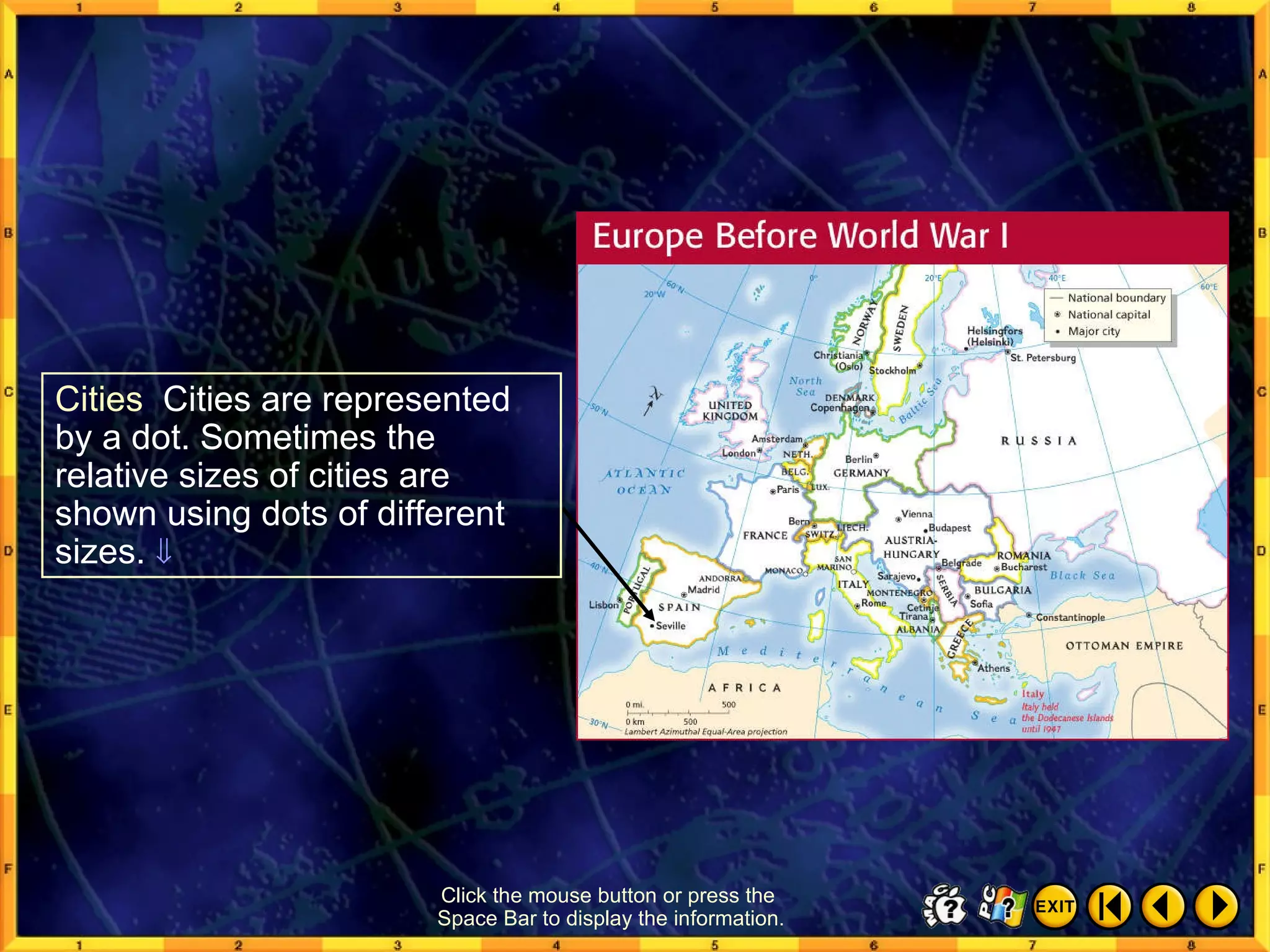
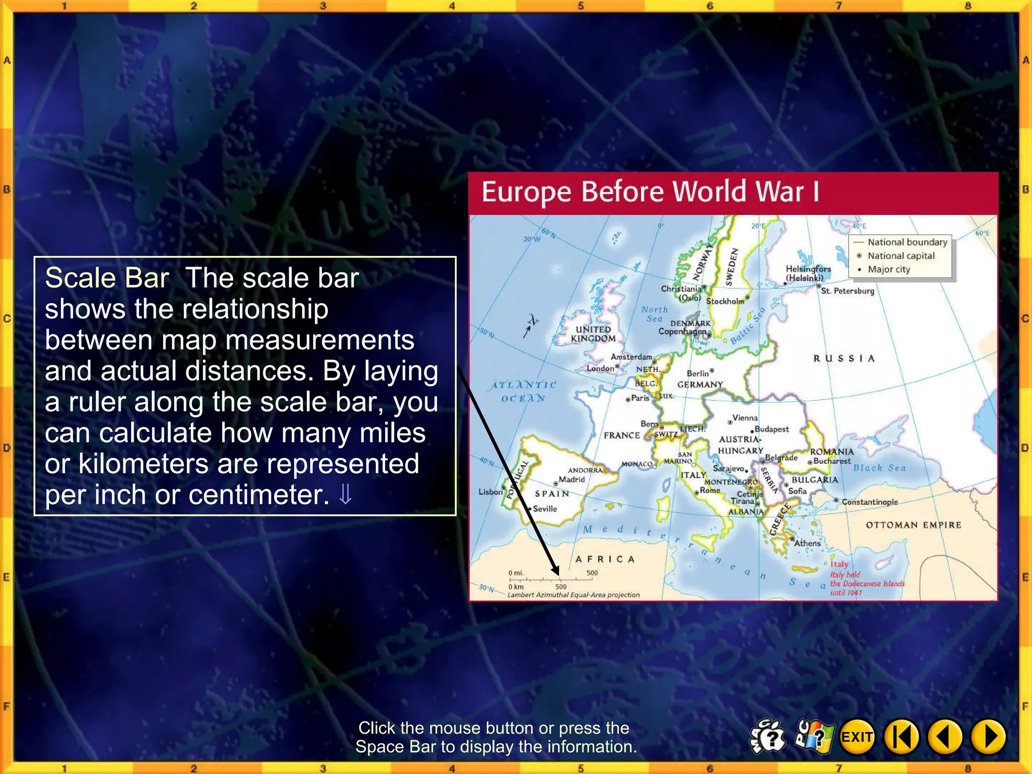
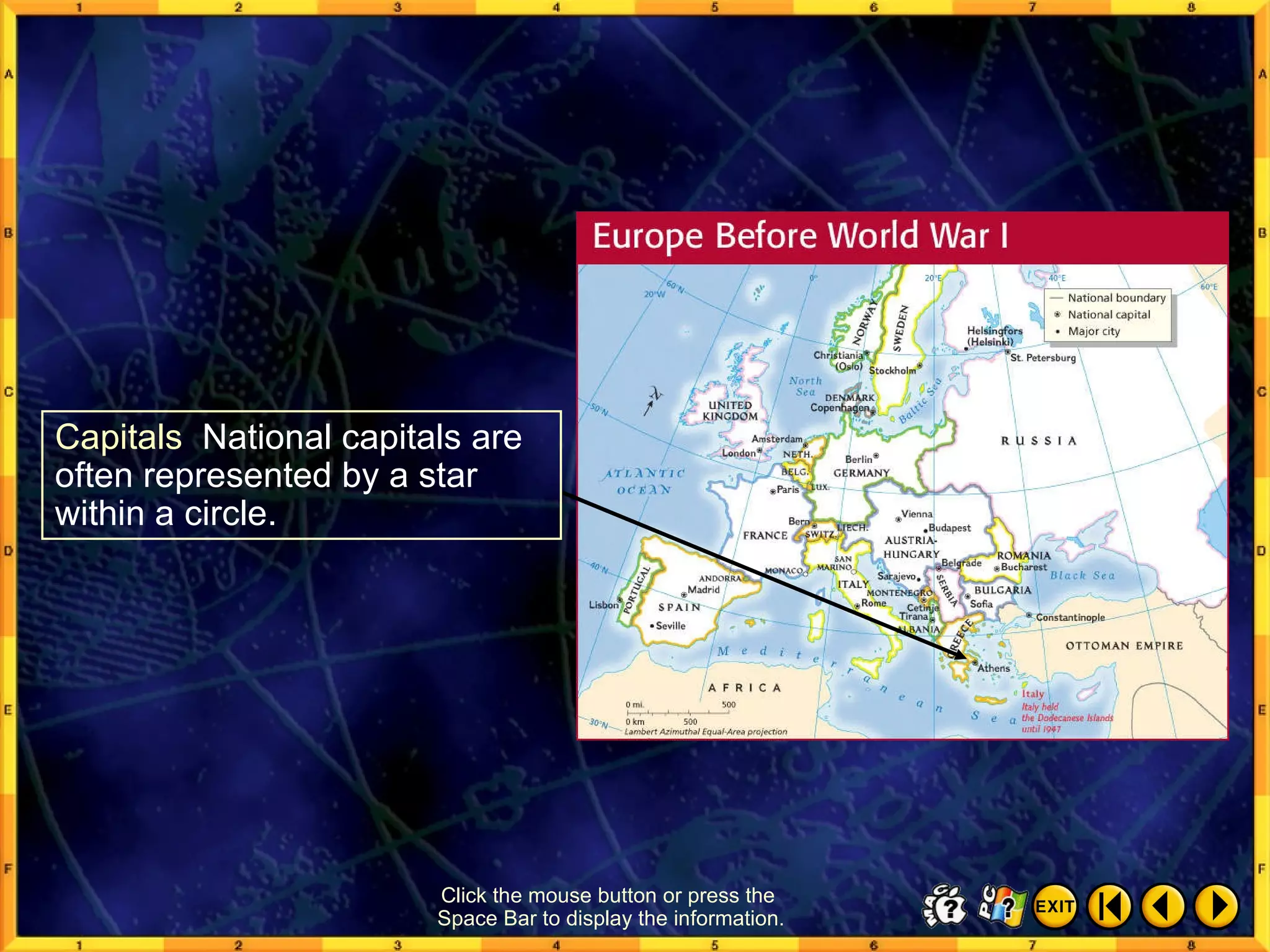
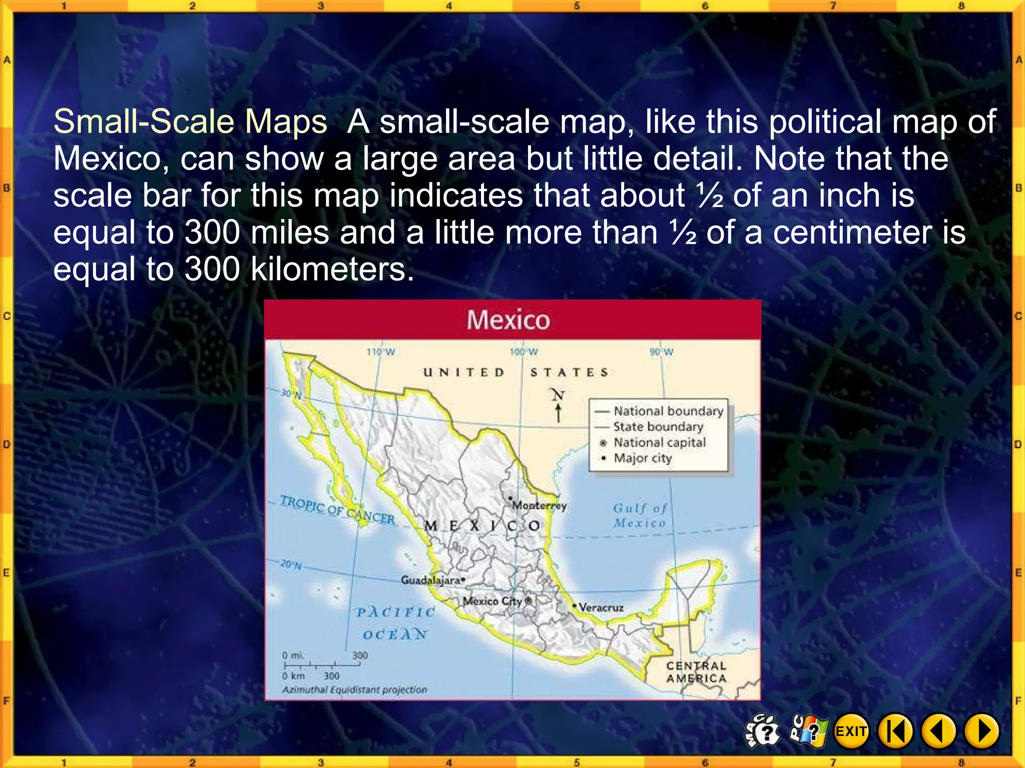
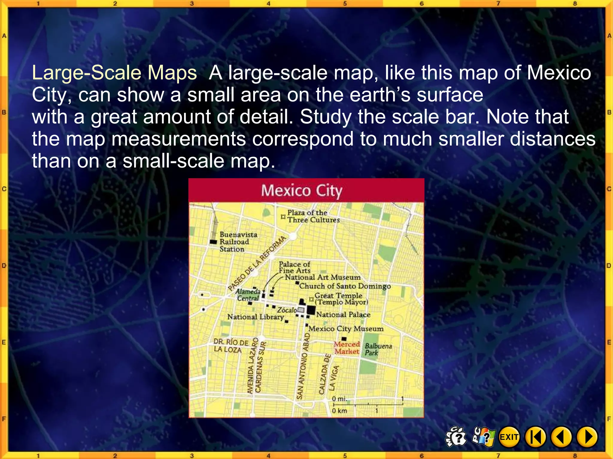
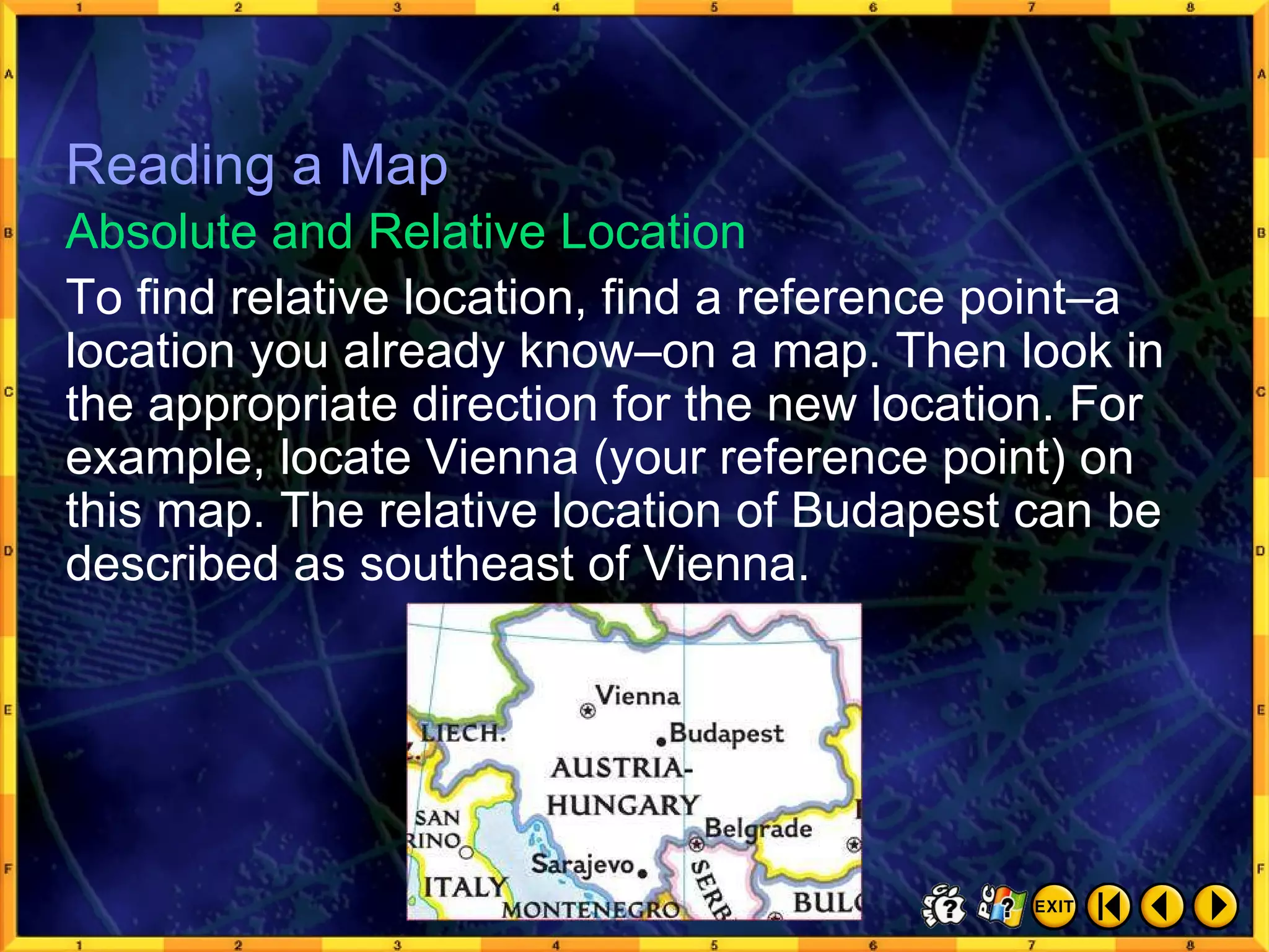
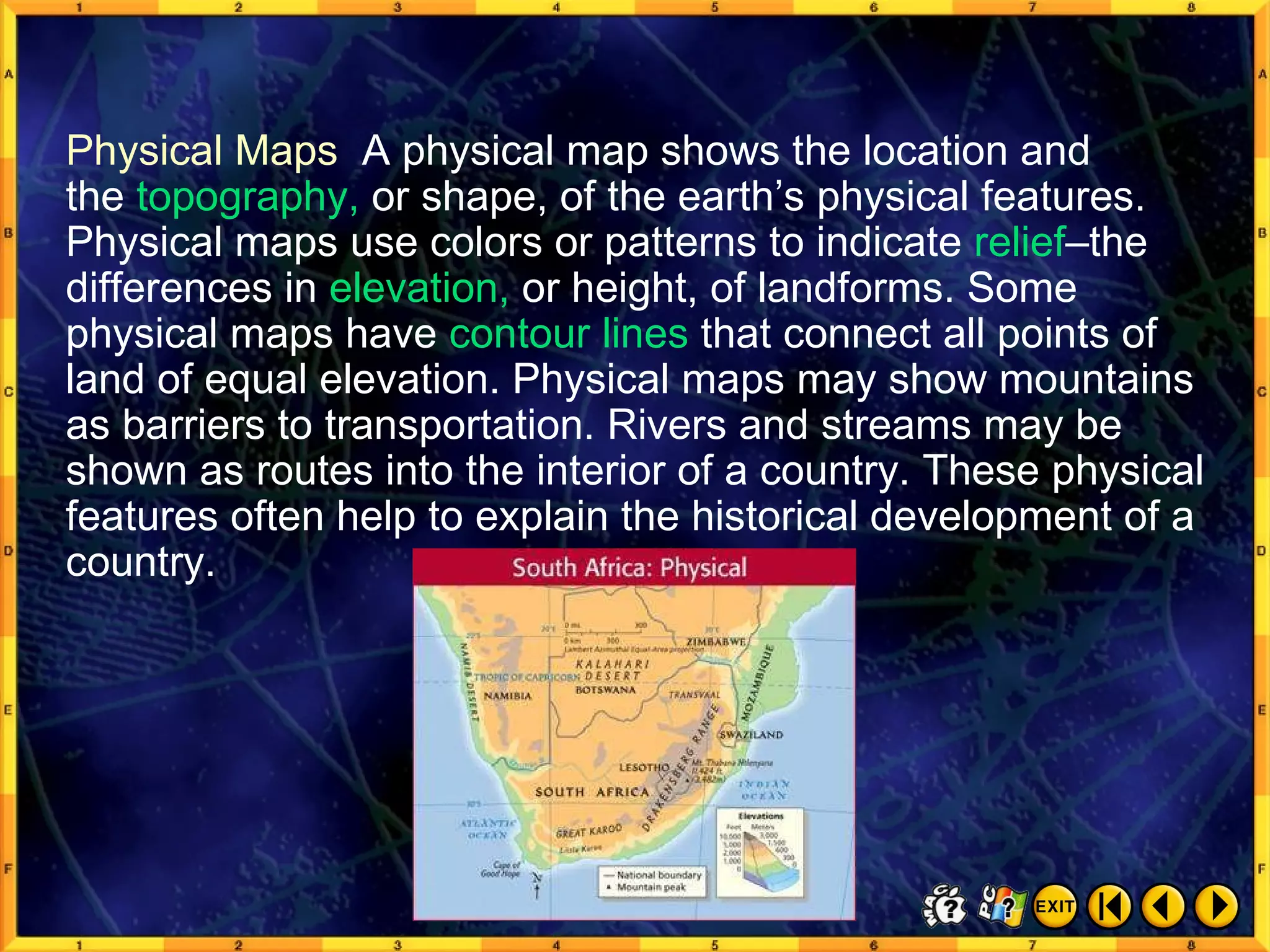
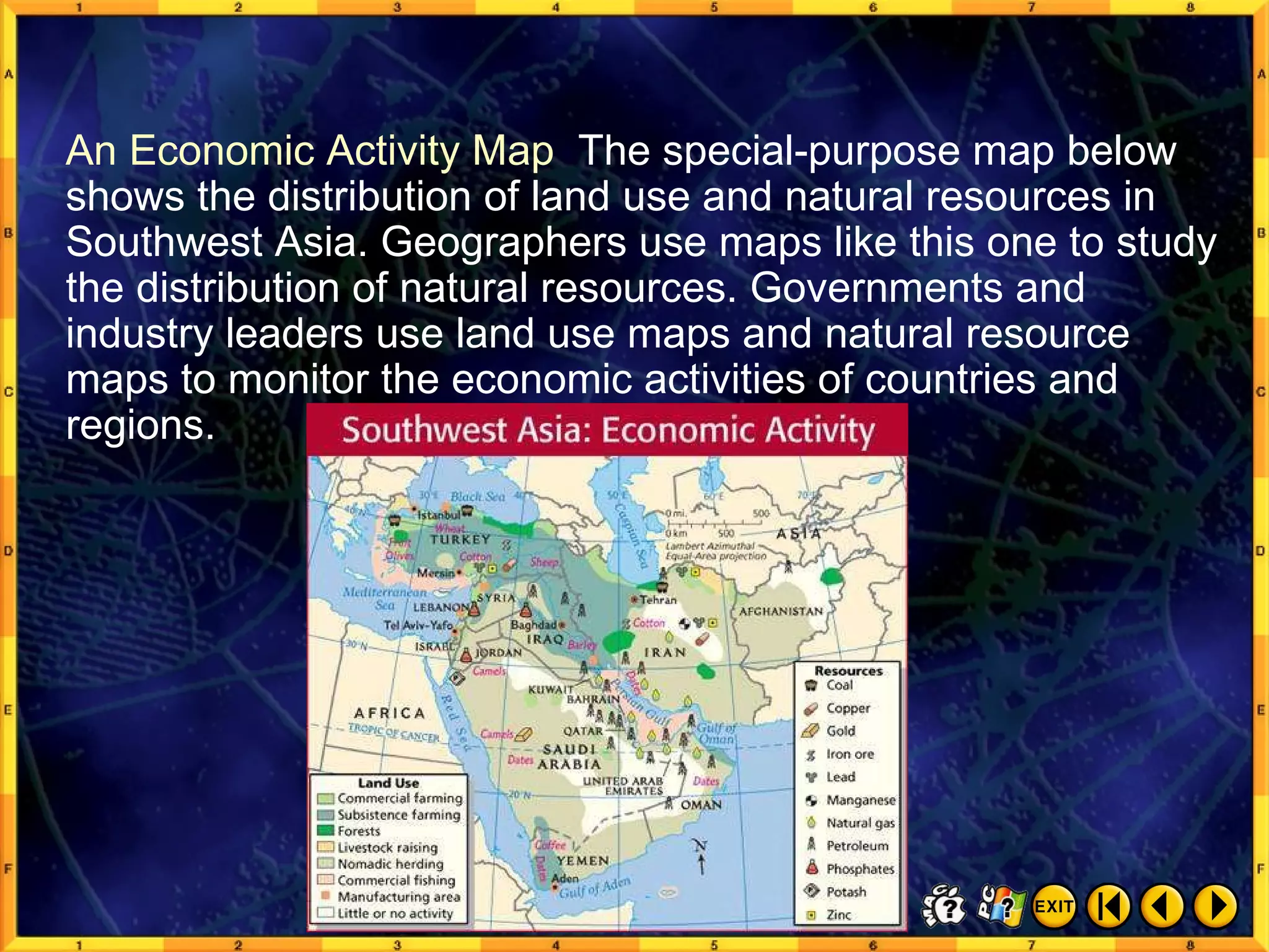
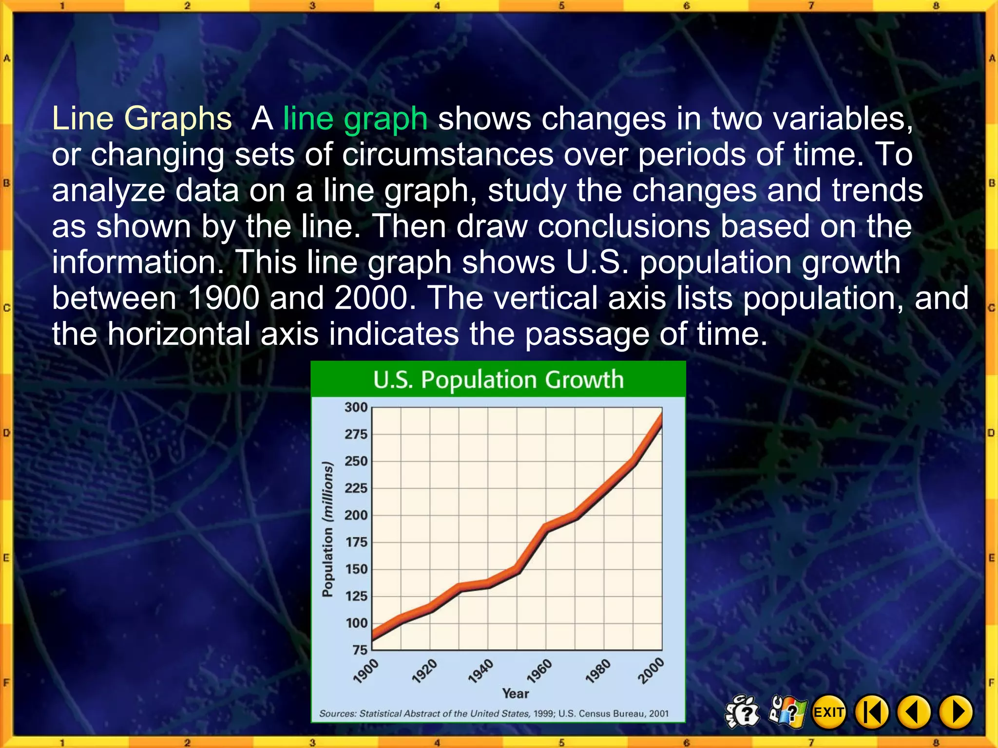
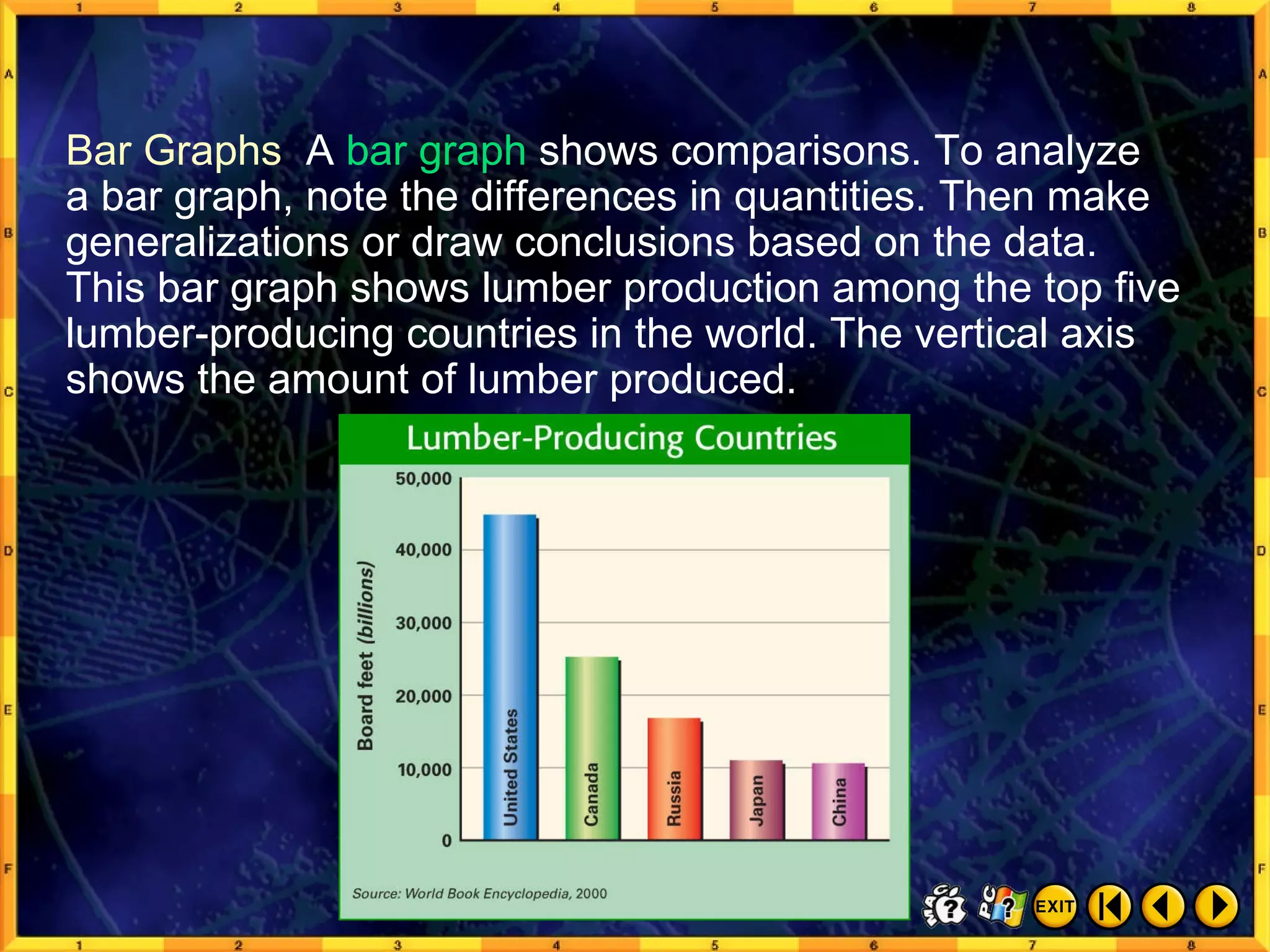
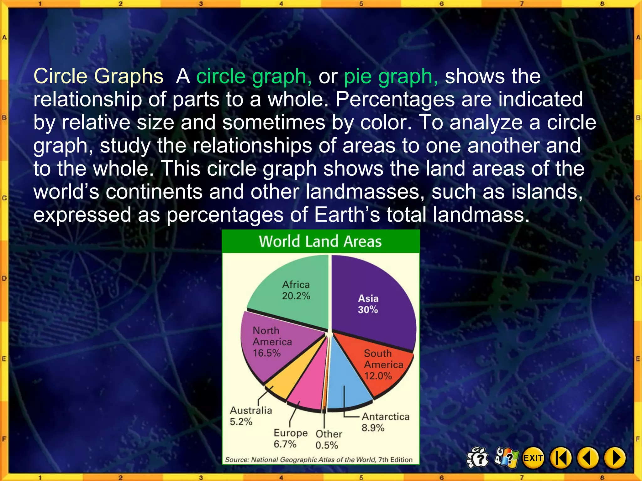
This document introduces various geographic tools used to represent spatial information, including globes, maps, and other visual representations. It discusses how globes provide accurate depictions of location but lack detail, while maps show specific areas in greater detail. The document also covers map projections that translate the round earth onto a flat surface, common map elements like scale and keys, and different types of maps and graphs used by geographers.