Downloaded 1,495 times
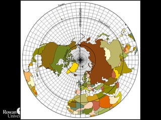
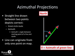
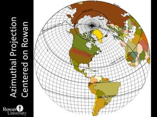
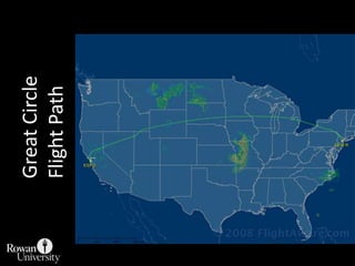


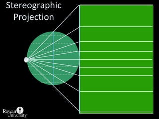
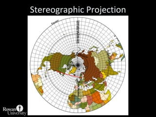
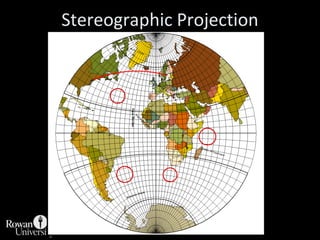
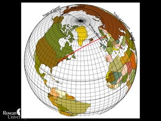
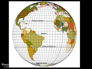
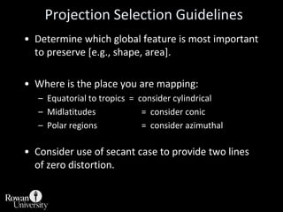
![Projection Selection GuidelinesDetermine which global feature is most important to preserve [e.g., shape, area].Where is the place you are mapping:Equatorial to tropics = consider cylindricalMidlatitudes = consider conicPolar regions = consider azimuthalConsider use of secant case to provide two lines of zero distortion.](https://image.slidesharecdn.com/lecture06projections-110221075217-phpapp01/85/Map-Projections-57-320.jpg)
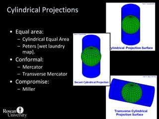
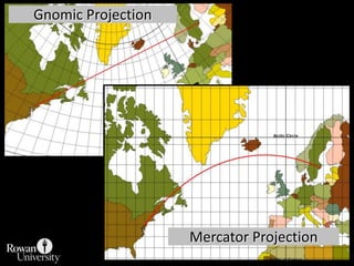
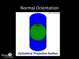
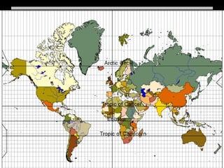
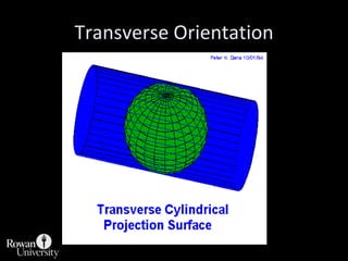
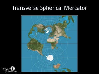
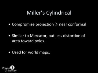
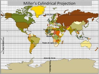
![Cylindrical ProjectionsEqual area:Cylindrical Equal AreaPeters [wet laundry map].Conformal:MercatorTransverse MercatorCompromise:Miller](https://image.slidesharecdn.com/lecture06projections-110221075217-phpapp01/85/Map-Projections-60-320.jpg)
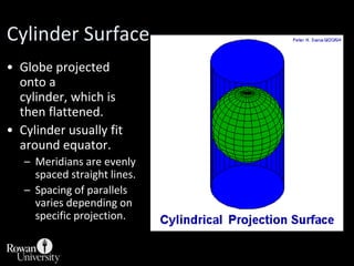
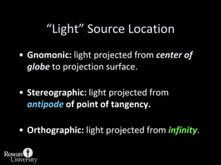
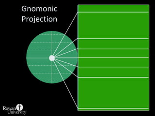
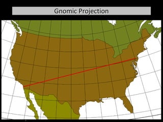
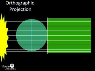
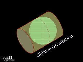
![Cylindrical ProjectionsCylinder wrapped around globe:Scale factor = 1 at equator [normal aspect]Meridians are evenly spaced. As one moves poleward, equal longitudinal distance on the map represents less and less distance on the globe.Parallel spacing varies depending on the projection. For instance different light sources result in different spacing.](https://image.slidesharecdn.com/lecture06projections-110221075217-phpapp01/85/Map-Projections-61-320.jpg)
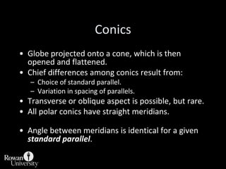
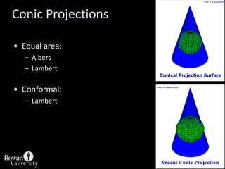
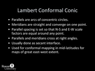
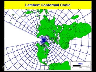
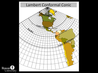
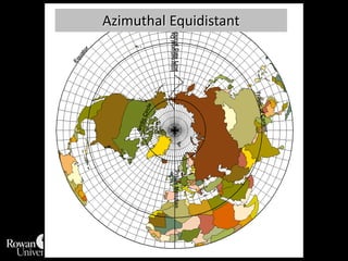
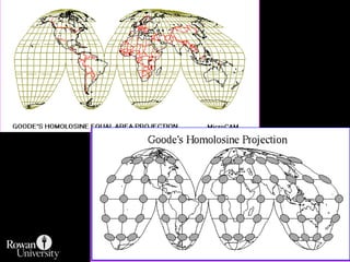
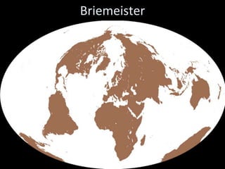
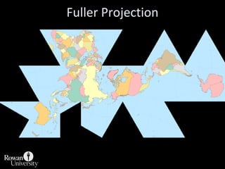

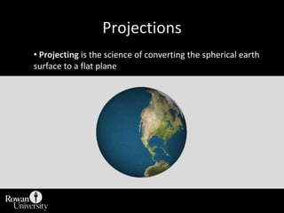
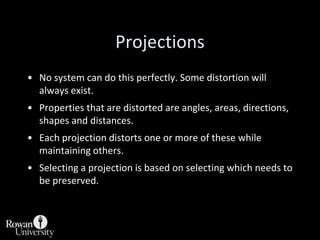
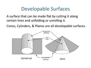
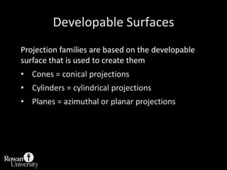
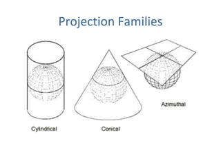
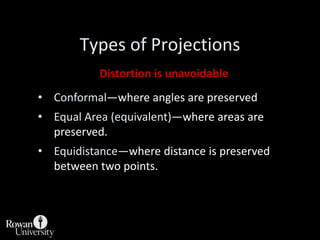
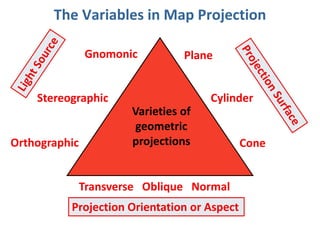
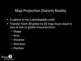
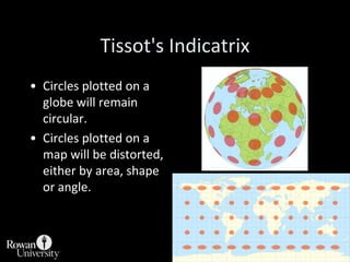
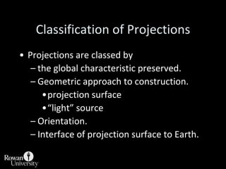
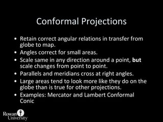
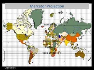
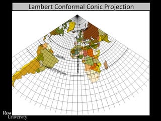
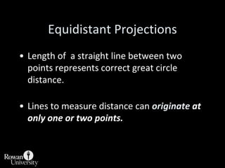
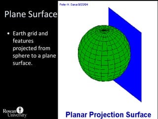
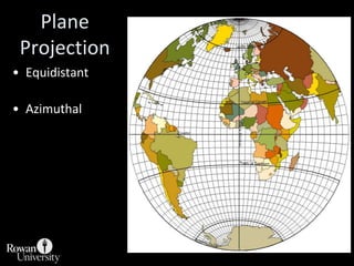
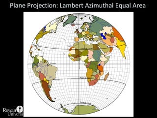
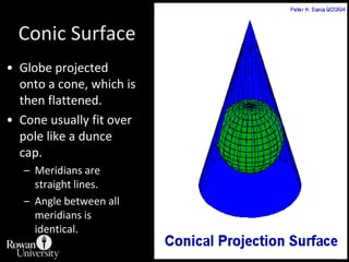
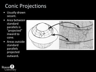
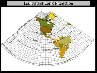
This document discusses different types of map projections used to represent the spherical earth on a flat surface. It describes how all projections involve some distortion of properties like shapes, areas, distances or directions. The key types are conformal, equivalent, and equidistant projections. It explains the concepts of projection surfaces like cones, cylinders and planes, as well as variables like the light source and orientation. Specific common projections are also outlined, such as Mercator, Lambert conformal conic, and azimuthal equidistant, along with their characteristic distortions and uses.


![CTR_ppresentation[1RRRRRRRRRRRRRRRRR].pptx](https://cdn.slidesharecdn.com/ss_thumbnails/ctrppresentation1-250330155714-ac87e8bd-thumbnail.jpg?width=640&height=640&fit=bounds)