Enterprise geodatabase sql access and administration
The document provides an overview of accessing and administering an enterprise geodatabase through SQL and Python. It discusses how the geodatabase is based on relational database principles with user data stored in tables and system metadata stored in system tables. It describes how spatial types store geometry data and the benefits of using SQL to access and edit geodatabase content. The document also outlines how Python can be used for geodatabase administration tasks like schema creation, maintenance, and publishing tools.
Enterprise geodatabase sql access and administration
1.
Accessing and Administeringyour
Enterprise Geodatabase through
SQL and Python
Brent Pierce @brent_pierce
Russell Brennan @russellbrennan
hashtag: #sqlpy
2.
Assumptions
• Basic knowledge of SQL, Python and relational
databases
• Basic knowledge of the Geodatabase
• We’ll hold all questions till end
Please turn off cell phones
3.
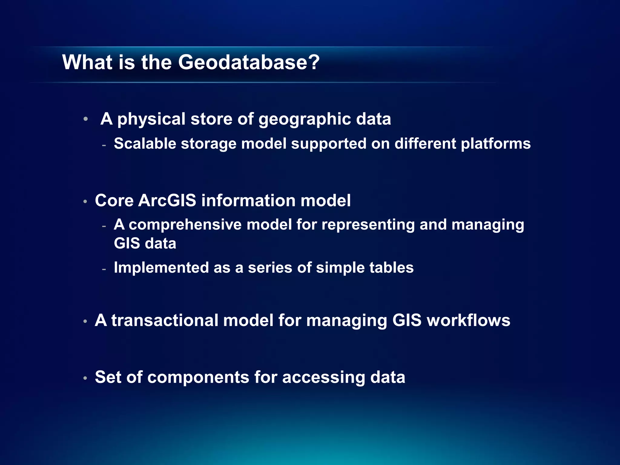
What is theGeodatabase?
• A physical store of geographic data
- Scalable storage model supported on different platforms
• Core ArcGIS information model
- A comprehensive model for representing and managing
GIS data
- Implemented as a series of simple tables
• A transactional model for managing GIS workflows
• Set of components for accessing data
4.
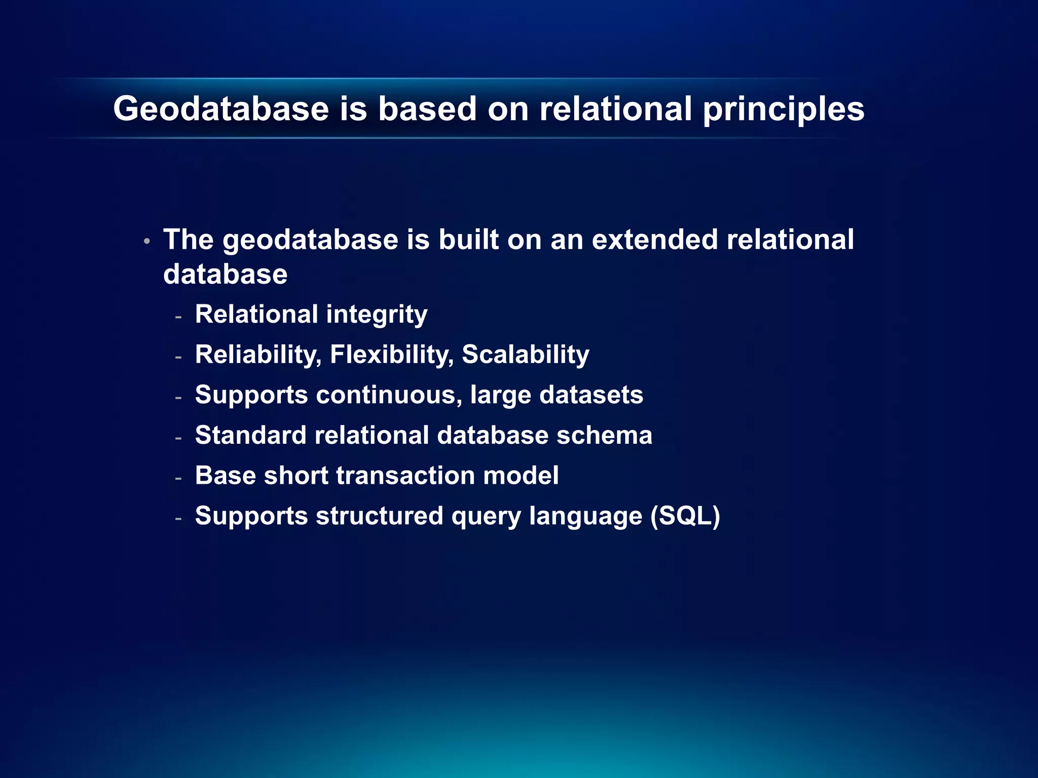
Geodatabase is basedon relational principles
• The geodatabase is built on an extended relational
database
- Relational integrity
- Reliability, Flexibility, Scalability
- Supports continuous, large datasets
- Standard relational database schema
- Base short transaction model
- Supports structured query language (SQL)
5.
Geodatabase is basedon relational principles …
• Leverages key DBMS principles and concepts to
store geographic data as tables in a DBMS
- Data is organized into tables
- Tables contain rows
- All rows in a table have the same attributes
- Each attribute has a type
- Relational integrity rules exist for tables
6.
Geodatabase is basedon relational principles …
• A feature class is stored as a simple DBMS table
• Each row represents a feature
• The fields in each row represent various
characteristics or properties of the feature
• One of the fields holds the feature geometry which is
stored as a spatial type
7.
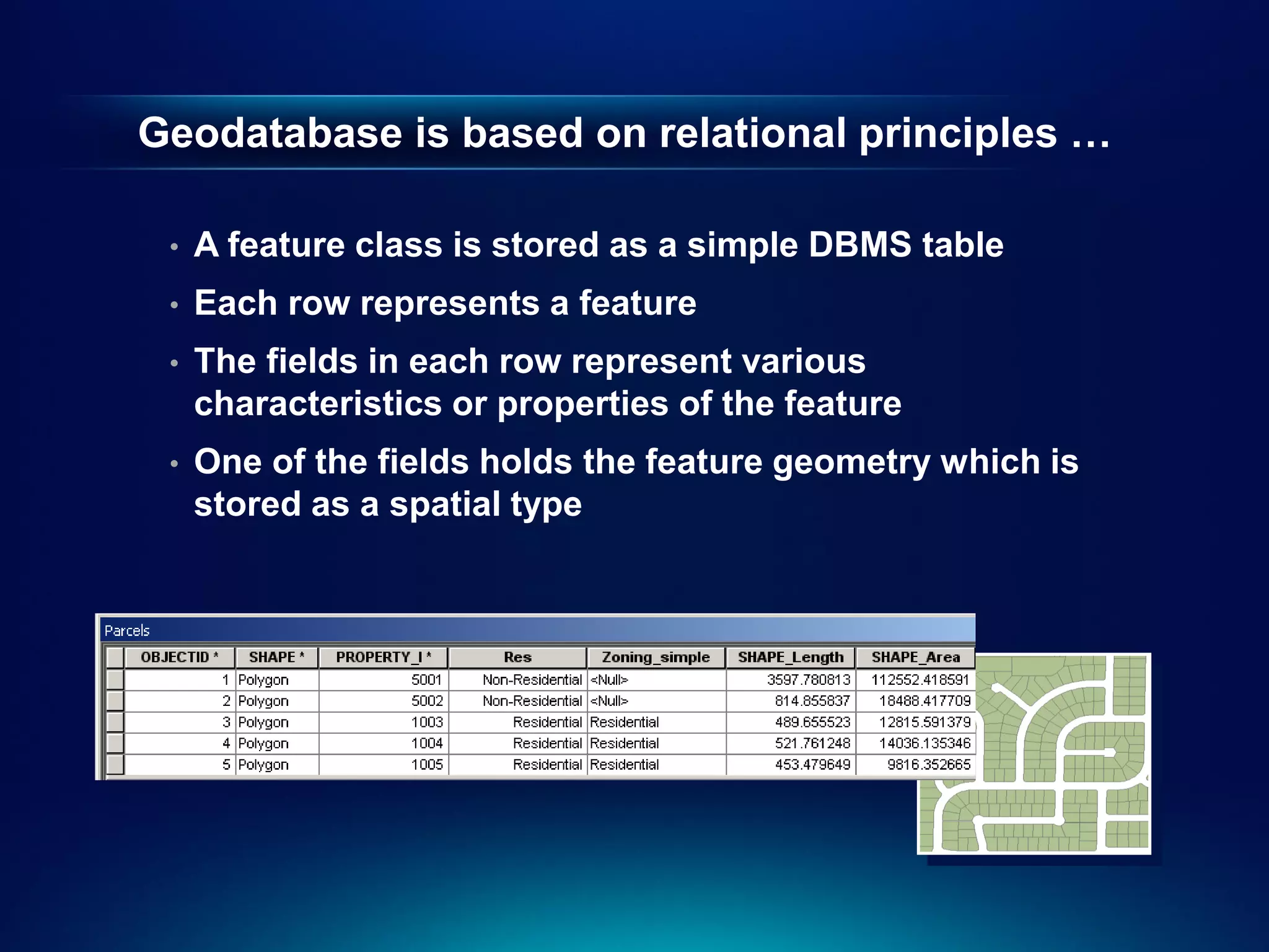
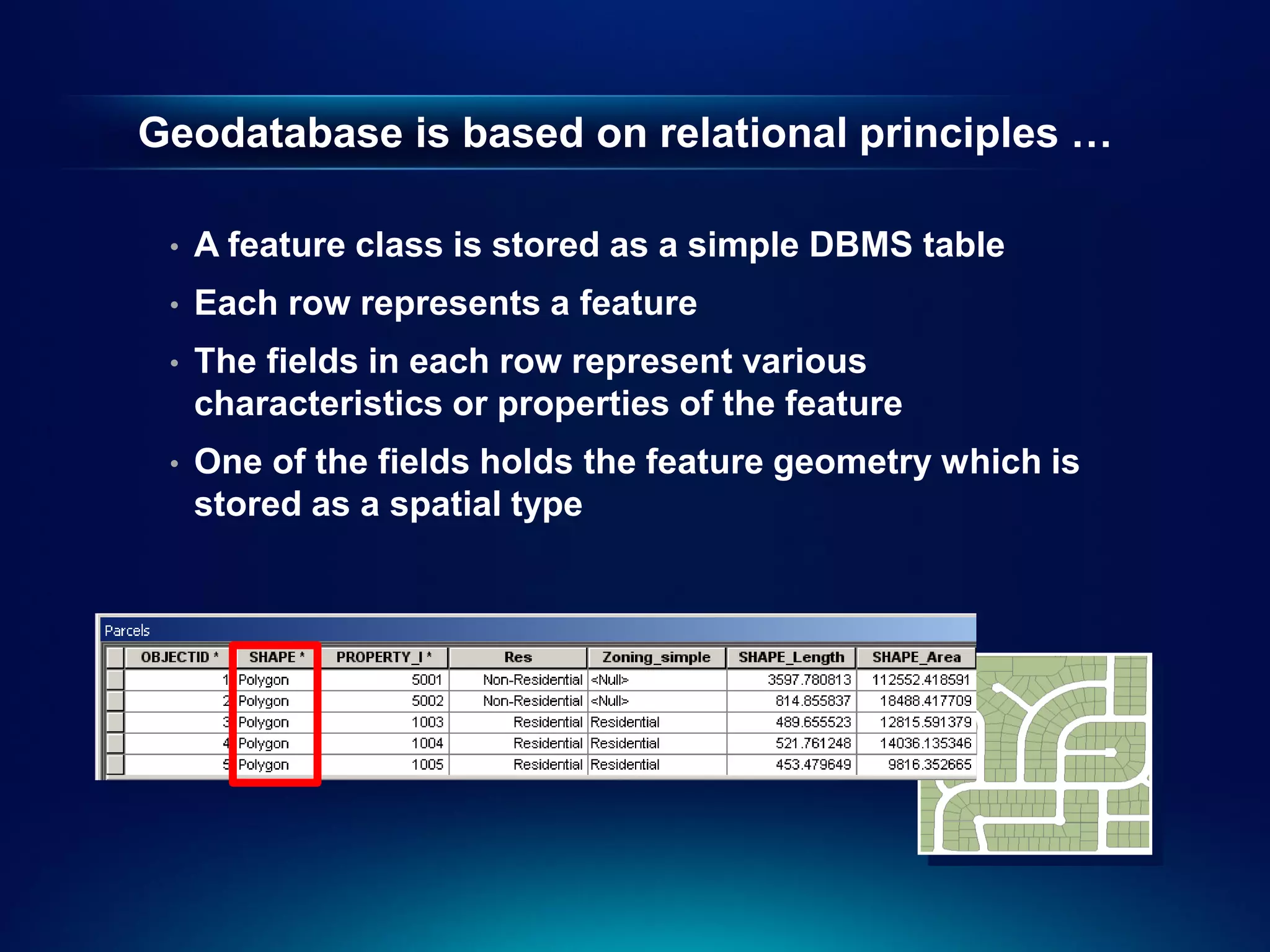
Geodatabase is basedon relational principles …
• A feature class is stored as a simple DBMS table
• Each row represents a feature
• The fields in each row represent various
characteristics or properties of the feature
• One of the fields holds the feature geometry which is
stored as a spatial type
8.
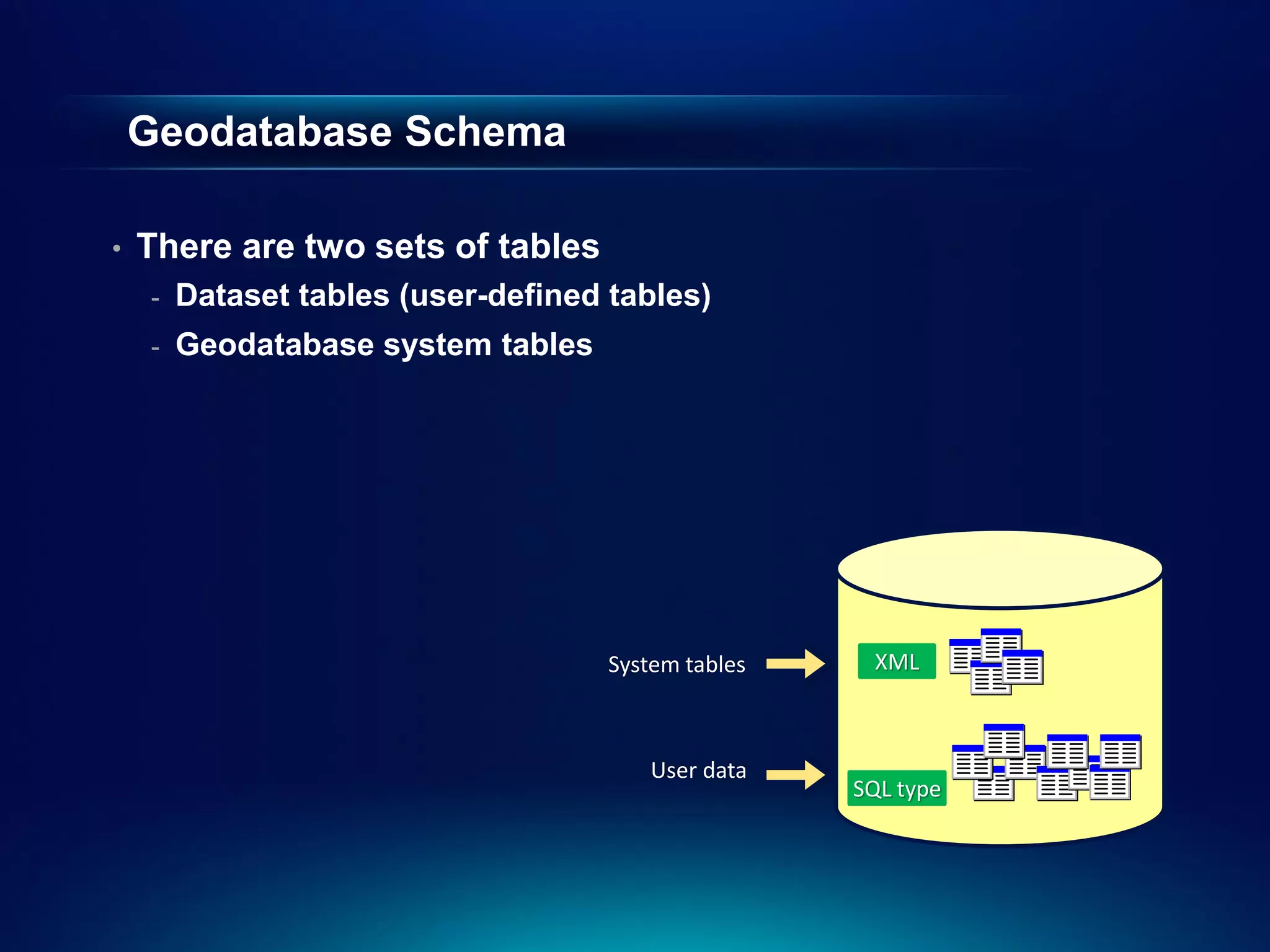
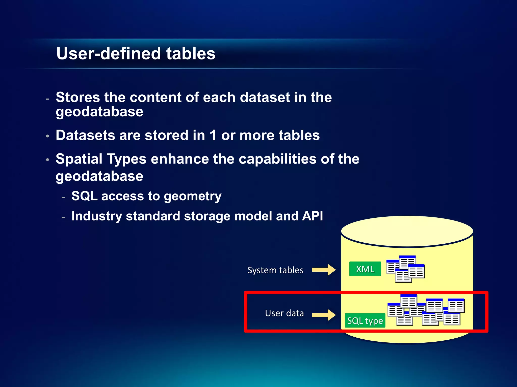
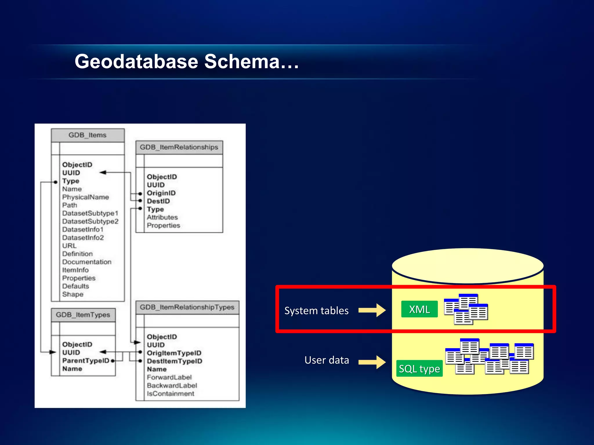
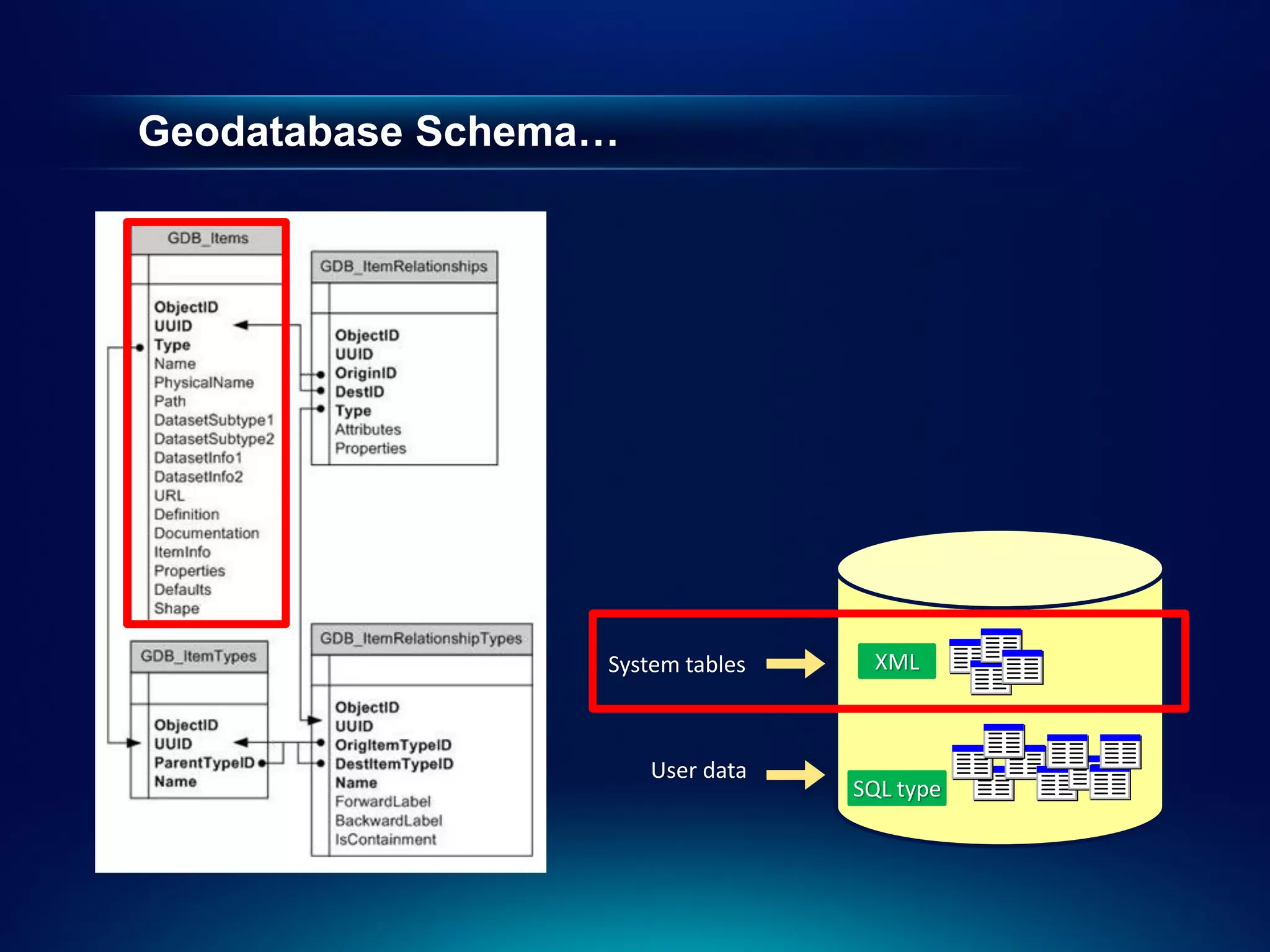
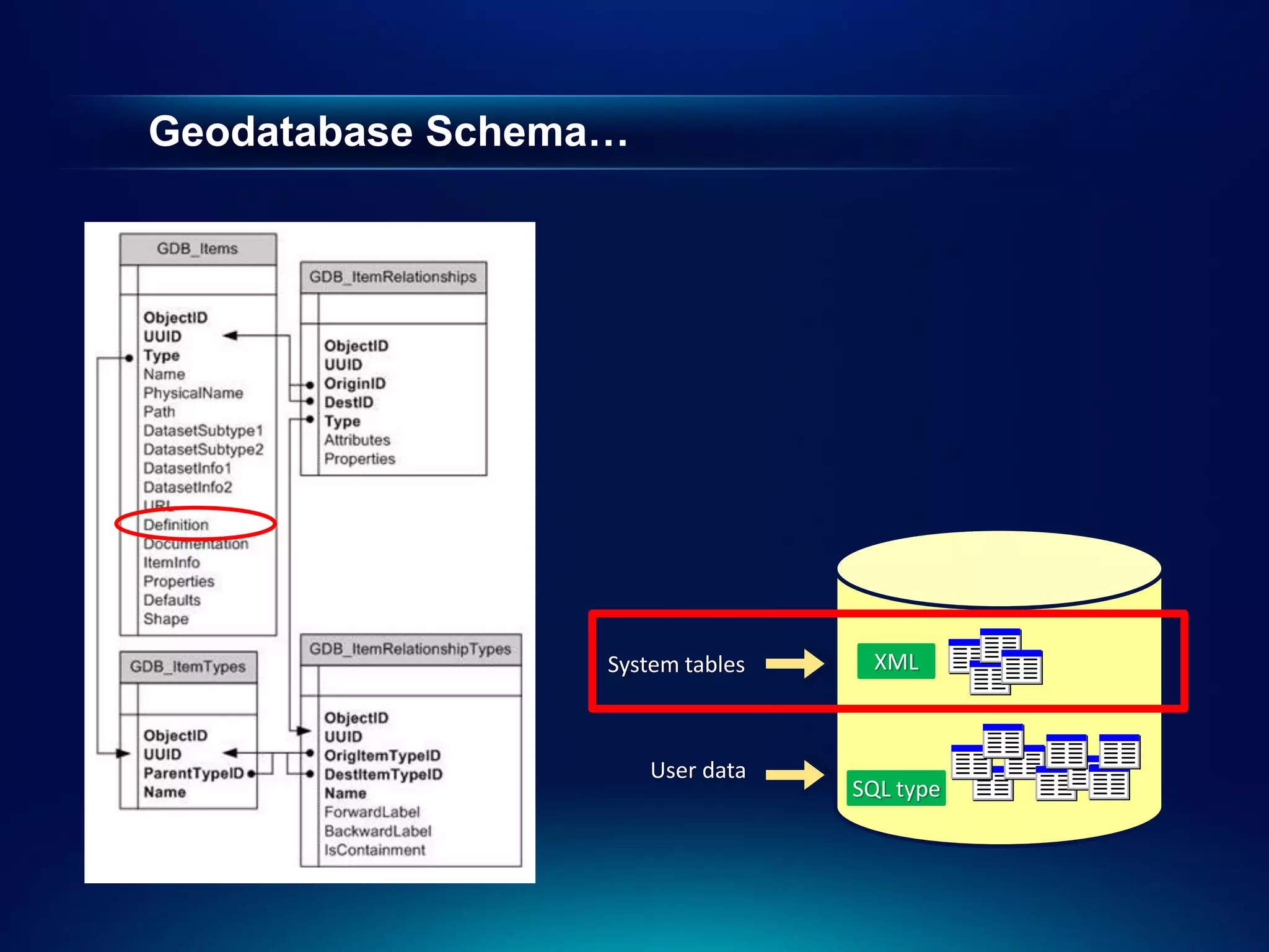
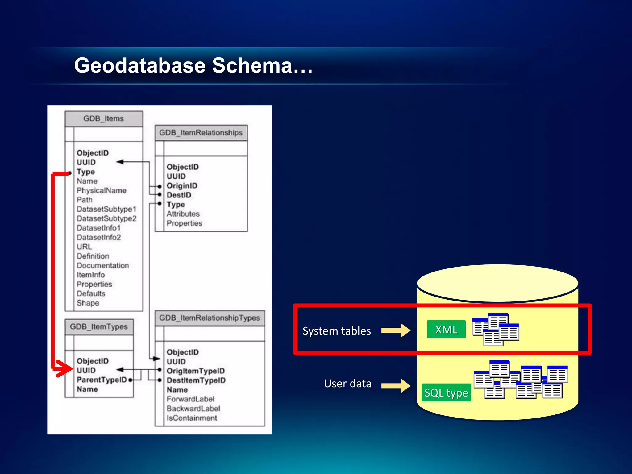
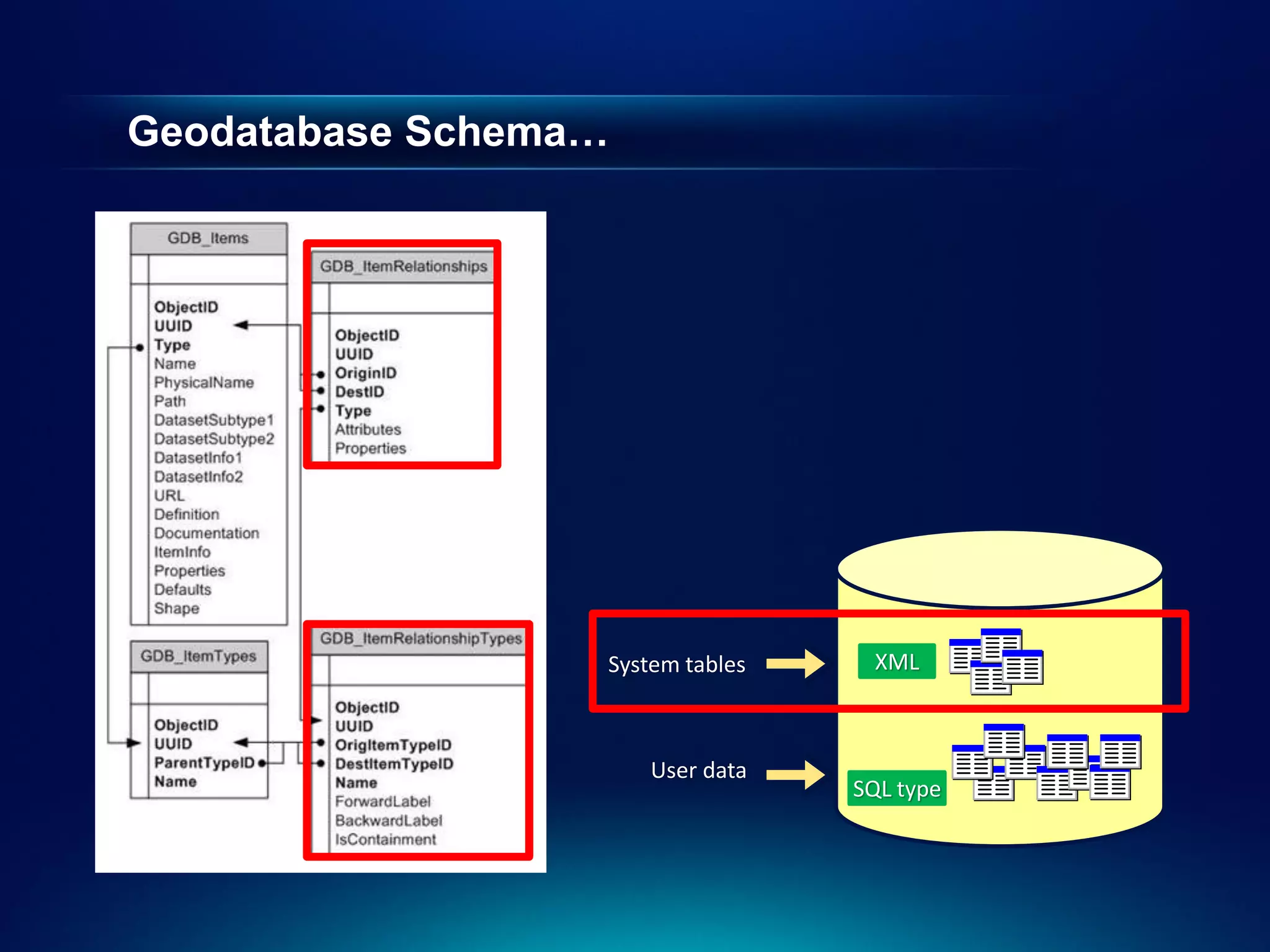
Geodatabase Schema
• There are two sets of tables
- Dataset tables (user-defined tables)
- Geodatabase system tables
System tables XML
User data
SQL type
9.
User-defined tables
- Stores the content of each dataset in the
geodatabase
• Datasets are stored in 1 or more tables
• Spatial Types enhance the capabilities of the
geodatabase
- SQL access to geometry
- Industry standard storage model and API
System tables XML
User data
SQL type
10.
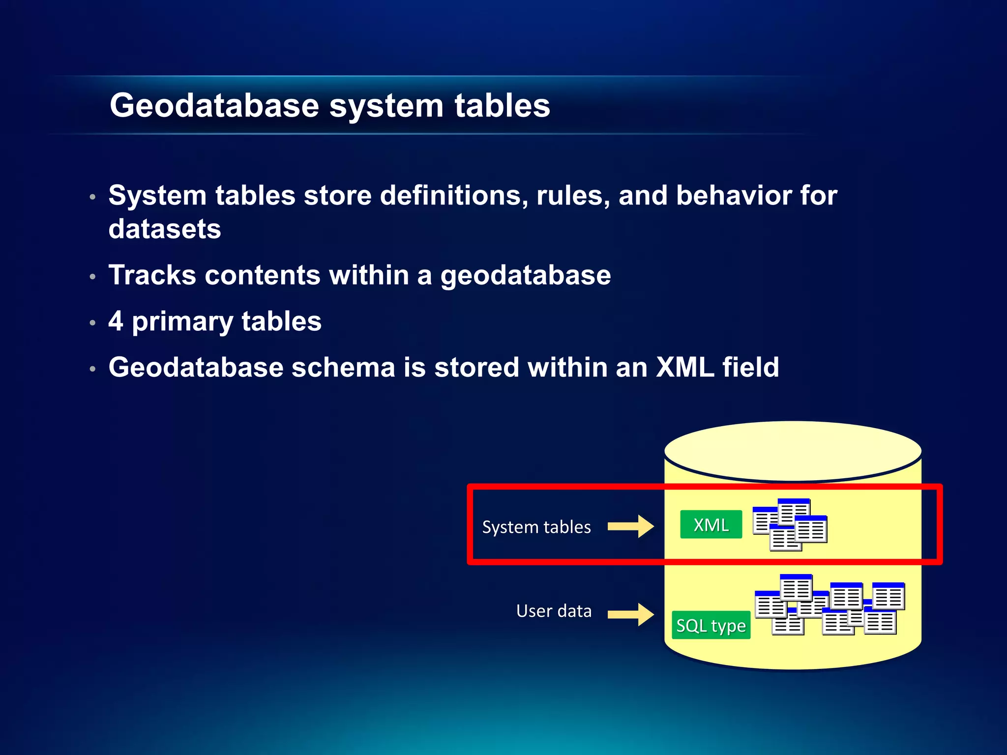
Geodatabase system tables
• System tables store definitions, rules, and behavior for
datasets
• Tracks contents within a geodatabase
• 4 primary tables
• Geodatabase schema is stored within an XML field
System tables XML
User data
SQL type
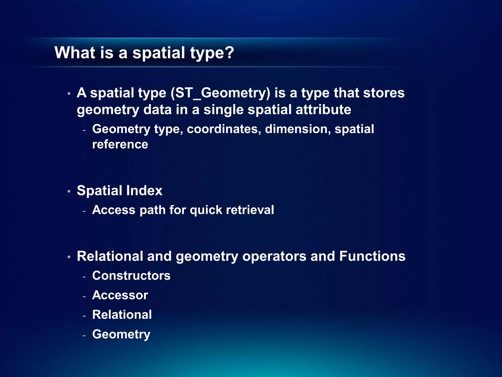
What is aspatial type?
• A spatial type (ST_Geometry) is a type that stores
geometry data in a single spatial attribute
- Geometry type, coordinates, dimension, spatial
reference
• Spatial Index
- Access path for quick retrieval
• Relational and geometry operators and Functions
- Constructors
- Accessor
- Relational
- Geometry
17.
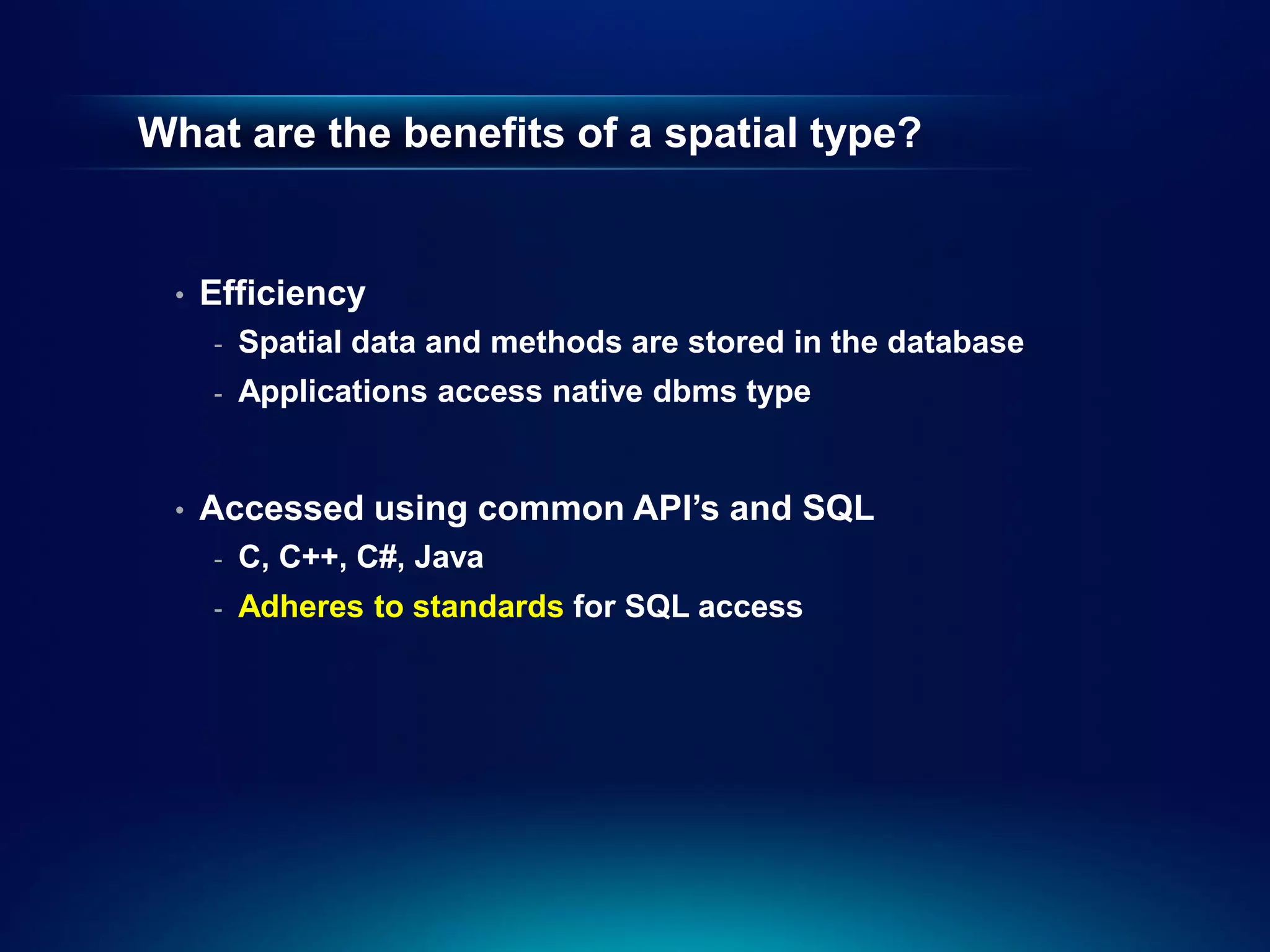
What are thebenefits of a spatial type?
• Efficiency
- Spatial data and methods are stored in the database
- Applications access native dbms type
• Accessed using common API’s and SQL
- C, C++, C#, Java
- Adheres to standards for SQL access
18.
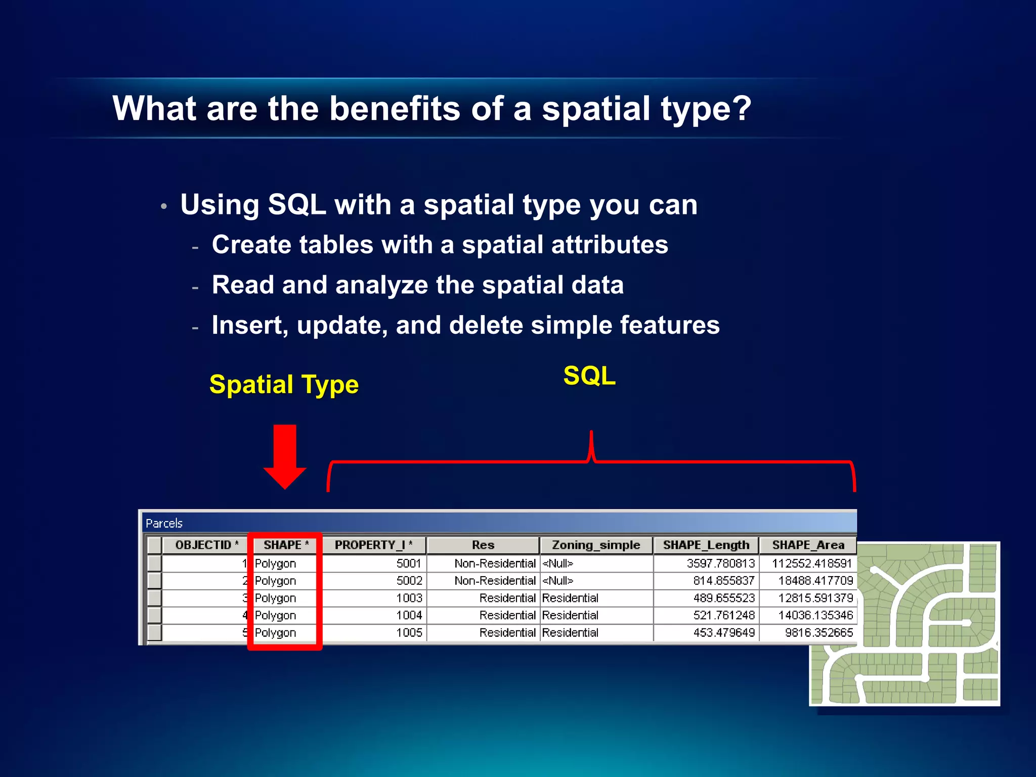
What are thebenefits of a spatial type?
• Using SQL with a spatial type you can
- Create tables with a spatial attributes
- Read and analyze the spatial data
- Insert, update, and delete simple features
Spatial Type SQL
19.
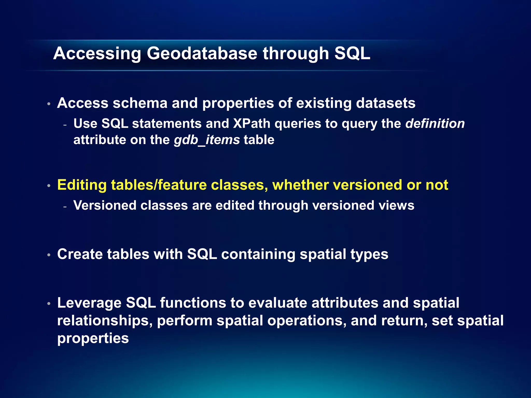
Accessing Geodatabase throughSQL
• Access schema and properties of existing datasets
- Use SQL statements and XPath queries to query the definition
attribute on the gdb_items table
• Editing tables/feature classes, whether versioned or not
- Versioned classes are edited through versioned views
• Create tables with SQL containing spatial types
• Leverage SQL functions to evaluate attributes and spatial
relationships, perform spatial operations, and return, set spatial
properties
20.
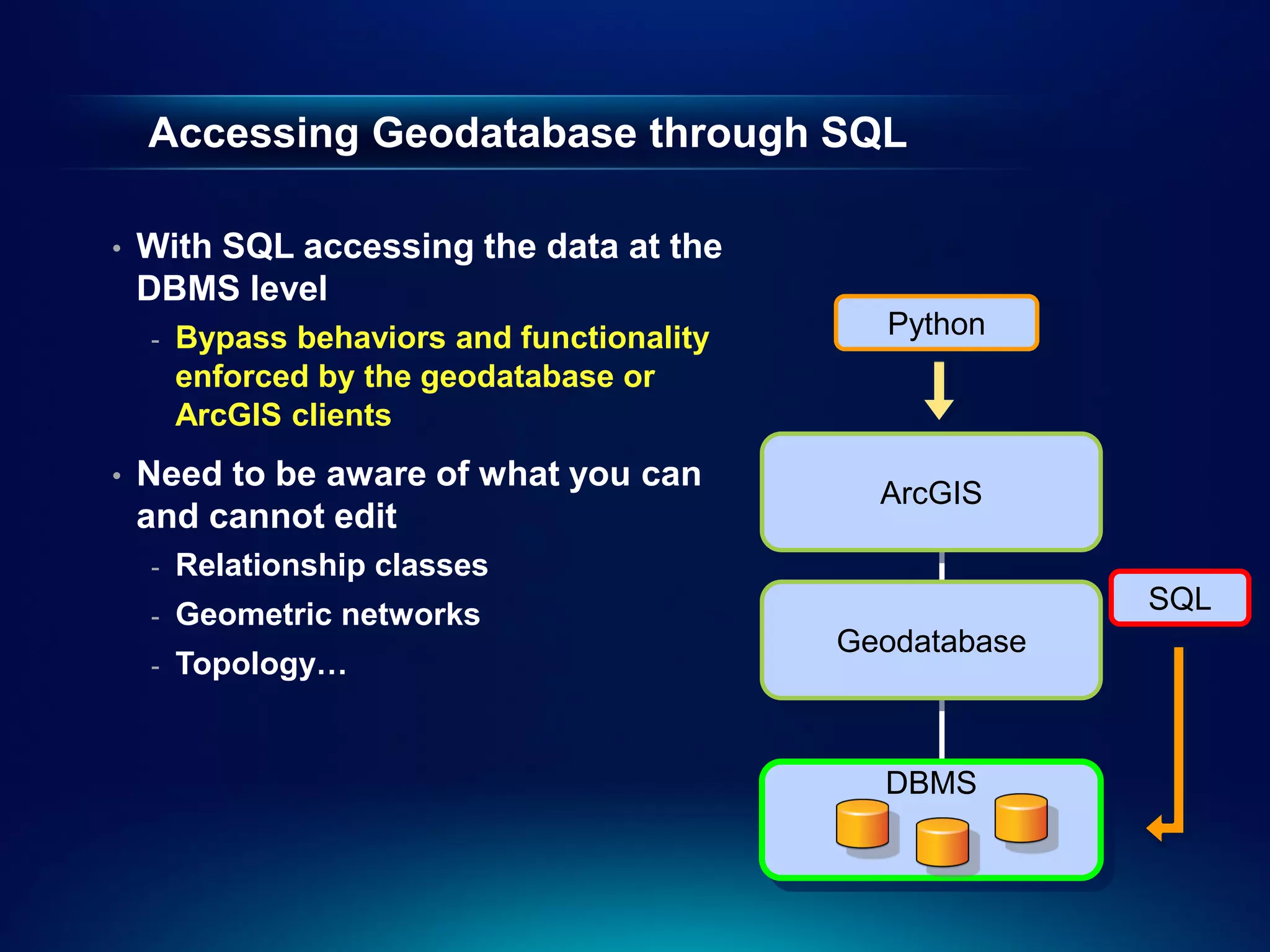
Accessing Geodatabase throughSQL
• With SQL accessing the data at the
DBMS level
- Bypass behaviors and functionality Python
enforced by the geodatabase or
ArcGIS clients
• Need to be aware of what you can
ArcGIS
and cannot edit
- Relationship classes
- Geometric networks SQL
Geodatabase
- Topology…
DBMS
21.
Accessing Geodatabase throughSQL
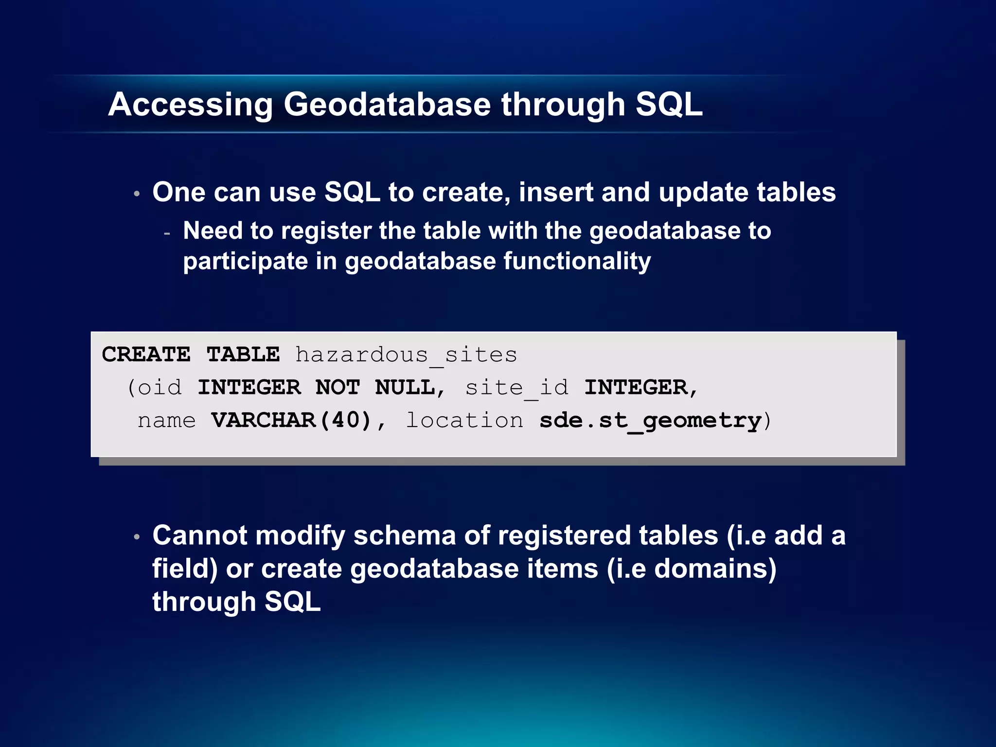
• One can use SQL to create, insert and update tables
- Need to register the table with the geodatabase to
participate in geodatabase functionality
CREATE TABLE hazardous_sites
(oid INTEGER NOT NULL, site_id INTEGER,
name VARCHAR(40), location sde.st_geometry)
• Cannot modify schema of registered tables (i.e add a
field) or create geodatabase items (i.e domains)
through SQL
22.
Accessing Geodatabase throughSQL
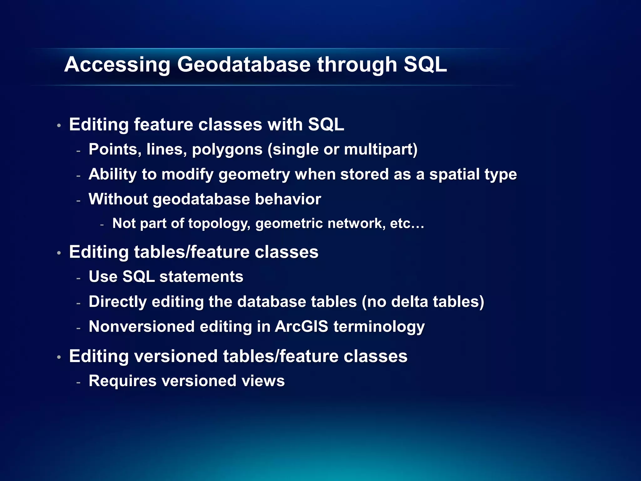
• Editing feature classes with SQL
- Points, lines, polygons (single or multipart)
- Ability to modify geometry when stored as a spatial type
- Without geodatabase behavior
- Not part of topology, geometric network, etc…
• Editing tables/feature classes
- Use SQL statements
- Directly editing the database tables (no delta tables)
- Nonversioned editing in ArcGIS terminology
• Editing versioned tables/feature classes
- Requires versioned views
23.
Editing tables/feature classes
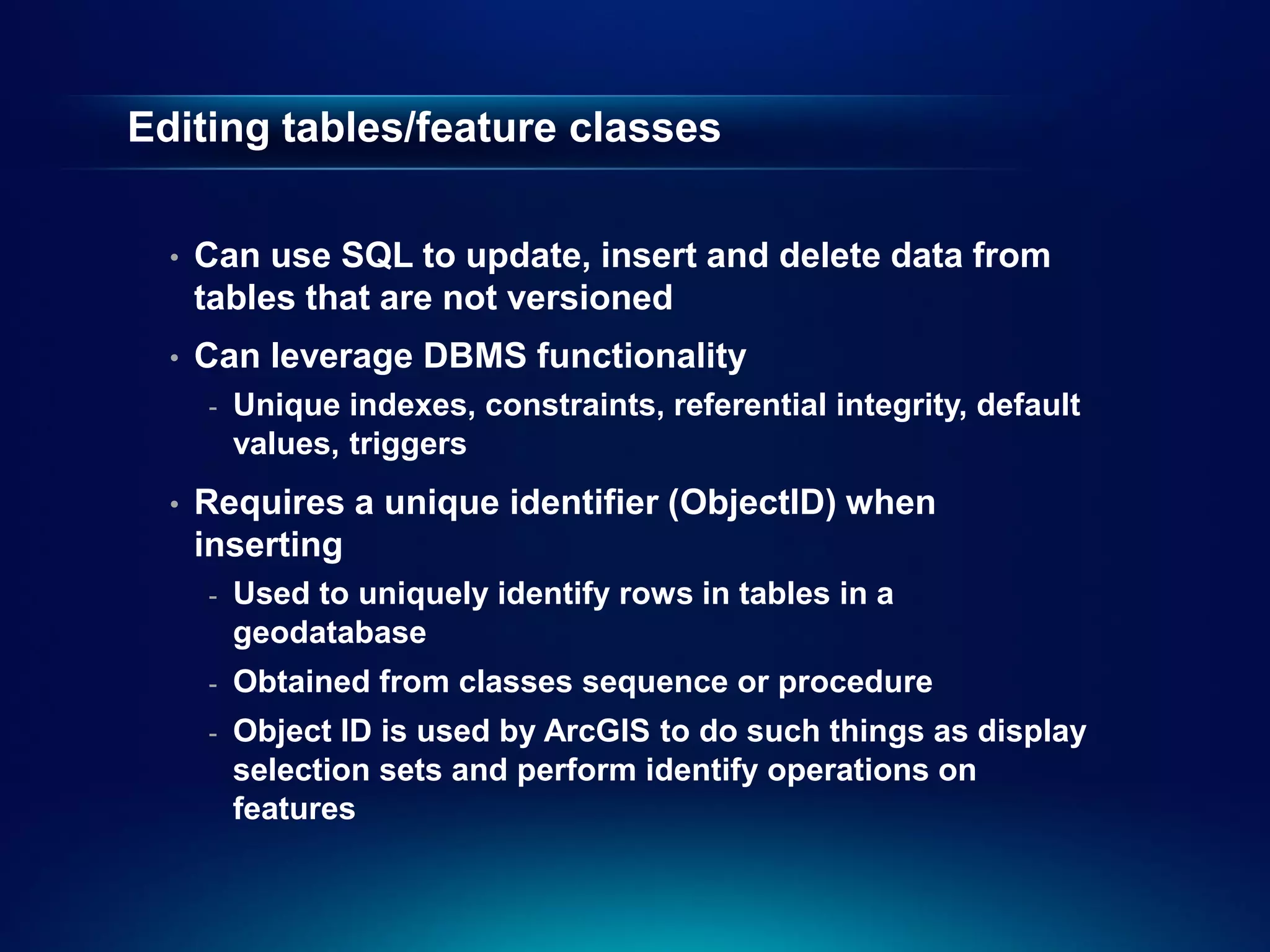
• Can use SQL to update, insert and delete data from
tables that are not versioned
• Can leverage DBMS functionality
- Unique indexes, constraints, referential integrity, default
values, triggers
• Requires a unique identifier (ObjectID) when
inserting
- Used to uniquely identify rows in tables in a
geodatabase
- Obtained from classes sequence or procedure
- Object ID is used by ArcGIS to do such things as display
selection sets and perform identify operations on
features
24.
Editing versioned tables/featureclasses
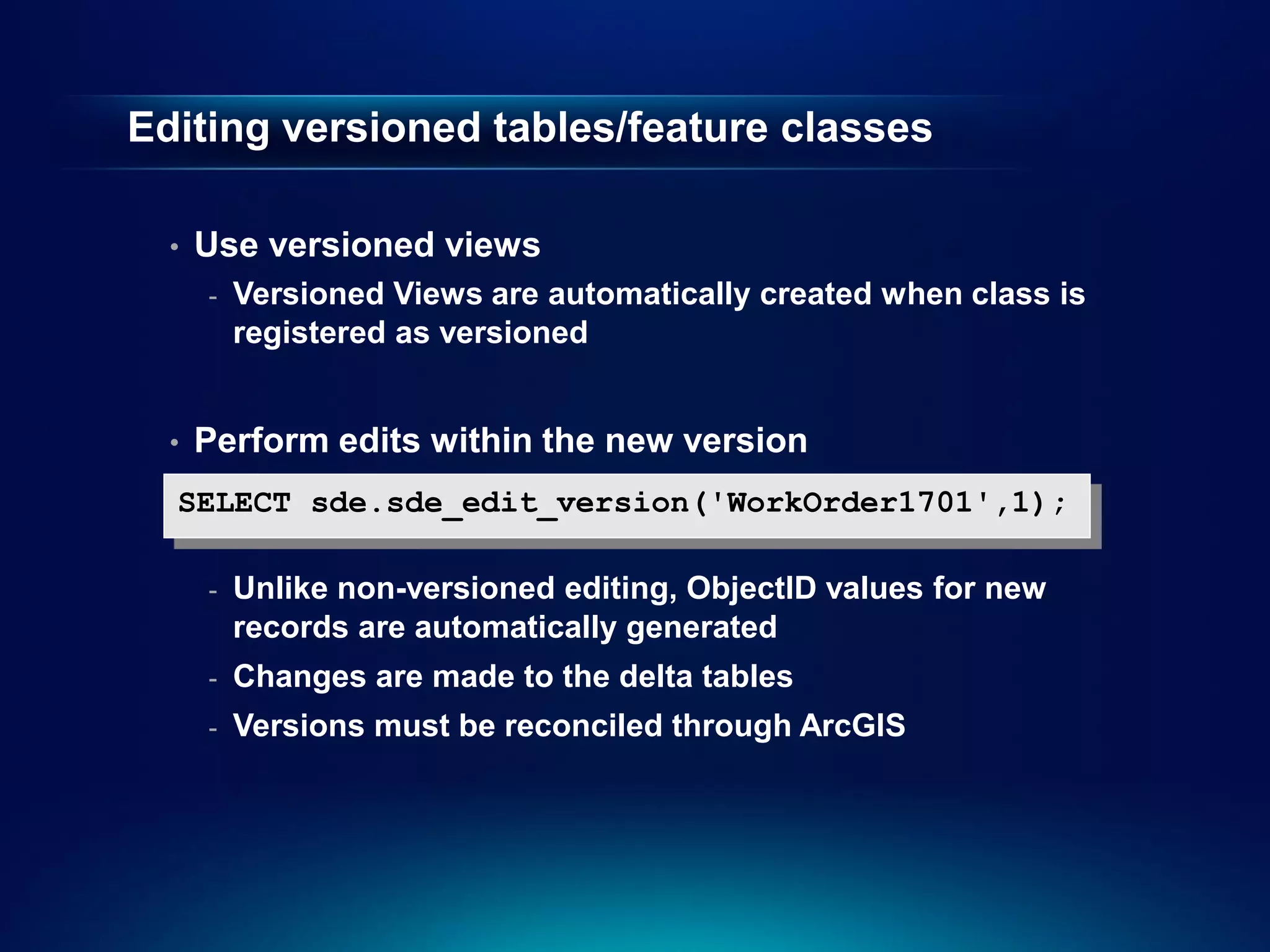
• Use versioned views
- Versioned Views are automatically created when class is
registered as versioned
• Perform edits within the new version
SELECT sde.sde_edit_version('WorkOrder1701',1);
- Unlike non-versioned editing, ObjectID values for new
records are automatically generated
- Changes are made to the delta tables
- Versions must be reconciled through ArcGIS
Second Half Agenda
• Why use Python?
• Tips for using Python with geodatabases
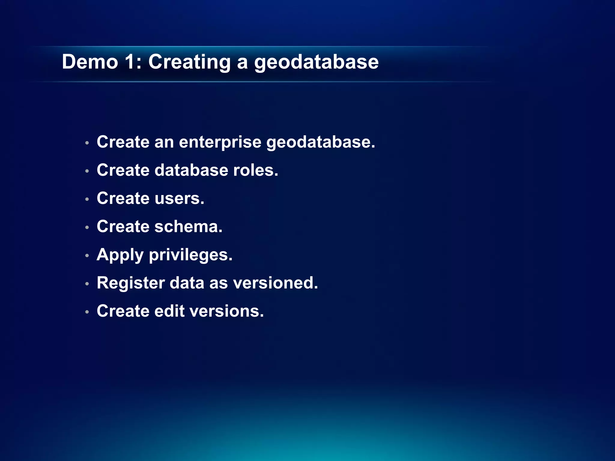
• Demo: Creating geodatabase schema
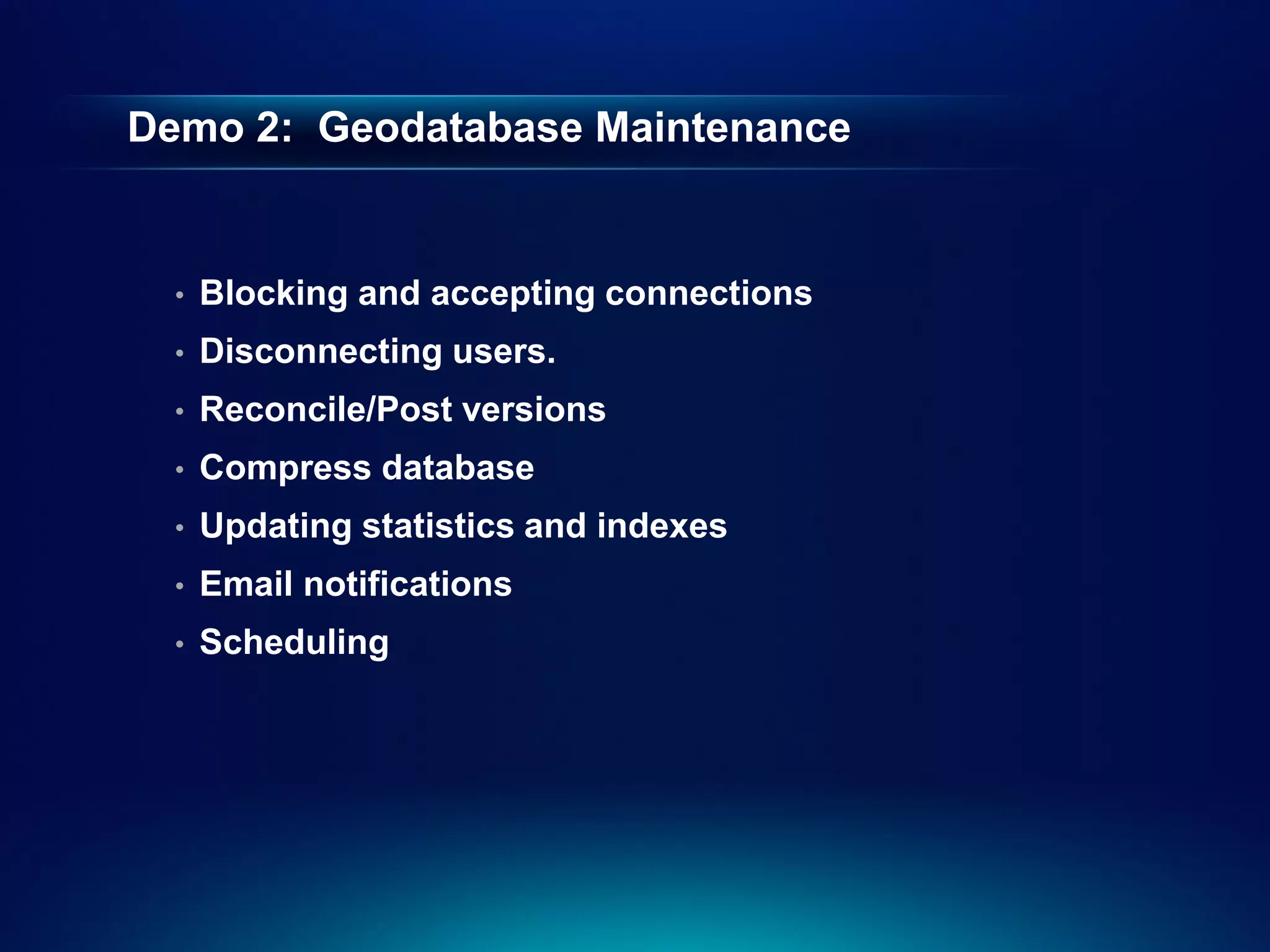
• Demo: Performing geodatabase maintenance
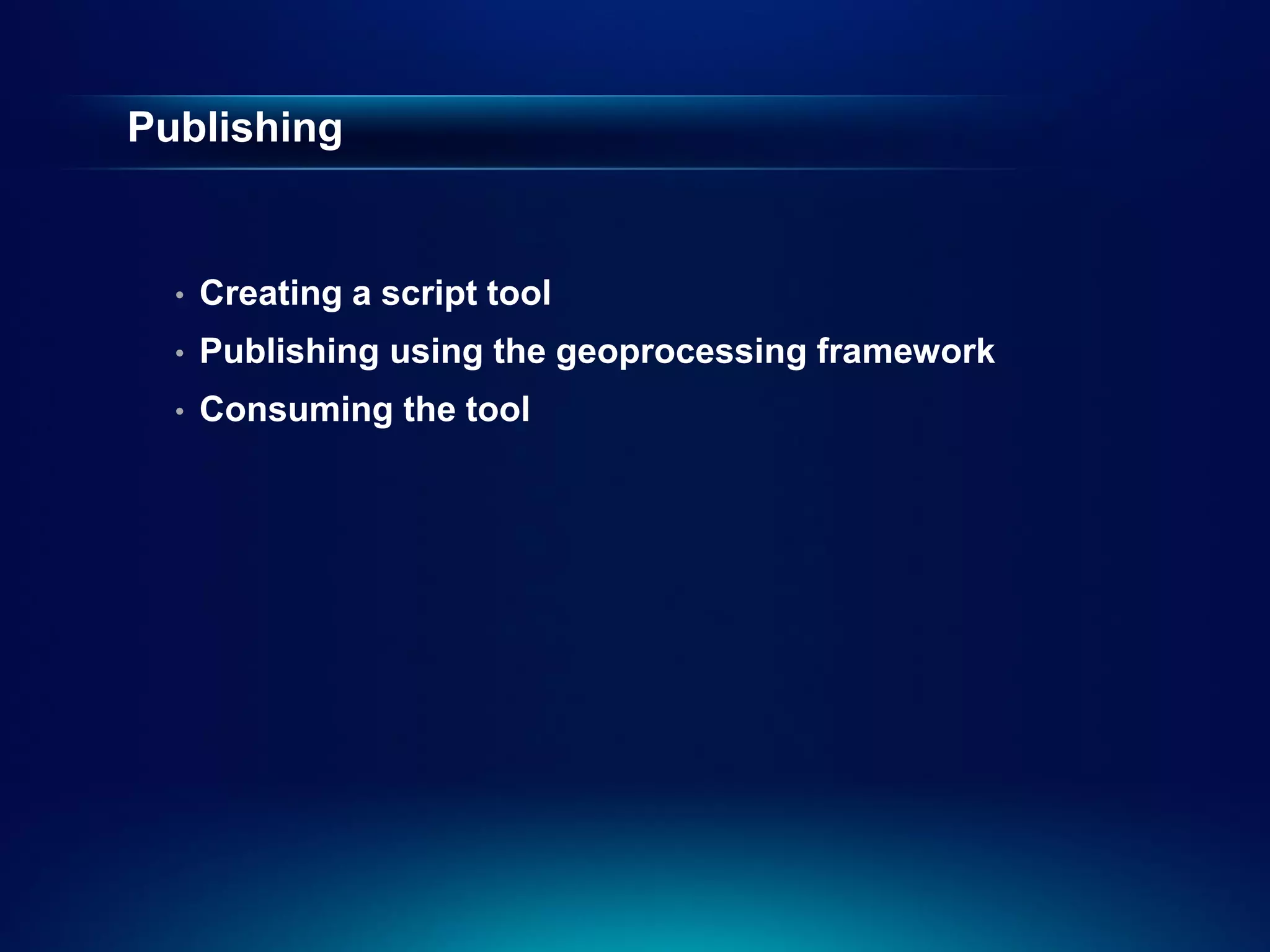
• Demo: Publishing
28.
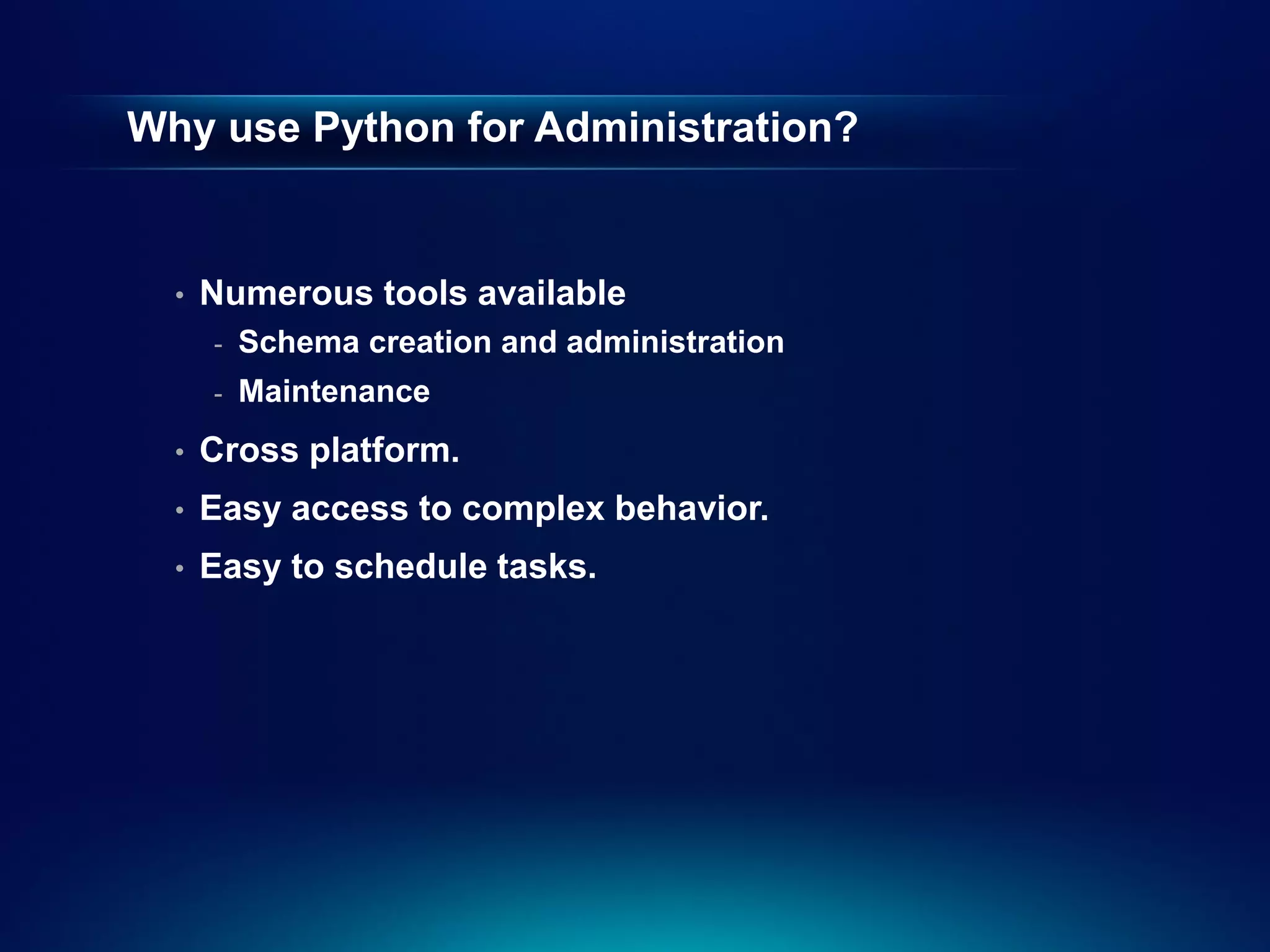
Why use Pythonfor Administration?
• Numerous tools available
- Schema creation and administration
- Maintenance
• Cross platform.
• Easy access to complex behavior.
• Easy to schedule tasks.
29.
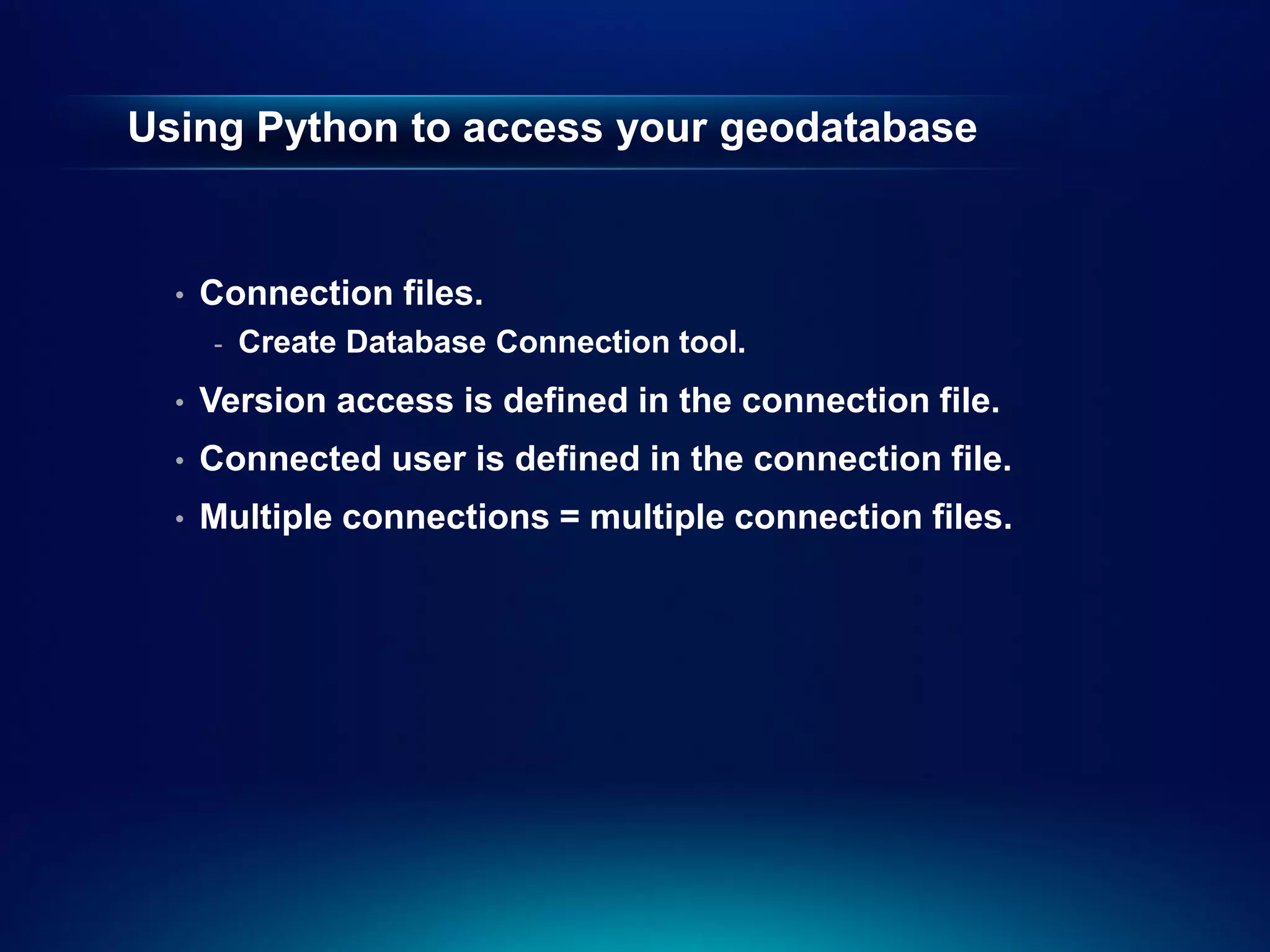
Using Python toaccess your geodatabase
• Connection files.
- Create Database Connection tool.
• Version access is defined in the connection file.
• Connected user is defined in the connection file.
• Multiple connections = multiple connection files.