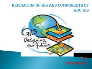
Defination of gis and components of arc gis
•Download as PPTX, PDF•
3 likes•1,536 views

GIS is a combination of software, hardware, geographical data, and tools for capturing, storing, retrieving, manipulating, analyzing, and presenting map-based information. The document outlines the history and components of ArcGIS software, the most popular GIS platform, including ArcMap for mapping and editing, ArcCatalog for database management, and ArcScene and ArcGlobe for 3D visualization and analysis.

Recommended
More Related Content
What's hot
What's hot (20)
Viewers also liked
Viewers also liked (20)
Similar to Defination of gis and components of arc gis
Similar to Defination of gis and components of arc gis (20)
Recently uploaded
Recently uploaded (20)
Defination of gis and components of arc gis
- 2. GIS is a combination of Software Hardware Any geographical information Data Capture Store Retrieval Manipulate Analyzing Presenting Map
- 3. 1969 Jack Dangermond founds ESRI 1982 Arc/INFO (Unix) 1989PC Arc/INFO (DOS + Windows) 1992 ArcView + Arc/INFO 2002 ArcView 3.3 “retired product” 1999ArcGIS v.8.0 (to v8.3) 2004 ArcGIS v.9.0 2010 ArcGIS v.10.0 2008 ArcGIS v.9.3
- 4. Components of Arc GIS Arc Catalog - Used for managing database design and for recording and viewing metadata Arc Map - Used mapping and editing tasks as well as for map based analysis Arc Scene - Used 3-D display tool. Arc Globe - specialized 3-D visualization and analysis How to Open GIS Components o Start Programs Arc GIS Arc Catalog o Start Programs Arc GIS Arc Map o Start Programs Arc GIS Arc Scene o Start Programs Arc GIS Arc Globe
- 5. Arc Map window Arc Globe windowArc Scene window Arc Catalog window