Downloaded 308 times
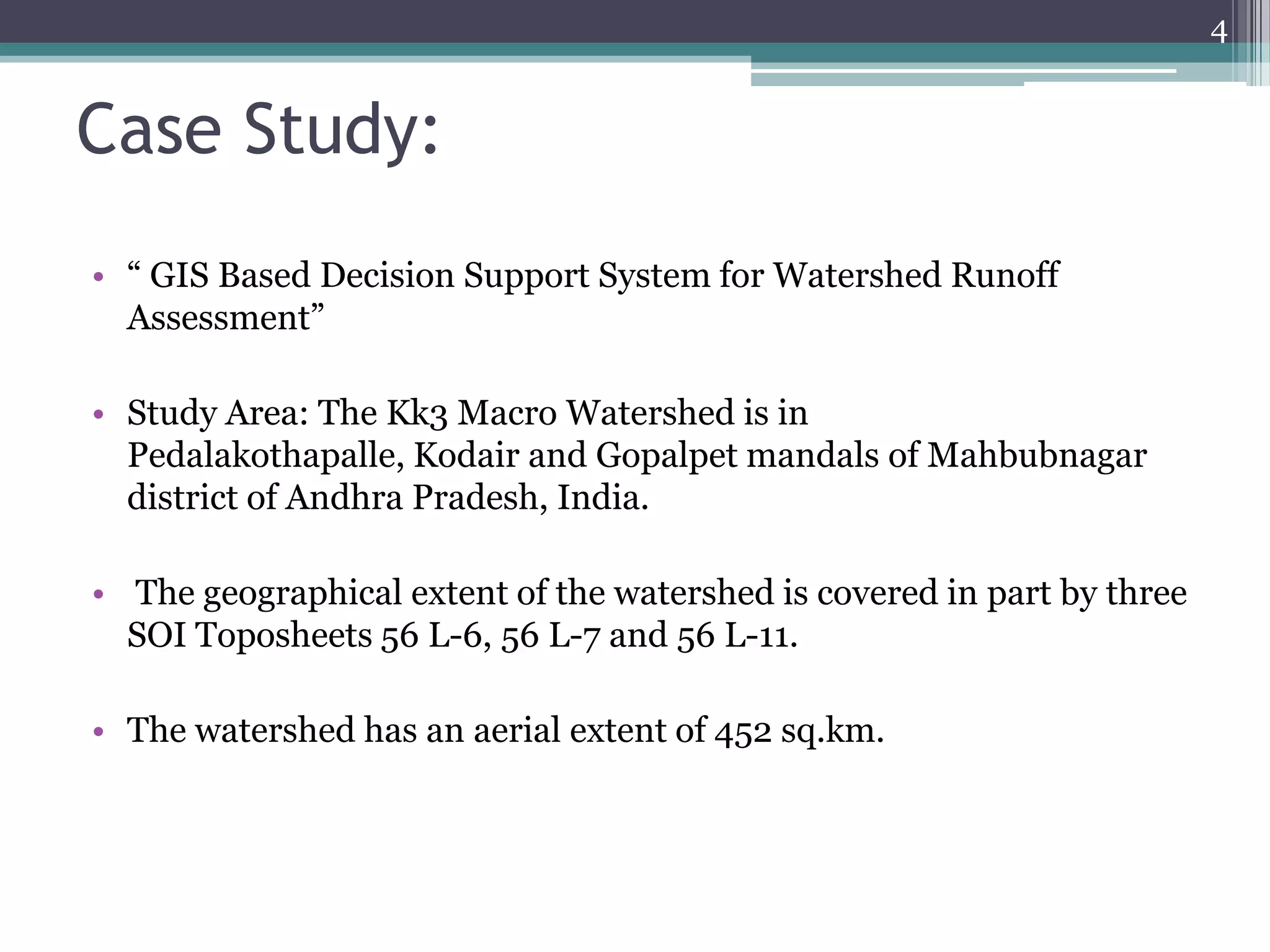
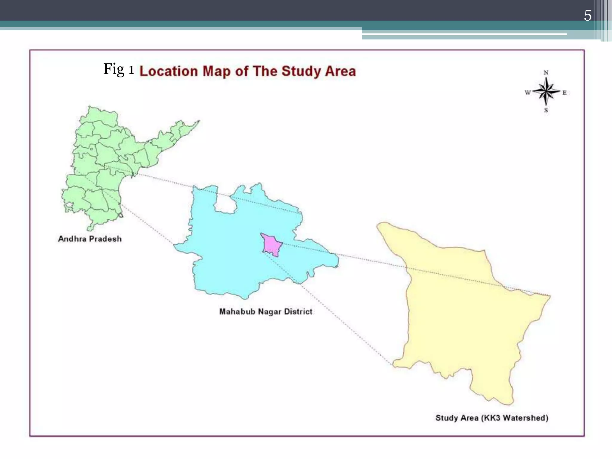
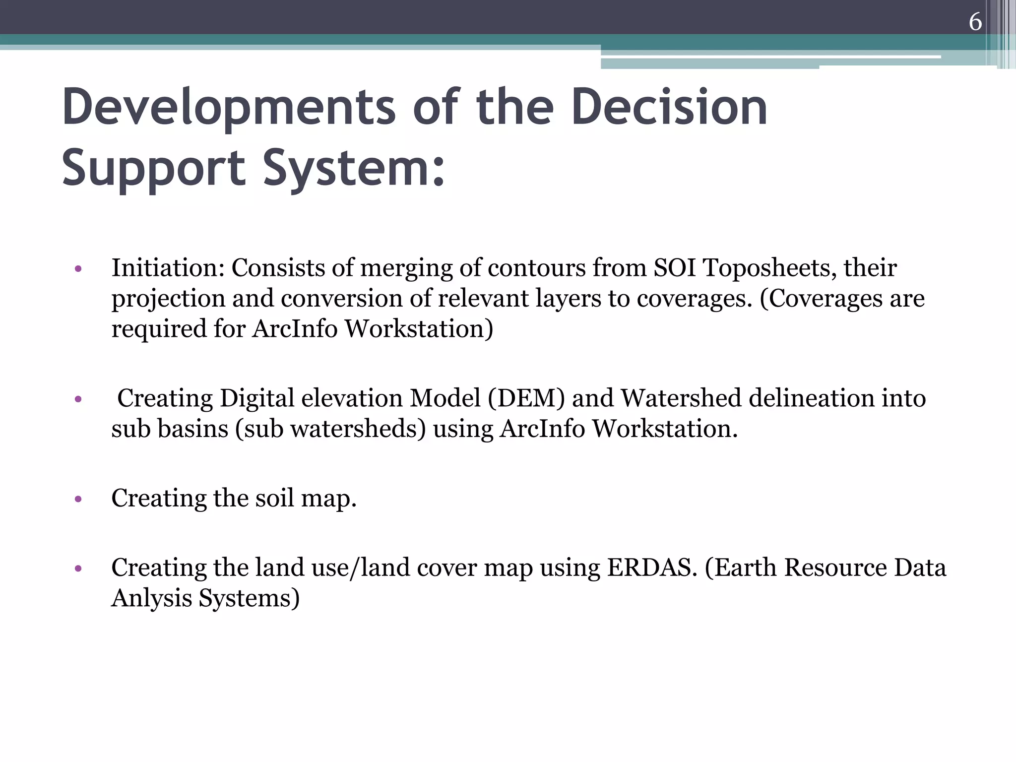
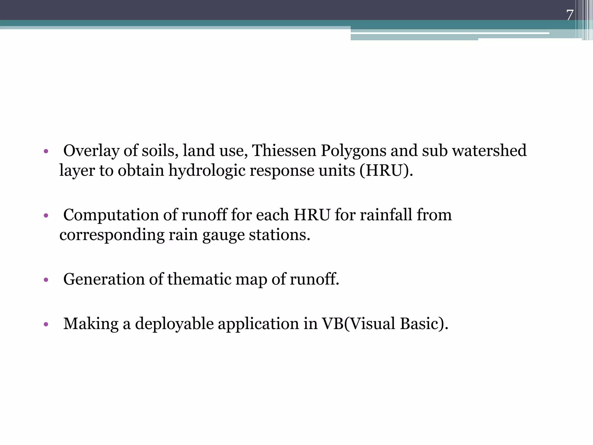
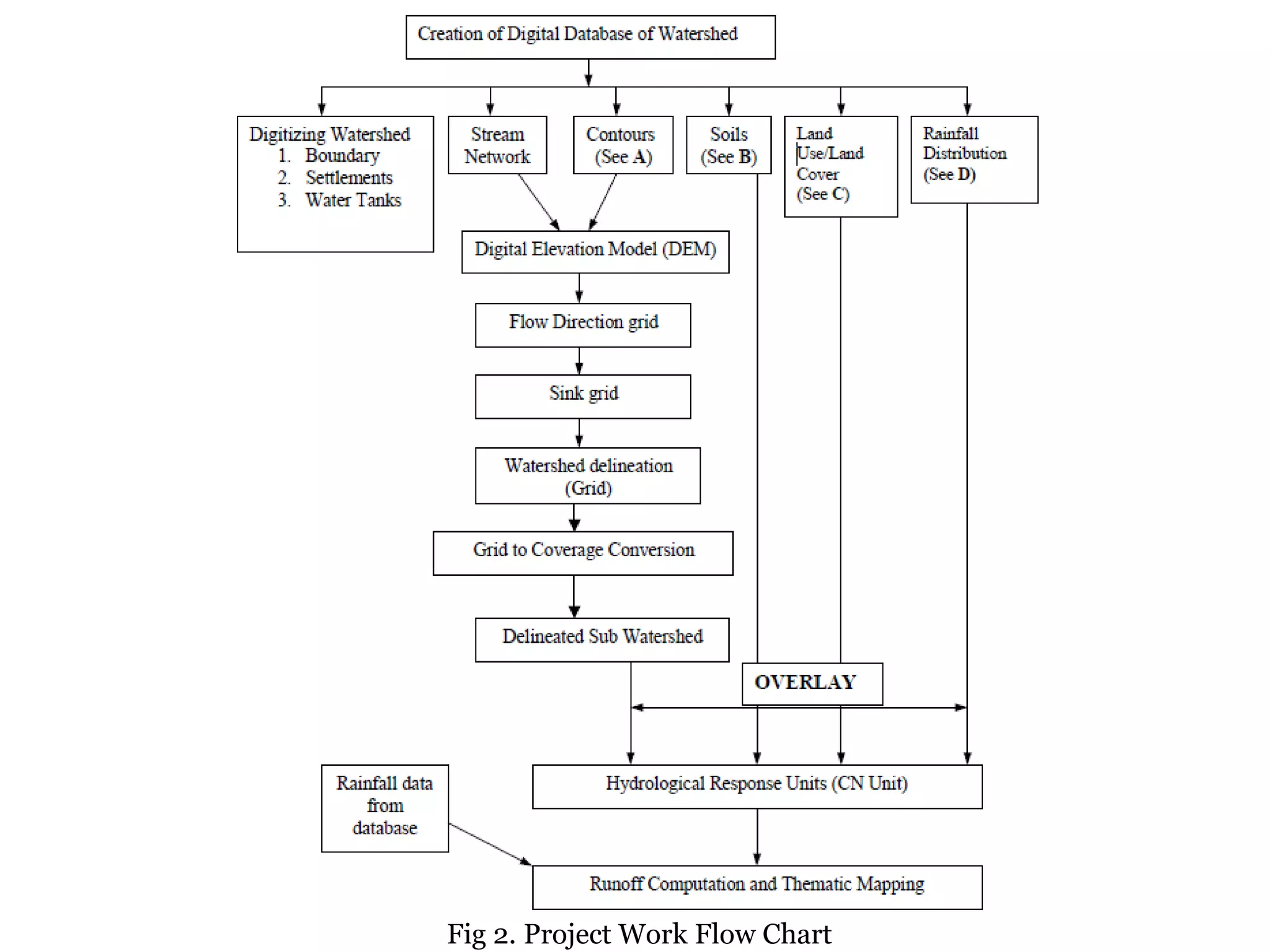
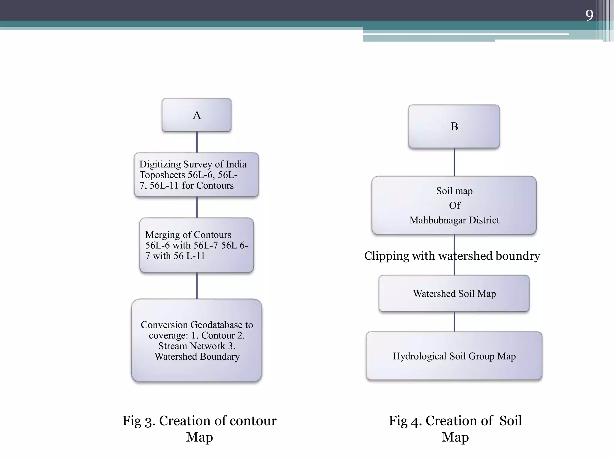
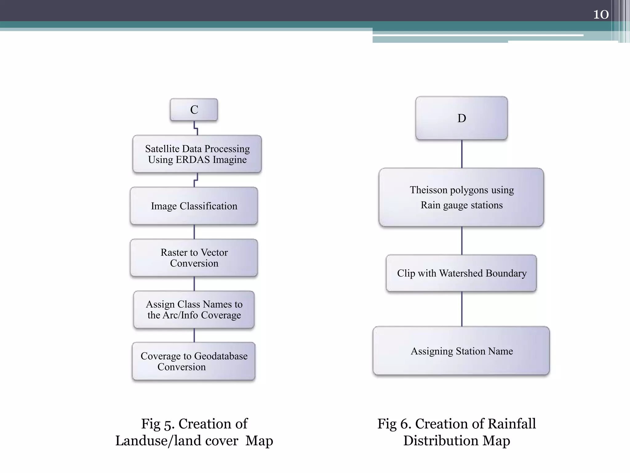
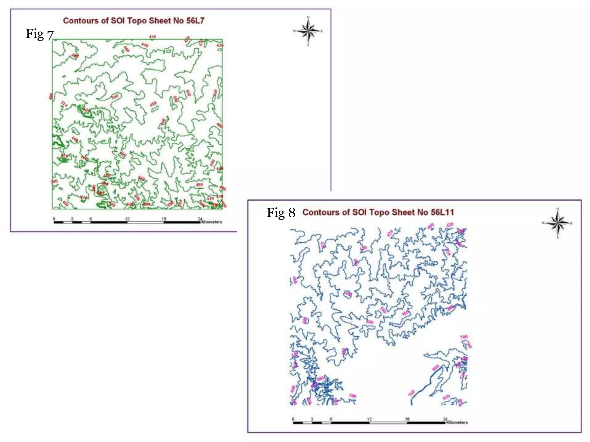
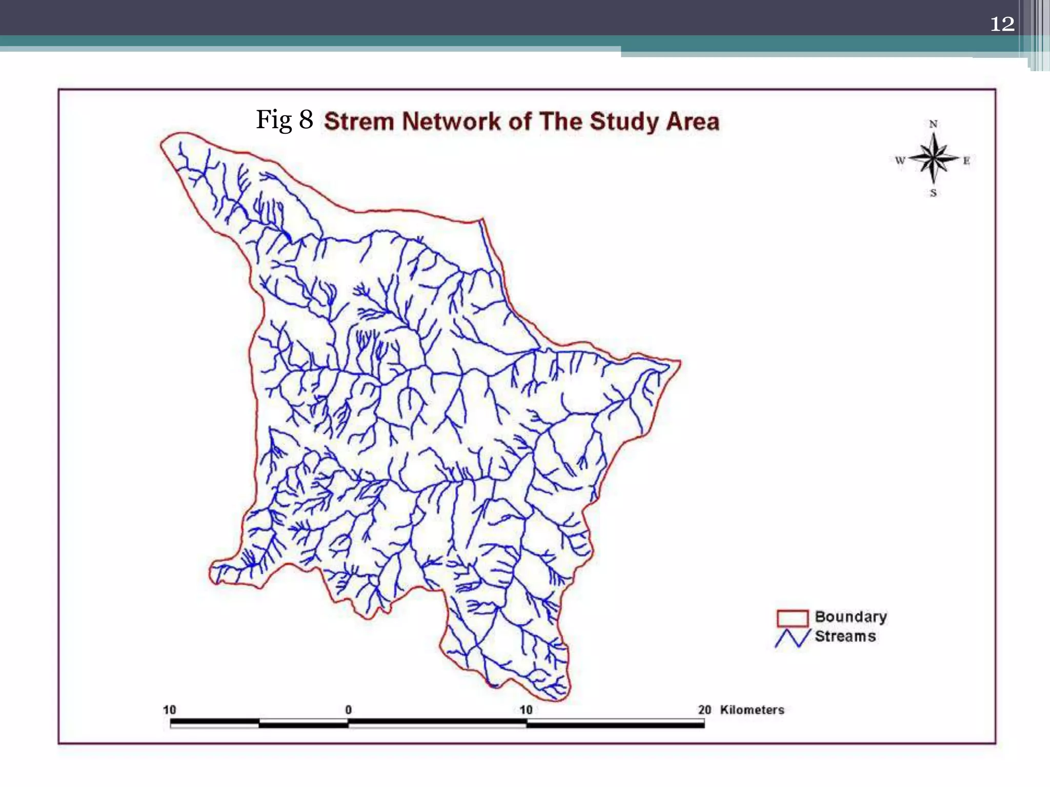
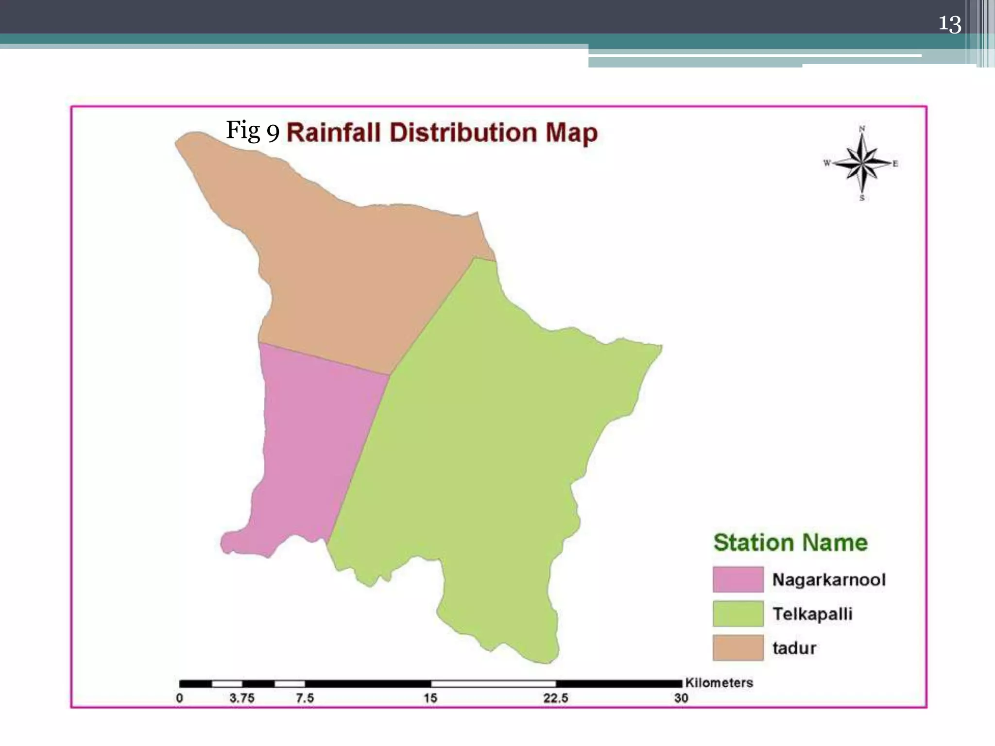
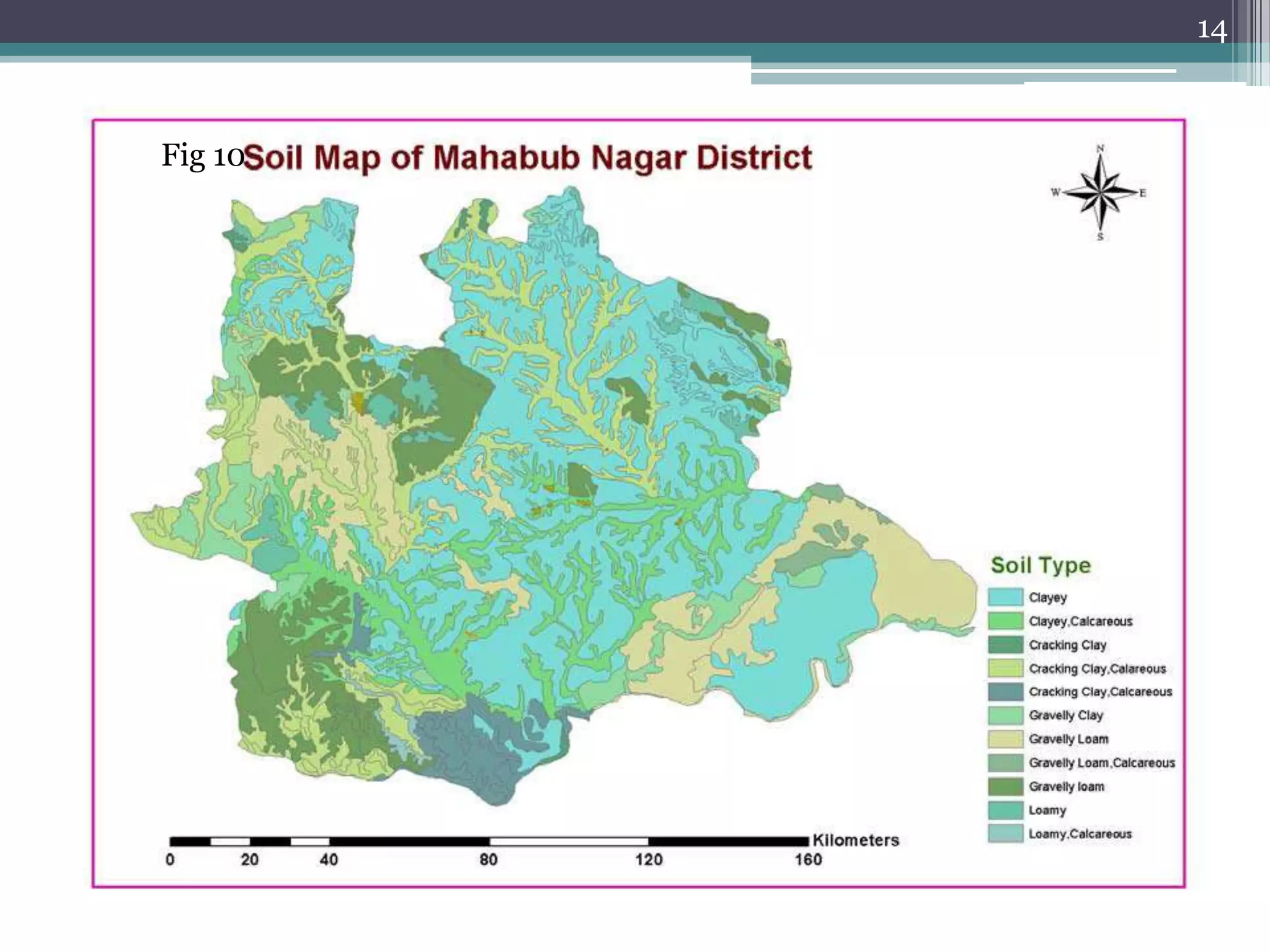
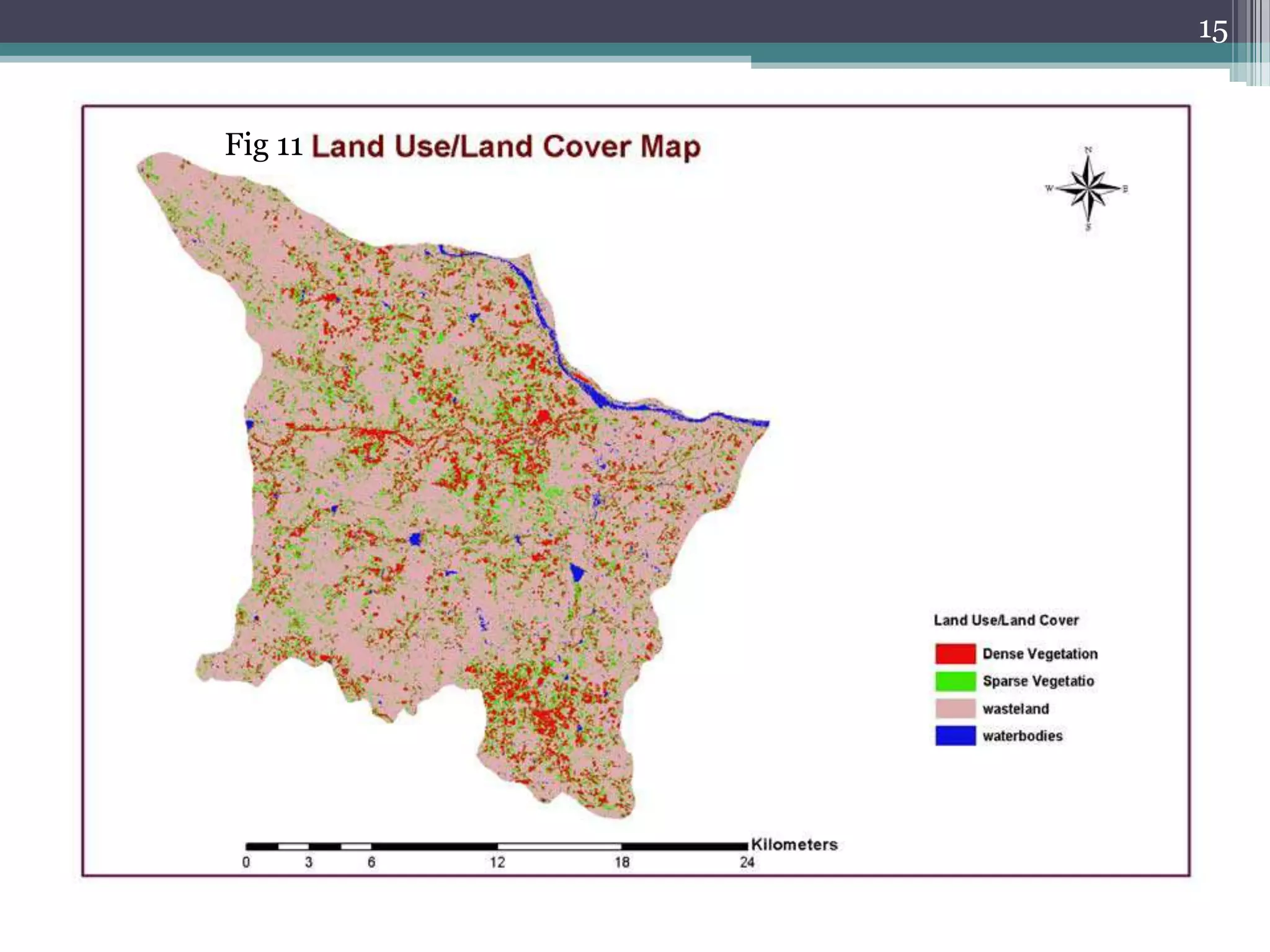
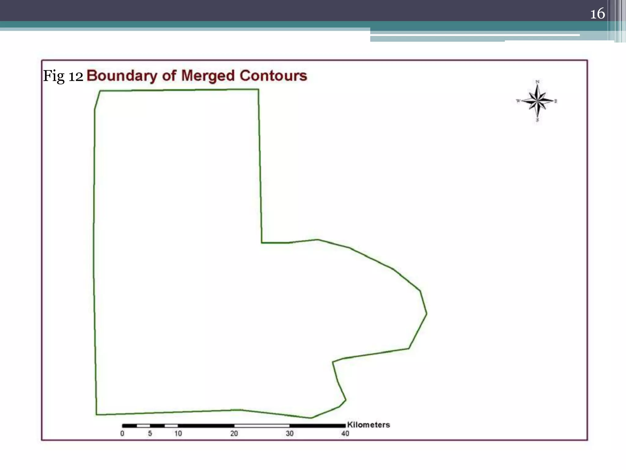
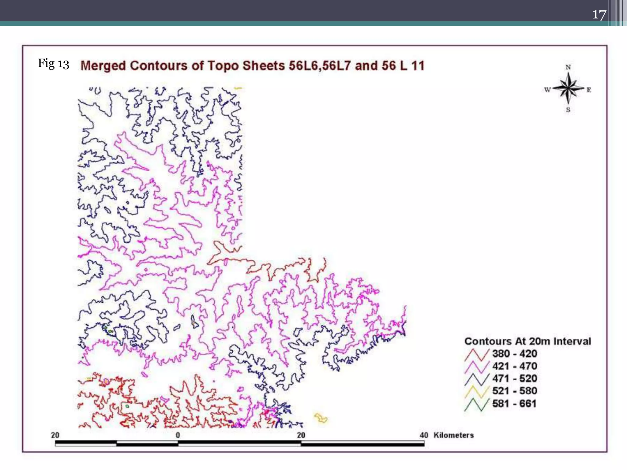
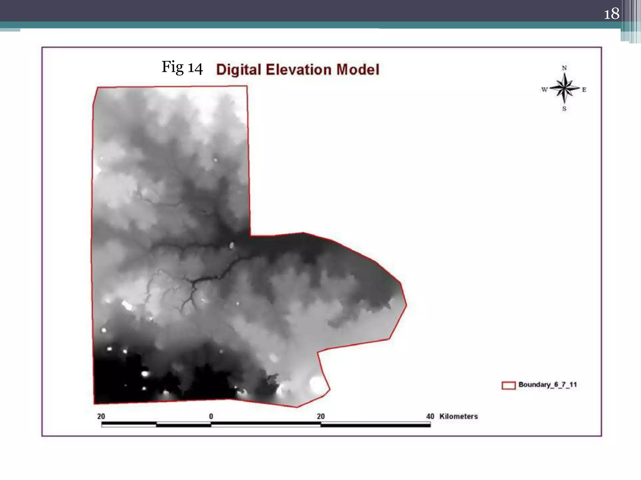
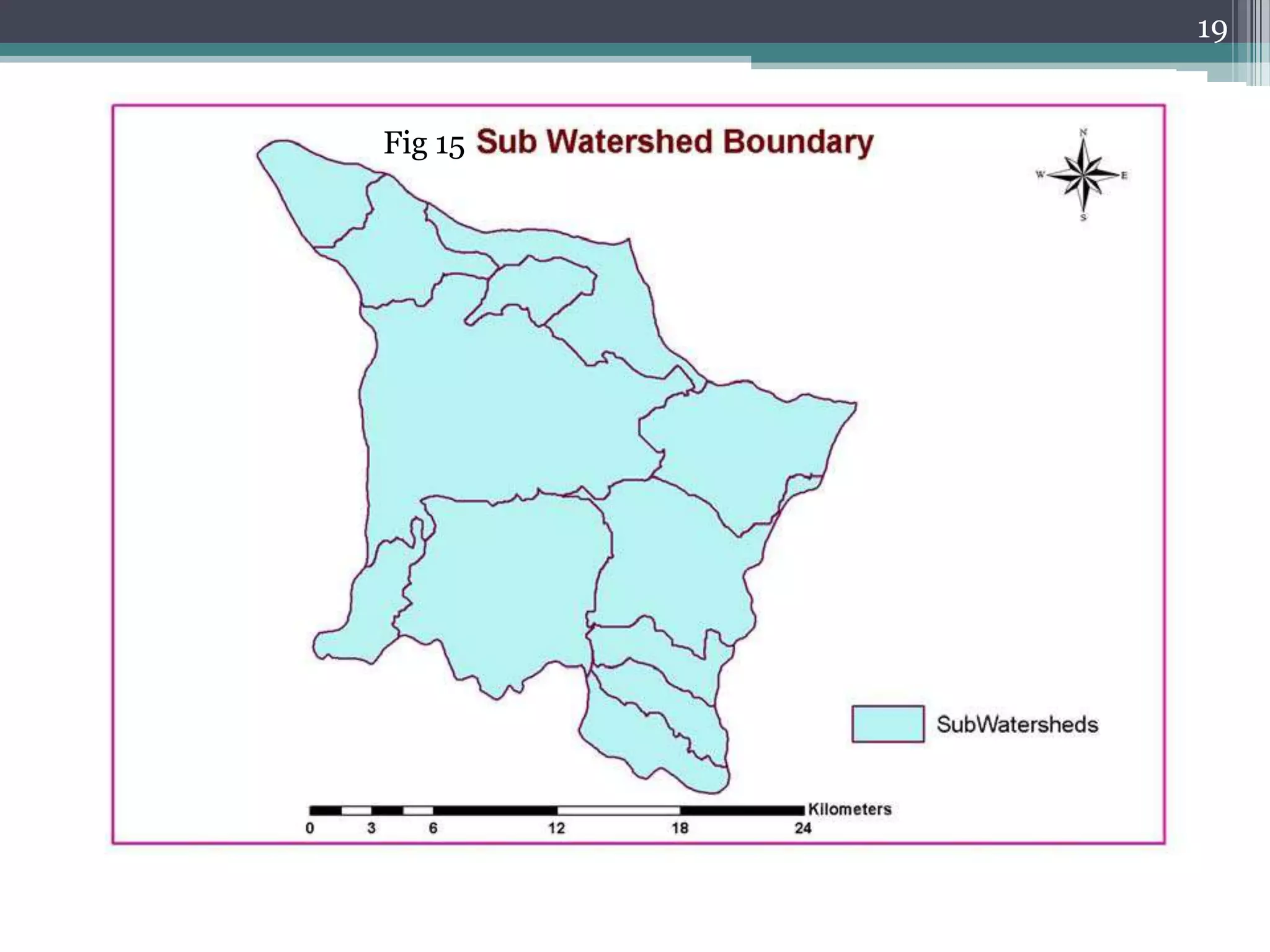
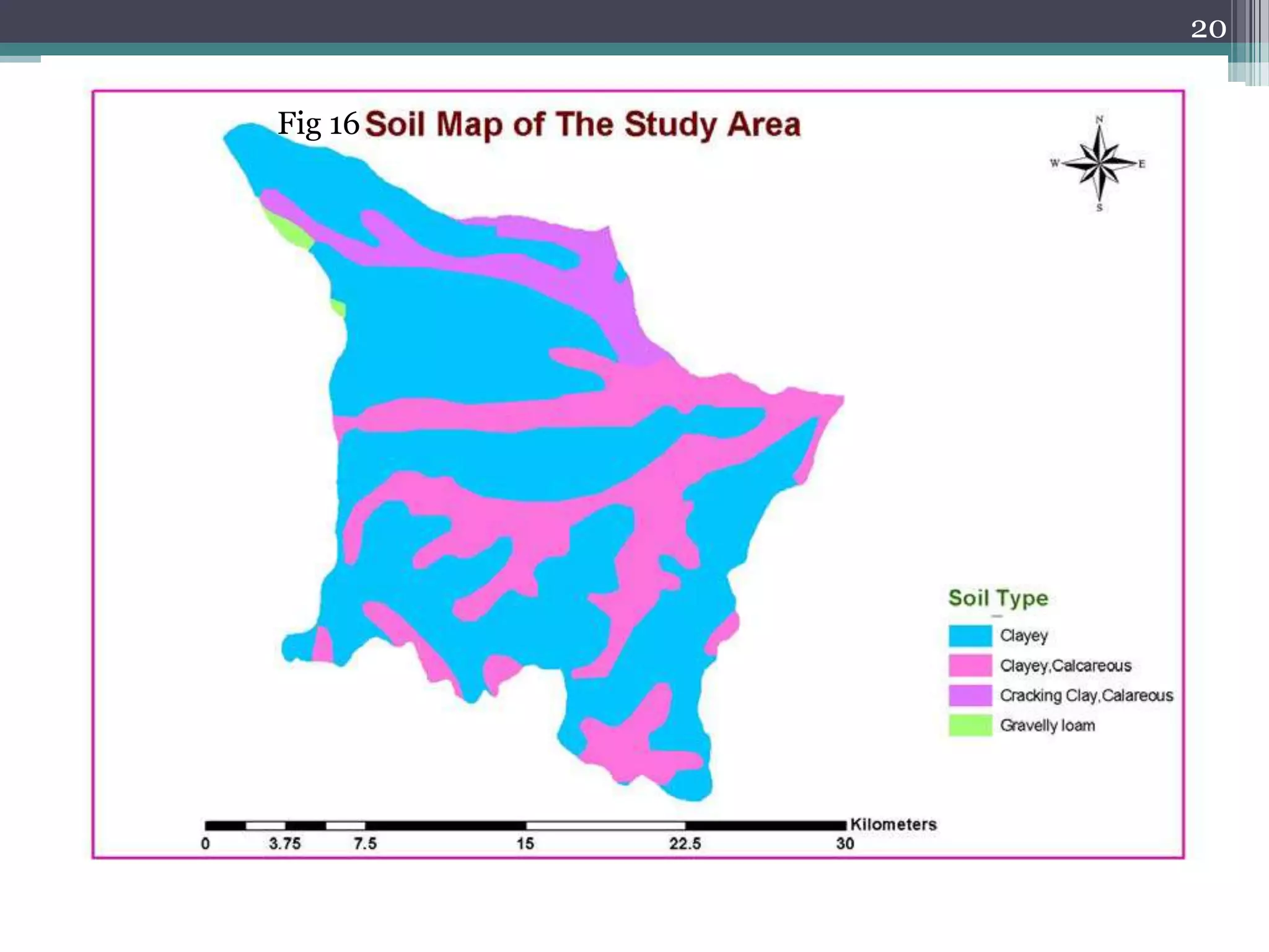
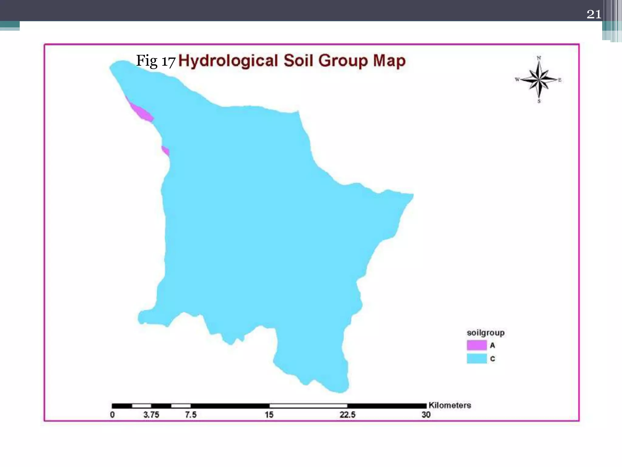
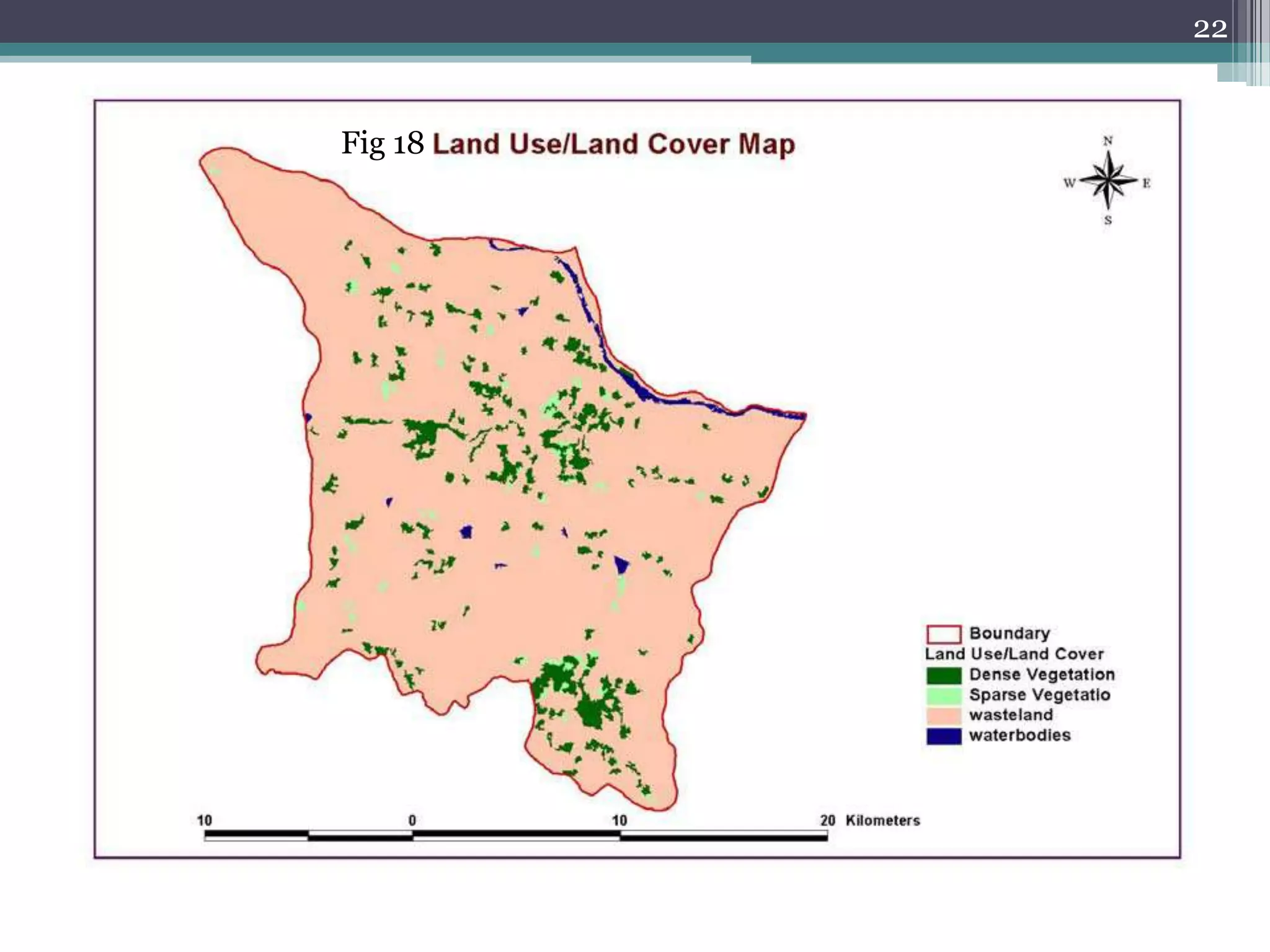
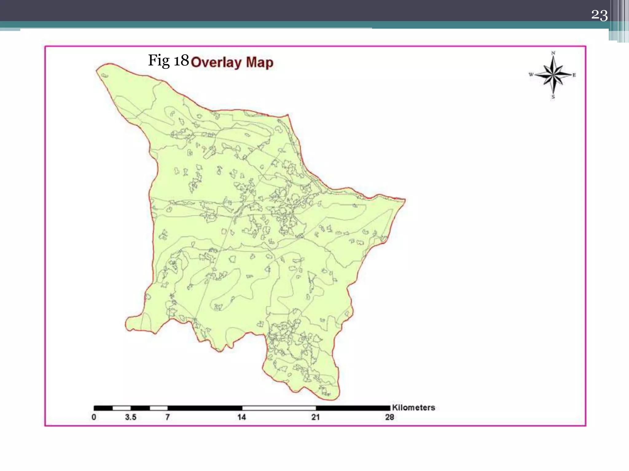
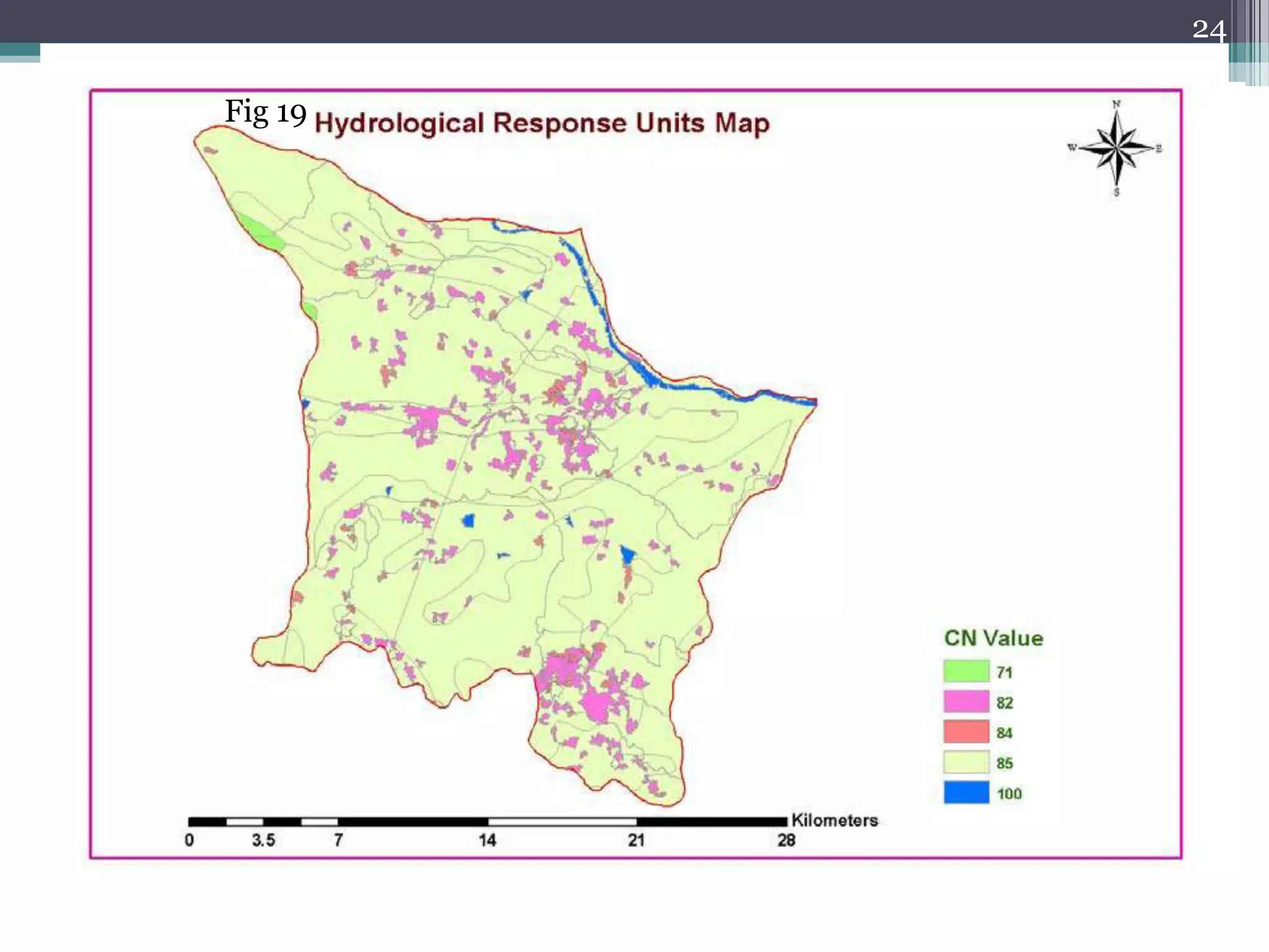
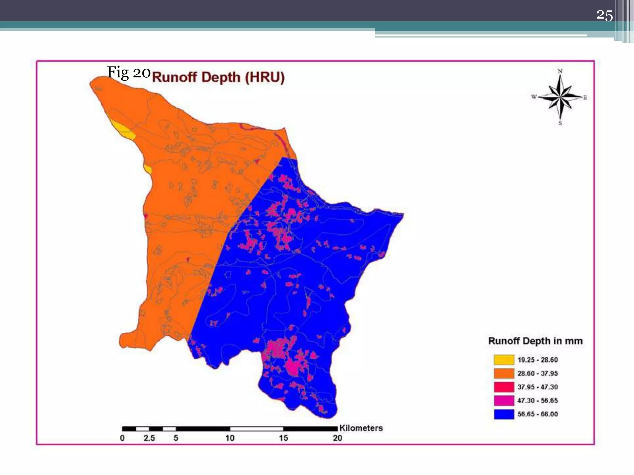
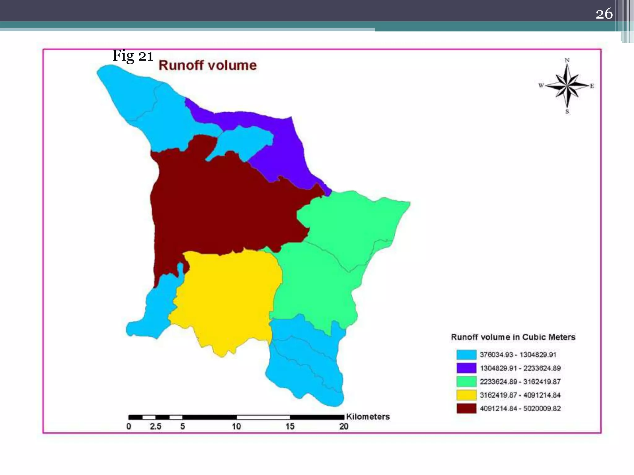
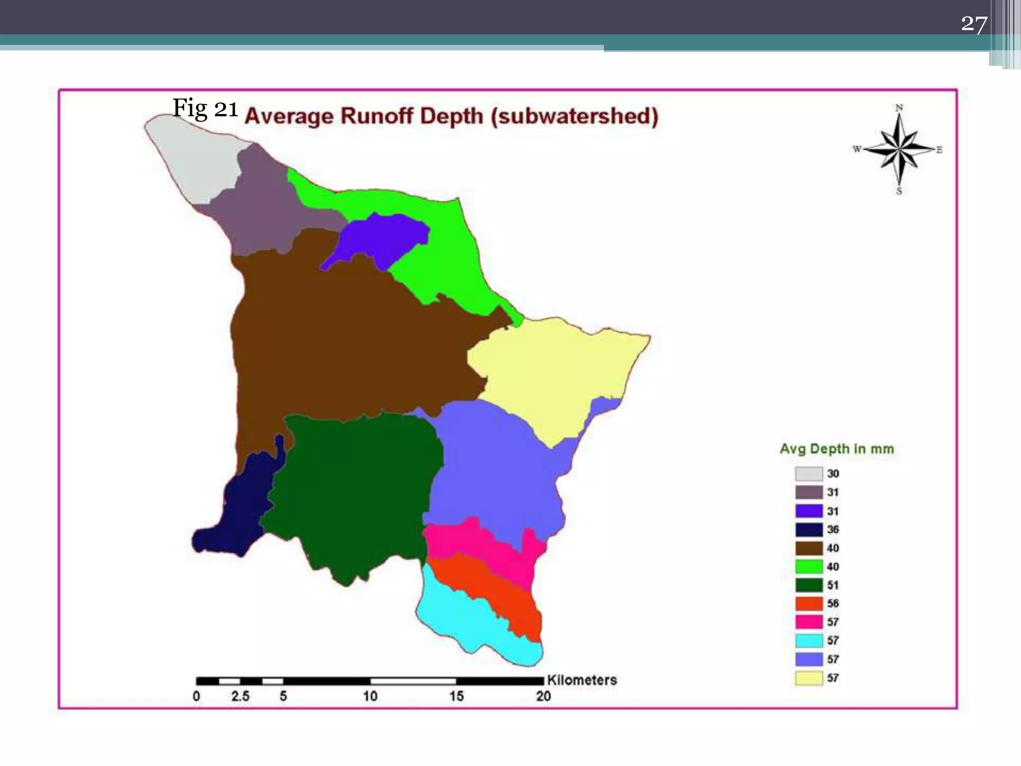
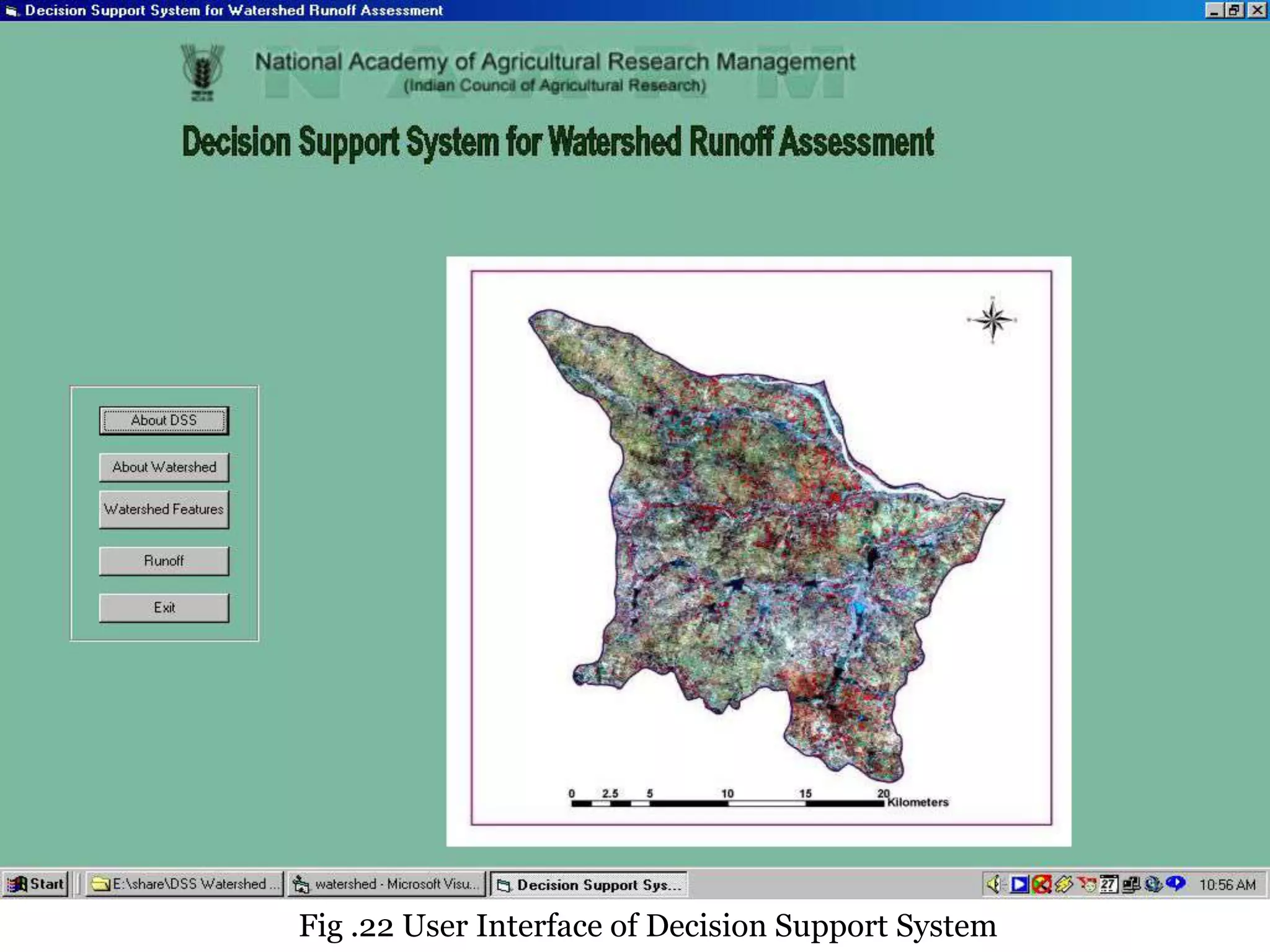

This document discusses the use of geographic information systems (GIS) in water resource management and assessment. It provides examples of GIS applications in watershed management, groundwater assessment, flood management, and water quality studies. It then describes a case study that developed a GIS-based decision support system to assess watershed runoff in the Kk3 Macro Watershed in India. Key steps included delineating sub-watersheds, creating soil and land use maps, determining hydrologic response units, computing runoff, and generating thematic runoff maps. The system allows users to update rainfall data and evaluate variations in spatial runoff distribution over time.


![Vibe Coding vs. Spec-Driven Development [Free Meetup]](https://cdn.slidesharecdn.com/ss_thumbnails/vibecodingvsspecdrivendevelopment-251209105622-43f455e7-thumbnail.jpg?width=640&height=640&fit=bounds)


