Downloaded 23 times
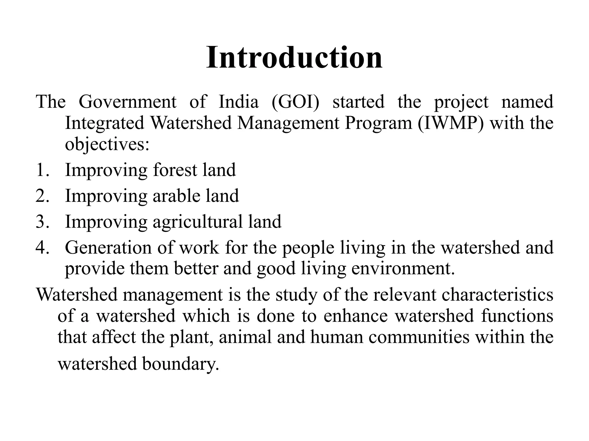
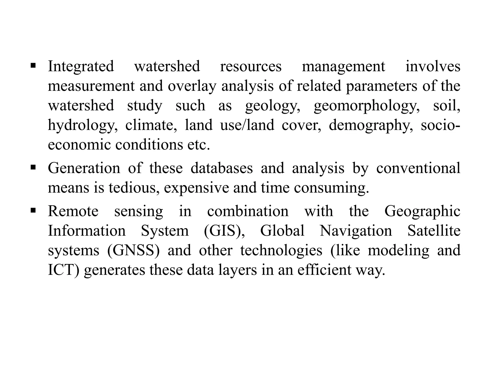
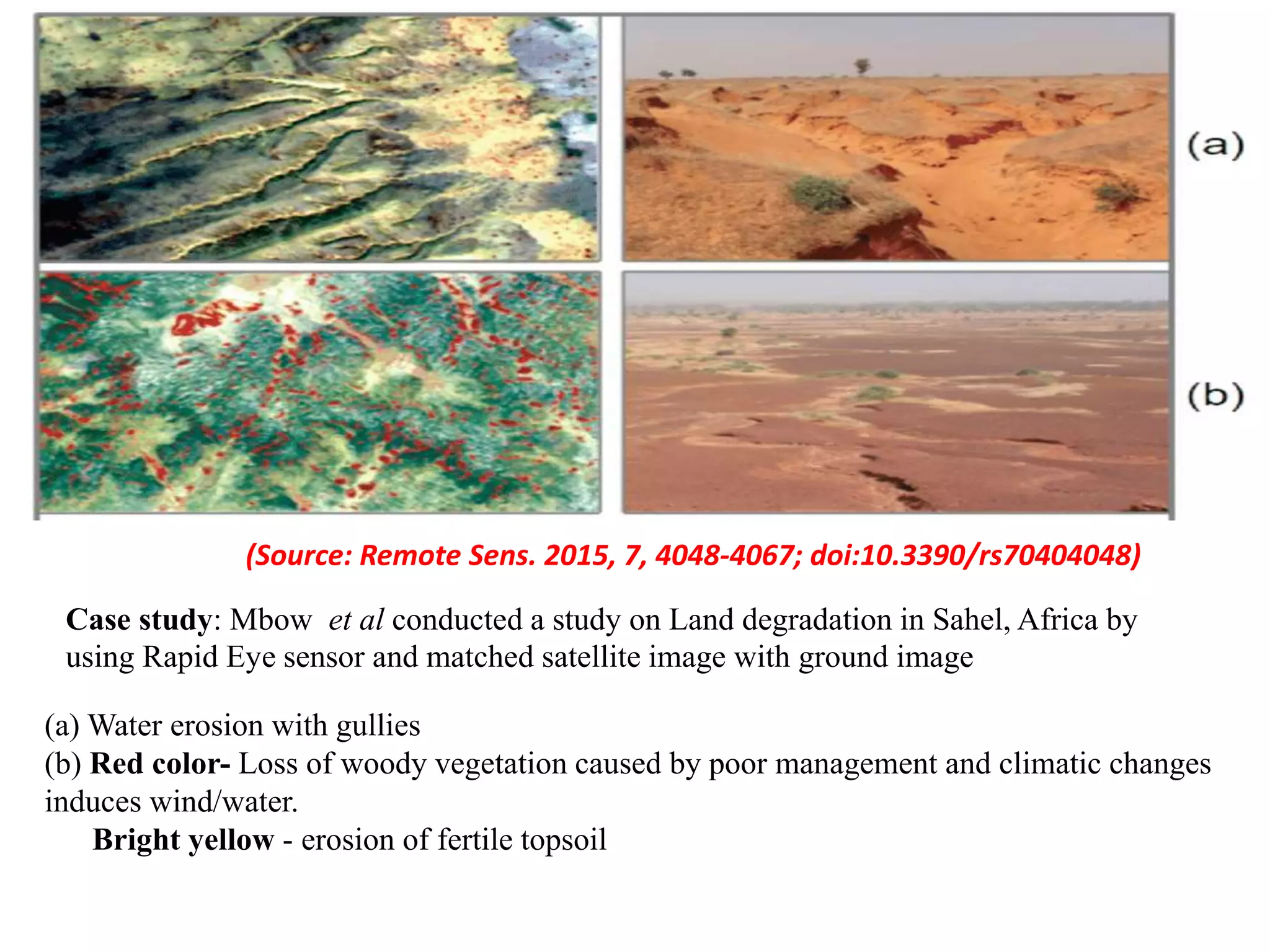
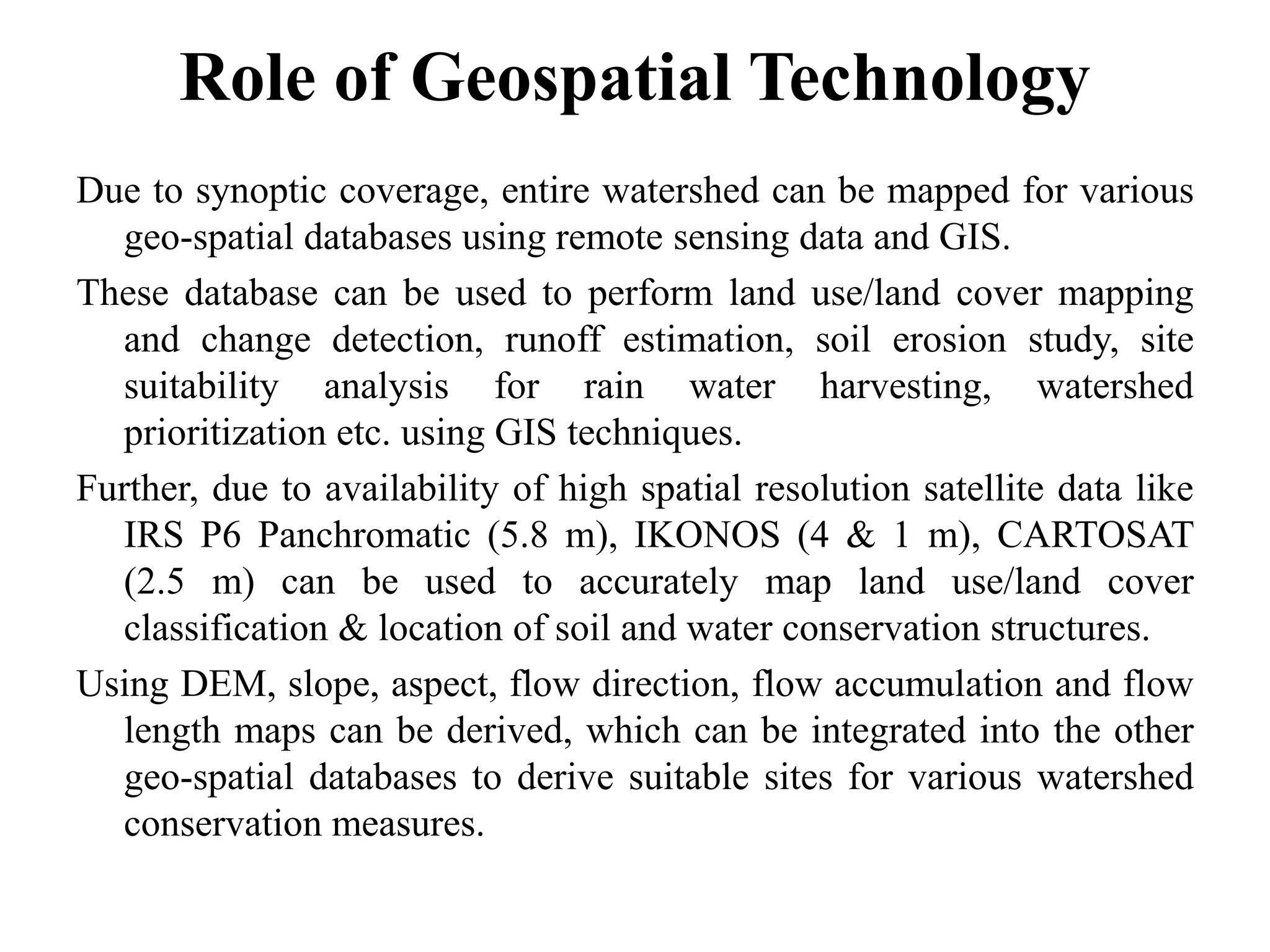
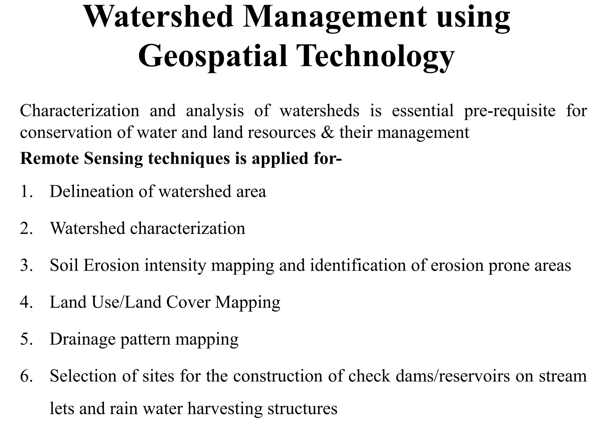
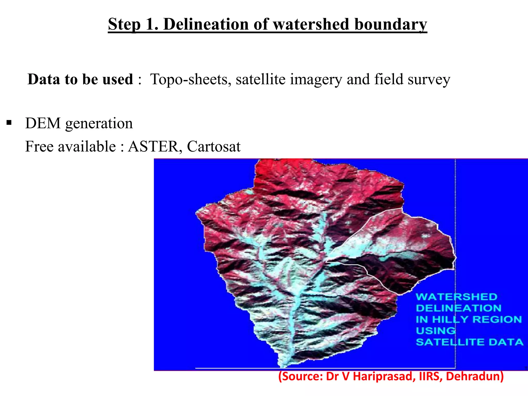
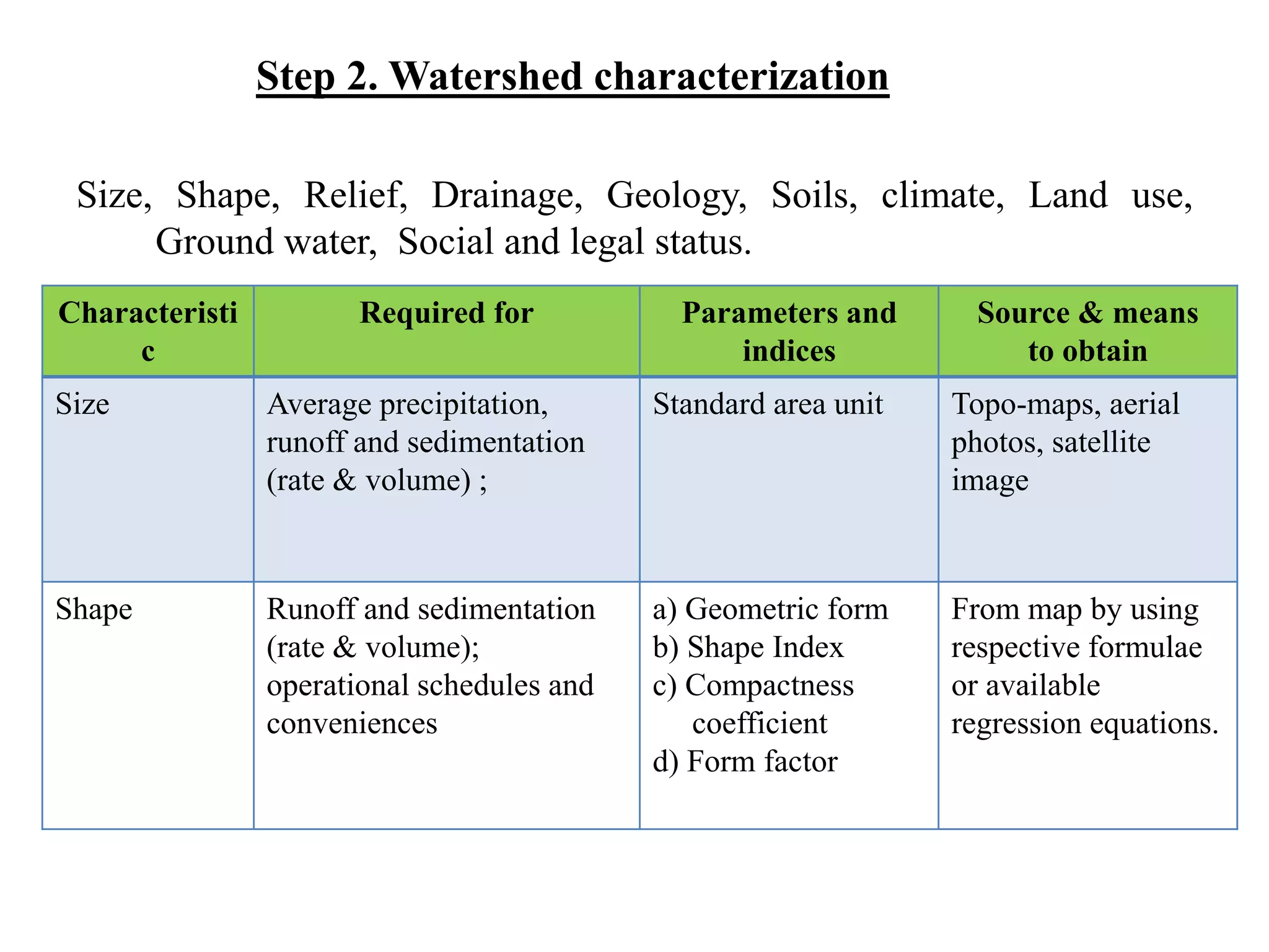
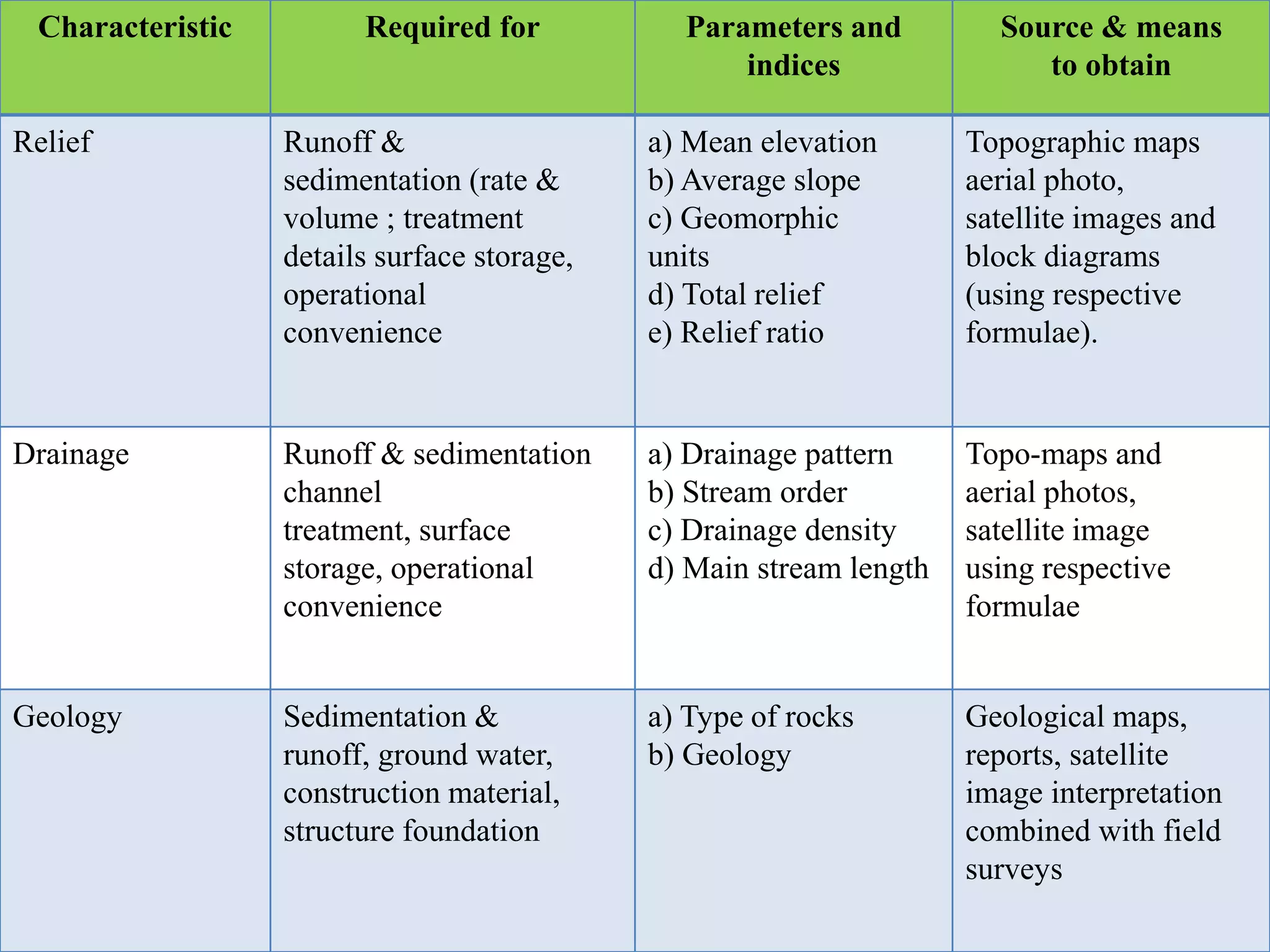
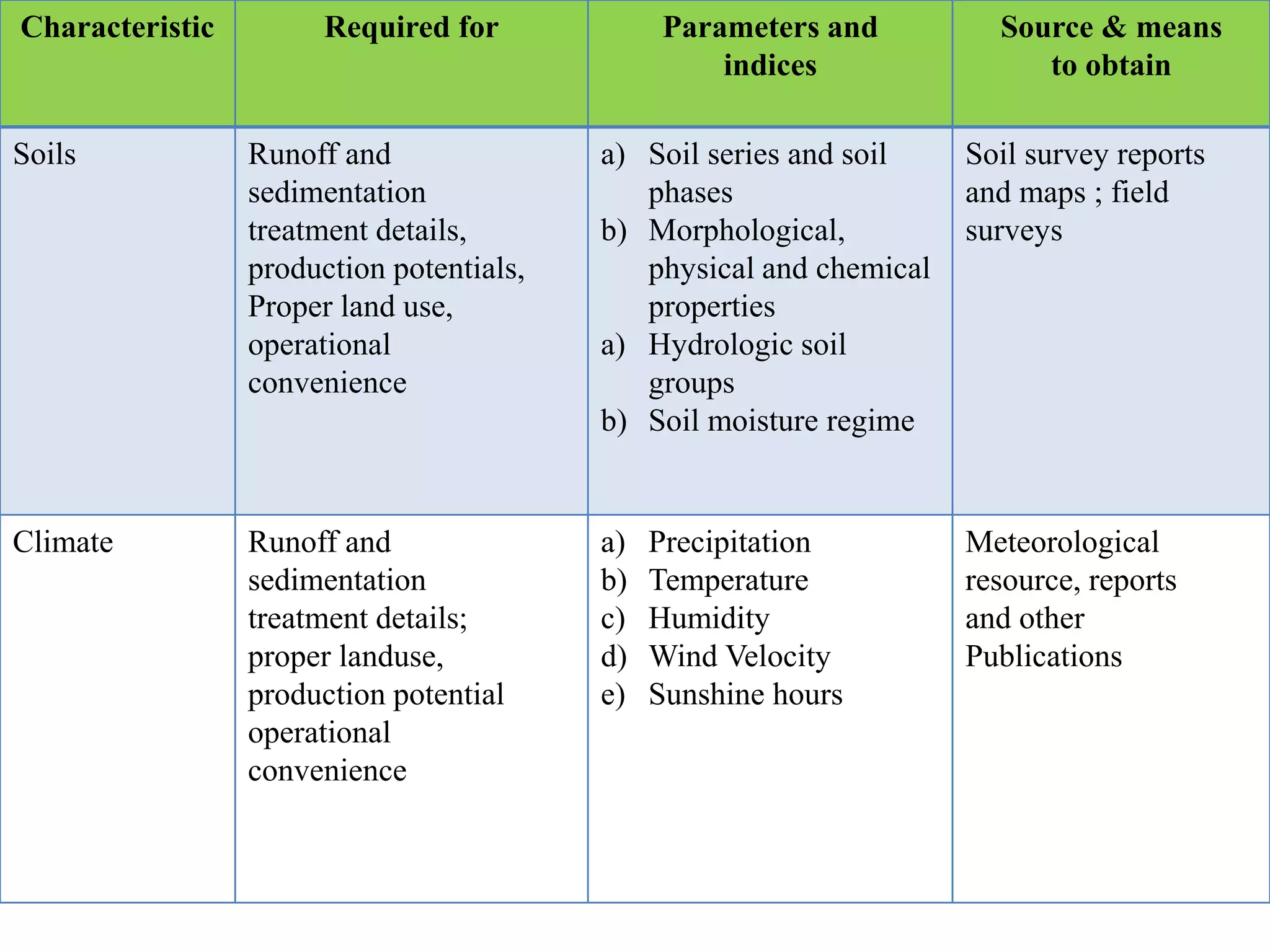
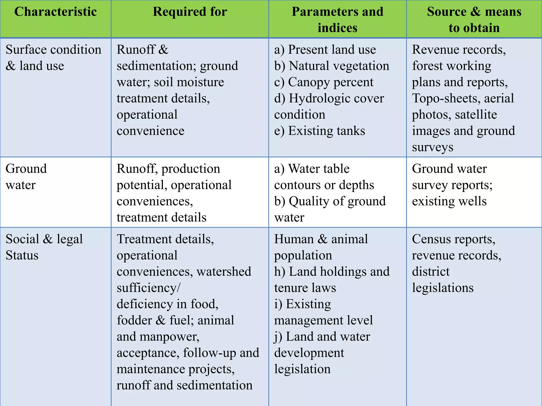
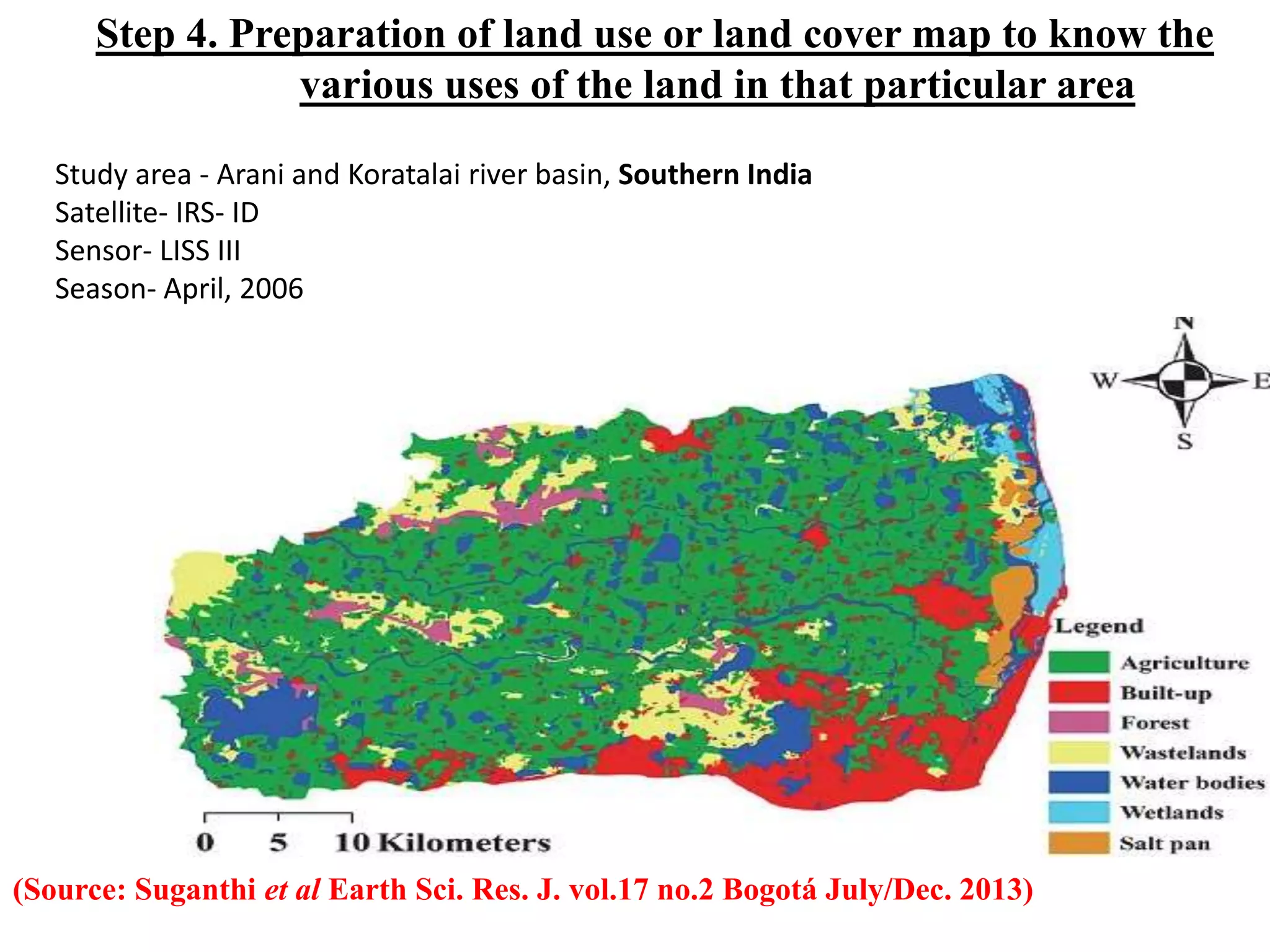
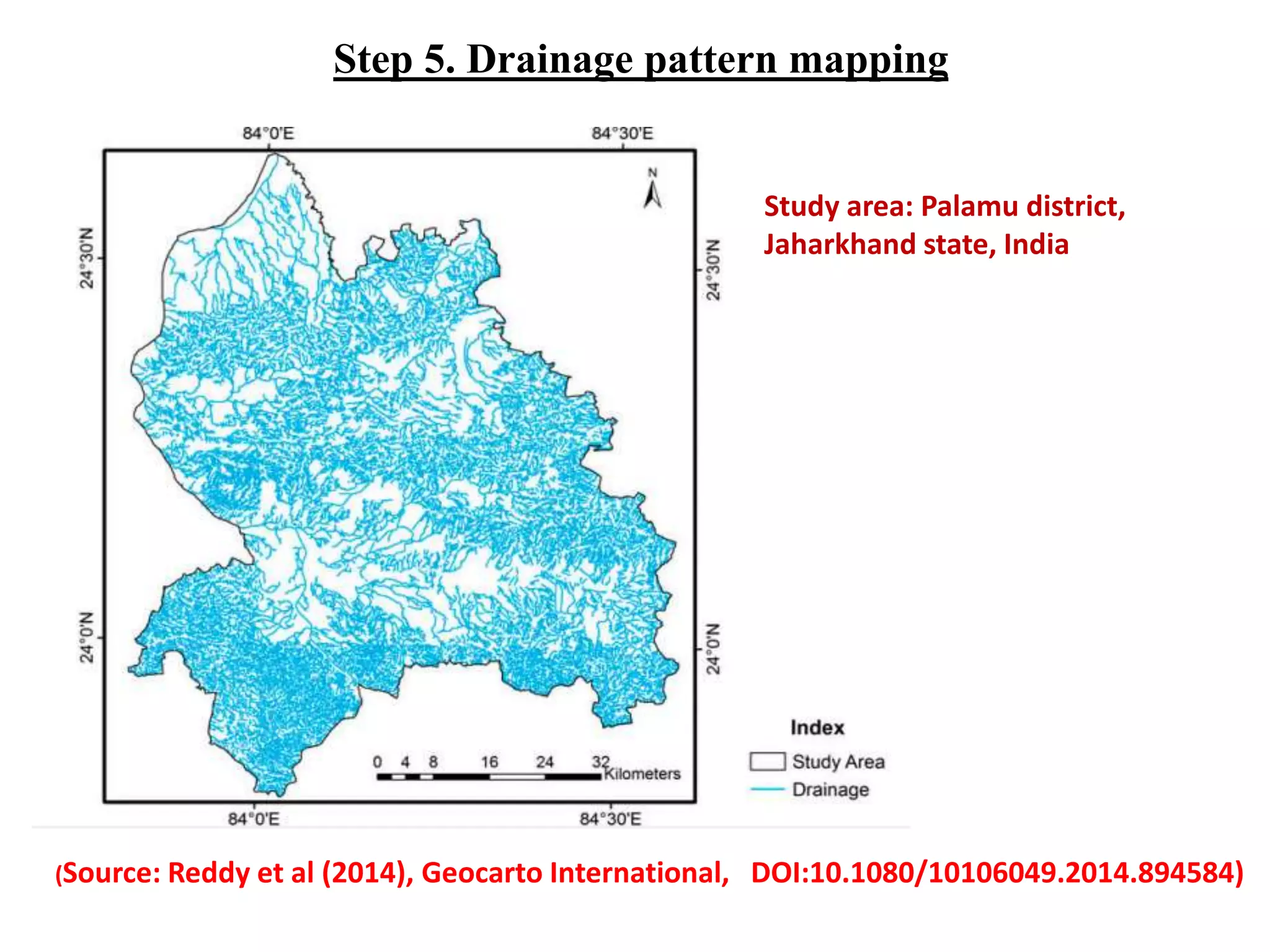
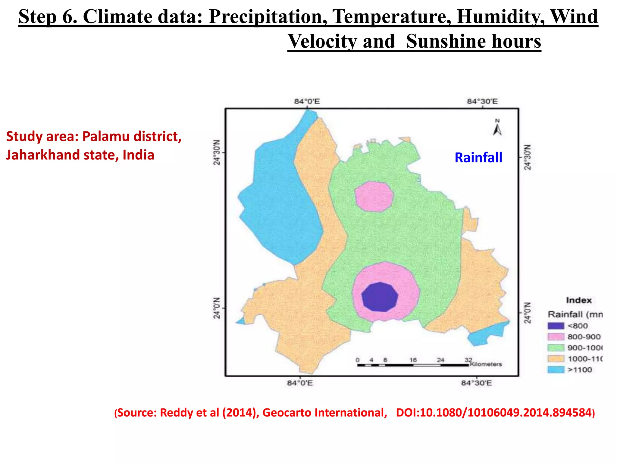
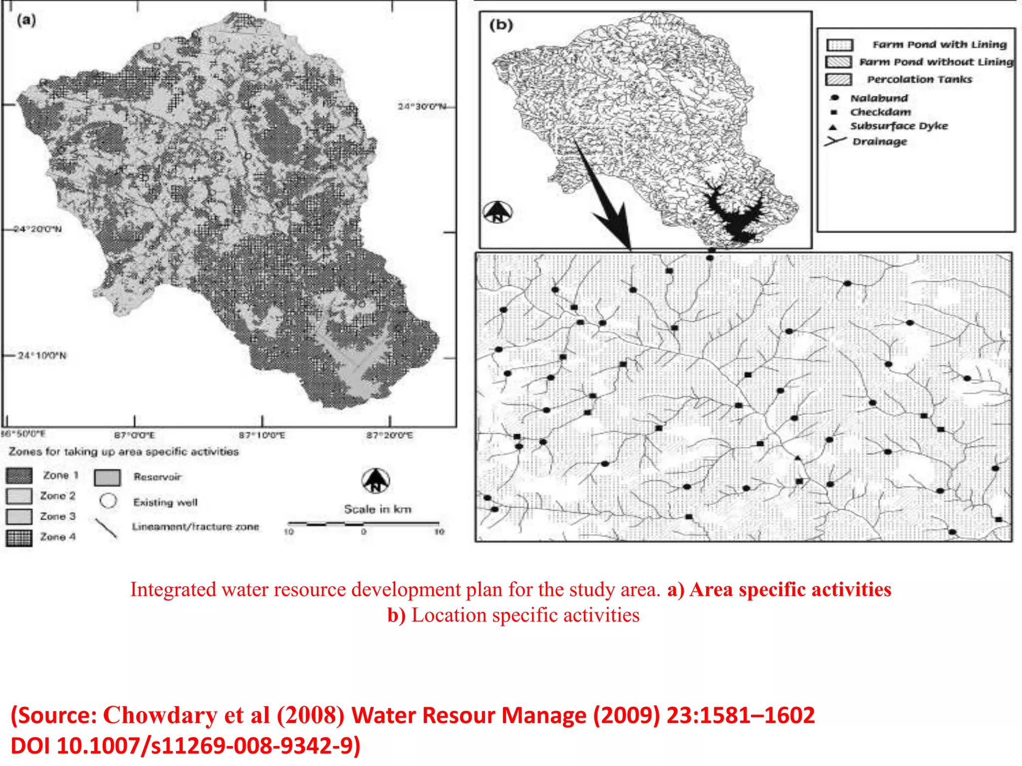
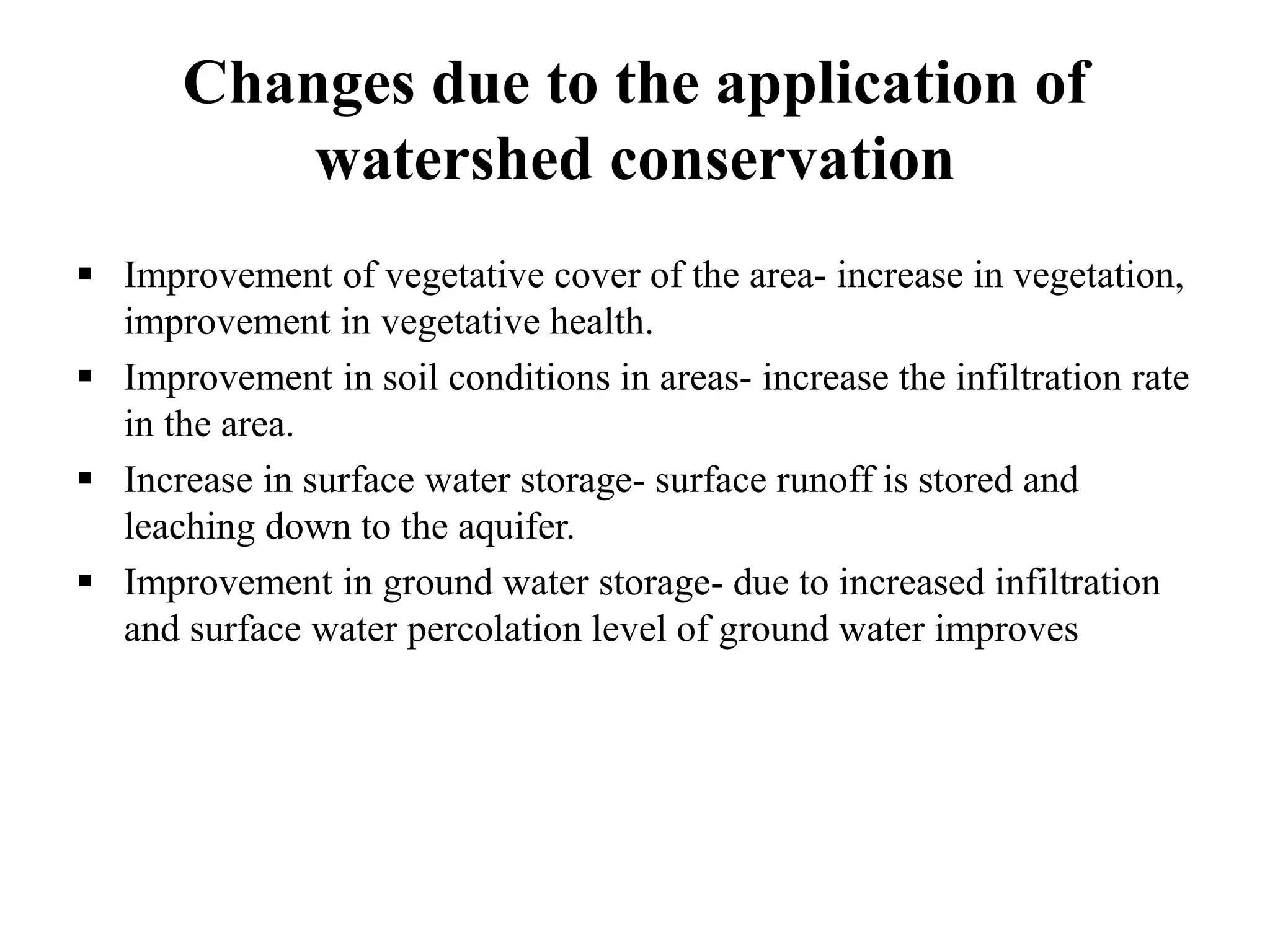
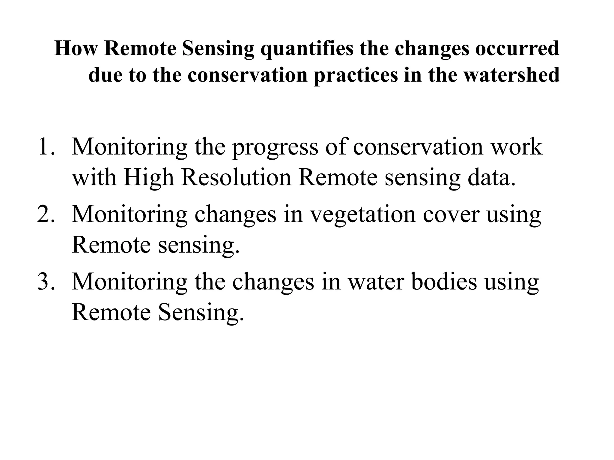
The document discusses the significance of geospatial technology in watershed management, highlighting India's Integrated Watershed Management Program aimed at enhancing forest, agricultural, and arable lands while improving living conditions. It emphasizes the use of remote sensing, GIS, and GNSS to analyze watershed characteristics and address issues like soil erosion, water-logging, and land degradation efficiently. Additionally, case studies illustrate how these technologies support sustainable management practices and assess changes in vegetation and water bodies resulting from conservation efforts.