Downloaded 44 times

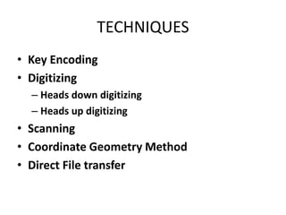
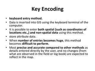
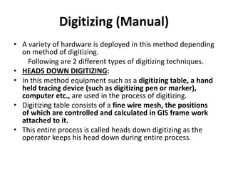

Key encoding, digitizing, scanning, coordinate geometry, and direct file transfer are the main techniques for inputting data into a geographic information system (GIS). Key encoding involves directly entering spatial and attribute data using a keyboard. Digitizing can be done heads down using a digitizing tablet or heads up using a mouse on a digital map. Scanning uses electronic detectors to automatically input data faster but may require data cleaning. Coordinate geometry enters survey measurements to calculate feature coordinates. Direct file transfer imports available GIS data sets after adjustments.


![Rs unit iii-gis--- [repaired]](https://cdn.slidesharecdn.com/ss_thumbnails/rsunit-iiigis-repaired-180305142705-thumbnail.jpg?width=640&height=640&fit=bounds)
![Rs unit iii-gis--- [repaired]](https://cdn.slidesharecdn.com/ss_thumbnails/rsunit-iiigis-repaired-180305142425-thumbnail.jpg?width=640&height=640&fit=bounds)


