Downloaded 611 times
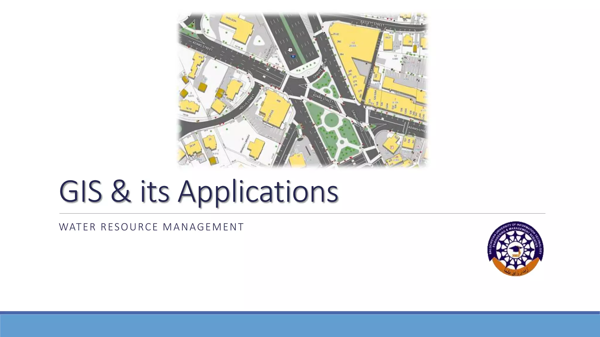

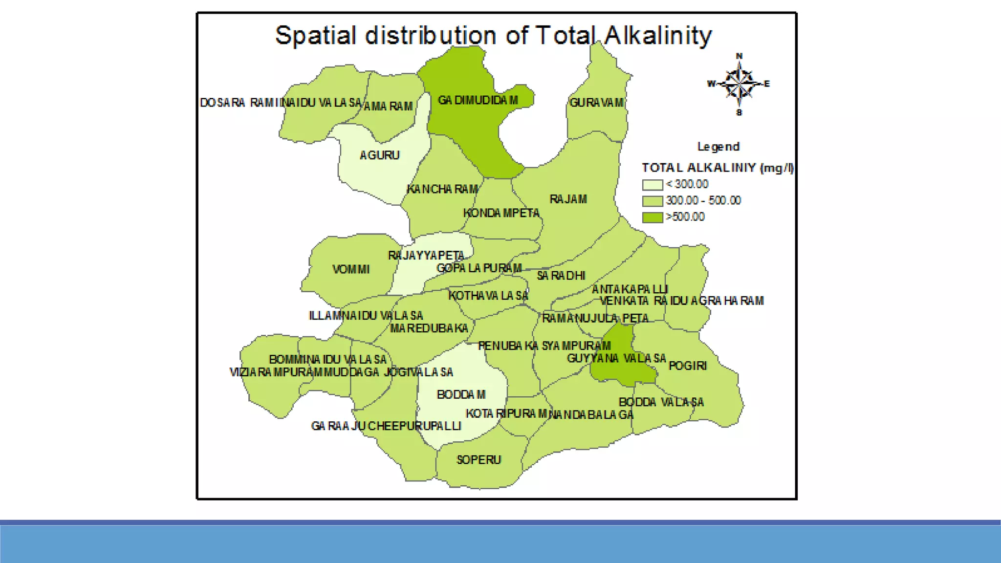
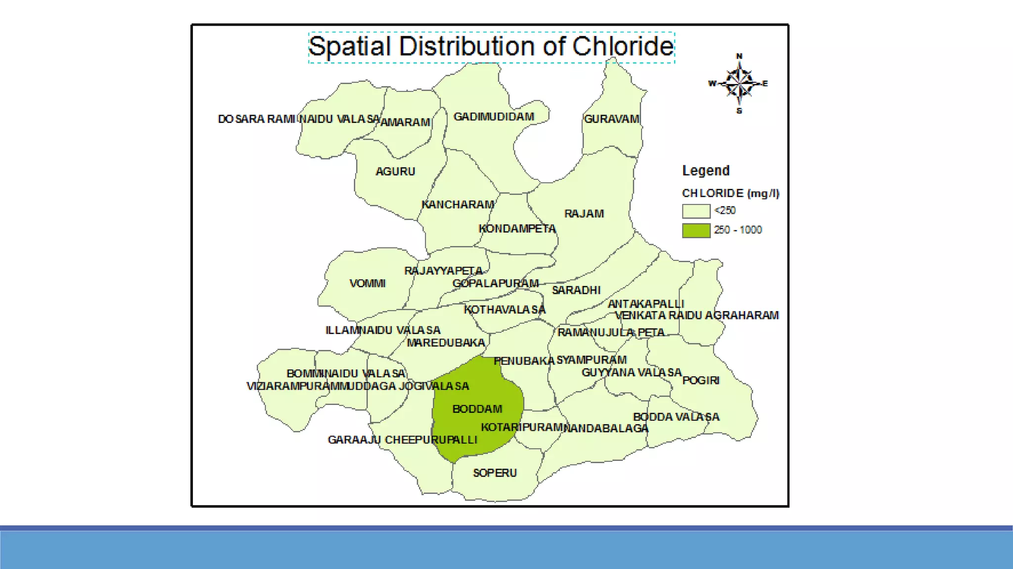
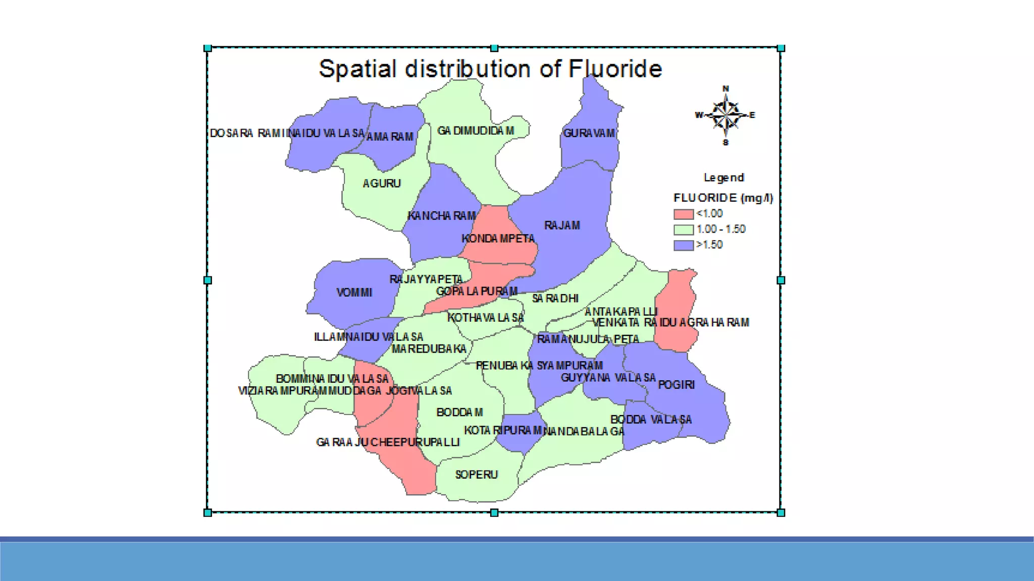
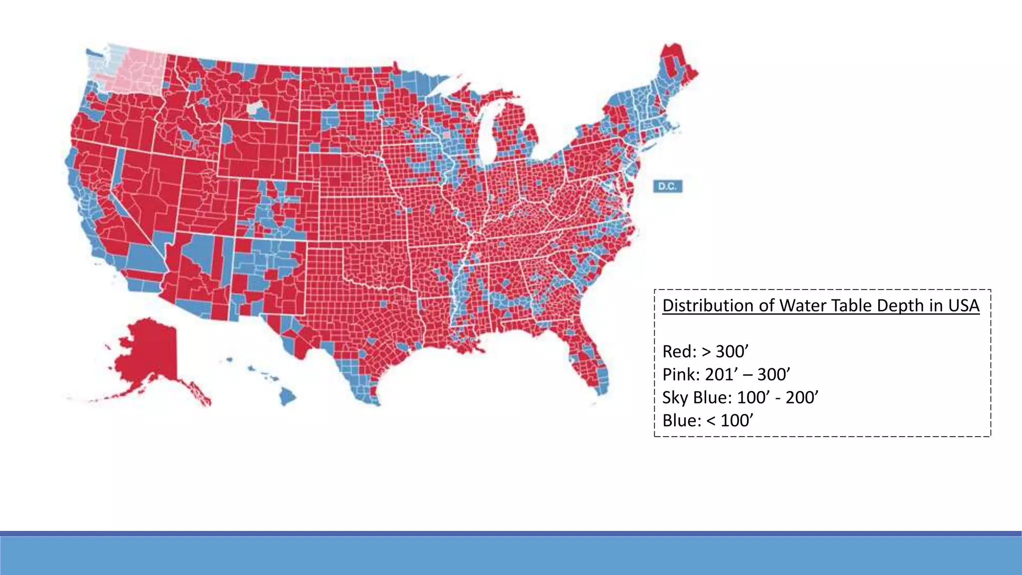
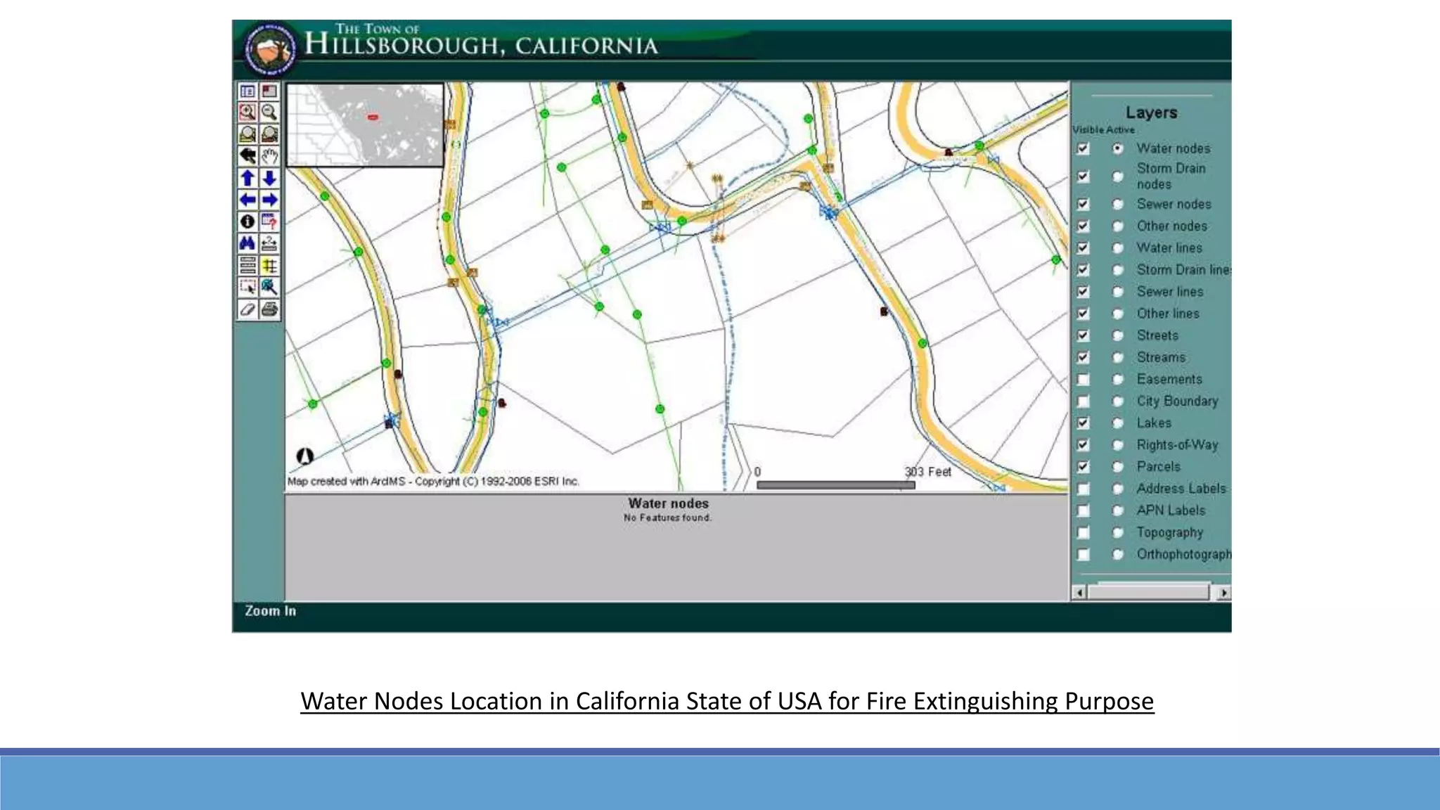
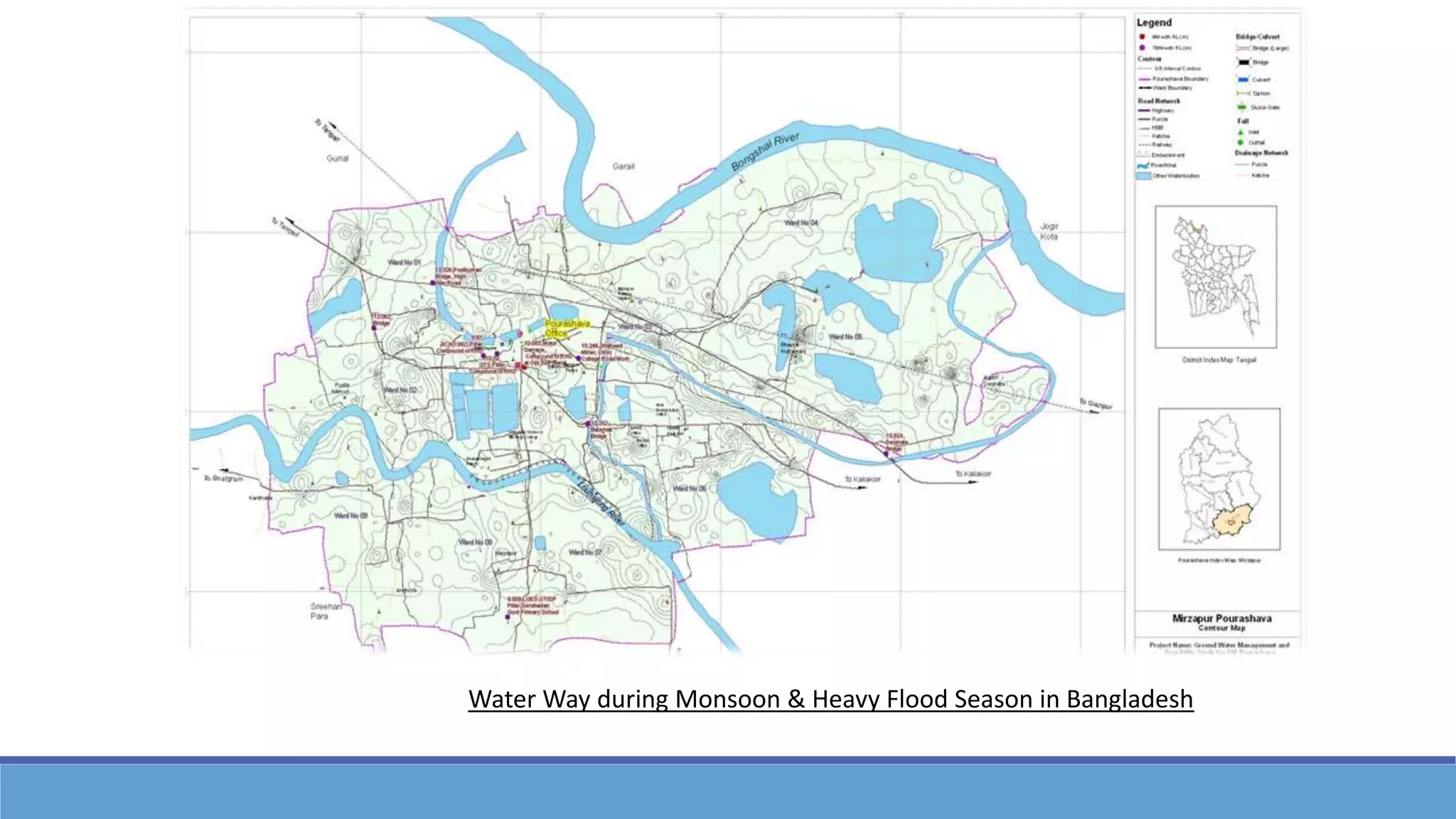
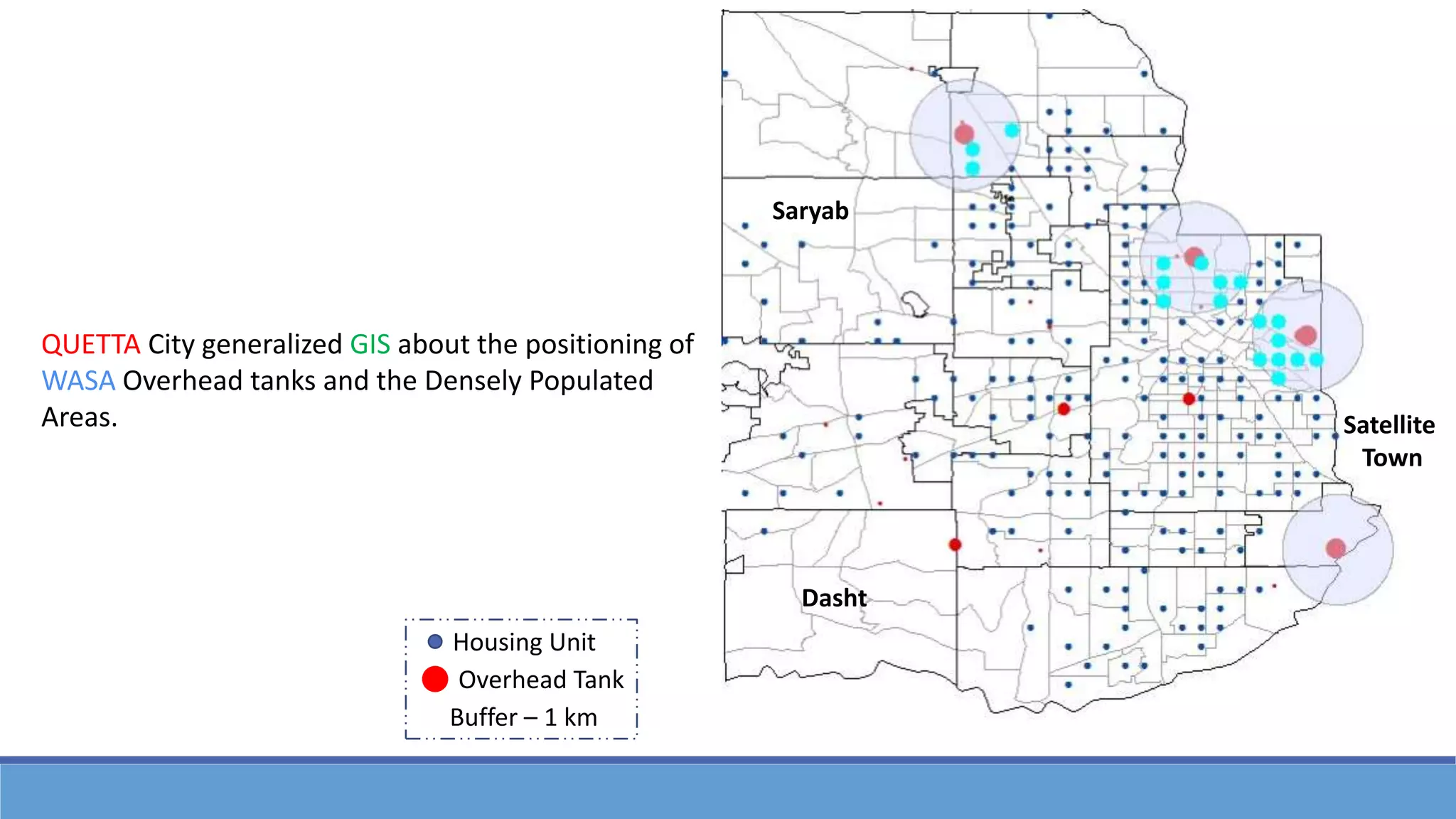
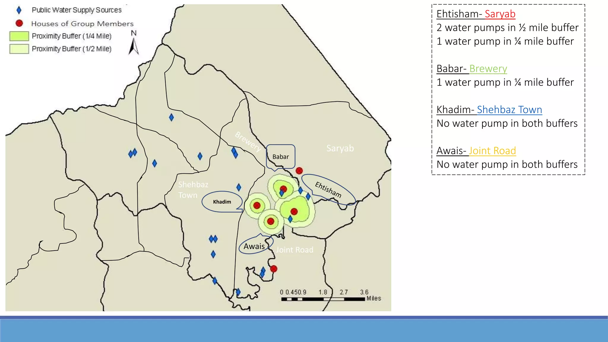
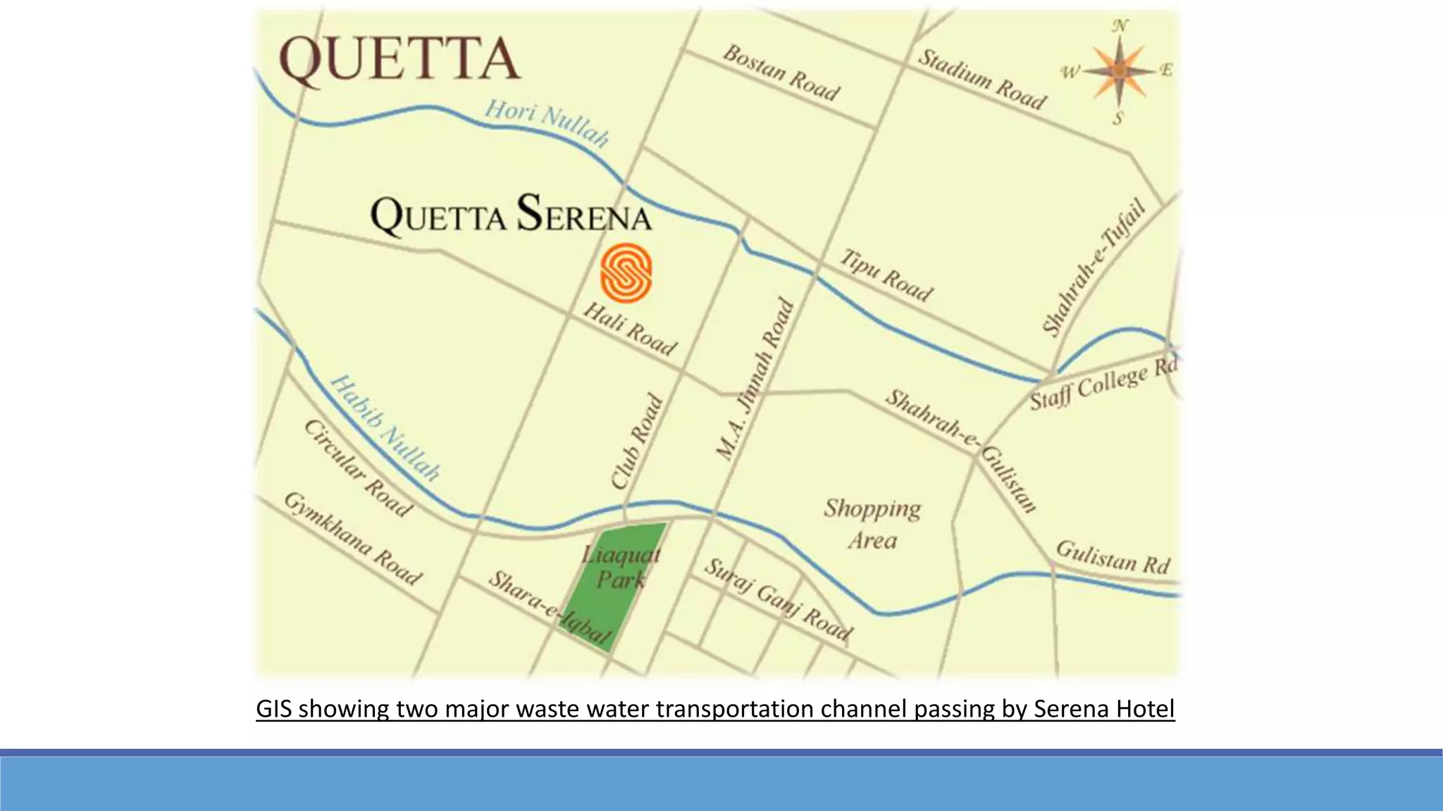


The document provides an overview of Geographic Information Systems (GIS) and their applications in water resource management, detailing the tools, data types, and analytical steps involved in GIS projects. It highlights various applications such as analyzing water table depth distribution in the USA and planning for water resources in areas like California and Bangladesh. The document concludes with examples of GIS usage for optimizing water management and waste transportation channels.