IRJET-About Urban Sprawl: A Case Study of Ahmedabad City
•
1 like•135 views

https://irjet.net/archives/V5/i1/IRJET-V5I1174.pdf

Recommended
Recommended
More Related Content
What's hot
What's hot (20)
Similar to IRJET-About Urban Sprawl: A Case Study of Ahmedabad City
Similar to IRJET-About Urban Sprawl: A Case Study of Ahmedabad City (20)
More from IRJET Journal
More from IRJET Journal (20)
Recently uploaded
Recently uploaded (20)
IRJET-About Urban Sprawl: A Case Study of Ahmedabad City
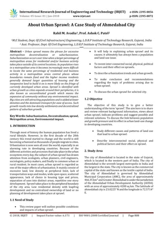
- 1. International Research Journal of Engineering and Technology (IRJET) e-ISSN: 2395-0056 Volume: 05 Issue: 01 | Jan-2018 www.irjet.net p-ISSN: 2395-0072 © 2018, IRJET | Impact Factor value: 6.171 | ISO 9001:2008 Certified Journal | Page 808 About Urban Sprawl: A Case Study of Ahmedabad City Rahil M. Avadia1, Prof. Ashok C. Patel2 1M.E Student, Dept. Of (Civil Infrastructure) Engineering, L.D.R.P Institute of Technology Research, Gujarat, India 2 Asst. Professor, Dept. Of Civil Engineering, L.D.R.P Institute of Technology Research, Gujarat, India ---------------------------------------------------------------------***--------------------------------------------------------------------- Abstract - Urban sprawl means the phrase for excessive metropolitan decentralization or suburbanization. Suburbanization occurs over time when alargerpercentageof metropolitan areas for residential and/or business activity takes place outside of its central locations. As population rises in a metropolitan area it becomes increasingly more difficult to locate the same percentage of residential and business activity in a metropolitan areas central places whose boundaries remain fixed and the higher income residents generally demand larger quantities of housing and the inexpensive land to build it on is more likely on the fringe of currently developed urban areas. Sprawl is identified with urban growth as cities expands around their peripheries, it is also known as uncoordinated growth which means the expansion of community without any environmental impact. Big cities are still attracting populations and is addedatlower densities and the dominant transport for ease of access. Such growth results into low density settlements and decentralized pattern of suburban growth. Key Words: Suburbanization, Decentralization,sprawl, Metropolitan areas, Environmental impact. 1. INTRODUCTION Through most of history the human population has lived a rural lifestyle. However, in the first decade of the 20th century this trend started to change and the world is still becoming urbanized asthousandsof peoplemigratetocities. Urbanization is now seen all over the world, especially in an alarming rate in developing countries. Because of the different activities and processes that take placeintheurban ecosystem every day, the subject of urban sprawl hasdrawn attention from ecologists, urban planners, civil engineers, sociologists, policy makers, and finally to common urban or rural resident. In most cases, urban sprawl is regarded as one of the major effects of urbanization. It mainly consist of excessive land, low density at peripheral limit, lack of transportation ways and modes, wide open space, scattered appearance, lack of choice in housing type and prices, separation of uses into distinct areas, repetitive one story development. Sprawl takesplace in theperipheralboundary of the city area. Low residential density with leapfrog development and no centralized ownership of land or no planning of development takes place at sprawl. 1.1 Need of Study This review paper will outline possible conditions and impacts of urban sprawl. It will help in explaining urban sprawl and its causes; it ultimately has always been a population and land-use issue. To invent inter-connected social, physical, political factors and their effect on sprawls. To describe urbanization trendsand urban growth. To make conclusion and recommendations regarding the topic of problems arising due to urban sprawl. To discuss the urban sprawl for selected city. 1.2 Objective The objective of this study is to give a better understanding of the term ’sprawl’. The aim here is to share and review relevant background information, views about urban sprawl, indicate problems and suggest possible and relevant solutions. To discuss the link between population and growth pressure and itseffect in urban land-use change in developing countries. Study different causes and patterns of land use that lead to urban sprawl. Describe interconnected social, physical and political factors and their effect on sprawl. 2. Study Area The city of Ahmedabad is located in the state of Gujarat, which is located in the western part of India. The city of Ahmedabad is the seventh largest metropolis in India and the largest in the state. The city is known as the commercial capital of the state and known as the textile capital of India. The city of Ahmedabad is governed by Ahmedabad Municipal Corporation (AMC), the area of approximately 466.35 km² and Greater Ahmedabadisunderthejurisdiction of the Ahmedabad Urban Development Authority (AUDA) with an area of approximately 4200 sq km. The lattitude of ahmedabad city is 23.0225° N and the longitude is 72.5714° E.
- 2. International Research Journal of Engineering and Technology (IRJET) e-ISSN: 2395-0056 Volume: 05 Issue: 01 | Jan-2018 www.irjet.net p-ISSN: 2395-0072 © 2018, IRJET | Impact Factor value: 6.171 | ISO 9001:2008 Certified Journal | Page 809 Figure 1: Location map of Ahmedabad In addition the study of this research is limited to selecting only two neighborhood area. These two neighborhoods are compared and verified with the indicatorsof the sustainable transportation system. These two neighborhoods are Chandkheda and Kathwada, which are located at the edge of the city of Ahmedabad. Figure 2: Location map of Chandkheda Both the areas have similar characteristics, intermsofsocio- economic characteristics. Both the areas are of similar size and well-developed neighborhoods. As one is old developed and other is newly developed area. Also one is located near the city center and the other is located far from the city center. Fig 3: Location map of Kathwada The population of Chandkheda is 1 lakh and contains the area of 11 sq. km. The density of Chandkheda area is 9100/km sq. It contains the household of 10,989. The population of Kathwada is 23,300 and containsthe area of 7.25 sq. km. The density of Kathwada area is 3,217/kmsq. It contains the household of 4,940. Figure 4: location map of neighbourhood As shown in above map, Chandkheda area and Kathwada area are located at the peripherial boundary oh Ahmedabad city and are growing on large extent. Both the area contains residential,non-residential,industrial and recreational zones. It also contains different transportation indicators. 2.1 Problem of Urban Sprawl Urbanization is a form of metropolitan growth that is often less understood implications of the economic, social and geography of a region. Due to significant economic and livelihood opportunities in urban areas, an expansion to attract immigrants isresulting in greater urbanizationandis lead to sprawl growth. Urbanization is not considered a threat to environment and development but it is unplanned and urban dynamic urbanization growth, or sprawl that affects the land use of any area that becomes a topic of concern by the lossof prime agricultural land. The twogiven areas are expanding to that extent that it is losing its agricultural land due to development in housing and industrial zone. It can be taken as a perfect example in the topic of growth of sprawl. Both these areas are connected to the highways and are in the immediate vicinity of the city area thus forming an outgrowth to the highwaysand roadsconnectingtothecities at tits peripherial boundary. Due to the location of urban sprawl at boundry of a city, it increasesthe traffic ofcarsand trucks by creating longer and more frequent journeys, resulting in a significant increase in air pollution and smog on the ground. Vehiclesare the main cause of air pollutionin
- 3. International Research Journal of Engineering and Technology (IRJET) e-ISSN: 2395-0056 Volume: 05 Issue: 01 | Jan-2018 www.irjet.net p-ISSN: 2395-0072 © 2018, IRJET | Impact Factor value: 6.171 | ISO 9001:2008 Certified Journal | Page 810 many urban areas, with seriousconsequencesfor the health of the public, wildlife and ecosystems. Also the case of water pollution takes place in sprawl due to the presence of industries and factories which uses a large amount of chemicals. Due to the improper developmentinsprawlitcan create water supply problemsand overuse of water,asmore water is consumed due to residential, industrial as well as agricultural purpose in the same area which can alsodeplete water supply. Solution The people can be a solution to urban sprawl through participation and action. The people can challenge local bodies to vote for more sustainable development methods. People can also challenge local government to partner with organizations that promote smart growth and new urbanism. Investors can buy land that is spreading, while government can draw attention to the disadvantages and effectsof urban sprawl and solve them. Also smart growthis required by the planners, by combining residential areas with work and commercial areas instead of isolating individual areas, allowing more pedestrians and transit as opposed to traffic and pollution. Conclusion The successful implementation of development plans is an essential aspect of the regulation of development of urban areas. The large number of development plans for major cities have been prepared by civil authorities to overcome the problem of sprawl. Some of the urban communities are taking various steps to integrate transit into their communities as indicated that they participated in land use planning in their metropolitan area. The methods like meetings, planning activities and personal networks have taken place between the people and government. The citizens are made aware of sprawl and transit facilities connected to it and how to use it. References 1. AUGUSTO de Lollo,(june 2012). Urban Sprawl and the Challenges for Urban Planning. 2. Darren Bilsborough, Roman Trubka, (april-2010). THE COSTS OF URBAN SPRAWL – INFRASTRUCTURE AND TRANSPORTATION. 3. DERMOT FOLEY and MORAG CARTER,(2003). Understanding Sprawl A CITIZEN’S GUIDE. The Chawkers Foundation. 4. DEL PETERSEN, (oct-2009). TRANSIT AND SMALL URBAN SPRAWL.Small urban and Rural Transit center. 5. W WASMER, (2005), Causes of Urban Sprawl (Decentralization) in the United States: Natural Evolution, Flight from Blight, and the Fiscalization of Land Use. 6. Nina Shirkhanloo, (2013), Analyzing the Effects of Urban Sprawl on the Physical Environment in the case of Kyrenia.