Urban sprawl in india and smart growth model
•
29 likes•7,361 views

Policies responsible for Urban Sprawl in India. Smart Growth Models. TDR and other programs when combined with focused policy can work for intensive community development. Community empowerment through land equity.

Recommended
More Related Content
What's hot
What's hot (20)
Similar to Urban sprawl in india and smart growth model
Similar to Urban sprawl in india and smart growth model (20)
Recently uploaded
Recently uploaded (20)
Urban sprawl in india and smart growth model
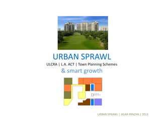
- 1. URBAN SPRAWL | JIGAR PANDYA | 2013 URBAN SPRAWL ULCRA | L.A. ACT | Town Planning Schemes & smart growth
- 2. URBAN SPRAWL | JIGAR PANDYA | 2013 Urban sprawl is the biggest barrier to smart growth
- 3. URBAN SPRAWL | JIGAR PANDYA | 2013 Urban Sprawl creates ~ linkages ~ beyond urban fringe. It displays inefficient land use Which results into poor urban infrastructure
- 4. URBAN SPRAWL | JIGAR PANDYA | 2013 How does a City Grow? In theory, any city requires spaces to grow. IF there are geographic constraints, the growth can either be restricted or immensely sporadic in nature. An urban center growth has one of the 4 classic patterns.
- 5. URBAN SPRAWL | JIGAR PANDYA | 2013 THEORY 1 | Concentric Urban Sprawl In1920s. Ernest Burgess, a geographer at the university of Chicago’s School of Uraban Geography, proposed a ‘Concentric Circle Theory’ for Urban Land use structure. As per the theory, most of the cities have a clearly visible business core, known as ‘Central Business district (CBD), where office buildings, major retail stores, services, government buildings, library, etc are located. The development takes place around the CBD in a circular ring pattern. The inner most ring, closest to the CBD is usually known as ‘Transition Zone’ which has some manufacturing zones and low income housing for workers and labors associated with manufacturing industries. The outer two rings are mainly hosing developments having low to medium income residential multifamily or single houses scattered in the ring and the outermost ring having the upper income groups housing having luxurious ranches with lavish multifamily houses for the medium income groups.
- 6. URBAN SPRAWL | JIGAR PANDYA | 2013 Transportation and infrastructure play a major role in the direction in which the communities grow. Railroads were major drivers for the manufacturing industry carrying freight, making growth pattern concentrated around the railroad network. Other land uses developed in a circular pattern around the business core of a town or city.
- 7. URBAN SPRAWL | JIGAR PANDYA | 2013 THEORY 2 | Sectoral Growth This theory was proposed by Homer Hoyt, a geographer from Chicago. The sector sprawl is similar to the Concentric sprawl, however, unlike rings, the development develops concentric to the CBD in a radial or sectoral pattern. The upper and middle income groups, likely to have their own personal transportation tend to be located away on the opposite side of the CBD to gain advantage of the environmental factors, class prestige and peace.
- 8. URBAN SPRAWL | JIGAR PANDYA | 2013 THEORY 3 | Axial Sprawl The axial Growth theory of land use develops on the concentric growth pattern by adding transportation routes which are characterized by their axes. It recognizes the CBD as the most intensely used area, travel time to the CBD is the key for growth and not the distance between the two locations. Several towns and city having geographic entities such as sea faces, riverfronts or mountains have shown axial sprawl.
- 9. URBAN SPRAWL | JIGAR PANDYA | 2013 THEROY 4 | Multiple Nuclei Sprawl In recent times, the urbanization trend price of REAL ESTATE has developed several pockets of settlement in and around a major city. A metropolitan city in every country is known to have several suburbs around it. These suburbs have been there for some time now, but due to scarcity of land in the CBD, and industries not willing to relocate to new towns or states, they tend to re establish themselves, or have branch operations from the suburbs.. Slowly, these suburbs are transformed into mini satellite urban centers around the CBD, having their own mini Business district. Multiple nuclei sprawl is seen very commonly in many major cities across the world.
- 10. URBAN SPRAWL | JIGAR PANDYA | 2013 Identifying growth patterns and vectors | An Investor/ Planner can identify growth patterns by plotting historical data on maps of the sub-markets and comparing the results. Classifying the historical pattern (concentric, sector, axial or multiple nuclei) may provide deep insight into how the area will change and predict future developments. In addition an investor can track:- – Where is the capital moving? – Where are the population pockets evolving? – Where are the land use changing? – What are the trends in the land prices, area wise? – What are major upcoming directions of roads and transportation construction? – What is the Location and direction of existing and upcoming municipal services? – What are zoning changes? – What are the various Annexation activities? – What kind of building permits are granted in certain areas? – How are the neighborhoods changing?
- 11. URBAN SPRAWL | JIGAR PANDYA | 2013 ULCRA- 1976 Urban Land Ceiling & Regulation Act CLASS BOUNDARY MAX LAND HOLDING CITIES A 10 Kms 500 Sq. Mts MUMBAI, KOLKATA, CHENNAI, NEW DELHI B 8 Kms 1000 Sq. Mts AHMEDABAD, BANGALORE, HYDERABAD C 6 Kms 1500 Sq. Mts LUCKNOW, PUNE, and more. D 4 Kms 2000 Sq. Mts BARODA, SURAT, and more.
- 12. URBAN SPRAWL | JIGAR PANDYA | 2013 IMPACT OF ULCRA | URBAN LAND DEVELOPMENTS CL LIMIT MAX LAND HOLDING CITIES A 10 Kms 500 M2 METROS B 8 Kms 1000 M2 AHMEDABAD, C 6 Kms 1500 M2 PUNE D 4 Kms 2000 M2 BARODA, SURAT City Center With Municipal Corporation Limit
- 13. URBAN SPRAWL | JIGAR PANDYA | 2013 IMPACT OF ULCRA | URBAN LAND DEVELOPMENTS CL LIMIT MAX LAND HOLDING CITIES A 10 Kms 500 M2 METROS B 8 Kms 1000 M2 AHMEDABAD, C 6 Kms 1500 M2 PUNE D 4 Kms 2000 M2 BARODA, SURAT Corporation Area Distance for ULCRA limit (8 Kms)
- 14. URBAN SPRAWL | JIGAR PANDYA | 2013 IMPACT OF ULCRA | URBAN LAND DEVELOPMENTS CL LIMIT MAX LAND HOLDING CITIES A 10 Kms 500 M2 METROS B 8 Kms 1000 M2 AHMEDABAD, C 6 Kms 1500 M2 PUNE D 4 Kms 2000 M2 BARODA, SURAT Area for Development as per Master Plan or Development Plan
- 15. URBAN SPRAWL | JIGAR PANDYA | 2013 IMPACT OF ULCRA | URBAN LAND DEVELOPMENTS CL LIMIT MAX LAND HOLDING CITIES A 10 Kms 500 M2 METROS B 8 Kms 1000 M2 AHMEDABAD, C 6 Kms 1500 M2 PUNE D 4 Kms 2000 M2 BARODA, SURAT
- 16. URBAN SPRAWL | JIGAR PANDYA | 2013 IMPACT OF ULCRA | URBAN LAND DEVELOPMENTS CL LIMIT MAX LAND HOLDING CITIES A 10 Kms 500 M2 METROS B 8 Kms 1000 M2 AHMEDABAD, C 6 Kms 1500 M2 PUNE D 4 Kms 2000 M2 BARODA, SURAT
- 17. URBAN SPRAWL | JIGAR PANDYA | 2013 IMPACT OF ULCRA | URBAN LAND DEVELOPMENTS CL LIMIT MAX LAND HOLDING CITIES A 10 Kms 500 M2 METROS B 8 Kms 1000 M2 AHMEDABAD, C 6 Kms 1500 M2 PUNE D 4 Kms 2000 M2 BARODA, SURAT
- 18. URBAN SPRAWL | JIGAR PANDYA | 2013 IMPACT OF ULCRA | URBAN LAND DEVELOPMENTS CL LIMIT MAX LAND HOLDING CITIES A 10 Kms 500 M2 METROS B 8 Kms 1000 M2 AHMEDABAD, C 6 Kms 1500 M2 PUNE D 4 Kms 2000 M2 BARODA, SURAT
- 19. URBAN SPRAWL | JIGAR PANDYA | 2013 Approaches to Managing New Growth: The Gujarat Model There have been, by and large, two approaches to managing new urban growth in India. In the first approach the public planning authorities and development agencies acquire large portions of land and then re plan them in a desirable or appropriate manner. This is referred to as the “land acquisition” method. In the second approach, the public planning agencies and development authorities, instead of acquiring land, bring together or “pool together” a group of owners and then re plan the area by readjusting or reshaping every land parcel in a manner such that it is given a regular shape and access and in the process a portion of land parcel is appropriated to provide for roads, infrastructure, and public amenities. This is referred to as the “land readjustment and pooling” method. Both the approaches, with their merits and demerits, are briefly explained and illustrated through sketches.
- 20. URBAN SPRAWL | JIGAR PANDYA | 2013 Land Acquisition Method In this method, the public planning authorities/development agencies acquire large areas of land from agricultural landholders (farmers) under the Land Acquisition Act of 1894. Compensation paid to farmers is based on prevailing agricultural land prices. To minimize opposition to acquisition farmers are paid prices marginally higher than agricultural land prices. Then a master plan of the area is prepared, laying out the roads, plots for social amenities, and plots for sale. Roads and infrastructure are then built, using government funds or loans. Serviced plots are then sold for urban uses at market rates, which are most often much higher than the rate at which land is acquired.
- 21. URBAN SPRAWL | JIGAR PANDYA | 2013 Advantages of LA method Adequate amounts of land for urban uses can be rapidly generated, provided that there is little opposition to bulk acquisition from farmers. To expedite acquisition, some states allow private developers to assemble land. In many cases, developers use extralegal means ( additional incentives/ non formal offers) to secure farmers' consent. There are very few constraints in preparing the master plan. The benefit of appreciation of land value on its being converted to urban use accrues to the development authority. ( Builders and authority profit more)
- 22. URBAN SPRAWL | JIGAR PANDYA | 2013 Disadvantages of LA method Original owners or farmers don’t share this benefit in any manner. This goes against the grain of fairness. In this method, farmers are essentially thrown off their land. Unable to wisely invest the money received as compensation for their land and deprived of a means of livelihood, they have to join the pool of urban labor. This process adds to familiar urban problems—growth of slums, increase in crime rates, and increased informal-sector economic activity. The development process is slow. Any person who needs land for urban use has to approach the urban development authority. The development authority ends up becoming a bottleneck for development. Development agencies using the method of bulk land acquisition end up being powerful large-scale land developers, controlling vast urban resources. This is likely to breed corruption and is antithetical to the emerging paradigm, where government plays a facilitator’s role.
- 23. URBAN SPRAWL | JIGAR PANDYA | 2013 TDR stands for transferable development rights. Maharastra and some others States have allowed builders to exceed their FSI for a particular plot, by transferring development rights from elsewhere. Reason Sometimes state Governments have to acquire land for public purposes and reimburse them according as per the provisions of Land Acquisition Act. In order to speed up the acquisition of reserved plots of land, some of the states Governments have evolved this new scheme. Under the scheme, the owner develops the plot required by the Govt. for public purposes at his own cost up to plinth level and hands over the same without receiving any monetary compensation. TDR
- 24. URBAN SPRAWL | JIGAR PANDYA | 2013 TDR The state Government however, in lieu, grants to the owner, FSI equivalent to the FSI of the land surrendered in the form of a certificate of Development Rights (DRC). These DRCs are transferable as negotiable instruments, and are commonly called TDRs. To sum up, TDR means that FSI of a property under acquisition or reservation is transferred as movable property to some other property where the same can be utilized for construction of additional floors / premises exceeding the permissible FSI of the latter property.
- 25. URBAN SPRAWL | JIGAR PANDYA | 2013 TDR a tool for Smart Growth • Allows Urban Densifications. • Can be controlled – depending on up gradation of Urban Infrastructure. • Incentives can be linked beyond FSI & Built-up • Can be used to solve the housing backlog. • Very effective for Slum Rehabilitation and Government Utility Buildings.
- 26. URBAN SPRAWL | JIGAR PANDYA | 2013 Land Pooling and Readjustment Method (Town Planning Schemes) • In this method, the public planning agency or development authority temporarily brings together a group of landowners for the purpose of planning, under the aegis of the state- level town or urban planning act. As there is no acquisition or transfer of ownership involved, there is no case for paying compensation. • A master plan of the area is prepared, laying out the roads and plots for social amenities. The remaining land is reconstituted into final plots for the original owners. The size of the final plot is in proportion to the size of the original plot, and its location is as close as possible to the original plot. • A betterment charge based on the cost of the infrastructure proposed to be laid is levied on the landowners. Infrastructure is then provided utilizing these funds.
- 27. URBAN SPRAWL | JIGAR PANDYA | 2013 Town Planning Schemes | Land Pooling & readjustment Mechanism
- 28. URBAN SPRAWL | JIGAR PANDYA | 2013 • Town Planning Schemes | Land Pooling & readjustment Mechanism
- 29. URBAN SPRAWL | JIGAR PANDYA | 2013 • Town Planning Schemes | Land Pooling & readjustment Mechanism
- 30. URBAN SPRAWL | JIGAR PANDYA | 2013 Valuation & area Town Planning Schemes | Land Pooling & readjustment Mechanism
- 31. URBAN SPRAWL | JIGAR PANDYA | 2013 Valuation & area Town Planning Schemes | Land Pooling & readjustment Mechanism
- 32. URBAN SPRAWL | JIGAR PANDYA | 2013 Valuation & area Town Planning Schemes | Land Pooling & readjustment Mechanism
- 33. URBAN SPRAWL | JIGAR PANDYA | 2013 Advantages All the land, except whatever is needed for infrastructure development and social amenities, remains with the original owner. The development agency plays a limited role in ensuring planned urban growth. The increment in land value resulting from the development accrues to the original owner whenever the land is sold and developed for urban use. Thus the benefit of development goes to the original owner instead of the development agency. The original owner is not displaced in the process of land development and continues to enjoy access to the land resource. Thus the negative impact of the process of urbanization on farmers (original owners) is minimized. Town Planning Schemes | Land Pooling & readjustment Mechanism
- 34. URBAN SPRAWL | JIGAR PANDYA | 2013 Disadvantages • Time consuming, – land pooling or readjustment schemes is unduly complicated and cumbersome. • Betterment charges are levied at the time of Plan passing. – . Due to the inordinate delays in finalizing schemes, the betterment charges levied on finalization of the scheme do not meet the cost of the infrastructure provided. • This method has only been successfully used in Gujarat as of today. Town Planning Schemes | Land Pooling & readjustment Mechanism
- 35. URBAN SPRAWL | JIGAR PANDYA | 2013 Road network 40.0 0 M 12 .0 0M 12.00 M 12.00M 24.00 M 24.00 M 12.00 M 12.00M 18 .0 0M 18 .0 0M 9.00 M 24 .00M 12 .0 0 M 12.00 M 9.00 M 12.0 0 M 18 .0 0M 12.00 M 24.00M 12.00 M 7.50M 12.00 M 12.00M 12.00 M 12.0 0 M 12.00 M 40.0 0 M 18 .00M 24 .00M 18.00 M 12.00 M 12.00M 12.00 M 12.0 0 M 12 .0 0M 18 .0 0M 18 .0 0M 12.00M 12.00 M 18.00 M 7.50M 12.00M 18.00 M 24.00M 18.00 M 18.00 M 9.00M 18.00 M 24.00M 12.00M 12.00M 9.00M 12.00M 7.50M 12.00M 7.50M 9.00 M 18.00 M 18.00 M 18.00M 12.00M 30.00 M 30.00 M 9.00M 24.00M 9.00 M 9.00 M 12.00 M 12.00 M 9.00M 9.00 M12.00M 24.00M 18.00 M DRAFT T.P.S. NO-24 (VEJALPUR) 24.00M 12.00M 12.00M 18.00 M 18 .00M 18 .00M 18 .00M 18.00 M 18.00 M DRAFT T.P.S. NO-23 (VEJALPUR) 9.00 M 9.00 M 9.00M 7.50M 9.00 M 9.00 M DRAFT T.P.S. NO-25 (VEJALPUR) 18.00 M 7. 50 M 12.00M 12.00M DRAFT T.P.S. NO-26 (M AKARBA) A D J. M A K A R B A - D.P. A R E A A D J. V E J A L P U R - D.P. A R E A 60.00MT. NATIONAL HIGHWAY ROAD 9.00 M 7.50M AHMEDABAD URBAN DEVELOPMENT AUTHORITY ASSISTANT TOWN PLANNER CHIEF EXECUTIVE AUTHORITYSENIOR TOWN PLANNER 020 20 40 80 Meters AHMEDABAD URBAN DEVELOPMENT AUTHORITY TOSARKHEJ TOGANDHINAGAR TO SHYAMAL CROSS ROADS R A I L W A Y L I N E LEGEND T.P.S. BOUNDRY SURVEY BOUNDRY O.P. BOUNDARY F.P. BOUNDARY BUILD UP STRUCTURES SALE FOR COMMERCIAL NEIGHBOURHOOD CENTRE S.E.W.S.H.(Socially Eco. Weaker Sec. Housing ) GARDEN, PLAY GROUND, O.S. ROADS VILLAGE BOUNDRY SALE FOR RESIDENTIAL WATER BODY O.N.G.C. PIPELINE • Level 1 : 36m wide roads of 2.5 km length • Level 2 : 24 m wide roads of 3.2 km length Level 3 : 18 m wide roads of 6.5 km length • Level 4 : 12 m & below wide roads of 4.3 km length Bus routes and bus stops • Bus routes on level 1 and level 2 roads • 4 bus stops at major road junctions Town Planning Schemes | PRAHLADNAGAR
- 36. URBAN SPRAWL | JIGAR PANDYA | 2013 Final plots 333 335 334 323 282 314 339 329338 317 318 322 321 312 319 313 311 310 304 324 320 305 271 308 309 315 307 303 302 276 306 299 298 295 301 337 274 325 291 293/2 293/1 296 294 278 300 275 280 277 297 332 290 292 279 263 261 264 289 283 270 272 273 268/2 269 330 331 260 232 234 229 227 228 226 254 218 213220 222 231 230 225 219 208 223 224 259 209 206 205 207 210 215 211 268/1 233 216214 221 107 212 267 203 204 258 202 256 201 200 265 266 257 248 82 199 87 84 76 139/1 8081 130 169 85 86 83 73 192 69 77 79 67 78 68 75 70 71 72 62 63 64 66/1 74 66/2 96 65 117 95 97 100 101 102 103 189 246 99 128 129 45 54/2 46 53/2 49/1 236 58 44 43 49/2 47 48/1 60 20 19 1718151413/2 16 42 13/1 13/3 12 36 10 11 9 6 28 3 35 34 7 8 41 59 50 30 1 32 33 22 21/2 4 21/1 23 26 27 31 40 29 39/1 39/2 61 54/1 51 55 90/3 98 123 113 148 116 138137136115 114 110 111 112108 109 142 125 106 193 124 120 245 104 131 133 132 134 127 122 244 126 135 119 121 150 243 154 155 156186 157184183 151 180153195 196 177 158159 160 162 161 146145 147 149 144 143 165 164 163 141 237 179 140 167 191 194 250 181 185 190 178 166 174 173 165 187/2 139/2 170 171 172 197 240 239 188 249 242 241 238 251 175 176 187/1 252 326 284 286 287 285 288 327 235/1 235/2 316 40.0 0 M 12 .00 M 12.00 M 12.00M 24.00 M 24.00 M 12.00 M 12.00M 18 .00 M 18 .00 M 9.00 M 24 .00M 12.0 0 M 12.00 M 9.00 M 12.0 0 M 18 .00 M 12.00 M 24.00M 12.00 M 7.50M 12.00 M 12.00M 12.00 M 12.0 0 M 12.00 M 40.0 0 M 18.00M 24 .00M 18.00 M 12.00 M 12.00M 12.00 M 12.0 0 M 12 .00 M 18 .00 M 18 .00 M 12.00M 12.00 M 18.00 M 7.50M 12.00M 18.00 M 24.00M 18.00 M 18.00 M 9.00M 18.00 M 24.00M 12.00M 12.00M 9.00M 12.00M 7.50M 12.00M 7.50M 9.00 M 18.00 M 18.00 M 18.00M 12.00M 30.00 M 90/1 94 152 53/1 5289 57 105 88 90/2 91 9293 118 56 30.00 M 9.00M 24.00M 9.00 M 9.00 M 12.00 M 12.00 M 9.00M 9.00 M 12.00M 24.00M 18.00 M DRAFT T.P.S. NO-24 (VEJALPUR) 24.00M 12.00M 12.00M 18.00 M 18 .00M 18 .00M 18 .00M 18.00 M 18.00 M 5 2 DRAFT T.P.S. NO-23 (VEJALPUR) 9.00 M 9.00 M 9.00M 7.50M 9.00 M 9.00 M DRAFT T.P.S. NO-25 (VEJALPUR) 18.00 M 7. 50 M 12.00M 24 25 38 37 856 868/1/2 867 133 135/P 137 136/P 140 866/P 138 142/P 141 845/1/1 140 846 851 840 841 847 843 844 864 838 838 837 848 792 793 794/2 791 794/1 790 5/1 5/2 6 849 5/3 850 833 835/1 + 835/3 795 796 789 797/4 797/3 797/1 797/2 787 785/3 785/2 786 784 788/1 788/2 834 798/P 800/2 804/1 831 806 783 781/1 781/3 782 8/2 9 10 781/2 779 778 801 828/P 780 802/1+2 803/1/1+1 803/3 816 815 811 812 810 809 805 813 888 896 894 936 895 891 892 938 939 940/4 940/1 940/2 940/3 937 935 934/3 944 945 946/2 942/2 942/1 943 941/1 941/2 941/3 941/4 934/1 890 886 887 817 814 885/1 823 820 885/2 885/3 900 901/1 901/2 902 901/3 901/4 926/1 926/2 928/1 928/2 955 954/2 952 953 954/1 956/2 956/1 924/4 924/3925/3 925/2903/2903/1 904 905 908 907/2 907/1 912 909/1 909/3 910/2 925/1 922/1 921 911/2 911/1 1335/1+2 922/2 924/1 924/2 929/2 929/1 929/3 932/3 932/1 930/5 931 948 947 949 951 930/4 933/1 933/2 933/3 932/2 898 897 899 824 821 829 825 826 906 830 828 827 884 913 914/2 915 920 919/3 957 919/2 916 918 883 835 831 833 919/1 834 836 881 879880837 836 833 839/3 838/1 838/2 882 917 958 33959 875 876 877 878 862861 860 839/1 839/2 841/1 859/1 TO 7 864 863 857 865 866 868 869 870 872 873 871 874 SALE FOR RESIDENCE SALE FOR RESIDENCE SALE FOR RESIDENCE SALE FOR RESIDENCE SALE FOR RESIDENCE SALE FOR RESIDENCE SALE FOR RESIDENCE SALE FOR RESIDENCE SALE FOR RESIDENCE SALE FOR RESIDENCE SALE FOR RESIDENCE S.E.W.S.H. S.E.W.S.H. S.E.W.S.H. S.E.W.S.H. 336 12.00M GARDEN GARDEN GARDEN 262 GARDEN GARDEN GARDEN GARDEN SALE FOR SALE FORCOMM. COMM. SALE FOR COMM. SALE FOR COMM. 217 255 SALE FOR COMM. SALE FOR COMM. SALE FOR COMM. SALE FOR COMM. SALE FOR COMM. SALE FOR COMM. SALE FOR COMM. NEIGHBOUR HOOD CENTRE NEIGHBOUR HOOD CENTRE 198 NEIGHBOUR HOOD CENTRE 247 NEIGHBOUR HOOD CENTRE 253 NEIGHBOUR HOOD CENTRE NEIGHBOUR HOOD CENTRE SCHOOL SCHOOL SCHOOL SALE FOR COMM. GARDEN O.S. O.S. PLAY GROUND OPEN SPACE O.S. O.S. O.S. O.S. DRAFT T.P.S. NO-26 (M AKARBA) A D J. M A K A R B A - D.P. A R E A A D J. V E J A L P U R - D.P. A R E A 60.00MT. NATIONAL HIGHWAY ROAD S.E.W.S.H. S.E.W.S.H. S.E.W.S.H. S.E.W.S.H. S.E.W.S.H. 9.00 M 7.50M O.S. TANK N.C. O. S. O. S. N.C. AHMEDABAD URBAN DEVELOPMENT AUTHORITY 020 20 40 80 Meters 799/1 862 188 TOSARKHEJ TOGANDHINAGAR TO SHYAMAL CROSS ROADS O. S. 328 SALE COMM. FOR 914/1 822 182 910/1 923 909/2 909/4 956/3 927 950 930/1 930/6 930/2 930/3 934/2 946/2 818/2 826/P + 803/2 827/P 800/1 804/2 805 785 799/2 798 835/2 836 7 8/1+3+4 807 808 893 863 845/2 + 845/1+2 866/P 136/P 139/1 TO 139/6 859 144 135/P 145/P 146/1 146/2 180 869/2 869/1 184 185/P 870 214 871/P 842/1+2 881 889 852 R A I L W A Y L I N E LEGEND T.P.S. BOUNDRY SURVEY BOUNDRY O.P. BOUNDARY F.P. BOUNDARY BUILD UP STRUCTURES SALE FOR COMMERCIAL NEIGHBOURHOOD CENTRE S.E.W.S.H.(Socially Eco. Weaker Sec. Housing ) GARDEN, PLAY GROUND, O.S. ROADS VILLAGE BOUNDRY SALE FOR RESIDENTIAL WATER BODY O.N.G.C. PIPELINE • Total area of the scheme 162 Ha. • Total area of original plots 155 Ha. • Final plots allotted to land owners in lieu of original plots 78 Ha. • Net deduction 49.6 % • Area of road 32.13 Ha • Area of plots allotted to authority for public purpose 51.87 Ha. Town Planning Schemes | PRAHLADNAGAR
- 37. URBAN SPRAWL | JIGAR PANDYA | 2013 Plan no. 4 59 58 60 56 55/1 55/2 54 53 333 335 334 49/2 49/1 48 47/1 47/2 50 46/2 31/2 43 31/1 32 33 41 34 29 40 38 37 35 42 45 12 28 26 25 27 15 14 16 17 24 36 11/1+2 10 5 7 9 22 23 18 170 171 176 172 173 174 175 168 165 164 162 163 149 166 161 167 169 160 147 157 156 158 146 19 20 21 4 156 155 150 151 152 148 145 153 154 144 44 2 141 142 23 25 24 26 110 140 13 14 21 20 1 177 182 181 179 184 183 180 131 130 129 178 132 135 133 134 116 115 114113 109 107 117 119 118 120 128 121 122 123 124 125 126127 136 137 138 139 80 70 81 108 82 106 83 22 11 12 15 16 17 18 8 9 1 5 6 7 2 3 4 7 3 2 16 17 18 19 6/2 6/1 5 13/3 13/1 13/2 14 15 12/2 12/1 11 10 9 7 8 6 24 25 26 22 4 5 27 29 28 31 30 9 12 11 10 8 20 27 28 33 34 32 3031 51 35 39 40 41 36 37 38 46 47 44 45 42 43 68 67 66 69 71 72 73 75 84 74 76 77 78 55 54 79 86 88 85 87 89 91 100 101 99 103 104 105 102 9798 96 92 90 95 93 94 58 53 56 60 5962 57 63 64 65 50 49 52 19 29 52 30 61 13 3 143 61 48 21 32 1 23 323 282 314 339 329338 317 318 322 39 321 312 319 313 311 310 304 324 320 305 271 308 309 315 307 303 302 276 306 299 298 295 301 337 274 325 291 293/2 293/1 296 294 278 300 275 280 277 297 332 290 292 279 263 261 264 289 283 270 272 273 268/2 269 330 331 260 232 234 229 227 228 226 254 218 213220 222 231 230 225 219 208 223 224 259 209 206 205 207 210 215 211 268/1 233 216214 221 107 212 267 203 204 258 202 256 201 200 265 266 257 248 82 199 87 84 76 139/1 8081 130 169 85 86 83 73 192 69 77 79 67 78 68 75 70 71 72 62 63 64 66/1 74 66/2 96 65 117 95 97 100 101 102 103 189 246 99 128 129 45 54/2 46 53/2 49/1 236 4 58 44 43 49/2 47 48/1 60 20 19 1718151413/2 16 42 13/1 13/3 12 36 10 11 9 6 28 3 35 34 7 8 41 59 50 30 1 32 33 22 21/2 4 21/1 23 26 27 31 40 29 39/1 39/2 61 54/1 51 55 90/3 98 123 113 148 116 138137136115 114 110 111 112108 109 142 125 106 193 124 120 245 104 131 133 132 134 127 122 244 126 135 119 121 150 243 154 155 156186 157184183 151 180153195 196 177 158159 160 162 161 146145 147 149 144 143 165 164 163 141 237 179 140 167 191 194 250 181 185 190 178 166 174 173 165 187/2 139/2 170 171 172 197 240 239 188 249 242 241 238 251 175 176 187/1 252 326 284 286 287 285 288 327 235/1 235/2 316 40.0 0 M 12 .0 0 M 12.00 M 12.00 M 24.00 M 24 .00 M 12.00 M 12.00M 18 .0 0 M 18 .0 0 M 9.0 0 M 24 .00M 12 .0 0 M 12.00 M 9.00 M 12 .0 0 M 18 .0 0 M 12.00 M 24.00 M 12.00 M 7.50M 12.00 M 12.00 M 12.00 M 12 .0 0 M 12.00 M 40.0 0 M 18.00 M 24 .00M 18.00 M 12.00 M 12.00M 12.00 M 12.0 0 M 12 .0 0 M 18 .0 0 M 18 .0 0 M 12.00M 12.00 M 18.00 M 7.50M 12.00M 18.00 M 24.00M 18.00 M 18.00 M 9.00M 18.00 M 24.00M 12.00M 12.00M 9.00M 12.00M 7.50M 12.00M 7.50M 9.00 M 18.00 M 18.00 M 18.00M 12.00M 30.00 M 90/1 94 152 53/1 5289 57 105 88 90/2 91 9293 118 56 30.00 M 9.00M 24.00M 9.00 M 9.00 M 12.00 M 12.00 M 9.00M 9.00 M 12.00M 24.00M 18.00 M DRAFT T.P.S. NO-24 (VEJALPUR) 24.00M 12.00M 12.00M 18.00 M 18 .00M 18 .00M 18 .00M 18.00 M 18.00 M 5 2 DRAFT T.P.S. NO-23 (VEJALPUR) 9.00 M 9.00 M 9.00M 7.50M 9.00 M 9.00 M DRAFT T.P.S. NO-25 (VEJALPUR) 18.00 M 7. 50 M 12.00M 24 25 38 37 856 868/1/2 867 133 135/P 137 136/P 140 866/P 138 142/P 141 845/1/1 140 846 851 840 841 847 843 844 864 838 838 837 848 792 793 794/2 791 794/1 790 5/1 5/2 6 849 5/3 850 833 835/1 + 835/3 795 796 789 797/4 797/3 797/1 797/2 787 785/3 785/2 786 784 788/1 788/2 834 798/P 800/2 804/1 831 806 783 781/1 781/3 782 8/2 9 10 781/2 779 778 801 828/P 780 802/1+2 803/1/1+1 803/3 816 815 811 812 810 809 805 813 888 896 894 936 895 891 892 938 939 940/4 940/1 940/2 940/3 937 935 934/3 944 945 946/2 942/2 942/1 943 941/1 941/2 941/3 941/4 934/1 890 886 887 817 814 885/1 823 820 885/2 885/3 900 901/1 901/2 902 901/3 901/4 926/1 926/2 928/1 928/2 955 954/2 952 953 954/1 956/2 956/1 924/4 924/3925/3 925/2903/2903/1 904 905 908 907/2 907/1 912 909/1 909/3 910/2 925/1 922/1 921 911/2 911/1 1335/1+2 922/2 924/1 924/2 929/2 929/1 929/3 932/3 932/1 930/5 931 948 947 949 951 930/4 933/1 933/2 933/3 932/2 898 897 899 824 821 829 825 826 906 830 828 827 884 913 914/2 915 920 919/3 957 919/2 916 918 883 835 831 833 919/1 834 836 881 879880837 836 833 839/3 838/1 838/2 882 917 958 33959 875 876 877 878 862861 860 839/1 839/2 841/1 859/1 TO 7 864 863 857 865 866 868 869 870 872 873 871 874 SALE FOR RESIDENCE SALE FOR RESIDENCE SALE FOR RESIDENCE SALE FOR RESIDENCE SALE FOR RESIDENCE SALE FOR RESIDENCE SALE FOR RESIDENCE SALE FOR RESIDENCE SALE FOR RESIDENCE SALE FOR RESIDENCE SALE FOR RESIDENCE S.E.W.S.H. S.E.W.S.H. S.E.W.S.H. S.E.W.S.H. 336 12.00M GARDEN GARDEN GARDEN 262 GARDEN GARDEN GARDEN GARDEN SALE FOR SALE FORCOMM. COMM. SALE FOR COMM. SALE FOR COMM. 217 255 SALE FOR COMM. SALE FOR COMM. SALE FOR COMM. SALE FOR COMM. SALE FOR COMM. SALE FOR COMM. SALE FOR COMM. NEIGHBOUR HOOD CENTRE NEIGHBOUR HOOD CENTRE 198 NEIGHBOUR HOOD CENTRE 247 NEIGHBOUR HOOD CENTRE 253 NEIGHBOUR HOOD CENTRE NEIGHBOUR HOOD CENTRE SCHOOL SCHOOL SCHOOL SALE FOR COMM. GARDEN O.S. O.S. PLAY GROUND OPEN SPACE O.S. O.S. O.S. O.S. DRAFT T.P.S. NO-26 (M AKARBA) A D J. M A K A R B A - D.P. A R E A A D J. V E J A L P U R - D.P. A R E A 60.00MT. NATIONAL HIGHWAY ROAD S.E.W.S.H. S.E.W.S.H. S.E.W.S.H. S.E.W.S.H. S.E.W.S.H. 9.00 M 7.50M O.S. TANK N.C. O. S. O. S. N.C. AHMEDABAD URBAN DEVELOPMENT AUTHORITY 020 20 40 80 Meters 799/1 862 188 TOSARKHEJ TOGANDHINAGAR TO SHYAMAL CROSS ROADS O. S. 328 SALE COMM. FOR 914/1 822 10 182 1 910/1 923 909/2 909/4 956/3 927 950 930/1 930/6 930/2 930/3 934/2 946/2 818/2 826/P + 803/2 827/P 800/1 804/2 805 785 799/2 798 6 835/2 8 836 7 8/1+3+4 807 808 112 893 863 845/2 + 845/1+2 866/P46/1 136/P 139/1 TO 139/6 859 144 135/P 145/P 146/1 146/2 51 180 869/2 869/1 184 57 185/P 870 214 871/P 842/1+2 881 111 889 852 R A I L W A Y L I N E LEGEND T.P.S. BOUNDRY SURVEY BOUNDRY O.P. BOUNDARY F.P. BOUNDARY BUILD UP STRUCTURES SALE FOR COMMERCIAL NEIGHBOURHOOD CENTRE S.E.W.S.H.(Socially Eco. Weaker Sec. Housing ) GARDEN, PLAY GROUND, O.S. ROADS VILLAGE BOUNDRY SALE FOR RESIDENTIAL WATER BODY O.N.G.C. PIPELINE • Plots allotted to AUDA for public purpose were distributed spatially to cater the demand sector wise. • Water bodies were not only preserved but are proposed for development. • Roads were proposed in continuance with adjacent schemes and lands on other side of highway Town Planning Schemes | PRAHLADNAGAR
- 38. URBAN SPRAWL | JIGAR PANDYA | 2013 plots to AUDA 40.0 0 M 12 .0 0 M 12.00 M 12.00M 24.00 M 24 .00 M 12.00 M 12.00M 18 .0 0 M 18 .0 0 M 9.00 M 24 .00M 12.0 0 M 12.00 M 9.00 M 12.0 0 M 18 .0 0 M 12.00 M 24.00M 12.00 M 7.50M 12.00 M 12.00M 12.00 M 12.0 0 M 12.00 M 40.0 0 M 18.00M 24 .00M 18.00 M 12.00 M 12.00M 12.00 M 12.0 0 M 12 .0 0 M 18 .0 0 M 18 .0 0 M 12.00M 12.00 M 18.00 M 7.50M 12.00M 18.00 M 24.00M 18.00 M 18.00 M 9.00M 18.00 M 24.00M 12.00M 12.00M 9.00M 12.00M 7.50M 12.00M 7.50M 9.00 M 18.00 M 18.00 M 18.00M 12.00M 30.00 M 30.00 M 9.00M 24.00M 9.00 M 9.00 M 12.00 M 12.00 M 9.00M 9.00 M 12.00M 24.00M 18.00 M DRAFT T.P.S. NO-24 (VEJALPUR) 24.00M 12.00M 12.00M 18.00 M 18 .00M 18 .00M 18 .00M 18.00 M 18.00 M DRAFT T.P.S. NO-23 (VEJALPUR) 9.00 M 9.00 M 9.00M 7.50M 9.00 M 9.00 M DRAFT T.P.S. NO-25 (VEJALPUR) 18.00 M 7. 50 M 12.00M 12.00M DRAFT T.P.S. NO-26 (M AKARBA) A D J. M A K A R B A - D.P. A R E A A D J. V E J A L P U R - D.P. A R E A 60.00MT. NATIONAL HIGHWAY ROAD 9.00 M 7.50M AHMEDABAD URBAN DEVELOPMENT AUTHORITY 020 20 40 80 Meters TOSARKHEJ TOGANDHINAGAR TO SHYAMAL CROSS ROADS R A I L W A Y L I N E LEGEND T.P.S. BOUNDRY SURVEY BOUNDRY O.P. BOUNDARY F.P. BOUNDARY BUILD UP STRUCTURES SALE FOR COMMERCIAL NEIGHBOURHOOD CENTRE S.E.W.S.H.(Socially Eco. Weaker Sec. Housing ) GARDEN, PLAY GROUND, O.S. ROADS VILLAGE BOUNDRY SALE FOR RESIDENTIAL WATER BODY O.N.G.C. PIPELINE • Plots allotted to appropriate authority for sale for residential & commercial of an area of 20 Ha. Is estimated to fetch an amount of 40 crores that may be used for infrastructure to be developed. • Loans from financial institutions can also be availed in lieu of it Town Planning Schemes | PRAHLADNAGAR
- 39. URBAN SPRAWL | JIGAR PANDYA | 2013 gardens/o.s. & road Area % in Ha. Garden/O.S. 7.55 4.66 Water bodies 2.00 1.24 Roads 32.13 19.83 TOTAL 41.86 25.73 Area of scheme – 162 Ha. 25.73 % area covered under roads & open space at scheme level is highest compared to any scheme in AUDA. 40.00 M 12 .00M 12.00 M 12.00M 24.00 M 24.00 M 12.00 M 12.00M 18 .00M 18 .00M 9.00 M 24 .00M 12.0 0 M 12.00 M 9.00 M 12.0 0 M 18 .00M 12.00 M 24.00M 12.00 M 7.50M 12.00 M 12.00M 12.00 M 12.0 0 M 12.00 M 40.0 0 M 18 .00M 24 .00M 18.00 M 12.00 M 12.00M 12.00 M 12.0 0 M 12 .00M 18 .00M 18 .00M 12.00M 12.00 M 18.00 M 7.50M 12.00M 18.00M 24.00M 18.00 M 18.00 M 9.00M 18.00 M 24.00M 12.00M 12.00M 9.00M 12.00M 7.50M 12.00M 7.50M 9.00 M 18.00M 18.00 M 18.00M 12.00M 30.00 M 30.00 M 9.00M 24.00M 9.00 M 9.00 M 12.00 M 12.00 M 9.00M 9.00 M 12.00M 24.00M 18.00 M DRAFT T.P.S. NO-24 (VEJALPUR) 24.00M 12.00M 12.00M 18.00 M 18 .00M 18 .00M 18 .00M 18.00 M 18.00 M DRAFT T.P.S. NO-23 (VEJALPUR) 9.00 M 9.00 M 9.00M 7.50M 9.00 M 9.00 M DRAFT T.P.S. NO-25 (VEJALPUR) 18.00 M 7. 50 M 12.00M 12.00M DRAFT T.P.S. NO-26 (M AKARBA) 9.00 M 7.50M AHMEDABAD URBAN DEVELOPMENT AUTHORITY ASSISTANT TOWN PLANNER CHIEF EXECUTIVE AUTHORITYSENIOR TOWN PLANNER 020 20 40 80 Meters AHMEDABAD URBAN DEVELOPMENT A UTHORITY TO SHYAMAL CROSS ROADS LEGEND T.P.S. BOUNDRY SURVEY BOUNDRY O.P. BOUNDARY F.P. BOUNDARY BUILD UP STRUCTURES SALE FOR COMMERCIAL NEIGHBOURHOOD CENTRE S.E.W.S.H.(Socially Eco. Weaker Sec. Housing ) GARDEN, PLAY GROUND, O.S. ROADS VILLAGE BOUNDRY SALE FOR RESIDENTIAL WATER BODY O.N.G.C. PIPELINE Town Planning Schemes | PRAHLADNAGAR
- 40. URBAN SPRAWL | JIGAR PANDYA | 2013 Finance | Form ‘G’ • Expenses u/s 40(3)(c,f,g,h) 25,40,60,275/- • Compensation as per col. 11 20,50,23,034/- • Cost of publication 5,50,000/- • Legal expenses 12,50,000/- • Compensation u/s 82 1,00,000/- • Cost of preparing scheme 1,70,00,000/- • Total cost of scheme 47,79,83,309/- • Total of increment, col. 12 82,16,24,229/- • 50% of increment paid to auda 41,08,12,115/- • Net cost of scheme to AUDA 6,71,71,193/- Town Planning Schemes | PRAHLADNAGAR
- 41. URBAN SPRAWL | JIGAR PANDYA | 2013 TPS Redistribution & valuation | F form ~ Betterment charge T Revenue Serial e Survey Without Num- Name of Owner n Number reference ber u ---------- Num- Area in to Inclusive r C. S . ber Sq.Mtrs value of of e NO. structures structures 1 2 3 3(a) 4 5 6 (a) 6(b) 1 CHANDKHEDA NAGAR PALIKA 705/P 1 5078 1015600 1015600 2 SHAMBHUPRASAD VIZ. GOVINDLAL SHANKARLAL 706/1 2/1 8052 1449360 1449360 JAIMINABEN G/O 706/2 2/2 1213 315380 315380 MINOR :- 706/3 2/3 2087 584360 584360 AMIBEN BHARATKUMAR PATEL 11352 2349100 2349100 NATVARLAL AMBALAL CHANCHALBEN WD/O AMBALAL MANIBEN PRABHUDAS PRAVINCHANDRA PRABHUDAS BHARATKUMAR PRABHUDAS SHARMISHTABEN PRABHUDAS NIRUBEN PRABHUDAS ORIGINAL PLOT VALUE IN RUPEES
- 42. URBAN SPRAWL | JIGAR PANDYA | 2013 Form ‘ F’ contd. Contribution Addition to (+) Net demand (+) or deduction from (+) or by Compensation Increment from (-) (-) owner being Without Without Under Section(Section 78) Contribution Contribution the addition of reference Inclusive reference Inclusive 80 Colmn 9(b) Column (Section 79) to be made columns Num- Area in to value of of struc- to value of of struc- MINUS 10(a) MINUS 50% of under other 11,13,14, ber Sq.Mtrs structures tures structures tures Column 6(b) Column 9(a) Column 12 Section columns 7 8 9(a) 9(b) 10 (a) 10(b) 11 12 13 14 15 1 3047 609360 609360 1828080 1828080 -406240 1218720 609360 --- 203120 2 6811 1430352 1430352 4291056 4291056 -918748 2860704 1430352 --- 511604 1) SHARES OF OWNERS IN F.P. AS PER THEIR SHARES IN O.P. 2) OWNERS TO RECEIVE COMPENCATION AND PAY CONTRIBUTION IN PROPORATION TO THEIR SHARES FINAL PLOT VALUE IN RUPEES Undeveloped Developed TPS Redistribution & valuation | F form ~ Betterment charge
- 43. URBAN SPRAWL | JIGAR PANDYA | 2013 Summary • Town planning scheme is widely used tool for development of urban area in Gujarat • It is self financing mechanism for development of infrastructure • It is most democratic way of development where owner is not deprived of his land • If the tool is used in its utmost right way, development can be much faster than any other way of development • However, it has not played a vital role in Smart Growth..but it can. • No plot are reserved or planned for hawking, Parking, or community development. • The deductions too are not dynamic, and only vary depending on the zone in which the T.P.S is being executed.
- 44. URBAN SPRAWL | JIGAR PANDYA | 2013 Model testing | SWOT & PEST analysis time: 2 hrs Group A & B Dynamic Land Deductions based on Pre-Specified Land Use.(30%, 40% & 50%) (pre Construction) Group C & D Contiguous Common Open Plot planning at the rear to create Land equity for community purpose ( post Occupancy ) Group E & F 5% Land Deductions on FP to create Land equity for community purpose ( post Occupancy)