Downloaded 467 times
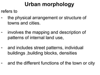


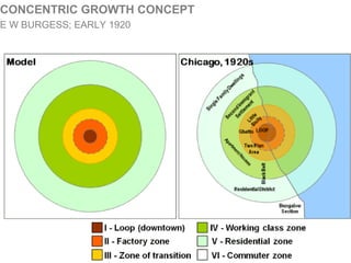


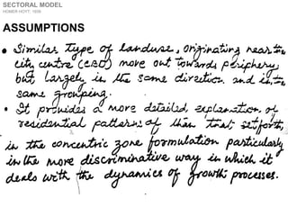


Urban morphology refers to the physical structure and patterns of towns and cities, including land use, street patterns, building arrangements, and densities. It is influenced by site factors, history, culture, economics, transportation, and government policy. Models of urban structure have been developed to represent typical land use zones as cities grow from infancy to maturity. Early models include the concentric zone model by Burgess and the sector model by Hoyt, while later models incorporate multiple nuclei of development. Students are assigned a project to study and map the past and projected future land use and transportation patterns of various Indian cities from 1980 to 2020.


