Downloaded 3,351 times


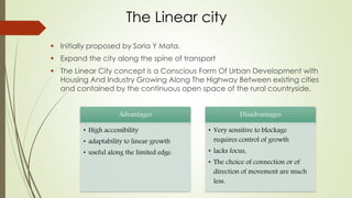


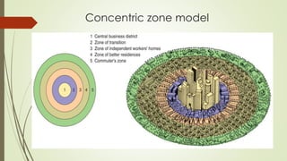


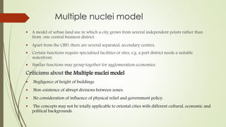


The document discusses different types of city forms including the radiocentric, gridiron, and linear cities. It provides examples like Moscow as a radiocentric city with concentric rings radiating from the Kremlin. Chandigarh and San Francisco are discussed as examples of gridiron cities with orthogonal street grids. Navi Mumbai is presented as a linear city developing along transportation routes. The document also covers models of urban land use including the concentric zone, sector, and multiple nuclei models.


