Downloaded 137 times


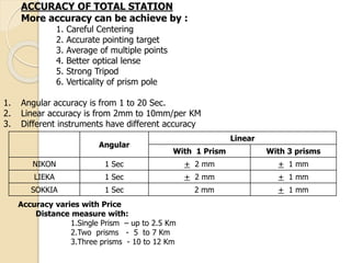
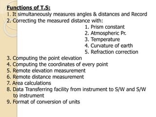
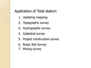
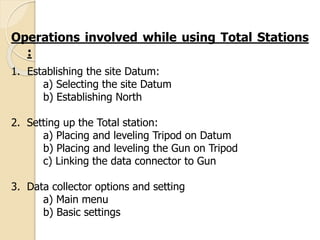


Total stations are surveying instruments that electronically measure angles and distances to calculate locations of points. They combine an electronic distance meter, theodolite, and microprocessor. Measurements can achieve angular accuracy of 1-20 seconds and linear accuracy of 2-10 mm per km. Total stations are used for topographic surveys, construction layout, and other applications. Proper use requires careful centering, accurate pointing, averaging multiple measurements, and accounting for environmental factors.


