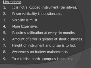
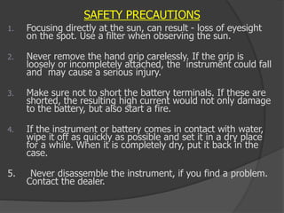
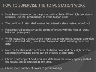
Download to read offline


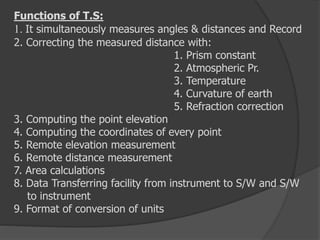


This document discusses various surveying techniques and equipment, including total stations. It provides details on total stations such as their basic components, accuracy levels, functions, applications, and operations involved in using them. Some key points covered include that total stations simultaneously measure angles and distances, have accuracy levels of 1-20 seconds for angles and 2mm-10mm per km for distances, and are used for applications like topographic, hydrographic, and cadastral surveys. The document also discusses limitations, safety precautions, and how to supervise total station work.


