16
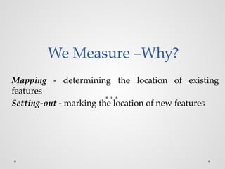
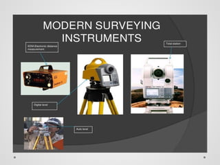
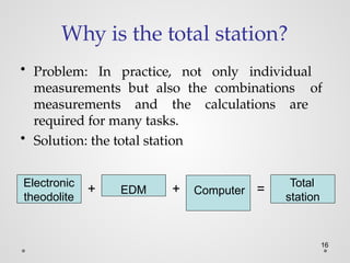
Why is thetotal station?
• Problem: In practice, not only individual
measurements but also the combinations of
measurements and the calculations are
required for many tasks.
• Solution: the total station
Electronic
theodolite
EDM Computer
+ + = Total
station
21.
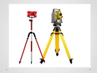
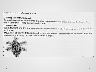
Basic components ofTotal station
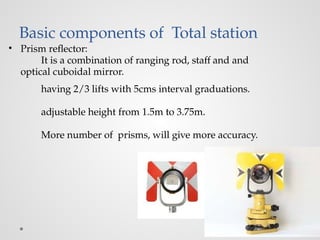
• Prism reflector:
It is a combination of ranging rod, staff and and
optical cuboidal mirror.
having 2/3 lifts with 5cms interval graduations.
adjustable height from 1.5m to 3.75m.
More number of prisms, will give more accuracy.
22.
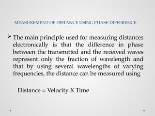
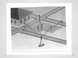
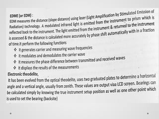
MEASUREMENT OF DISTANCEUSING PHASE DIFFERENCE
The main principle used for measuring distances
electronically is that the difference in phase
between the transmitted and the received waves
represent only the fraction of wavelength and
that by using several wavelengths of varying
frequencies, the distance can be measured using
Distance = Velocity X Time
24.
• An EDMuses electromagnetic (EM) energy to determine
the length of a line.
• The energy originates at an instrument at one end of a
line and is transmitted to a “reflector” at the other end
from where it is returned to the originating instrument.
• The instrument measures the phase shaft.
• By comparison of the phase shift between the
transmitted and the reflected signals the time, and thus
the distance is obtained.
25.
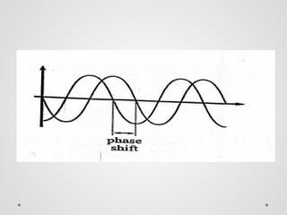
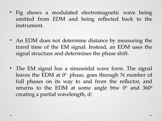
• Fig showsa modulated electromagnetic wave being
emitted from EDM and being reflected back to the
instrument.
• An EDM does not determine distance by measuring the
travel time of the EM signal. Instead, an EDM uses the
signal structure and determines the phase shift.
• The EM signal has a sinusoidal wave form. The signal
leaves the EDM at 00
phase, goes through N number of
full phases on its way to and from the reflector, and
returns to the EDM at some angle btw 00
and 3600
creating a partial wavelength, d:
26.
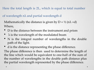
Here the totallength is 2L, which is equal to total number
of wavelength nλ and partial wavelength d
Mathematically the distance is given by D = ½ (nλ +d)
Where,
D is the distance between the instrument and prism
λ is the wavelength of the modulated beam
N is the integral number of wavelengths in the double
path of the light.
d is the distance representing the phase difference.
The phase difference is then used to determine the length of
the line which would be equivalent to one-half of the sum of
the number of wavelengths in the double path distance plus
the partial wavelength represented by the phase difference.
27.
ERRORS IN TOTALSTATION SURVEY
• THE FOLLOWING ARE THE MAIN SOURCES OF ERRORS
1. Errors in the equipment.
2. Atmospheric effects
28.
ERRORS DUE TOATMOSPHERIC EFFECTS
• Electromagnetic waves travel at a speed of light in vaccum .
But their velocity is affected by atmospheric condition of
temperature and pressure. it gives measurement of phase
difference and hence in distances measured.
• Manufacturers provide charts for finding this error. Looking
at temperature and atmospheric pressure this error may be
found from chart and data given to the total station.
• The micro-processor records the corrected distances. To
minimize it, better to avoid working in extremely varying
atmospheric conditions. Measurements of very long
distances should be avoided.
29.
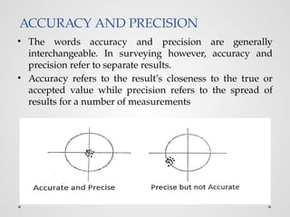
ACCURACY AND PRECISION
•The words accuracy and precision are generally
interchangeable. In surveying however, accuracy and
precision refer to separate results.
• Accuracy refers to the result’s closeness to the true or
accepted value while precision refers to the spread of
results for a number of measurements
30.
• For instance,six independent measurements of a line ( using
the single tape measure) could result in six different
distances. These values may vary either by very little or by a
lot. This is precision.
• If those results were close to the accepted value then they
would also be accurate, but if the tape had been stretched,
the result could be far from the accepted true value.
• Then, the given result could be said to have high precision
but low accuracy. These terms are used frequently in
engineering surveying both by manufactures when quoting
specifications for their equipments and on site by surveyors
to describe results obtained from the field work.
31.
• Accuracy allowscertain amount of tolerance (either plus
or minus) in a measurement while; precision demands
exact measurement.
• Since there is no such thing as an absolutely exact
measurement, a set of observations that are closely
grouped together having small deviations from the
sample mean will have a small standard error and are
said to be precise.
32.
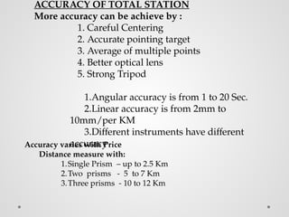
ACCURACY OF TOTALSTATION
More accuracy can be achieve by :
1. Careful Centering
2. Accurate pointing target
3. Average of multiple points
4. Better optical lens
5. Strong Tripod
1.Angular accuracy is from 1 to 20 Sec.
2.Linear accuracy is from 2mm to
10mm/per KM
3.Different instruments have different
accuracy
Accuracy varies with Price
Distance measure with:
1.Single Prism – up to 2.5 Km
2.Two prisms - 5 to 7 Km
3.Three prisms - 10 to 12 Km
33.
Advantages of TS
•Compact, accurate, highly precise, easy work and user
friendly.
• Quick setting of the instrument on the tripod using
plummets.
• Given the co-ordinates (or) position of point (x,y and z)
w.r.t known point.
• Measures distances and angles and displays co-ordinates.
• On-board area computation programme to compute area,
contours of the field.
• Automation of old maps.
34.
• Human errorin recording observations are eliminated.
• Auto level compensator is available.
• Work can be done in lesser visibility.
• Measures upto 3 to 5km distance
• It is water proof.
• On board software are available.
• Total solution for surveying work.
35.
Disadvantages
• It maybe difficult for the surveyor to look over
and check the work while surveying.
• Instrument is costly and skilled person is
required.
• For an overall check of survey, it will be
necessary to return to the office and prepare the
drawings using appropriate software.
• The instrument contains sensitive electronic
assemblies which have been well protected
against dust and moisture.
36.
Advantages of Digitallevels
Field work is carried out very fast.
Accuracy of measurement is high.
Manual errors involved in reading and recording are
eliminated.
Calculation of coordinates is very fast and accurate.
Computers can be employed for map making and
plotting contour and cross-sections.
38.
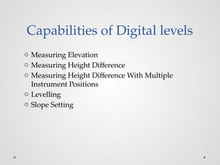
Capabilities of Digitallevels
o Measuring Elevation
o Measuring Height Difference
o Measuring Height Difference With Multiple
Instrument Positions
o Levelling
o Slope Setting
Functions of Totalstation
• Coordinates determination
• Distance measurement
• Angular measurement
• Data processing
51.
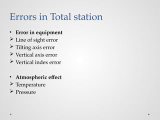
Errors in Totalstation
• Error in equipment
Line of sight error
Tilting axis error
Vertical axis error
Vertical index error
• Atmospheric effect
Temperature
Pressure
52.
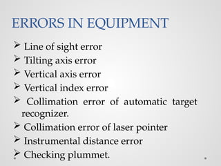
ERRORS IN EQUIPMENT
Line of sight error
Tilting axis error
Vertical axis error
Vertical index error
Collimation error of automatic target
recognizer.
Collimation error of laser pointer
Instrumental distance error
Checking plummet.
55.
Types of Totalstations
• Following types of total stations are available in the
market
Mechanical/manual
Motorized
Autolock
Robotic/automatic
56.
Advantages of Totalstation
Compact, most accurate, high precise, easy to work
Quick setting of the instrument on the tripod using laser plummet.
On- board area computation programme to compute the
area , contours of the field.
Measures distance and angles and displays coordinates.
Human error in recording observations are eliminated.
Surveying and calculations of elevtaions & coordinates
are very fast thus reduces time and labour.
Automation of old maps.
Greater accuracy in area computation.
Graphical view of plots and land for quick
visualization.
On board memory to store data.
57.
Disadvantages of Totalstation
o It may be difficult for the surveyor to look over and check the
work while surveying.
o The instrument is costly. And conducting surveys using total
station, skilled personnel are required.
o For an over all check of the survey, it will be necessary to
return to the office and prepare the drawings using
appropriate software.
o The instrument contains sensitive electronic assemblies
which have been well protected against dust and moisture.
58.
o It isnot a Rugged instrument (Sensitive).
o Visibility is must.
o More Expensive.
o Requires calibration at every six months.
o Amount of error is greater at short
distances.
o Awareness on battery maintenance.
o To establish north- compass is required.
Limitations
59.
Application of Totalstation.
• Land surveyors to record features as in
topographic surveying.
• Archaeologists to record excavations.
• Police, crime scene investigators, private accident
re-constructionists and insurance companies to
take measurements of scenes.
• Mining for location of tunnel walls, ceiling and
floors.
• Meterologist to track weather ballon.
60.
IN THE CIVILFIELD USED FOR:
• General purpose angle measurements.
• General purpose distance measurements.
• Provision of control surveys.
• Contour and detail mapping.
• Setting out and construction work.
61.
SAFETY PRECAUTIONS
o Focusingdirectly at the sun, can result - loss of eyesight on the
spot. Use a filter when observing the sun.
o Never remove the hand grip carelessly. If the grip is loosely or
incompletely attached, the instrument could fall and may
cause a serious injury.
o Make sure not to short the battery terminals. If these are
shorted, the resulting high current would not only damage to
the battery, but also start a fire.
o If the instrument or battery comes in contact with water, wipe it
off as quickly as possible and set it in a dry place for a while.
When it is completely dry, put it back in the case.
o Never disassemble the instrument, if you find a problem.
Contact the dealer.