Role of metro for traffic in kolkata
•Download as PPTX, PDF•
4 likes•1,238 views

The Kolkata Metro, run by the Indian Railways, is the oldest underground system in India since 1984,It runs parallel to the River Hooghly and spans the north-south length of the city covering a distance of 22.3 km.

Recommended
More Related Content
What's hot
What's hot (20)
Viewers also liked
Similar to Role of metro for traffic in kolkata
Similar to Role of metro for traffic in kolkata (20)
More from Piter Biswas
More from Piter Biswas (20)
Recently uploaded
Recently uploaded (20)
Role of metro for traffic in kolkata
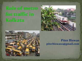
- 1. Role of metro for traffic in Kolkata Piter Biswas piterbiswas11@gmail.com
- 2. Role of
- 3. •IT HAS BEEN A GREAT BOON FOR KOLKATA AND OUR COUNTRY TOO •THE MTP (RLYS) HAD PREPARED A MASTER PLAN IN 1971 ENVISAGING CONSTRUCTION OF FIVE RAPID-TRANSIT LINES FOR THE CITY OF KOLKATA, TOTALLING A ROUTE LENGTH OF 97.5 KM. OF THESE, THE HIGHEST PRIORITY WAS GIVEN TO THE BUSY NORTH-SOUTH AXIS BETWEEN DUM DUM AND MAHANAYAK UTTAM KUMAR (TOLLYGUNGE)
- 4. The Kolkata Metro, run by the Indian Railways, is the oldest underground system in India since 1984,It runs parallel to the River Hooghly and spans the north-south length of the city covering a distance of 22.3 km. CITY WITH TRANSPORTS METRO
- 5. Performance of Metro Rail Growth of traffic: The yearwise number of passengers who travelled on the Metro Railway for last 10 years. Financial Performance: The yearwise total working expenses and total traffic earning of the Metro Railway.
- 6. •Traffic condition before the introduction of Kolkata metro was a havoc Recently there has been proposal of extending the metro. Connecting east west corridor. And another parallel line to the north south corridor.
- 7. The new proposed east west corridor is hoped to be a big blessing towards Kolkata traffic. The 33km long network will connect the other important hub of Kolkata resulting to a better Rapid transport system. Construction of Kolkata metro during 1984 was a huge challenge towards Indian engineers. It was constructed with the collaboration of a Japanese company • The most amazing aspect of the east-west connector is the rail network will pass beneath the Hooghly river. First of its kind in India
- 8. Construction in progress of east-west metro connector. This connector is a multi million project enhancing the lives of people of Kolkata
- 9. Due to maximum cars, buses, taxis, bikes and construction on road takes too much time to transport. Traffic on road
- 10. Traffic in Kolkata: Calcuttans are aggressive commuters, but with a sense of humour. The local and suburban rails and buses, as well as the underground Kolkata Metro railway are usually packed during office hours . The practice of "reserving" public seats by daily passengers is widespread. Share taxis are a common occurrence for travel to and from railway stations and such. The practice of car pools is also growing after the construction of the Eastern Metropolitan Bypass and the emergence of the CBD in Bidhan Nagar. Another phenomenon of Kolkata traffic is the Auto- rikshaws. Auto- rikshaws or autos as they are acronymed are small contraptions on the roads. They have three wheels, and are extremely agile. The regulation is three passengers at back, one in front along with the driver
- 11. This regulation is disregarded with impunity and often six or more people get in. Autos ply on fixed routes and the fare ranges from Rs.4 to Rs. 15, depending on the distance covered. Another phenomenon of Kolkata traffic is the Auto- rikshaws. Auto- rikshaws or autos as they are acronymed are small contraptions on the roads. They have three wheels, and are extremely agile. The regulation is three passengers at back, one in front along with the driver. This regulation is disregarded with impunity and often six or more people get in. Autos ply on fixed routes and the fare ranges from Rs.4 to Rs. 15, depending on the distance covered.
- 12. The junctions where having most of the traffic Shyambazar five point Bidhan Nagar crossing Boroh Bazar market place Dharmatala square Rubi Hospital square Hardko square Hazra square Chiriya Mohr square Rashbehari avenue Rajabazar Terminus Airport Junction Golpark Garia Gariahat Mohr College Street Kasba Mohr Tollygunge Phari NSC Bose Rd. Prince Anwarshah Rd. Taratala Jadavpur Thana Moulali
- 13. Accident on roads due to Rush drive Improper management of traffic Signal managing Sign board managing Control of traffic on rotary and junction
- 14. Merits: In short metro is a time saver simply transport system Its is a safety transporter Metro is faster access to different places It solves time schedule Demerits: But present day Kolkata metro having some problems Cost efficiency Maximum capacities Merits and demerits of Kolkata metro
- 15. The problems of KolkataMetro Financial viability: The biggest problem being faced by the Kolkata Metro Railway is that it is incurring loses, which are increasing every year. The total working expenses for 2000-01 were US $20.12 million . Low Ridership: The growth of passenger traffic has been far below the estimated mark. The figure stood at 55.8 million during 1999-2000. Sensitive Ridership: The commuters in Kolkata are very sensitive to the level of fare. Perhaps, it is because of the primacy of workers in the city and other socio- economic factors. The fares for city buses and trams are very low. In such, circumstances, it is very difficult to raise the fares, frequently and substantially.
- 16. Latest Projects & Plans 1)Dum Dum- Dakshineswar Extension The plan to extend the line in the north from Dumdum to Dakshineswar (5.2 km) is under execution. The construction of this line started in February 2010. This line has also been planned to be extended till Barrackpore (12.5 km) in the north. The stations on this stretch will be - •Ma Sarada Devi (Noapara) •Swami Vivekananda (Baranagar) •Dakshineswar The extension to Barrackpore beyond Dakshineswar will have the following proposed stations - •Kamarhati •Agarpara •Panihati •Titagarh •Barrackpore
- 17. 2)Noapara- Barasat Link The project to build a 18.5 km long line from Noapara to Barasat via Netaji Subhash Chandra Bose International Airport is also sanctioned and construction work has commenced on this stretch. The proposed stations on this route are[- •Noapara •Dum Dum Cantonment •Jessore Road •Bimanbandar •Birati •Michael Nagar •New Barrackpore •Madhyamgram •Hridaypur •Barasat
- 18. 3)Dum Dum-Airport Link This is a planned link to connect the Metro to the Airport. This route will run over a length of 8.24 km on the Up section, and 6.40 km on the Down section. The proposed stations are - Up Section •Dum Dum •Noapara •Ramakrishna Palli •Shanti Nagar •Bimanbandar (Airport). Down Section •Bimanbandar (Airport) •Jessore Road •Dum Dum Cantonment •Dum Dum
- 19. 4)Joka-B.B.D. Bagh Link A 16.72 km long metro line from Joka (in extreme South Kolkata) and B.B.D Bagh (in central Kolkata) is also under construction . It is being constructed by RVNL and the tender has gone to Simplex Infrastructures. The proposed stations on this route are - •Joka •Thakurpukur •Sakherbazar •Behala Chowrasta •Behala Bazar •Taratalla •Majherhat The proposed Park Street and Esplanade stations won't be the same as the ones on the north-south Metro route. The Joka-BBD Bag route will meet the north- south services at the Central station, said a senior Metro official. This is where the upcoming East-West Metro is likely to meet the two routes as well. Passengers can take different routes from this station •Mominpur •Kidderpore •Hastings •Park Street •Esplanade •BBD Bag
- 20. 5)New Garia-Airport Link A connection between New Garia and the Airport(32 km) via E M Bypass , Saltlake and Rajarhat is on the cards in order to help reduce travel time between the southern fringes of Kolkata to the Netaji Subhash Chandra Bose International Airport. The work on this New Garia-Airport was inaugurated by Mamata Banerjee on February 7, 2011 with a project deadline of six months.[9] The deadline is surely going to be missed as construction work hasn't begun anywhere yet. The 32 km link between Kavi Subhas (New Garia) and the airport, to be set up at a cost of Rs 400 crore, will have 24 stations. The stations, as declared till now, will be named after eminent personalities. Satyajit Ray Station Jyotindra Nandy Station Sukanta Bhattacharya Station Hemanta Mukhopadhyay Station Barun Sengupta Station Gour Kishore Ghosh Station IT Station Kala Kshetra Station Titumir Station Rabindra Tirtha Ritwik Ghatak Station Jai Hind Station
- 21. Conclusions: Better for the environment and safer, public transport is the best option, when available and practical taking into account the nature of your journey, whether you can organise a day around fixed timetables, and whether you are feeling sociable: Weak-minded and frail persons may struggle carrying things and feel too insecure. Pooled transport should be used whenever it can be: the advantages to the world are too great for it to be overlooked for minor reasons. Personal transport should be used as a last resort. But as a public transport metro railway is a easy n safety transport system.
- 22. Thank you SIR