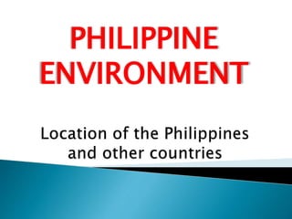
The Philippines can be located by its latitude and longitude. It lies between 116° 40' and 126° 34' east longitude and 4° 40' and 21° 10' north latitude. The Philippines is an archipelago consisting of over 7,000 islands surrounded by the Philippine Sea to the east, the South China Sea to the west, and the Celebes Sea to the south. It is bordered by Taiwan to the north and Borneo to the southwest.
This is an almost complete instructional material based from MELC in Grade 7 Science.
This is only applicable to the teachers in the Philippines. If you have any questions and wanted to avail the powerpoint you may contact me in my Facebook account: Jady Claire Jackson Lullegao
This is an almost complete instructional material based from MELC in Grade 7 Science.
This is only applicable to the teachers in the Philippines. If you have any questions and wanted to avail the powerpoint you may contact me in my Facebook account: Jady Claire Jackson Lullegao
Pinadaling paglalarawan sa mga bahagi ng globo o sa mga imahinaryong guhit sa globo gaya ng Ekwador, longitude at latitude, para sa ikalwa at ikatlong baitang (Grade 2 and 3).
Natural resources and Man-Made resources
Effect of water
Watershed
Some factors that will affect the amount of water in watersheds
Main function of watershed
Some watershed that can be found in the Philippines
Soil
Weathering
Formation of soil from rocks
Factors acting together on rocks to form soil (Soil Formation)
Minerals
Properties of Minerals
MINERAL RESOURCES IN THE PHILIPPINES
Two Types of Natural Resources
Advantage and Disadvantage of some energy resources
Ways People Destroy Natural Resources
*Pictures are not mine.
@KidsEduc – Kids Educational Games
HUMIDITY
RELATIVE HUMIDITY
DEW POINT
DEW, FROST
CLOUDS AND FOG
CLOUDS FORMATION
CLASSIFICATION OF CLOUDS
PRECIPITATION
THE MOST COMMON TYPES OF PRECIPITATION
AIR MASSES
CLASSIFICATIONS OF AIR MASSES
AIR MASSES THAT MOST AFFECT WEATHER
FRONTS
FOUR TYPES OF FRONT
More about land breezes
- this causes small temperature gradient between the ocean surface and the nearby land at night and the wind will blow from the land to the ocean creating the land breeze.
Sea Breeze and Land Breeze, Weather and Climate Unit, Earth Science PowerPointwww.sciencepowerpoint.com
This PowerPoint is one small part of the Weather and Climate unit from www.sciencepowerpoint.com. This unit consists of a five part 2500+ slide PowerPoint roadmap, 14 page bundled homework package, modified homework, detailed answer keys, 19 pages of unit notes for students who may require assistance, follow along worksheets, and many review games. The homework and lesson notes chronologically follow the PowerPoint slideshow. The answer keys and unit notes are great for support professionals. The activities and discussion questions in the slideshow are meaningful. The PowerPoint includes built-in instructions, visuals, and review questions. Also included are critical class notes (color coded red), project ideas, video links, and review games. This unit also includes four PowerPoint review games (110+ slides each with Answers), 38+ video links, lab handouts, activity sheets, rubrics, materials list, templates, guides, and much more. Also included is a 190 slide first day of school PowerPoint presentation.
Areas of Focus within The Weather and Climate Unit: -What is weather?, Climate, Importance of the Atmosphere, Components of the Atmosphere, Layers of the Atmosphere, Air Quality and Pollution, Carbon Monoxide, Ozone Layer, Ways to Avoid Skin Cancer, Air Pressure, Barometer, Air Pressure and Wind, Fronts, Wind, Global Wind, Coriolis Force, Jet Stream, Sea Breeze / Land Breeze, Mountain Winds, Mountain Rain Shadow, Wind Chill, Flight, Dangerous Weather Systems, Light, Albedo, Temperature, Thermometers, Seasons, Humidity / Condensation / Evaporation, Dew Points, Clouds, Types of Clouds, Meteorology, Weather Tools, Isotherms, Ocean Currents, Enhanced Global Warming, Greenhouse Effect, The Effects of Global Warming, Biomes, Types of Biomes. Difficulty rating 8/10.
This unit aligns with the Next Generation Science Standards and with Common Core Standards for ELA and Literacy for Science and Technical Subjects. See preview for more information
If you have any questions please feel free to contact me. Thanks again and best wishes. Sincerely, Ryan Murphy M.Ed www.sciencepowerpoint@gmail.com
Lines of Latitude and Longitude – PowerPointYaryalitsa
PowerPoint on Lines of Latitude, Lines of Longitude, Climate Zones, Equinoxes, Solstices, The Three Norths, Prime Meridian, International Date Line, Greenwich Mean Time, Coordinated Universal Time.
Lines of Latitude and Longitude – Worksheet at:
http://www.slideshare.net/yaryalitsa/lines-of-latitude-and-longitude-worksheet
Data presentation and interpretation I Quantitative ResearchJimnaira Abanto
Topics;
DATA PRESENTATION & INTERPRETATION
Preparation in writing your data analysis
Techniques in Data Processing
Presentation and Interpretation of Data
Using statistical Techniques (Sample)
Topics:
Quantitative research
Characteristics of Quantitative Research
Strengths of Quantitative Research
Weaknesses of Quantitative Research
Importance of Quantitative Research Across Fields
TYPES OF QUANTITATIVE RESEARCH DESIGN
Resign Design
Quantitative Research
5 types of quantitative research design
You can watch here! https://www.youtube.com/watch?v=LJpb0wW_6lo
****You can reach me on my email jimnairaabanto@deped.gov.ph, if you have clarification or corrections. Thank you so much.
QUANTITATIVE RESEARCH VERSUS QUALITATIVE RESEARCHJimnaira Abanto
Content:
I. When to use Qualitative versus Quantitative Research
II. Differences: Qualitative Research versus Quantitative Research
III. Similarities: Qualitative Research and Quantitative Research
IV. The Kinds of Research Across Fields
You can watch here: https://www.youtube.com/watch?v=0k7QqwBEvGE&t=919s
TOPICS:
I. Definition of Qualitative Research
II. Purpose of Qualitative Research
III. Characteristics of Qualitative Research
IV. Strengths of Qualitative Research
V. Weaknesses of Qualitative Research
VI. Kinds of Qualitative Research
You can Watch here: https://www.youtube.com/watch?v=a-PstCR7RTQ&t=803s
Objectives:
1. Distinguish the different Types of Research
2. Differentiate quantitative and qualitative data
3. Identify the approaches to Research
4. Cite examples of different Kinds of Research Across Fields
You can watch here: https://www.youtube.com/watch?v=w_IZXxN58ag&t=24s
Practical Research 1 for SHS
Lesson 1: The Importance of Research in Daily life
Content
1. Differentiate Inquiry from Research
2. Share research experiences and knowledge
3. Explain the importance of research in daily life.
You can watch here https://www.youtube.com/watch?v=bY8lFadJia8&t=1357s
Macroeconomics- Movie Location
This will be used as part of your Personal Professional Portfolio once graded.
Objective:
Prepare a presentation or a paper using research, basic comparative analysis, data organization and application of economic information. You will make an informed assessment of an economic climate outside of the United States to accomplish an entertainment industry objective.
Honest Reviews of Tim Han LMA Course Program.pptxtimhan337
Personal development courses are widely available today, with each one promising life-changing outcomes. Tim Han’s Life Mastery Achievers (LMA) Course has drawn a lot of interest. In addition to offering my frank assessment of Success Insider’s LMA Course, this piece examines the course’s effects via a variety of Tim Han LMA course reviews and Success Insider comments.
Unit 8 - Information and Communication Technology (Paper I).pdfThiyagu K
This slides describes the basic concepts of ICT, basics of Email, Emerging Technology and Digital Initiatives in Education. This presentations aligns with the UGC Paper I syllabus.
Francesca Gottschalk - How can education support child empowerment.pptxEduSkills OECD
Francesca Gottschalk from the OECD’s Centre for Educational Research and Innovation presents at the Ask an Expert Webinar: How can education support child empowerment?
Introduction to AI for Nonprofits with Tapp NetworkTechSoup
Dive into the world of AI! Experts Jon Hill and Tareq Monaur will guide you through AI's role in enhancing nonprofit websites and basic marketing strategies, making it easy to understand and apply.
The French Revolution, which began in 1789, was a period of radical social and political upheaval in France. It marked the decline of absolute monarchies, the rise of secular and democratic republics, and the eventual rise of Napoleon Bonaparte. This revolutionary period is crucial in understanding the transition from feudalism to modernity in Europe.
For more information, visit-www.vavaclasses.com
Instructions for Submissions thorugh G- Classroom.pptxJheel Barad
This presentation provides a briefing on how to upload submissions and documents in Google Classroom. It was prepared as part of an orientation for new Sainik School in-service teacher trainees. As a training officer, my goal is to ensure that you are comfortable and proficient with this essential tool for managing assignments and fostering student engagement.
Read| The latest issue of The Challenger is here! We are thrilled to announce that our school paper has qualified for the NATIONAL SCHOOLS PRESS CONFERENCE (NSPC) 2024. Thank you for your unwavering support and trust. Dive into the stories that made us stand out!
A Strategic Approach: GenAI in EducationPeter Windle
Artificial Intelligence (AI) technologies such as Generative AI, Image Generators and Large Language Models have had a dramatic impact on teaching, learning and assessment over the past 18 months. The most immediate threat AI posed was to Academic Integrity with Higher Education Institutes (HEIs) focusing their efforts on combating the use of GenAI in assessment. Guidelines were developed for staff and students, policies put in place too. Innovative educators have forged paths in the use of Generative AI for teaching, learning and assessments leading to pockets of transformation springing up across HEIs, often with little or no top-down guidance, support or direction.
This Gasta posits a strategic approach to integrating AI into HEIs to prepare staff, students and the curriculum for an evolving world and workplace. We will highlight the advantages of working with these technologies beyond the realm of teaching, learning and assessment by considering prompt engineering skills, industry impact, curriculum changes, and the need for staff upskilling. In contrast, not engaging strategically with Generative AI poses risks, including falling behind peers, missed opportunities and failing to ensure our graduates remain employable. The rapid evolution of AI technologies necessitates a proactive and strategic approach if we are to remain relevant.
2. 1. By determining its latitude
and longitude.
2. By determining the
landmasses and bodies of
water
3. Latitude
--are parallel to the equator and to each other.
--the distance from north or south of the
equator.
Written this way: 25°N (25 degrees North), 60°S
(60 degrees South)
*The starting point for latitude is the equator.
4. LONGITUDE
--a distance east or west of the prime
meridian.
Written this way: 20° E (15 degrees east), 45°W (
45 degrees west)
*The starting point for longitude is the
prime meridian.
5. PRIME MERIDIAN
--line that measured in degrees to the
west or east of the line, which is at
longitude 0°.
INTERNATIONAL DATE LINE
--This line of longitude which at 180° E
and 180° W, is a line that is on the
opposite side of the world from the Prime
meridian and from which a new calendar
day begins.
6.
7. 1. Equator – at latitude 0°
2. Tropic of Cancer – 23.5° N
3. Tropic of Capricorn - 23.5° S
--Tropic of Cancer and Capricorn,
countries that are located these zones
experience a tropical climate where the
annual average temperature is above
18° C.
8. 4. Arctic Circle – 66.5° N
5. Antarctic Circle – 66.5° S
--Countries in these circles go
through four seasons-winter, spring,
summer and Autumn.
9.
10. The closer the latitude is to
the equator, the warmer the
climate. The closer it is to the
poles, the colder.
11. The closer the latitude is to
the equator, the warmer the
climate. The closer it is to the
poles, the colder.
12. Ex.
15°N, 30° E – Sudan
a. Sweden
b. 15°N, 90° W
c. 45°E, 23°S
13. 1. 15° N, 105° E
2. 15° S, 30° E
3. 60° N, 24° W
4. 30° N, 0° W
5. 30° S, 30° E
14. WHAT ARE THE LANDMASSES
AND BODIES OF WATER THAT
SURROUND THE PHILIPPINES?