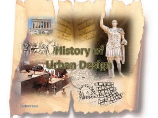
History of Urban Design
•Download as PPTX, PDF•
25 likes•14,259 views

The document discusses the origins and early forms of cities. It describes how the first cities like Jericho and Catal Huyuk emerged when people transitioned away from solely focusing on basic survival needs. These early cities relied on advanced agriculture and trade. Catal Huyuk had unusual features like houses built together without doors and accessed through roof hatches for added safety. Central planning and social hierarchies emerged as irrigation systems required organization and defense structures were built. The document then contrasts natural, unplanned growth of settlements with planned cities laid out using grids and master plans.

Recommended
More Related Content
What's hot
What's hot (20)
Viewers also liked
Viewers also liked (20)
Similar to History of Urban Design
Similar to History of Urban Design (20)
More from Alshimaa Aboelmakarem Farag
More from Alshimaa Aboelmakarem Farag (20)
Recently uploaded
Recently uploaded (20)
History of Urban Design
- 2. The building of cities is one of man’s greatest achievements . The form of his city always has been and always will be a pitiless indicator of the state of his civilization. Bacon, E., (1974), “design of cities”
- 3. Zaqaziq University Faculty of Engineering Architecture Department the law of human history …that mankind first of all must’ eat, drink, have shelter and clothing, before it can pursue politics, science, art, religion etc’.
- 4. Zaqaziq University Faculty of Engineering Architecture Department The first cities obviously were built when humankind had got beyond the struggle for mere existence. The earliest known city, Jericho “Ariha” (c. 7000 BC) was an oasis near the River Jordan whilst Catal Huyuk in Central Anatolia (Asian Turkey c. 6500 BC) seems to have flourished on trade Both depended on sophisticated agriculture, including the rearing of livestock.
- 5. Jericho “Ariha” (c. 7000 BC)
- 6. Zaqaziq University Faculty of Engineering Architecture Department In Catal Huyuk the houses were made of mud brick. Houses were built touching against each other. They did not have doors and houses were entered through hatches in roofs. Presumably having entrances in the roofs was safer than having them in the walls. (Catal Huyuk was unusual among early towns as it was not surrounded by walls). Since houses were built touching each other the roofs must have acted as streets! People must have walked across them
- 7. atal Huyuk in Central Anatolia (Asian urkey c. 6500 BC)
- 8. Zaqaziq University Faculty of Engineering Architecture Department In Catal Huyuk there were no panes of glass in windows and houses did not have chimneys. Instead there were only holes in the roofs to let out smoke. Inside houses were plastered and often had painted murals of people and animals on the walls. People slept on platforms.
- 9. Zaqaziq University Faculty of Engineering Architecture Department So it is hardly surprising that traces of the first great cities on the whole are to be found in great river valleys and basins. The presence of great rivers made irrigation possible but it had to be organized: The successful practice of irrigation involves an elaborate control system. A system of main channels feeds subsidiary channels, watering the fields when the necessary sluice gates are closed. The implications therefore are that there must be some central communal organization and the beginnings of a code of laws which the organization enforces …the evidence that there was an efficient communal organization is to be seen in the great defensive systems.
- 10. None of this could have been achieved without centralized planning. Small wonder then, that the first cities show evidence of social stratification and the development of craft specializations. Zaqaziq University Faculty of Engineering Architecture Department
- 11. Zaqaziq University Faculty of Engineering Architecture Department So, four things in the first place, made the city possible: 3. and the development of craft- specialties to serve not only the needs or the desires of the urban population but also as bases for trade. 4. the development of power structures by which the irrigation systems, and other aspects of urban life, could be controlled—usually by kings and priests; 1. the separation of the built-up area from the surrounding countryside, possibly by defensive walls; 2. the development of irrigation systems for intensive agriculture;
- 12. Zaqaziq University Faculty of Engineering Architecture Department As for their physical design, cities and parts of cities, have grown in two ways. The first: is described by Alexander (1964) as the natural way in which people simply start building, as they still do in the shanty towns of the emerging world. The second: And then there is the artificial way in which a master plan is prepared; streets laid out, squares and urban blocks on to which buildings are then placed according to some planners’ sense of order (Stanislawski, 1947). So will another contrast: between formality and informality.
- 14. Zaqaziq University Faculty of Engineering Architecture Department Classical planning Straight streets, meeting at right angles, were known in Nebuchadnezzar’s Babylon which was planned between 1126 and 1105BC
- 15. Zaqaziq University Faculty of Engineering Architecture Department The Egyptian pyramid stands as the consummate expression of a form which emerges from the earth as dominant mass. It is a statement of unchangeable absolutes.
- 17. Zaqaziq University Faculty of Engineering Architecture Department
- 18. Classical planning Such planning was invented by Hippodamus of Miletus (479 BC) “the father of urban planning. Miletus was planned on a checkerboard or grid as many later cities have been Zaqaziq University Faculty of Engineering Architecture Department
- 19. Zaqaziq University Faculty of Engineering Architecture Department Priene built on steeply sloping ground with the main streets running along the contours and the (stepped) minor streets crossing them
- 20. Zaqaziq University Faculty of Engineering Architecture Department
- 21. Zaqaziq University Faculty of Engineering Architecture Department
- 22. Zaqaziq University Faculty of Engineering Architecture Department
- 24. Zaqaziq University Faculty of Engineering Architecture Department
- 25. Zaqaziq University Faculty of Engineering Architecture Department
- 26. Zaqaziq University Faculty of Engineering Architecture Department Alexander laying out the city of Alexandria
- 27. Zaqaziq University Faculty of Engineering Architecture Department Classical planning The typical Roman city had a rectangular plan and resembled a Roman military camp with two major roads, the decumanus (east-west) and the cardo (north-south) a grid of smaller streets dividing the town into blocks, and a wall circuit with gates
- 28. Zaqaziq University Faculty of Engineering Architecture Department This Plan too is evidence indeed that geometric instruments were used by the Roman surveyors, not just straight edges and squares but also compasses. If such instruments were available for map-making and measured drawings then of course they were also available for designing.
- 29. Zaqaziq University Faculty of Engineering Architecture Department
- 30. Zaqaziq University Faculty of Engineering Architecture Department The Acropolis was by no means a typical part of the city
- 32. Zaqaziq University Faculty of Engineering Architecture Department Islamic planning Whilst the rules for regular planning were well known in Classical times those for informal planning were developed in quite a different culture, Islam, during that period which we in the West tend to think of as the Dark Ages.
- 33. Zaqaziq University Faculty of Engineering Architecture Department As Hakim says (1986) Islamic Law itself was extracted from the Qu’ran and the Sunna by al-Shafi’i (died 819), al-Bukhari (died 870) and Muslim (died 875). Once a system of Laws had been encoded, others, such as Isa ben Mousa (996) and Ibn al-Rami (1334) extracted and codified Ahkam or building solutions out of the more general Laws. Hakim (1986) analyses the Principles behind these ‘solutions’, finding that each is based, directly, on specific verses from the Qur’an or the Prophet’s own practices from the Sunna. Hakim analyses these in terms of their effects on the form of the Islamic city.
- 34. Zaqaziq University Faculty of Engineering Architecture Department He distinguishes between the public street (the Shari) which is open to everyone and the cul-de-sac (Zanqa) giving acess to a small group of houses belonging in co-ownership, to those who live along it. The Principles include those of: 1. Harm: by which one is encouraged to exercise one’s personal rights to the full, provided that in doing so one causes no harm to others. Guidelines of many kinds were derived from this including those concerned with locations within the city for activities that smoke, created offensive smells, made offensive amounts of noise and so on caused Tunis: plan of the Suq south of the Zaytuna Mosque
- 35. Zaqaziq University Faculty of Engineering Architecture Department 2. Interdependence : by which people within the city and the structures they inhabit are considered interdependent in what we would call an ecological sense.
- 36. Zaqaziq University Faculty of Engineering Architecture Department 3. Privacy: by which every family is entitled to acoustic, visual, and other kinds of privacy. Given the nature of the Muslim family and the way in which the women had to be protected from the eyes of strangers, there were strict rules indeed against overlooking of any kind. These affected the positions of windows including their height above the street so that people could not see in. Nor should doors or windows face each other directly across the street into someone else’s doorway or windows. Above all, visual corridors of any kind had to be avoided, which of course led inevitably to irregularities in façade design. Nor should one be able to look into any part of one’s neighbor's premises, especially the courtyard and the roof where his women might be. Even the Muezzin, as he climbs the minaret of the mosque to call the faithful to prayer, is forbidden to overlook neighbouring premises.
- 37. Zaqaziq University Faculty of Engineering Architecture Department 5. Building higher: consisting, surprisingly, of a right to build as high as one pleases, provided the construction is contained within one’s own air space. This right applies even if such building will deprive one’s neighbours of air and sun. It will be refused, however, where there was evidence of intent to harm one’s neighbour(s). 6. Respect for the property of others. 7. Pre-emption: by which in selling one’s property one must, in the interests of social cohesion, offer first refusal to one’s neighbour(s), adjacent property-owner(s), or even one’s partner.
- 38. Zaqaziq University Faculty of Engineering Architecture Department 8. Seven cubits as the minimum width of public sharis. A cubit is about half a metre and this dimension allows two fully laden camels to pass without colliding. As Hakim points out, a fully laden camel might be seven cubits high which gives a minimum of headroom under any building which spans across the street. The cul-de-sac of course may be narrower than the public street (shari) but at least one laden camel should be able to pass down it so the minimum width will have to be four cubits. 9. Any public thoroughfare should never be obstructed by permanent or even temporary obstructions. Each owner, however, had a right to use that part of the fina immediately outside his house for the loading and unloading of his beasts, and so on, but still he had no right to block the fina (the fina is the exterior space immediately adjacent to the exterior wall of a building, approximately one meter in width).
- 39. Each of these Principles interacted with the predominant urban and architectural elements, and each of them too has a name which is deeply embedded in Arabic. And of course there were regional variations depending on local climate. Zaqaziq University Faculty of Engineering Architecture Department
- 40. Zaqaziq University Faculty of Engineering Architecture Department Arab influences in Europe We know from history, of course, that Arabs carried Islam along the north coast of Africa and converted the Berbers to Islam who, with their converters, came to be known as the Moors. Medieval planning : The Dark Ages Having moved to the north-west tip of Africa, the Moors crossed the Straits of Gibraltar then moved up and into Spain and even into France (where Charles Martel turned them back… and so on.
- 41. Zaqaziq University Faculty of Engineering Architecture Department The precepts of Islam itself, and the nature of family life, forced irregularity on to Moslem urban design and, most particularly, on to the layout of housing. But many cities of medieval Europe also were irregular.
- 42. Zaqaziq University Faculty of Engineering Architecture Department Since few cities developed very much during Europe’s Dark Ages, it is important that we establish just how much the cities of ‘the Recovery’ of civilization in Europe owed to Arab precedents. Many of them, but by no means all, were almost as irregular as Islamic cities.
- 43. Zaqaziq University Faculty of Engineering Architecture Department The great Islamic cities on the mainland of Europe, of course, were those which the Moors built in Andalucia. There are substantial, not to say magnificent, remains of their building in Cordoba, Granada and elsewhere. But apart from 19th century pastiches, there are few signs of Islamic influence on architecture or planning elsewhere in mainland Europe
- 44. Zaqaziq University Faculty of Engineering Architecture Department We should look at urban layouts which display the unmistakable signs of labyrinthine planning, with tortuous, blind alleys, very narrow, often covered and ending in private courtyards. Palermo: survivals of Arabic Planning We should look for typically Islamic discontinuities, irregular aggregations of houses, the all-of-a-piece organic planning which is so characteristic of Islam.
- 45. Zaqaziq University Faculty of Engineering Architecture Department We might look at constructional techniques, methods of planning and so on, particularly the hierarchy of various kinds of street, Islamic distinctions between fortified areas and residential areas.
- 46. Zaqaziq University Faculty of Engineering Architecture Department Even where they were built many such developments have been lost or prove difficult to trace since often they were built on to classical layouts and themselves overlaid by later, Byzantine or Norman constructions. What had been a mosque might well have been converted into a church. The necessary traces are to be found in a hundred cities, large and small, in various parts of Italy. As in Spain, so in Italy cities which had been almost entirely Islamic might have been changed for various reasons: military, general urban viability—the need, for instance, to accommodate different means of transport—and even for aesthetic reasons. So streets might be widened and straightened, dead-end alleyways opened up, and so on.
- 47. Zaqaziq University Faculty of Engineering Architecture Department There were several reasons therefore why so many medieval cities were irregular: 1. including the nature of the sites on which they were built, 2. often initially for defensive purposes, 3. the facts of topology, influences from Islam and so on. 4. As Mumford says (1938) (p. 53) the medieval builders had ‘no a priori love for symmetry as such’. Where it was simpler to ‘follow nature’s contours’ they did so rather than grading them down or evening them up. 5. Nor were regular streets needed to accommodate wheeled vehicles. Mules were used for transport so the streets could be even narrower than those of Islam which had to accommodate laden camels
- 48. Zaqaziq University Faculty of Engineering Architecture Department
- 49. Zaqaziq University Faculty of Engineering Architecture Department Medieval regularity We tend to think of medieval planning, typically, as irregular. But that was by no means always the case; medieval drawings exist of regular, geometric planning. These are plans for monasteries including one for Canterbury (mid 12th century) showing the drainage system and the much earlier design drawing for the Abbey of St Gall (c. AD 820–830) The Plan fits into a 160 foot grid, three squares deep from north to south and four squares wide from east to west. The centre line of the church lies one square in from the northern boundary and the church itself is two squares long. A large cloister is attached to the south side of the church containing a refectory, quarters for the monks and so on.
- 50. Zaqaziq University Faculty of Engineering Architecture Department As Europe recovered from her Dark Ages some of the new urban forms came from the invaders themselves. Once the invasions had been halted, Europe recovered very quickly. continuing sources of income. Medieval planning 2: European recovery
- 51. Zaqaziq University Faculty of Engineering Architecture Department The presence of the merchants naturally attracted artisans and indeed as Pirenne says (1937) there was a real, if limited, Industrial Revolution. Thus it was in Flanders particularly that manufacturing and trading began to be developed side by side which, naturally, had its effects on the form of the medieval city. The sites most desirable for entrepreneurs within the town: merchants, artisans and so on, were those immediately surrounding the market place. According to Burke (1975) plots adjoining the market place, used for shops, commanded the highest rents. Indeed as Platt suggests (1976) there was a premium on sites with desirable frontages which might be taxed to encourage efficient planning. Platt shows ingenious developments in King’s Lynn, Oxford and other places, planned so that street frontages were occupied by several shops but with a single large residence behind them