Downloaded 130 times


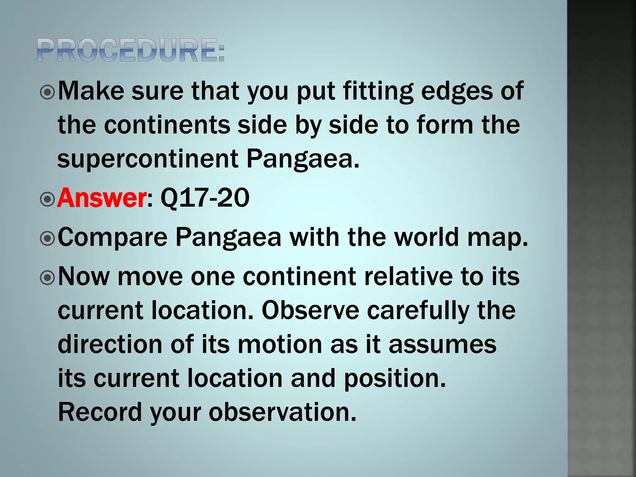

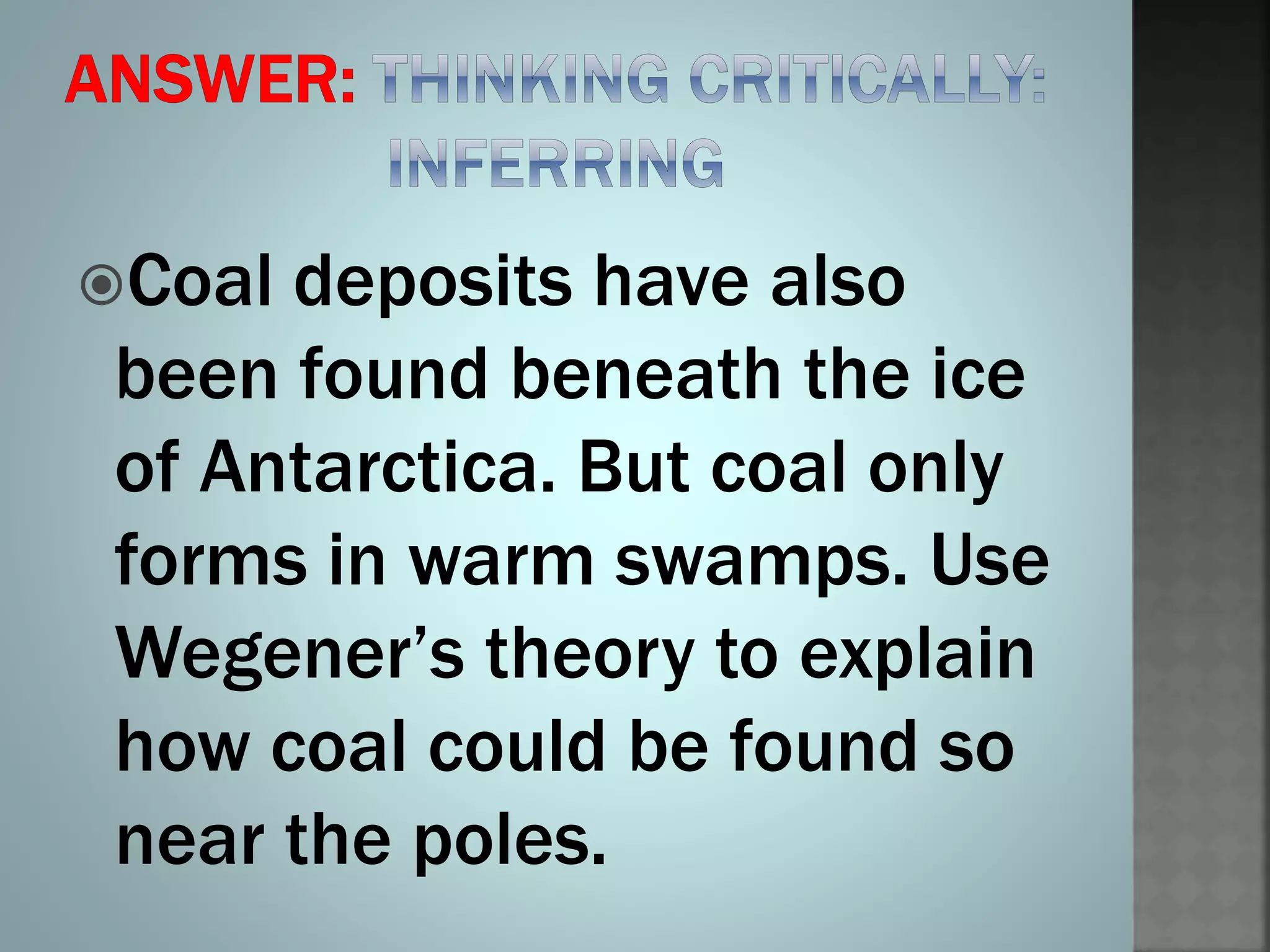


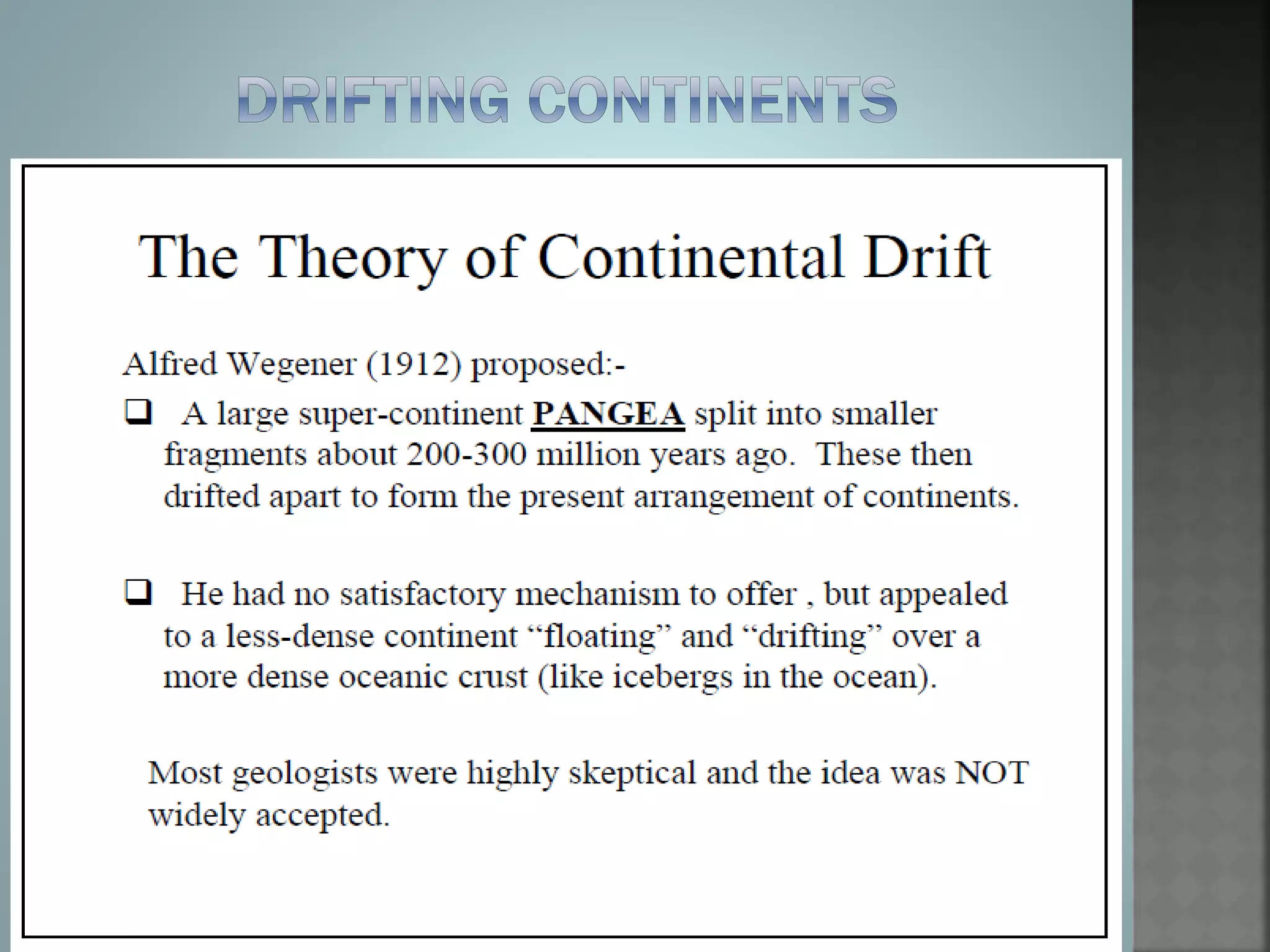


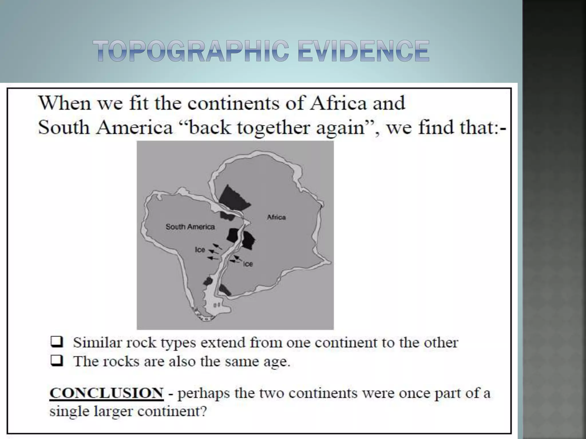
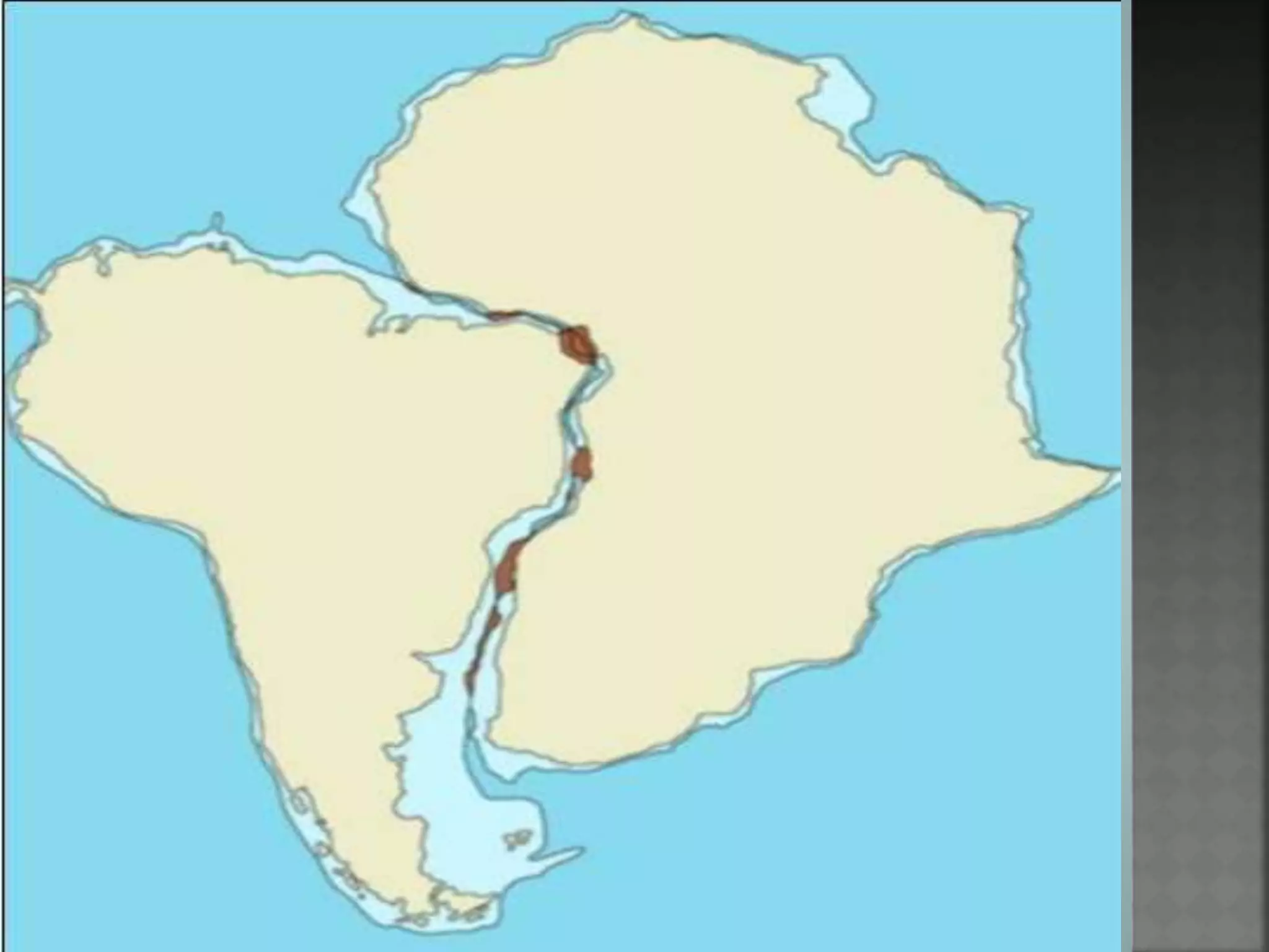
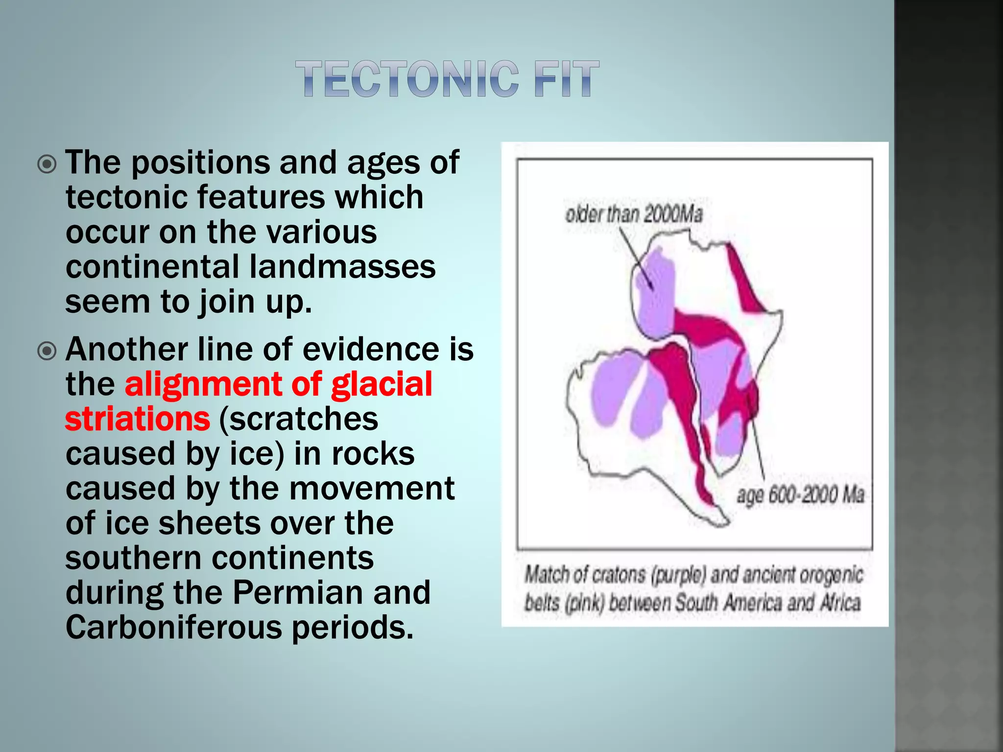
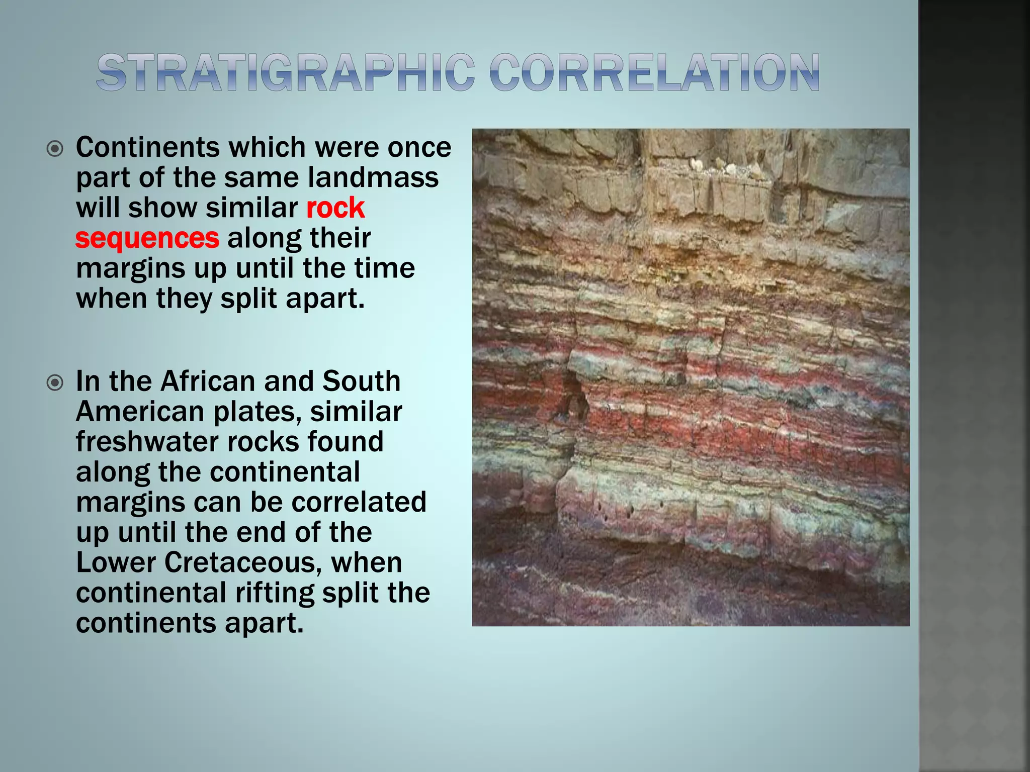

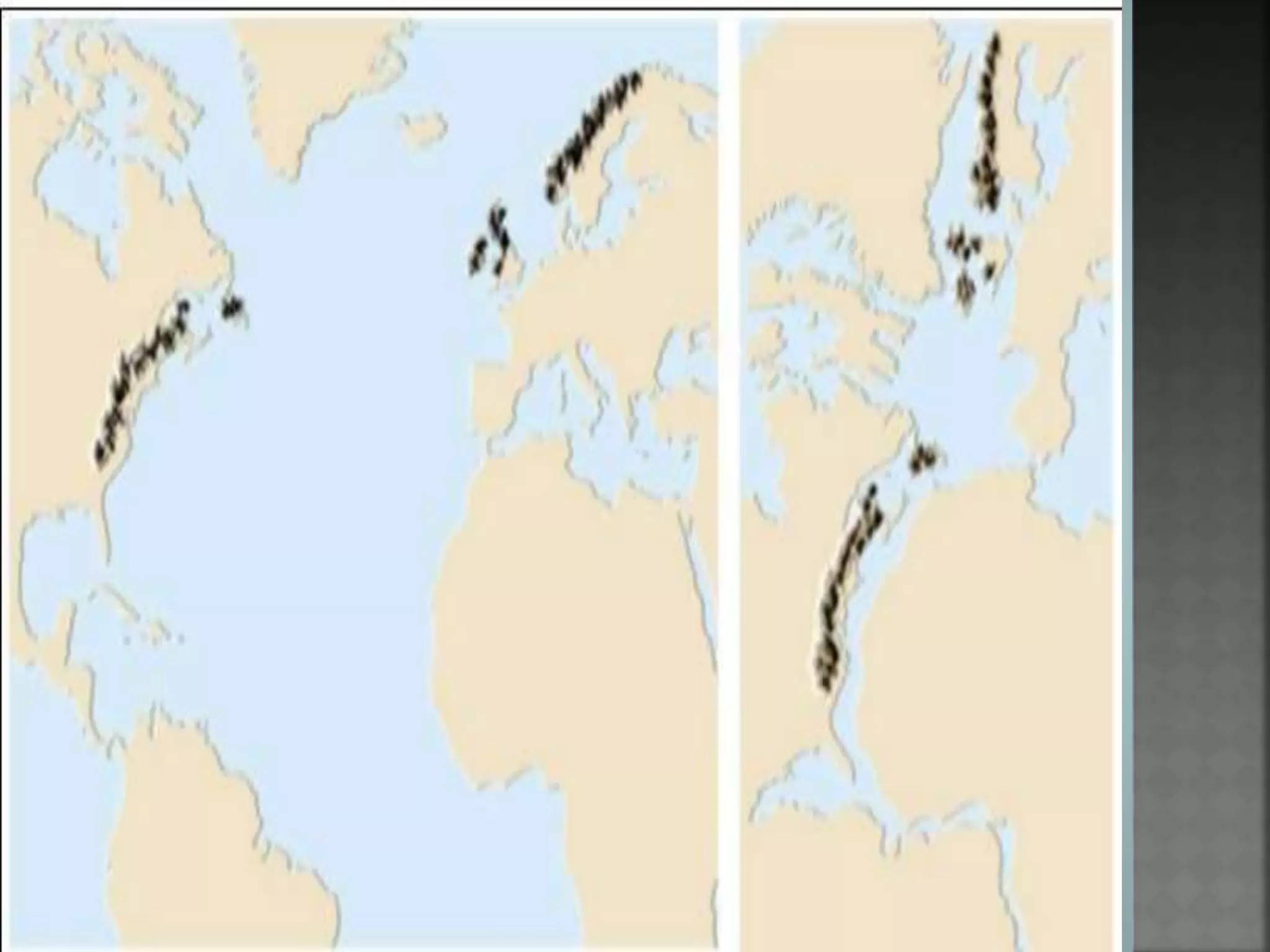

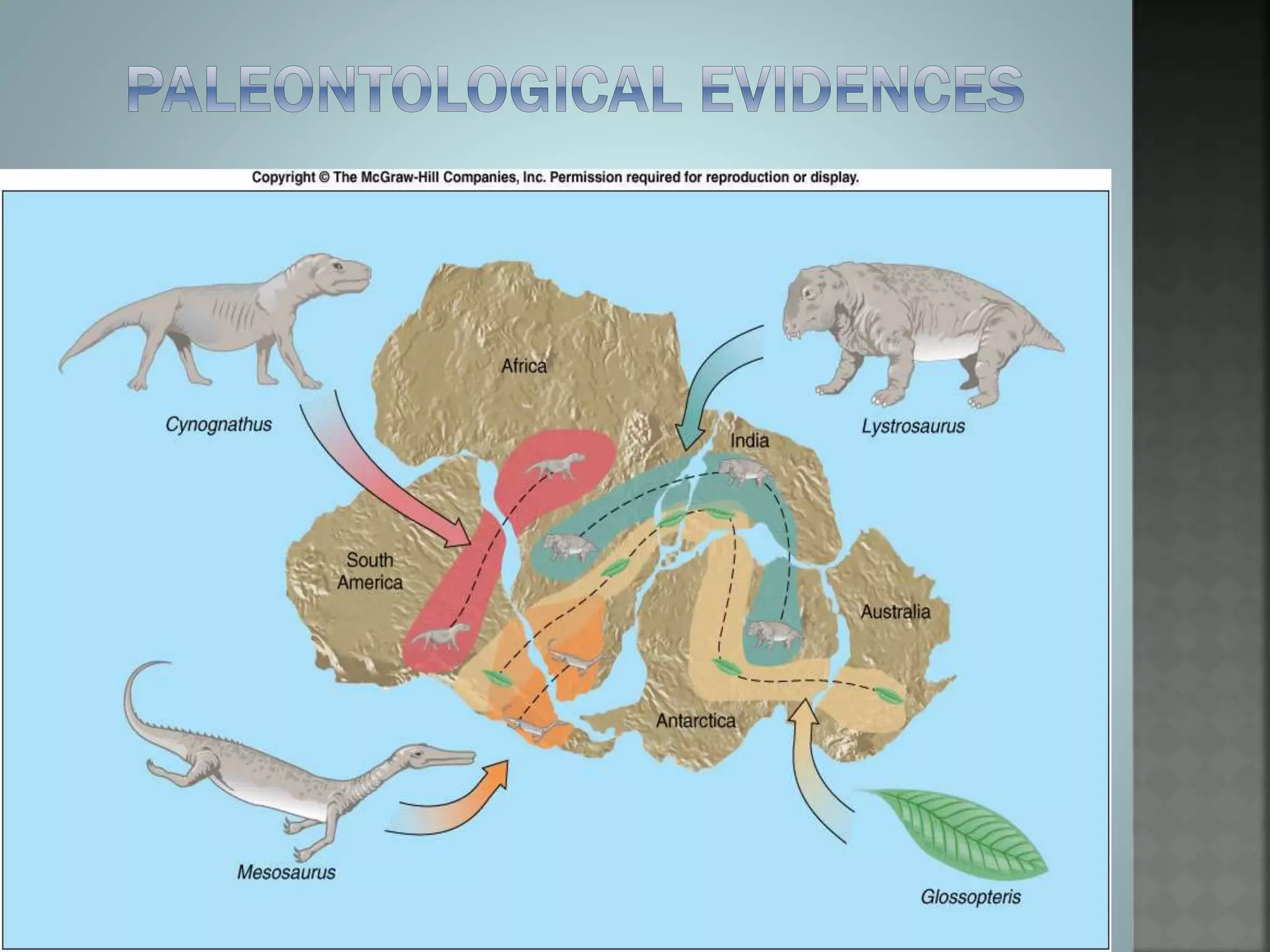

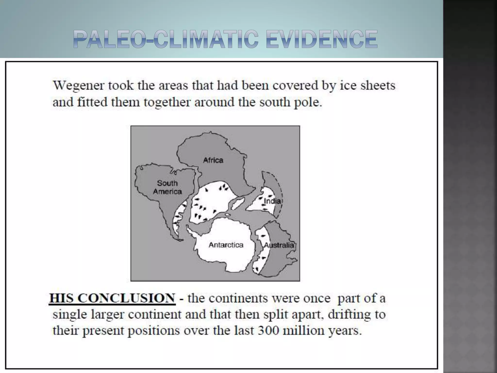


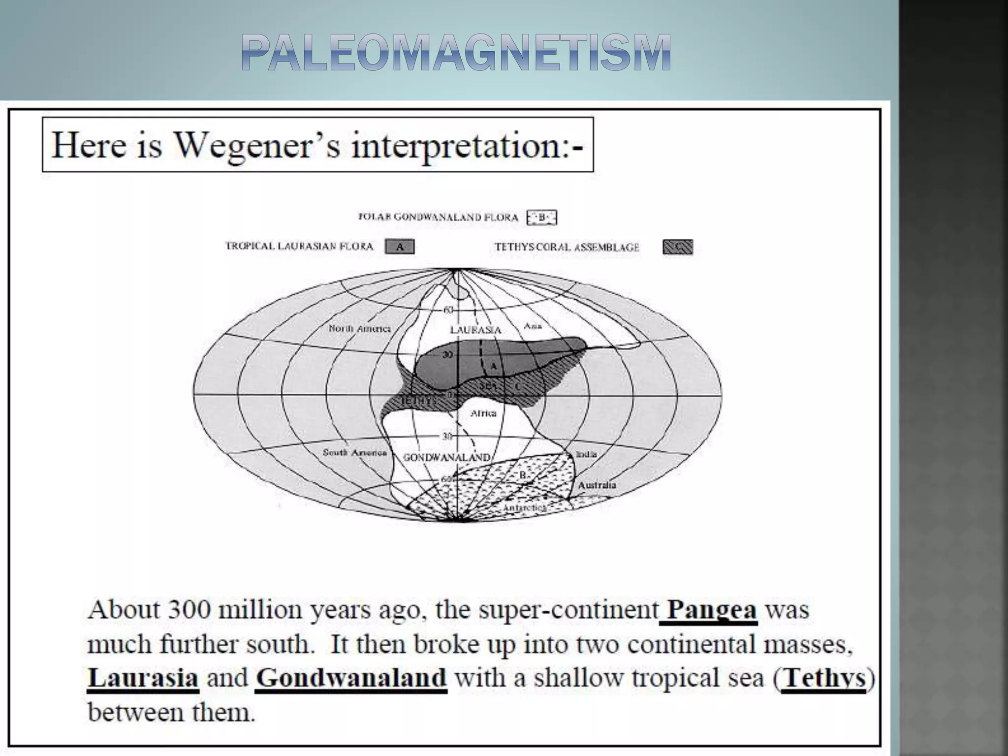


The document discusses Alfred Wegener's theory of continental drift. Some key points: - Wegener proposed that continents were not stationary but moved over time, drifting across Earth's surface. - Evidence for this included matching coastline geometries of continents like Africa and South America, as well as matching fossil and rock sequences along continental margins. - Paleomagnetic data from ancient rocks also supported continental drift, as their magnetic signatures did not match Earth's present-day magnetic field orientation. - Wegener's theory helped explain geological features like coal deposits under Antarctica, which could only have formed when that land was in a warmer climate.


![Integ Sci 10 Lesson 1 [Autosaved].pptx](https://cdn.slidesharecdn.com/ss_thumbnails/integsci10lesson1autosaved-230829103353-6f6fc3f8-thumbnail.jpg?width=640&height=640&fit=bounds)


![1 PPT CUHP [Compatibility Mode]the continentaldrift theory based upon wegener...](https://cdn.slidesharecdn.com/ss_thumbnails/1pptcuhpcompatibilitymode-240719144041-274948ba-thumbnail.jpg?width=640&height=640&fit=bounds)