Downloaded 147 times
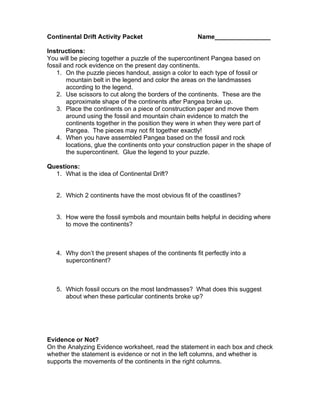
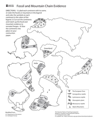

This document provides instructions for an activity where students will piece together the supercontinent Pangea based on fossil and rock evidence from present-day continents. Students will color code continents according to a legend matching fossil and mountain types. They will then cut out the continents and rearrange them to reconstruct Pangea, guided by the fossil and mountain evidence. Finally, students will glue the rearranged continents onto a map and answer questions about continental drift and the fit of continents in the supercontinent configuration.