Downloaded 77 times
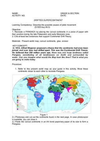

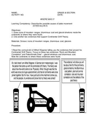


This document provides instructions for an activity to recreate the supercontinent Pangaea and support the Continental Drift Theory. Students will cut out and paste continents onto a map to show their positioning in Pangaea. They will then place icons within continents to indicate the locations of mountain ranges, coal deposits, and glacial features found as evidence. The activity aims to describe plate movement and cite evidence like rock and mountain correlations and paleoclimate data that support Continental Drift Theory.