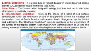
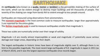
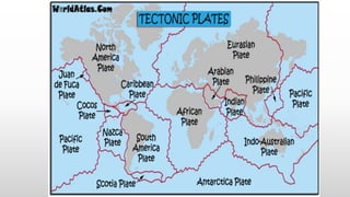
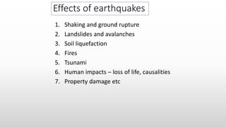
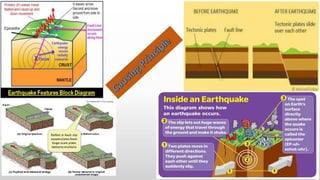
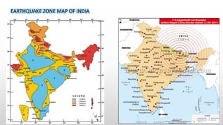
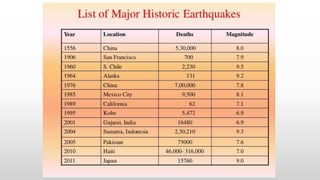
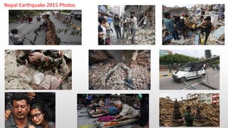
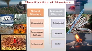
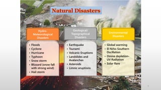
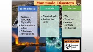
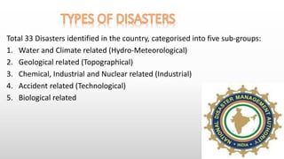
The document discusses different types of natural and man-made disasters. It categorizes natural disasters as meteorological, topographical/geological, and environmental. Man-made disasters are categorized as technological, industrial, and warfare. Specific natural disasters discussed include floods, cyclones, earthquakes, tsunamis, volcanoes, landslides, and more. Man-made disasters include accidents, pollution, industrial accidents, and wars. The document also provides details on the causes and impacts of various disasters like earthquakes, floods, oil spills, and epidemics. Classification schemes for different types of disasters are presented.

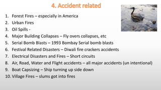
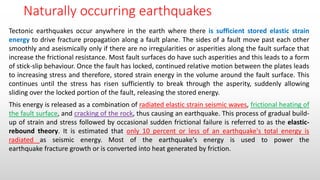
![Largest oil spills.
Spill / Tanker Location Date
Tonnes of crude oil
(thousands)[a]
Barrels
(thousands)
US Gallons
(thousands)
References
Kuwaiti oil fires[dubious –
discuss] [b] Kuwait
January 16, 1991 -
November 6, 1991
136,000 1,000,000 42,000,000 [5][6]
Kuwaiti oil lakes [c] Kuwait
January 1991 -November
1991
3,409-6,818 25,000-50,000 1,050,000-2,100,000 [7][8][9]
Lakeview Gusher
United States, Kern
County, California
March 14, 1910 –
September 1911
1,200 9,000 378,000 [10]
Gulf War oil spill [d] Kuwait, Iraq, and
the Persian Gulf
January 19, 1991 -January
28, 1991
818–1,091 6,000–8,000 252,000–336,000 [8][12][13]
Deepwater Horizon
United States, Gulf of
Mexico
April 20, 2010 – July 15,
2010
560-585 4,100-4,900 172,000-180,800 [14][15][16][17][18]
Ixtoc I Mexico, Gulf of Mexico
June 3, 1979 –March 23,
1980
454–480 3,329–3,520 139,818–147,840 [19][20][21]
Atlantic
Empress / Aegean
Captain
Trinidad and Tobago July 19, 1979 287 2,105 88,396 [22][23][24]
Fergana Valley Uzbekistan March 2, 1992 285 2,090 87,780 [25]
Nowruz Field Platform Iran, Persian Gulf February 4, 1983 260 1,907 80,080 [26]
ABT Summer
Angola, 700 nmi
(1,300 km; 810 mi)
offshore
May 28, 1991 260 1,907 80,080 [22]
Castillo de Bellver
South Africa, Saldanha
Bay
August 6, 1983 252 1,848 77,616 [22]
Amoco Cadiz France, Brittany March 16, 1978 223 1,635 68,684 [22][25][25][27][28]
MAJOR OIL SPILLS IN THE WORLD](https://image.slidesharecdn.com/unitii-disastertypesandearthquake-160927172942/85/Unit-ii-disaster-types-and-earthquake-12-320.jpg)