Ten things about GPS
•Download as PPTX, PDF•
0 likes•208 views
References: link to original article by Adena Schutzberg http://www.directionsmag.com/entry/ten-things-you-need-to-know-about-gps/258449
Report
Share
Report
Share

Recommended
cors-gps-grp6-homework
GPS and CORS systems provide global positioning capabilities using satellite constellations. GPS satellites broadcast time and location data that allows GPS receivers to determine their position via triangulation. CORS establishes continuously operating reference stations to improve GPS accuracy to the centimeter level by eliminating errors. CORS data supports a wide range of applications including surveying, navigation, mapping, and infrastructure monitoring.
All about-gps-technology
GPS uses satellites to provide location and time information anywhere in the world. It works by triangulating signals from 24 satellites in orbit. GPS is used for navigation in vehicles, ships, planes and more. It can display maps and provide turn-by-turn directions. A-GPS improves GPS for mobile phones by using cellular networks to assist with location. Both GPS and A-GPS are constantly improving and being used in more applications like watches, satellites, and tracking units.
11 9 Gps
The document discusses key things to know about GPS (Global Positioning System). It explains that GPS uses 24 satellites orbiting 12,500 miles above Earth that transmit precise signals allowing GPS receivers to calculate location, speed, and time. GPS is free and maintained by the US military, though accessible worldwide. The document also defines common GPS terms like longitude, latitude, UTM grids, datums, and how to read topographic maps using GPS coordinates.
GPS Presentation
GPS is a satellite-based navigation system that was originally developed for military use but is now widely used by civilians. It works globally in all weather conditions and provides location data 24/7. GPS is commonly used in vehicles for navigation, in cell phones, and to geotag photos. It helps with tasks like recovering stolen vehicles and emergency response. Newer GPS devices have features like voice guidance in multiple languages. When purchasing a GPS unit, it is best to select one with at least 12 satellite channels and 8 megabytes of memory for clear reception and storage of maps.
Gpa
The document summarizes the Global Positioning System (GPS). It describes GPS as a satellite-based navigation system consisting of 24 satellites placed into orbit by the U.S. Department of Defense. GPS satellites transmit radio signals that allow GPS receivers to calculate their precise location on Earth based on the time it takes signals to reach them from multiple satellites. Key components of GPS include the space segment of satellites, the user segment of receivers, and the control segment which monitors the system.
GPS and GIS
This document provides an overview of GPS and GIS technologies. It explains how GPS works using satellites and receivers to calculate location via trilateration. It discusses different receiver types and common data protocols like NMEA 0183. It also describes popular mapping systems, map servers, and map data formats. Google Maps API is introduced for embedding maps. Putting the pieces together, a sample application is outlined that uses a GPS receiver and Gpsd to plot locations on a Google Map.
Application of gps
GPS has both military and civilian applications across many industries including public safety, environmental monitoring, aviation, recreation, and business. It provides location data through satellite signals that can track devices, guide users to waypoints, and calculate speed and elevation. GPS is integrated into vehicle navigation systems, geographic information systems, aviation safety and traffic control, emergency response systems, and scientific research applications like atmospheric sensing and wildlife tracking.
Global positioning system(GPS)
This document provides an overview of GPS (Global Positioning System). It discusses what GPS is, the evolution of GPS, how the three segments (space, control, and user) work together, how GPS determines location using trilateration of signals from multiple satellites, sources of errors in GPS signals, advantages and disadvantages of the system, applications of GPS in fields like aviation, agriculture and more, and concludes that GPS is a valuable positioning system with wide civilian and military usage.
Presentation on GPS
GPS is a satellite-based navigation system consisting of 24 satellites used worldwide to determine precise locations. It was developed by the U.S. Department of Defense and first launched satellites in 1974 for military purposes. GPS works by triangulating the distance and timing signals from multiple satellites to determine a receiver's position. It has many uses including navigation in vehicles, boats and planes as well as applications on smartphones.
Gps global positioning system
GPS is a satellite-based navigation system that allows users to determine their exact location on Earth. It consists of three parts: satellites in orbit that transmit radio signals, receivers that detect these signals, and software that calculates the user's position. Originally developed by the US Department of Defense in 1973, GPS has both military and civilian applications. It works by using at least four satellites to triangulate the user's position based on the time it takes signals to reach their receiver. Ground stations monitor the satellites and send updates to keep them on their precise orbits. GPS is now widely used in mobile phones, automotive navigation, disaster relief, wildlife tracking, and more.
Gps tracking system
We at GPS Tracking System deals in variety of security gadgets includes GPS Tracking System, GPRS Tracking System, Home Security systems, Mobile Network Signal Booster
GPS - Fall 2011
Global Positioning Systems (GPS) can be used for navigation, surveying, and precise timekeeping. GPS works by using satellites that transmit encoded signals to receivers, which then use triangulation to determine their location. However, GPS has limitations - it is a one-way system so additional equipment is needed for tracking, signals cannot penetrate buildings or underground, and it only provides location data without navigation directions. The accuracy of GPS locations can be affected by factors like receiver quality, multipath issues, and satellite health.
Global positioning system (GPS)
This document provides information about the Global Positioning System (GPS). It discusses the history and development of GPS, including its three segments - space, control, and user. The space segment consists of GPS satellites that transmit signals. The control segment operates the satellites from ground stations. The user segment includes GPS receivers that can determine location from the satellite signals. The document outlines how GPS works by using triangulation of signals from multiple satellites. It also discusses sources of GPS errors, applications such as navigation and tracking, and advantages like accuracy and flexibility and disadvantages like indoor limitations.
GPS Application
GPS has evolved since its development in the 1970s by the US Department of Defense. It was originally intended for military use but has grown to support many civilian applications. GPS uses a constellation of satellites that transmit timing and location data to receivers, which use triangulation to calculate the user's precise position. It has applications in navigation, tracking, emergency services, and more. A survey found that while GPS is commonly used for transportation, respondents felt it could benefit other sectors as well and its future trends are promising. However, some have privacy concerns about its growing use.
Gps and its application
The document provides an overview of GPS (Global Positioning System) including:
- GPS uses 24 satellites and their ground stations as reference points to calculate positions accurate to within meters.
- It works globally in all weather and allows users to determine their location, velocity, and time.
- GPS was originally developed by the US Department of Defense but is now widely used by civilians as well as the military.
Location And Distance On The Earth Take Home
The document provides instructions and links for learning about various coordinate systems and tools used to determine location on Earth, including latitude and longitude, UTM grids, and GPS. It asks the reader to use the resources to find the latitude and longitude or specific places, convert between coordinate systems, calculate distances, and learn about systems like GPS. The reader is also asked to research the life and contributions of Eratosthenes, who first calculated the circumference of Earth over 2,000 years ago.
Gps systems m. emin özgünsür
This document discusses GPS systems and how they work. It begins with defining GPS as the Global Positioning System, which uses satellites and radio signals to pinpoint a receiver's location anywhere in the world. It then discusses where GPS is used, including for military and civilian navigation, and how GPS works by measuring distances to multiple satellites. The document also provides details on GPS satellite locations and movements, the radio frequencies used, and how GPS receivers use timing data from satellites to triangulate their position. It concludes with an example of a GPS circuit using a PIC microcontroller.
GIS and GPS - Presentation to 4th graders at King Kaumualii Elementary School
GIS and GPS - Presentation to 4th graders at King Kaumualii Elementary SchoolHawaii Geographic Information Coordinating Council
Maps have been used for many purposes throughout history, from depicting the heavens and earth in ancient times to recording journeys. Modern maps serve various functions such as showing locations, changes over time, comparisons between places, and stories or itineraries. Today, geographic information systems (GIS) and global positioning systems (GPS) enable highly accurate digital maps by gathering data about the world via satellites. Key components of maps include legends, north arrows, and scale bars, while GPS units and GIS software are important mapping tools.Gps introduction
The document discusses Global Navigation Satellite Systems (GNSS) such as GPS, GLONASS, Galileo, and Compass. It describes the three main segments of GPS - the space segment consisting of satellites, the ground control segment consisting of ground stations, and the user segment of receivers and applications. It then provides examples of GPS applications in areas such as surveying, agriculture, transportation, and navigation. Differential GPS is also introduced as a technique to improve accuracy by using reference station corrections.
Global Positioning System (GPS)
The document discusses the Global Positioning System (GPS). It provides a brief history of GPS, explaining that it was originally created by the US Department of Defense and became fully operational in 1995. It defines GPS as a satellite navigation system that uses 24+ satellites to determine the location of a GPS receiver. The document outlines the structure of GPS including its three segments: space segment, control system, and user segment. It describes how GPS determines location by measuring the distance from satellites to the receiver using travel time of radio signals.
What is the gps surveying and its methods
GPS Surveying is a method of measuring a Particular Land area with the help of Digital Data Collecting Equipment from a Group of Satellites.
Seminar on gps
The Global Positioning System (GPS) is a satellite-based navigation system that provides location and time information to GPS receivers anywhere on Earth. It was developed by the United States Department of Defense in the 1970s to overcome limitations of previous navigation systems. GPS uses a constellation of satellites that continuously transmit precise timing signals, allowing GPS receivers to determine their location by calculating the time difference of signals from multiple satellites. The system consists of three segments - space, control, and user - with the space segment comprising the satellites, the control segment managing the satellites, and the user segment being anyone using a GPS receiver.
GLOBAL POSITIONING SYSTEM (GPS)
This document discusses the Global Positioning System (GPS). It contains sections on what GPS is, its three segments including space, control, and user segments, how GPS signals work, how GPS determines location using triangulation of signals from multiple satellites, advantages like easy navigation and tracking, disadvantages like inaccuracy and failures, and applications such as location, mapping, and timing synchronization. In conclusion, GPS is a very useful satellite-based navigation system for activities like adventures and water navigation, despite some limitations.
Gps application
The document discusses many applications of GPS technology across several domains. It begins by covering general applications and then discusses uses in engineering like 3D modeling, geodesy, geophysics, geology, geodynamics and GIS. It also outlines innovative applications like tracking wildlife, GPS aides for the blind, and GPS uses in emergency systems. The document provides examples of GPS applications in areas like navigation, aviation, mining, transportation and more.
Global positioning system(GPS)
This document contains information about GPS from four group members: Hassan Rohail, Talha Noman, Anas Ali, and Arslan Ikram. Hassan provides a history of GPS, noting it was designed for military use and fully operational by 1995. Talha defines GPS as a space-based system that provides location, weather, and navigation info using 3 segments. Anas will discuss how GPS works. Arslan covers applications of GPS like aviation and mapping, drawbacks like signal issues, and future developments like improved accuracy.
Global positioning system GPS
GPS is a satellite-based navigation system that provides accurate location information to users. It consists of 24 satellites in medium Earth orbit that transmit signals used by GPS receivers to calculate positions. GPS receivers incorporate signals from at least 3 satellites to determine latitude, longitude, and altitude. The satellites are monitored by ground stations that calculate orbital data and clock corrections. GPS works by measuring the time it takes signals to travel from satellites to receivers, allowing distances to be calculated.
Global positioning system ppt
GPS uses a constellation of 24 satellites orbiting Earth to provide location and time information to GPS receivers. The satellites circle the planet every 12 hours across multiple orbital planes inclined at 55 degrees to the equator, ensuring signals from 8-10 satellites are visible from any point on Earth. GPS receivers triangulate their position by measuring the time delay of signals from 3 or more satellites, determining distance based on the time required for signals to travel. Factors like ionosphere delays, multipath signals, and satellite geometry can introduce errors, but parallel channel receivers maintain locks on satellites to provide accuracy within 15 meters.
Gps and tablets
GPS uses a constellation of 24 satellites that orbit Earth to allow receivers to pinpoint their geographic location with accuracy ranging from 100 to 10 meters. While standalone GPS equipment can be used for various applications, the GPS in smartphones and tablets relies on assistance from cell towers, WiFi networks, and memory of the user's last known location since true GPS chips consume too much power for mobile devices. These assisted GPS systems provide reasonably accurate location services even when users are indoors without a direct view of satellites.
OSM to Garmin
Preparation OSM data to Map of GPS Garmin
Презентация с семинара "ГИС и заповедные территории - 2014" http://pzf.gis.kh.ua
More Related Content
What's hot
Presentation on GPS
GPS is a satellite-based navigation system consisting of 24 satellites used worldwide to determine precise locations. It was developed by the U.S. Department of Defense and first launched satellites in 1974 for military purposes. GPS works by triangulating the distance and timing signals from multiple satellites to determine a receiver's position. It has many uses including navigation in vehicles, boats and planes as well as applications on smartphones.
Gps global positioning system
GPS is a satellite-based navigation system that allows users to determine their exact location on Earth. It consists of three parts: satellites in orbit that transmit radio signals, receivers that detect these signals, and software that calculates the user's position. Originally developed by the US Department of Defense in 1973, GPS has both military and civilian applications. It works by using at least four satellites to triangulate the user's position based on the time it takes signals to reach their receiver. Ground stations monitor the satellites and send updates to keep them on their precise orbits. GPS is now widely used in mobile phones, automotive navigation, disaster relief, wildlife tracking, and more.
Gps tracking system
We at GPS Tracking System deals in variety of security gadgets includes GPS Tracking System, GPRS Tracking System, Home Security systems, Mobile Network Signal Booster
GPS - Fall 2011
Global Positioning Systems (GPS) can be used for navigation, surveying, and precise timekeeping. GPS works by using satellites that transmit encoded signals to receivers, which then use triangulation to determine their location. However, GPS has limitations - it is a one-way system so additional equipment is needed for tracking, signals cannot penetrate buildings or underground, and it only provides location data without navigation directions. The accuracy of GPS locations can be affected by factors like receiver quality, multipath issues, and satellite health.
Global positioning system (GPS)
This document provides information about the Global Positioning System (GPS). It discusses the history and development of GPS, including its three segments - space, control, and user. The space segment consists of GPS satellites that transmit signals. The control segment operates the satellites from ground stations. The user segment includes GPS receivers that can determine location from the satellite signals. The document outlines how GPS works by using triangulation of signals from multiple satellites. It also discusses sources of GPS errors, applications such as navigation and tracking, and advantages like accuracy and flexibility and disadvantages like indoor limitations.
GPS Application
GPS has evolved since its development in the 1970s by the US Department of Defense. It was originally intended for military use but has grown to support many civilian applications. GPS uses a constellation of satellites that transmit timing and location data to receivers, which use triangulation to calculate the user's precise position. It has applications in navigation, tracking, emergency services, and more. A survey found that while GPS is commonly used for transportation, respondents felt it could benefit other sectors as well and its future trends are promising. However, some have privacy concerns about its growing use.
Gps and its application
The document provides an overview of GPS (Global Positioning System) including:
- GPS uses 24 satellites and their ground stations as reference points to calculate positions accurate to within meters.
- It works globally in all weather and allows users to determine their location, velocity, and time.
- GPS was originally developed by the US Department of Defense but is now widely used by civilians as well as the military.
Location And Distance On The Earth Take Home
The document provides instructions and links for learning about various coordinate systems and tools used to determine location on Earth, including latitude and longitude, UTM grids, and GPS. It asks the reader to use the resources to find the latitude and longitude or specific places, convert between coordinate systems, calculate distances, and learn about systems like GPS. The reader is also asked to research the life and contributions of Eratosthenes, who first calculated the circumference of Earth over 2,000 years ago.
Gps systems m. emin özgünsür
This document discusses GPS systems and how they work. It begins with defining GPS as the Global Positioning System, which uses satellites and radio signals to pinpoint a receiver's location anywhere in the world. It then discusses where GPS is used, including for military and civilian navigation, and how GPS works by measuring distances to multiple satellites. The document also provides details on GPS satellite locations and movements, the radio frequencies used, and how GPS receivers use timing data from satellites to triangulate their position. It concludes with an example of a GPS circuit using a PIC microcontroller.
GIS and GPS - Presentation to 4th graders at King Kaumualii Elementary School
GIS and GPS - Presentation to 4th graders at King Kaumualii Elementary SchoolHawaii Geographic Information Coordinating Council
Maps have been used for many purposes throughout history, from depicting the heavens and earth in ancient times to recording journeys. Modern maps serve various functions such as showing locations, changes over time, comparisons between places, and stories or itineraries. Today, geographic information systems (GIS) and global positioning systems (GPS) enable highly accurate digital maps by gathering data about the world via satellites. Key components of maps include legends, north arrows, and scale bars, while GPS units and GIS software are important mapping tools.Gps introduction
The document discusses Global Navigation Satellite Systems (GNSS) such as GPS, GLONASS, Galileo, and Compass. It describes the three main segments of GPS - the space segment consisting of satellites, the ground control segment consisting of ground stations, and the user segment of receivers and applications. It then provides examples of GPS applications in areas such as surveying, agriculture, transportation, and navigation. Differential GPS is also introduced as a technique to improve accuracy by using reference station corrections.
Global Positioning System (GPS)
The document discusses the Global Positioning System (GPS). It provides a brief history of GPS, explaining that it was originally created by the US Department of Defense and became fully operational in 1995. It defines GPS as a satellite navigation system that uses 24+ satellites to determine the location of a GPS receiver. The document outlines the structure of GPS including its three segments: space segment, control system, and user segment. It describes how GPS determines location by measuring the distance from satellites to the receiver using travel time of radio signals.
What is the gps surveying and its methods
GPS Surveying is a method of measuring a Particular Land area with the help of Digital Data Collecting Equipment from a Group of Satellites.
Seminar on gps
The Global Positioning System (GPS) is a satellite-based navigation system that provides location and time information to GPS receivers anywhere on Earth. It was developed by the United States Department of Defense in the 1970s to overcome limitations of previous navigation systems. GPS uses a constellation of satellites that continuously transmit precise timing signals, allowing GPS receivers to determine their location by calculating the time difference of signals from multiple satellites. The system consists of three segments - space, control, and user - with the space segment comprising the satellites, the control segment managing the satellites, and the user segment being anyone using a GPS receiver.
GLOBAL POSITIONING SYSTEM (GPS)
This document discusses the Global Positioning System (GPS). It contains sections on what GPS is, its three segments including space, control, and user segments, how GPS signals work, how GPS determines location using triangulation of signals from multiple satellites, advantages like easy navigation and tracking, disadvantages like inaccuracy and failures, and applications such as location, mapping, and timing synchronization. In conclusion, GPS is a very useful satellite-based navigation system for activities like adventures and water navigation, despite some limitations.
Gps application
The document discusses many applications of GPS technology across several domains. It begins by covering general applications and then discusses uses in engineering like 3D modeling, geodesy, geophysics, geology, geodynamics and GIS. It also outlines innovative applications like tracking wildlife, GPS aides for the blind, and GPS uses in emergency systems. The document provides examples of GPS applications in areas like navigation, aviation, mining, transportation and more.
Global positioning system(GPS)
This document contains information about GPS from four group members: Hassan Rohail, Talha Noman, Anas Ali, and Arslan Ikram. Hassan provides a history of GPS, noting it was designed for military use and fully operational by 1995. Talha defines GPS as a space-based system that provides location, weather, and navigation info using 3 segments. Anas will discuss how GPS works. Arslan covers applications of GPS like aviation and mapping, drawbacks like signal issues, and future developments like improved accuracy.
Global positioning system GPS
GPS is a satellite-based navigation system that provides accurate location information to users. It consists of 24 satellites in medium Earth orbit that transmit signals used by GPS receivers to calculate positions. GPS receivers incorporate signals from at least 3 satellites to determine latitude, longitude, and altitude. The satellites are monitored by ground stations that calculate orbital data and clock corrections. GPS works by measuring the time it takes signals to travel from satellites to receivers, allowing distances to be calculated.
Global positioning system ppt
GPS uses a constellation of 24 satellites orbiting Earth to provide location and time information to GPS receivers. The satellites circle the planet every 12 hours across multiple orbital planes inclined at 55 degrees to the equator, ensuring signals from 8-10 satellites are visible from any point on Earth. GPS receivers triangulate their position by measuring the time delay of signals from 3 or more satellites, determining distance based on the time required for signals to travel. Factors like ionosphere delays, multipath signals, and satellite geometry can introduce errors, but parallel channel receivers maintain locks on satellites to provide accuracy within 15 meters.
Gps and tablets
GPS uses a constellation of 24 satellites that orbit Earth to allow receivers to pinpoint their geographic location with accuracy ranging from 100 to 10 meters. While standalone GPS equipment can be used for various applications, the GPS in smartphones and tablets relies on assistance from cell towers, WiFi networks, and memory of the user's last known location since true GPS chips consume too much power for mobile devices. These assisted GPS systems provide reasonably accurate location services even when users are indoors without a direct view of satellites.
What's hot (20)
GIS and GPS - Presentation to 4th graders at King Kaumualii Elementary School
GIS and GPS - Presentation to 4th graders at King Kaumualii Elementary School
Viewers also liked
OSM to Garmin
Preparation OSM data to Map of GPS Garmin
Презентация с семинара "ГИС и заповедные территории - 2014" http://pzf.gis.kh.ua
Localization using filtered dgps
Abstract In this paper, localization of the robot is achieved by considering two Global Positioning Systems (GPS) or DGPS. Differential Global Positioning System (DGPS) is interfaced with MBED with the help of Zigbee protocol. For accurate localization of mobile robot DGPS is preferred. Filters are used to remove the erroneous noise from the data obtained from GPS. Low pass IIR filter for DGPS is realized. The project work discusses each of these approaches for localization in Outdoor environment. The above algorithm is implemented on MBED Platform. Simulation results are extracted using Matlab. Keywords—localization, Outdoor environment, Low pass IIR filter, DGPS, MBED
GLONASS forum
Slide share doesn't support animations :(
Presentation made in Moscow, October 2010
Yes, it is in Russian
9 free rtos
Девятое занятие курса по программированию микроконтроллеров stm32. На занятии рассказано про операционные системы реального времени.
Satellite Navigation. Present and Future
Presentation at the session of the Academy of Navigation and Motion Control
Internet Of Things: возможности Intel Galileo gen 2 и Intel Edison
Роман Хатько, Intel, Mobile-секция CodeFest 2015
era_27Nov2012
This document discusses plans for unifying in-vehicle systems (IVS) in Russia, including the ERA-GLONASS emergency response system, fleet management systems, road tolling systems, and digital tachographs. The goals are to reduce costs by eliminating redundant hardware and functions across different IVS, standardize interfaces and communication protocols, and develop a single "connected IVS" approach. Key steps include developing standards for IVS/backend communication, regulations around unified use of GNSS data, and software/test tools to validate a reference implementation of unified protocols. Unifying these systems could lower total IVS costs per vehicle by at least 40% according to estimates.
Daniel Khachay - GPS navigation algorithm based on osm data
Daniel Khachay works at the Institute of Mathematics and Computer Science at Ural Federal University. The document provides Daniel Khachay's name and affiliation with the Institute of Mathematics and Computer Science at Ural Federal University.
Introduction-of-GNSS-2
The document discusses various global and regional satellite navigation systems:
- GLONASS is Russia's system with 24 operational satellites. It provides improved precision and reliability when integrated with GPS.
- EGNOS and Galileo are Europe's systems to enhance GPS. EGNOS went live in 2004 as a precursor to Galileo, which launched its first satellites in 2016.
- BeiDou is China's system with 5 geostationary and 30 non-geostationary satellites. It began covering Asia-Pacific in 2012 and will cover the world by 2020.
- IRNSS is India's system consisting of 7 satellites, 3 geostationary and 4 geosynchronous, providing accuracy of 20 meters over India
Introduction of gps global navigation satellite systems
This document provides information on Global Navigation Satellite Systems (GNSS). It discusses several GNSS including GPS (USA), GLONASS (Russia), and Galileo (Europe). It provides details on GLONASS and Galileo constellations and signal structures. The benefits of multiple GNSS include improved availability, accuracy, reliability and efficiency of position determination.
Global Positioning System
The document provides an overview of the Global Positioning System (GPS). It describes how GPS works using trilateration based on signal timing from multiple satellites. It discusses the space, control, and user segments. It also covers GPS signals, frequencies, accuracy issues, and methods to improve accuracy such as augmentation systems. Applications of GPS are outlined for civilian, military, and other uses.
Global Positioning System
This document provides an overview of the Global Positioning System (GPS). It discusses what GPS is, its evolution, how it works, and its three segments: the space segment consisting of 24 satellites, the control segment of 5 ground stations, and the user segment of GPS receivers. The document outlines the information contained in GPS signals, how triangulation is used to determine position, and sources of errors like the ionosphere. It also discusses differential GPS, applications of GPS, and concludes with a bibliography.
8086 microprocessor instruction set by Er. Swapnil Kaware
The document describes the instruction set of the 8086 microprocessor. It discusses the different types of instructions including data transfer instructions like MOV, PUSH, POP, XCHG, IN, OUT, and XLAT. It also covers addressing modes, instruction formats, and the various registers used by the 8086 microprocessor like the stack pointer and flag register. In total there are 14 different data transfer instructions described that are used to move data between registers, memory, ports, and the flag and stack pointers.
Viewers also liked (20)
Существующие и перспективные системы навигации (Борис Салтовский)
Существующие и перспективные системы навигации (Борис Салтовский)
Internet Of Things: возможности Intel Galileo gen 2 и Intel Edison
Internet Of Things: возможности Intel Galileo gen 2 и Intel Edison
Daniel Khachay - GPS navigation algorithm based on osm data
Daniel Khachay - GPS navigation algorithm based on osm data
Introduction of gps global navigation satellite systems
Introduction of gps global navigation satellite systems
8086 microprocessor instruction set by Er. Swapnil Kaware
8086 microprocessor instruction set by Er. Swapnil Kaware
Similar to Ten things about GPS
GPS
The GPS consists of 3 segments - the space segment of 24 satellites orbiting Earth, the control segment of ground stations monitoring the satellites, and the user segment of GPS receivers. GPS satellites continuously transmit radio signals allowing receivers to calculate their location on Earth by triangulating signals from at least 3 satellites. Originally intended for military use, GPS is now widely used for civilian navigation in vehicles, hiking, boating and more.
Global positioning system (GPS)
The document provides information about the Global Positioning System (GPS). It discusses how GPS works using a constellation of satellites and trilateration to determine a user's location. The key segments of GPS are the space, control, and user segments. GPS is used for both military and civilian navigation and applications across various industries like automobiles, aircraft, agriculture, and more. Future developments aim to improve the accuracy, reliability, and capabilities of GPS through modernization efforts.
Gps technology
GPS is a satellite-based navigation system consisting of 24 satellites placed into orbit by the U.S. Department of Defense. It was originally intended for military use but is now available for civilian use free of charge. GPS works globally under any weather conditions using satellites to calculate location via trilateration. Common GPS devices include those in cars, phones, and pet collars that receive location data from satellites. A GPS receiver receives radio signals from multiple satellites to calculate its precise position on Earth.
Gps
The GPS system uses satellites to provide location and time information anywhere on Earth. It became fully operational in 1994 with 24 satellites. Modernization efforts now aim to implement new GPS III satellites and control systems. GPS calculates position by precisely timing signals from at least 4 satellites. It determines distance to each satellite and uses trilateration to find the receiver's location. Various augmentation systems can further improve GPS accuracy. Key sources of GPS error include effects of the ionosphere, satellite orbit and clock errors, multipath interference, and atmospheric conditions.
Global positioning system
The document provides an overview of the Global Positioning System (GPS). It describes the three segments that make up GPS - the space, user, and control segments. It explains how GPS works by using satellites to triangulate a user's position based on distance measurements. Sources of errors and limitations are discussed. Differential GPS is introduced as a method to improve accuracy. Finally, applications of GPS in fields like aviation, mapping, and emergency services are outlined.
GIS & GPS PPt
The Global Positioning System (GPS) is a satellite-based navigation system consisting of three segments: space, control, and user. The space segment includes 24 satellites in orbit that transmit timing signals. The control segment consists of monitoring stations that track satellite orbits and clock corrections. The user segment includes any GPS receiver used for navigation or timing. GPS provides location and time information to users worldwide for applications like navigation, mapping, and tracking.
PERFORMANCE TESTING OF TRIMBLE GEOEXPLORER 3 GLOBAL POSITIONING SYSTEM RECEIVER
The document is a project report that evaluates the performance of a Trimble GeoExplorer 3 GPS receiver. It was submitted by four students to fulfill their B.Tech degree in Civil Engineering at Jamia Millia Islamia, under the supervision of Dr. Shamshad Ahmad. The report includes an introduction to GPS technology, the objectives of testing the GeoExplorer 3 receiver's accuracy under various conditions, a description of the coordinate systems used, and the various sections of the report such as data collection methods, test results, and conclusions.
GPS technologies group 9
The document discusses Global Positioning Systems (GPS). It provides information on how GPS works using satellites, GPS receiving devices, and applications of GPS in various industries like transportation, sports, healthcare and business. It also outlines advantages of GPS such as ability to track locations anywhere in the world. Limitations including satellite geometry, multipath errors and reliance on technology are mentioned. The future of GPS is discussed including increased usage, indoor maps, augmented reality and applications like Google Sky Map.
Gps
GPS uses a network of 24 satellites to enable positioning worldwide. It works by calculating the distance from the user to at least 4 satellites to determine the 3D position. While generally accurate to 15 meters, newer receivers with WAAS can achieve 3 meters of accuracy. The main sources of error used to be selective availability, an intentional degradation of the signal by the US military, but this was turned off in 2000, improving civilian accuracy significantly.
Yarab
The document provides information about the Global Positioning System (GPS). It discusses the three main segments of GPS: 1) The space segment which consists of 24 satellites in orbit, 2) The control segment which monitors the satellites and sends updates, and 3) GPS receivers which use trilateration of signals from multiple satellites to determine location. It also describes sources of error in GPS signals and how increasing the number of satellites improves accuracy of position determination.
Radio aids & navigation
This document provides an introduction and overview of the Global Positioning System (GPS). It discusses what GPS is, how it works with satellites and receivers, its advantages, and applications. GPS allows users to determine their precise location on Earth at any time. The summary is:
GPS is a satellite-based navigation system that provides accurate location and time information to users around the world. It consists of satellites orbiting Earth that transmit signals picked up by GPS receivers, which then calculate the user's position and time. GPS has many advantages like working in all weather and being freely accessible, and it is used widely in aviation, shipping, hiking and more.
Gps
The Global Positioning System (GPS) is a satellite-based navigation system consisting of a constellation of over two dozen satellites. GPS satellites broadcast precise timing signals that allow GPS receivers to determine their longitude, latitude, and altitude on Earth. Originally developed by the U.S. military, GPS has become vital for navigation worldwide in applications like automobiles, ships, aircraft, and smartphones. It provides location services, timing references, and is used for surveying, agriculture, and more.
GPS system and its application in mining
The document discusses the Global Positioning System (GPS). It provides details on:
- How GPS uses 24 satellites to determine accurate 3D positions anywhere on Earth.
- The three segments that make up GPS - the space segment of satellites, control segment of monitoring stations, and user segment of receivers.
- How GPS uses triangulation of distance measurements from multiple satellites to calculate a user's precise location, velocity, and time.
Global Positioning System
The document provides an overview of the GPS (Global Positioning System) including its key elements and how it works. It discusses the three segments of GPS - space, user, and control. The space segment consists of satellites that transmit timing signals. The user segment includes GPS receivers. The control segment monitors and controls the satellites. It then describes how GPS determines position using timing signals from multiple satellites and triangulation. Sources of errors in GPS signals are also reviewed.
Global Positioning System (GPS) in Helthcare
GPS, or the Global Positioning System, is a satellite-based navigation system that provides location and time information to users with GPS receivers. It works by precisely timing the signals sent by GPS satellites high above the Earth. GPS was originally developed by the U.S. military but is now used worldwide for both military and civilian purposes. In healthcare, GPS technology helps emergency responders locate patients faster, tracks patients with cognitive issues, and aids in telemedicine, disease surveillance, disaster response, and more. It provides accurate positioning information that supports a variety of applications improving healthcare delivery and outcomes.
GPS in Planning
The Global Positioning System (GPS) uses a constellation of 24 satellites to determine accurate positions globally. It was originally developed by the US Department of Defense for military navigation but is now widely used by civilians. GPS works by precisely timing the signals from at least 3 satellites to triangulate the user's position on Earth. Its applications include navigation, mapping, tracking of vehicles, vessels and aircraft.
ECDIS NAVIGATION 5
This document provides an overview of differential GPS (DGPS) and its history. It explains that DGPS uses fixed, ground-based reference stations to broadcast corrections to improve GPS accuracy from 15 meters to about 10 cm. Selective availability was introduced by the US military to degrade civilian GPS but was turned off in 2000. DGPS was developed as a solution, broadcasting corrections to offset errors and allow 5 meter accuracy, meeting most civilian needs. It has expanded to cover many waterways through systems like the US Coast Guard's National DGPS.
Introduction togps shsm
This document provides an introduction to Global Positioning Systems (GPS) and their safe use. It discusses some key concepts about how GPS works including how satellites transmit timing signals that allow receivers to calculate their position. It outlines several sources of error that can impact GPS accuracy such as signal multipath, receiver clock errors, and satellite geometry. The document emphasizes that GPS should be used together with maps and a compass for maximum safety. Hands-on training is recommended before relying solely on a GPS unit for navigation.
presentation on gps
GPS uses a network of satellites that transmit precise time signals to receivers on Earth. GPS receivers use these signals from at least 3 satellites to calculate the user's location through trilateration. The GPS system consists of 3 segments - the space segment containing 30 satellites in orbit, the control segment that monitors the satellites from ground stations, and the user segment which are the GPS receivers. GPS is now used widely for navigation, tracking, mapping, timing applications in transportation, vehicles, military, agriculture, tourism, wildlife monitoring and more.
Gps
This document summarizes GPS (Global Positioning System). It discusses that GPS uses satellites to determine location on Earth and consists of three segments - space, control, and user. The space segment maintains GPS satellites in orbit. The control segment monitors and maintains the satellites. The user segment refers to GPS receivers that can determine location with satellite signals. Applications of GPS include navigation, mapping, and use by both military and civilian sectors.
Similar to Ten things about GPS (20)
PERFORMANCE TESTING OF TRIMBLE GEOEXPLORER 3 GLOBAL POSITIONING SYSTEM RECEIVER
PERFORMANCE TESTING OF TRIMBLE GEOEXPLORER 3 GLOBAL POSITIONING SYSTEM RECEIVER
Recently uploaded
Philippine Edukasyong Pantahanan at Pangkabuhayan (EPP) Curriculum
(𝐓𝐋𝐄 𝟏𝟎𝟎) (𝐋𝐞𝐬𝐬𝐨𝐧 𝟏)-𝐏𝐫𝐞𝐥𝐢𝐦𝐬
𝐃𝐢𝐬𝐜𝐮𝐬𝐬 𝐭𝐡𝐞 𝐄𝐏𝐏 𝐂𝐮𝐫𝐫𝐢𝐜𝐮𝐥𝐮𝐦 𝐢𝐧 𝐭𝐡𝐞 𝐏𝐡𝐢𝐥𝐢𝐩𝐩𝐢𝐧𝐞𝐬:
- Understand the goals and objectives of the Edukasyong Pantahanan at Pangkabuhayan (EPP) curriculum, recognizing its importance in fostering practical life skills and values among students. Students will also be able to identify the key components and subjects covered, such as agriculture, home economics, industrial arts, and information and communication technology.
𝐄𝐱𝐩𝐥𝐚𝐢𝐧 𝐭𝐡𝐞 𝐍𝐚𝐭𝐮𝐫𝐞 𝐚𝐧𝐝 𝐒𝐜𝐨𝐩𝐞 𝐨𝐟 𝐚𝐧 𝐄𝐧𝐭𝐫𝐞𝐩𝐫𝐞𝐧𝐞𝐮𝐫:
-Define entrepreneurship, distinguishing it from general business activities by emphasizing its focus on innovation, risk-taking, and value creation. Students will describe the characteristics and traits of successful entrepreneurs, including their roles and responsibilities, and discuss the broader economic and social impacts of entrepreneurial activities on both local and global scales.
Jemison, MacLaughlin, and Majumder "Broadening Pathways for Editors and Authors"
Jemison, MacLaughlin, and Majumder "Broadening Pathways for Editors and Authors"National Information Standards Organization (NISO)
This presentation was provided by Racquel Jemison, Ph.D., Christina MacLaughlin, Ph.D., and Paulomi Majumder. Ph.D., all of the American Chemical Society, for the second session of NISO's 2024 Training Series "DEIA in the Scholarly Landscape." Session Two: 'Expanding Pathways to Publishing Careers,' was held June 13, 2024.Benner "Expanding Pathways to Publishing Careers"
This presentation was provided by Rebecca Benner, Ph.D., of the American Society of Anesthesiologists, for the second session of NISO's 2024 Training Series "DEIA in the Scholarly Landscape." Session Two: 'Expanding Pathways to Publishing Careers,' was held June 13, 2024.
NIPER 2024 MEMORY BASED QUESTIONS.ANSWERS TO NIPER 2024 QUESTIONS.NIPER JEE 2...
NIPER JEE PYQ
NIPER JEE QUESTIONS
MOST FREQUENTLY ASK QUESTIONS
NIPER MEMORY BASED QUWSTIONS
How to Manage Reception Report in Odoo 17
A business may deal with both sales and purchases occasionally. They buy things from vendors and then sell them to their customers. Such dealings can be confusing at times. Because multiple clients may inquire about the same product at the same time, after purchasing those products, customers must be assigned to them. Odoo has a tool called Reception Report that can be used to complete this assignment. By enabling this, a reception report comes automatically after confirming a receipt, from which we can assign products to orders.
Gender and Mental Health - Counselling and Family Therapy Applications and In...
A proprietary approach developed by bringing together the best of learning theories from Psychology, design principles from the world of visualization, and pedagogical methods from over a decade of training experience, that enables you to: Learn better, faster!
Level 3 NCEA - NZ: A Nation In the Making 1872 - 1900 SML.ppt
The History of NZ 1870-1900.
Making of a Nation.
From the NZ Wars to Liberals,
Richard Seddon, George Grey,
Social Laboratory, New Zealand,
Confiscations, Kotahitanga, Kingitanga, Parliament, Suffrage, Repudiation, Economic Change, Agriculture, Gold Mining, Timber, Flax, Sheep, Dairying,
BÀI TẬP BỔ TRỢ TIẾNG ANH LỚP 8 - CẢ NĂM - FRIENDS PLUS - NĂM HỌC 2023-2024 (B...
BÀI TẬP BỔ TRỢ TIẾNG ANH LỚP 8 - CẢ NĂM - FRIENDS PLUS - NĂM HỌC 2023-2024 (B...Nguyen Thanh Tu Collection
https://app.box.com/s/nrwz52lilmrw6m5kqeqn83q6vbdp8yzpLeveraging Generative AI to Drive Nonprofit Innovation
In this webinar, participants learned how to utilize Generative AI to streamline operations and elevate member engagement. Amazon Web Service experts provided a customer specific use cases and dived into low/no-code tools that are quick and easy to deploy through Amazon Web Service (AWS.)
مصحف القراءات العشر أعد أحرف الخلاف سمير بسيوني.pdf
مصحف أحرف الخلاف للقراء العشرةأعد أحرف الخلاف بالتلوين وصلا سمير بسيوني غفر الله له
HYPERTENSION - SLIDE SHARE PRESENTATION.
IT WILL BE HELPFULL FOR THE NUSING STUDENTS
IT FOCUSED ON MEDICAL MANAGEMENT AND NURSING MANAGEMENT.
HIGHLIGHTS ON HEALTH EDUCATION.
Temple of Asclepius in Thrace. Excavation results
The temple and the sanctuary around were dedicated to Asklepios Zmidrenus. This name has been known since 1875 when an inscription dedicated to him was discovered in Rome. The inscription is dated in 227 AD and was left by soldiers originating from the city of Philippopolis (modern Plovdiv).
How to Download & Install Module From the Odoo App Store in Odoo 17
Custom modules offer the flexibility to extend Odoo's capabilities, address unique requirements, and optimize workflows to align seamlessly with your organization's processes. By leveraging custom modules, businesses can unlock greater efficiency, productivity, and innovation, empowering them to stay competitive in today's dynamic market landscape. In this tutorial, we'll guide you step by step on how to easily download and install modules from the Odoo App Store.
Recently uploaded (20)
Philippine Edukasyong Pantahanan at Pangkabuhayan (EPP) Curriculum
Philippine Edukasyong Pantahanan at Pangkabuhayan (EPP) Curriculum
Jemison, MacLaughlin, and Majumder "Broadening Pathways for Editors and Authors"
Jemison, MacLaughlin, and Majumder "Broadening Pathways for Editors and Authors"
SWOT analysis in the project Keeping the Memory @live.pptx
SWOT analysis in the project Keeping the Memory @live.pptx
NIPER 2024 MEMORY BASED QUESTIONS.ANSWERS TO NIPER 2024 QUESTIONS.NIPER JEE 2...
NIPER 2024 MEMORY BASED QUESTIONS.ANSWERS TO NIPER 2024 QUESTIONS.NIPER JEE 2...
Gender and Mental Health - Counselling and Family Therapy Applications and In...
Gender and Mental Health - Counselling and Family Therapy Applications and In...
Level 3 NCEA - NZ: A Nation In the Making 1872 - 1900 SML.ppt
Level 3 NCEA - NZ: A Nation In the Making 1872 - 1900 SML.ppt
BÀI TẬP BỔ TRỢ TIẾNG ANH LỚP 8 - CẢ NĂM - FRIENDS PLUS - NĂM HỌC 2023-2024 (B...
BÀI TẬP BỔ TRỢ TIẾNG ANH LỚP 8 - CẢ NĂM - FRIENDS PLUS - NĂM HỌC 2023-2024 (B...
Leveraging Generative AI to Drive Nonprofit Innovation
Leveraging Generative AI to Drive Nonprofit Innovation
مصحف القراءات العشر أعد أحرف الخلاف سمير بسيوني.pdf
مصحف القراءات العشر أعد أحرف الخلاف سمير بسيوني.pdf
How to Download & Install Module From the Odoo App Store in Odoo 17
How to Download & Install Module From the Odoo App Store in Odoo 17
Juneteenth Freedom Day 2024 David Douglas School District
Juneteenth Freedom Day 2024 David Douglas School District
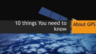
Ten things about GPS
- 1. 10 things You need to know About GPS
- 2. Definition The Global Positioning System (GPS) is a space-based satellite navigation system that provides location and time information in all weather conditions, anywhere on or near the earth where there is an unobstructed line of sight to four or more GPS satellites. 1
- 3. The Generic Term The generic term for these systems is Global Navigation Satellite System, GNSS. There is such systems as Russian`s GLONASS, USA`s GPS, European project Galileo, etc. 2
- 4. How GNSS Works 3 The satellites orbit around earth and broadcast information. That information is basically a time stamp.
- 5. GNSS Receivers Receive GNSS receivers do not have two-way communication with the navigation satellites; the satellites are broadcast-only. 4
- 6. GNSS is not Great at Elevation Horizontal accuracy for recreational/consumer devices and many cell phones is about +/- 10 meters (within a tennis court) while vertical accuracy can be two or three times that, about +/- 20 or 30 meters. The cause of this relies to geometry. 5
- 7. Assisted GPS With multiple GNSSs online, or coming online, and a variety of non-GPS locating technologies in use (wi-fi, cell tower, etc.), there’s an effort to bring them together for enhanced solutions. 6
- 8. GPS Interference Because GPS signals from satellites are very weak radio signals, they are susceptible to interference by natural and man-made signals. 7
- 9. Government Control of GPS While the U.S. Department of Defense developed and operates GPS, it serves a wide range of civilian users. To date, the Department of Defense has never “shut off” GPS in any part of the world, for any reason. 8
- 10. Navigating by GNSS The GNSS only provides information to a receiver to determine its current location, velocity and time. Any other information, such as the direction of motion, a suggested route to a destination, a map, is provided by software algorithms and stored map data. 9
- 11. The GPS is Wrong! • Most of the time a GPS receiver is correct in determining its position, within its tolerance. If a navigation system fails to provide an accurate route, other things are more likely to be the culprit, for example: • poor algorithm • out-of-date street network • wrong destination address • The U.S. government received so many complaints on this matter it compiled an article to explain to users how to “fix” such errors. 10
- 12. This is the end