Radio aids & navigation
•Download as DOCX, PDF•
1 like•1,340 views

This document provides an introduction and overview of the Global Positioning System (GPS). It discusses what GPS is, how it works with satellites and receivers, its advantages, and applications. GPS allows users to determine their precise location on Earth at any time. The summary is: GPS is a satellite-based navigation system that provides accurate location and time information to users around the world. It consists of satellites orbiting Earth that transmit signals picked up by GPS receivers, which then calculate the user's position and time. GPS has many advantages like working in all weather and being freely accessible, and it is used widely in aviation, shipping, hiking and more.

Recommended
More Related Content
What's hot
What's hot (20)
Viewers also liked
Viewers also liked (20)
Similar to Radio aids & navigation
Similar to Radio aids & navigation (20)
More from Amidee Azizan Stringfellow
More from Amidee Azizan Stringfellow (20)
Recently uploaded
Recently uploaded (20)
Radio aids & navigation
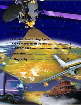
- 1. Table of contents Introduction……………………………………….1 Contents Global Positioning System...…………….2 GPS Navigation Devices…………………..5 Advantages…………………………………….6 Conclusion…………………………………………7 Bibliography………………………………………8 0
- 2. T Introduction he Global Positioning System (GPS) is a space-based global navigation satellite system that provides reliable location and time information in all weather and at all times and anywhere on or near the Earth when and where there is an unobstructed line of sight to four or more GPS satellites. It is maintained by the United States government and is freely accessible by anyone with a GPS receiver. The Global Positioning System (GPS) is a U.S. space-based radionavigation system that provides reliable positioning, navigation, and timing services to civilian users on a continuous worldwide basis - freely available to all. For anyone with a GPS receiver, the system will provide location and time. GPS provides accurate location and time information for an unlimited number of people in all weather, day and night, anywhere in the world. The GPS is made up of three parts: satellites orbiting the Earth; control and monitoring stations on Earth; and the GPS receivers owned by users. GPS satellites broadcast signals from space that are picked up and identified by GPS receivers. Each GPS receiver then provides three-dimensional location (latitude, longitude, and altitude) plus the time. GPS satellites provide service to civilian and military users. The civilian service is freely available to all users on a continuous, worldwide basis. The military service is available to U.S. and allied armed forces as well as approved Government agencies.A variety of GPS augmentation systems and techniques are available to enhance system performance to meet specific user requirements. These improve signal availability, accuracy, and integrity, allowing even better performance than is possible using the basic GPS civilian service.The outstanding performance of GPS over many years has earned the confidence of millions of civil users worldwide. It has proven its dependability in the past and promises to be of benefit to users, throughout the world, far into the future. 1
- 3. Global Position System G lobal Positioning System (GPS) is a satellite based navigation system that helps to find the location or position on the Earth.Official name of GPS is Navigational Satellite Timing And Ranging Global Positioning System (NAVSTAR GPS). G Developer PS was U.S. created and realized Department of Defense and was originally run by the (DOD) with 24 satellites. It was established in 1973 to overcome limitations of previous navigation systems. The DOD is the major tenant of the The Pentagon building near Washington, D.C., and has three major components — the Departments of the Army, Navy, and Air Force 2
- 4. Purpose P rovides reliable location and time information in all weather and at all times and anywhere on or near the Earth.GPS provides specially coded satellite signals that can be processed in a GPS receiver, enabling the receiver to compute position, velocity, and time. Four GPS satellite signals are used to compute positions in three dimensions and the time offset in the receiver clock. W WHY DO WE NEED GPS e need a powerful system such GPS because GPS can provide accurate information and cover wide area. In other words, all GPS devices can answer the question "Where am I?", and may also be able to answer: which roads or paths are available to me now? which roads or paths should I take in order to get my desired destination? if some roads are usually busy at this time or are busy right now, what would be a better route to take? where can I get something to eat nearby or where can I get fuel for my vehicle? 3
- 5. G WHO CAN USED PS operates in the UHF band.Each navigation satellite transmits a unique UHF signal.The receiver pairs itself to this transmission and determines the time difference between the satellite clock and the receiver clock.The time difference multiplied by the speed of light gives the receiver distance from the satellite. Signals from multiple satellites are used to fix the receivers position in space. There are two types of services available: 1. For Civilian/Research Use Standard Positioning System – L1 (1575.42 MHz), L2 (1227.60 MHz), L5 (1176.45 MHz) – For Civilian – L4 (1379.913 MHz) – For Research 2. For Military Use Precise Positioning System – L3 (1381.05 MHz) USERS AIRCRAFT NAVIGATION CIVILIAN(individual) MILITARY RAILROAD SYSTEMS MARINE WEATHER PREDICTION AUTOMOBILE SPORTS(sky diving) 4
- 6. GPS NAVIGATION DEVICES A GPS navigation device is any device that receives Global Positioning System (GPS) signals for the purpose of determining the device's current location on Earth. GPS devices provide latitude and longitude information, and some may also calculate altitude, although this is not considered sufficiently accurate or continuously available enough (due to the possibility of signal blockage and other factors) to rely on exclusively to pilot aircraft. GPS devices are used in military, aviation, marine and consumer product applications. GPS devices may also have additional capabilities such as: containing maps, which may be displayed in human readable format via text or in a graphical format providing suggested directions to a human in charge of a vehicle or vessel via text or speech providing directions directly to an autonomous vehicle such as a robotic probe providing information on traffic conditions (either via historical or real time data) and suggesting alternative directions providing information on nearby amenities such as restaurants, fueling stations, etc. 5
- 7. I ADVANTAGES mproved approaches to airports, which significantly increase operational benefits and safety, are now being implemented even at remote locations where traditional ground-based services are unavailable. In some regions of the world, satellite signals are augmented, or improved for special aviation applications, such as landing planes during poor visibility conditions. In those cases, even greater precision operations are possible. BENEFITS Continuous, reliable, and accurate positioning information for all phases of flight on a global basis, freely available to all. Safe, flexible, and fuel-efficient routes for airspace service providers and airspace users. Potential decommissioning and reduction of expensive ground based navigation facilities, systems, and services. Increased safety for surface movement operations made possible by situational awareness. Reduced aircraft delays due to increased capacity made possible through reduced separation minimums and more efficient air traffic management, particularly during inclement weather. Increased safety-of-life capabilities such as EGPWS The good news for the aviation community is that GPS is being constantly improved and modernized. A main component of the ongoing civilian modernization effort is the addition of two new signals. These signals complement the existing civilian service. The first of these new signals is for general use in non-safety critical applications. The second new signal will be internationally protected for aviation navigational purposes. This additional safety-of-life civilian signal will make GPS an even more robust navigation service for many aviation applications. 6
- 8. CONCLUSION A viators throughout the world use the Global Positioning System (GPS) to increase the safety and efficiency of flight. With its accurate, continuous, and global capabilities, GPS offers seamless satellite navigation services that satisfy many of the requirements for aviation users. Space-based position and navigation enables three-dimensional position determination for all phases of flight from departure, en route, and arrival, to airport surface navigation. The trend toward an Area Navigation concept means a greater role for GPS. Area Navigation allows aircraft to fly user-preferred routes from waypoint to waypoint, where waypoints do not depend on ground infrastructure. Procedures have been expanded to use GPS and augmented services for all phases of flight. This has been especially true in areas that lack suitable ground based navigation aids or surveillance equipment. New and more efficient air routes made possible by GPS are continuing to expand. Vast savings in time and money are being realized. In many cases, aircraft flying over data-sparse areas such as oceans have been able to safely reduce their separation between one another, allowing more aircraft to fly more favorable and efficient routes, saving time, fuel, and increasing cargorevenue. “Ten of the major airports here in the Democratic Republic of the Congo now have the added capability of GPS approaches and departures. The satellite-based navigation system we are using is not dependent on expensive ground-based navigational aides, and it increases the safety and efficiency of our operations.” -Chris O'Brien, Deputy Chief of Aviation, MONUC/ICAO Project, Democratic Republic of the Congo- 7
- 9. BIBLIOGRAPHY 1. For Books: Author(s) Year Title City Publisher AMC Radio Aids & Navigation KL AMC 2010 2. For Encyclopedias (no author) Encyclopedia Article Title Year Title Publisher Volume/Page(s) Vol.1, pp.1-66 3. For Internet Sources (no author) Article Title Date (Year/Month/Day) URL (Internet Site Address) 4. For Educated Person and Other Periodicals: Name(s) Position Zulianabt Ismail Lecturer 8