Downloaded 21 times
![REFERENCES
Use of Remote Sensing and GIS for monitoring Environmental factors associated
with Vector-Borne Disease [Indian Geographic Journal, June and December 2006,
Volume 81(1&2) ISSN 0019 – 4824 page number 47 – 60] (By M. Prasahanthi Devi
and Balasubramanian, Department of Environmental Sciences, Bharathiar
University, Coimbatore, India and B.Manickam, ISRO Head Quarters, Bangalore,
India).
Spatial Temporal Analysis of Vector- Borne Diseases in Mysore District
[International Journal of Life Sciences, Vol.2 N.12013 pages 43 – 52 ISSN: 2227 –
193X] (By Minutha. V and Subhash.S.Sanasiddanannavar, Department of
Geography University of Mysore)
Monitoring environmental indicators of Vector-Borne disease from space: a new
opportunity for RADARSAT – 2 [Canadian Journal of Remote Sensing, Vol. 30, No.3
pages: 560 – 565, 2004] (By S.Kaya, J. Sokol and T.J. Pultz).
International conference on Globalisation and Sustainable Development
perspective of Digital Revolution and Environmental Management. [Aug 2002,
Vol.1 page : 23 – 25]](https://image.slidesharecdn.com/remotesensingandgisformonitoringvector-bornediseasesjanakimoorthy-190309155215/75/Remote-sensing-and-gis-for-monitoring-vector-borne-diseases-10-2048.jpg)


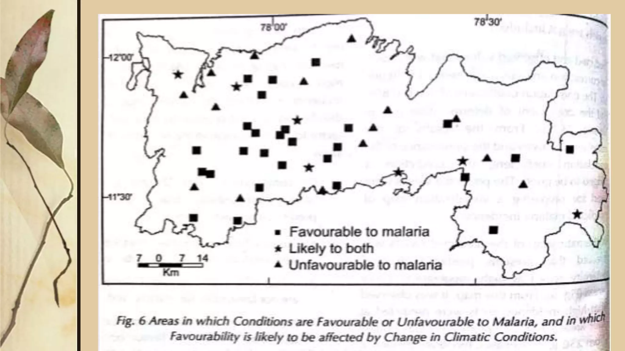
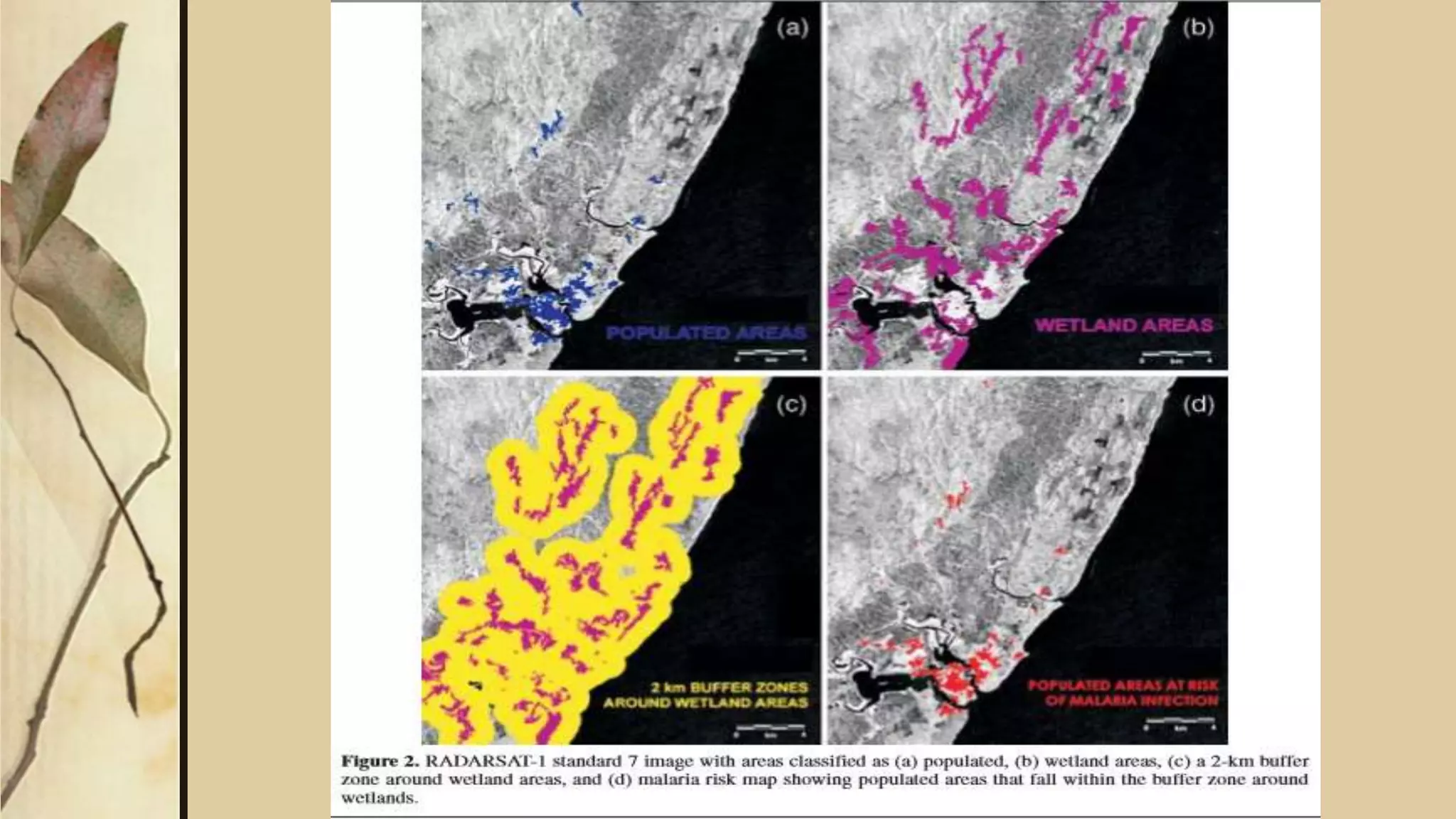
This document discusses using remote sensing and GIS technologies to monitor vector-borne diseases. Specifically, it aims to determine how environmental factors like temperature, rainfall, humidity, forest cover, and water bodies affect disease occurrence. The methodology includes using regression analysis and geostatistical approaches to produce risk maps for predicting and controlling diseases. Remote sensing images and meteorological data are analyzed in GIS to map high, medium, and low risk areas. Radar images offer advantages for this type of analysis as they can image landscapes day or night, through clouds and haze. The results demonstrate how these tools can effectively model disease transmission and promote public health planning.


