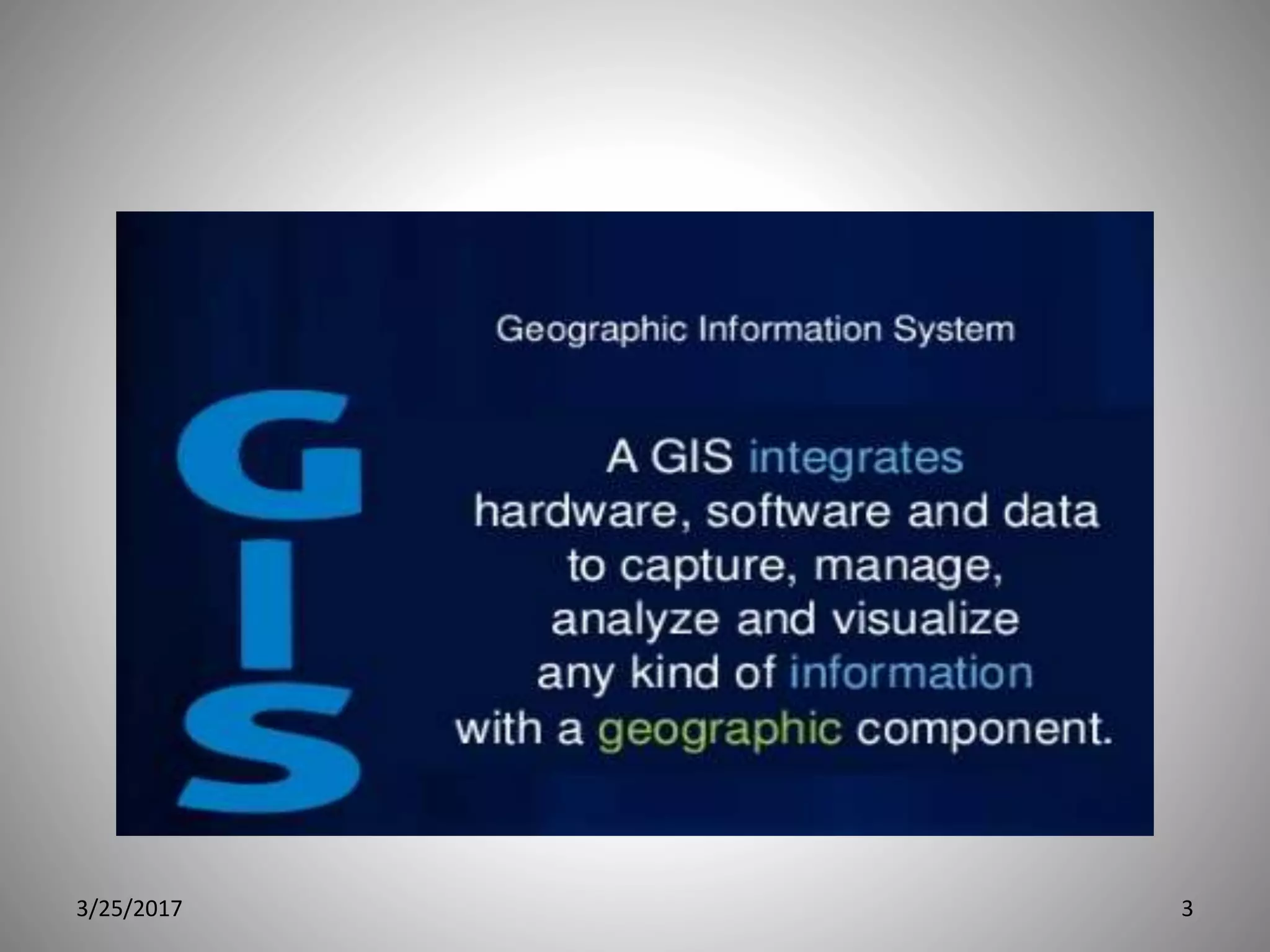
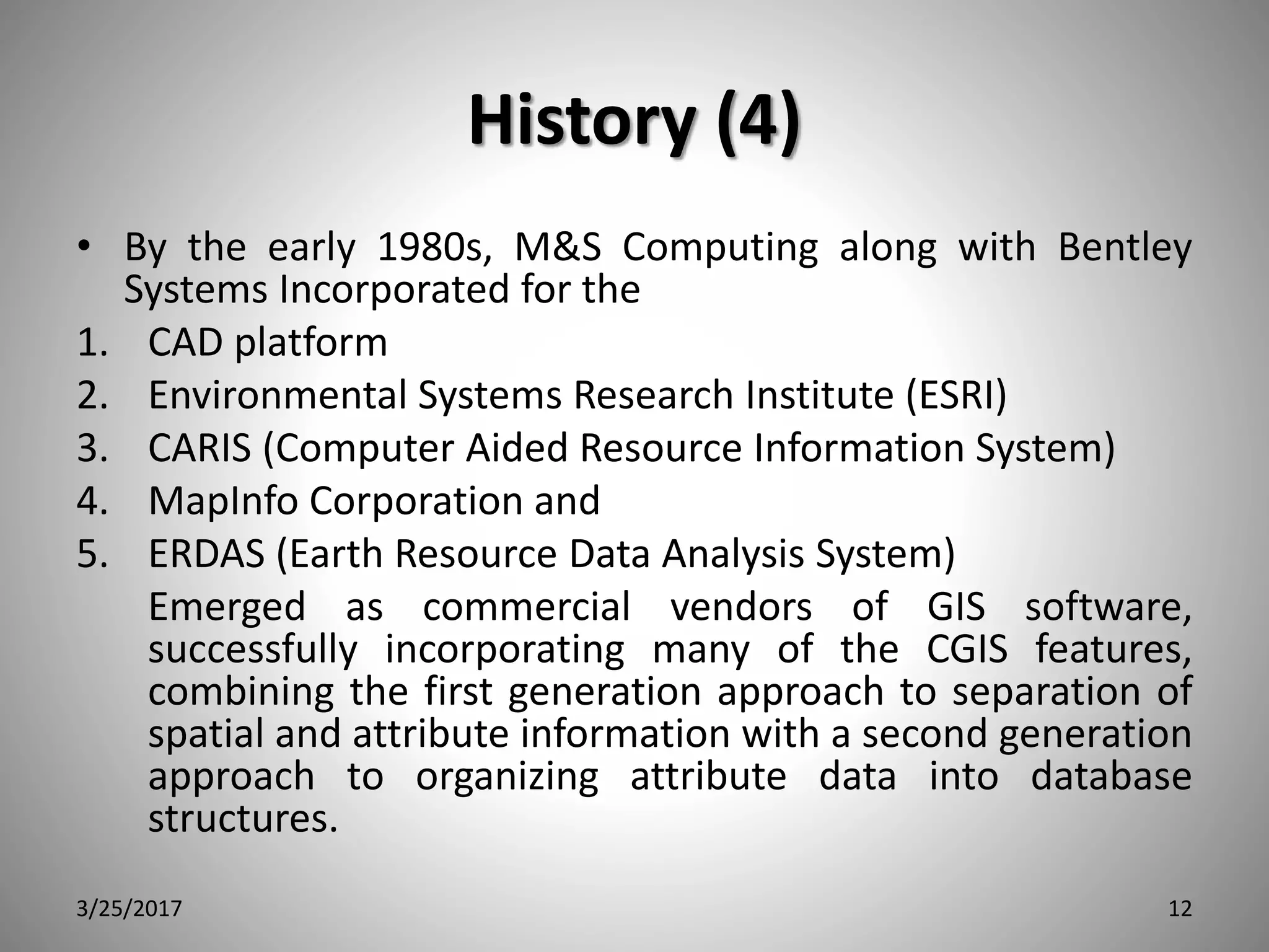
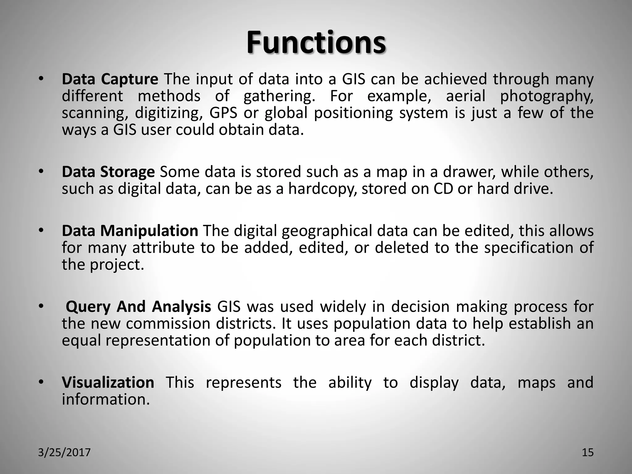
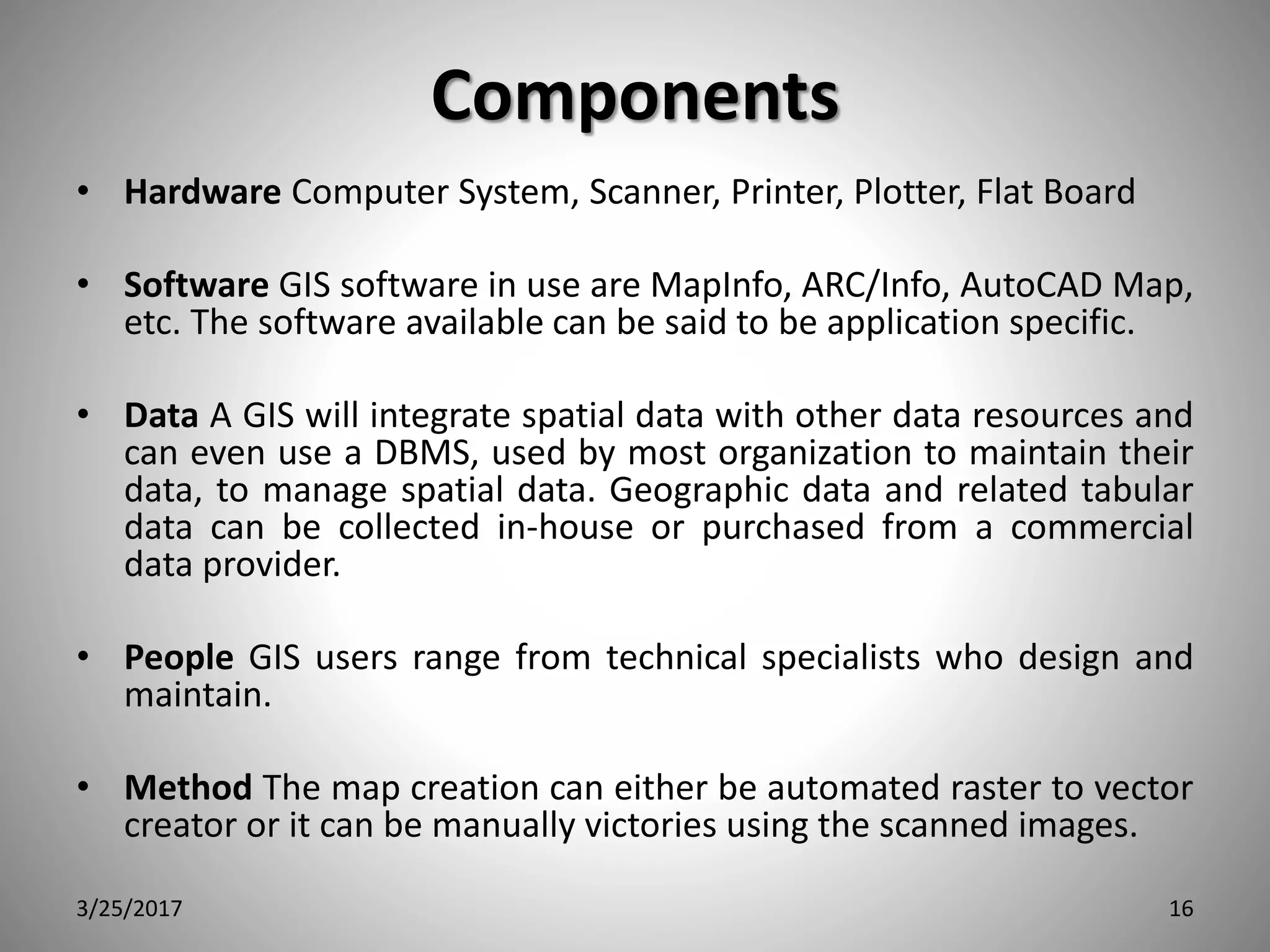
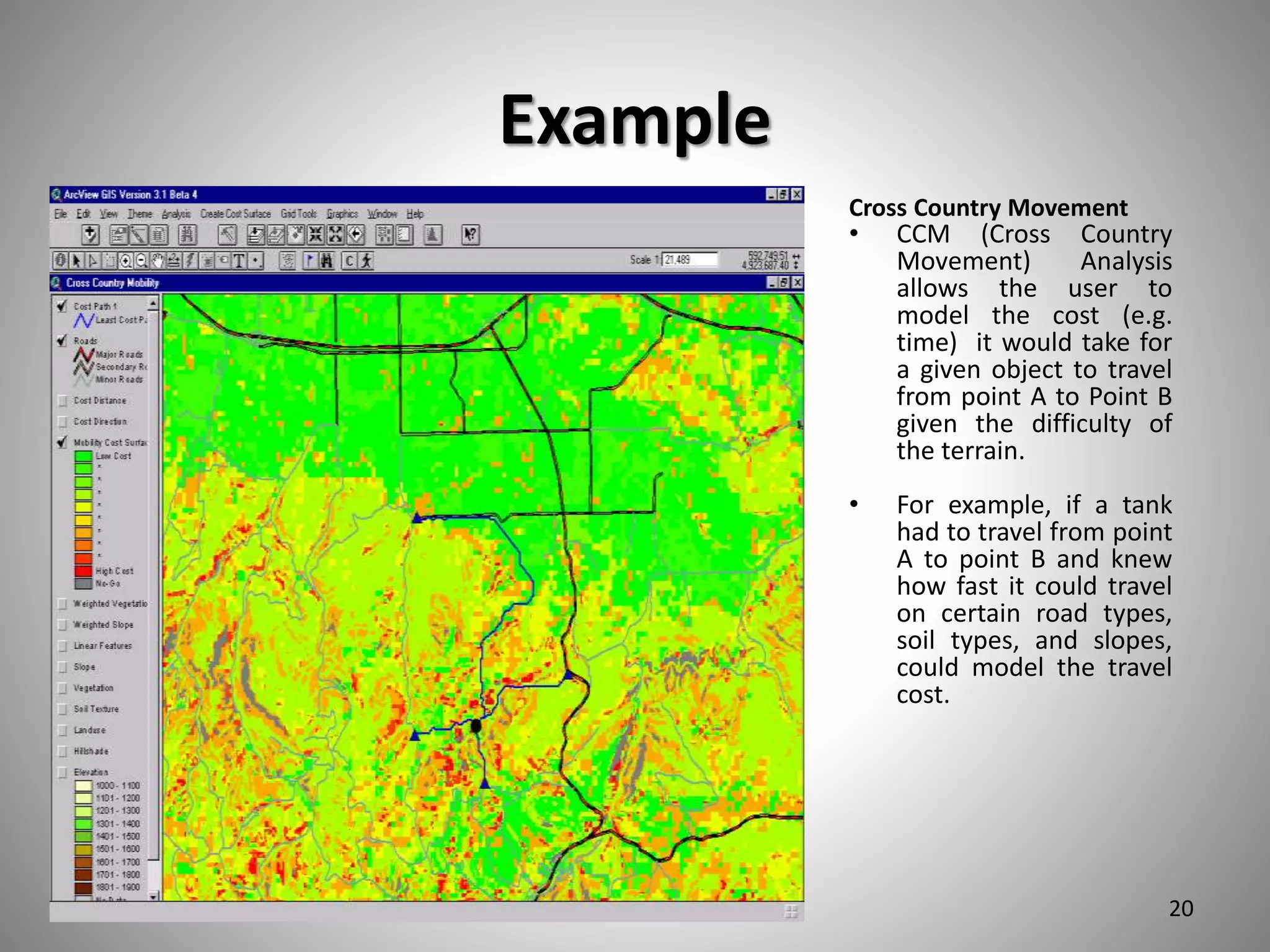
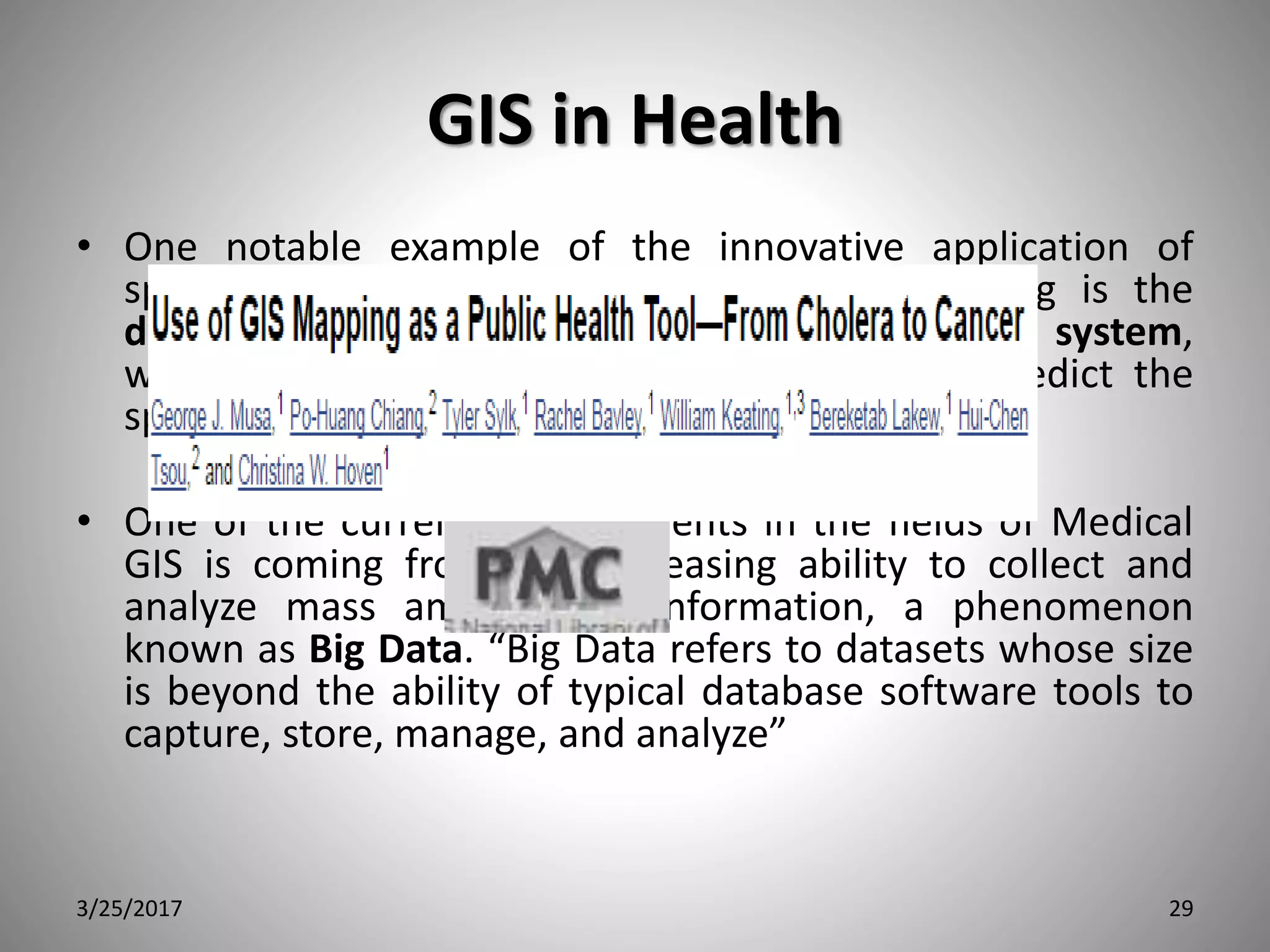
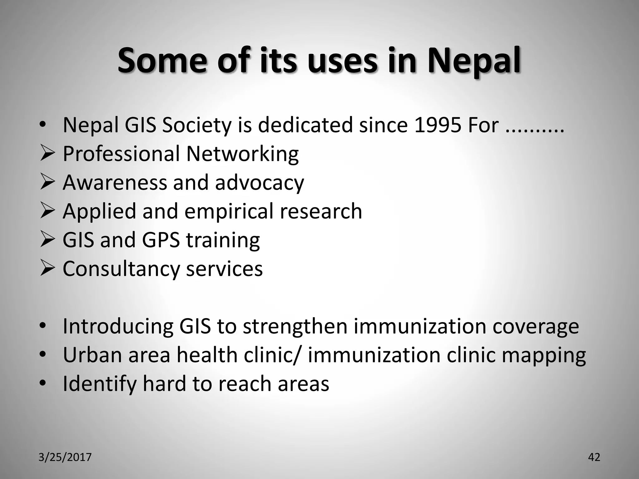
This document discusses the history and applications of geographic information systems (GIS) with a focus on its use in public health. It provides background on GIS, describing it as a set of tools for collecting, storing, manipulating, and displaying spatial data. The document outlines the history of GIS from early maps in the 1850s to the development of computer-based systems in the 1960s-1980s. It then discusses various uses of GIS in public health including disease mapping and surveillance, environmental health analysis, and health resource planning and accessibility analysis. Specific examples of GIS applications in Nepal are also mentioned.


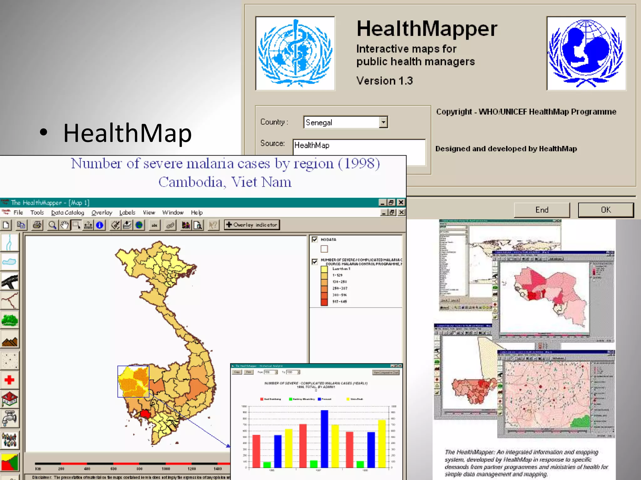


![• Nepal’s Health innovation
https://bibekjournal.wordpress.com/tag/nepal-gis-health-map
• DOHS/Information system/GIS
• CROE polio program/CHD/society for conservation GIS-SGIS Nepal
• ESRI
• Gromley EK, McLafferty SL. GIS and Public Health. New York:
Guilford Press; 2002.
• McLafferty SL. GIS and health care. Annual Review of Public
Health. 2003;24(1):25–42. [PubMed]
• SAS. What Is Big Data? 2013. [Accessed May 22, 2013]. Available
at http://www.sas.com/big-data.
• Zia K, Farrahi K, Riener A, Ferscha A. An agent-based parallel geo-
simulation of urban mobility during city-scale
evacuation. Simulation. 2013:1–31.
3/25/2017 50](https://image.slidesharecdn.com/gis-170325034241/75/Gis-50-2048.jpg)


