Download as PDF, PPTX
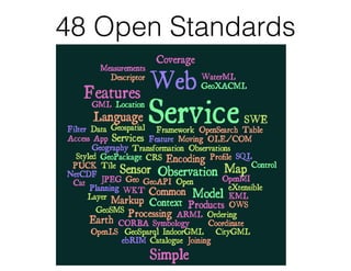
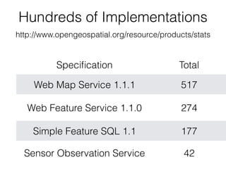
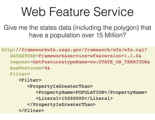
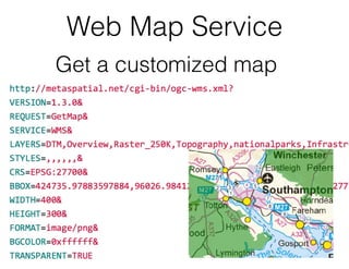

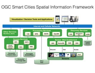


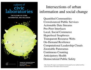

The document summarizes the work of the Open Geospatial Consortium (OGC) in developing open standards for geospatial data and applications to support smart cities. It provides examples of OGC standards and pilots including the Web Feature Service, Sensor Observation Service, Sensor Things API, and CityGML. It introduces the OGC Smart Cities Spatial Information Framework for integrating geospatial data and applications across different city domains and layers. It also discusses social aspects of smart cities and how open data and technologies can promote public services, inclusion, and quality of life.


![Hci [6]interaction design](https://cdn.slidesharecdn.com/ss_thumbnails/hci-6interactiondesign-140116110647-phpapp02-thumbnail.jpg?width=640&height=640&fit=bounds)


![5G Explained! A High Level Overview [Introduction]](https://cdn.slidesharecdn.com/ss_thumbnails/5gexplainedahighleveloverview-260119165306-cc137a3e-thumbnail.jpg?width=640&height=640&fit=bounds)


