Download to read offline


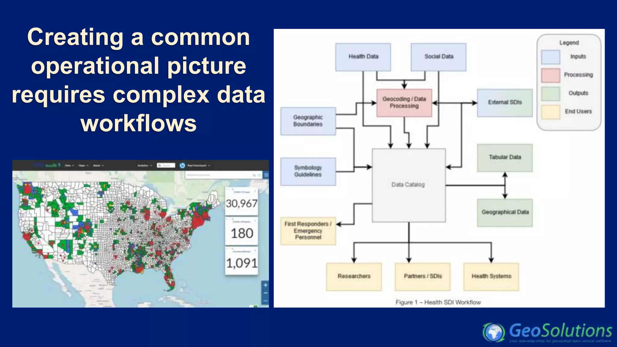

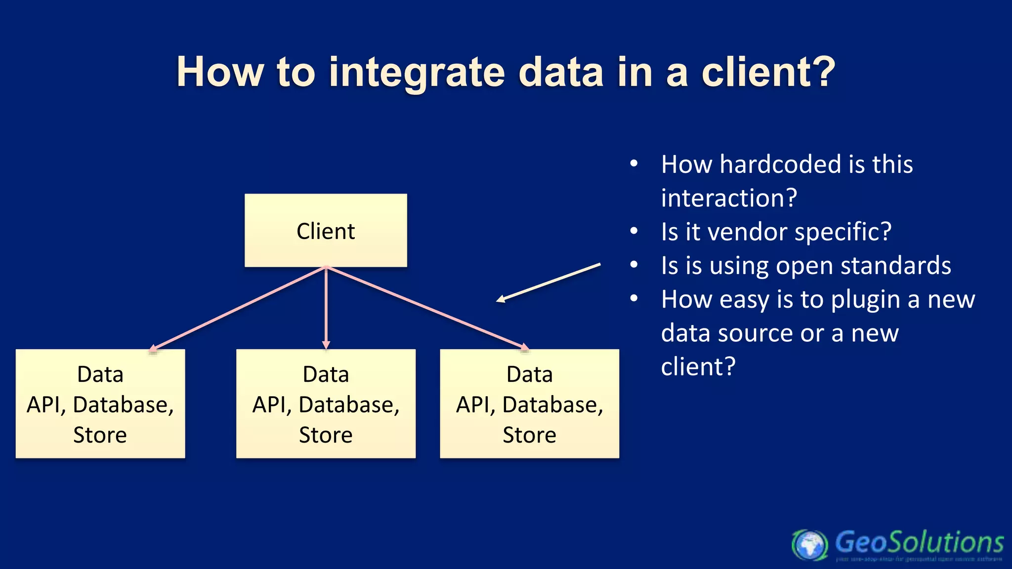
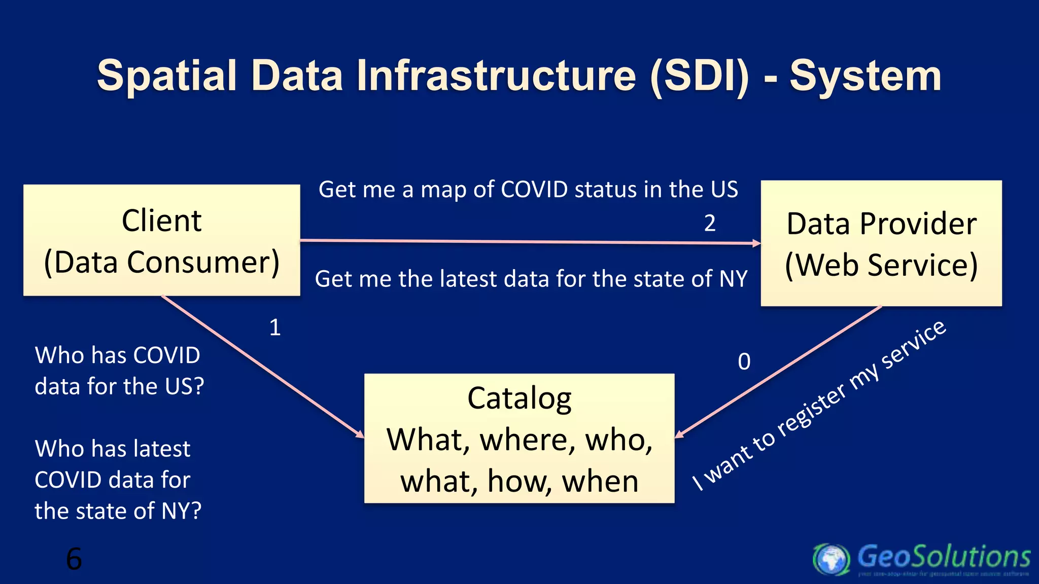


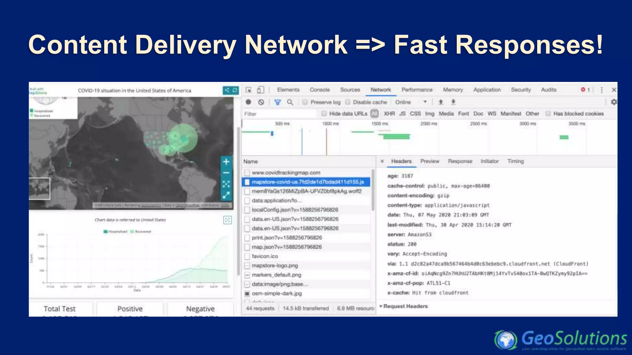
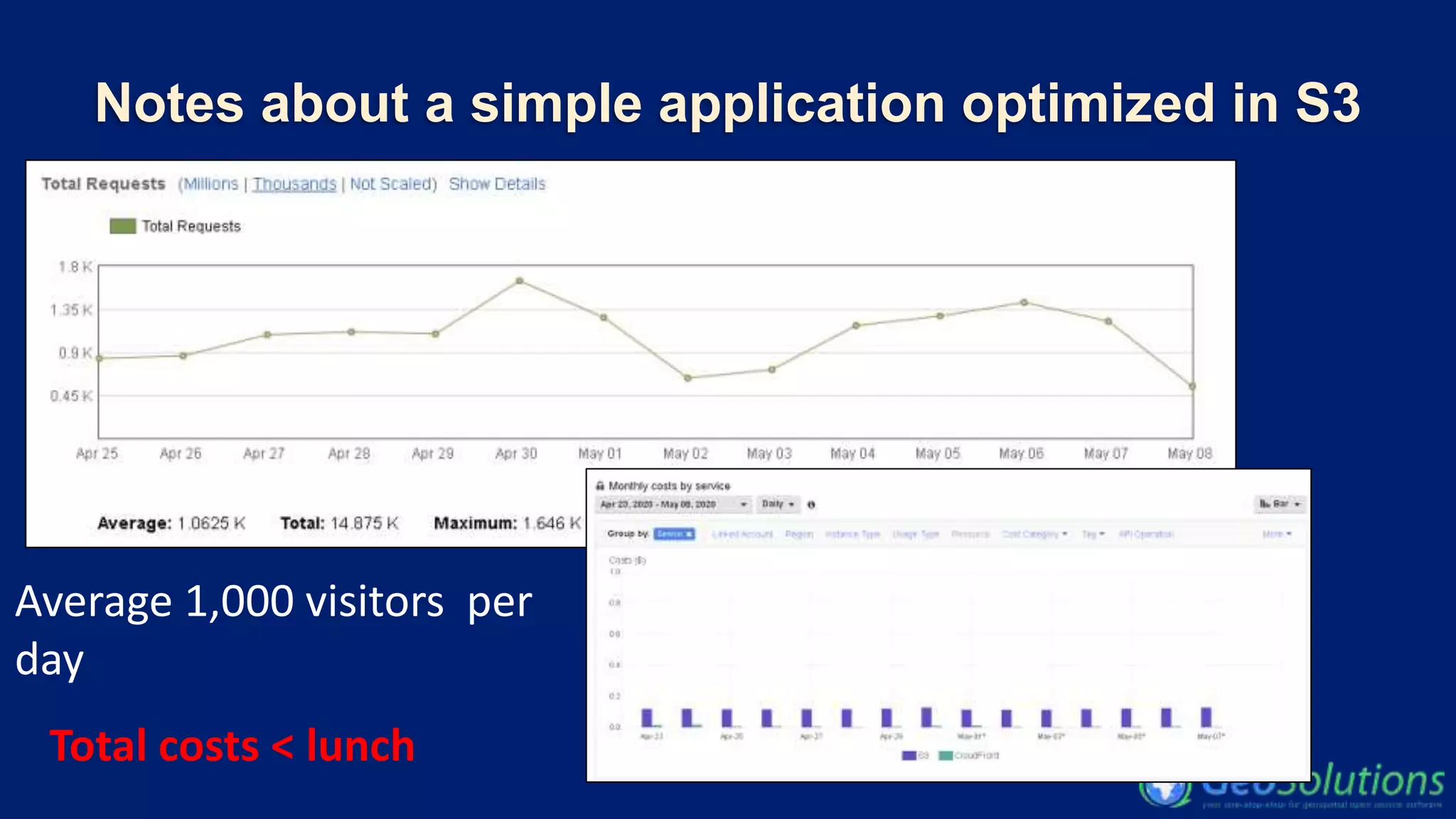
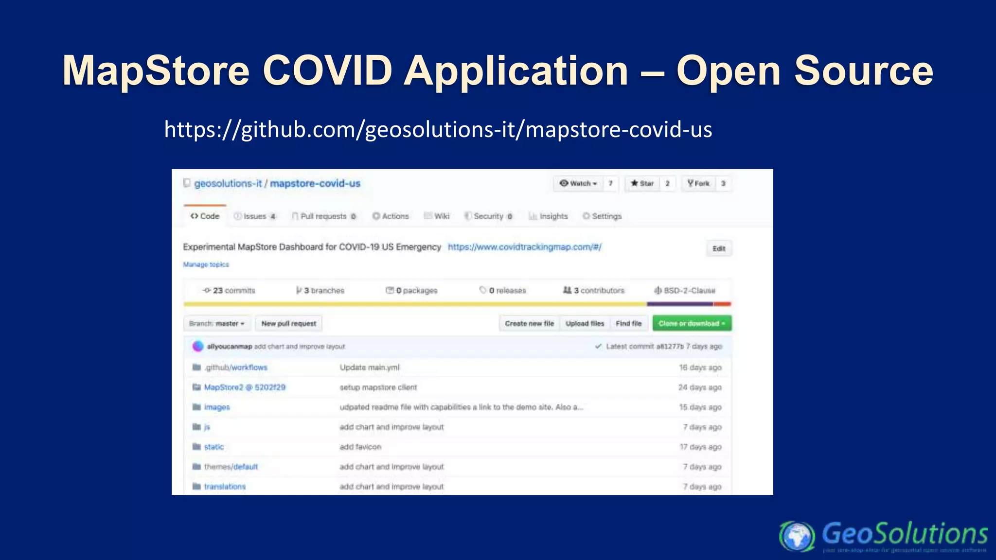


This document discusses an open-source dashboard for COVID-19 data developed by Geosolutions, highlighting their contributions to various geospatial software and initiatives. It outlines the integration of different data sources and the infrastructure required for effective data dissemination. The document also emphasizes the use of open standards and APIs for creating an efficient COVID-19 tracking application while detailing its cost-effectiveness and architecture.


![Vibe Coding vs. Spec-Driven Development [Free Meetup]](https://cdn.slidesharecdn.com/ss_thumbnails/vibecodingvsspecdrivendevelopment-251209105622-43f455e7-thumbnail.jpg?width=640&height=640&fit=bounds)


![Coded Agents – with UiPath SDK + LangGraph [Virtual Hands-on Workshop]](https://cdn.slidesharecdn.com/ss_thumbnails/codedagentsdeck-251215155422-5497c599-thumbnail.jpg?width=640&height=640&fit=bounds)
