CONTENTS
1. INTRODUCTION
2. MINING SCENARIO IN INDIA
3. ALL ABOUT ‘ASTER’
4. APPLICATIONS OF ASTER
5. REMOTE SENSING IN MINING
6. GIS FOR MINERAL EXPLORATION
7. CASE STUDIES & ANALYSIS
MINERAL RESOURCE AND RESERVE DECLARATIONS AND ASSET MANAGEMENT; Resource Evaluation; Mineral Resource Asset Management; Inferred Mineral Resources; Indicated Mineral Resources; Measured Mineral Resources; Mineral reserves; Reserve definition; Feasibility study; GEOLOGIC CONDITIONS AND CHARACTERISTIC OF ORE DEPOSITS; MINE GEOLOGY RESPONSIBILITIES; Geological Database Configuration; Ore Control Process
Introduction of mineral deposits: Mineral deposit ; A geological definition of an ore deposit; Ore Deposit Environments; The significance of ore deposit size; Which commodities are included by the definition of Ore Deposits ; The extraction of an economic commodity from ore ; Geological Factors Affecting Economics of Ore Extraction ; Shape and depth of the deposit; Mineralogy and texture of the ore; The presence of multiple extractable products; Metals enrichment factors; Ore Deposit Constitutes; Ore Deposit Geology and Related Sciences; Structural Control Ore Deposits; Depth of Occurrence Mineral deposits; Nature of Mineralization; Morphology of Ore Deposit; Geographical Localization of Ore Deposits;
Orebodies; oreshoots; ore deposits; ore reserves
Tectonic Processes and Metallogeny along the Tethyan Mountain Ranges of the M...MYO AUNG Myanmar
https://www.researchgate.net/publication/309130798_Tectonic_Processes_and_Metallogeny_along_the_Tethyan_Mountain_Ranges_of_the_Middle_East_and_South_Asia_Oman_Himalaya_Karakoram_Tibet_Myanmar_Thailand_Malaysia
The genesis of mineral deposits has been widely linked to speci c tectonic settings, but has less frequently been linked to tectonic processes. Understanding processes of oceanic and continental collision tectonics is crucial to understanding key factors leading to the genesis of magmatic-, metamorphic-, hydrothermal-, and sedimentary-related mineral deposits. Geologic studies of most ore deposits typically focus on the nal stages of concentration and emplacement. The ultimate source (mantle, lower crust, upper crust) of mineral deposits in many cases remains more cryptic. Uniquely, along the Tethyan collision zones of Asia, every stage of the conver- gence process can be studied from the initial oceanic settings where ophiolite complexes were formed, through subduction zone and island-arc settings with ultrahigh- to high-pressure metamorphism, to the continental col- lision settings of the Himalaya, and advanced, long-lived collisional settings such as Afghanistan, the Karakoram Ranges, and the Tibetan plateau. The India-Asia collision closed the intervening Neotethys ocean at ~50 Ma and resulted in the formation of the Himalayan mountain ranges, and increased crustal thickening, metamor- phism, deformation, and uplift of the Karakoram-Hindu Kush ranges, Tibetan plateau, and older collision zones across central Asia. Metallogenesis in oceanic crust (hydrothermal Cu-Au; Fe, Mn nodules) and mantle (Cr, Ni, Pt) can be deduced from ophiolite complexes preserved around the Arabia/India-Asia collision (Oman, Ladakh, South Tibet, Myanmar, Andaman Islands). Tectonic-metallogenic processes in island arcs and ancient subduc- tion complexes (VMS Cu-Zn-Pb) can be deduced from studies in the Dras-Kohistan arc (Pakistan) and the various arc complexes along the Myanmar-Andaman segment of the collision zone. Metallogenesis of Andean- type margins (Cu-Au-Mo porphyry; epithermal Au-Ag) can be seen along the Jurassic-Eocene Transhimalayan ranges of Pakistan, Ladakh, South Tibet, and Myanmar. Large porphyry Cu deposits in Tibet are related to both precollisional calc-alkaline granites and postcollisional alkaline adakite-like intrusions. Metallogenesis of continent-continent collision zones is prominent along the Myanmar-Thailand-Malaysia Sn-W granite belts, but less common along the Himalaya. The Mogok metamorphic belt of Myanmar is known for its gemstones associated with regional high-temperature metamorphism (ruby, spinel, sapphire, etc). In Myanmar it is likely that extensive alkaline magmatism has contributed extra heat during the formation of high-temperature meta- morphism. This paper attempts to link metallogeny of the Himalaya-Karakoram-Tibet and Myanmar collision zone to tectonic processes derived from multidisciplinary geologic studies.
Slides related to wall rock alteration.In these slides it is described that how host rock behave when it comes in contact with the hydro thermal fluid coming from deep Earth (Mantle) and their results.
THE PRESENCE AND VARIETY OF A PARTICULAR PLANTS
SPECIES IN THE AREA OF MINERALISATION HAVE BEEN RECOGNISED AS A GUIDE TO LOCATING ORE, METHOD,UNIVERSAL INDICATORS , UNIVERSAL INDICATOR ,LOCAL INDICATOR
Geology is the one of the most interesting subject about mother earth which can be best studied on field. This report of geological field work done at Chobhar area, Kathmandu consists observation with analysis regarding geological features, structures and processes.
Information about these fluids is an invaluable aid in mineral exploration.
Conventional academic methods of analysing fluid inclusions are too slow and tedious to be of practical application in typical mineral exploration activities.
However, the academic data from numerous studies does show that CO2 is an exceptionally important indicator when exploring for most types of gold deposit.
Because the baro-acoustic decrepitation method is a rapid and reliable method to measure CO2 contents in fluids, it can be used to study a spatial array of data and it is an invaluable and practical exploration method.
Measurements of temperatures of fluid inclusions does not usually help in mineral exploration as hydrothermal minerals deposit over a wide temperature range and there is no specific temperature which is indicative of mineralisation. However, if temperatures are available on a large spatial array of samples, then temperature trends may be a useful exploration method to find the hottest part of the system, which is presumably the location of the best economic mineralisation. Baro-acoustic decrepitation is the most practical method to determine temperatures of the large numbers of samples required.
Salinities of fluid inclusions are of limited use in exploration and are difficult to measure. However, they can be used to recognise intrusion related hydrothermal systems.
“Cadastral Maps for Socio-Economic Data Visualization and Integration for Lan...irjes
The impact of mining and mineral extraction activities can be significant on the surrounding land,
water and air bodies, in any operational area. The environmental degradation ranges from localized surface and
ground water contamination to the damaging effects of airborne pollutants on the regional ecosystem; which
need the properly designed geospatial database. The monitoring of these environmental impacts requires a userfriendly
and cost effective method to quantify the land cover changes over large time periods. Now-a-days, it
has become compulsory to use the remote sensing techniques for regular monitoring of these environmental
hazards in-and-around the mining areas using cadastral map. This paper provides a case study on the use of
geospatial techniques for environmental monitoring in the mining areas.
The International Journal of Engineering & Science is aimed at providing a platform for researchers, engineers, scientists, or educators to publish their original research results, to exchange new ideas, to disseminate information in innovative designs, engineering experiences and technological skills. It is also the Journal's objective to promote engineering and technology education. All papers submitted to the Journal will be blind peer-reviewed. Only original articles will be published.
Research Inventy : International Journal of Engineering and Science is published by the group of young academic and industrial researchers with 12 Issues per year. It is an online as well as print version open access journal that provides rapid publication (monthly) of articles in all areas of the subject such as: civil, mechanical, chemical, electronic and computer engineering as well as production and information technology. The Journal welcomes the submission of manuscripts that meet the general criteria of significance and scientific excellence. Papers will be published by rapid process within 20 days after acceptance and peer review process takes only 7 days. All articles published in Research Inventy will be peer-reviewed.
The article linked to (below) is somewhat of an odyssey. It commences with discussion on, possibly, the first land information system in Australia and my association with it - Eurobodalla.
It then briefly describes follow on applications including a military terrain-mapping product. Subsequent products cover the littoral zone for beach landings. So, it could be described as terrain intelligence.
This idea stemmed from the D-Day invasion maps (Benson and Bigot).
And, so, follows the Benson and Bigot story – an amazing cartographic accomplishment. To view a video of this stunning activity view the link at the end of the article
The article linked to (below) is somewhat of an odyssey. It commences with discussion on, possibly, the first land information system in Australia and my association with it - Eurobodalla.
It then briefly describes follow on applications including a military terrain-mapping product. Subsequent products cover the littoral zone for beach landings. So, it could be described as terrain intelligence.
This idea stemmed from the D-Day invasion maps (Benson and Bigot).
And, so, follows the Benson and Bigot story – an amazing cartographic accomplishment. To view a video of this stunning activity view the link at the end of the article.
Identification Of Ground Water Potential Zones In Tamil Nadu By Remote Sensin...IJERA Editor
A case study was conducted to find out the groundwater potential zones in Salem, Erode and Namakkal districts, Tamil Nadu, India with an aerial extent of 360.60 km2. The thematic maps such as geology, geomorphology, soil hydrological group, land use / land cover and drainage map were prepared for the study area. The Digital Elevation Model (DEM) has been generated from the 10 m interval contour lines (which is derived from SOI, Toposheet 1:25000 scale) and obtained the slope (%) of the study area. The groundwater potential zones were obtained by overlaying all the thematic maps in terms of weighted overlay methods using the spatial analysis tool in Arc GIS 9.3. During weighted overlay analysis, the ranking has been given for each individual parameter of each thematic map and weights were assigned according to the influence such as soil −25%, geomorphology − 25%, land use/land cover −25%, slope − 15%, lineament − 5% and drainage / streams − 5% and find out the potential zones in terms of good, moderate and poor zones with the area of 49.70 km2, 261.61 km2 and 46.04 km2 respectively. The potential zone wise study area was overlaid with village boundary map and the village wise groundwater potential zones with three categories such as good, moderate and poor zones were obtained. This GIS based output result was validated by conducting field survey by randomly selecting wells in different villages using GPS instruments. The coordinates of each well location were obtained by GPS and plotted in the GIS platform and it was clearly shown that the well coordinates were exactly seated with the classified zones.
Rapid Damage and Needs Assessment Report (RDNA), post-Cyclone Phailin in Odisha, was prepared in response to a request from the Department of Economic Affairs (DEA), Government of India (GoI). It was undertaken jointly by the Government of Odisha (GoO), the Asian Development Bank and the World Bank.
The RDNA team visited Bhubaneswar (Odisha) and the three most severely affected districts of Ganjam, Puri and Khordha, from November 26 to December 3 2013, and collaborated with the GoO to assess the damage and develop a recovery and restoration framework.
The Kaldor-Hicks Compensation Principle was given by British Economists Nicholas Kaldor And Noble laureate John Hicks. Both are famous for giving their contribution to economic concepts in the existing knowledge of literature.
This report focuses on the Cost-Benefit Analysis which is effective tool and a rational technique for economic valuation where market information is either non-existent or deficient is.
‘Separation of sample components after their distribution between two phases.’’ - IUPAC definition
Ion Chromatography (IC) was introduced in 1975 by Small, Stevens and Baumann as a new analytical method for sensitive detection of ions via their electrical conductance. Chromatography is a separation technique that is used for separation a sample mixture into its constituents or components.
Paper Review of Local building materials: affordable strategy for housing the...Hrishikesh Satpute
The PowerPoint presentation is a review of a Journal Article "Local building materials: affordable strategy for housing the Urban poor in Nigeria."by Iwuagwu Ben Ugochukwua, Iwuagwu Ben Chioma Mb.
The paper examines the national housing need and housing provision, major constrain in delivery of low cost housing in Nigeria by recommending locally produced building materials and intermediate technology which can reduce construction cost by about 60%.
Analysed Parameters:
1.Condition Of Census House
2.Housing Structure
3.Ownership Status Of The House
4.Material of Roof and Wall
5.Number of Dwelling Rooms
6.Latrine Facility
7.Status of Housing
8.Housing Demand, Supply and Shortage
9.Obsolescence Factor
10.Homeless Factor
Acetabularia Information For Class 9 .docxvaibhavrinwa19
Acetabularia acetabulum is a single-celled green alga that in its vegetative state is morphologically differentiated into a basal rhizoid and an axially elongated stalk, which bears whorls of branching hairs. The single diploid nucleus resides in the rhizoid.
Honest Reviews of Tim Han LMA Course Program.pptxtimhan337
Personal development courses are widely available today, with each one promising life-changing outcomes. Tim Han’s Life Mastery Achievers (LMA) Course has drawn a lot of interest. In addition to offering my frank assessment of Success Insider’s LMA Course, this piece examines the course’s effects via a variety of Tim Han LMA course reviews and Success Insider comments.
June 3, 2024 Anti-Semitism Letter Sent to MIT President Kornbluth and MIT Cor...Levi Shapiro
Letter from the Congress of the United States regarding Anti-Semitism sent June 3rd to MIT President Sally Kornbluth, MIT Corp Chair, Mark Gorenberg
Dear Dr. Kornbluth and Mr. Gorenberg,
The US House of Representatives is deeply concerned by ongoing and pervasive acts of antisemitic
harassment and intimidation at the Massachusetts Institute of Technology (MIT). Failing to act decisively to ensure a safe learning environment for all students would be a grave dereliction of your responsibilities as President of MIT and Chair of the MIT Corporation.
This Congress will not stand idly by and allow an environment hostile to Jewish students to persist. The House believes that your institution is in violation of Title VI of the Civil Rights Act, and the inability or
unwillingness to rectify this violation through action requires accountability.
Postsecondary education is a unique opportunity for students to learn and have their ideas and beliefs challenged. However, universities receiving hundreds of millions of federal funds annually have denied
students that opportunity and have been hijacked to become venues for the promotion of terrorism, antisemitic harassment and intimidation, unlawful encampments, and in some cases, assaults and riots.
The House of Representatives will not countenance the use of federal funds to indoctrinate students into hateful, antisemitic, anti-American supporters of terrorism. Investigations into campus antisemitism by the Committee on Education and the Workforce and the Committee on Ways and Means have been expanded into a Congress-wide probe across all relevant jurisdictions to address this national crisis. The undersigned Committees will conduct oversight into the use of federal funds at MIT and its learning environment under authorities granted to each Committee.
• The Committee on Education and the Workforce has been investigating your institution since December 7, 2023. The Committee has broad jurisdiction over postsecondary education, including its compliance with Title VI of the Civil Rights Act, campus safety concerns over disruptions to the learning environment, and the awarding of federal student aid under the Higher Education Act.
• The Committee on Oversight and Accountability is investigating the sources of funding and other support flowing to groups espousing pro-Hamas propaganda and engaged in antisemitic harassment and intimidation of students. The Committee on Oversight and Accountability is the principal oversight committee of the US House of Representatives and has broad authority to investigate “any matter” at “any time” under House Rule X.
• The Committee on Ways and Means has been investigating several universities since November 15, 2023, when the Committee held a hearing entitled From Ivory Towers to Dark Corners: Investigating the Nexus Between Antisemitism, Tax-Exempt Universities, and Terror Financing. The Committee followed the hearing with letters to those institutions on January 10, 202
Read| The latest issue of The Challenger is here! We are thrilled to announce that our school paper has qualified for the NATIONAL SCHOOLS PRESS CONFERENCE (NSPC) 2024. Thank you for your unwavering support and trust. Dive into the stories that made us stand out!
Macroeconomics- Movie Location
This will be used as part of your Personal Professional Portfolio once graded.
Objective:
Prepare a presentation or a paper using research, basic comparative analysis, data organization and application of economic information. You will make an informed assessment of an economic climate outside of the United States to accomplish an entertainment industry objective.
Introduction to AI for Nonprofits with Tapp NetworkTechSoup
Dive into the world of AI! Experts Jon Hill and Tareq Monaur will guide you through AI's role in enhancing nonprofit websites and basic marketing strategies, making it easy to understand and apply.
Palestine last event orientationfvgnh .pptxRaedMohamed3
An EFL lesson about the current events in Palestine. It is intended to be for intermediate students who wish to increase their listening skills through a short lesson in power point.
2024.06.01 Introducing a competency framework for languag learning materials ...Sandy Millin
http://sandymillin.wordpress.com/iateflwebinar2024
Published classroom materials form the basis of syllabuses, drive teacher professional development, and have a potentially huge influence on learners, teachers and education systems. All teachers also create their own materials, whether a few sentences on a blackboard, a highly-structured fully-realised online course, or anything in between. Despite this, the knowledge and skills needed to create effective language learning materials are rarely part of teacher training, and are mostly learnt by trial and error.
Knowledge and skills frameworks, generally called competency frameworks, for ELT teachers, trainers and managers have existed for a few years now. However, until I created one for my MA dissertation, there wasn’t one drawing together what we need to know and do to be able to effectively produce language learning materials.
This webinar will introduce you to my framework, highlighting the key competencies I identified from my research. It will also show how anybody involved in language teaching (any language, not just English!), teacher training, managing schools or developing language learning materials can benefit from using the framework.
3. STAGE 1 : INTRODUCTION
What Is Mining ?
Environmental Problems caused by Mining
Mining Stages
Overview in India
Characteristics and Properties of Minerals
Use of Minerals
4. 1. Mine:
An excavation made in the earth to extract minerals.
2. Mining:
Mining is a process of extracting mineral from earth
interferes with elements of environment which in turn
affects the growth and survival of flora and fauna and also
affect the life on the earth.
OR
The activity, occupation, and industry concerned
with the extraction of minerals.
WHAT IS MINING ?
Image No. 1. Excavators Used In Mining
DEFINITIONS:
5. 1. Pollution of ground water and surface water
2. Loss of Productive Land
3. Loss of Soil Fertility
4. Air pollution
5. Noise pollution
6. Disturbance of soil strength
7. Deforestation, etc.
ENVIRONMENTAL PROBLEMS CAUSED
BY MINING
Image No. 2. Effects of bauxite
mining
6. STAGES IN MININIG
Time : 1 — 3Yr
1. Prospecting (Mineral Deposit) 2. Exploration (Ore Body)
Time : 2 — 5Yr
A. Prospecting methods :
i. Direct: physical geologic
ii. Indirect: geophysical, geochemical
B. Locate favorable loci
(maps,literature,old mines)
B. Air: aerial photography, airborne
geophysics, satellite
d. Surface:
ground geophysics,geology
e. Spot anomaly,analyze,
evaluate
9. Due to the nature of the process of mineral exploration, geologists deal with a variety of
data from different sources to explore for mineral deposits.They need to display and interpret
this information quickly and easily. So, the study divided into several stages:
1. - Design the geodatabase according to the information that will go to be needed.
2. - Collect different datasets from a variety of sources and select the datasets which related to
the study.
3. - Define the geological features based on the geological background and concepts that
indicate to an area of mineralization.
4. - Bring all the datasets within the geodatabase along with all available and previous maps,
charts and studies.
5. - Defining regions of interest from maps and graphs and it'll be created using a shape file
from ArcGIS.
METHODOLOGY
10.
11. India is a mineral
richcountryandhasfavourablegeologicalmilieuwhichisyettobefullyexplored,assessedandexploite
d.
•ExplorationactivitiesinIndiaaremostlycarriedoutbyGSI,MECL,variousStateDGMs,publicsectoru
ndertakings(PSU)andprivatesectorentitiesbothdomesticandsubsidiariesofmanyglobalcompanie
s.
•Indiahasatotallandareaof3.2875millionsq.km.spreadacross5,065toposheetsandanareaof3.146
millionsq.km.ismappableandGSIhascovered3.09611millionsq.km.(98.41%)on1:50,000scaletillM
arch31,2013.
•GSIhasidentified0.571millionsq.km.asObviousGeologicalPotential(OGP)areaforminerals.Amaj
orpartofthisOGPareaisyettobefullyexplored.
TheGDPcontributionoftheminingindustryvariesfrom2.2%to2.5%onlybutgoingbytheGDPofthet
otalindustrialsectoritcontributesaround10%to11%.
Indianminingindustryprovidesjobopportunitiestoaround700,000individuals.
MINERAL EXPLORATION IN INDIA
13. Major Minerals include coal, manganese ore, iron
ore, bauxite, limestone,
kyanite, sillimanite, barites, chromite, silica sand,
fluorite, quartz, sand used for stowing
purposes in coal mines and many other minerals
USED FOR INDUSTRIAL PURPOSE
Minor Mineral have been defined under section
3 (e) of Mines and Minerals (Regulation and
development) Act, 1957.They include building
stones, gravel, ordinary clay, ordinary sand,
limestone used for lime burning, boulders, kankar,
murum, brick earth, bentonite, road metal, slate,
marble, stones used for making household
utensils etc
REGULATION OF MINERALS (MAJOR/MINOR)
14. The policy level guidelines for mineral sector is given by the National
Mineral Policy of 2008.
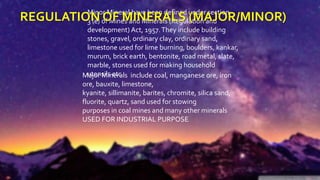
Mining operations are regulated under the Mines and Minerals
(Development and Regulation) [MMDR] Act of 1957.
The State Governments, as owners of minerals, grant mineral
concessions and collect royalty, dead rent and fees as per the
provisions of MMDR Act 1957.These revenues are held in the
Consolidated Fund of State Government until the state legislature
approves their use through budgetary processes.
In a recent development, the Supreme Court has said that "Ownership
of minerals should be vested with the owner of the land and not with
the government.”
15. •The Advanced Space bornThermal Emission and Reflection Radiometer(ASTER) is a
NASA instrument on the earth observing system(EOS)Terra platform.
• It provides visible & near infrared(VNIR), shortwave-infrared (SWIR), long-wave
infrared(LWIR) Earth observations in 14 spectral bands (plus one backward looking band).
ASTER IMAGES FOR MINERAL EXPLORATION
Table-1: Characteristics of ASTER
16. 4VNIR Bands:
Provide information about Iron mineralogy and Rare earth minerals(fluoride, apatite,
titanite, ect..,).
6 SWIR Bands:
Mapping of molecular vibration absorption features. Ex:- carbonates and clays.
5 LWIR Bands:
Mapping of silica content in surface exposures
ASTER has 95% coverage of earth’s landmass, so ASTER images are a readily available
data set that can provide timely and accurately positioned spatial information to facilitate fast
mining activities around the world.
ASTER provides data that will greatly improve geologists abilities to produce more
accurate geologic maps at a fraction of the cost of conventional ground-based methods.
ASTER data have characteristics that are particularly useful for geologic
studies, especially where the rocks are well exposed.
17. • GIS can help in many aspects of the mineral exploration activities: data collection,
management, analysis, and reporting.
• Field geologists capture field data electronically using ArcPad and GPS receivers.
• Data sources for mineral exploration vary from geologic maps, multispectral satellite
images, and geophysical images to databases in many formats.
• GIS is an ideal platform to integrate the all above data sources together and
deliver meaningful outcomes.
HOW GIS USED ?
18. 1. B.K.Bhadra et.al, (2012)
Explained how SWIR bands are used in identification of alteration zones which have
developed during hydrothermal activity.
2. Bob Agar (2005)
Discussed on processing of ASTER level 1B images for radiance at the sensor &
locating different minerals by developing algorithms and compared with reference spectra
are taken from the USGS spectral library.
LITERATURE REVIEW : CASE STUDY
19. 1. Most of the data related to the operations of mineral exploration have a spatial nature. So,
GIS has the capability for storage, updating, revising, displaying, retrieving, processing,
manipulating and integrating of different geo-spatial data.
2. Recently, GIS technology able to help geoscientists and geologists in mapping and
modeling the subsurface by a modern tools and softwares packages and can be integrated
with other specialized 3D programs to get a precious results. All this just act as additional
properties to its traditional functionality.
3. Now it is important to finish polishing the tool so it can be used to advance the mineral
exploration process while saving time and money and increasing profitability and efficacy.
CONCLUSION
20. “MINING IS LIKE
A SEARCH AND
DESTROY MISSION”
-Anonymous
THANK YOU… EDITED BY –
@ME_HRISHI_7