SlideShare a Scribd company logo
CASE STUDY:
GAYA, BIHAR
ASSIGNMENT – II
INFRASTRUCTURE PLANNING
Report by:
Hrishikesh Satpute (2019MEP012)
Guided by:
Gaurav Vaidya
The Great Buddha Statue, Gaya
_____________________________________________________________________________________
Infrastructure Planning Assignment – II 1
Physical Infrastructure Assessment Report: A case study of Gaya, Bihar
TABLE OF CONTENTS
1. Introduction ________________________________________________________________________5
1.1 Background _____________________________________________________________________5
1.2. Physiography, Topography and Natural Slope __________________________________________5
1.3. Administrative Setup of the District __________________________________________________6
1.4. Climate ________________________________________________________________________6
1.5. Existing Spatial Growth____________________________________________________________6
2. City Profile__________________________________________________________________________6
3. Regional Context_____________________________________________________________________8
4. Demography ________________________________________________________________________9
5. Infrastructure Assessment ____________________________________________________________10
5.1. Water Supply__________________________________________________________________ 10
5.1.1. Issues and Findings _________________________________________________________ 11
5.1.2. Key Strategies _____________________________________________________________ 11
5.2. Sewerage and Sanitation ________________________________________________________ 11
5.2.1. Issues and Findings _________________________________________________________ 12
5.2.2. Key Strategies _____________________________________________________________ 12
5.3. Storm Water Drainage __________________________________________________________ 12
5.3.1. Issues and Findings _________________________________________________________ 13
5.3.2. Key Strategies _____________________________________________________________ 13
5.4. Solid Waste Management________________________________________________________ 13
5.4.1. Issues and Findings _________________________________________________________ 13
5.4.2. Key Strategies _____________________________________________________________ 14
5.5. Roads, Traffic, and Transportation _________________________________________________ 14
5.5.1. Issues and Findings _________________________________________________________ 15
5.5.2. Key Strategies _____________________________________________________________ 15
6. Capital Investment Plan (CIP) __________________________________________________________15
7. Financial Operating Plan (FOP) _________________________________________________________16
8. Bibliography and References __________________________________________________________18
_____________________________________________________________________________________
Infrastructure Planning Assignment – II 2
Physical Infrastructure Assessment Report: A case study of Gaya, Bihar
LIST OF TABLES
Table 1: Phase wise Investments in Water Supply sector ................................................................................ 10
Table 2 : Phase wise Investments in Sewerage and Sanitation sector ............................................................. 12
Table 3 : Phase wise Investments in Storm Water Drainage sector................................................................. 13
Table 4 : Phase wise Investments in Solid Waste Management sector............................................................ 13
Table 5 : Phase wise Investments in Roads, Traffic, and Transportation sector .............................................. 14
Table 6 : Capital Investment Plan ..................................................................................................................... 16
Table 7 : Financial Operating Plan..................................................................................................................... 17
_____________________________________________________________________________________
Infrastructure Planning Assignment – II 3
Physical Infrastructure Assessment Report: A case study of Gaya, Bihar
LIST OF FIGURES
Figure 1 : Location of Gaya district ......................................................................................................................5
Figure 2 : Location of Bodh Gaya tehsil /CD block...............................................................................................5
Figure 3 : The Great Buddha Statue - Gaya, Bihar ...............................................................................................5
Figure 4 : Mahabodhi Temple - Gaya, Bihar ........................................................................................................5
Figure 5 : Map showing Gaya City statutory limit................................................................................................7
Figure 6 : Map showing Ward map of Gaya.........................................................................................................8
Figure 7 : Map showing Regional Network..........................................................................................................9
Figure 8: Population Projection till 2030 for Gaya, Bihar ................................................................................. 10
Figure 9 : Map showing Water Supply infrastructure of Gaya ......................................................................... 11
Figure 10 : Map showing Existing Roads and Transportation of Gaya ............................................................. 15
_____________________________________________________________________________________
Infrastructure Planning Assignment – II 4
Physical Infrastructure Assessment Report: A case study of Gaya, Bihar
ABBREVATIONS
CIP – Capital Investment Plan
FOP – Financial Operating Plan
DSCR – Debt Service Coverage Ratio
LPCD – Litre Per Capita per Day
MLD – Million Litres per Day
NH – National Highway
OHT – Overhead Tank
O&M – Operation and Maintenance
PPHA – Persons per Hectare
RCC – Reinforced Concrete Cement
SH – State Highway
SWM – Solid Waste Management
ULB – Urban Local Body
W/S – Water Supply
_____________________________________________________________________________________
Infrastructure Planning Assignment – II 5
Physical Infrastructure Assessment Report: A case study of Gaya, Bihar
1. Introduction
1.1 Background
Gaya is a town of ancient historical significance and finds mention in texts dating back to 600 BC. Gaya was
projected to the world by Bimbisara the Fifth of the Sisunaga dynasty who lived and ruled around 519 BC.
Gaya finds mention in the great epics of Ramayana and Mahabharata. Lord Rama is said to have visited Gaya
along with Sita and Lakshman to offer ‘pind-dan’ to his father. The Mahabharata refers to the city as Gayapuri.
Gaya is one of the best historical sites in India. Gaya is named after the demon Gayasur (meaning "the demon
Gaya"). According to Vayu Purana, Gaya was the name of a demon (Asura) whose body became pious after
he performed strict penance and secured blessings from Lord Vishnu. It was said that the body of Gayasura
was transformed into the series of rocky hills that make up the landscape of Gaya.
Gaya is 100 kilometers south of Patna, the capital city of Bihar. It is the state's second-largest city, with a
population of 470,839, and is the headquarters of Gaya district and Magadh division. The city is surrounded
on three sides by small, rocky hills (Mangla-Gauri, Shringa-Sthan, Ram-Shila, and Brahmayoni), with the
Phalgu River on its fourth (eastern) side.
1.2. Physiography, Topography and Natural Slope
Gaya stands in the transit‐region where the uplands of the Chotanagarpur plateau merge in the south Bihar
alluvial Gangetic plains. It is doted by small rocky hills (Mangala‐Gauri, Shringa‐Sthan, Ram‐Shila and
Brahmayoni) on three sides and the river flowing on the fourth (eastern) side.
Figure 2 : Location of Bodh Gaya tehsil /CD block
Figure 1 : Location of Gaya district
Figure 3 : The Great Buddha Statue - Gaya, Bihar Figure 4 : Mahabodhi Temple - Gaya, Bihar
_____________________________________________________________________________________
Infrastructure Planning Assignment – II 6
Physical Infrastructure Assessment Report: A case study of Gaya, Bihar
The topography of the west‐bank town, viz. Gaya proper, is influenced by the Brahmayanoni hill and the
smaller elevation along the river in Andar Gaya; the hills of Murli and Ramsila to the north; the Katari hill and
plateau to the west, and the Pretsila hill, further beyond to the north‐west. The situation of these outcrops
gives the encompassed urban area the shape of an irregular broken saucer. The north and the north‐eastern
slope are obstructed to some degree by the Ramsila, not only makes the Bairagi Mohulla and its environs the
lowest part of Gaya proper but also causes vicious problems of water logging to arise within it.
1.3. Administrative Setup of the District
Until 1864, Gaya was a part of the district of Bihar and Ramgarh (now in the state of Jharkhand). It became a
district of Bihar in its own right on 3 October 1865. In May 1981, the Bihar state government created the
Magadh division, comprising the district of Gaya, along with Nawada, Aurangabad and Jehanabad, all of which
had originally been sub-divisions when Gaya district was created. Aurangabad and Nawada were partitioned
from the territory of Gaya in 1976; and Jehanabad in 1988. Gaya district occupies an area of 4,976 km2
.
Gaya city is the administrative headquarters of the district. The district is divided into four Sub‐Divisions,
nine Tehsils, twenty-four CD Blocks, three hundred and thirty-two Panchayats and two thousand eight
hundred and sixty Villages. The district has one Municipal Corporation, three Nagar panchayats and one Zila
Parishad. It has one parliamentary constituency and ten assembly constituency.
1.4. Climate
The town lies in the hot and humid tropical zone and with wide sandy expanse of the Falgu, has become one
of the hottest and humid places in the country with absolute maximum temperatures reaching as high as 45
degree C and 90% humidity. The climate of Gaya is thus hot in summers and cold in winters, so also, the
variation in day and night temperature is high. The prevailing wind direction, except during monsoon when
easterlies and south‐easterlies predominate, is from the west. The average annual rainfall here is 1096 mm
per annum. The context of temperature obviously indicates that micro‐climatology has an important role to
play at Gaya.
1.5. Existing Spatial Growth
Gaya is surrounded by a ring of hills around it, the Ramshila hill on the north, Katari hill on the west, and
Brahmyoni on the south and the south‐west of the city, is the rugged ravines and rocks. River Falgu flows on
the eastern side of the city. After Independence the town experienced a faster growth. New colonies such
as police lines and railway quarters were developed in a planned manner. The south‐west part of the city has
largely developed as institutional/residential low-density area.
Major portion of the city is on the western side of Falgu River and a smaller portion of the city has been grown
along eastern bank of Falgu River. Because Gaya is a district head quarter and its strategic location has
tendency of growing as commercial centre, it has resulted in increased pressure of commercial activities in
the old city. Thus, town had started spreading along all major spines of the town. The town has spread almost
in all directions especially along Jahanabad‐Patna road, Sherghati road, Nawada Road and Gaya‐Dobi road.
National Highways and State Highways like NH‐82, NH‐83, SH‐4, SH‐7 and SH‐70 passes through the city
2. City Profile
Gaya is located in south central Bihar on the banks of the River Falgu 13km to the north of Bodhgaya and 120
km south of Patna. Gaya is well connected to Patna via NH 83; to Aurangabad, Sasaram and Delhi by NH 2 and
to Kolkata by SH 8 and NH 2. Gaya is the second most important railway junction in the state after Patna. It
has an international airport catering to tourists from Sri Lanka, Thailand, Singapore and Bhutan.
_____________________________________________________________________________________
Infrastructure Planning Assignment – II 7
Physical Infrastructure Assessment Report: A case study of Gaya, Bihar
Gaya is a Municipal Corporation with an area of 50.17 sq km. It is divided into 53 wards and had a population
of 3,89,192 (Census 2001) and 468,614 (Census 2011). The population density of the town is 78 and 93
persons per hectare.
Figure 5 : Map showing Gaya City statutory limit
_____________________________________________________________________________________
Infrastructure Planning Assignment – II 8
Physical Infrastructure Assessment Report: A case study of Gaya, Bihar
3. Regional Context
The competitive advantage of Gaya lies is in its good connectivity. The town has several National and State
Highways that support its connectivity to other parts of the state and region. Gaya also has an international
airport and serves as a gateway to religious tourism.
Gaya is surrounded by hills on three sides – Mangala Gauri, Shringa Sthan, Ramshila and Brahmayoni – and
the River Falgu forming the fourth natural boundary. Gaya is an important place of Hindu tourism for ‘Pind-
dan’ and sees a huge influx of tourists for the month long ‘Pitra Paksh’ mela annually.
Gaya is also well connected to Delhi, Kolkata, Mumbai, Guwahati, and Chennai metro cities and to Patna
and Kiul through broad gauge railway line. It is the second most important station and junction in Bihar after
Patna. Gaya has an International Airport. It is an international airport connected to Colombo (Sri Lanka),
Bangkok (Thailand), Singapore, and Bhutan.
Gaya is well connected with the regional road network within the state and to various meteropolises in the
country. Gaya city is regionally connected with Patna via Jahanabad through NH‐83 towards the north of Gaya.
Further Gaya is connected to Aurangabad, Sasaram to Delhi though NH‐2 which meets NH‐83 (passing from
Gaya City) at Dobhi. Also, Gaya is connected to Kolkata by SH‐8 and by NH‐2.
Figure 6 : Map showing Ward map of Gaya
_____________________________________________________________________________________
Infrastructure Planning Assignment – II 9
Physical Infrastructure Assessment Report: A case study of Gaya, Bihar
4. Demography
Gaya’s growth has been largely an outcome of its position as the leading town in the region. Gaya’s
connectivity to the neighboring towns and villages also contributed to its development into a regional centre
for trade and commerce. The average growth rate of the population in the period 1961 – 2001 has been
between 18-37%. The highest growth rate in the last ten decades was in the period 1971-1981 at 37.4%.
Thereafter, the rate has shown a marginal decline to 33.4% in the decade 1991-2001. This fluctuating growth
rate may be due to the migration from surrounding villages linked to economic possibilities in the town.
Gaya is spread over an area of 50.17 sq.km with housing a population of 3,89,192 (Census 2001). Highest
density is in ward no. 21 i.e. 1450 PPHA and the lowest density is in ward no. 29 i.e. 8 PPHA. Sex ratio of
Gaya is 885 females per 1000 males (2001) which is lower than the district and state average. Literacy rate in
Gaya is 77.2 percent of which 58% are males and 42% are females.
Population in 53 wards varies from 6401 to 8305. Lowest population size of 6401 is of Ward No. 20 which is
spread over an area of 13 Ha and the highest population size 8305 is of Ward No. 49 which is spread over an
area of 53 Ha approximately. It can be observed from above table that maximum wards are having population
size ranging from 7000 to 8000
Figure 7 : Map showing Regional Network
_____________________________________________________________________________________
Infrastructure Planning Assignment – II 10
Physical Infrastructure Assessment Report: A case study of Gaya, Bihar
Based on population figures from Census 1961 to 2001, a population projection has been done using three
different methods namely Arithmetic Increase Method, Geometric Increase Method and Incremental
Increase Method. The estimated population using the Incremental Increase Method has been adopted for
planning purposes on account of its greater alliance with ground realities. The estimated projection shows
that the population of Gaya will increase to about 7.03 lakhs (approx.) by year 2030.
5. Infrastructure Assessment
5.1.Water Supply
Ground water is the main source of water in Gaya. Ground water is extracted through 28 functional high
yielding tube-wells. The water supply system is decentralized and based on 7 overhead tanks (OHTs) with a
combined capacity of 30 lakh gallons. The present demand is 46.4 MLD at the rate of 100 LPCD. The present
supply is 20 MLD at 40-50 LPCD. The water supply system covers 40-45% of the town. The supply duration
is for 8 hours a day through direct pumping and 4 hours a day through reservoirs. Only bleaching powder is
used as a disinfectant. The town is divided into five water supply zones and the total length of the distribution
system is 70kms. It is estimated that 60% of households have individual connections; the town has 122 public
stand posts and 493 hand pumps. Water does not attract a separate charge – the municipality charges a flat
fee of Rs. 700 as connection charges.
Figure 8: Population Projection till 2030 for Gaya, Bihar
Table 1: Phase wise Investments in Water Supply sector
Detailed Project
Phase-I (2011-16) Phase-II (2016-21)
Quantity
Investment
(in Rs. Cr.)
Quantity
Investment
(in Rs. Cr.)
Main W/S pipeline 10 kms 4.2
Distribution W/S pipeline 58 kms 17.4 20kms 6
Construction of underground Tank, Pump
house with 6 no. of pump sets (Raw Water)
1 No. 15
Overhead reservoirs (25 lakh capacity each) 3 Nos. 18.75 1No. 6.25
Pumps and pumping station 8.25 2.75
Underground reservoirs 2 Nos. 6.4 1 No. 3.2
Filtration / treatment works (100 MLD
capacity)
26.72 9.76
Contingency Charges (10%) 9.672 2.796
Sub Total 106.4 24.8
Grand Total 131.15 crore
_____________________________________________________________________________________
Infrastructure Planning Assignment – II 11
Physical Infrastructure Assessment Report: A case study of Gaya, Bihar
5.1.1. Issues and Findings
Inadequate quantity, area covered & duration of water supply; Distribution network is very old (high losses
and water contamination), Inadequate infrastructure viz. storage, pumping station etc., Non‐revenue water
(no metered connections), O & M Cost Recovery is 40%.
5.1.2. Key Strategies
A comprehensive water supply augmentation scheme with detailed engineering design of all required
components. To enhance supply to 100 LPCD in Phase 1 and 135 LPCD in Phase II. To ensure minimum
transmission losses; ground water recharge through rain water harvesting, conserving water bodies and
controlling water extraction. Recycling of treated waste water. Reduction of non-revenue water in phases
through 100% metered pipe connections and removal of public stand posts. Recovery of O&M costs.
5.2. Sewerage and Sanitation
Gaya has no organized sewerage system. The absence of a systematic wastewater disposal system has led
to waste water and sullage into the rivers/storm water drains that are mostly open. It is estimated that 40%
of households have septic tanks. Gaya town has 10 public conveniences, of which 5 are located in slums. It
is estimated that the current waste generation is about 37.09 MLD and this is projected to increase to 75.95
MLD. At present, waste water and sullage are discharged into the River Falgu and in other low-lying areas of
the town. The present system is inadequate and poses a potential threat to overall health and hygiene.
Figure 9 : Map showing Water Supply infrastructure of Gaya
_____________________________________________________________________________________
Infrastructure Planning Assignment – II 12
Physical Infrastructure Assessment Report: A case study of Gaya, Bihar
5.2.1. Issues and Findings
Lack of sanitation facilities (individual and community toilets) leads to open defecation along river & open
drains; Intermixing of wastewater with storm water in drains; Falling of untreated waste into Falgu River and
open low-lying areas creates pollution in city.
5.2.2. Key Strategies
Making Gaya ‘open defecation free’ through 100% access to toilets. Establishment of a waste water
treatment plant in the short term. A comprehensive sewer network in the long term & household
connections to the network. Community toilets where individual toilets are not possible. Integrated planning
& implementation of water supply-drainage-sewerage-solid waste management system to optimize benefits
including recycling.
5.3.Storm Water Drainage
The drainage of Gaya is influenced by the hills surrounding it on three sides – Mangla Gauri, Shringa Sthan,
Ramshila and Brahmayoni – and the River Falgu on the remaining side. The road to the west of the Collectorate
divides the drainage into two zones – western and eastern. Gaya’s drainage network is 60kms long – covering
40% of the road network – with 46 kms of the drains being pucca and 16km kutcha.
The main drains in the western zone include Kujapi, Karimganj and Katari Hill Road Nallah and these
discharge effluents at various places like the Gandhi Maidan, near the Railway Station etc. The main drains in
the eastern zone include Mansarva, Mashanghat and Nadraganj Nallah and these discharge effluents into the
River Falgu. The area to the north of Dhobi Road Nallah to Katari Hill Road Nala, Gandhi Maidan to Kujapi
Nallah and newly developed colonies in Manpur, Ghughari, Monapur, and Kumar Colony have no drainage
and are prone to water logging.
Detailed Project
Phase-I (2011-16) Phase-II (2016-21)
Quantity
Investment
(in Rs. Cr.)
Quantity
Investment
(in Rs. Cr.)
Main Pipe line installation 20 km 30
Secondary & Collector line 102 km 35.7 20 km 9.1
Treatment Plant (2 nos., 40 MLD each) 1 No. 32 1 No. 3.2
Community Toilet Blocks 5 No. 0.15 5 No. 0.15
Public Toilets 10 No. 0.5 5 No. 0.25
Sub Total 98.35 41.5
Grand Total 139.85 crore
Table 2 : Phase wise Investments in Sewerage and Sanitation sector
_____________________________________________________________________________________
Infrastructure Planning Assignment – II 13
Physical Infrastructure Assessment Report: A case study of Gaya, Bihar
5.3.1. Issues and Findings
Inadequate coverage of drainage network. Clogging of open drains due to collection of solid waste and
encroachments; Intermixing of wastewater and storm water creates pollution; Water logging in ward no. 7,
8, 18, 19, 23, 24 and 36 due to inadequate drains; Discharging of untreated waste into Falgu River and other
open spaces causes pollution.
5.3.2. Key Strategies
To attain full network coverage of adequate capacity. To manage water logging – this is a priority area. To
install a waste water treatment plant in the short term.
5.4. Solid Waste Management
It is estimated that Gaya generates about 275 tons of garbage per day. Garbage generation is expected to
increase to 415 tons per day by 2030. About 90% of the waste generated is collected while the rest is
unattended. Door to door collection has been introduced recently and covers 25% of the city area.
Secondary collection of garbage is done from 250 dustbins in different parts of the city in addition to street
sweeping. The municipal corporation uses hand trolleys, hand rickshaws, tractors, dumpers, loaders, tempos
and roller to collect and transport garbage. Sites have been identified at Panchvati Akhata (5acres) and Nailli
(23 acres) for development into sanitary landfill sites. Currently garbage is dumped at various open spaces.
5.4.1. Issues and Findings
Inadequate coverage of door to door collection; Lack of waste management Infrastructure; Absence of
scientific disposal of waste; Dumping of waste on roads, drains and open Spaces.
Detailed Project
Phase-I (2011-16) Phase-II (2016-21)
Quantity
Investment
(in Rs. Cr.)
Quantity
Investment
(in Rs. Cr.)
Main line 30 km 9
Secondary & Tertiary drains length 180 km 36 40 km 8
Strengthening of existing drain 46 km 2.3
Construction of Waste Water Treatment
Plant 10 MLD capacity each
2 No. 1 1 No. 0.5
Sub Total 48.3 8.5
Grand Total 56.80 crore
Table 3 : Phase wise Investments in Storm Water Drainage sector
Table 4 : Phase wise Investments in Solid Waste Management sector
_____________________________________________________________________________________
Infrastructure Planning Assignment – II 14
Physical Infrastructure Assessment Report: A case study of Gaya, Bihar
5.4.2. Key Strategies
Door to door collection in whole town. Segregation of wastes at source. Introduction of best practices to
reduce manual handling of wastes and efficient and effective outcomes. Scientific disposal at sanitary landfill.
IEC campaigns to complement planned systems improvements.
5.5. Roads, Traffic, and Transportation
Gaya is well connected to the rest of the state and other parts of the country through the NH 83, SH 7, SH 8
and SH 70. The total road length in the city is estimated at 128 kms of which 39% is surfaced. The road width
varies from 12 – 3.5m on account of encroachments and on-street parking. Some important roads in the city
are Collectorate Road, Station Road, Jail Road, Tikari Road, Nawada Road, Manglagauri Road, Vishnupad Road,
Swarajpur Road, G.B. Road etc.
Table 5 : Phase wise Investments in Roads, Traffic, and Transportation sector
Detailed Project
Phase-I (2011-16) Phase-II (2016-21) Phase-II (2021-30)
Quantity
Investment
(in Rs. Cr.)
Quantity
Investment
(in Rs. Cr.)
Quantity
Investment
(in Rs. Cr.)
Development of Bus Terminal 4 Nos. 24
Truck Terminal 1 No. 35
Footpaths (Rs. 1000 / sq. m.) 30 4.5 20 3
Parking lots 2 Nos. 30 3 45 1 15
Construction of passenger
sheds
6 Nos. 0.6 4 0.4
Up gradation and
Strengthening of roads within
the city and for missing links.
58.5kms 35.1 19.5kms 11.7
Construction of R.C.C. Bridge 1 No. 15
Construction of Ring Road 10kms 18
New Road Construction and
linking
6kms 9 4 6
Repairing of the City Road 30kms 15 20kms 10
Signage, Road Markings and
Pedestrian Crossing etc. at
various locations
11 Nos. 0.22 5Nos. 0.1
Foot Over Bridge 1No. 0.5 1No. 0.5
Junction and Traffic Signal
Improvement
8Nos. 4 8 Nos. 4
Comprehensive Mobility Plan LS 0.75
Sub Total 163.92 102.45 21
Conventional Street Lights 1373 4.1
Solar Lights 1373 5.5
Sub Total 9.6
Grand Total Rs. 287.37 crore
_____________________________________________________________________________________
Infrastructure Planning Assignment – II 15
Physical Infrastructure Assessment Report: A case study of Gaya, Bihar
5.5.1. Issues and Findings
Passing of NH & SH from city puts high pressure on the city roads; Inadequate road width (varies from 3.5 to
7m); Only 39% of the roads are surfaced, poor maintenance of existing roads; Lack of organized parking
leads to on‐street parking causes congestion on roads; Lack of traffic management in the city viz. traffic
signalization, markings etc.; Unorganized bus stand and absence of truck terminal facility, loading, unloading,
parking takes place on commercial roads leading to congestion.
5.5.2. Key Strategies
Upgradation, strengthening of existing roads; development of missing links. Development of an Outer Ring
Road. Development of new roads in Phase II. Junction improvements, signage’s etc. priority. Removal of
encroachments from pavements & construction of new pavements. Organized parking lots at main
commercial centers. Comprehensive Mobility Plan Provision of street lights including nonconventional
energy based.
6. Capital Investment Plan (CIP)
The total funding, i.e. up to year 2030, is estimated at Rs. 933.03 crore. Sector-wise details of the investments
have been defined for the entire period. The scheduling or phasing of the CIP is based on the analysis of fiscal
resources for new investments and O&M, technical capacity for construction and the choice of specific
improvements to be taken up. About 31% of the capital investment estimate is envisaged for roads and
transportation; 15% for sewerage and sanitation and 15% for water supply.
Figure 10 : Map showing Existing Roads and Transportation of Gaya
_____________________________________________________________________________________
Infrastructure Planning Assignment – II 16
Physical Infrastructure Assessment Report: A case study of Gaya, Bihar
7. Financial Operating Plan (FOP)
The investment capacity of the Gaya Municipal Corporation is assessed through a Financial Operating Plan
(FOP) that gives a multi-year forecast of finances of the local body for the short-term period. The FOP is
generated to assess the investment-sustaining capacity of the ULB, if it adopts a project funding structure
comprising grants with internal resources and loans accounting for the rest. The level of investment that the
ULB can sustain is then determined by studying the overall surpluses/year-to-year opening balance and debt
service coverage ratio (DSCR). An important aspect that needs to be considered in raising financial resources
is beneficiary contribution. This practice has to be promoted and the concept of PPP also needs to be
introduced to make the services sustainable. Thus, a total investment of Rs. 603.50 crores in the short-term
(2011-12 – 2015-16) can be pooled by implementing PPP – this further decreases the financial burden of the
ULB in the next five years.
Sectors
Investment Required (Rs. Crore)
Phase-I
(2011-16)
Phase-II
(2016-21)
Phase-II
(2021-30)
Total Sector-wise
Distribution (%)
Economic Development 49 34 - 83 8.9
Water Supply 106.39 30.76 - 137.15 14.7
Sewerage and Sanitation 98.35 41.5 - 139.85 14.99
Drainage 48.3 8.5 - 56.8 6.09
Solid Waste Management 49.76 12.67 6.33 68.76 7.37
Roads and Transportation 163.92 102.45 21 287.37 30.8
Street Lights 9.61 - - 9.61 1.03
Social Infrastructure 17.85 12.2 5.75 35.8 3.84
Services to Urban Poor 15 17.37 15 47.37 5.08
Heritage and Conservation 41 22 - 63 6.75
Urban Reforms 4.32 - - 4.32 0.46
TOTAL 603.5 281.45 48.08 933.03 100
Phase-wise Distribution (%) 64.68 30.17 5.15 100.00
Table 6 : Capital Investment Plan
_____________________________________________________________________________________
Infrastructure Planning Assignment – II 17
Physical Infrastructure Assessment Report: A case study of Gaya, Bihar
The FOP assumes that in the short term:
• At least 10% contribution of the overall fund requirement will be from the ULB.
• Rs. 0.50 crores (Sewerage and Sanitation) for public toilets will be through PPP.
• Rs. 7.90 crores (Solid Waste Management) towards vehicles and equipment will be through PPP.
• Rs. 89.00 crores (Roads and Transportation) towards upgradation of bus terminal, construction of
truck terminal and parking lots will be through PPP.
The key considerations for the FOP are:
• At least 10% of the overall fund requirement will be from the ULB therefore, stringent steps and
interventions are required to enhance its ‘own’ resource base.
• It is assumed that in cases where funding other than state government will be available (could be
loans from financial institutions, central government, other funded programmes), there will be part
contribution from the state government and the ULB will contribute at least 10%.
• Emphasis to be on developing projects on PPP wherever possible.
Sector
Amount
(Rs Crore)
Funding Pattern (Rs. Crore)
Other sources
including GoI
GoB ULB PPP
Economic Development 49 15 7.5 24 2.5
Water Supply 106.4 85.1 10.6 10.6 0
Sewerage & Sanitation 98.4 78.3 9.8 9.8 0.5
Drainage 48.3 38.6 4.8 4.8 0
SWM 49.8 33.5 4.2 4.2 7.9
Roads & Transportation 163.9 15.8 51.7 7.5 89
Social Infrastructure 17.9 0 13.8 1.5 2.5
Urban Poor & Slums 15 12 1.5 1.5 0
Urban Reform 4.3 0 3.9 0.4 0
Street Light 9.6 0 8.6 1 0
Heritage & Tourism 41 32.8 4.1 4.1 0
Total 603.6 311.1 120.5 69.4 102.4
52% 20% 11% 17%
Table 7 : Financial Operating Plan
_____________________________________________________________________________________
Infrastructure Planning Assignment – II 18
Physical Infrastructure Assessment Report: A case study of Gaya, Bihar
8. Bibliography and References
City Development Plan. (2010). City Development Plan (2010-30)
(Urban Development & Housing Department Government of Bihar. Retrieved from
http://urban.bih.nic.in/Docs/CDP/CDP-Patna.pdf)
Consultant, D. S. C. (2015). DETAILED PROJECT REPORT PACKAGE-1 FOR GAYA
MUNICIPAL CORPORATION.
MSME. (2015). Brief Industrial Profile of Mansa, 1–13. Retrieved from
http://dcmsme.gov.in/dips/PURULIA_wb.pdf

More Related Content

What's hot

TOD - Transit Oriented Development
TOD - Transit Oriented DevelopmentTOD - Transit Oriented Development
TOD - Transit Oriented Development
Shruthi Kshirasagar
 
Urban villages(india)
Urban villages(india)Urban villages(india)
Urban villages(india)
Aaqib Iqbal
 
Bhubaneswar Street Design Guidelines
Bhubaneswar Street Design GuidelinesBhubaneswar Street Design Guidelines
Bhubaneswar Street Design Guidelines
WRI Ross Center for Sustainable Cities
 
City Development Plan Solapur 2041
City Development Plan Solapur 2041City Development Plan Solapur 2041
City Development Plan Solapur 2041
AdithyaA16
 
Riverfront development Case study Hoshangabad Thesis
Riverfront development  Case study Hoshangabad Thesis Riverfront development  Case study Hoshangabad Thesis
Riverfront development Case study Hoshangabad Thesis
Praveen Mukati
 
Bhubaneswar an ideal capital city
Bhubaneswar   an ideal capital cityBhubaneswar   an ideal capital city
Bhubaneswar an ideal capital city
Rajesh Kolli
 
Settlement pattern of town (Varanasi)
Settlement pattern of town (Varanasi)Settlement pattern of town (Varanasi)
Settlement pattern of town (Varanasi)
Jagjeet Kumar
 
Urban Governance of Surat City : S.M.C.
Urban Governance of Surat City : S.M.C.Urban Governance of Surat City : S.M.C.
Urban Governance of Surat City : S.M.C.
Siddhi Vakharia
 
HRIDAY
HRIDAYHRIDAY
HRIDAY
VIPUL MEHTA
 
Varanasi -town planning pdf
Varanasi -town planning  pdfVaranasi -town planning  pdf
Varanasi -town planning pdf
AayushiMalviya4
 
Smart city-Ahmedabad, Bhopal & Kakinada
Smart city-Ahmedabad, Bhopal & KakinadaSmart city-Ahmedabad, Bhopal & Kakinada
Smart city-Ahmedabad, Bhopal & Kakinada
╚»Śăńğĩť Βăńĩķ«╝
 
Masters thesis - Urban renewal of Historic core- Case of Varanasi (Ongoing).pdf
Masters thesis - Urban renewal of Historic core- Case of Varanasi (Ongoing).pdfMasters thesis - Urban renewal of Historic core- Case of Varanasi (Ongoing).pdf
Masters thesis - Urban renewal of Historic core- Case of Varanasi (Ongoing).pdf
Deep Gupta
 
Varanasi Riverfront Development
Varanasi Riverfront DevelopmentVaranasi Riverfront Development
Varanasi Riverfront Development
Beda Choudhury
 
URBAN GOVERNANCE OF CHENNAI
URBAN GOVERNANCE OF CHENNAIURBAN GOVERNANCE OF CHENNAI
URBAN GOVERNANCE OF CHENNAI
michellesahay
 
Bhubaneswar- Urban Planning
Bhubaneswar- Urban PlanningBhubaneswar- Urban Planning
Bhubaneswar- Urban Planning
Kharunya Chitravelu
 
Varanasi development plan analysis
Varanasi development plan analysisVaranasi development plan analysis
Varanasi development plan analysis
AvanitaSharma
 
Gandhinagar town planning and master plan study
Gandhinagar town planning and master plan studyGandhinagar town planning and master plan study
Gandhinagar town planning and master plan study
Anoushka Tyagi
 
REGIONAL PLAN: A CASE OF MUMBAI METROPOLITAN REGION
REGIONAL PLAN: A CASE OF MUMBAI METROPOLITAN REGIONREGIONAL PLAN: A CASE OF MUMBAI METROPOLITAN REGION
REGIONAL PLAN: A CASE OF MUMBAI METROPOLITAN REGION
Yash Shah
 
urban transformation and planning intervention-1999
 urban transformation and planning intervention-1999 urban transformation and planning intervention-1999
urban transformation and planning intervention-1999
Surajit Bhattacharya
 

What's hot (20)

TOD - Transit Oriented Development
TOD - Transit Oriented DevelopmentTOD - Transit Oriented Development
TOD - Transit Oriented Development
 
Urban villages(india)
Urban villages(india)Urban villages(india)
Urban villages(india)
 
Bhubaneswar Street Design Guidelines
Bhubaneswar Street Design GuidelinesBhubaneswar Street Design Guidelines
Bhubaneswar Street Design Guidelines
 
City Development Plan Solapur 2041
City Development Plan Solapur 2041City Development Plan Solapur 2041
City Development Plan Solapur 2041
 
Riverfront development Case study Hoshangabad Thesis
Riverfront development  Case study Hoshangabad Thesis Riverfront development  Case study Hoshangabad Thesis
Riverfront development Case study Hoshangabad Thesis
 
Bhubaneswar an ideal capital city
Bhubaneswar   an ideal capital cityBhubaneswar   an ideal capital city
Bhubaneswar an ideal capital city
 
Settlement pattern of town (Varanasi)
Settlement pattern of town (Varanasi)Settlement pattern of town (Varanasi)
Settlement pattern of town (Varanasi)
 
Urban Governance of Surat City : S.M.C.
Urban Governance of Surat City : S.M.C.Urban Governance of Surat City : S.M.C.
Urban Governance of Surat City : S.M.C.
 
HRIDAY
HRIDAYHRIDAY
HRIDAY
 
Varanasi -town planning pdf
Varanasi -town planning  pdfVaranasi -town planning  pdf
Varanasi -town planning pdf
 
Smart city-Ahmedabad, Bhopal & Kakinada
Smart city-Ahmedabad, Bhopal & KakinadaSmart city-Ahmedabad, Bhopal & Kakinada
Smart city-Ahmedabad, Bhopal & Kakinada
 
Masters thesis - Urban renewal of Historic core- Case of Varanasi (Ongoing).pdf
Masters thesis - Urban renewal of Historic core- Case of Varanasi (Ongoing).pdfMasters thesis - Urban renewal of Historic core- Case of Varanasi (Ongoing).pdf
Masters thesis - Urban renewal of Historic core- Case of Varanasi (Ongoing).pdf
 
Varanasi Riverfront Development
Varanasi Riverfront DevelopmentVaranasi Riverfront Development
Varanasi Riverfront Development
 
URBAN GOVERNANCE OF CHENNAI
URBAN GOVERNANCE OF CHENNAIURBAN GOVERNANCE OF CHENNAI
URBAN GOVERNANCE OF CHENNAI
 
Bhubaneswar- Urban Planning
Bhubaneswar- Urban PlanningBhubaneswar- Urban Planning
Bhubaneswar- Urban Planning
 
Varanasi development plan analysis
Varanasi development plan analysisVaranasi development plan analysis
Varanasi development plan analysis
 
Gandhinagar town planning and master plan study
Gandhinagar town planning and master plan studyGandhinagar town planning and master plan study
Gandhinagar town planning and master plan study
 
REGIONAL PLAN: A CASE OF MUMBAI METROPOLITAN REGION
REGIONAL PLAN: A CASE OF MUMBAI METROPOLITAN REGIONREGIONAL PLAN: A CASE OF MUMBAI METROPOLITAN REGION
REGIONAL PLAN: A CASE OF MUMBAI METROPOLITAN REGION
 
urban transformation and planning intervention-1999
 urban transformation and planning intervention-1999 urban transformation and planning intervention-1999
urban transformation and planning intervention-1999
 
Navsari
NavsariNavsari
Navsari
 

More from Hrishikesh Satpute

Cyclone Phailin in Odisha, 2013
Cyclone Phailin in Odisha, 2013Cyclone Phailin in Odisha, 2013
Cyclone Phailin in Odisha, 2013
Hrishikesh Satpute
 
Energy Efficient Planning for a Local Area: A Case Study of Aurangabad City (...
Energy Efficient Planning for a Local Area: A Case Study of Aurangabad City (...Energy Efficient Planning for a Local Area: A Case Study of Aurangabad City (...
Energy Efficient Planning for a Local Area: A Case Study of Aurangabad City (...
Hrishikesh Satpute
 
Indian Green Building Council (IGBC) Green New Buildings – 2014
Indian Green Building Council (IGBC) Green New Buildings – 2014Indian Green Building Council (IGBC) Green New Buildings – 2014
Indian Green Building Council (IGBC) Green New Buildings – 2014
Hrishikesh Satpute
 
The Kaldor Hicks Compensation Principle
The Kaldor Hicks Compensation PrincipleThe Kaldor Hicks Compensation Principle
The Kaldor Hicks Compensation Principle
Hrishikesh Satpute
 
Cost Benefit Analysis
Cost Benefit AnalysisCost Benefit Analysis
Cost Benefit Analysis
Hrishikesh Satpute
 
Ion Chromatography
Ion ChromatographyIon Chromatography
Ion Chromatography
Hrishikesh Satpute
 
Multiple Nuclei Model by Harris and Ullman (1945)
Multiple Nuclei Model by Harris and Ullman (1945)Multiple Nuclei Model by Harris and Ullman (1945)
Multiple Nuclei Model by Harris and Ullman (1945)
Hrishikesh Satpute
 
Paper Review of Local building materials: affordable strategy for housing the...
Paper Review of Local building materials: affordable strategy for housing the...Paper Review of Local building materials: affordable strategy for housing the...
Paper Review of Local building materials: affordable strategy for housing the...
Hrishikesh Satpute
 
Jalna Municipal Council Budget Analysis
Jalna Municipal Council Budget AnalysisJalna Municipal Council Budget Analysis
Jalna Municipal Council Budget Analysis
Hrishikesh Satpute
 
PLANNING AND MANAGEMENT OF INFORMAL SECTOR REPORT - PUNE SLUM
 PLANNING AND MANAGEMENT OF INFORMAL SECTOR REPORT - PUNE SLUM PLANNING AND MANAGEMENT OF INFORMAL SECTOR REPORT - PUNE SLUM
PLANNING AND MANAGEMENT OF INFORMAL SECTOR REPORT - PUNE SLUM
Hrishikesh Satpute
 
Project Formulation and Management - Project Scope Management
Project Formulation and Management - Project Scope ManagementProject Formulation and Management - Project Scope Management
Project Formulation and Management - Project Scope Management
Hrishikesh Satpute
 
Minning Application and Remote Sensing Using Aster Imagery
Minning Application and Remote Sensing Using Aster ImageryMinning Application and Remote Sensing Using Aster Imagery
Minning Application and Remote Sensing Using Aster Imagery
Hrishikesh Satpute
 
Local Area Plan : Vancouver
Local Area Plan : VancouverLocal Area Plan : Vancouver
Local Area Plan : Vancouver
Hrishikesh Satpute
 
Housing and Community Planning - Chennai
Housing and Community Planning - ChennaiHousing and Community Planning - Chennai
Housing and Community Planning - Chennai
Hrishikesh Satpute
 
Latur, Patna RP & PMAY, Rurban Scheme
Latur, Patna RP & PMAY, Rurban SchemeLatur, Patna RP & PMAY, Rurban Scheme
Latur, Patna RP & PMAY, Rurban Scheme
Hrishikesh Satpute
 

More from Hrishikesh Satpute (15)

Cyclone Phailin in Odisha, 2013
Cyclone Phailin in Odisha, 2013Cyclone Phailin in Odisha, 2013
Cyclone Phailin in Odisha, 2013
 
Energy Efficient Planning for a Local Area: A Case Study of Aurangabad City (...
Energy Efficient Planning for a Local Area: A Case Study of Aurangabad City (...Energy Efficient Planning for a Local Area: A Case Study of Aurangabad City (...
Energy Efficient Planning for a Local Area: A Case Study of Aurangabad City (...
 
Indian Green Building Council (IGBC) Green New Buildings – 2014
Indian Green Building Council (IGBC) Green New Buildings – 2014Indian Green Building Council (IGBC) Green New Buildings – 2014
Indian Green Building Council (IGBC) Green New Buildings – 2014
 
The Kaldor Hicks Compensation Principle
The Kaldor Hicks Compensation PrincipleThe Kaldor Hicks Compensation Principle
The Kaldor Hicks Compensation Principle
 
Cost Benefit Analysis
Cost Benefit AnalysisCost Benefit Analysis
Cost Benefit Analysis
 
Ion Chromatography
Ion ChromatographyIon Chromatography
Ion Chromatography
 
Multiple Nuclei Model by Harris and Ullman (1945)
Multiple Nuclei Model by Harris and Ullman (1945)Multiple Nuclei Model by Harris and Ullman (1945)
Multiple Nuclei Model by Harris and Ullman (1945)
 
Paper Review of Local building materials: affordable strategy for housing the...
Paper Review of Local building materials: affordable strategy for housing the...Paper Review of Local building materials: affordable strategy for housing the...
Paper Review of Local building materials: affordable strategy for housing the...
 
Jalna Municipal Council Budget Analysis
Jalna Municipal Council Budget AnalysisJalna Municipal Council Budget Analysis
Jalna Municipal Council Budget Analysis
 
PLANNING AND MANAGEMENT OF INFORMAL SECTOR REPORT - PUNE SLUM
 PLANNING AND MANAGEMENT OF INFORMAL SECTOR REPORT - PUNE SLUM PLANNING AND MANAGEMENT OF INFORMAL SECTOR REPORT - PUNE SLUM
PLANNING AND MANAGEMENT OF INFORMAL SECTOR REPORT - PUNE SLUM
 
Project Formulation and Management - Project Scope Management
Project Formulation and Management - Project Scope ManagementProject Formulation and Management - Project Scope Management
Project Formulation and Management - Project Scope Management
 
Minning Application and Remote Sensing Using Aster Imagery
Minning Application and Remote Sensing Using Aster ImageryMinning Application and Remote Sensing Using Aster Imagery
Minning Application and Remote Sensing Using Aster Imagery
 
Local Area Plan : Vancouver
Local Area Plan : VancouverLocal Area Plan : Vancouver
Local Area Plan : Vancouver
 
Housing and Community Planning - Chennai
Housing and Community Planning - ChennaiHousing and Community Planning - Chennai
Housing and Community Planning - Chennai
 
Latur, Patna RP & PMAY, Rurban Scheme
Latur, Patna RP & PMAY, Rurban SchemeLatur, Patna RP & PMAY, Rurban Scheme
Latur, Patna RP & PMAY, Rurban Scheme
 

Recently uploaded

block diagram and signal flow graph representation
block diagram and signal flow graph representationblock diagram and signal flow graph representation
block diagram and signal flow graph representation
Divya Somashekar
 
ML for identifying fraud using open blockchain data.pptx
ML for identifying fraud using open blockchain data.pptxML for identifying fraud using open blockchain data.pptx
ML for identifying fraud using open blockchain data.pptx
Vijay Dialani, PhD
 
Hybrid optimization of pumped hydro system and solar- Engr. Abdul-Azeez.pdf
Hybrid optimization of pumped hydro system and solar- Engr. Abdul-Azeez.pdfHybrid optimization of pumped hydro system and solar- Engr. Abdul-Azeez.pdf
Hybrid optimization of pumped hydro system and solar- Engr. Abdul-Azeez.pdf
fxintegritypublishin
 
ethical hacking in wireless-hacking1.ppt
ethical hacking in wireless-hacking1.pptethical hacking in wireless-hacking1.ppt
ethical hacking in wireless-hacking1.ppt
Jayaprasanna4
 
Sachpazis:Terzaghi Bearing Capacity Estimation in simple terms with Calculati...
Sachpazis:Terzaghi Bearing Capacity Estimation in simple terms with Calculati...Sachpazis:Terzaghi Bearing Capacity Estimation in simple terms with Calculati...
Sachpazis:Terzaghi Bearing Capacity Estimation in simple terms with Calculati...
Dr.Costas Sachpazis
 
Hierarchical Digital Twin of a Naval Power System
Hierarchical Digital Twin of a Naval Power SystemHierarchical Digital Twin of a Naval Power System
Hierarchical Digital Twin of a Naval Power System
Kerry Sado
 
Fundamentals of Electric Drives and its applications.pptx
Fundamentals of Electric Drives and its applications.pptxFundamentals of Electric Drives and its applications.pptx
Fundamentals of Electric Drives and its applications.pptx
manasideore6
 
AKS UNIVERSITY Satna Final Year Project By OM Hardaha.pdf
AKS UNIVERSITY Satna Final Year Project By OM Hardaha.pdfAKS UNIVERSITY Satna Final Year Project By OM Hardaha.pdf
AKS UNIVERSITY Satna Final Year Project By OM Hardaha.pdf
SamSarthak3
 
Immunizing Image Classifiers Against Localized Adversary Attacks
Immunizing Image Classifiers Against Localized Adversary AttacksImmunizing Image Classifiers Against Localized Adversary Attacks
Immunizing Image Classifiers Against Localized Adversary Attacks
gerogepatton
 
Standard Reomte Control Interface - Neometrix
Standard Reomte Control Interface - NeometrixStandard Reomte Control Interface - Neometrix
Standard Reomte Control Interface - Neometrix
Neometrix_Engineering_Pvt_Ltd
 
AP LAB PPT.pdf ap lab ppt no title specific
AP LAB PPT.pdf ap lab ppt no title specificAP LAB PPT.pdf ap lab ppt no title specific
AP LAB PPT.pdf ap lab ppt no title specific
BrazilAccount1
 
RAT: Retrieval Augmented Thoughts Elicit Context-Aware Reasoning in Long-Hori...
RAT: Retrieval Augmented Thoughts Elicit Context-Aware Reasoning in Long-Hori...RAT: Retrieval Augmented Thoughts Elicit Context-Aware Reasoning in Long-Hori...
RAT: Retrieval Augmented Thoughts Elicit Context-Aware Reasoning in Long-Hori...
thanhdowork
 
Investor-Presentation-Q1FY2024 investor presentation document.pptx
Investor-Presentation-Q1FY2024 investor presentation document.pptxInvestor-Presentation-Q1FY2024 investor presentation document.pptx
Investor-Presentation-Q1FY2024 investor presentation document.pptx
AmarGB2
 
HYDROPOWER - Hydroelectric power generation
HYDROPOWER - Hydroelectric power generationHYDROPOWER - Hydroelectric power generation
HYDROPOWER - Hydroelectric power generation
Robbie Edward Sayers
 
Final project report on grocery store management system..pdf
Final project report on grocery store management system..pdfFinal project report on grocery store management system..pdf
Final project report on grocery store management system..pdf
Kamal Acharya
 
J.Yang, ICLR 2024, MLILAB, KAIST AI.pdf
J.Yang,  ICLR 2024, MLILAB, KAIST AI.pdfJ.Yang,  ICLR 2024, MLILAB, KAIST AI.pdf
J.Yang, ICLR 2024, MLILAB, KAIST AI.pdf
MLILAB
 
DESIGN A COTTON SEED SEPARATION MACHINE.docx
DESIGN A COTTON SEED SEPARATION MACHINE.docxDESIGN A COTTON SEED SEPARATION MACHINE.docx
DESIGN A COTTON SEED SEPARATION MACHINE.docx
FluxPrime1
 
space technology lecture notes on satellite
space technology lecture notes on satellitespace technology lecture notes on satellite
space technology lecture notes on satellite
ongomchris
 
Student information management system project report ii.pdf
Student information management system project report ii.pdfStudent information management system project report ii.pdf
Student information management system project report ii.pdf
Kamal Acharya
 
ASME IX(9) 2007 Full Version .pdf
ASME IX(9)  2007 Full Version       .pdfASME IX(9)  2007 Full Version       .pdf
ASME IX(9) 2007 Full Version .pdf
AhmedHussein950959
 

Recently uploaded (20)

block diagram and signal flow graph representation
block diagram and signal flow graph representationblock diagram and signal flow graph representation
block diagram and signal flow graph representation
 
ML for identifying fraud using open blockchain data.pptx
ML for identifying fraud using open blockchain data.pptxML for identifying fraud using open blockchain data.pptx
ML for identifying fraud using open blockchain data.pptx
 
Hybrid optimization of pumped hydro system and solar- Engr. Abdul-Azeez.pdf
Hybrid optimization of pumped hydro system and solar- Engr. Abdul-Azeez.pdfHybrid optimization of pumped hydro system and solar- Engr. Abdul-Azeez.pdf
Hybrid optimization of pumped hydro system and solar- Engr. Abdul-Azeez.pdf
 
ethical hacking in wireless-hacking1.ppt
ethical hacking in wireless-hacking1.pptethical hacking in wireless-hacking1.ppt
ethical hacking in wireless-hacking1.ppt
 
Sachpazis:Terzaghi Bearing Capacity Estimation in simple terms with Calculati...
Sachpazis:Terzaghi Bearing Capacity Estimation in simple terms with Calculati...Sachpazis:Terzaghi Bearing Capacity Estimation in simple terms with Calculati...
Sachpazis:Terzaghi Bearing Capacity Estimation in simple terms with Calculati...
 
Hierarchical Digital Twin of a Naval Power System
Hierarchical Digital Twin of a Naval Power SystemHierarchical Digital Twin of a Naval Power System
Hierarchical Digital Twin of a Naval Power System
 
Fundamentals of Electric Drives and its applications.pptx
Fundamentals of Electric Drives and its applications.pptxFundamentals of Electric Drives and its applications.pptx
Fundamentals of Electric Drives and its applications.pptx
 
AKS UNIVERSITY Satna Final Year Project By OM Hardaha.pdf
AKS UNIVERSITY Satna Final Year Project By OM Hardaha.pdfAKS UNIVERSITY Satna Final Year Project By OM Hardaha.pdf
AKS UNIVERSITY Satna Final Year Project By OM Hardaha.pdf
 
Immunizing Image Classifiers Against Localized Adversary Attacks
Immunizing Image Classifiers Against Localized Adversary AttacksImmunizing Image Classifiers Against Localized Adversary Attacks
Immunizing Image Classifiers Against Localized Adversary Attacks
 
Standard Reomte Control Interface - Neometrix
Standard Reomte Control Interface - NeometrixStandard Reomte Control Interface - Neometrix
Standard Reomte Control Interface - Neometrix
 
AP LAB PPT.pdf ap lab ppt no title specific
AP LAB PPT.pdf ap lab ppt no title specificAP LAB PPT.pdf ap lab ppt no title specific
AP LAB PPT.pdf ap lab ppt no title specific
 
RAT: Retrieval Augmented Thoughts Elicit Context-Aware Reasoning in Long-Hori...
RAT: Retrieval Augmented Thoughts Elicit Context-Aware Reasoning in Long-Hori...RAT: Retrieval Augmented Thoughts Elicit Context-Aware Reasoning in Long-Hori...
RAT: Retrieval Augmented Thoughts Elicit Context-Aware Reasoning in Long-Hori...
 
Investor-Presentation-Q1FY2024 investor presentation document.pptx
Investor-Presentation-Q1FY2024 investor presentation document.pptxInvestor-Presentation-Q1FY2024 investor presentation document.pptx
Investor-Presentation-Q1FY2024 investor presentation document.pptx
 
HYDROPOWER - Hydroelectric power generation
HYDROPOWER - Hydroelectric power generationHYDROPOWER - Hydroelectric power generation
HYDROPOWER - Hydroelectric power generation
 
Final project report on grocery store management system..pdf
Final project report on grocery store management system..pdfFinal project report on grocery store management system..pdf
Final project report on grocery store management system..pdf
 
J.Yang, ICLR 2024, MLILAB, KAIST AI.pdf
J.Yang,  ICLR 2024, MLILAB, KAIST AI.pdfJ.Yang,  ICLR 2024, MLILAB, KAIST AI.pdf
J.Yang, ICLR 2024, MLILAB, KAIST AI.pdf
 
DESIGN A COTTON SEED SEPARATION MACHINE.docx
DESIGN A COTTON SEED SEPARATION MACHINE.docxDESIGN A COTTON SEED SEPARATION MACHINE.docx
DESIGN A COTTON SEED SEPARATION MACHINE.docx
 
space technology lecture notes on satellite
space technology lecture notes on satellitespace technology lecture notes on satellite
space technology lecture notes on satellite
 
Student information management system project report ii.pdf
Student information management system project report ii.pdfStudent information management system project report ii.pdf
Student information management system project report ii.pdf
 
ASME IX(9) 2007 Full Version .pdf
ASME IX(9)  2007 Full Version       .pdfASME IX(9)  2007 Full Version       .pdf
ASME IX(9) 2007 Full Version .pdf
 

Physical Infrastructure Assessment Report: A case study of Gaya, Bihar

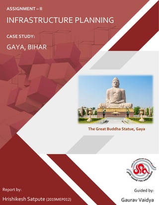
  • 1. CASE STUDY: GAYA, BIHAR ASSIGNMENT – II INFRASTRUCTURE PLANNING Report by: Hrishikesh Satpute (2019MEP012) Guided by: Gaurav Vaidya The Great Buddha Statue, Gaya
  • 2. _____________________________________________________________________________________ Infrastructure Planning Assignment – II 1 Physical Infrastructure Assessment Report: A case study of Gaya, Bihar TABLE OF CONTENTS 1. Introduction ________________________________________________________________________5 1.1 Background _____________________________________________________________________5 1.2. Physiography, Topography and Natural Slope __________________________________________5 1.3. Administrative Setup of the District __________________________________________________6 1.4. Climate ________________________________________________________________________6 1.5. Existing Spatial Growth____________________________________________________________6 2. City Profile__________________________________________________________________________6 3. Regional Context_____________________________________________________________________8 4. Demography ________________________________________________________________________9 5. Infrastructure Assessment ____________________________________________________________10 5.1. Water Supply__________________________________________________________________ 10 5.1.1. Issues and Findings _________________________________________________________ 11 5.1.2. Key Strategies _____________________________________________________________ 11 5.2. Sewerage and Sanitation ________________________________________________________ 11 5.2.1. Issues and Findings _________________________________________________________ 12 5.2.2. Key Strategies _____________________________________________________________ 12 5.3. Storm Water Drainage __________________________________________________________ 12 5.3.1. Issues and Findings _________________________________________________________ 13 5.3.2. Key Strategies _____________________________________________________________ 13 5.4. Solid Waste Management________________________________________________________ 13 5.4.1. Issues and Findings _________________________________________________________ 13 5.4.2. Key Strategies _____________________________________________________________ 14 5.5. Roads, Traffic, and Transportation _________________________________________________ 14 5.5.1. Issues and Findings _________________________________________________________ 15 5.5.2. Key Strategies _____________________________________________________________ 15 6. Capital Investment Plan (CIP) __________________________________________________________15 7. Financial Operating Plan (FOP) _________________________________________________________16 8. Bibliography and References __________________________________________________________18
  • 3. _____________________________________________________________________________________ Infrastructure Planning Assignment – II 2 Physical Infrastructure Assessment Report: A case study of Gaya, Bihar LIST OF TABLES Table 1: Phase wise Investments in Water Supply sector ................................................................................ 10 Table 2 : Phase wise Investments in Sewerage and Sanitation sector ............................................................. 12 Table 3 : Phase wise Investments in Storm Water Drainage sector................................................................. 13 Table 4 : Phase wise Investments in Solid Waste Management sector............................................................ 13 Table 5 : Phase wise Investments in Roads, Traffic, and Transportation sector .............................................. 14 Table 6 : Capital Investment Plan ..................................................................................................................... 16 Table 7 : Financial Operating Plan..................................................................................................................... 17
  • 4. _____________________________________________________________________________________ Infrastructure Planning Assignment – II 3 Physical Infrastructure Assessment Report: A case study of Gaya, Bihar LIST OF FIGURES Figure 1 : Location of Gaya district ......................................................................................................................5 Figure 2 : Location of Bodh Gaya tehsil /CD block...............................................................................................5 Figure 3 : The Great Buddha Statue - Gaya, Bihar ...............................................................................................5 Figure 4 : Mahabodhi Temple - Gaya, Bihar ........................................................................................................5 Figure 5 : Map showing Gaya City statutory limit................................................................................................7 Figure 6 : Map showing Ward map of Gaya.........................................................................................................8 Figure 7 : Map showing Regional Network..........................................................................................................9 Figure 8: Population Projection till 2030 for Gaya, Bihar ................................................................................. 10 Figure 9 : Map showing Water Supply infrastructure of Gaya ......................................................................... 11 Figure 10 : Map showing Existing Roads and Transportation of Gaya ............................................................. 15
  • 5. _____________________________________________________________________________________ Infrastructure Planning Assignment – II 4 Physical Infrastructure Assessment Report: A case study of Gaya, Bihar ABBREVATIONS CIP – Capital Investment Plan FOP – Financial Operating Plan DSCR – Debt Service Coverage Ratio LPCD – Litre Per Capita per Day MLD – Million Litres per Day NH – National Highway OHT – Overhead Tank O&M – Operation and Maintenance PPHA – Persons per Hectare RCC – Reinforced Concrete Cement SH – State Highway SWM – Solid Waste Management ULB – Urban Local Body W/S – Water Supply
  • 6. _____________________________________________________________________________________ Infrastructure Planning Assignment – II 5 Physical Infrastructure Assessment Report: A case study of Gaya, Bihar 1. Introduction 1.1 Background Gaya is a town of ancient historical significance and finds mention in texts dating back to 600 BC. Gaya was projected to the world by Bimbisara the Fifth of the Sisunaga dynasty who lived and ruled around 519 BC. Gaya finds mention in the great epics of Ramayana and Mahabharata. Lord Rama is said to have visited Gaya along with Sita and Lakshman to offer ‘pind-dan’ to his father. The Mahabharata refers to the city as Gayapuri. Gaya is one of the best historical sites in India. Gaya is named after the demon Gayasur (meaning "the demon Gaya"). According to Vayu Purana, Gaya was the name of a demon (Asura) whose body became pious after he performed strict penance and secured blessings from Lord Vishnu. It was said that the body of Gayasura was transformed into the series of rocky hills that make up the landscape of Gaya. Gaya is 100 kilometers south of Patna, the capital city of Bihar. It is the state's second-largest city, with a population of 470,839, and is the headquarters of Gaya district and Magadh division. The city is surrounded on three sides by small, rocky hills (Mangla-Gauri, Shringa-Sthan, Ram-Shila, and Brahmayoni), with the Phalgu River on its fourth (eastern) side. 1.2. Physiography, Topography and Natural Slope Gaya stands in the transit‐region where the uplands of the Chotanagarpur plateau merge in the south Bihar alluvial Gangetic plains. It is doted by small rocky hills (Mangala‐Gauri, Shringa‐Sthan, Ram‐Shila and Brahmayoni) on three sides and the river flowing on the fourth (eastern) side. Figure 2 : Location of Bodh Gaya tehsil /CD block Figure 1 : Location of Gaya district Figure 3 : The Great Buddha Statue - Gaya, Bihar Figure 4 : Mahabodhi Temple - Gaya, Bihar
  • 7. _____________________________________________________________________________________ Infrastructure Planning Assignment – II 6 Physical Infrastructure Assessment Report: A case study of Gaya, Bihar The topography of the west‐bank town, viz. Gaya proper, is influenced by the Brahmayanoni hill and the smaller elevation along the river in Andar Gaya; the hills of Murli and Ramsila to the north; the Katari hill and plateau to the west, and the Pretsila hill, further beyond to the north‐west. The situation of these outcrops gives the encompassed urban area the shape of an irregular broken saucer. The north and the north‐eastern slope are obstructed to some degree by the Ramsila, not only makes the Bairagi Mohulla and its environs the lowest part of Gaya proper but also causes vicious problems of water logging to arise within it. 1.3. Administrative Setup of the District Until 1864, Gaya was a part of the district of Bihar and Ramgarh (now in the state of Jharkhand). It became a district of Bihar in its own right on 3 October 1865. In May 1981, the Bihar state government created the Magadh division, comprising the district of Gaya, along with Nawada, Aurangabad and Jehanabad, all of which had originally been sub-divisions when Gaya district was created. Aurangabad and Nawada were partitioned from the territory of Gaya in 1976; and Jehanabad in 1988. Gaya district occupies an area of 4,976 km2 . Gaya city is the administrative headquarters of the district. The district is divided into four Sub‐Divisions, nine Tehsils, twenty-four CD Blocks, three hundred and thirty-two Panchayats and two thousand eight hundred and sixty Villages. The district has one Municipal Corporation, three Nagar panchayats and one Zila Parishad. It has one parliamentary constituency and ten assembly constituency. 1.4. Climate The town lies in the hot and humid tropical zone and with wide sandy expanse of the Falgu, has become one of the hottest and humid places in the country with absolute maximum temperatures reaching as high as 45 degree C and 90% humidity. The climate of Gaya is thus hot in summers and cold in winters, so also, the variation in day and night temperature is high. The prevailing wind direction, except during monsoon when easterlies and south‐easterlies predominate, is from the west. The average annual rainfall here is 1096 mm per annum. The context of temperature obviously indicates that micro‐climatology has an important role to play at Gaya. 1.5. Existing Spatial Growth Gaya is surrounded by a ring of hills around it, the Ramshila hill on the north, Katari hill on the west, and Brahmyoni on the south and the south‐west of the city, is the rugged ravines and rocks. River Falgu flows on the eastern side of the city. After Independence the town experienced a faster growth. New colonies such as police lines and railway quarters were developed in a planned manner. The south‐west part of the city has largely developed as institutional/residential low-density area. Major portion of the city is on the western side of Falgu River and a smaller portion of the city has been grown along eastern bank of Falgu River. Because Gaya is a district head quarter and its strategic location has tendency of growing as commercial centre, it has resulted in increased pressure of commercial activities in the old city. Thus, town had started spreading along all major spines of the town. The town has spread almost in all directions especially along Jahanabad‐Patna road, Sherghati road, Nawada Road and Gaya‐Dobi road. National Highways and State Highways like NH‐82, NH‐83, SH‐4, SH‐7 and SH‐70 passes through the city 2. City Profile Gaya is located in south central Bihar on the banks of the River Falgu 13km to the north of Bodhgaya and 120 km south of Patna. Gaya is well connected to Patna via NH 83; to Aurangabad, Sasaram and Delhi by NH 2 and to Kolkata by SH 8 and NH 2. Gaya is the second most important railway junction in the state after Patna. It has an international airport catering to tourists from Sri Lanka, Thailand, Singapore and Bhutan.
  • 8. _____________________________________________________________________________________ Infrastructure Planning Assignment – II 7 Physical Infrastructure Assessment Report: A case study of Gaya, Bihar Gaya is a Municipal Corporation with an area of 50.17 sq km. It is divided into 53 wards and had a population of 3,89,192 (Census 2001) and 468,614 (Census 2011). The population density of the town is 78 and 93 persons per hectare. Figure 5 : Map showing Gaya City statutory limit
  • 9. _____________________________________________________________________________________ Infrastructure Planning Assignment – II 8 Physical Infrastructure Assessment Report: A case study of Gaya, Bihar 3. Regional Context The competitive advantage of Gaya lies is in its good connectivity. The town has several National and State Highways that support its connectivity to other parts of the state and region. Gaya also has an international airport and serves as a gateway to religious tourism. Gaya is surrounded by hills on three sides – Mangala Gauri, Shringa Sthan, Ramshila and Brahmayoni – and the River Falgu forming the fourth natural boundary. Gaya is an important place of Hindu tourism for ‘Pind- dan’ and sees a huge influx of tourists for the month long ‘Pitra Paksh’ mela annually. Gaya is also well connected to Delhi, Kolkata, Mumbai, Guwahati, and Chennai metro cities and to Patna and Kiul through broad gauge railway line. It is the second most important station and junction in Bihar after Patna. Gaya has an International Airport. It is an international airport connected to Colombo (Sri Lanka), Bangkok (Thailand), Singapore, and Bhutan. Gaya is well connected with the regional road network within the state and to various meteropolises in the country. Gaya city is regionally connected with Patna via Jahanabad through NH‐83 towards the north of Gaya. Further Gaya is connected to Aurangabad, Sasaram to Delhi though NH‐2 which meets NH‐83 (passing from Gaya City) at Dobhi. Also, Gaya is connected to Kolkata by SH‐8 and by NH‐2. Figure 6 : Map showing Ward map of Gaya
  • 10. _____________________________________________________________________________________ Infrastructure Planning Assignment – II 9 Physical Infrastructure Assessment Report: A case study of Gaya, Bihar 4. Demography Gaya’s growth has been largely an outcome of its position as the leading town in the region. Gaya’s connectivity to the neighboring towns and villages also contributed to its development into a regional centre for trade and commerce. The average growth rate of the population in the period 1961 – 2001 has been between 18-37%. The highest growth rate in the last ten decades was in the period 1971-1981 at 37.4%. Thereafter, the rate has shown a marginal decline to 33.4% in the decade 1991-2001. This fluctuating growth rate may be due to the migration from surrounding villages linked to economic possibilities in the town. Gaya is spread over an area of 50.17 sq.km with housing a population of 3,89,192 (Census 2001). Highest density is in ward no. 21 i.e. 1450 PPHA and the lowest density is in ward no. 29 i.e. 8 PPHA. Sex ratio of Gaya is 885 females per 1000 males (2001) which is lower than the district and state average. Literacy rate in Gaya is 77.2 percent of which 58% are males and 42% are females. Population in 53 wards varies from 6401 to 8305. Lowest population size of 6401 is of Ward No. 20 which is spread over an area of 13 Ha and the highest population size 8305 is of Ward No. 49 which is spread over an area of 53 Ha approximately. It can be observed from above table that maximum wards are having population size ranging from 7000 to 8000 Figure 7 : Map showing Regional Network
  • 11. _____________________________________________________________________________________ Infrastructure Planning Assignment – II 10 Physical Infrastructure Assessment Report: A case study of Gaya, Bihar Based on population figures from Census 1961 to 2001, a population projection has been done using three different methods namely Arithmetic Increase Method, Geometric Increase Method and Incremental Increase Method. The estimated population using the Incremental Increase Method has been adopted for planning purposes on account of its greater alliance with ground realities. The estimated projection shows that the population of Gaya will increase to about 7.03 lakhs (approx.) by year 2030. 5. Infrastructure Assessment 5.1.Water Supply Ground water is the main source of water in Gaya. Ground water is extracted through 28 functional high yielding tube-wells. The water supply system is decentralized and based on 7 overhead tanks (OHTs) with a combined capacity of 30 lakh gallons. The present demand is 46.4 MLD at the rate of 100 LPCD. The present supply is 20 MLD at 40-50 LPCD. The water supply system covers 40-45% of the town. The supply duration is for 8 hours a day through direct pumping and 4 hours a day through reservoirs. Only bleaching powder is used as a disinfectant. The town is divided into five water supply zones and the total length of the distribution system is 70kms. It is estimated that 60% of households have individual connections; the town has 122 public stand posts and 493 hand pumps. Water does not attract a separate charge – the municipality charges a flat fee of Rs. 700 as connection charges. Figure 8: Population Projection till 2030 for Gaya, Bihar Table 1: Phase wise Investments in Water Supply sector Detailed Project Phase-I (2011-16) Phase-II (2016-21) Quantity Investment (in Rs. Cr.) Quantity Investment (in Rs. Cr.) Main W/S pipeline 10 kms 4.2 Distribution W/S pipeline 58 kms 17.4 20kms 6 Construction of underground Tank, Pump house with 6 no. of pump sets (Raw Water) 1 No. 15 Overhead reservoirs (25 lakh capacity each) 3 Nos. 18.75 1No. 6.25 Pumps and pumping station 8.25 2.75 Underground reservoirs 2 Nos. 6.4 1 No. 3.2 Filtration / treatment works (100 MLD capacity) 26.72 9.76 Contingency Charges (10%) 9.672 2.796 Sub Total 106.4 24.8 Grand Total 131.15 crore
  • 12. _____________________________________________________________________________________ Infrastructure Planning Assignment – II 11 Physical Infrastructure Assessment Report: A case study of Gaya, Bihar 5.1.1. Issues and Findings Inadequate quantity, area covered & duration of water supply; Distribution network is very old (high losses and water contamination), Inadequate infrastructure viz. storage, pumping station etc., Non‐revenue water (no metered connections), O & M Cost Recovery is 40%. 5.1.2. Key Strategies A comprehensive water supply augmentation scheme with detailed engineering design of all required components. To enhance supply to 100 LPCD in Phase 1 and 135 LPCD in Phase II. To ensure minimum transmission losses; ground water recharge through rain water harvesting, conserving water bodies and controlling water extraction. Recycling of treated waste water. Reduction of non-revenue water in phases through 100% metered pipe connections and removal of public stand posts. Recovery of O&M costs. 5.2. Sewerage and Sanitation Gaya has no organized sewerage system. The absence of a systematic wastewater disposal system has led to waste water and sullage into the rivers/storm water drains that are mostly open. It is estimated that 40% of households have septic tanks. Gaya town has 10 public conveniences, of which 5 are located in slums. It is estimated that the current waste generation is about 37.09 MLD and this is projected to increase to 75.95 MLD. At present, waste water and sullage are discharged into the River Falgu and in other low-lying areas of the town. The present system is inadequate and poses a potential threat to overall health and hygiene. Figure 9 : Map showing Water Supply infrastructure of Gaya
  • 13. _____________________________________________________________________________________ Infrastructure Planning Assignment – II 12 Physical Infrastructure Assessment Report: A case study of Gaya, Bihar 5.2.1. Issues and Findings Lack of sanitation facilities (individual and community toilets) leads to open defecation along river & open drains; Intermixing of wastewater with storm water in drains; Falling of untreated waste into Falgu River and open low-lying areas creates pollution in city. 5.2.2. Key Strategies Making Gaya ‘open defecation free’ through 100% access to toilets. Establishment of a waste water treatment plant in the short term. A comprehensive sewer network in the long term & household connections to the network. Community toilets where individual toilets are not possible. Integrated planning & implementation of water supply-drainage-sewerage-solid waste management system to optimize benefits including recycling. 5.3.Storm Water Drainage The drainage of Gaya is influenced by the hills surrounding it on three sides – Mangla Gauri, Shringa Sthan, Ramshila and Brahmayoni – and the River Falgu on the remaining side. The road to the west of the Collectorate divides the drainage into two zones – western and eastern. Gaya’s drainage network is 60kms long – covering 40% of the road network – with 46 kms of the drains being pucca and 16km kutcha. The main drains in the western zone include Kujapi, Karimganj and Katari Hill Road Nallah and these discharge effluents at various places like the Gandhi Maidan, near the Railway Station etc. The main drains in the eastern zone include Mansarva, Mashanghat and Nadraganj Nallah and these discharge effluents into the River Falgu. The area to the north of Dhobi Road Nallah to Katari Hill Road Nala, Gandhi Maidan to Kujapi Nallah and newly developed colonies in Manpur, Ghughari, Monapur, and Kumar Colony have no drainage and are prone to water logging. Detailed Project Phase-I (2011-16) Phase-II (2016-21) Quantity Investment (in Rs. Cr.) Quantity Investment (in Rs. Cr.) Main Pipe line installation 20 km 30 Secondary & Collector line 102 km 35.7 20 km 9.1 Treatment Plant (2 nos., 40 MLD each) 1 No. 32 1 No. 3.2 Community Toilet Blocks 5 No. 0.15 5 No. 0.15 Public Toilets 10 No. 0.5 5 No. 0.25 Sub Total 98.35 41.5 Grand Total 139.85 crore Table 2 : Phase wise Investments in Sewerage and Sanitation sector
  • 14. _____________________________________________________________________________________ Infrastructure Planning Assignment – II 13 Physical Infrastructure Assessment Report: A case study of Gaya, Bihar 5.3.1. Issues and Findings Inadequate coverage of drainage network. Clogging of open drains due to collection of solid waste and encroachments; Intermixing of wastewater and storm water creates pollution; Water logging in ward no. 7, 8, 18, 19, 23, 24 and 36 due to inadequate drains; Discharging of untreated waste into Falgu River and other open spaces causes pollution. 5.3.2. Key Strategies To attain full network coverage of adequate capacity. To manage water logging – this is a priority area. To install a waste water treatment plant in the short term. 5.4. Solid Waste Management It is estimated that Gaya generates about 275 tons of garbage per day. Garbage generation is expected to increase to 415 tons per day by 2030. About 90% of the waste generated is collected while the rest is unattended. Door to door collection has been introduced recently and covers 25% of the city area. Secondary collection of garbage is done from 250 dustbins in different parts of the city in addition to street sweeping. The municipal corporation uses hand trolleys, hand rickshaws, tractors, dumpers, loaders, tempos and roller to collect and transport garbage. Sites have been identified at Panchvati Akhata (5acres) and Nailli (23 acres) for development into sanitary landfill sites. Currently garbage is dumped at various open spaces. 5.4.1. Issues and Findings Inadequate coverage of door to door collection; Lack of waste management Infrastructure; Absence of scientific disposal of waste; Dumping of waste on roads, drains and open Spaces. Detailed Project Phase-I (2011-16) Phase-II (2016-21) Quantity Investment (in Rs. Cr.) Quantity Investment (in Rs. Cr.) Main line 30 km 9 Secondary & Tertiary drains length 180 km 36 40 km 8 Strengthening of existing drain 46 km 2.3 Construction of Waste Water Treatment Plant 10 MLD capacity each 2 No. 1 1 No. 0.5 Sub Total 48.3 8.5 Grand Total 56.80 crore Table 3 : Phase wise Investments in Storm Water Drainage sector Table 4 : Phase wise Investments in Solid Waste Management sector
  • 15. _____________________________________________________________________________________ Infrastructure Planning Assignment – II 14 Physical Infrastructure Assessment Report: A case study of Gaya, Bihar 5.4.2. Key Strategies Door to door collection in whole town. Segregation of wastes at source. Introduction of best practices to reduce manual handling of wastes and efficient and effective outcomes. Scientific disposal at sanitary landfill. IEC campaigns to complement planned systems improvements. 5.5. Roads, Traffic, and Transportation Gaya is well connected to the rest of the state and other parts of the country through the NH 83, SH 7, SH 8 and SH 70. The total road length in the city is estimated at 128 kms of which 39% is surfaced. The road width varies from 12 – 3.5m on account of encroachments and on-street parking. Some important roads in the city are Collectorate Road, Station Road, Jail Road, Tikari Road, Nawada Road, Manglagauri Road, Vishnupad Road, Swarajpur Road, G.B. Road etc. Table 5 : Phase wise Investments in Roads, Traffic, and Transportation sector Detailed Project Phase-I (2011-16) Phase-II (2016-21) Phase-II (2021-30) Quantity Investment (in Rs. Cr.) Quantity Investment (in Rs. Cr.) Quantity Investment (in Rs. Cr.) Development of Bus Terminal 4 Nos. 24 Truck Terminal 1 No. 35 Footpaths (Rs. 1000 / sq. m.) 30 4.5 20 3 Parking lots 2 Nos. 30 3 45 1 15 Construction of passenger sheds 6 Nos. 0.6 4 0.4 Up gradation and Strengthening of roads within the city and for missing links. 58.5kms 35.1 19.5kms 11.7 Construction of R.C.C. Bridge 1 No. 15 Construction of Ring Road 10kms 18 New Road Construction and linking 6kms 9 4 6 Repairing of the City Road 30kms 15 20kms 10 Signage, Road Markings and Pedestrian Crossing etc. at various locations 11 Nos. 0.22 5Nos. 0.1 Foot Over Bridge 1No. 0.5 1No. 0.5 Junction and Traffic Signal Improvement 8Nos. 4 8 Nos. 4 Comprehensive Mobility Plan LS 0.75 Sub Total 163.92 102.45 21 Conventional Street Lights 1373 4.1 Solar Lights 1373 5.5 Sub Total 9.6 Grand Total Rs. 287.37 crore
  • 16. _____________________________________________________________________________________ Infrastructure Planning Assignment – II 15 Physical Infrastructure Assessment Report: A case study of Gaya, Bihar 5.5.1. Issues and Findings Passing of NH & SH from city puts high pressure on the city roads; Inadequate road width (varies from 3.5 to 7m); Only 39% of the roads are surfaced, poor maintenance of existing roads; Lack of organized parking leads to on‐street parking causes congestion on roads; Lack of traffic management in the city viz. traffic signalization, markings etc.; Unorganized bus stand and absence of truck terminal facility, loading, unloading, parking takes place on commercial roads leading to congestion. 5.5.2. Key Strategies Upgradation, strengthening of existing roads; development of missing links. Development of an Outer Ring Road. Development of new roads in Phase II. Junction improvements, signage’s etc. priority. Removal of encroachments from pavements & construction of new pavements. Organized parking lots at main commercial centers. Comprehensive Mobility Plan Provision of street lights including nonconventional energy based. 6. Capital Investment Plan (CIP) The total funding, i.e. up to year 2030, is estimated at Rs. 933.03 crore. Sector-wise details of the investments have been defined for the entire period. The scheduling or phasing of the CIP is based on the analysis of fiscal resources for new investments and O&M, technical capacity for construction and the choice of specific improvements to be taken up. About 31% of the capital investment estimate is envisaged for roads and transportation; 15% for sewerage and sanitation and 15% for water supply. Figure 10 : Map showing Existing Roads and Transportation of Gaya
  • 17. _____________________________________________________________________________________ Infrastructure Planning Assignment – II 16 Physical Infrastructure Assessment Report: A case study of Gaya, Bihar 7. Financial Operating Plan (FOP) The investment capacity of the Gaya Municipal Corporation is assessed through a Financial Operating Plan (FOP) that gives a multi-year forecast of finances of the local body for the short-term period. The FOP is generated to assess the investment-sustaining capacity of the ULB, if it adopts a project funding structure comprising grants with internal resources and loans accounting for the rest. The level of investment that the ULB can sustain is then determined by studying the overall surpluses/year-to-year opening balance and debt service coverage ratio (DSCR). An important aspect that needs to be considered in raising financial resources is beneficiary contribution. This practice has to be promoted and the concept of PPP also needs to be introduced to make the services sustainable. Thus, a total investment of Rs. 603.50 crores in the short-term (2011-12 – 2015-16) can be pooled by implementing PPP – this further decreases the financial burden of the ULB in the next five years. Sectors Investment Required (Rs. Crore) Phase-I (2011-16) Phase-II (2016-21) Phase-II (2021-30) Total Sector-wise Distribution (%) Economic Development 49 34 - 83 8.9 Water Supply 106.39 30.76 - 137.15 14.7 Sewerage and Sanitation 98.35 41.5 - 139.85 14.99 Drainage 48.3 8.5 - 56.8 6.09 Solid Waste Management 49.76 12.67 6.33 68.76 7.37 Roads and Transportation 163.92 102.45 21 287.37 30.8 Street Lights 9.61 - - 9.61 1.03 Social Infrastructure 17.85 12.2 5.75 35.8 3.84 Services to Urban Poor 15 17.37 15 47.37 5.08 Heritage and Conservation 41 22 - 63 6.75 Urban Reforms 4.32 - - 4.32 0.46 TOTAL 603.5 281.45 48.08 933.03 100 Phase-wise Distribution (%) 64.68 30.17 5.15 100.00 Table 6 : Capital Investment Plan
  • 18. _____________________________________________________________________________________ Infrastructure Planning Assignment – II 17 Physical Infrastructure Assessment Report: A case study of Gaya, Bihar The FOP assumes that in the short term: • At least 10% contribution of the overall fund requirement will be from the ULB. • Rs. 0.50 crores (Sewerage and Sanitation) for public toilets will be through PPP. • Rs. 7.90 crores (Solid Waste Management) towards vehicles and equipment will be through PPP. • Rs. 89.00 crores (Roads and Transportation) towards upgradation of bus terminal, construction of truck terminal and parking lots will be through PPP. The key considerations for the FOP are: • At least 10% of the overall fund requirement will be from the ULB therefore, stringent steps and interventions are required to enhance its ‘own’ resource base. • It is assumed that in cases where funding other than state government will be available (could be loans from financial institutions, central government, other funded programmes), there will be part contribution from the state government and the ULB will contribute at least 10%. • Emphasis to be on developing projects on PPP wherever possible. Sector Amount (Rs Crore) Funding Pattern (Rs. Crore) Other sources including GoI GoB ULB PPP Economic Development 49 15 7.5 24 2.5 Water Supply 106.4 85.1 10.6 10.6 0 Sewerage & Sanitation 98.4 78.3 9.8 9.8 0.5 Drainage 48.3 38.6 4.8 4.8 0 SWM 49.8 33.5 4.2 4.2 7.9 Roads & Transportation 163.9 15.8 51.7 7.5 89 Social Infrastructure 17.9 0 13.8 1.5 2.5 Urban Poor & Slums 15 12 1.5 1.5 0 Urban Reform 4.3 0 3.9 0.4 0 Street Light 9.6 0 8.6 1 0 Heritage & Tourism 41 32.8 4.1 4.1 0 Total 603.6 311.1 120.5 69.4 102.4 52% 20% 11% 17% Table 7 : Financial Operating Plan
  • 19. _____________________________________________________________________________________ Infrastructure Planning Assignment – II 18 Physical Infrastructure Assessment Report: A case study of Gaya, Bihar 8. Bibliography and References City Development Plan. (2010). City Development Plan (2010-30) (Urban Development & Housing Department Government of Bihar. Retrieved from http://urban.bih.nic.in/Docs/CDP/CDP-Patna.pdf) Consultant, D. S. C. (2015). DETAILED PROJECT REPORT PACKAGE-1 FOR GAYA MUNICIPAL CORPORATION. MSME. (2015). Brief Industrial Profile of Mansa, 1–13. Retrieved from http://dcmsme.gov.in/dips/PURULIA_wb.pdf