Download as PDF, PPTX
![Airborne Geophysical Surveys
Acquisition of airborne geophysical data
Processing of airborne data
Interpretation of airborne geophysical data
Photo Geology and Remote Sensing
Procurement and interpretation of satellite data
Interpretation of remote sensing and geological data
Preparation of different Thematic Maps on 1:50,000 scale
Integration of Remote Sensing, Geological & airborne geophysical data.
Identification of Target blocks for detailed ground evaluation by Regions
Hyperspectral Mapping
Building up of a spectral library of various rocks/minerals from known
mineralised zones and integrate with similar other datasets to build up a
massive and comprehensive spectral library of native rocks/minerals.
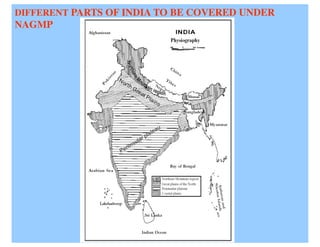
National Geomorphological & Lineament Mapping
[NGL]
Evaluating the quality of the final maps prepared by various work centres under
NRSC](https://image.slidesharecdn.com/mineralssectorpresentation12thplan-130320105601-phpapp02/85/Minerals-Sector-Presentation-12th-Plan-2012-2017-25-320.jpg)

The document discusses key strategies for India's mineral sector in the 12th Five Year Plan, including: 1. Strengthening institutions involved in mineral exploration like MECL and GSI and encouraging R&D in mineral processing. 2. The objectives are ensuring raw material security, boosting production of technology metals, and environmental sustainability. 3. Recommendations include reforms to encourage private exploration, building infrastructure, skills development, completing baseline surveys, and ensuring availability of financial resources.


![[Day 2] Center Presentation: ICARDA](https://cdn.slidesharecdn.com/ss_thumbnails/cgiar-csi-day2-1apr2009-center-icarda-090405003350-phpapp01-thumbnail.jpg?width=640&height=640&fit=bounds)


