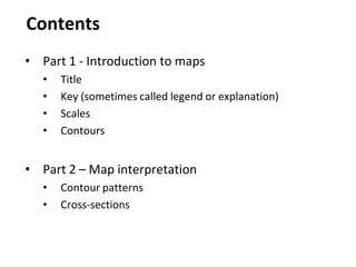
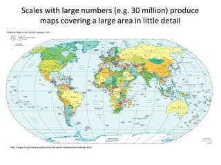
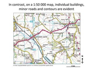
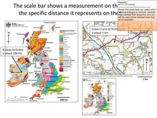
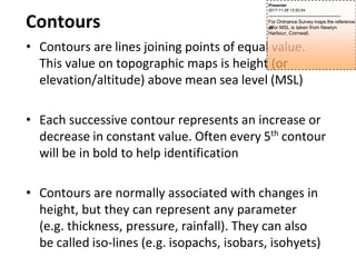
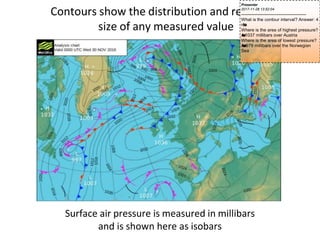
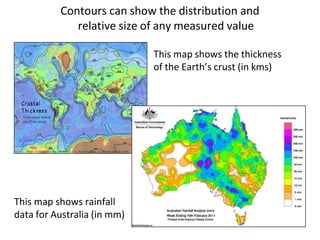
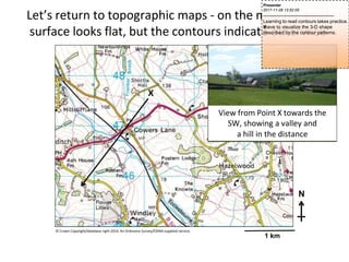
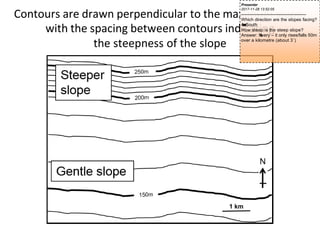
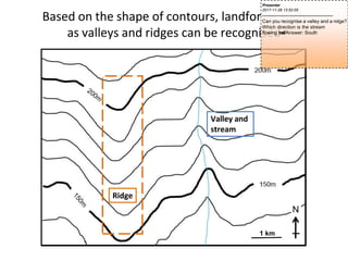
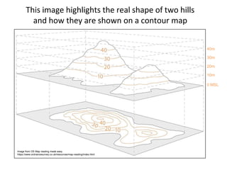
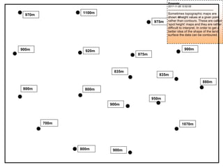
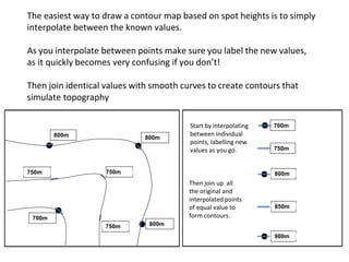
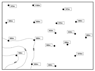
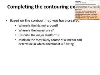
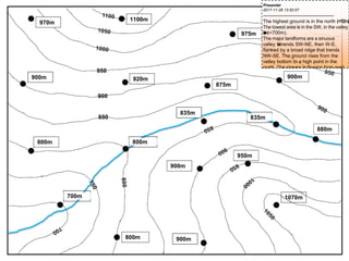
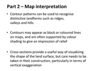
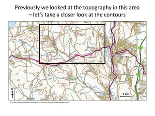
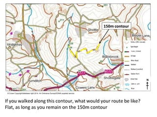
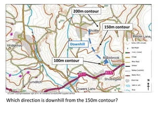
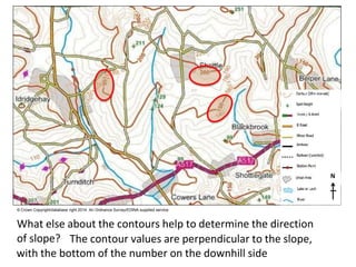
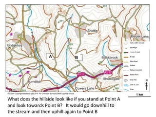
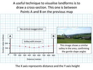
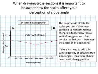
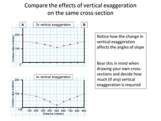
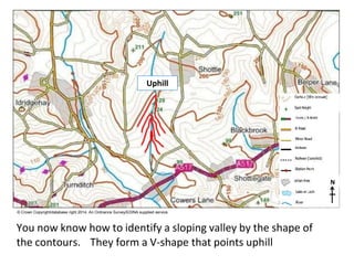
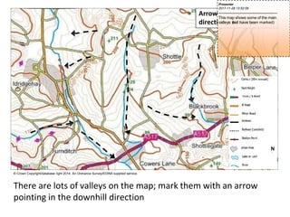
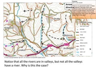
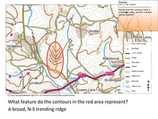
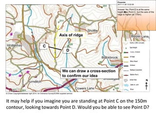
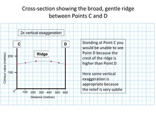
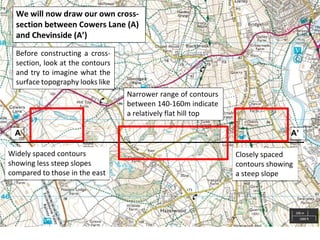
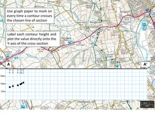
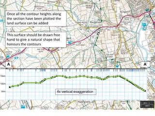
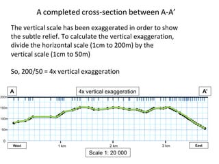
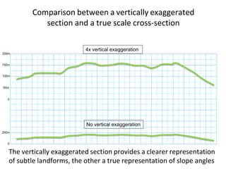
This document provides an introduction to maps and map interpretation for geology and geography students. It covers key map elements such as scale, contour lines, landforms, and cross-sections. The document aims to help students identify landforms using contours and cross-sections from topographic maps, as these are important tools for geoscientists. It includes examples of interpreting contour patterns and drawing cross-sections to visualize the 3D shape of terrain from a 2D map.