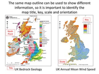
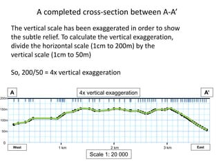
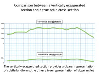
This document provides an introduction to reading and interpreting maps for geology and geography students. It covers key map elements like the title, scale, legend, and contours. Contours show elevations and can reveal landforms. Cross-sections help visualize terrain in 2D. The document teaches how to identify features like valleys, ridges, and hills based on contour patterns and recommends drawing cross-sections to confirm interpretations. It emphasizes that maps are a projection of 3D space onto a 2D surface.