Downloaded 82 times

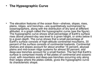
![• The Ocean Floor in Cross-Section
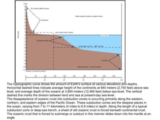
• The oceans begins, of course, at the shore, the irregular boundary where the
surface of a continent descends first to sea level and then beneath it. If the
depth of the ocean is measured along a line drawn straight out from a
continental shore, the following sequence of bottom features are typically
seen.
• Continental Shelf.
• For many miles out, the ocean is only a few hundred feet deep and gets
deeper quite slowly (i.e., slopes at an angle of 0.1°, or 1.7 meters per
kilometer [9 feet per mile]). This flat, wide margin is found around every
continent and is known as the continental shelf. The average width of a
continental shelf is 70 kilometers (43 miles).
• Continental Slope and Rise.
• The continental shelf ends at a sudden drop-off called the shelf break. Beyond
the shelf break, the slope of the ocean floor becomes much steeper, typically
a 4° slope, or 70 meters per kilometer (370 feet per mile). This steep
embankment is called the continental slope and is grooved by submarine
canyons and gullies. The continental slope is about 16 kilometers (10 miles)
wide, on average, and descends to a depth of about 2.4 kilometers (1.5 miles).
There it ends as the slope moderates to a mere degree or two from horizontal.
This gradual zone, which may be several hundred miles wide, is called the
continental rise. It is composed of fine-grained continental sediments (silt and
clay) washed down the many submarine canyons that notch the continental
slope.](https://image.slidesharecdn.com/kingsmodel-180201062245/85/King-s-model-Geomorhology-Chapter-18-320.jpg)


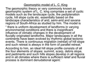
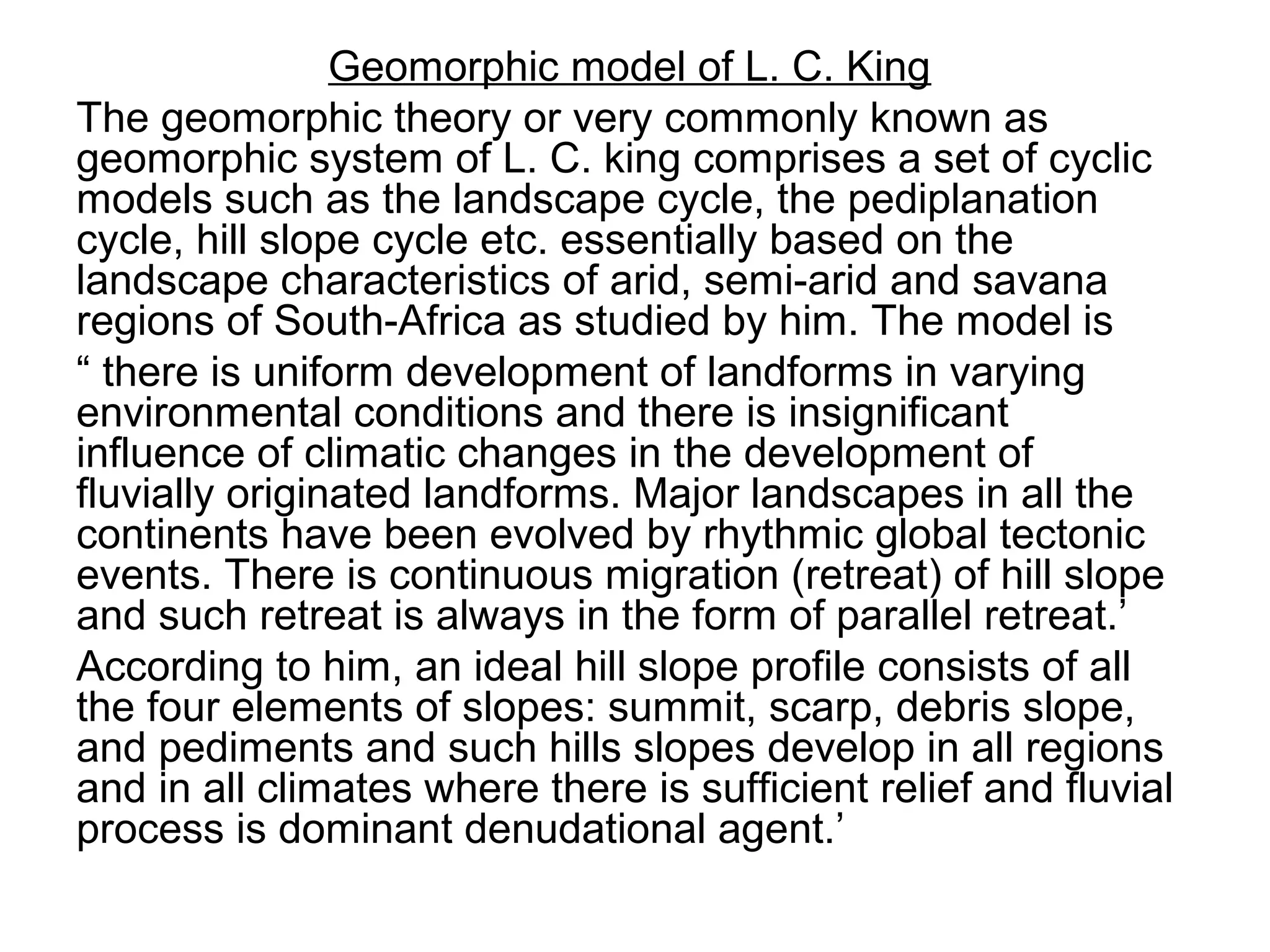
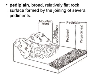
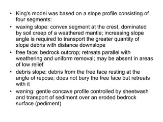
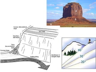
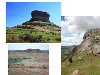
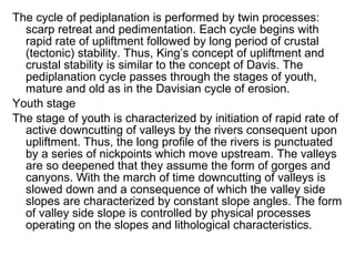
King's geomorphic model is based on the evolution of idealized hill slopes through four stages - waxing slope, free face, debris slope, and waning slope or pediment. The model involves the parallel retreat of scarps and formation of pediments, resulting in the development of a pediplain landscape over multiple cycles of scarp retreat and pedimentation. Each cycle progresses through youth, mature, and old stages similar to Davis' cycle of erosion. The model was developed based on King's extensive study of landscapes in South Africa.


