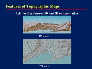
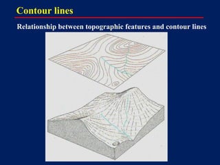
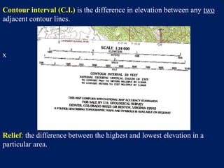
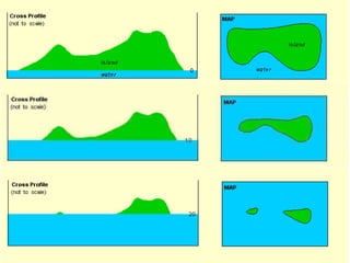
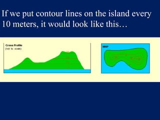
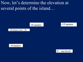
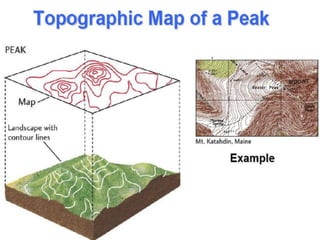
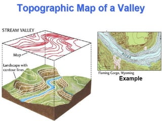
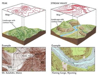
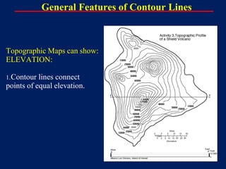
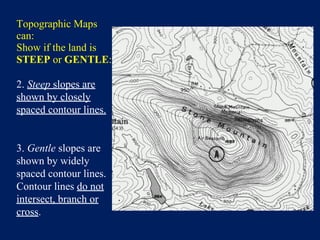
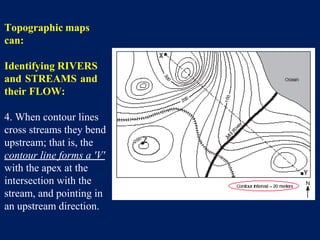
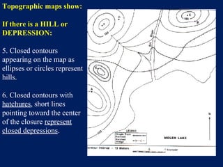
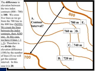
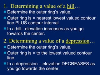
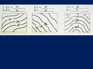
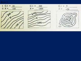
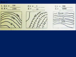
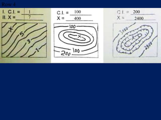
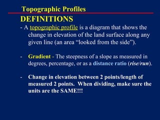
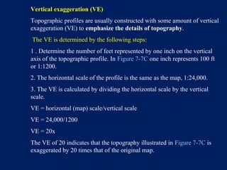
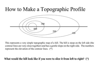
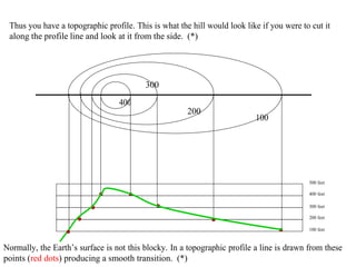
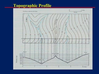
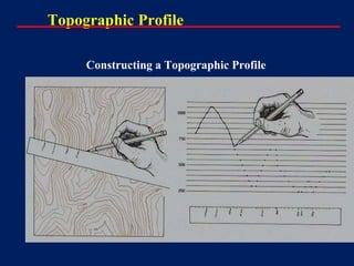
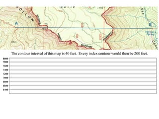
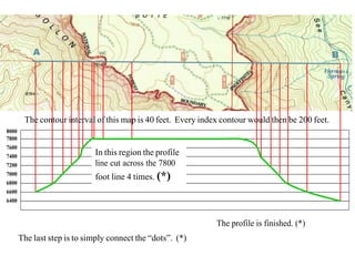
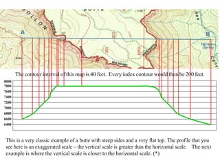
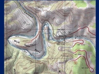
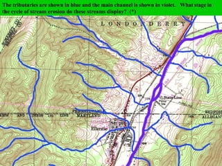
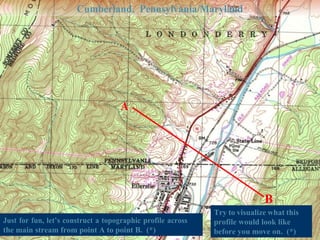
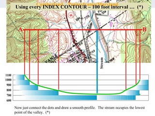
Topographic maps use contour lines to represent the three dimensional shape of the earth's surface. Contour lines connect points of equal elevation and the interval between lines indicates the steepness of slopes. A topographic profile can be created by slicing through a map along a line and plotting the elevations to show the shape and gradient of the terrain from the side.