Geographic Regions: by definition There three types of regions Formal regions are areas where a certain characteristic is found throughout. Functional regions consist of a central place and the surrounding places affected by it. Perceptual regions are defined by people’s attitudes and feelings about areas. 4.
In context of India n comparing it with the world. The presentation defines these concepts with apt case studies from various countries and India as well..
Theories and models for Regional planning and developmentKamlesh Kumar
This is a work on the major theories of Regional planning mainly consisting the work of Francois Perroux, Gunnar Myrdal, Albert O. Hirschman, Walter Whitman Rostow and John Friedman.
This slide discusses about the core-periphery model given by John Friedmann. This model is basically a model of regional Development. You will able to learn about the core-periphery model very easily by this slide.
Von thunen’s model of agricultural land useThe Urban Unit
This presentation is based on a agricultural land use model around the city. This is the theory of urban Geography it describe the agricultural pattern and how should the agricultural activities perform around the city. basically this Model was put forwarded before industrialization and when there was no roads networks and this Model is not applicable in real word but is gives great ideas for developing new towns and cities.
I’m professional presentation maker . These presentations are for sale for 20$ each, if required you can contact me on my gmail id bestpptmaker@gmail.com and you can also suggest me topics for your required presentations
Levels, Patterns and Trends of Urbanization (World)ShreemoyeeSaha1
1. What is Urbanization?
2. Levels of Urbanization in the World
3. Patterns of Urbanization in the World : Demographic Changes, Economic Development, Consumption Pattern, Urban Footprint.
4. Patterns of Urbanization in Asia.
5. Trends of Urbanization in the World : Past, Recent and Future Trends.
6. Timeline of Urbanization in the World (1950- 2050)
7. Projected Urban and Rural Population.
8. Urbanization and Sustainability.
The primary aim of studying settlement geography is to acquaint with the spatial and structural characteristics of human settlements under varied environmental conditions.
I’m professional presentation maker . These presentations are for sale for 20$ each, if required you can contact me on my gmail id bestpptmaker@gmail.com and you can also suggest me topics for your required presentations
Shift share analysis is a traditional tool; through a descriptive analysis of the productive structure, it allows the comparison of regional differences within a country, region or state (SIMÕES, 2004).Shift-share analysis is one way to account for the competitiveness of a region's industries and to analyze the local economic base. This analysis is primarily used to decompose employment changes within an economy over a specific period of time into mutually exclusive factors. Like other analytical economic tools, the shift-share technique is only a descriptive tool that should be used in combination with other analysis to provide a summary of a region's key employment potential industries.
Overview of Lumen Learning progress and milestones over the past year, supporting widespread adoption of open educational resources in U.S. higher education
Over 150 Primary, Secondary & International commercial real estate markets are covered in the 2013 Year End edition of the Coldwell Banker Commercial Blue Book.
A presentation to local business groups demonstrating how they can use .id's publicly available toolkit to understand the local demographic and economic profile.
The Buffalo Niagara region continues to undergo significant economic and demographic transitions. Its industry base is shifting toward diverse, knowledge-driven industries, while the region is increasingly leveraging border location and economic synergies with Canada. The region’s population, while shrinking on the whole and older compared to the nation, includes highly educated and mobile workers. Together these forces have important implications for emerging demands for labor, workforce readiness and opportunities for regional economic growth.
Derek Mabie, State of Search 2013 - "What a Difference a Year Makes: Search S...Evolve Digital Labs
Competition and costs are on the rise in the Search Engines, with little signs of change. Search experts are asked to deliver more value and take on a larger percentage of customer acquisition and influence. These request are not easy for a young and inexperienced industry.
Website: evolvedigitallabs.com
Facebook: facebook.com/EvolveDigitalLabs
Twitter: twitter.com/evolvedigitally
LinkedIn: linkedin.com/company/evolve-digital-labs
Each city has a multifaceted tax code with many moving parts, and San Diego is no exception. This chart books aims to help readers understand San Diego’s overall economy and tax system from a broad perspective.
An Untapped Economic Opportunity for WyomingFabian Lobera
Wyoming State Government's Economically Needed Diversity Options for Wyoming (ENDOW) initiative recently solicited perspective and ideas for economic diversification from the business community. The team at Pitchengine submitted the following slide deck to identify trends in the US economy and workforce that may constitute an opportunity that Wyoming appears to be well positioned to meet. As a local business, our interest is in helping our state realize economic growth outside of our traditional industries by promoting the independent spirit and culture that has made Wyoming a great place to live; earn, and; raise a family. If you have something to add to this conversation, please reach out and share that directly with us: FL@pitchengine.com
How can communities shape economic development and create quality jobsUrban Habitat
One of the keys to equitable economic development and creation of quality jobs is how we use land. Land use decisions drive everything from the type of jobs (service, manufacturing, tech) to quality of jobs to environmental impacts. The panel will analyze successful campaigns and explore key opportunities and coalition models for major impact throughout the region. Equitable economic development and quality jobs are the result of making the right decisions on land use involving the community.
How do we move from localized thinking to a regional approach for workforce and economic development?
How can advocates recognize opportunities?
What are the tools they can use to advance equitable development in their respective communities?
Moderator:
Belén Seara, Director of Community Relations, San Mateo County Union Community Alliance
Panelists:
Anu Natarajan, Vice Mayor of the City of Fremont
Feng Kung, Lead Organizer, Jobs with Justice San Francisco
Jahmese Myres, Senior Research & Policy Associate, East Bay Alliance for a Sustainable Economy (EBASE)
This panel is part of the Boards and Commissions Leadership Institute's (BCLI)
Current Issues Series of Urban Habitat.
This work was conducted on behalf of the Gold River Economic Development Committee of Council in an attempt to rationalize Committee targets with Council objectives.
Economic Gardening Using Information
`
For more information, Please see websites below:
`
Organic Edible Schoolyards & Gardening with Children
http://scribd.com/doc/239851214
`
Double Food Production from your School Garden with Organic Tech
http://scribd.com/doc/239851079
`
Free School Gardening Art Posters
http://scribd.com/doc/239851159`
`
Companion Planting Increases Food Production from School Gardens
http://scribd.com/doc/239851159
`
Healthy Foods Dramatically Improves Student Academic Success
http://scribd.com/doc/239851348
`
City Chickens for your Organic School Garden
http://scribd.com/doc/239850440
`
Simple Square Foot Gardening for Schools - Teacher Guide
http://scribd.com/doc/239851110
Students, digital devices and success - Andreas Schleicher - 27 May 2024..pptxEduSkills OECD
Andreas Schleicher presents at the OECD webinar ‘Digital devices in schools: detrimental distraction or secret to success?’ on 27 May 2024. The presentation was based on findings from PISA 2022 results and the webinar helped launch the PISA in Focus ‘Managing screen time: How to protect and equip students against distraction’ https://www.oecd-ilibrary.org/education/managing-screen-time_7c225af4-en and the OECD Education Policy Perspective ‘Students, digital devices and success’ can be found here - https://oe.cd/il/5yV
Operation “Blue Star” is the only event in the history of Independent India where the state went into war with its own people. Even after about 40 years it is not clear if it was culmination of states anger over people of the region, a political game of power or start of dictatorial chapter in the democratic setup.
The people of Punjab felt alienated from main stream due to denial of their just demands during a long democratic struggle since independence. As it happen all over the word, it led to militant struggle with great loss of lives of military, police and civilian personnel. Killing of Indira Gandhi and massacre of innocent Sikhs in Delhi and other India cities was also associated with this movement.
Unit 8 - Information and Communication Technology (Paper I).pdfThiyagu K
This slides describes the basic concepts of ICT, basics of Email, Emerging Technology and Digital Initiatives in Education. This presentations aligns with the UGC Paper I syllabus.
Model Attribute Check Company Auto PropertyCeline George
In Odoo, the multi-company feature allows you to manage multiple companies within a single Odoo database instance. Each company can have its own configurations while still sharing common resources such as products, customers, and suppliers.
Ethnobotany and Ethnopharmacology:
Ethnobotany in herbal drug evaluation,
Impact of Ethnobotany in traditional medicine,
New development in herbals,
Bio-prospecting tools for drug discovery,
Role of Ethnopharmacology in drug evaluation,
Reverse Pharmacology.
Instructions for Submissions thorugh G- Classroom.pptxJheel Barad
This presentation provides a briefing on how to upload submissions and documents in Google Classroom. It was prepared as part of an orientation for new Sainik School in-service teacher trainees. As a training officer, my goal is to ensure that you are comfortable and proficient with this essential tool for managing assignments and fostering student engagement.
The Art Pastor's Guide to Sabbath | Steve ThomasonSteve Thomason
What is the purpose of the Sabbath Law in the Torah. It is interesting to compare how the context of the law shifts from Exodus to Deuteronomy. Who gets to rest, and why?
How to Make a Field invisible in Odoo 17Celine George
It is possible to hide or invisible some fields in odoo. Commonly using “invisible” attribute in the field definition to invisible the fields. This slide will show how to make a field invisible in odoo 17.
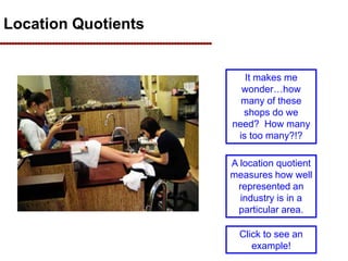
1. Location Quotients
It seems to me that
almost every
stripmall has a nail
shop in it.
It makes me
wonder…how
many of these
shops do we
need? How many
is too many?!?
One way to
measure this idea
is using location
quotients.
A location quotient
measures how well
represented an
industry is in a
particular area.
Click to see an
example!
2. Let’s apply the concept of a
location quotient in a beach town
A location quotient (LQ) is a measure of how concentrated an industry is in
a particular geographic area
For example, ice cream stores are heavily
concentrated in ocean front communities!
Can you think of another industry that is
heavily concentrated in ocean front
communities?
I bet you
guessed
“hotels”,
“restaurants”, or
maybe even
“Salt Water Taffy
stores”!
3. Let’s explore location quotients
In this unit, you’ll learn what a location
quotient is, how to calculate it, and (most
importantly) how it can be used.
Keep in mind that location quotients can be
calculated for a small area like a county or a
larger area like a region.
So before we begin, let’s define a region…
4. First of all, what is a region?
• A region is a geographic area that is
connected economically.
• The U.S. government refers to regions
as “Metropolitan Statistical Areas” or
“MSAs”.
• A Metropolitan Statistical Area
contains a core urban area of 50,000
people and can contain nearby
counties.
• They also include adjacent counties
that have a high degree of social and
economic integration (as measured by
commuting patterns).
This is an image of the future Dubai City and its
tallest building in the world. It will be almost 2,000
feet tall, surpassing the Sears Tower by 260 feet.
Clearly this is a “core urban area”.
5. There are about 330 MSAs in the U.S.
The nation’s 330 MSAs can be
seen on this map. Each is
shaded a different color. Some
include one county, others
include several counties.
Not every county is in an
MSA…but then again, not every
county has 50,000 people in it.
In fact, most of these counties do
not.
6. Where do we live?
Our region is nicknamed “Hampton
Roads” or “Tidewater” but is
technically known as the Virginia
Beach-Norfolk-Newport News MSA
It includes about 1.6 million people
living in these cities and counties.
Our population is about 0.6% of the
U.S. population.
7. Why do we study regional economics?
Because regions (i.e. MSAs) are the heart of our economy.
Regions are the source of much of our culture.
Regions are our economic centers.
Economically, regions are quite important.
Only about 25% of U.S. counties are in an MSA, yet those
counties hold 85% or our jobs and 83% of our
population!
8. Let’s use location quotients
to analyze a region
In the next few slides we will:
• Compare incomes in all MSAs
•Determine that the Bridgeport-Stanford-Norwalk
MSA has the highest income
•Calculate LQs for the Bridgeport-Stanford-
Norwalk MSA
•Calculate LQs for Hampton Roads (Virginia
Beach-Norfolk-Newport News MSA)
9. One economic measure of a
region is its incomes per person
Hampton Roads is ranked 108th
Note that Bridgeport-Stamford-Norwalk had
the nation’s highest income in 2004
10. Bridgeport-Stamford-Norwalk, CT
So where is Bridgeport-
Stamford-Norwalk?
And what is going on there to
make incomes so high?
Their region includes 0.3% of the U.S. population
and employment but has incomes and earnings
that are well above the national average.
Just to give you
geographic
perspective…This area
is very close to New
York City.
Let’s use LQs to figure out why their
income is so high!
11. Employment in Bridgeport, CT
So what kind of jobs do they
have there?
But how can I compare that
with the nation?
‘Looks like they are big on
health care and retail.
12. Comparing Bridgeport to the U.S.
First, we can
compare total
employment in
each industry in
Bridgeport-
Stamford-
Norwalk with the
U.S.
Obviously, the
number will be
smaller.
Note the “D” for Mining and Construction. D stands for “disclosure” which means there weren’t enough firms to
disclose the information. If there are only two firms and I own one, then I can figure out what the other is doing given
this information. To protect privacy, the data aren’t released. This point is unimportant for our work.
13. Calculating share of employment
in each industry
Then shares
of total
employment
can be
calculated for
each industry.
These shares
can be used
to calculate
location
quotients.
We’ll practice
calculating an
LQ on the
next slide.
Here we see that
only 0.1% of
people in the
Bridgeport-
Stanford-
Norwalk MSA
work in Forestry
& fishing.
That is less than
the national
average (0.6%)
but that
shouldn’t
surprise
us…Bridgeport
is urban
0.1% was calculated by dividing 381 by total employment in the MSA, which is 547,097.
381/547,097=0.1% when rounded.
14. Imagine “Anytown” has 500 employees in
ice cream shops and 2,000 employees total.
Calculating Location Quotients
Here is a hypothetical example:
In other words, Ice cream
stores are 5 times more
concentrated in Anytown
than the rest of the nation!
In other words, 25% of employment in
Anytown is in an ice cream shop.
Now imagine that in the entire country, there
are 10,000 people working in ice cream
shops and 200,000 people working in total.
In other words, the share of people working
in ice cream shops in the country is 5%
(which is 10,000 divided by 200,000)
To get Anytown’s Location Quotient for ice
cream shops, simply put 25% over
5%...which is 5!
15. Interpreting the Location Quotient
LQ= 0 LQ= 0.5 LQ= 1.0 LQ= 1.5 LQ= 2.0 LQ= 2.0+
Industry is UNDER
represented in my area
Industry is OVER
represented in my area
The
industry is
nonexistent
in my area
Industry is half
as
concentrated
in my area
than in the
nation.
The local
concentration is
the same as
the nation’s.
Industry is 50%
more
concentrated
locally than it is
nationally.
Industry is
substantially more
concentrated
locally than it is
nationally.
In other words, there aren’t many
businesses competing in this
area…could be an opportunity for
me!
In other words, the field is
crowded…I’d better make sure I
know what I am getting into if I
want to survive as a business.
16. Let’s return to Bridgeport-
Stamford-Norwalk
Make sure you understand how the last column is calculated!
With an LQ of less
than one, clearly,
forestry & fishing
is
underrepresented
in Bridgeport.
With an LQ of
2.46, we see that
Bridgeport
specializes in
management.
17. It is now easy to see why the
incomes in Bridgeport are high!
Note that employment in
Bridgeport is concentrated in
high wage industries.
No wonder their per capita
income is so high!!
18. Individual exercise
• Try to determine what you think will be the
Hampton Roads region’s top three leading
industries are (as measured by the
location quotient).
19. If you guessed Military, you
are correct!
Calculating location quotients
Here are the areas of
strength for Hampton Roads
20. Try this exercise to make
sure you understand!
Click to see the answers.
What do you think this town
might look like?
21. How can you use this information
• Determine an area’s strategic
strengths
– An industry may perform better in
certain areas
• Determine if an industry is
underrepresented
– If your area has a low LQ, the area
may need more firms in that industry
• Determine if an industry is
overrepresented
– If you open a business in an area
with a high LQ, your business will
face a lot of competition and may fail
22. OK…so how do I determine
a location quotient ?
Step 1: Select the geography
Go to: http://www.census.gov/econ/cbp/index.html
Use this box to change
geography. That will
allow you to collect
employment data for
your local MSA. You
can select any area in
the U.S.
You might also select a
county if you want better
detail.
23. Determining location quotients
for your business proposal (continued)
Step 2: Collect the employment data
Go to: http://www.census.gov/econ/cbp/index.html
The is total Employment
in the area for 2008
Use the detail button to
“Drill Down” on your
employment data using
your NAICS Code
24. Determining location quotients
for your business proposal (cont.)
Step 3: Select the geography
Go to: http://www.census.gov/econ/cbp/index.html
Use this box to collect
data for the US. You’ll
see total employment at
the top of that table and
have to click “detail”
next to your NAICS
code to get industry
data.
25. Determining my LQ
636,795
120,903,551
378
56,159
LQ = 1.16
Here is the actual data for pet sitting (NAICS
812910), assuming I am consider opening a business
in the Virginia Beach-Norfolk Newport News MSA:
There were 378 pet
sitters in Hampton
Roads in 2008.
There were 636,795
employees in Hampton
Roads in 2008.
There were 56,159 pet
sitters in the U.S. in
2008.
There were 120,903,551
employees in the U.S. in
2008.
It is up to you to interpret
this number!!!
26. Keep this in mind!
Navigating these databases can be
difficult and frustrating.
If you think you gave it your best shot
and want some help…email or call.
slacroix@tcc.edu …. 757-771-8009