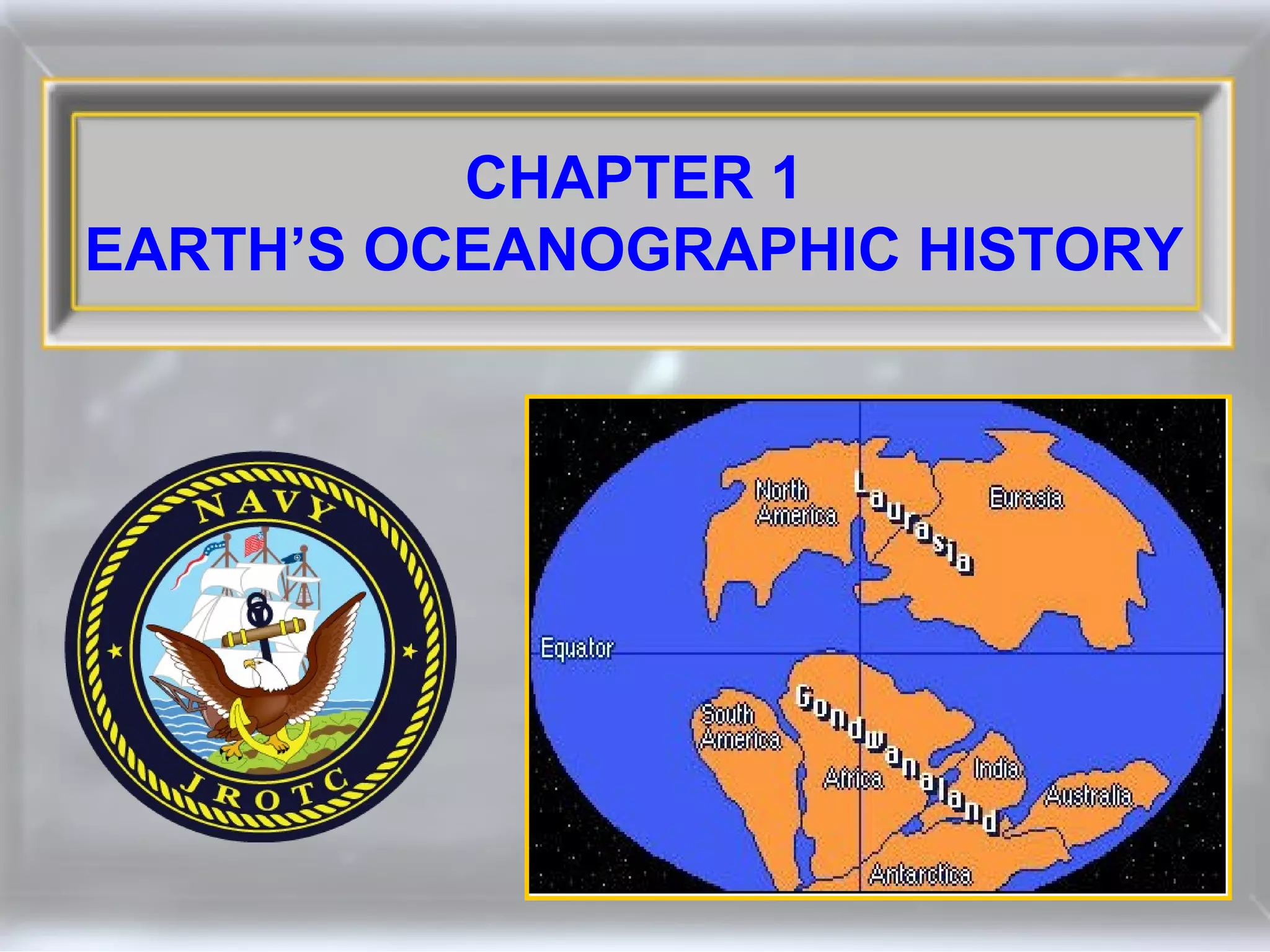
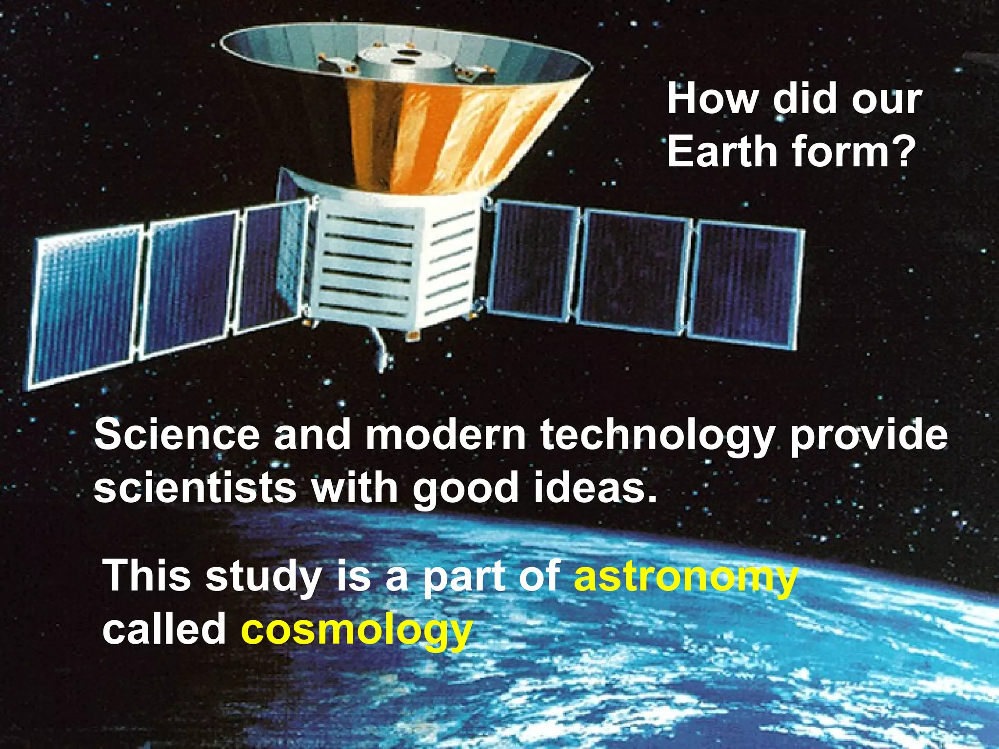
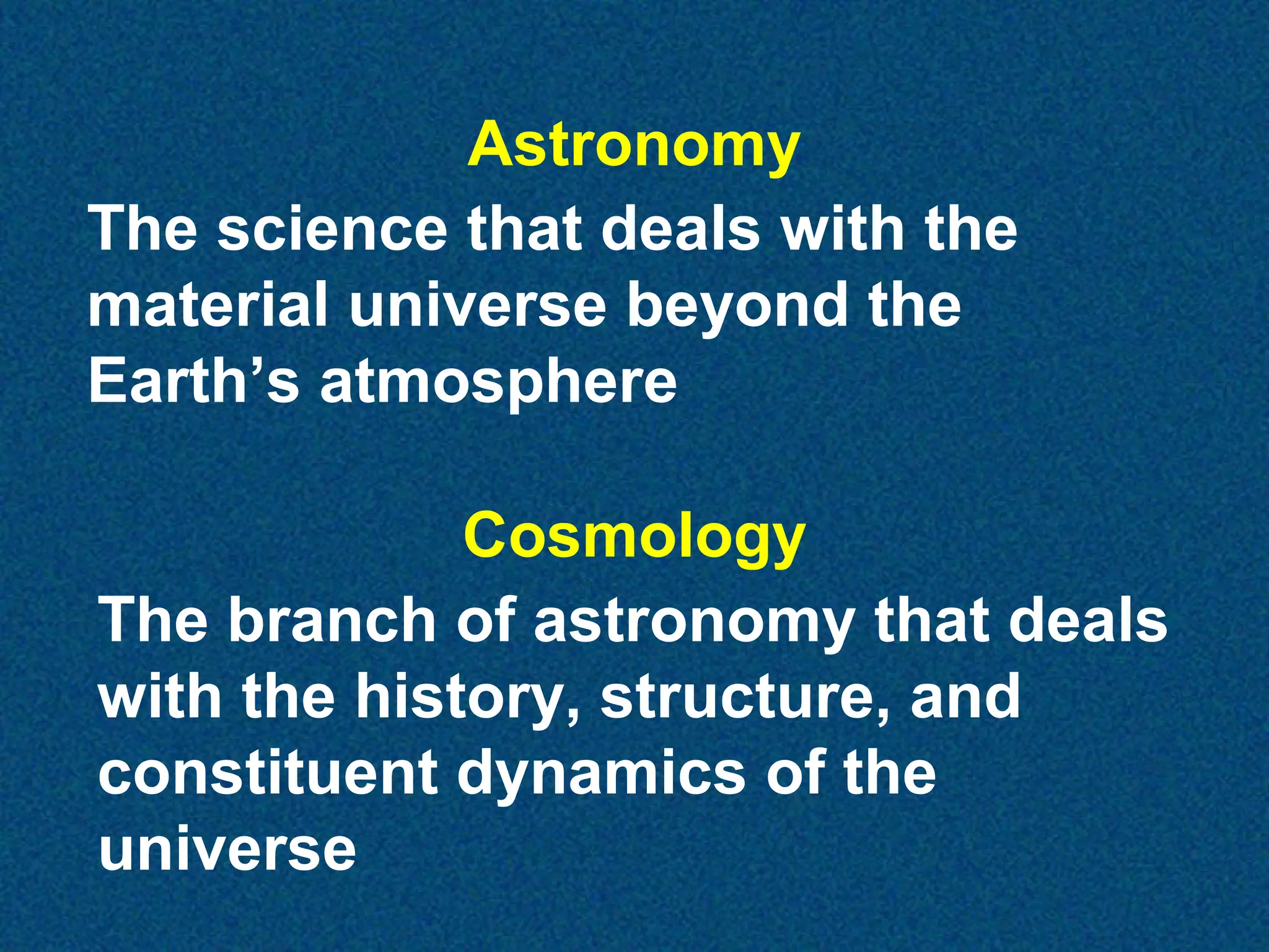
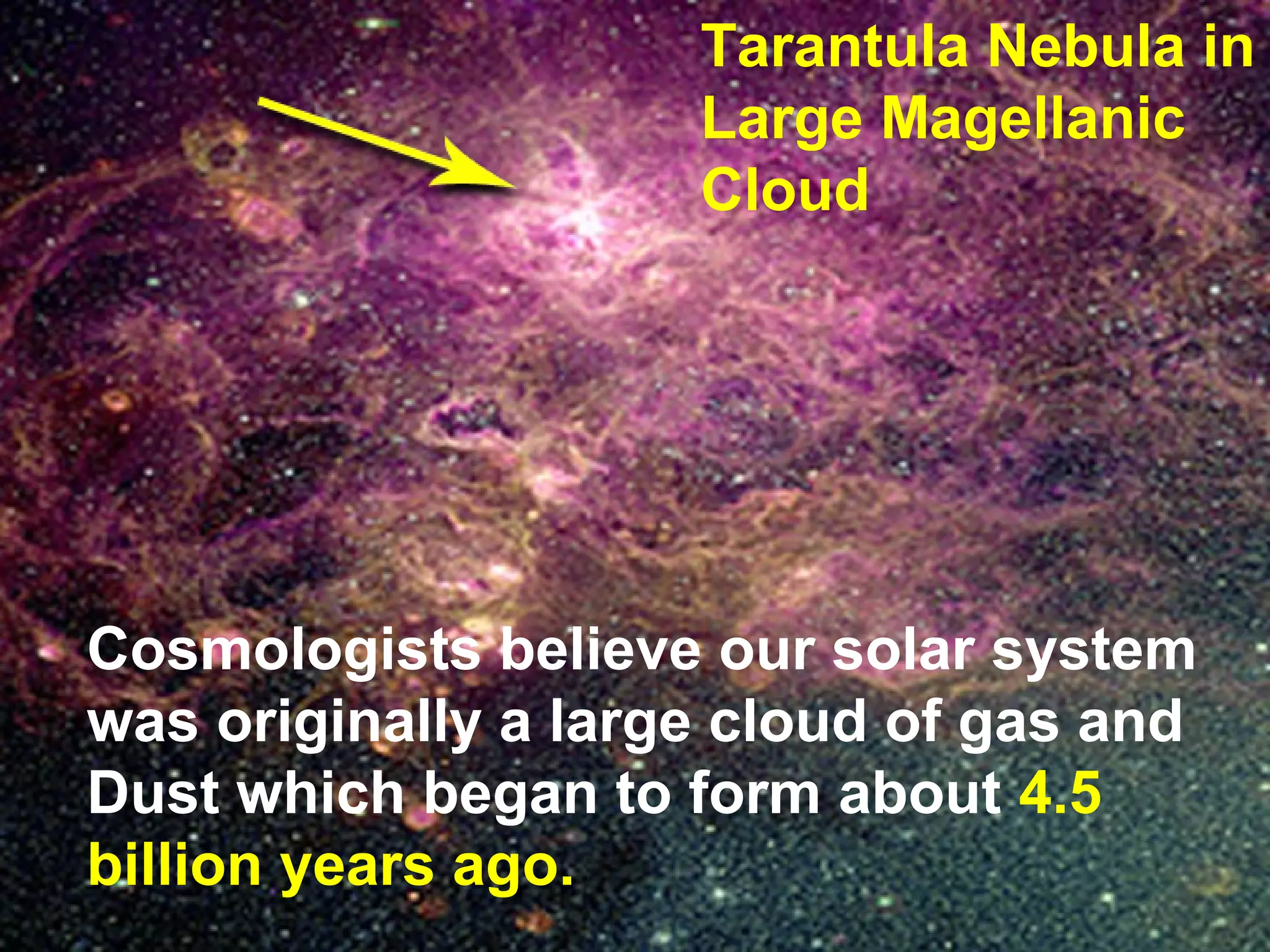
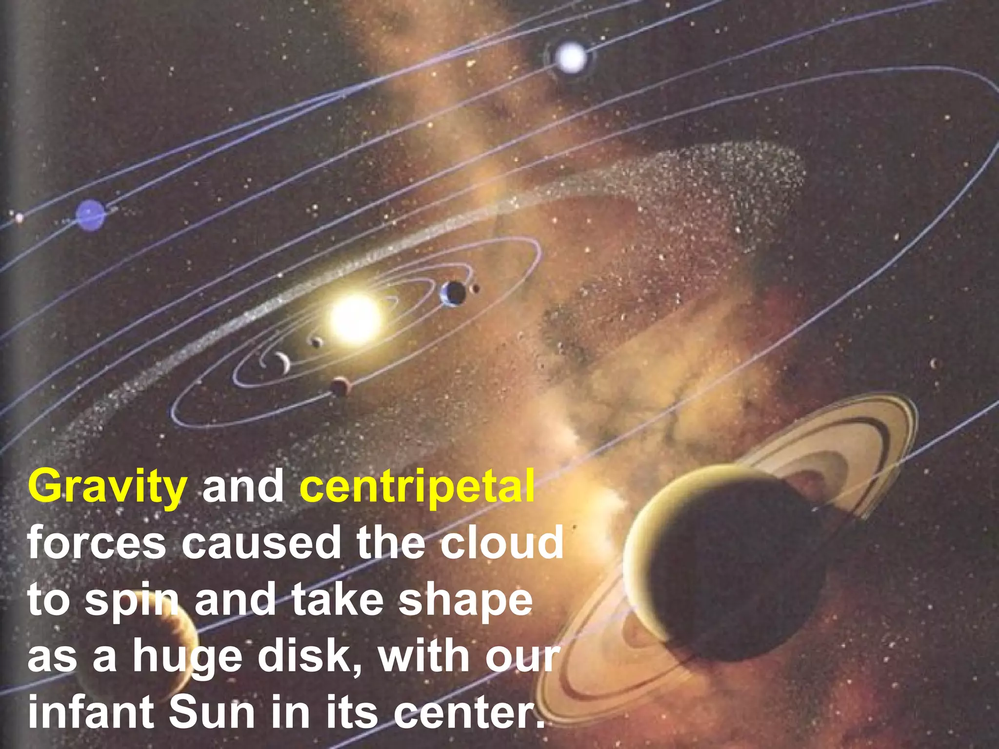
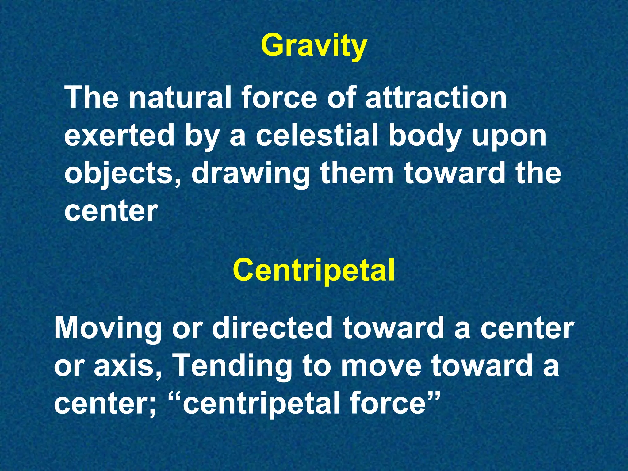
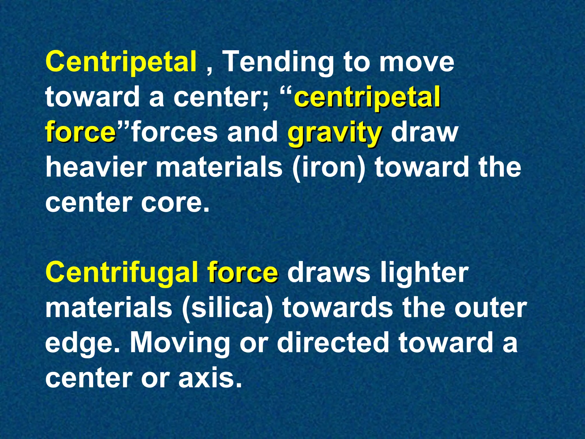
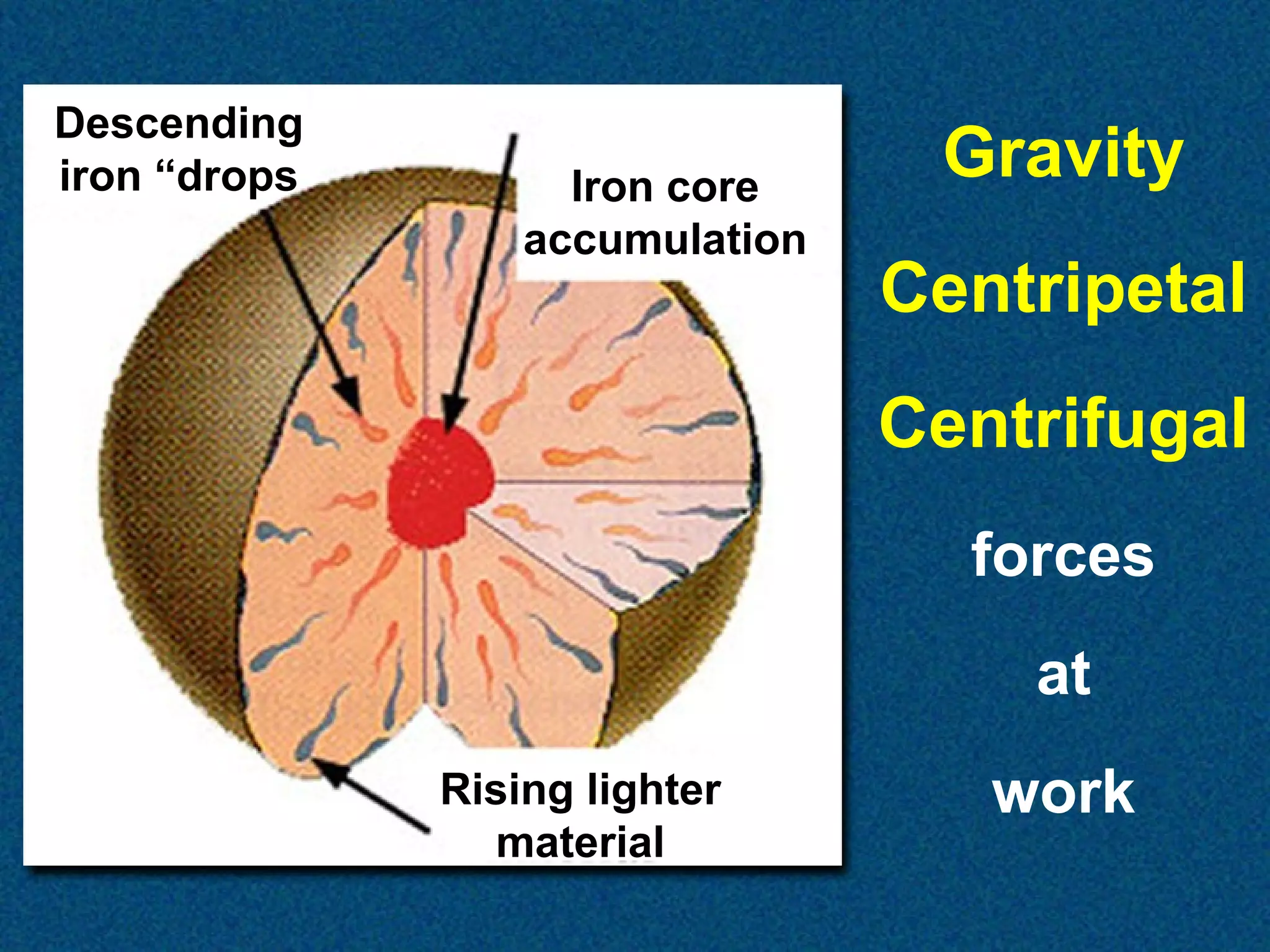
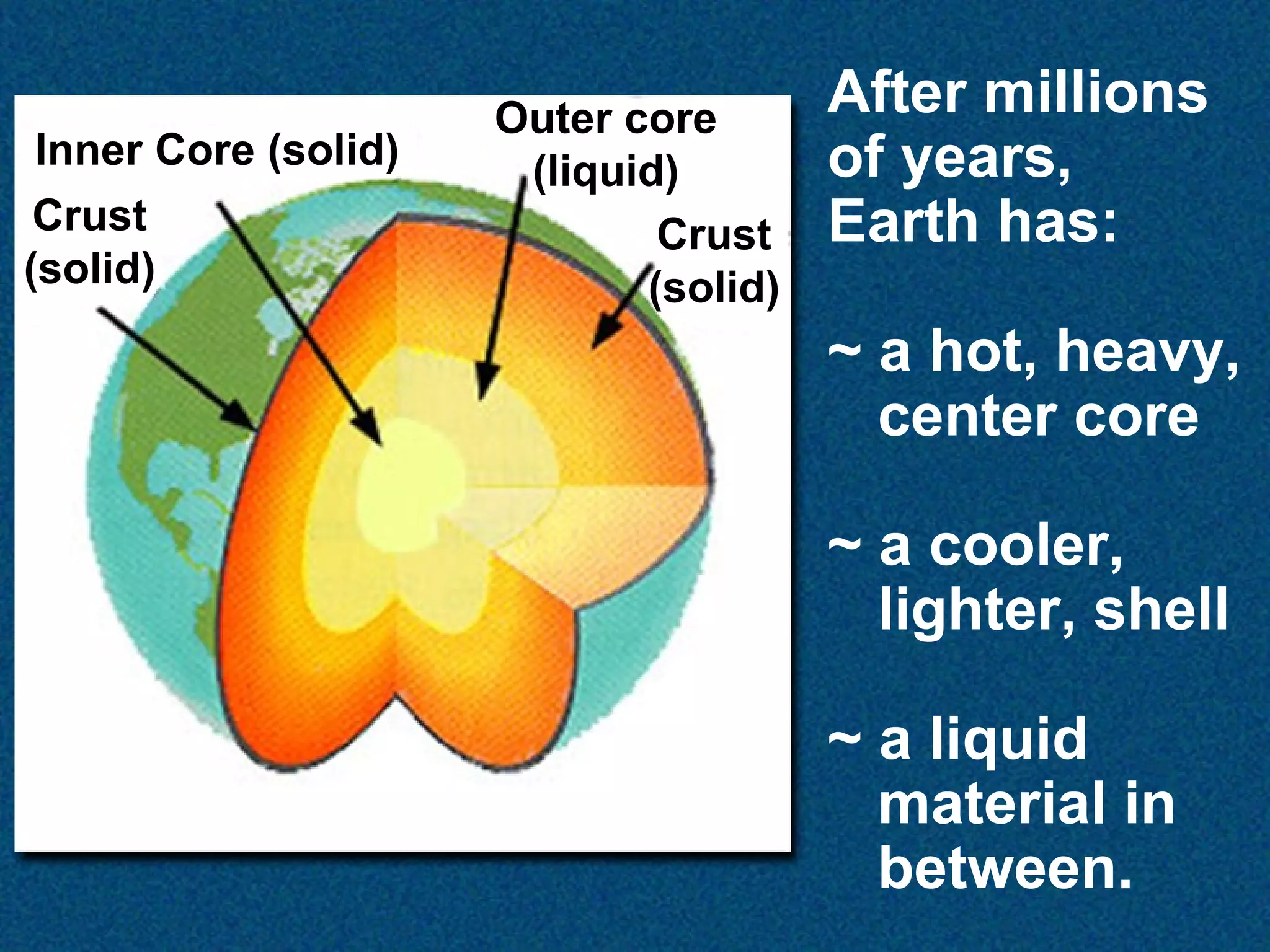
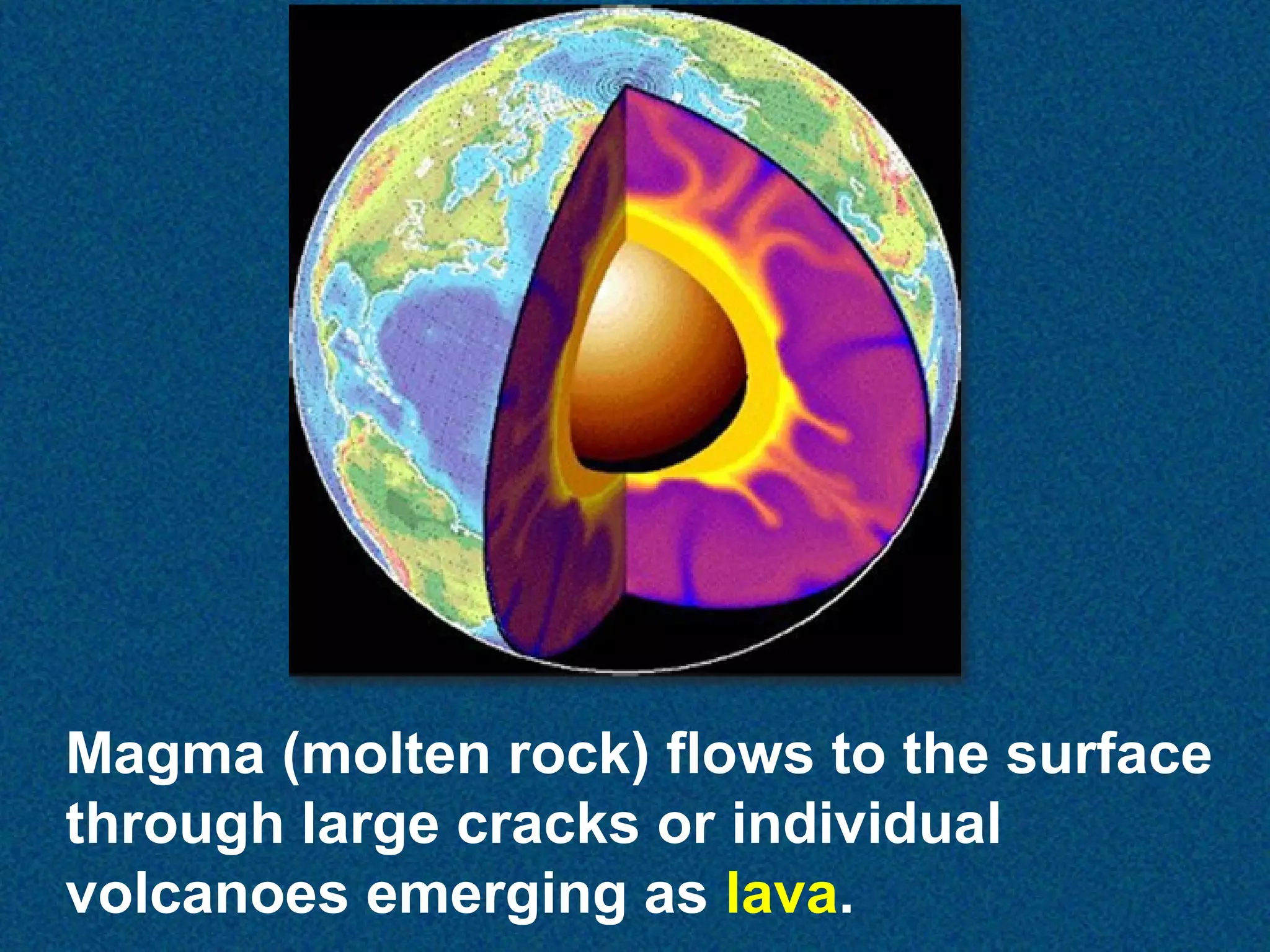
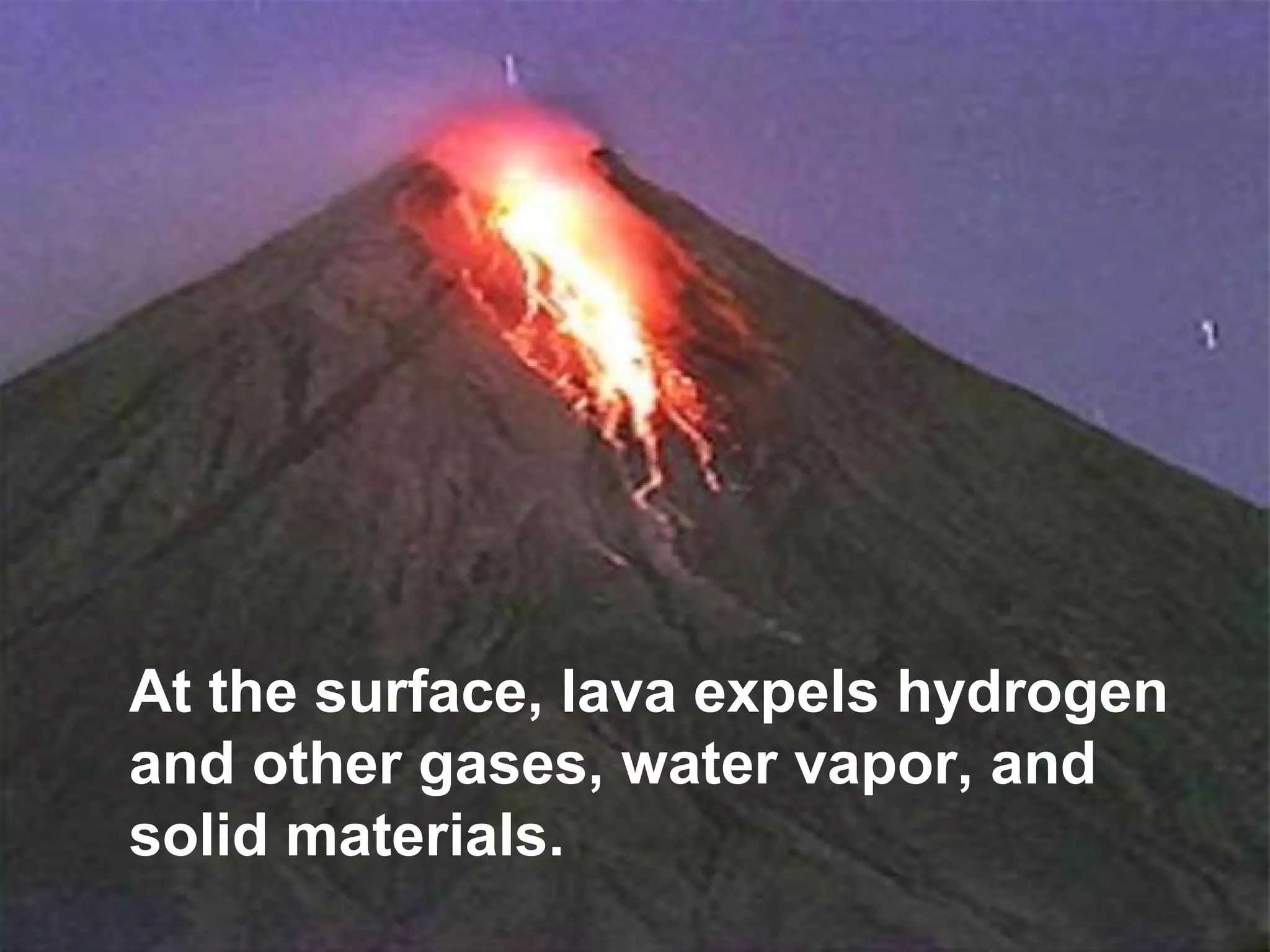
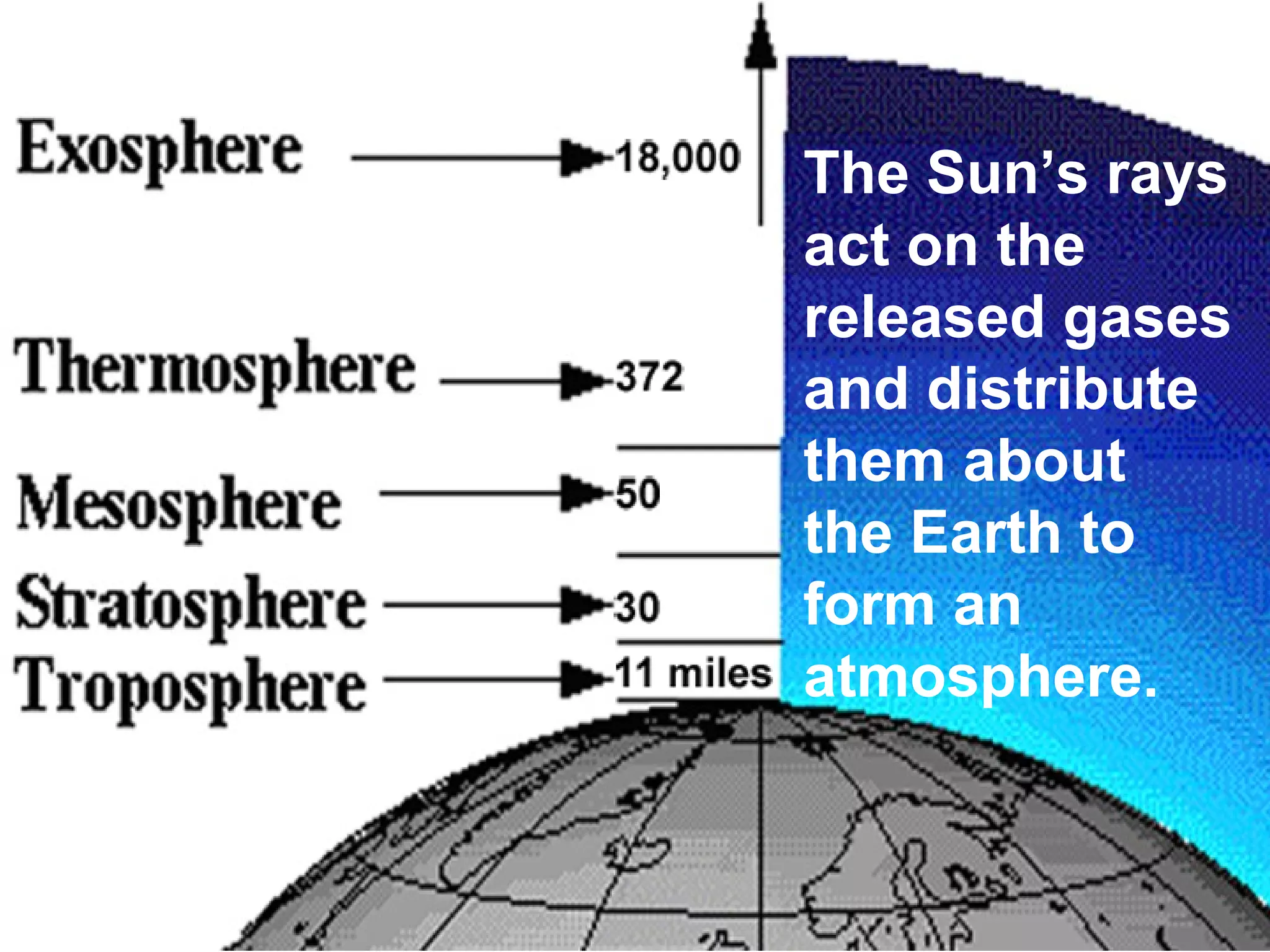
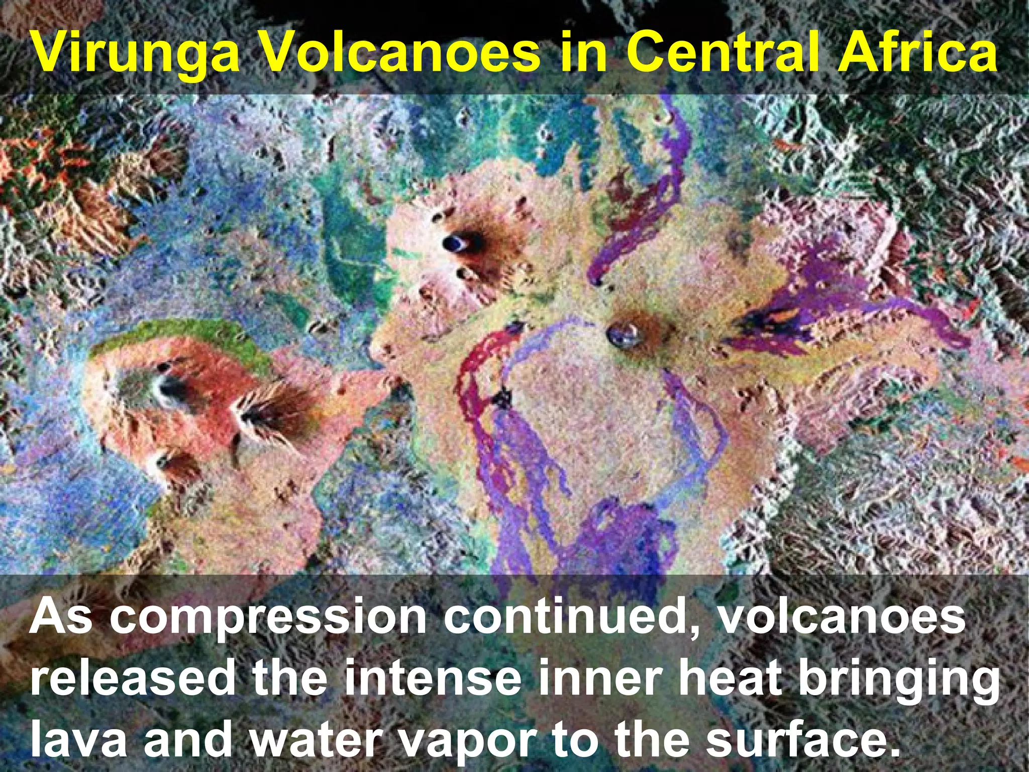
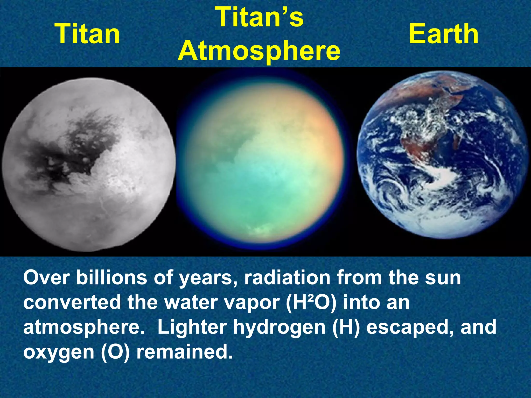
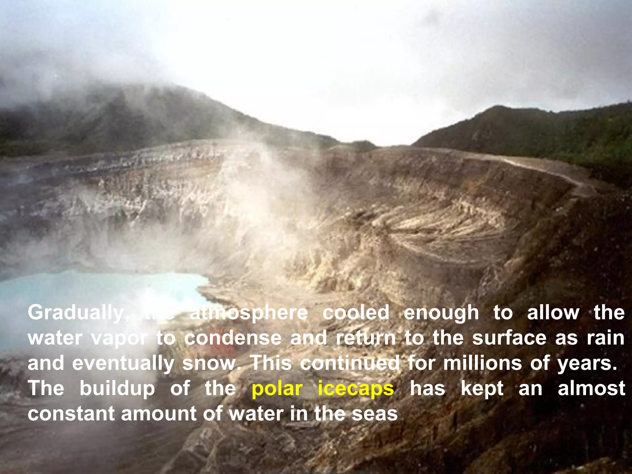
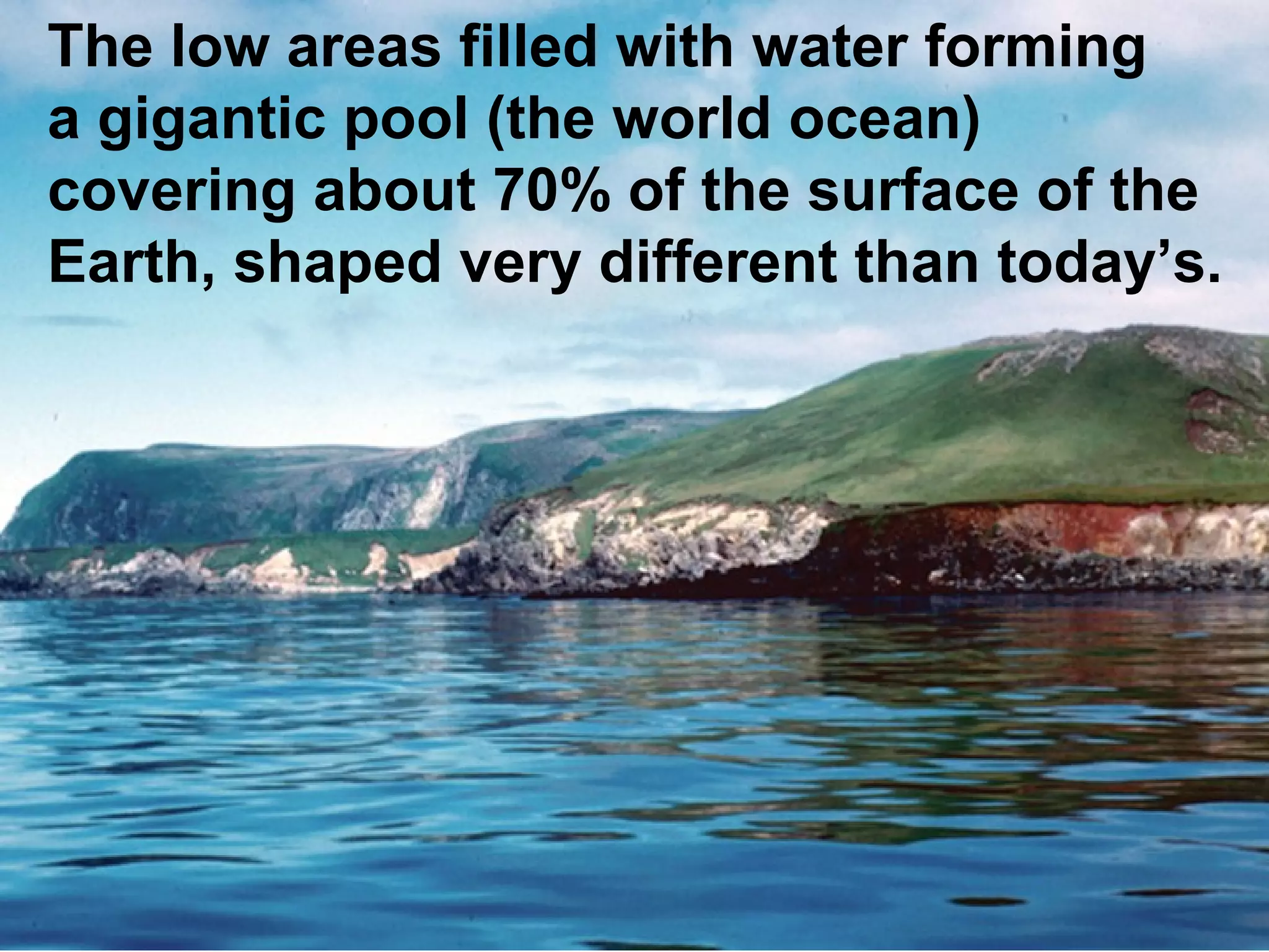
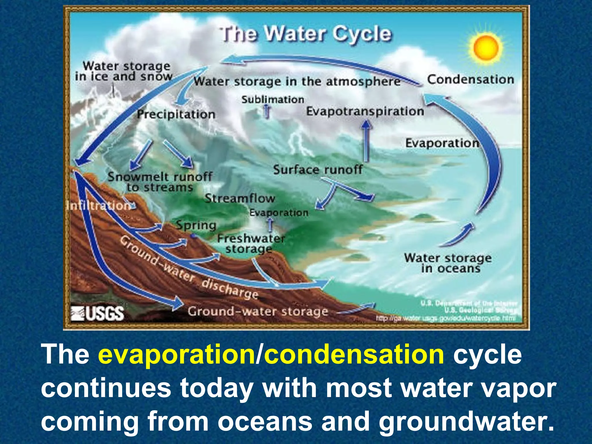
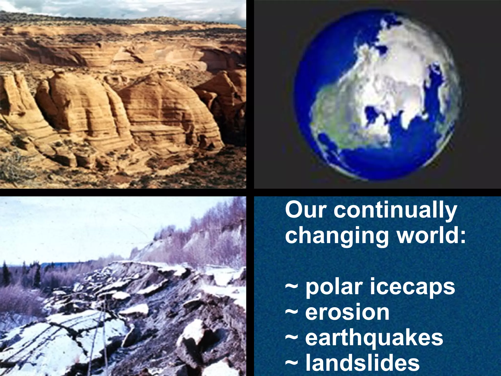
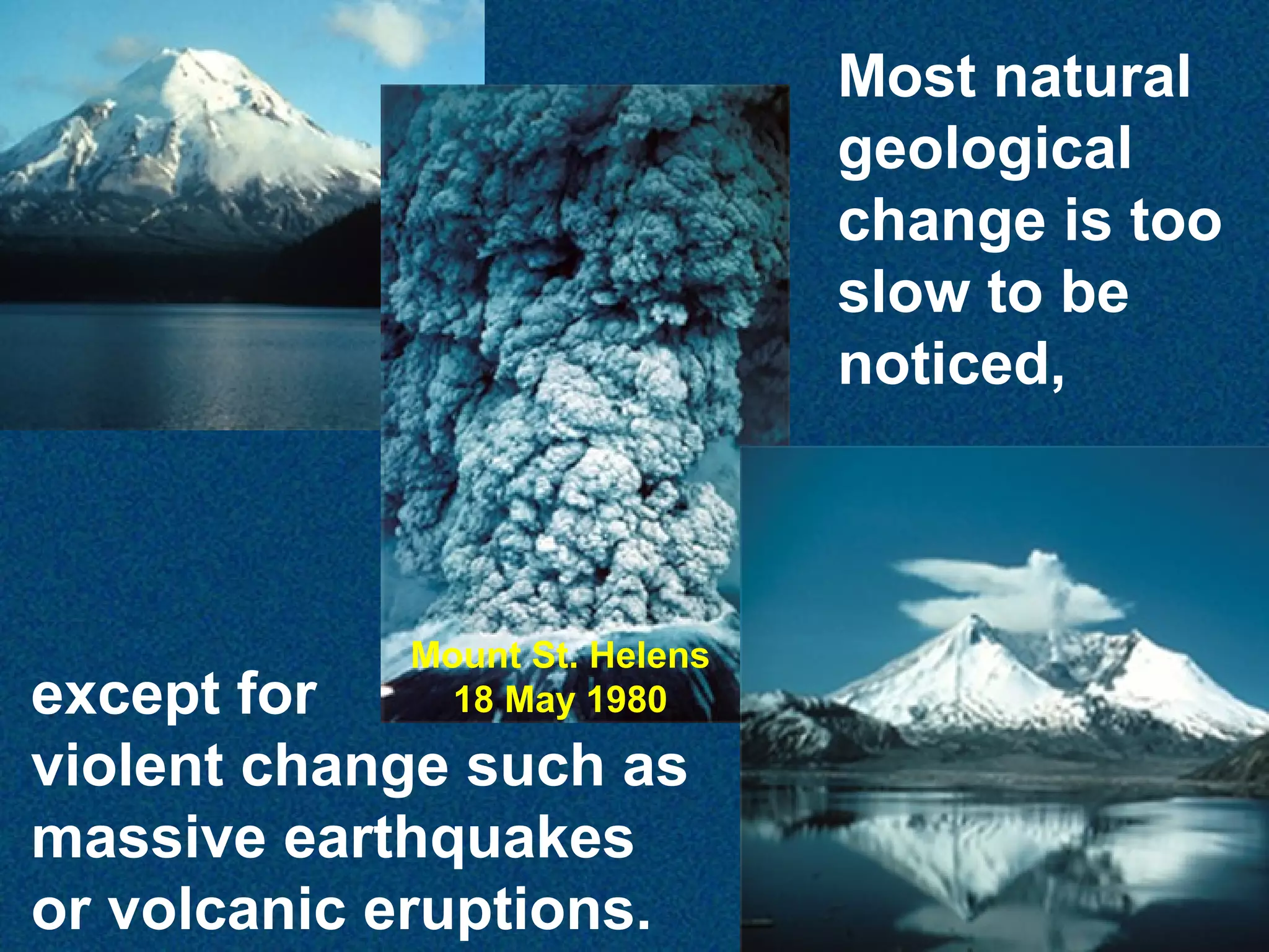
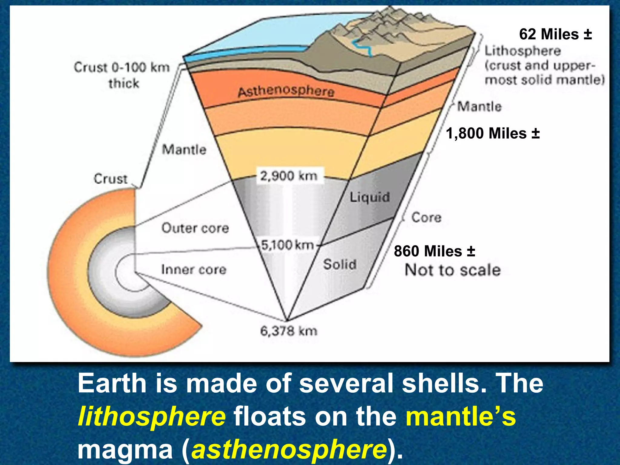
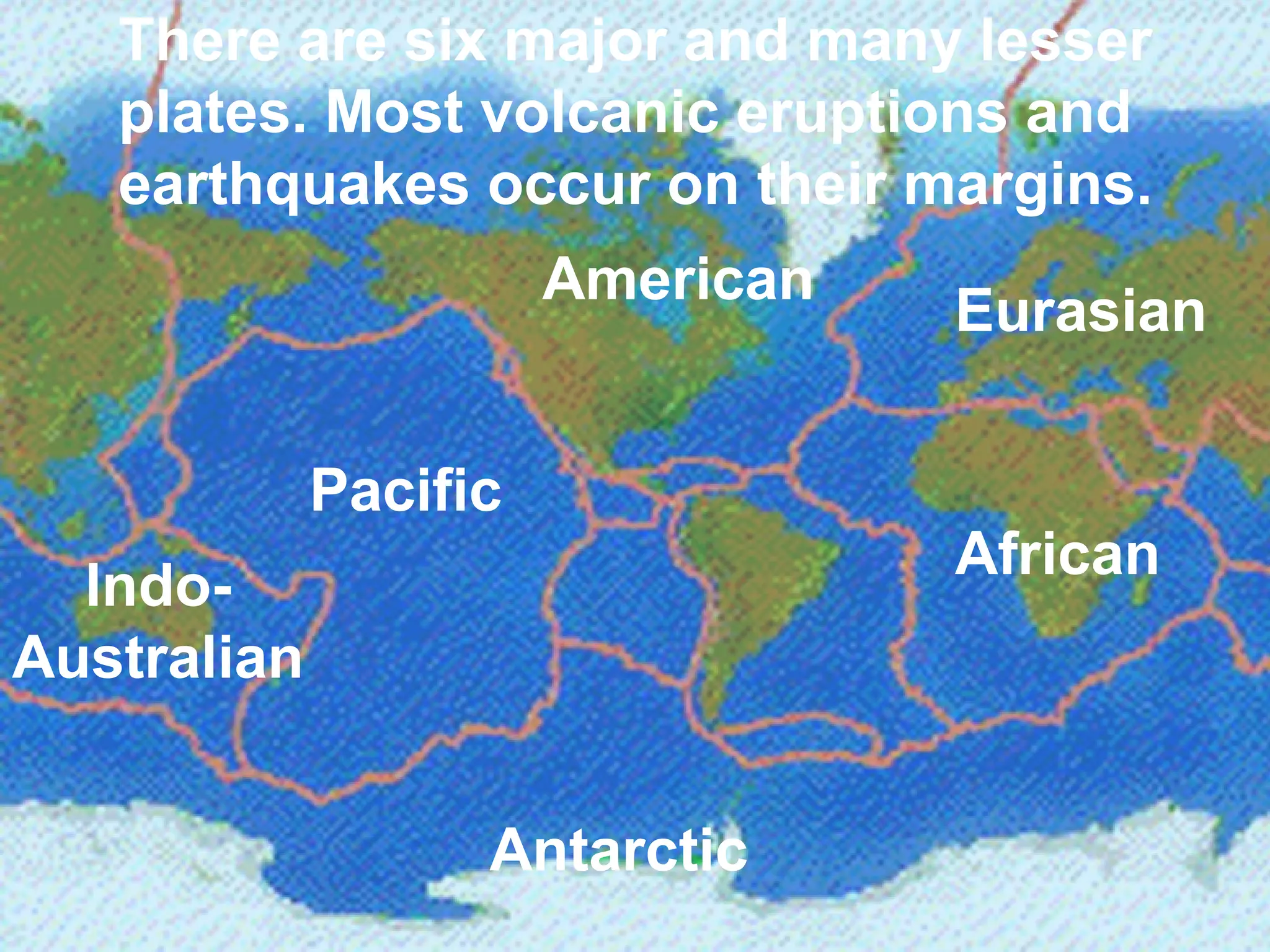
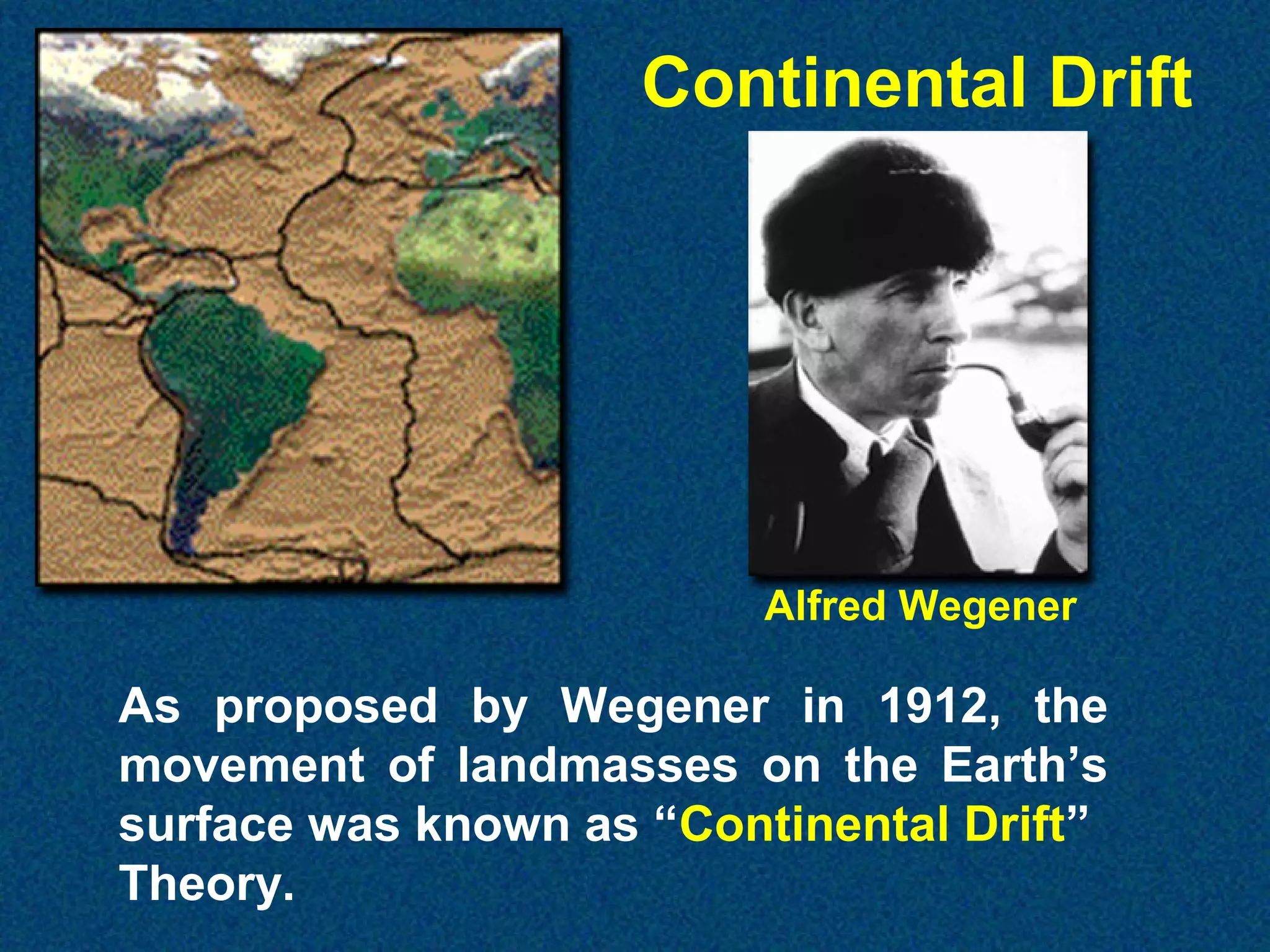
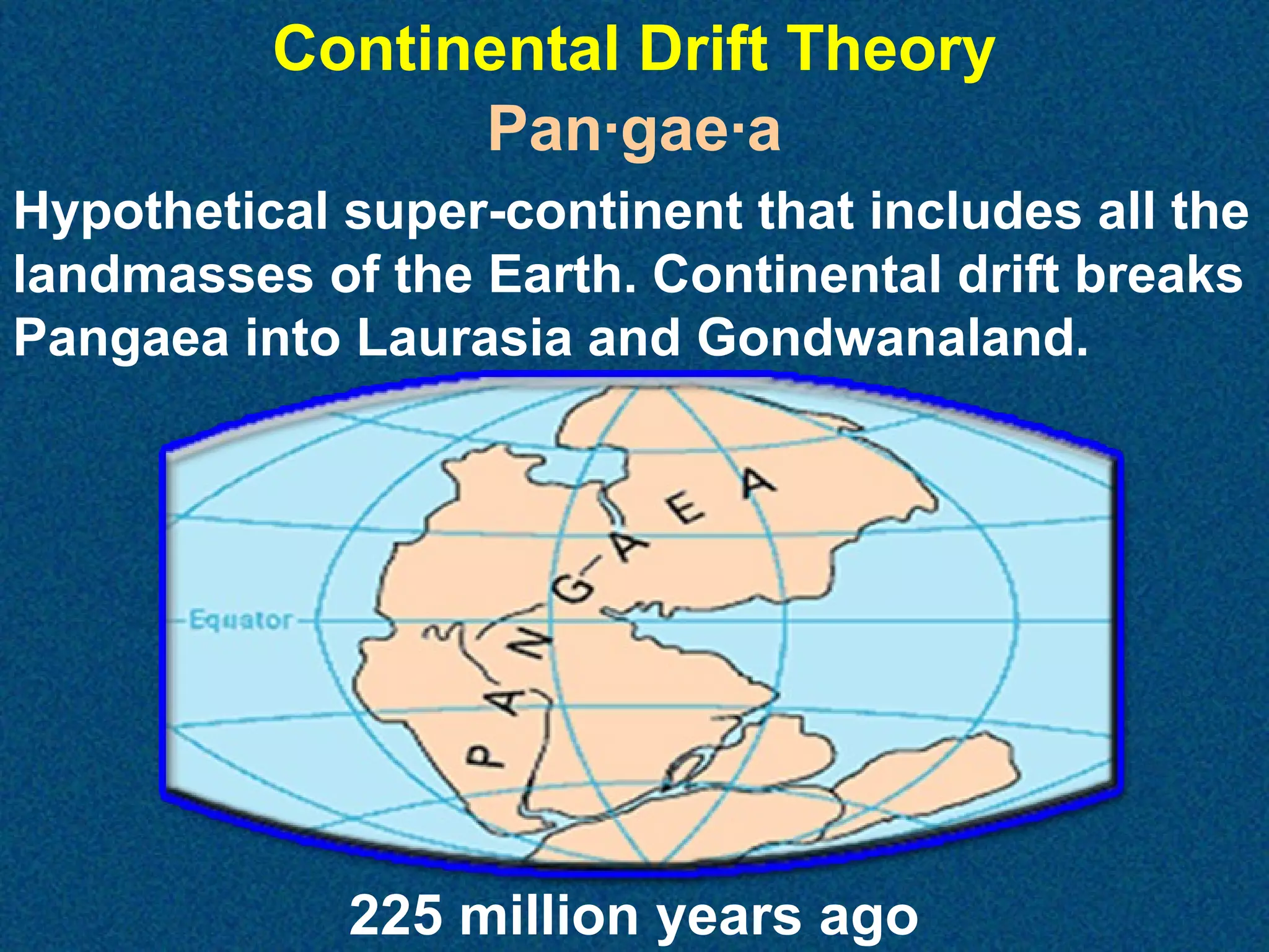
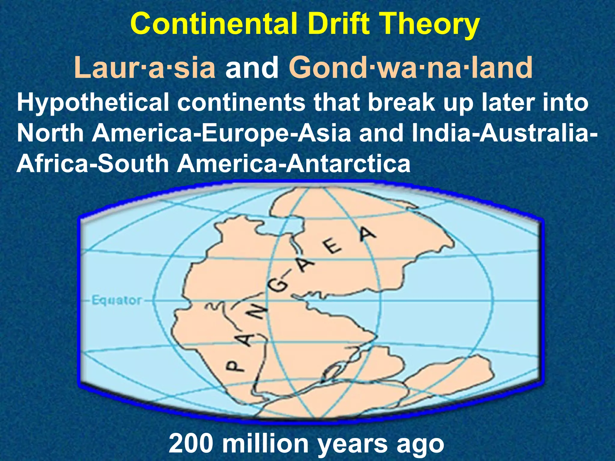
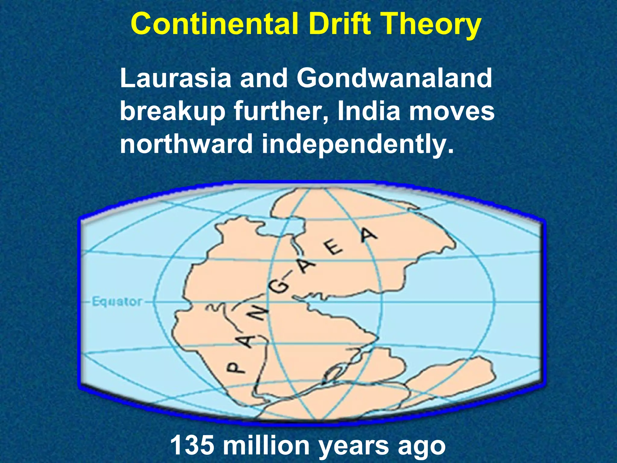
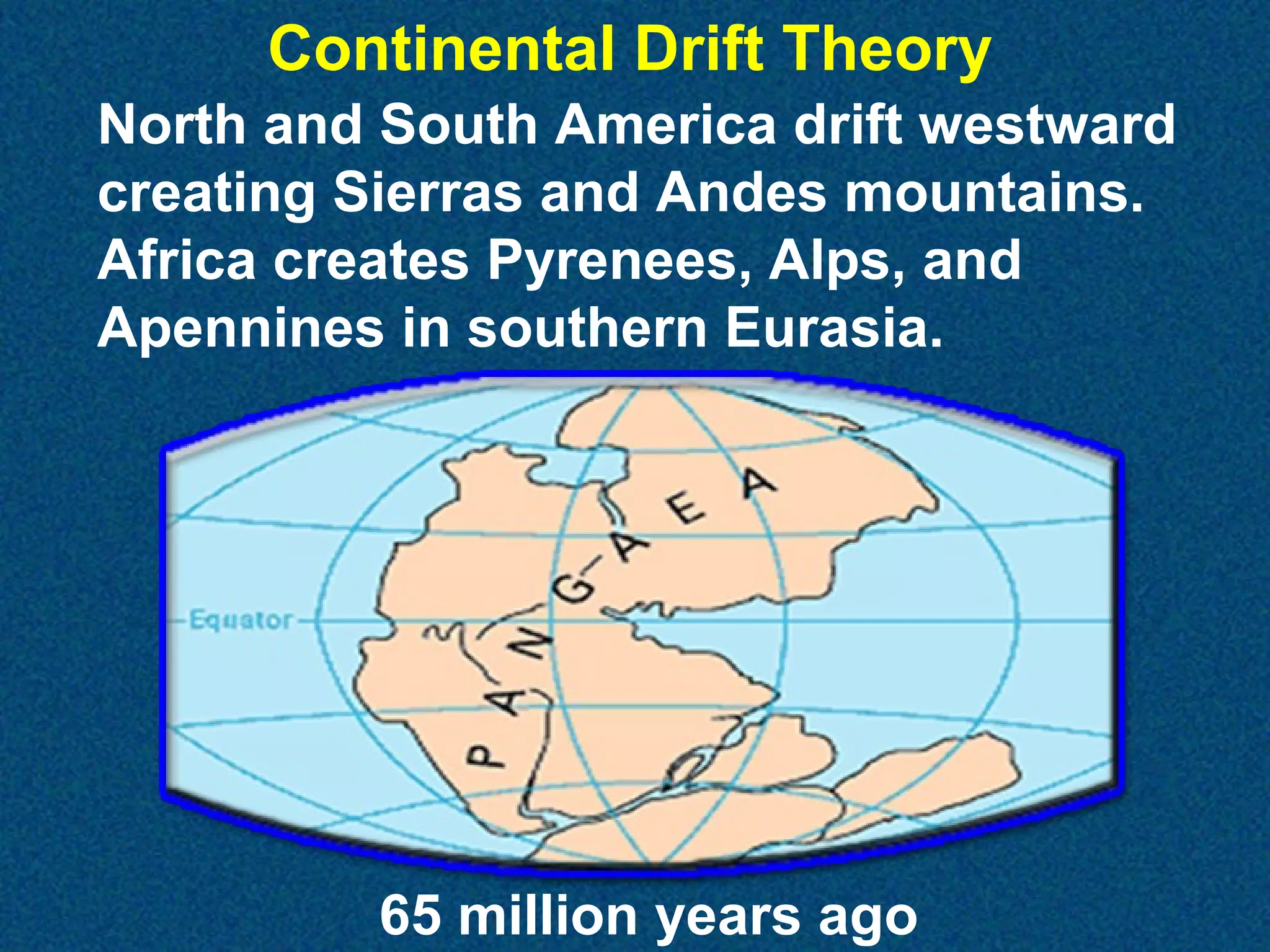
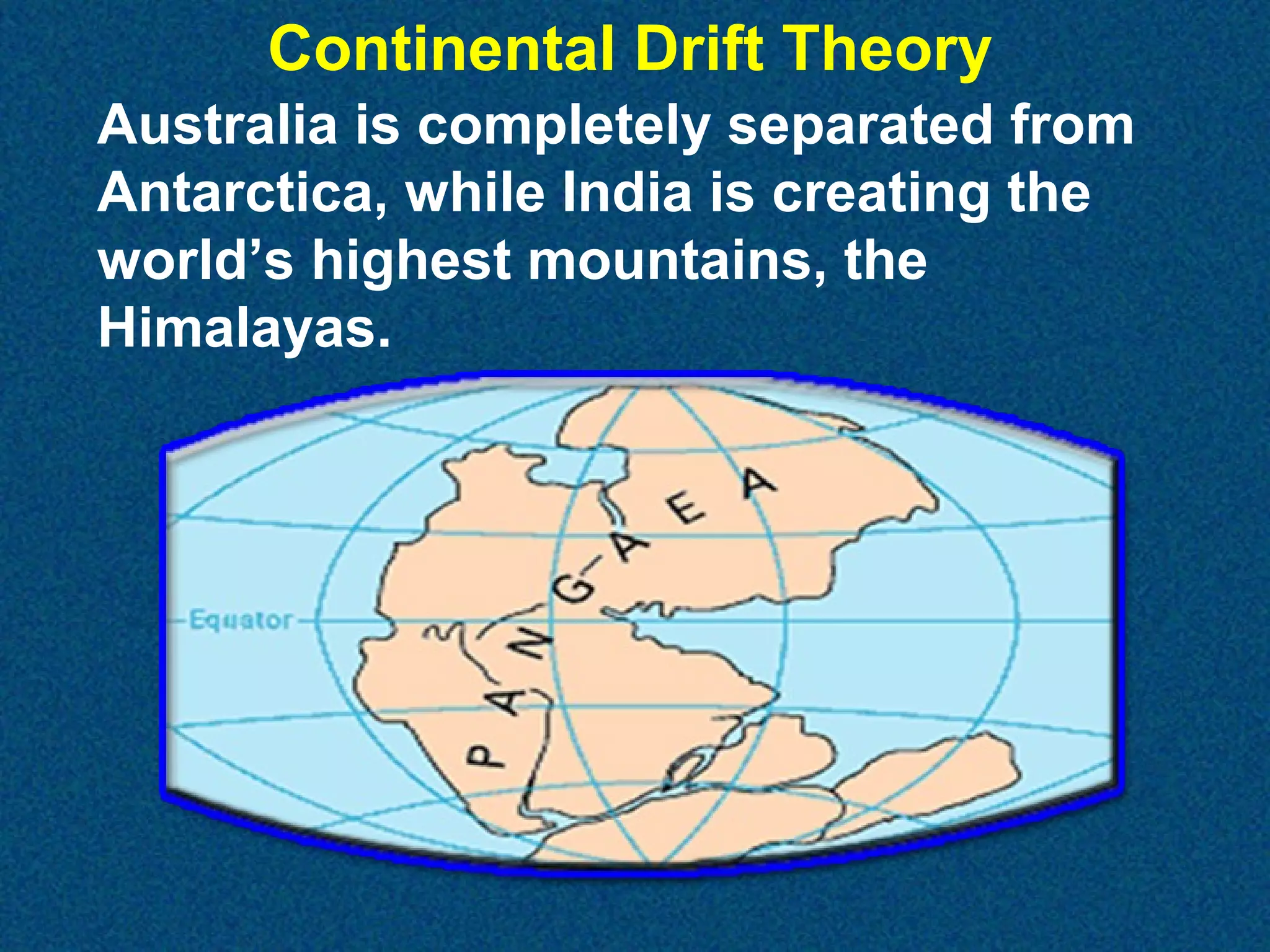
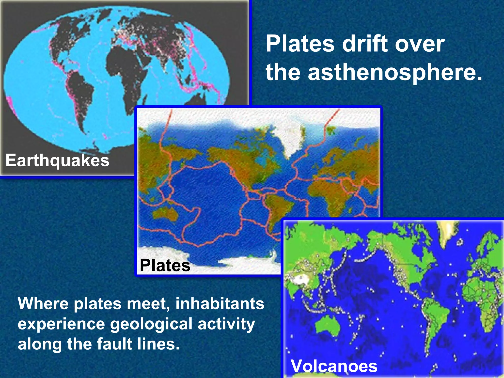
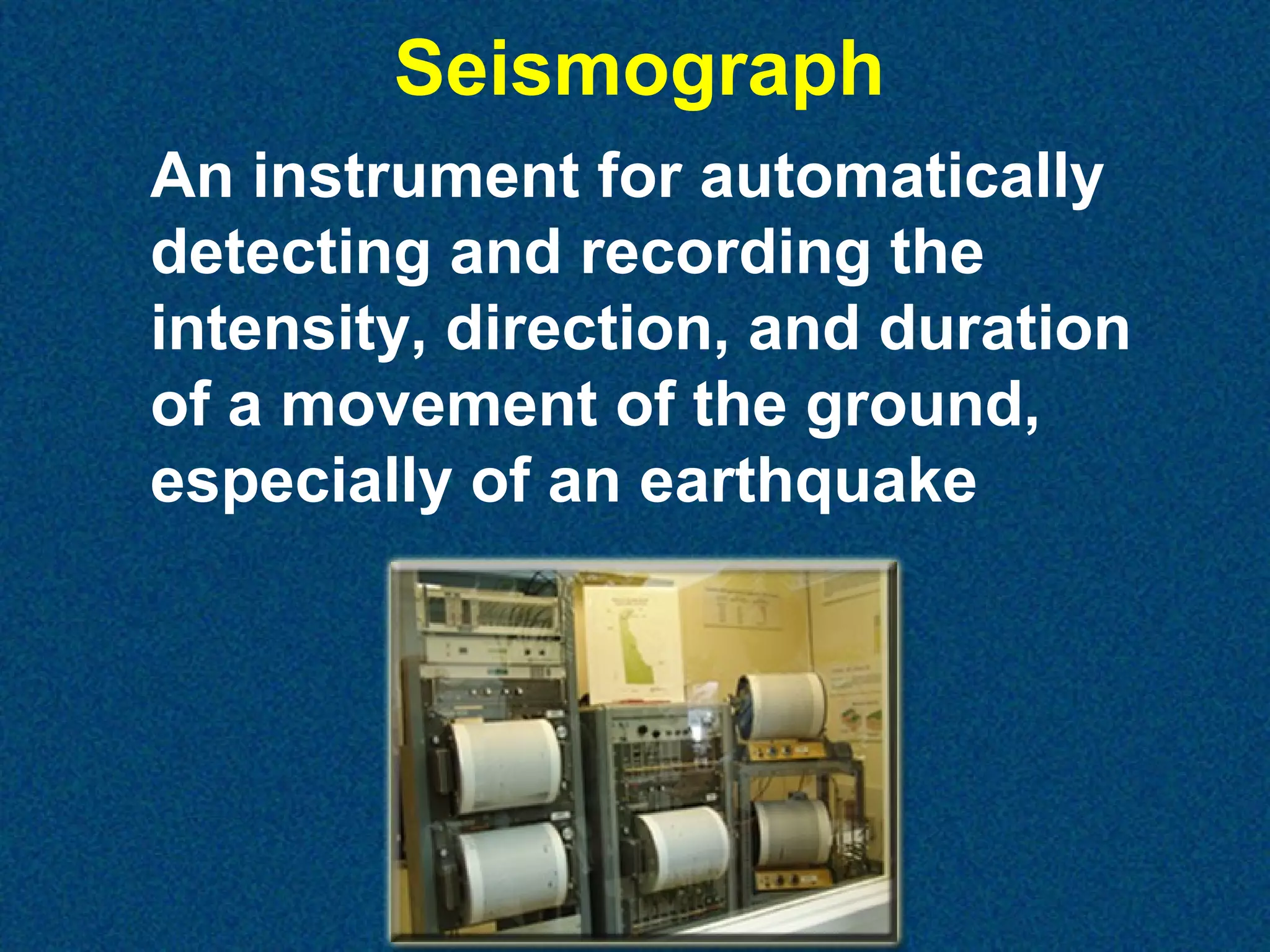
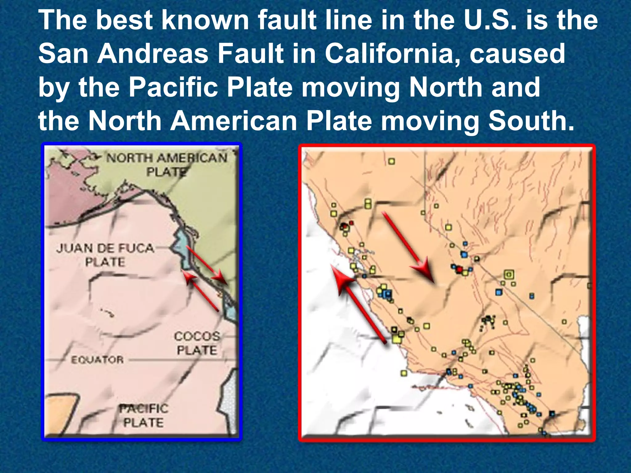
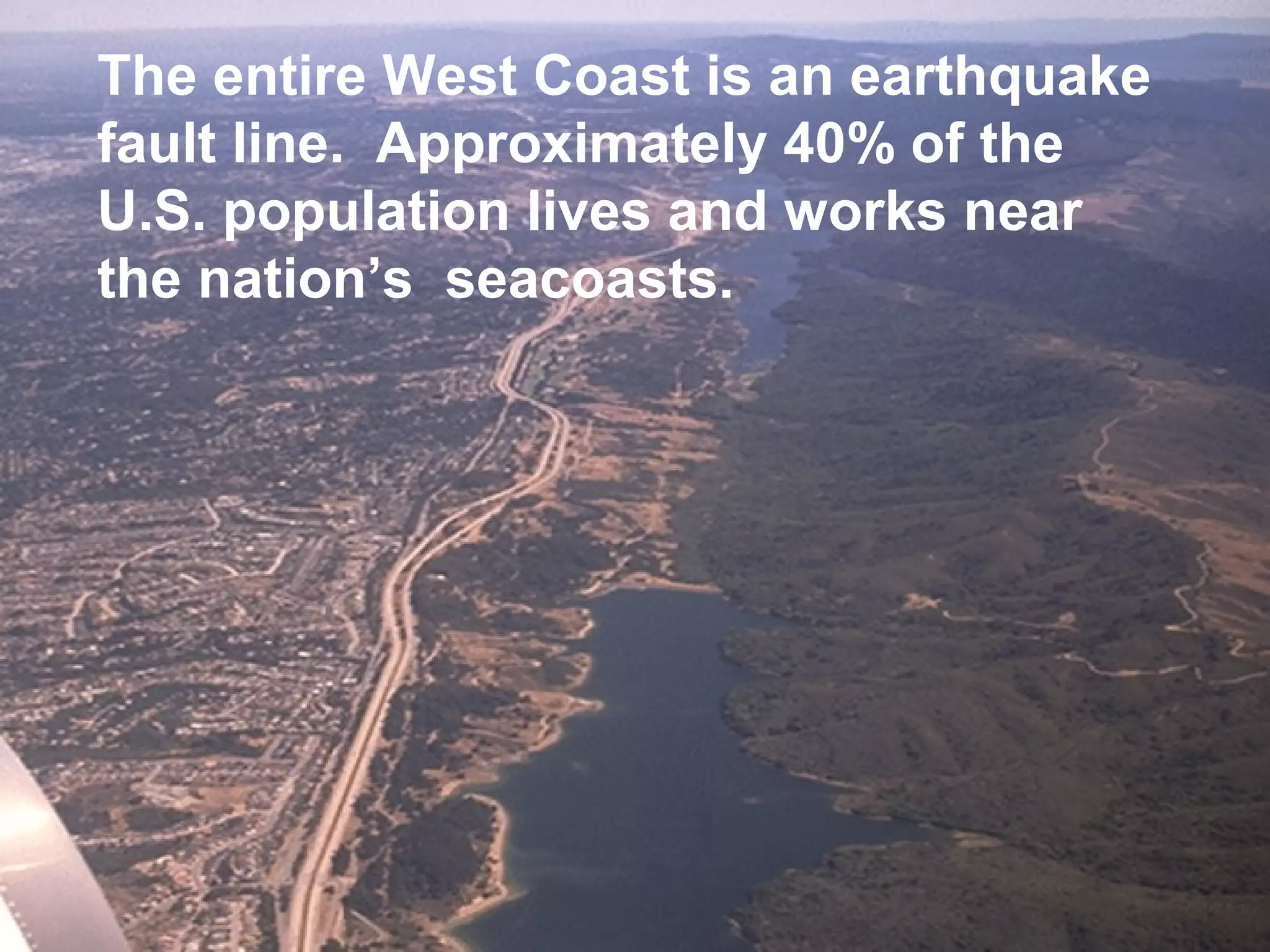
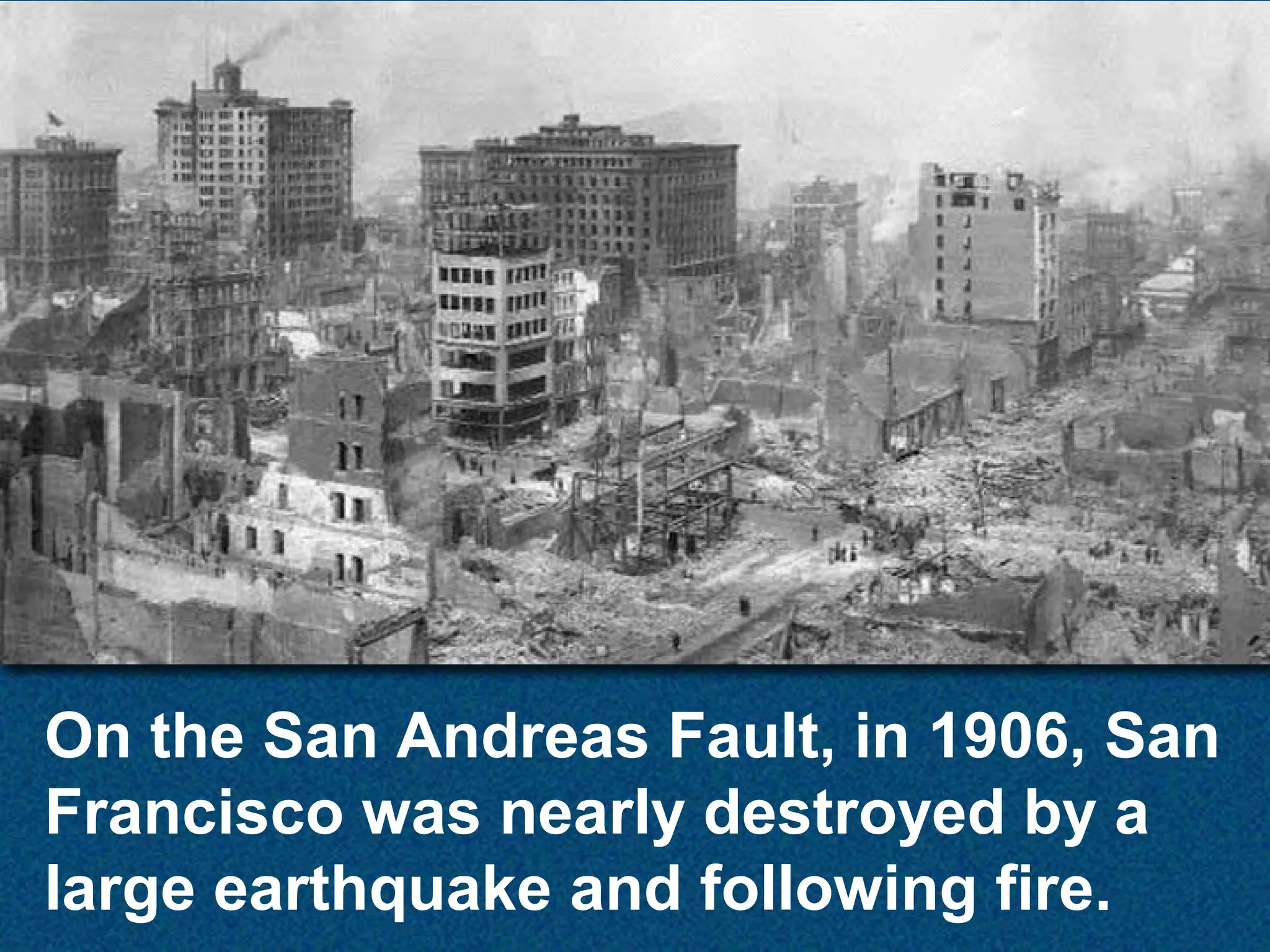
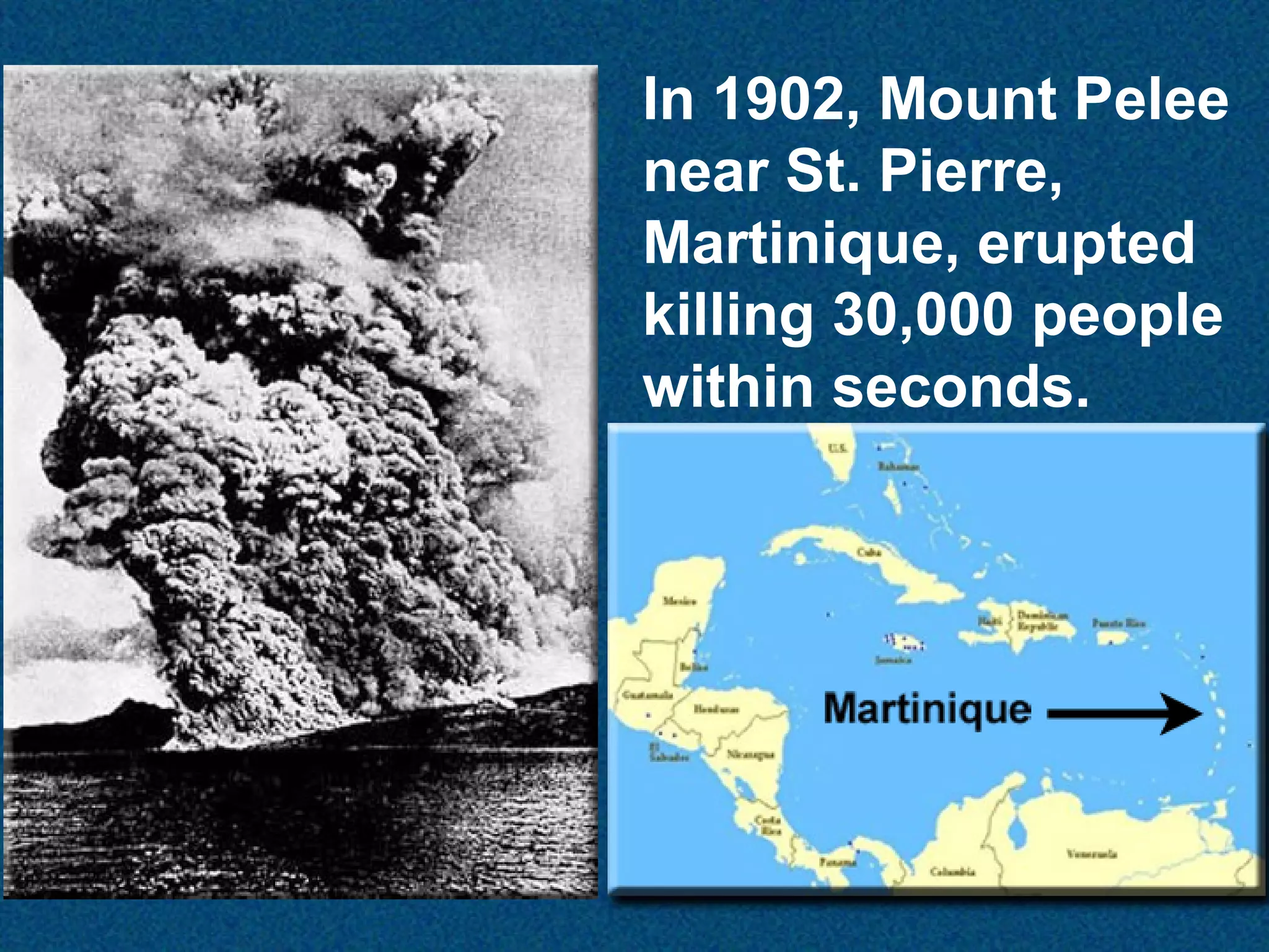
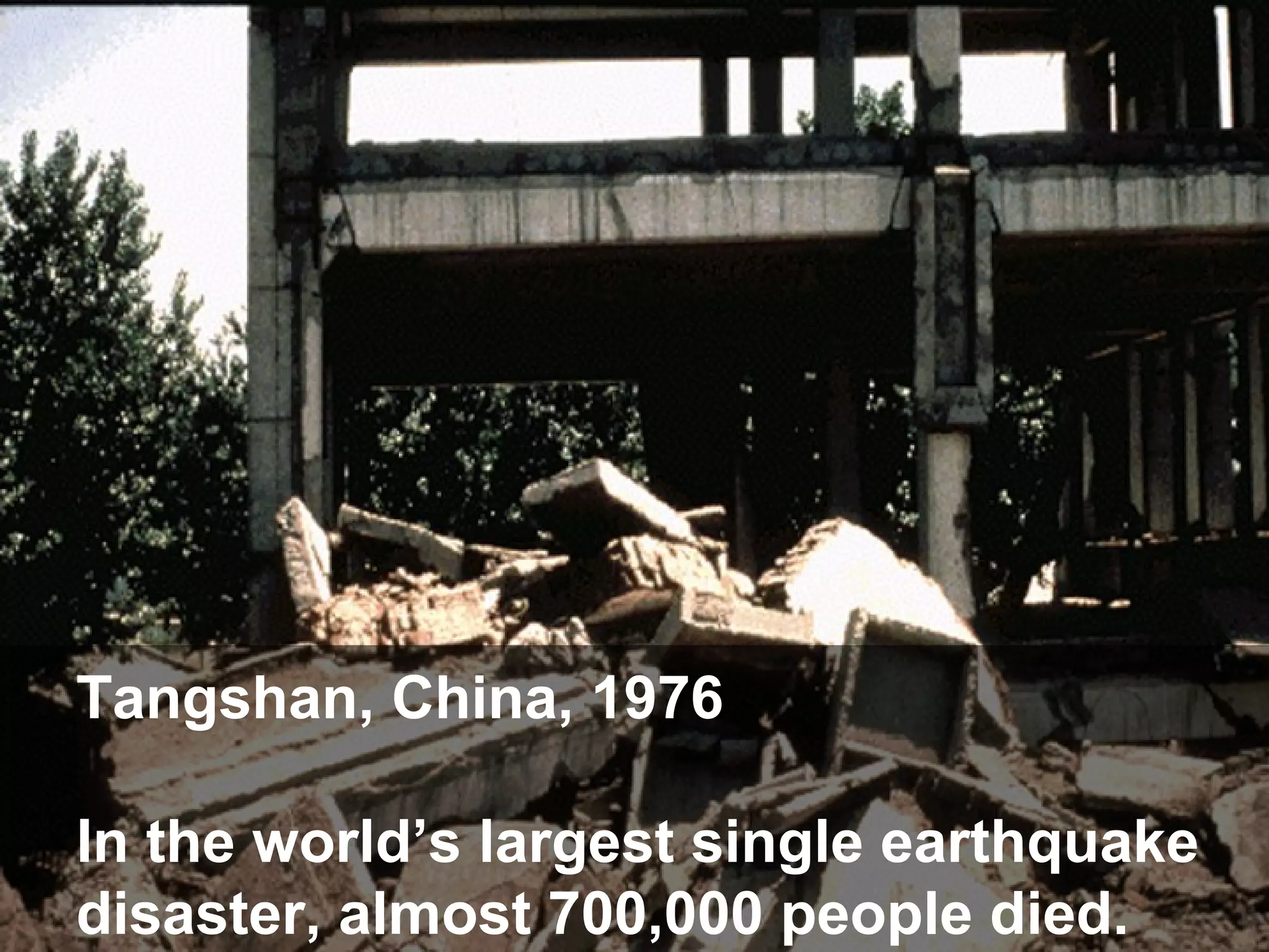
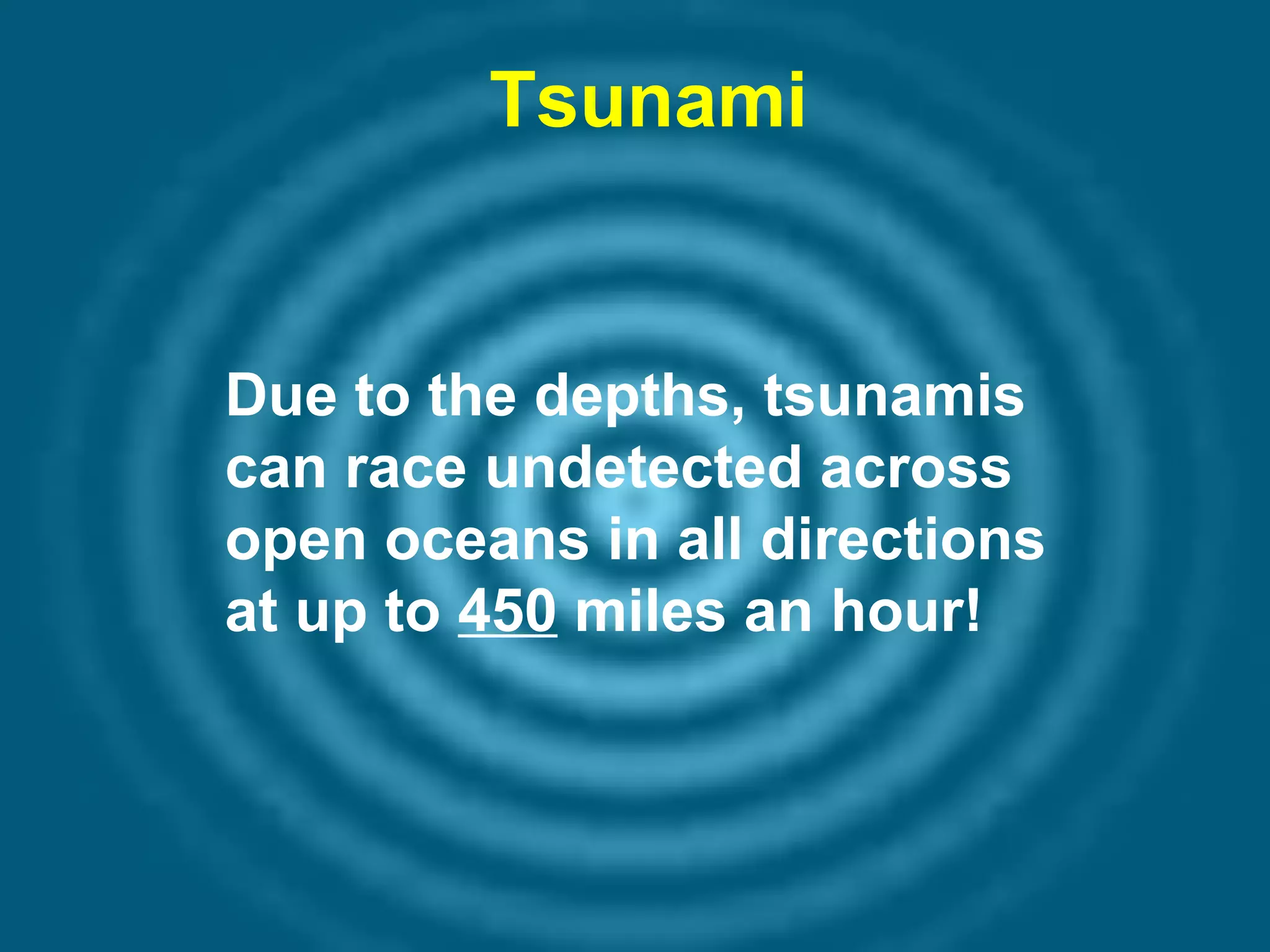
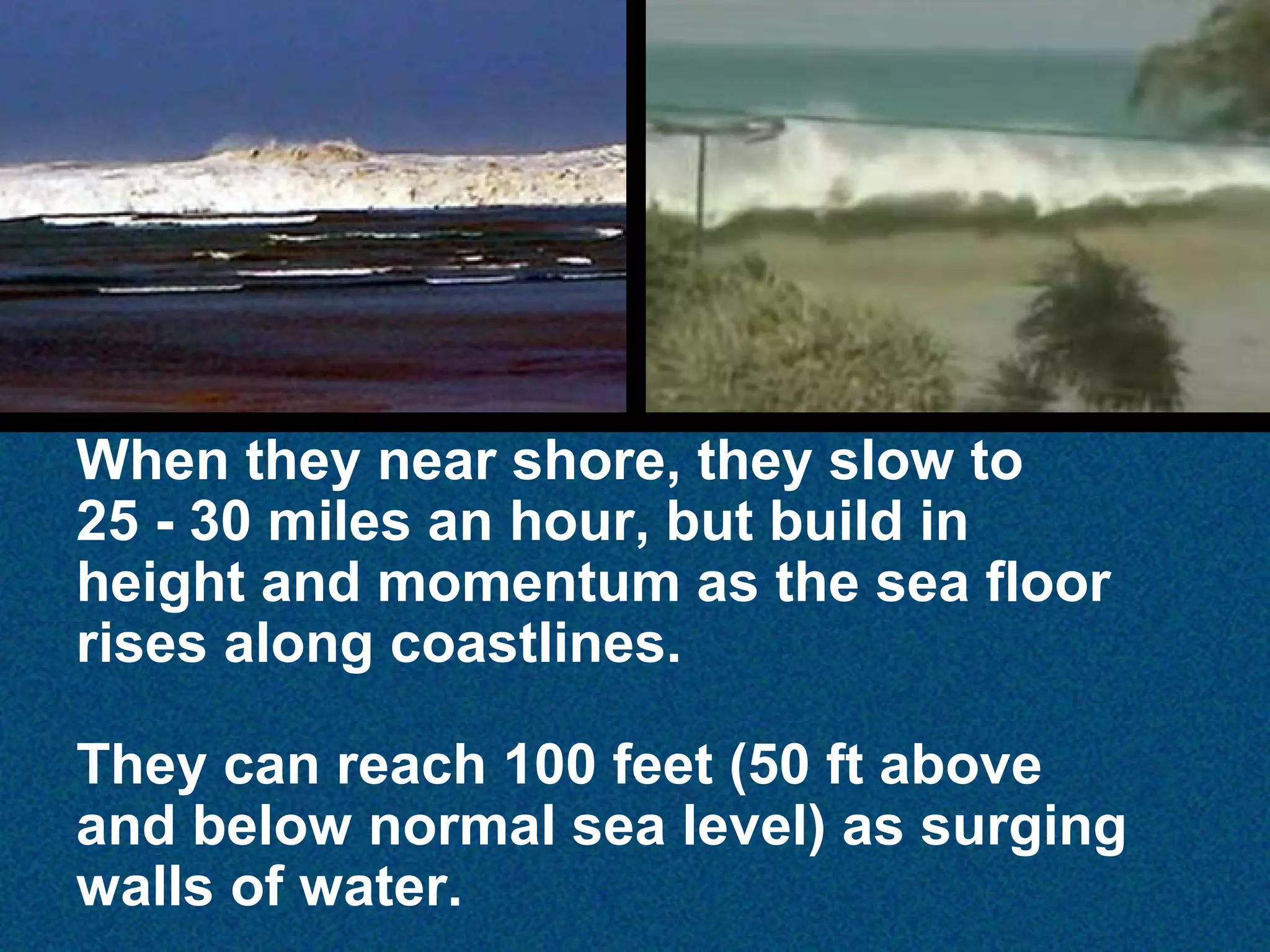
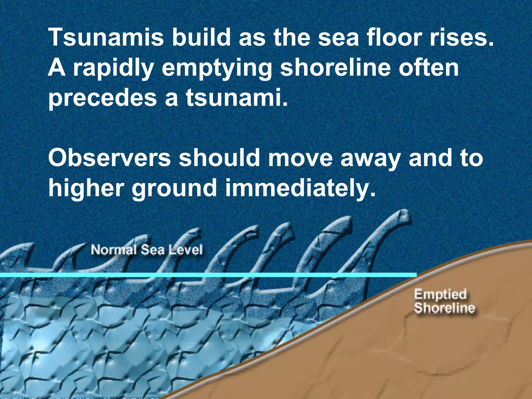
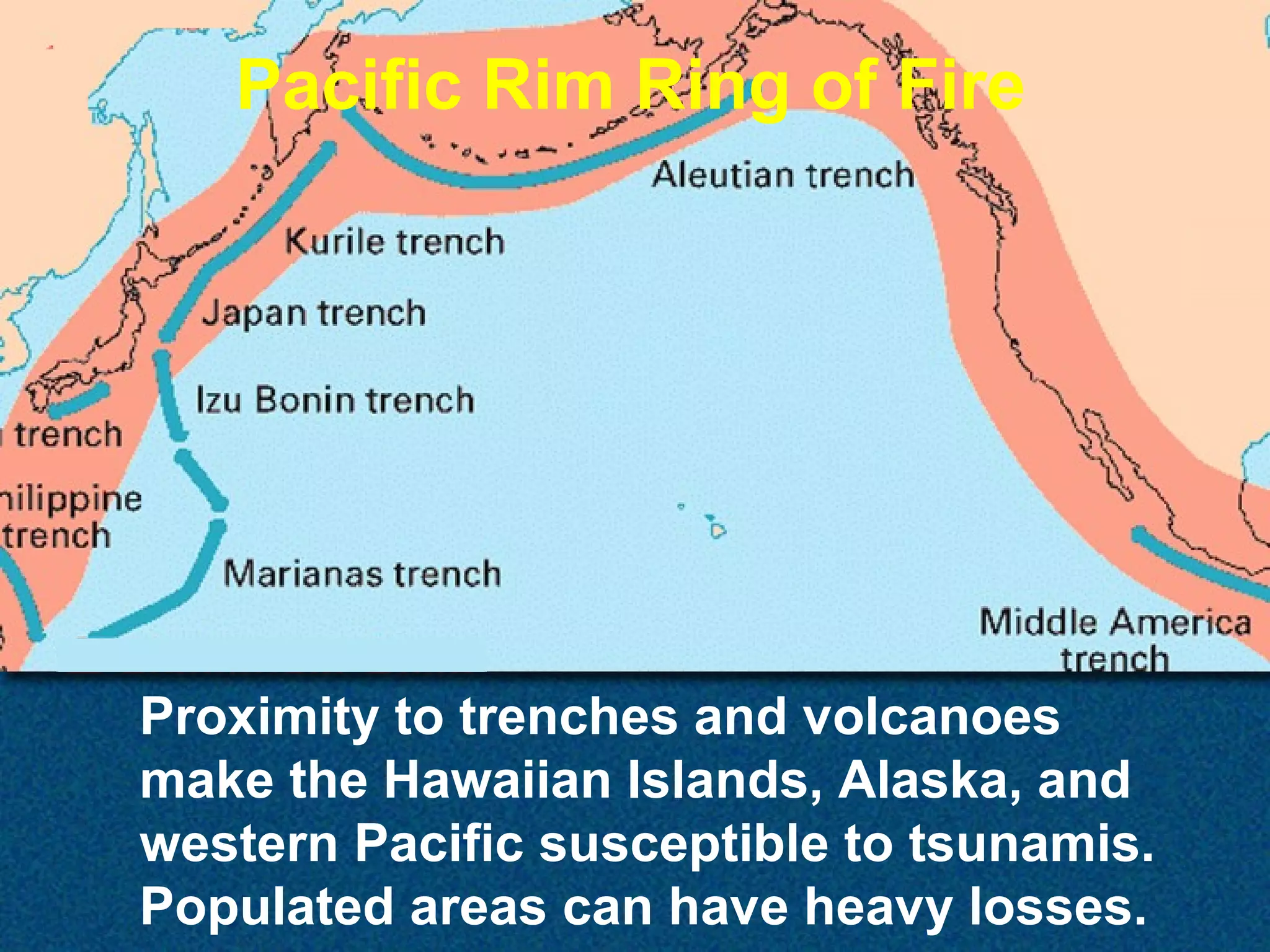
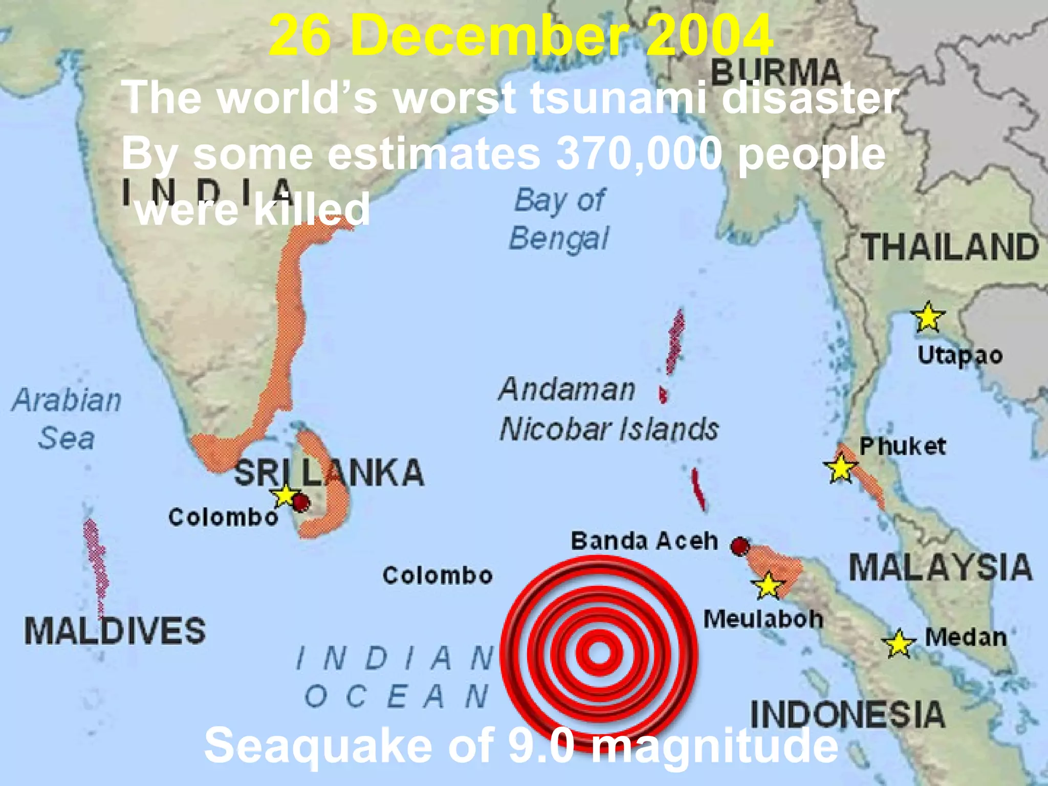
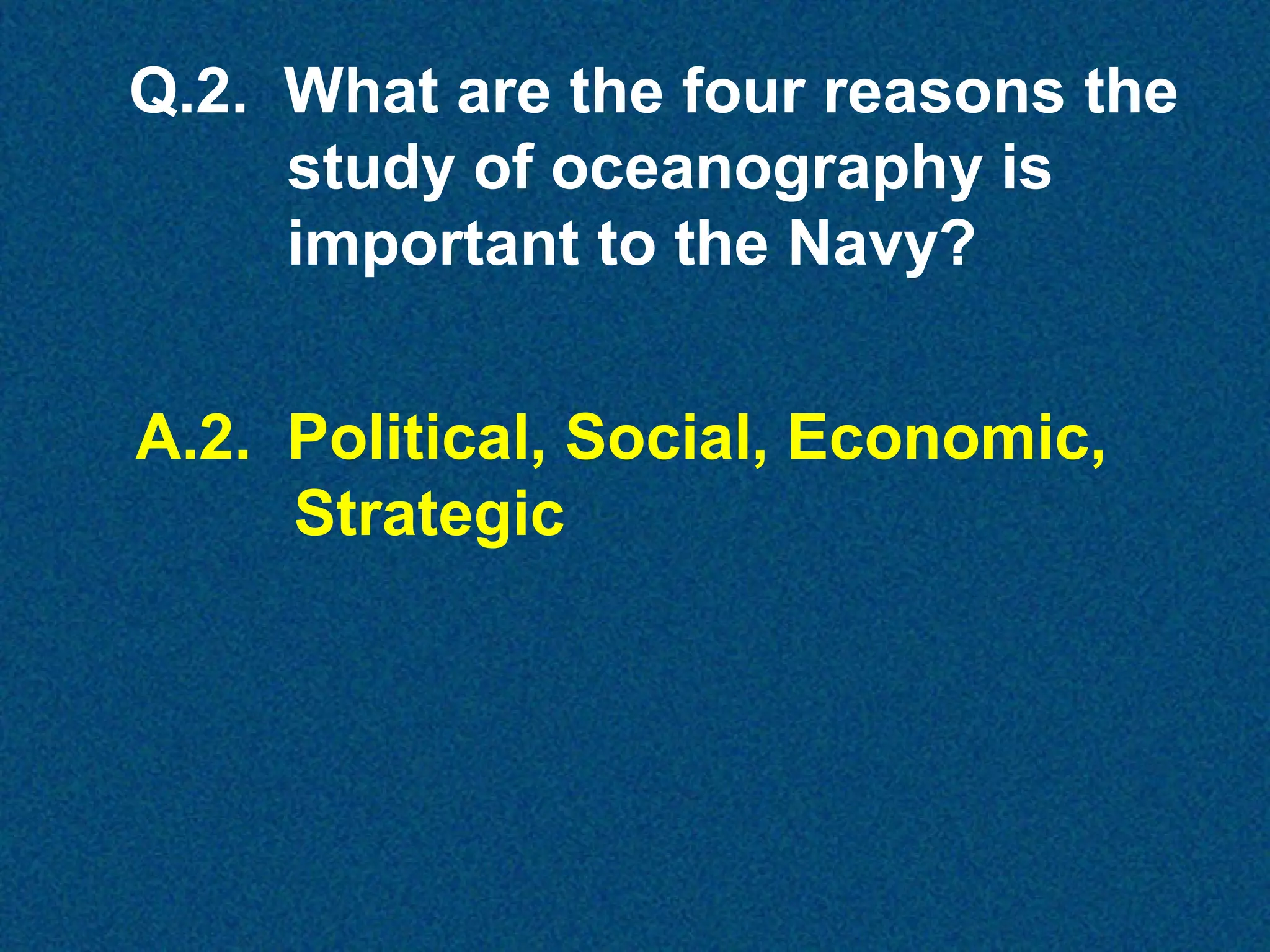
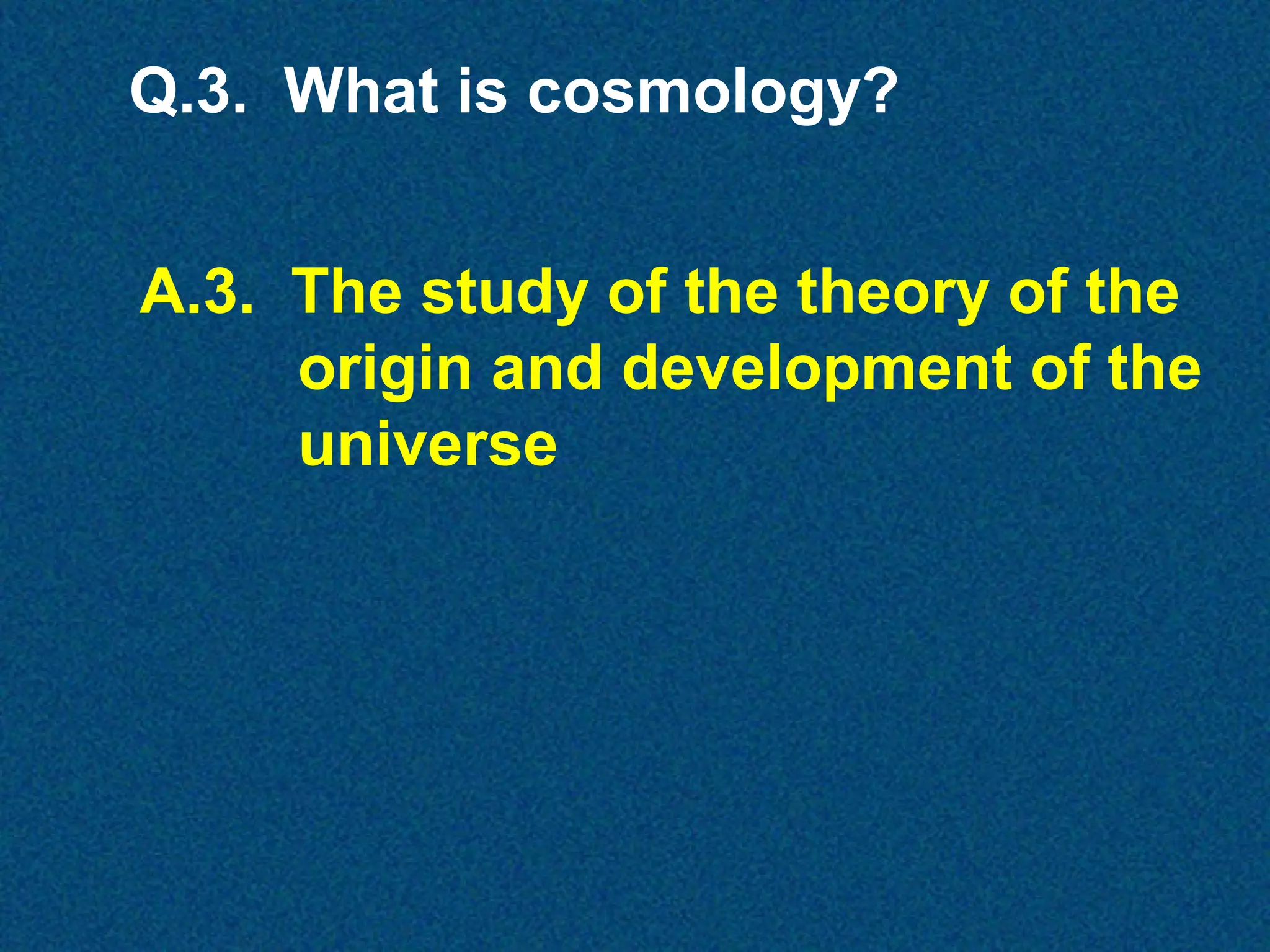
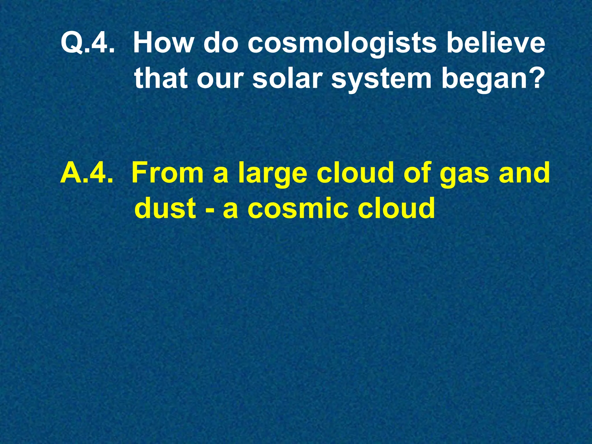
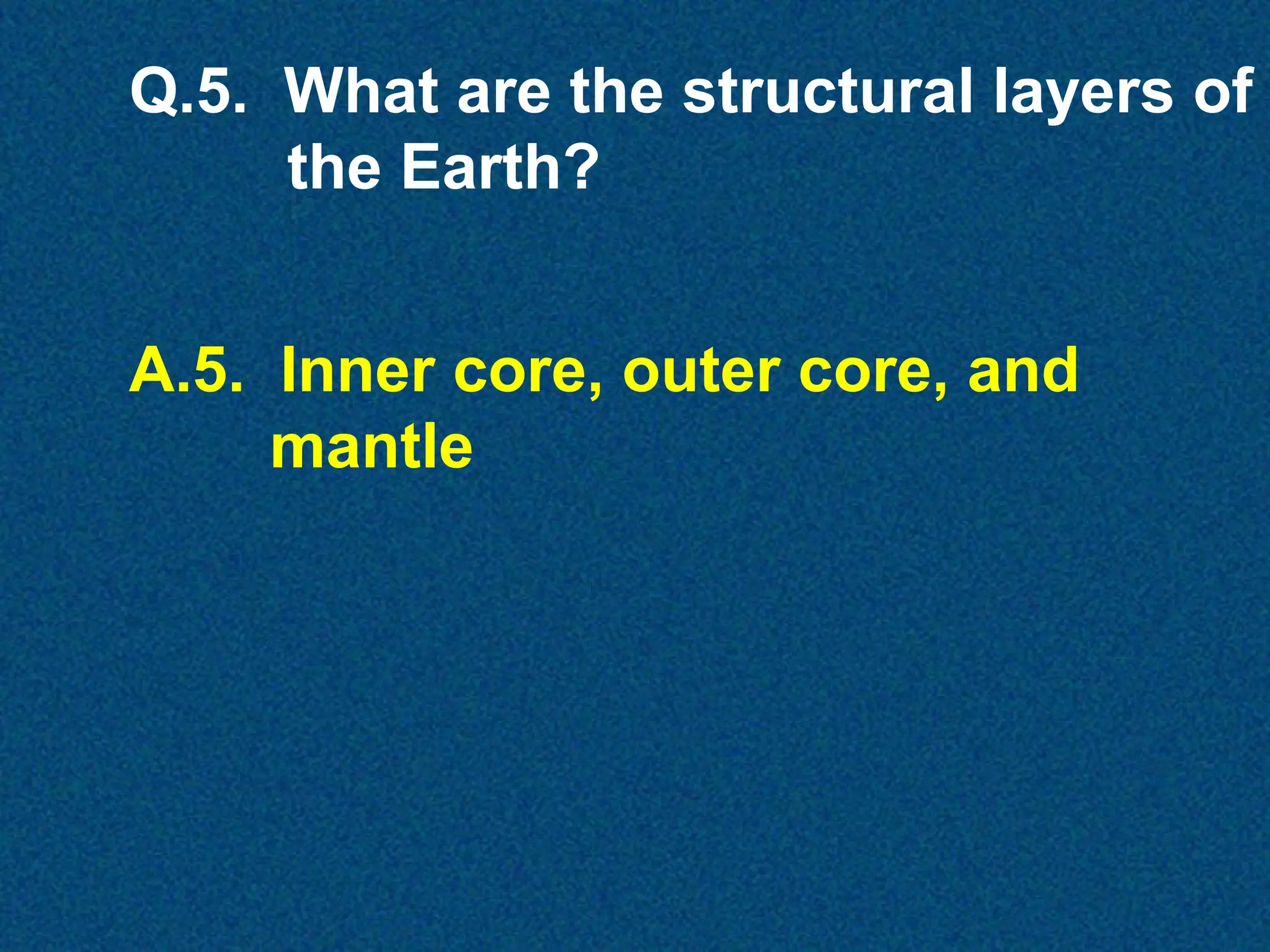
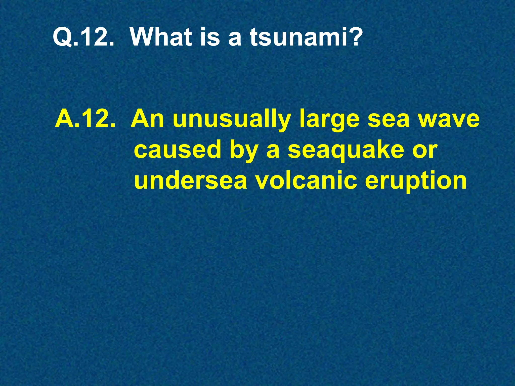
CHAPTER 1
EARTH’S OCEANOGRAPHIC HISTORY
How did our
Earth form?

Science and modern technology provide
scientists with good ideas.
This study is a part of astronomy
called cosmology
Astronomy
The science that deals with the
material universe beyond the
Earth’s atmosphere
Cosmology
The branch of astronomy that deals
with the history, structure, and
constituent dynamics of the
universe
Tarantula Nebula in
Large Magellanic
Cloud

Cosmologists believe our solar system
was originally a large cloud of gas and
Dust which began to form about 4.5
billion years ago.
Gravity and centripetal
forces caused the cloud
to spin and take shape
as a huge disk, with our
infant Sun in its center.
Gravity
The natural force of attraction
exerted by a celestial body upon
objects, drawing them toward the
center
Centripetal
Moving or directed toward a center
or axis, Tending to move toward a
center; “centripetal force”
Centripetal , Tending to move
toward a center; “centripetal
force”forces and gravity draw
force
heavier materials (iron) toward the
center core.
Centrifugal force draws lighter
materials (silica) towards the outer
edge. Moving or directed toward a
center or axis.
Descending
iron “drops

Iron core
accumulation

Gravity
Centripetal
Centrifugal
forces
at

Rising lighter
material

work
Inner Core (solid)
Crust
(solid)

Outer core
(liquid)
Crust
(solid)

After millions
of years,
Earth has:
~ a hot, heavy,
center core
~ a cooler,
lighter, shell
~ a liquid
material in
between.
Magma (molten rock) flows to the surface
through large cracks or individual
volcanoes emerging as lava.
At the surface, lava expels hydrogen
and other gases, water vapor, and
solid materials.
The Sun’s rays
act on the
released gases
and distribute
them about
the Earth to
form an
atmosphere.
Virunga Volcanoes in Central Africa

As compression continued, volcanoes
released the intense inner heat bringing
lava and water vapor to the surface.
Titan

Titan’s
Atmosphere

Earth

Over billions of years, radiation from the sun
converted the water vapor (H²O) into an
atmosphere. Lighter hydrogen (H) escaped, and
oxygen (O) remained.
Gradually, the atmosphere cooled enough to allow the
water vapor to condense and return to the surface as rain
and eventually snow. This continued for millions of years.
The buildup of the polar icecaps has kept an almost
constant amount of water in the seas
The low areas filled with water forming
a gigantic pool (the world ocean)
covering about 70% of the surface of the
Earth, shaped very different than today’s.
The evaporation/condensation cycle
continues today with most water vapor
coming from oceans and groundwater.
Our continually
changing world:
~ polar icecaps
~ erosion
~ earthquakes
~ landslides
Most natural
geological
change is too
slow to be
noticed,

Mount St. Helens
18 May 1980

except for
violent change such as
massive earthquakes
or volcanic eruptions.
62 Miles ±

1,800 Miles ±

860 Miles ±

Earth is made of several shells. The
lithosphere floats on the mantle’s
magma (asthenosphere).
Lithosphere
The outer part of the Earth, consisting
of the crust and upper mantle,
approximately 62 miles thick
Mantle
The portion of the Earth, about 1,800
miles. Thick , which surrounds the
molten outer core of the earth
Asthenosphere
The region below the lithosphere,
variously estimated as being from fifty
to several hundred miles (eighty-five to
several hundred kilometers) thick, in
which the rock is less rigid than that
above and below but rigid enough to
transmit transverse seismic waves
The crust (upper part of the lithosphere) may
be only 3 - 10 miles thick under oceans but up
to 40 miles thick under mountains.
There are six major and many lesser
plates. Most volcanic eruptions and
earthquakes occur on their margins.
American
Pacific
IndoAustralian
Antarctic

Eurasian

African
Continental Drift

Alfred Wegener

As proposed by Wegener in 1912, the
movement of landmasses on the Earth’s
surface was known as “Continental Drift”
Theory.
Continental Drift
The lateral movement of continents
resulting from the motion of crustal
plates
Continental Drift Theory
Pan·gae·a
Hypothetical super-continent that includes all the
landmasses of the Earth. Continental drift breaks
Pangaea into Laurasia and Gondwanaland.

225 million years ago
Continental Drift Theory
Laur·a·sia and Gond·wa·na·land
Hypothetical continents that break up later into
North America-Europe-Asia and India-AustraliaAfrica-South America-Antarctica

200 million years ago
Continental Drift Theory
Laurasia and Gondwanaland
breakup further, India moves
northward independently.

135 million years ago
Continental Drift Theory
North and South America drift westward
creating Sierras and Andes mountains.
Africa creates Pyrenees, Alps, and
Apennines in southern Eurasia.

65 million years ago
Continental Drift Theory
Australia is completely separated from
Antarctica, while India is creating the
world’s highest mountains, the
Himalayas.
Established science dismissed the
theory (and Wegener) until modern
oceanographic and geologic studies
revived it in the 1960s.
The Continental Drift theory has
since evolved into the:
Plate Tectonics theory as an all
encompassing explanation for the
Earth’s multiple geological activities.
Plate Tectonics
A theory of global tectonics in which
the lithosphere is divided into a number
of crustal plates, each of which moves
on the plastic asthenosphere more or
less independently to collide with, slide
under, or move past adjacent plates
Geological Plates
Large blocks of the lithosphere that
react to tectonic forces as a unit and
moves as such
The plates drift over the uppermost,
semi-molten layer of the Earth’s
mantle like giant chunks of ice, moved
by the churnings in the interior.
Plates drift over
the asthenosphere.

Earthquakes

Plates
Where plates meet, inhabitants
experience geological activity
along the fault lines.

Volcanoes
Seismograph
An instrument for automatically
detecting and recording the
intensity, direction, and duration
of a movement of the ground,
especially of an earthquake
The best known fault line in the U.S. is the
San Andreas Fault in California, caused
by the Pacific Plate moving North and
the North American Plate moving South.
The entire West Coast is an earthquake
fault line. Approximately 40% of the
U.S. population lives and works near
the nation’s seacoasts.
On the San Andreas Fault, in 1906, San
Francisco was nearly destroyed by a
large earthquake and following fire.
In 1902, Mount Pelee
near St. Pierre,
Martinique, erupted
killing 30,000 people
within seconds.
Tangshan, China, 1976
In the world’s largest single earthquake
disaster, almost 700,000 people died.
Tsunami

Due to the depths, tsunamis
can race undetected across
open oceans in all directions
at up to 450 miles an hour!
When they near shore, they slow to
25 - 30 miles an hour, but build in
height and momentum as the sea floor
rises along coastlines.
They can reach 100 feet (50 ft above
and below normal sea level) as surging
walls of water.
Tsunamis build as the sea floor rises.
A rapidly emptying shoreline often
precedes a tsunami.
Observers should move away and to
higher ground immediately.
Pacific Rim Ring of Fire

Proximity to trenches and volcanoes
make the Hawaiian Islands, Alaska, and
western Pacific susceptible to tsunamis.
Populated areas can have heavy losses.
26 December 2004
The world’s worst tsunami disaster
By some estimates 370,000 people
were killed

Seaquake of 9.0 magnitude
The volcano Krakatoa between Java
and Sumatra erupted in 1883. The
resultant tsunami, as high as 120
feet, killed 36,000.
Dirty rain (ash debris) from Krakatoa
orbited the Earth for many years.
In 1896, a tsunami in Japan
killed 27,000 and wrecked
7,000 fishing boats.
In 1976, a tsunami
killed 5,000 in the
Philippines.
Q.1. What is the definition of
oceanography?
A.1. The study of what happens on,
in, and under the seas
Q.2. What are the four reasons the
study of oceanography is
important to the Navy?
A.2. Political, Social, Economic,
Strategic
Q.3. What is cosmology?
A.3. The study of the theory of the
origin and development of the
universe
Q.4. How do cosmologists believe
that our solar system began?
A.4. From a large cloud of gas and
dust - a cosmic cloud
Q.5. What are the structural layers of
the Earth?
A.5. Inner core, outer core, and
mantle
Q.6. What are the two layers of the
Earth’s lithosphere?
A.6. The mantle and the crust
Q.7. What do scientists believe first
made the huge land mass break
up?
A.7. Fault lines in the crust caused
by stress and pressure from
below
Q.8. What is the name of the theory
about the formation of the
continents?
A.8. Continental drift theory
Q.9. What are the three phenomena
that cause great disasters?
A.9. Earthquakes, volcanoes, and
tsunamis
Q.10. What is a seismograph?
A.10. An instrument used to
Measure and record the
vibrations of earthquakes
Q.11. What is the name of the “best
known” fault on the west coast
of the United States?
A.11. The San Andreas Fault
Q.12. What is a tsunami?
A.12. An unusually large sea wave
caused by a seaquake or
undersea volcanic eruption

Intro to Oceanography

  • 1.
  • 2.
    How did our Earthform? Science and modern technology provide scientists with good ideas. This study is a part of astronomy called cosmology
  • 3.
    Astronomy The science thatdeals with the material universe beyond the Earth’s atmosphere Cosmology The branch of astronomy that deals with the history, structure, and constituent dynamics of the universe
  • 4.
    Tarantula Nebula in LargeMagellanic Cloud Cosmologists believe our solar system was originally a large cloud of gas and Dust which began to form about 4.5 billion years ago.
  • 5.
    Gravity and centripetal forcescaused the cloud to spin and take shape as a huge disk, with our infant Sun in its center.
  • 6.
    Gravity The natural forceof attraction exerted by a celestial body upon objects, drawing them toward the center Centripetal Moving or directed toward a center or axis, Tending to move toward a center; “centripetal force”
  • 7.
    Centripetal , Tendingto move toward a center; “centripetal force”forces and gravity draw force heavier materials (iron) toward the center core. Centrifugal force draws lighter materials (silica) towards the outer edge. Moving or directed toward a center or axis.
  • 8.
  • 9.
    Inner Core (solid) Crust (solid) Outercore (liquid) Crust (solid) After millions of years, Earth has: ~ a hot, heavy, center core ~ a cooler, lighter, shell ~ a liquid material in between.
  • 10.
    Magma (molten rock)flows to the surface through large cracks or individual volcanoes emerging as lava.
  • 11.
    At the surface,lava expels hydrogen and other gases, water vapor, and solid materials.
  • 12.
    The Sun’s rays acton the released gases and distribute them about the Earth to form an atmosphere.
  • 13.
    Virunga Volcanoes inCentral Africa As compression continued, volcanoes released the intense inner heat bringing lava and water vapor to the surface.
  • 14.
    Titan Titan’s Atmosphere Earth Over billions ofyears, radiation from the sun converted the water vapor (H²O) into an atmosphere. Lighter hydrogen (H) escaped, and oxygen (O) remained.
  • 15.
    Gradually, the atmospherecooled enough to allow the water vapor to condense and return to the surface as rain and eventually snow. This continued for millions of years. The buildup of the polar icecaps has kept an almost constant amount of water in the seas
  • 16.
    The low areasfilled with water forming a gigantic pool (the world ocean) covering about 70% of the surface of the Earth, shaped very different than today’s.
  • 17.
    The evaporation/condensation cycle continuestoday with most water vapor coming from oceans and groundwater.
  • 18.
    Our continually changing world: ~polar icecaps ~ erosion ~ earthquakes ~ landslides
  • 19.
    Most natural geological change istoo slow to be noticed, Mount St. Helens 18 May 1980 except for violent change such as massive earthquakes or volcanic eruptions.
  • 20.
    62 Miles ± 1,800Miles ± 860 Miles ± Earth is made of several shells. The lithosphere floats on the mantle’s magma (asthenosphere).
  • 21.
    Lithosphere The outer partof the Earth, consisting of the crust and upper mantle, approximately 62 miles thick
  • 22.
    Mantle The portion ofthe Earth, about 1,800 miles. Thick , which surrounds the molten outer core of the earth
  • 23.
    Asthenosphere The region belowthe lithosphere, variously estimated as being from fifty to several hundred miles (eighty-five to several hundred kilometers) thick, in which the rock is less rigid than that above and below but rigid enough to transmit transverse seismic waves
  • 24.
    The crust (upperpart of the lithosphere) may be only 3 - 10 miles thick under oceans but up to 40 miles thick under mountains.
  • 25.
    There are sixmajor and many lesser plates. Most volcanic eruptions and earthquakes occur on their margins. American Pacific IndoAustralian Antarctic Eurasian African
  • 26.
    Continental Drift Alfred Wegener Asproposed by Wegener in 1912, the movement of landmasses on the Earth’s surface was known as “Continental Drift” Theory.
  • 27.
    Continental Drift The lateralmovement of continents resulting from the motion of crustal plates
  • 28.
    Continental Drift Theory Pan·gae·a Hypotheticalsuper-continent that includes all the landmasses of the Earth. Continental drift breaks Pangaea into Laurasia and Gondwanaland. 225 million years ago
  • 29.
    Continental Drift Theory Laur·a·siaand Gond·wa·na·land Hypothetical continents that break up later into North America-Europe-Asia and India-AustraliaAfrica-South America-Antarctica 200 million years ago
  • 30.
    Continental Drift Theory Laurasiaand Gondwanaland breakup further, India moves northward independently. 135 million years ago
  • 31.
    Continental Drift Theory Northand South America drift westward creating Sierras and Andes mountains. Africa creates Pyrenees, Alps, and Apennines in southern Eurasia. 65 million years ago
  • 32.
    Continental Drift Theory Australiais completely separated from Antarctica, while India is creating the world’s highest mountains, the Himalayas.
  • 33.
    Established science dismissedthe theory (and Wegener) until modern oceanographic and geologic studies revived it in the 1960s. The Continental Drift theory has since evolved into the: Plate Tectonics theory as an all encompassing explanation for the Earth’s multiple geological activities.
  • 34.
    Plate Tectonics A theoryof global tectonics in which the lithosphere is divided into a number of crustal plates, each of which moves on the plastic asthenosphere more or less independently to collide with, slide under, or move past adjacent plates
  • 35.
    Geological Plates Large blocksof the lithosphere that react to tectonic forces as a unit and moves as such The plates drift over the uppermost, semi-molten layer of the Earth’s mantle like giant chunks of ice, moved by the churnings in the interior.
  • 36.
    Plates drift over theasthenosphere. Earthquakes Plates Where plates meet, inhabitants experience geological activity along the fault lines. Volcanoes
  • 37.
    Seismograph An instrument forautomatically detecting and recording the intensity, direction, and duration of a movement of the ground, especially of an earthquake
  • 38.
    The best knownfault line in the U.S. is the San Andreas Fault in California, caused by the Pacific Plate moving North and the North American Plate moving South.
  • 39.
    The entire WestCoast is an earthquake fault line. Approximately 40% of the U.S. population lives and works near the nation’s seacoasts.
  • 40.
    On the SanAndreas Fault, in 1906, San Francisco was nearly destroyed by a large earthquake and following fire.
  • 41.
    In 1902, MountPelee near St. Pierre, Martinique, erupted killing 30,000 people within seconds.
  • 42.
    Tangshan, China, 1976 Inthe world’s largest single earthquake disaster, almost 700,000 people died.
  • 43.
    Tsunami Due to thedepths, tsunamis can race undetected across open oceans in all directions at up to 450 miles an hour!
  • 44.
    When they nearshore, they slow to 25 - 30 miles an hour, but build in height and momentum as the sea floor rises along coastlines. They can reach 100 feet (50 ft above and below normal sea level) as surging walls of water.
  • 45.
    Tsunamis build asthe sea floor rises. A rapidly emptying shoreline often precedes a tsunami. Observers should move away and to higher ground immediately.
  • 46.
    Pacific Rim Ringof Fire Proximity to trenches and volcanoes make the Hawaiian Islands, Alaska, and western Pacific susceptible to tsunamis. Populated areas can have heavy losses.
  • 47.
    26 December 2004 Theworld’s worst tsunami disaster By some estimates 370,000 people were killed Seaquake of 9.0 magnitude
  • 48.
    The volcano Krakatoabetween Java and Sumatra erupted in 1883. The resultant tsunami, as high as 120 feet, killed 36,000.
  • 49.
    Dirty rain (ashdebris) from Krakatoa orbited the Earth for many years.
  • 50.
    In 1896, atsunami in Japan killed 27,000 and wrecked 7,000 fishing boats.
  • 51.
    In 1976, atsunami killed 5,000 in the Philippines.
  • 52.
    Q.1. What isthe definition of oceanography? A.1. The study of what happens on, in, and under the seas
  • 53.
    Q.2. What arethe four reasons the study of oceanography is important to the Navy? A.2. Political, Social, Economic, Strategic
  • 54.
    Q.3. What iscosmology? A.3. The study of the theory of the origin and development of the universe
  • 55.
    Q.4. How docosmologists believe that our solar system began? A.4. From a large cloud of gas and dust - a cosmic cloud
  • 56.
    Q.5. What arethe structural layers of the Earth? A.5. Inner core, outer core, and mantle
  • 57.
    Q.6. What arethe two layers of the Earth’s lithosphere? A.6. The mantle and the crust
  • 58.
    Q.7. What doscientists believe first made the huge land mass break up? A.7. Fault lines in the crust caused by stress and pressure from below
  • 59.
    Q.8. What isthe name of the theory about the formation of the continents? A.8. Continental drift theory
  • 60.
    Q.9. What arethe three phenomena that cause great disasters? A.9. Earthquakes, volcanoes, and tsunamis
  • 61.
    Q.10. What isa seismograph? A.10. An instrument used to Measure and record the vibrations of earthquakes
  • 62.
    Q.11. What isthe name of the “best known” fault on the west coast of the United States? A.11. The San Andreas Fault
  • 63.
    Q.12. What isa tsunami? A.12. An unusually large sea wave caused by a seaquake or undersea volcanic eruption