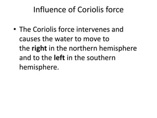
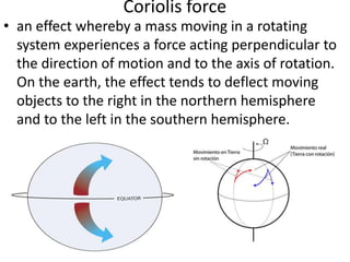
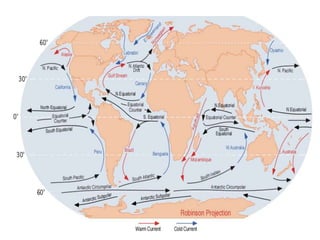
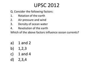
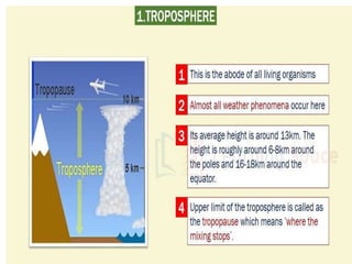
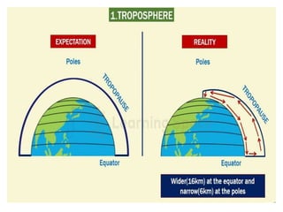
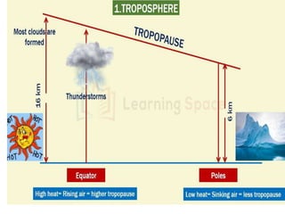
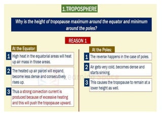
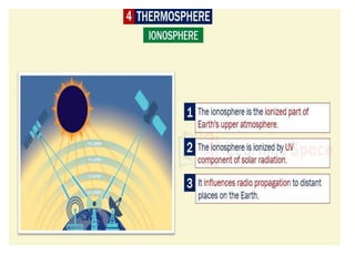
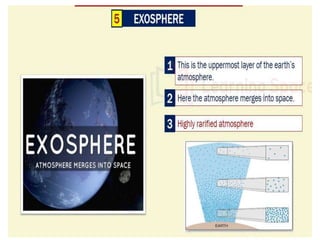
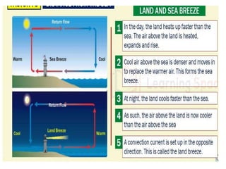
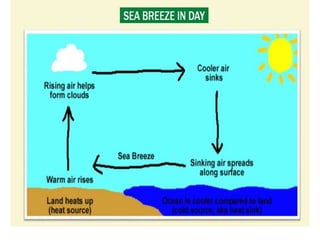
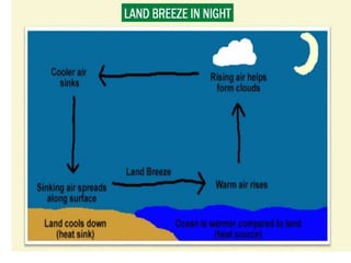
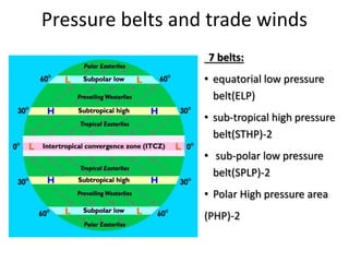
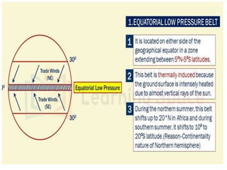
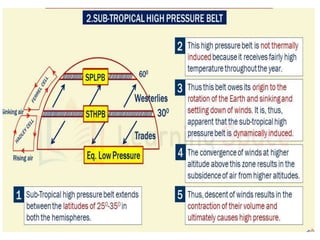
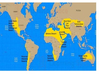
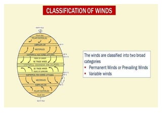
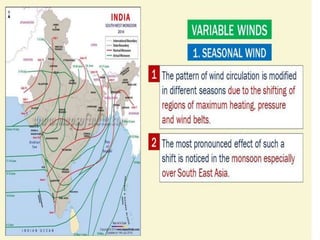
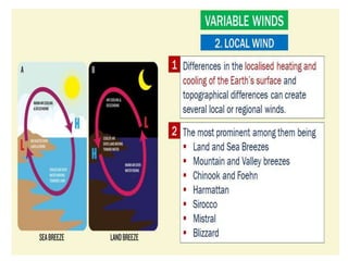
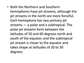
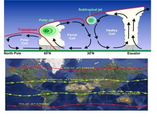
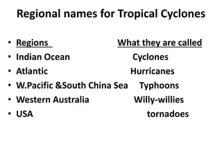
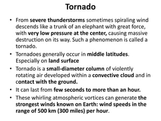
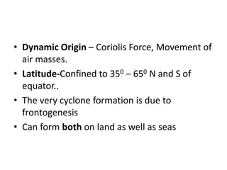
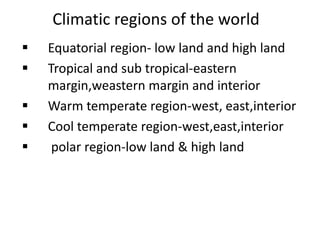
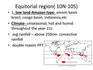
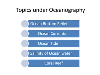
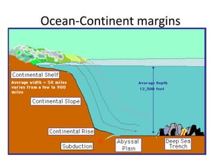
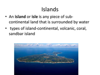
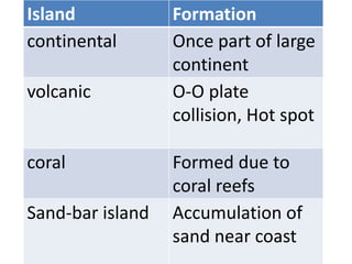
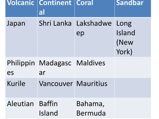
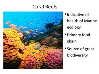
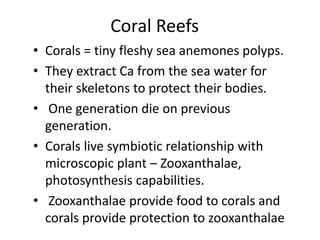
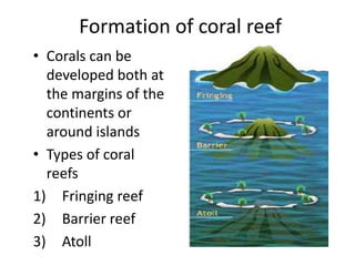
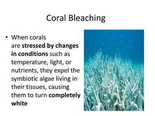
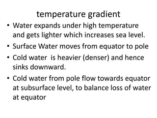
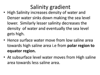
The document discusses various topics related to oceanography including ocean bottom relief, islands, coral reefs, coral bleaching, movement of ocean water through waves, currents and tides, and salinity of ocean water. It provides details on factors influencing ocean currents like rotation of Earth, air pressure, density gradients, and Coriolis force. Types of islands like continental, volcanic, coral and sandbar are described along with examples. Formation and types of coral reefs as well as conditions for coral growth are summarized.
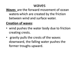
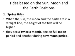
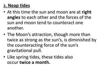
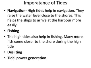
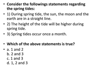
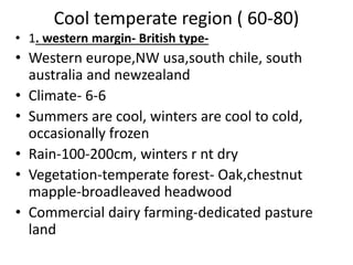
![influence of wind (atmospheric
circulation)
• Wind blowing on the surface of the ocean
pushes the water to move. Friction between
the wind and the water surface affects the
movement of the water body in its course.
• Winds are responsible for both magnitude and
direction [Coriolis force also affects direction] of
the ocean currents. Example: Monsoon
winds are responsible for the seasonal reversal
of ocean currents in the Indian ocean](https://image.slidesharecdn.com/geo3-180825103916/85/Geography-Oceanography-Pragnya-IAS-Academy-23-320.jpg)