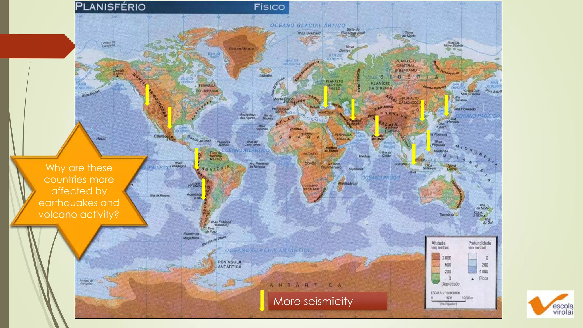
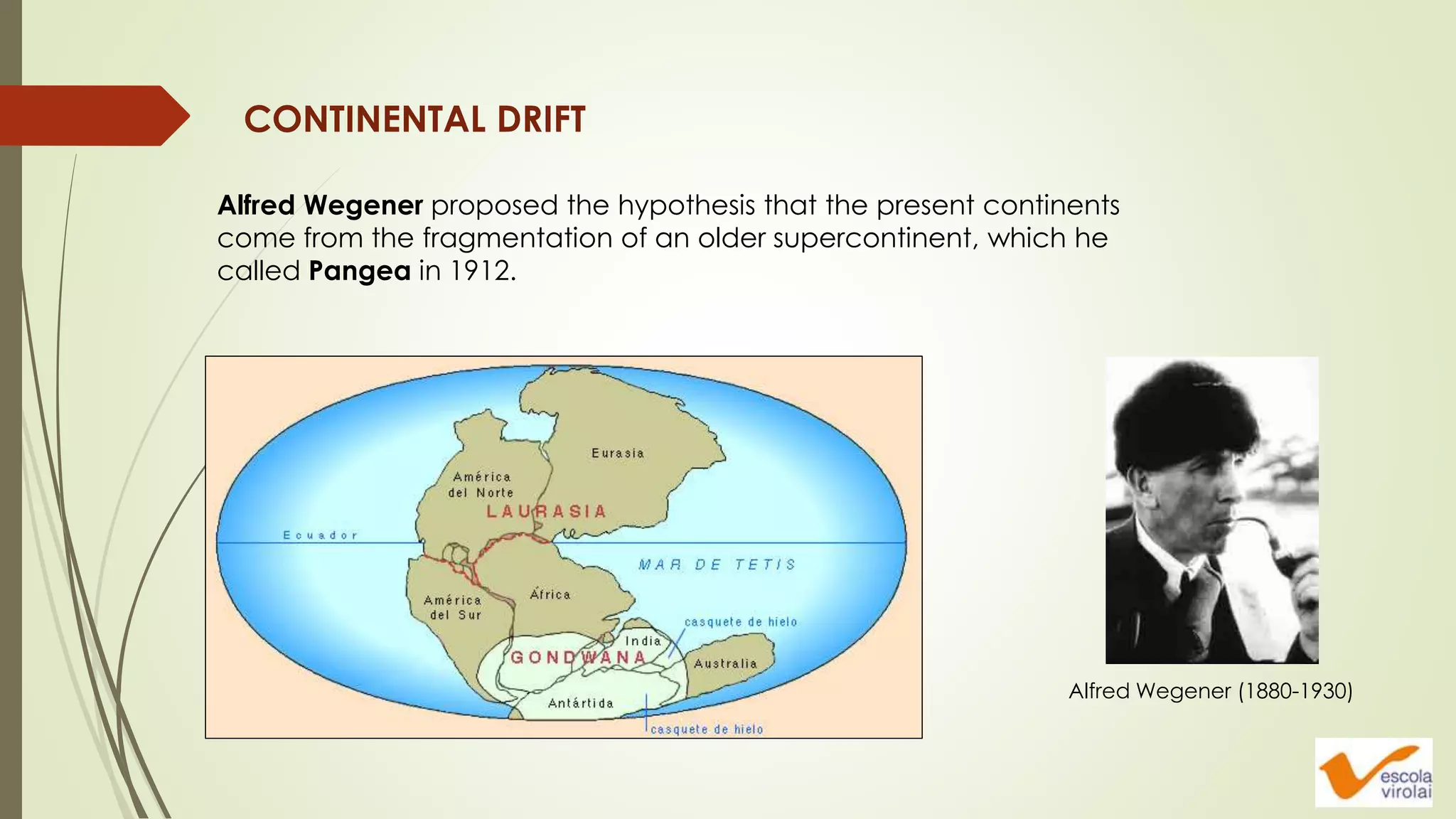
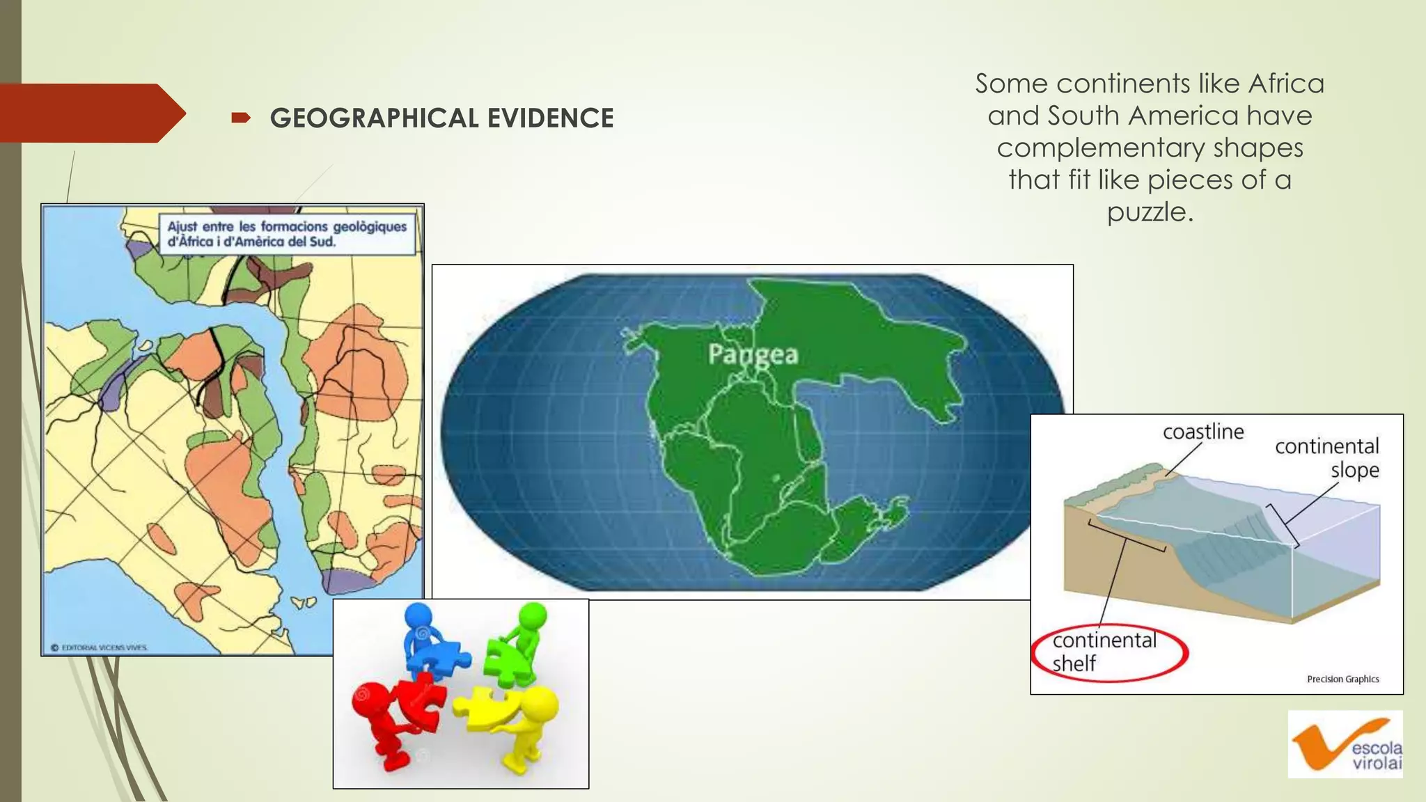
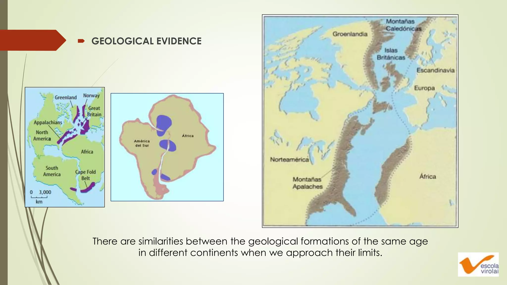
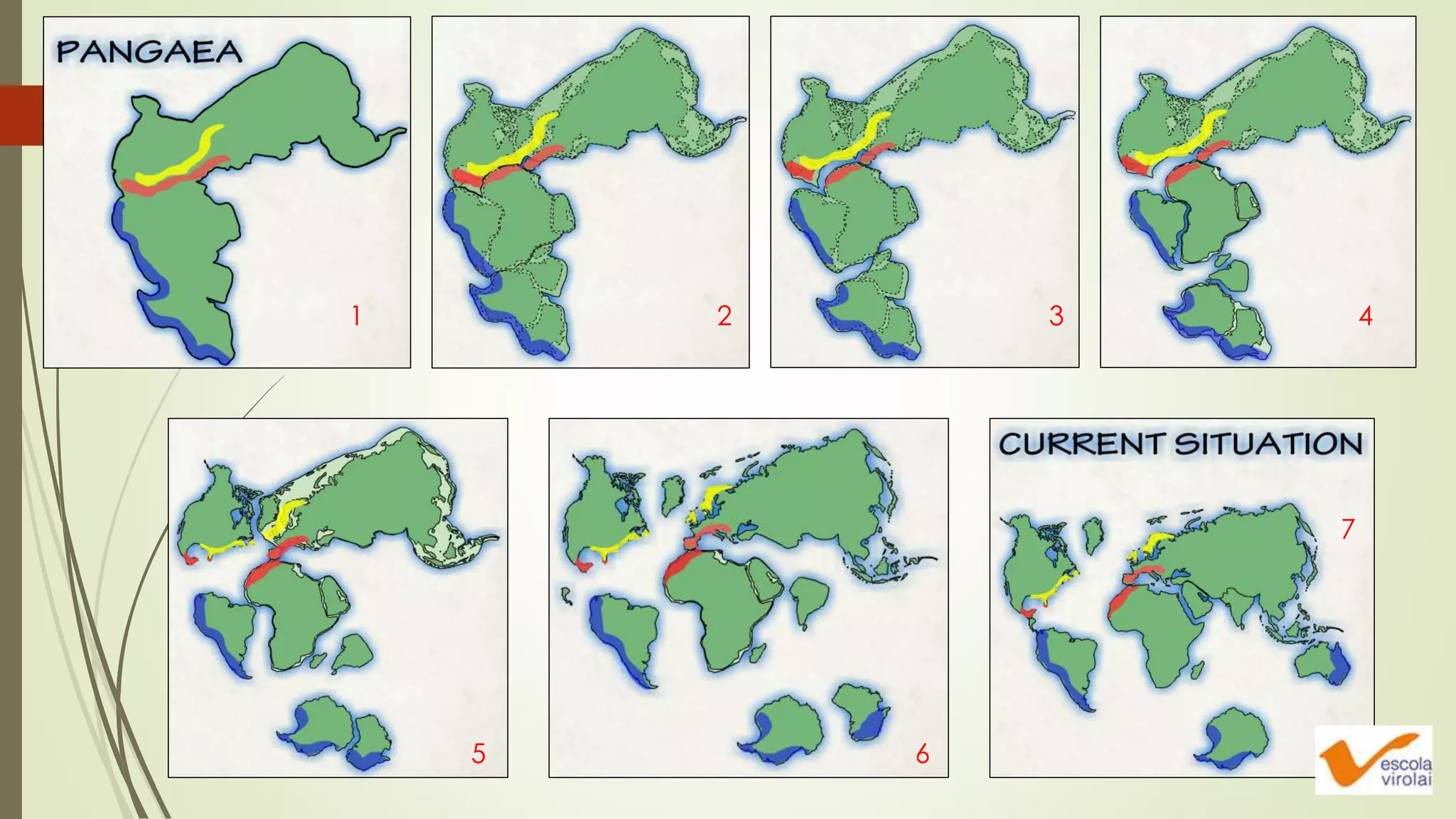
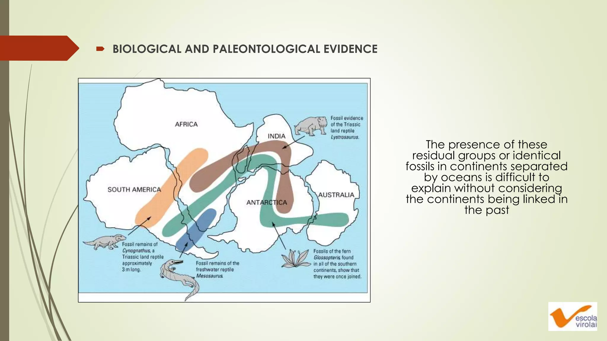
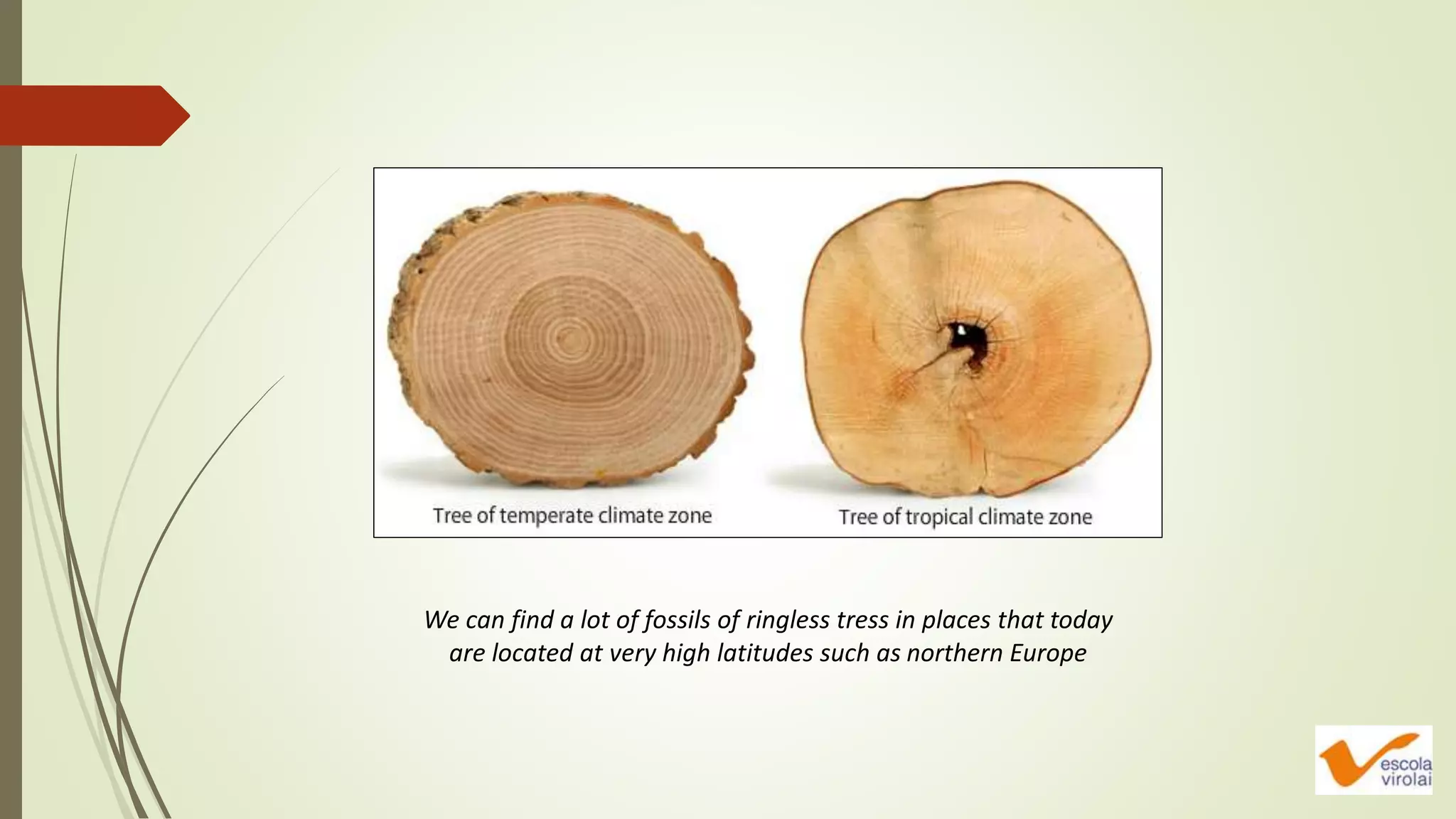
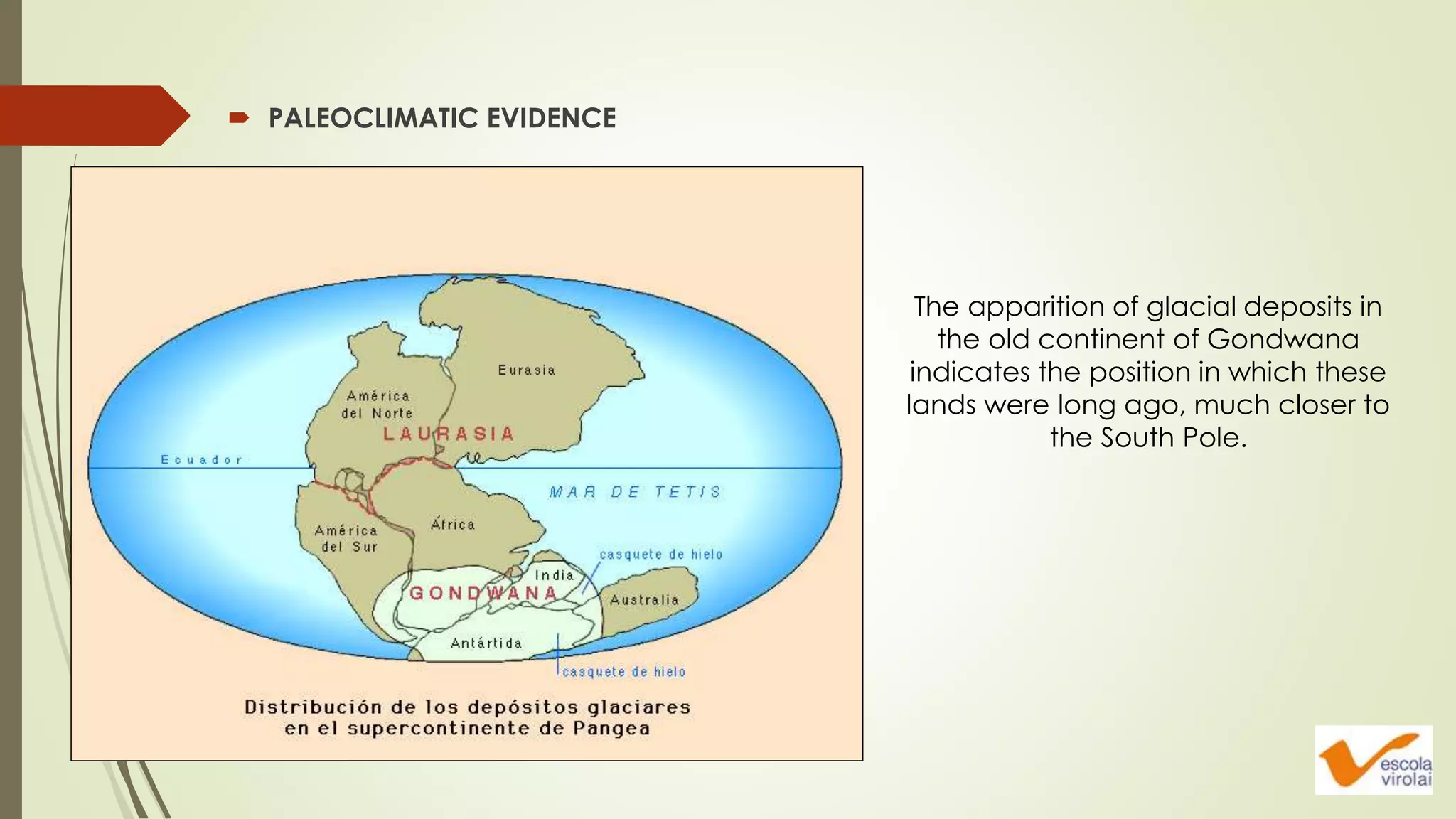
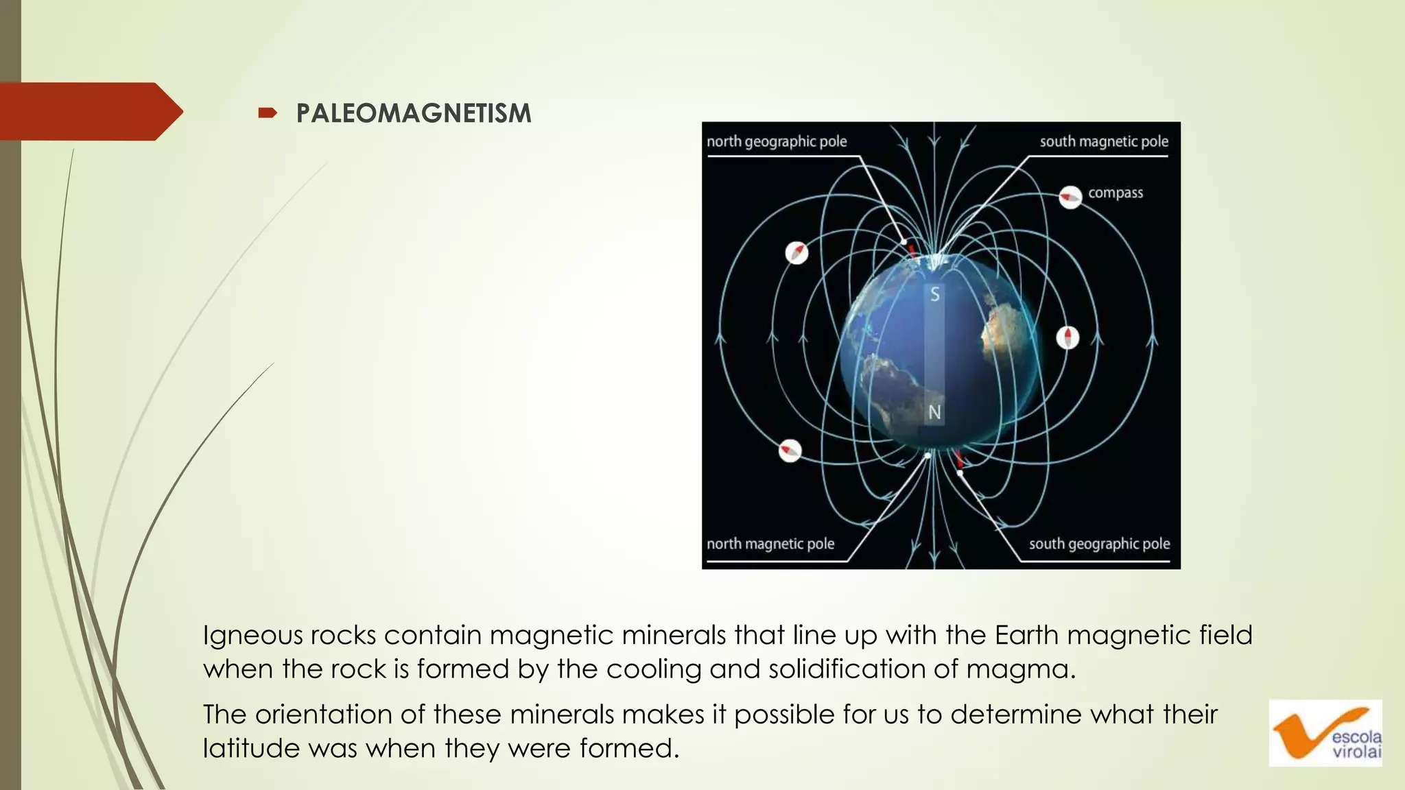
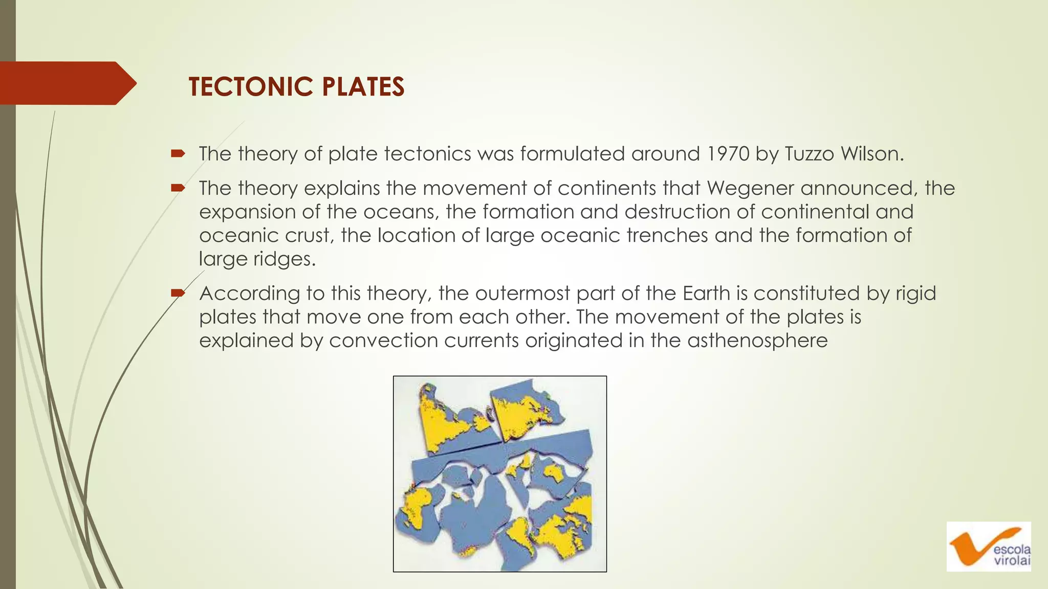
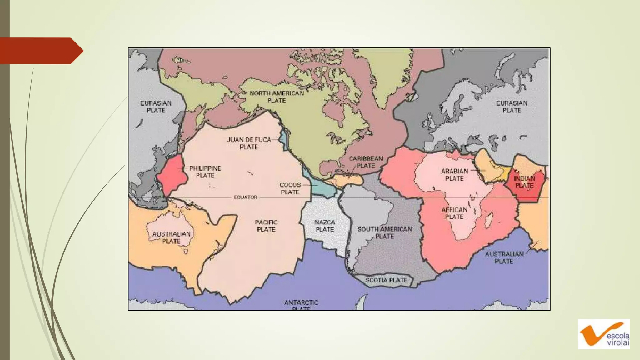
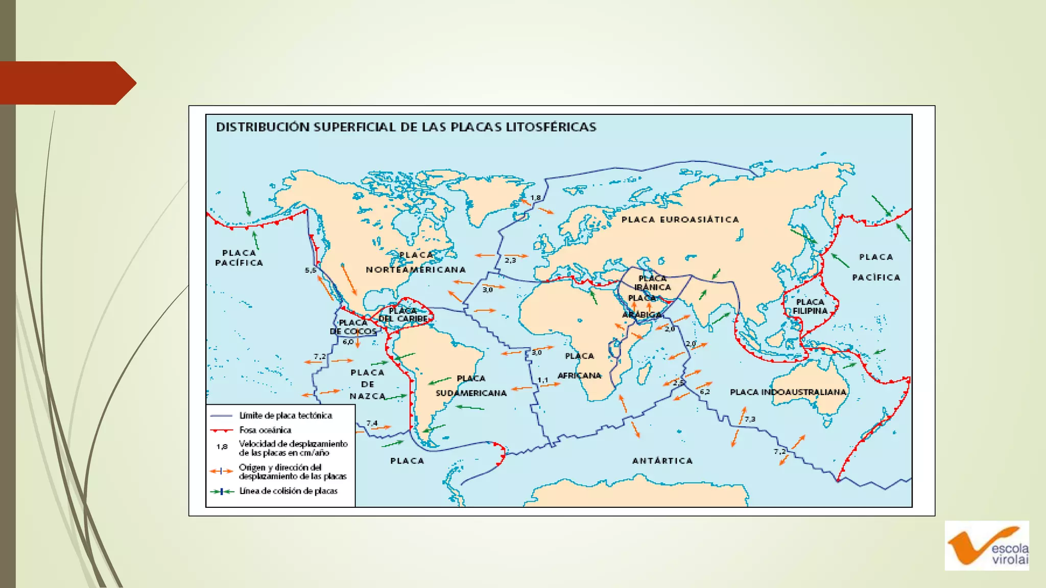
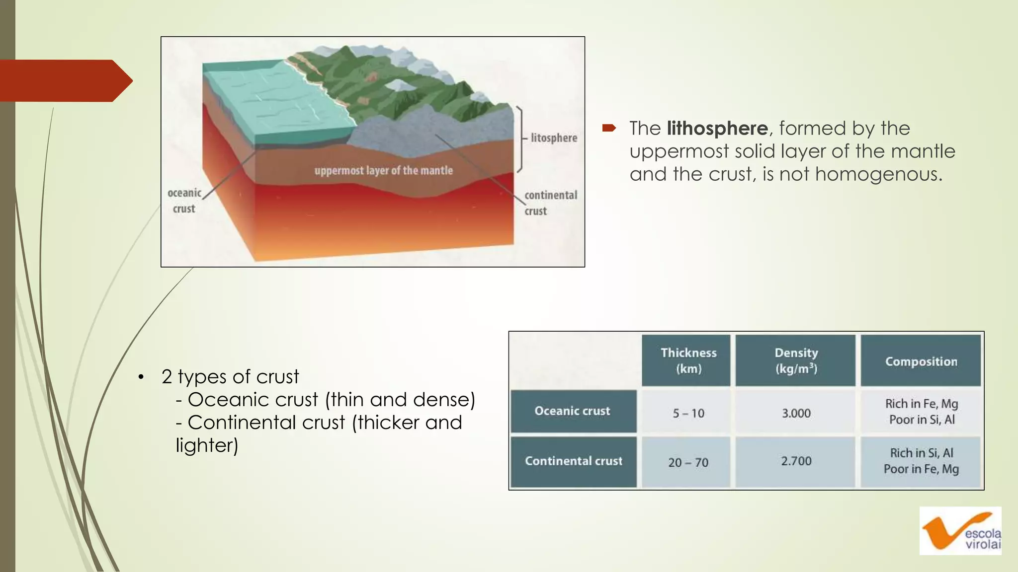
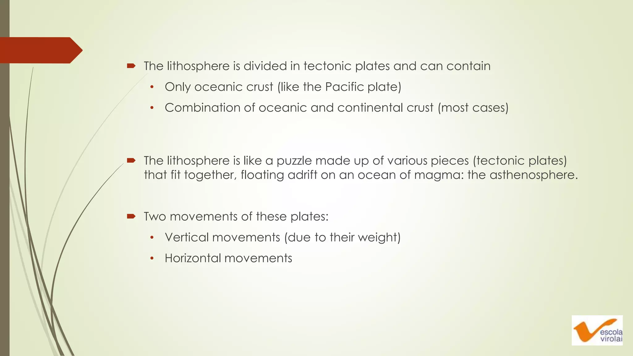
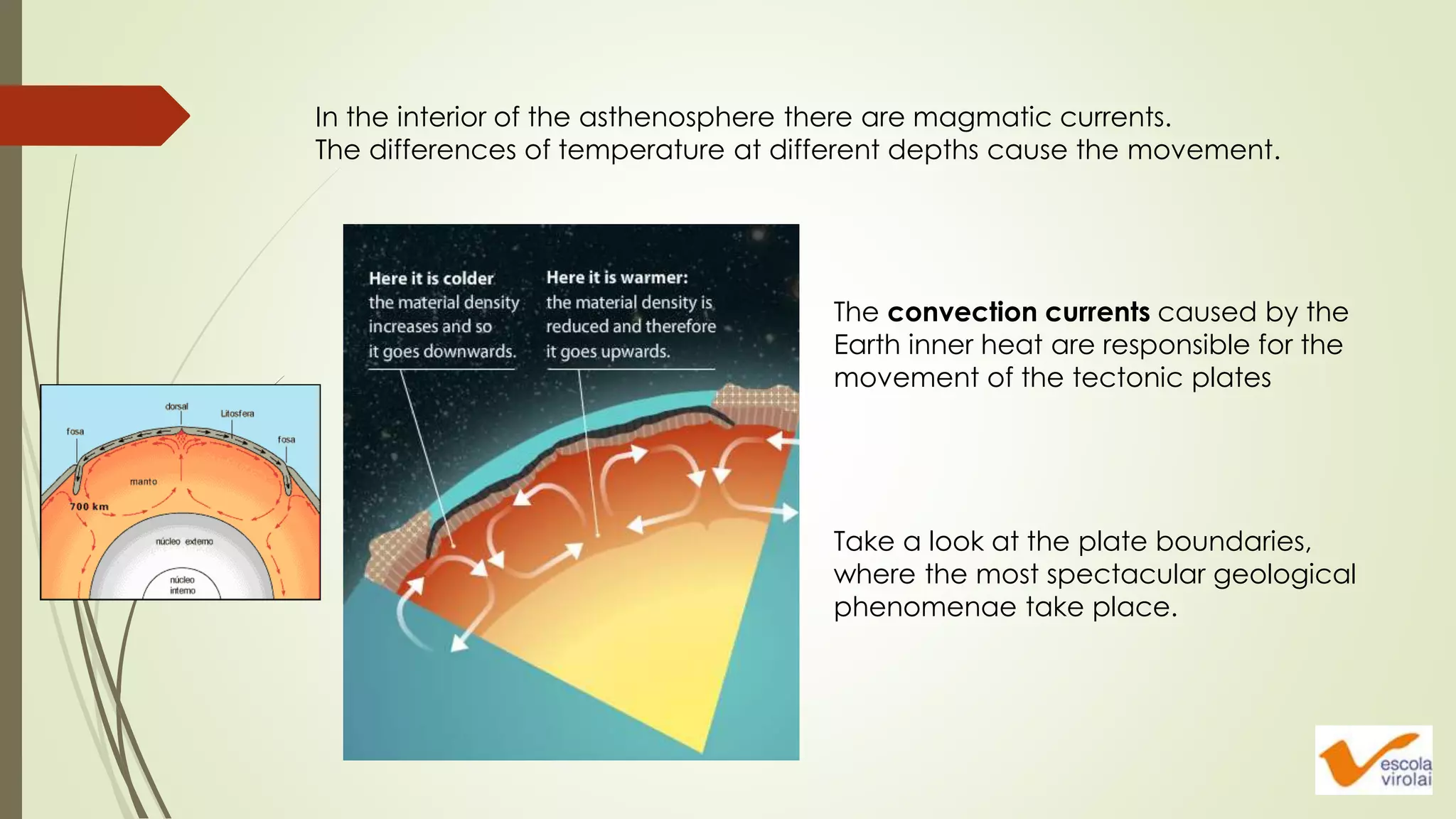
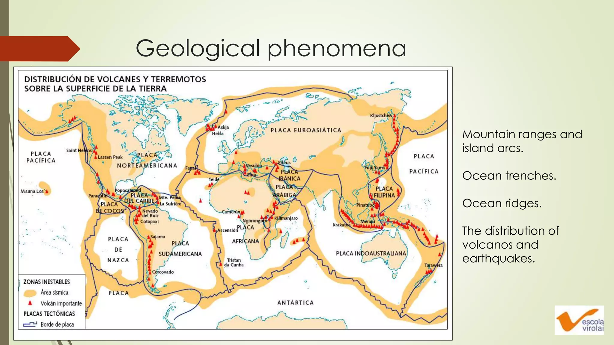
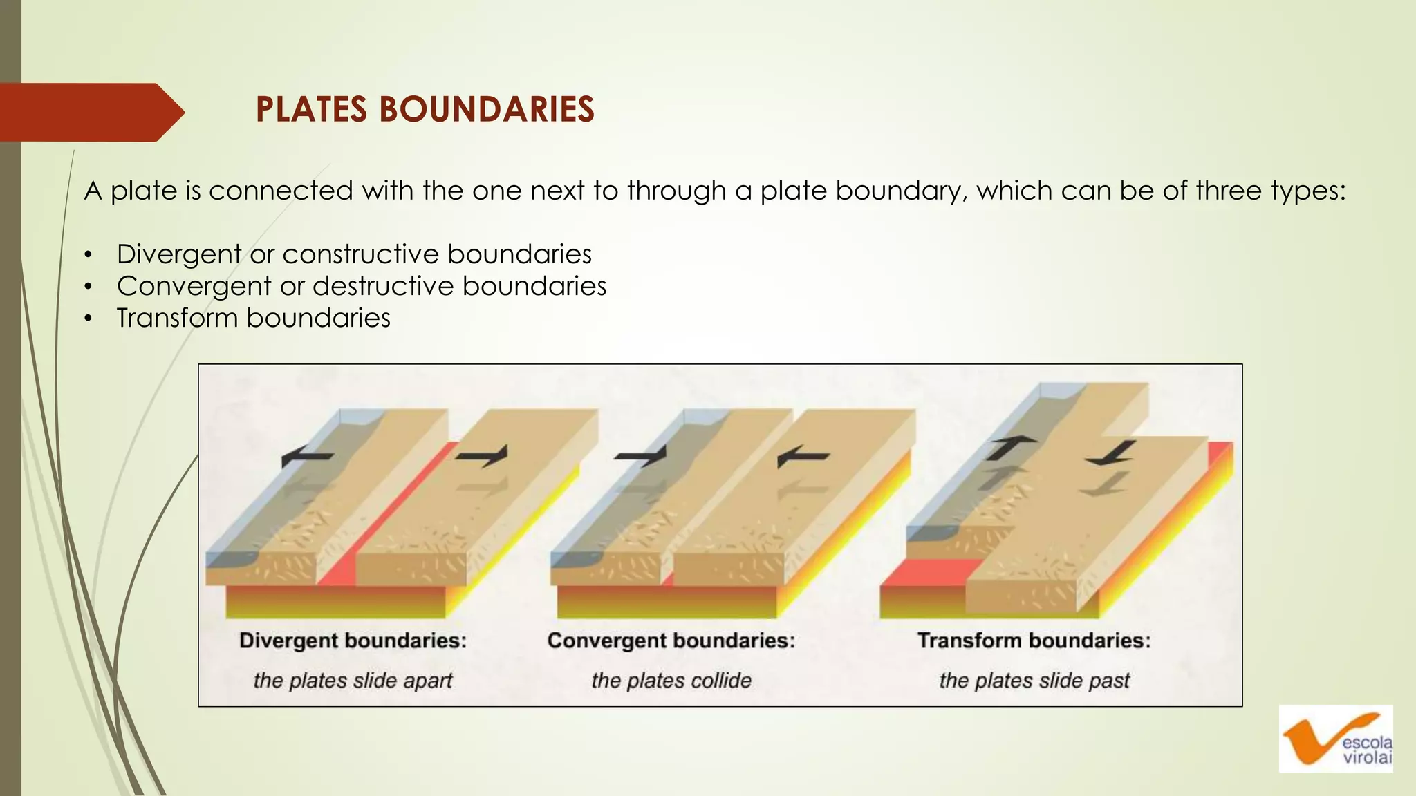
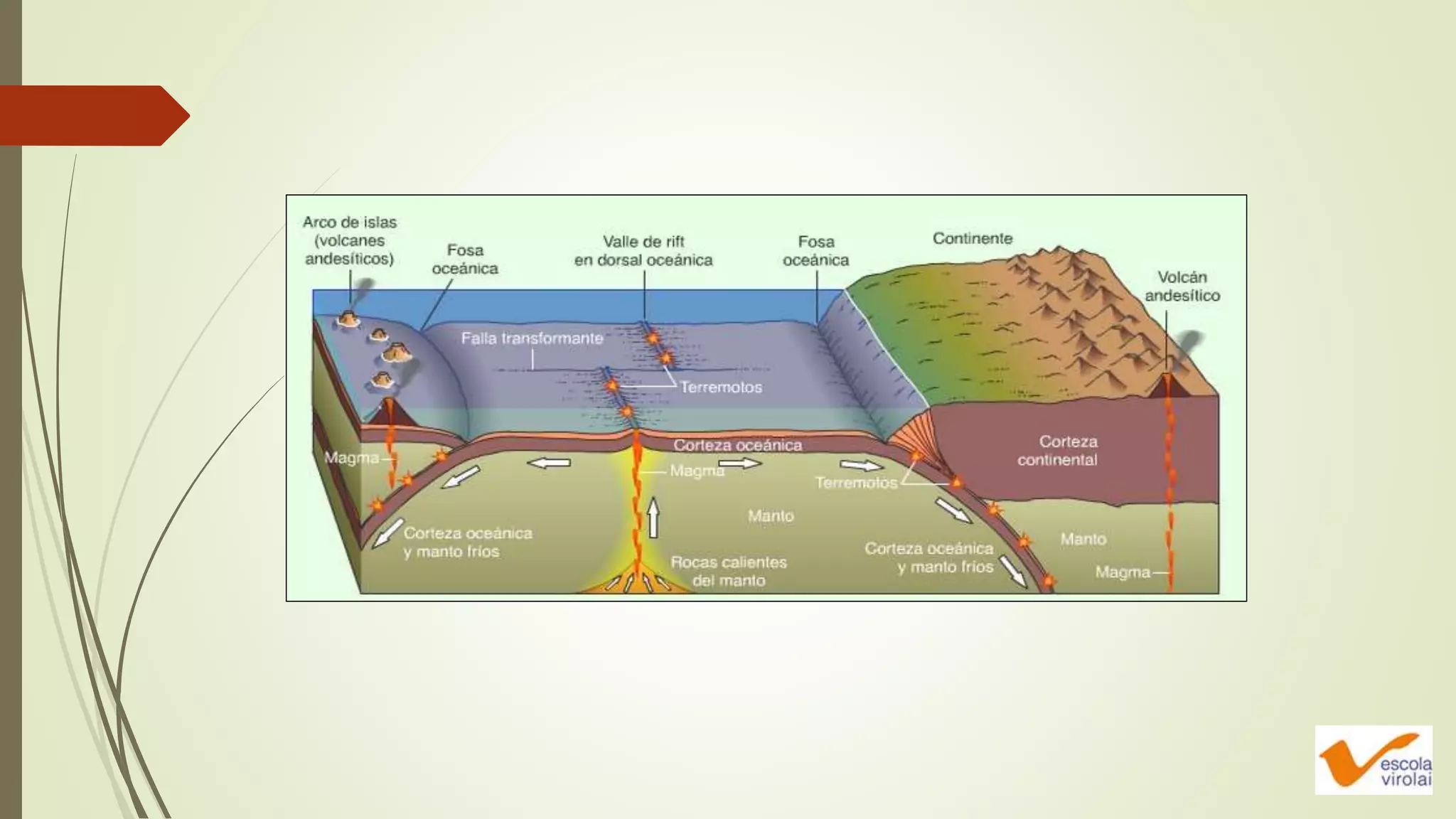
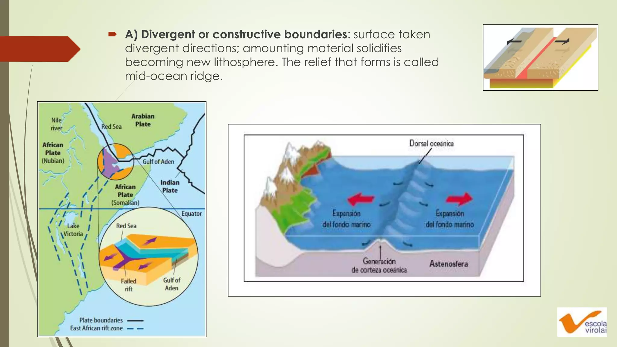
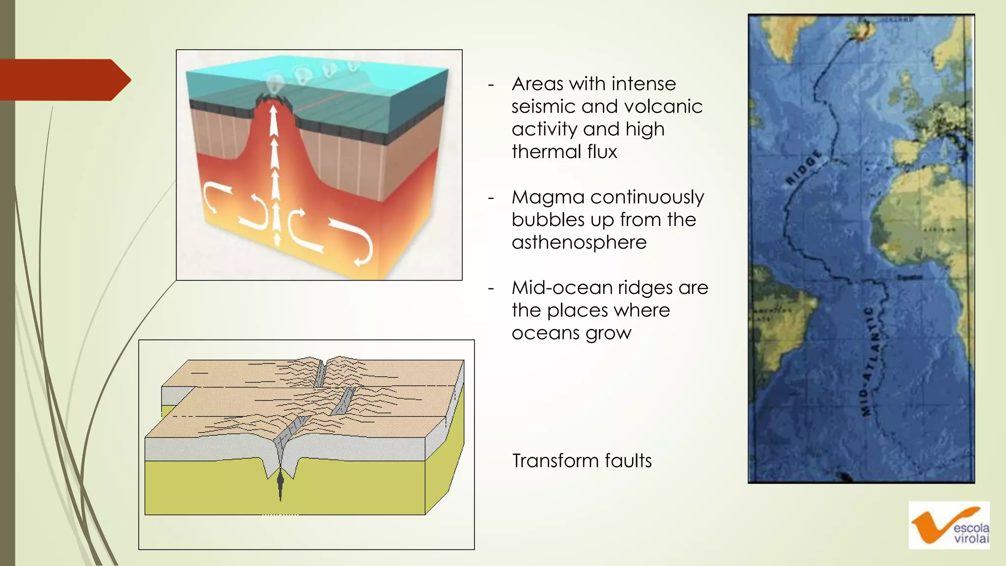
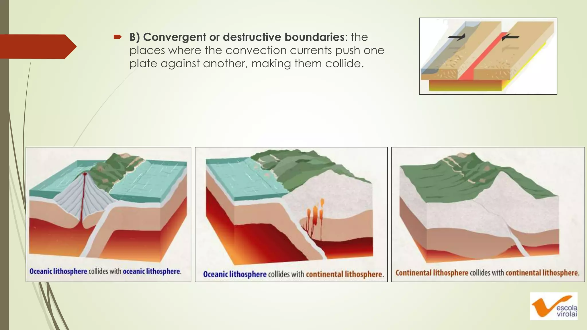
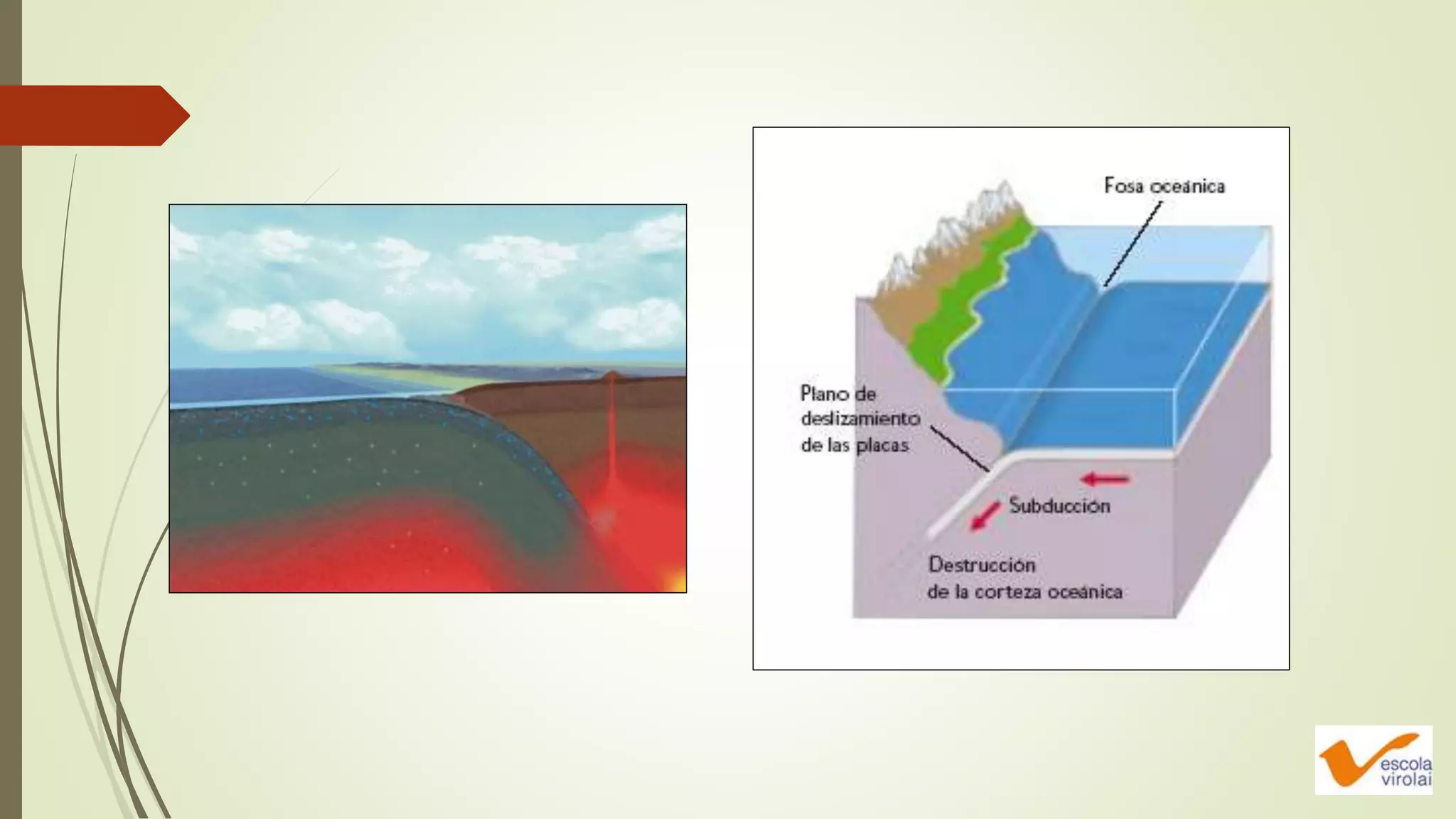
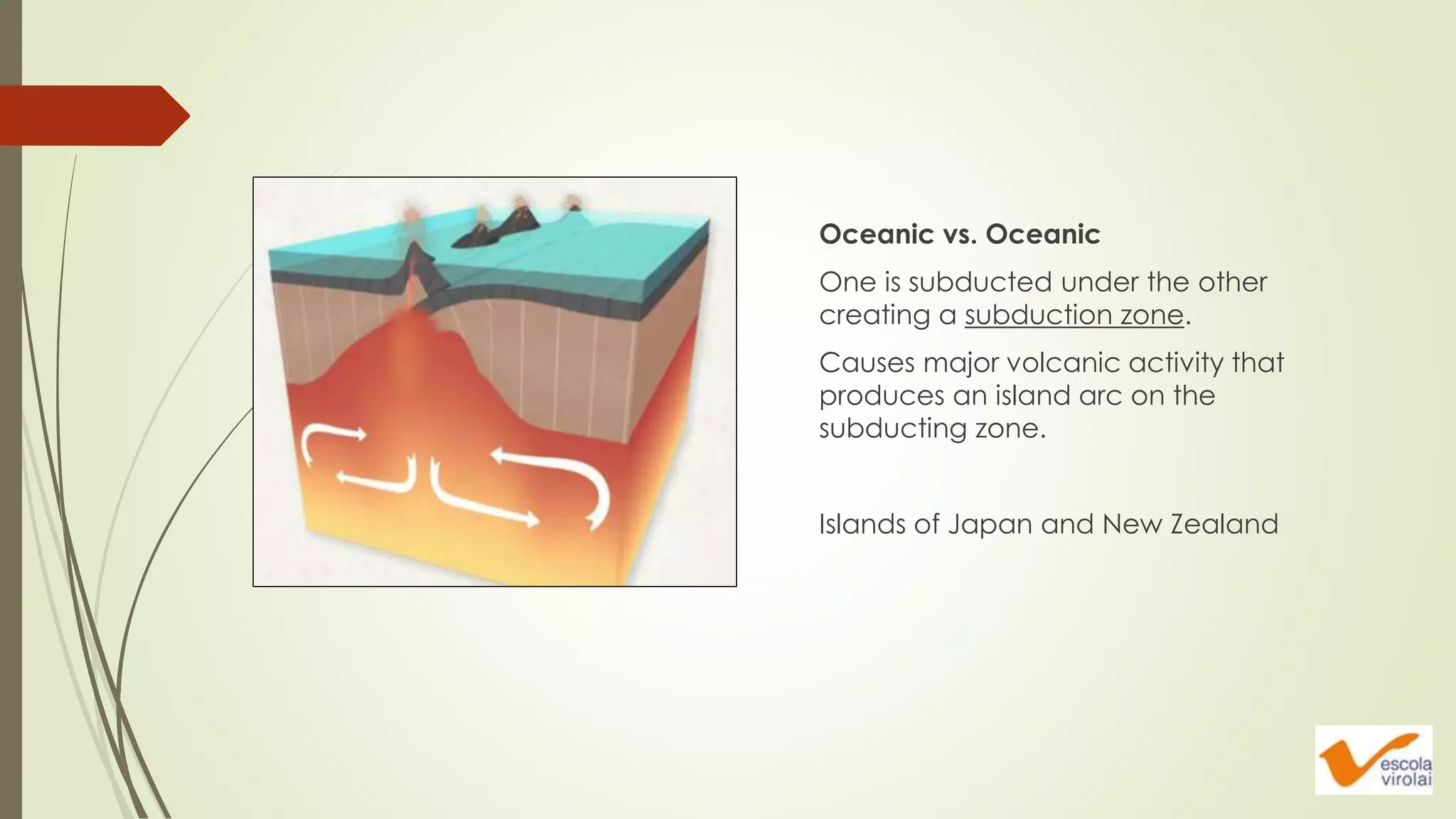
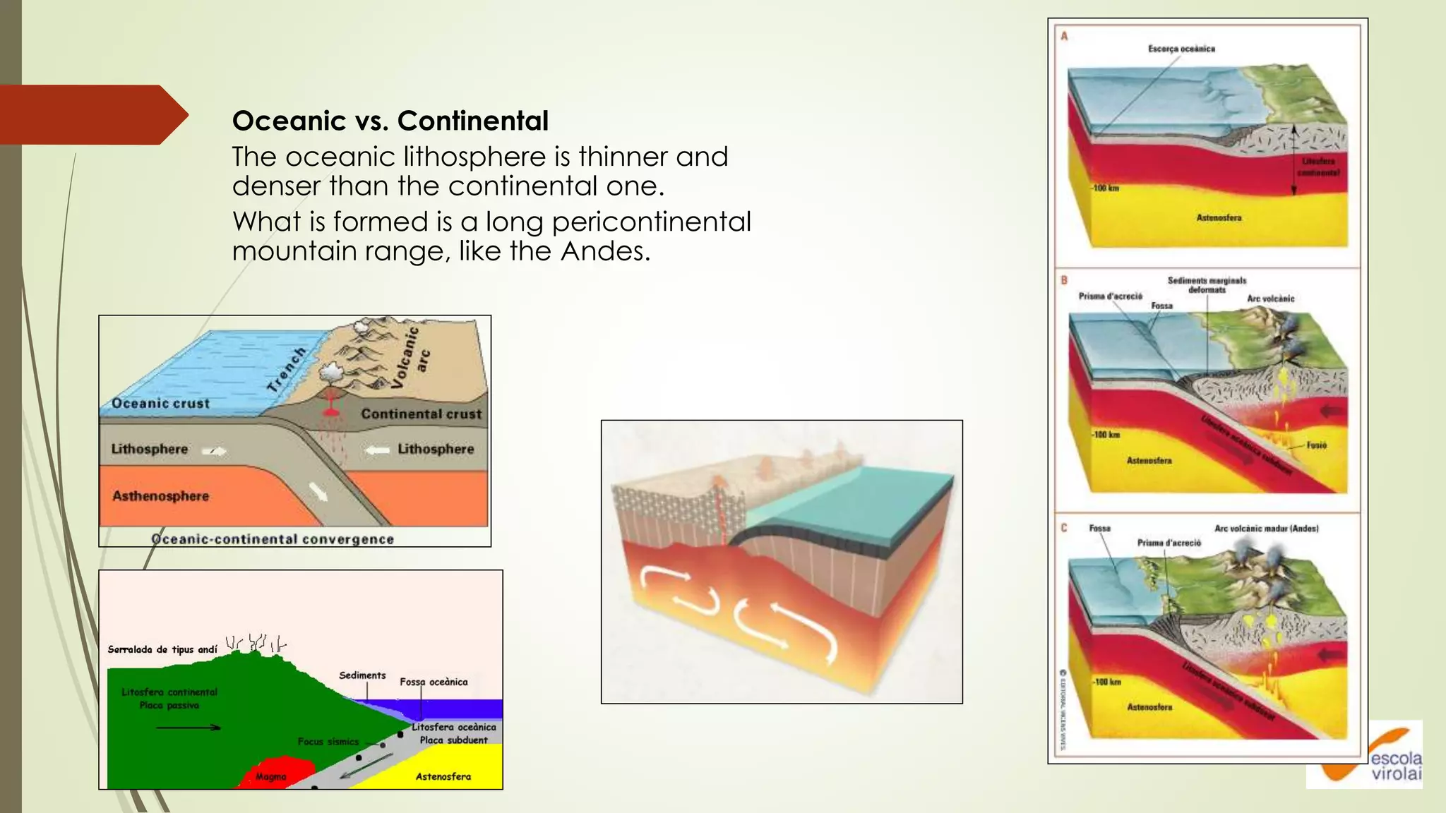
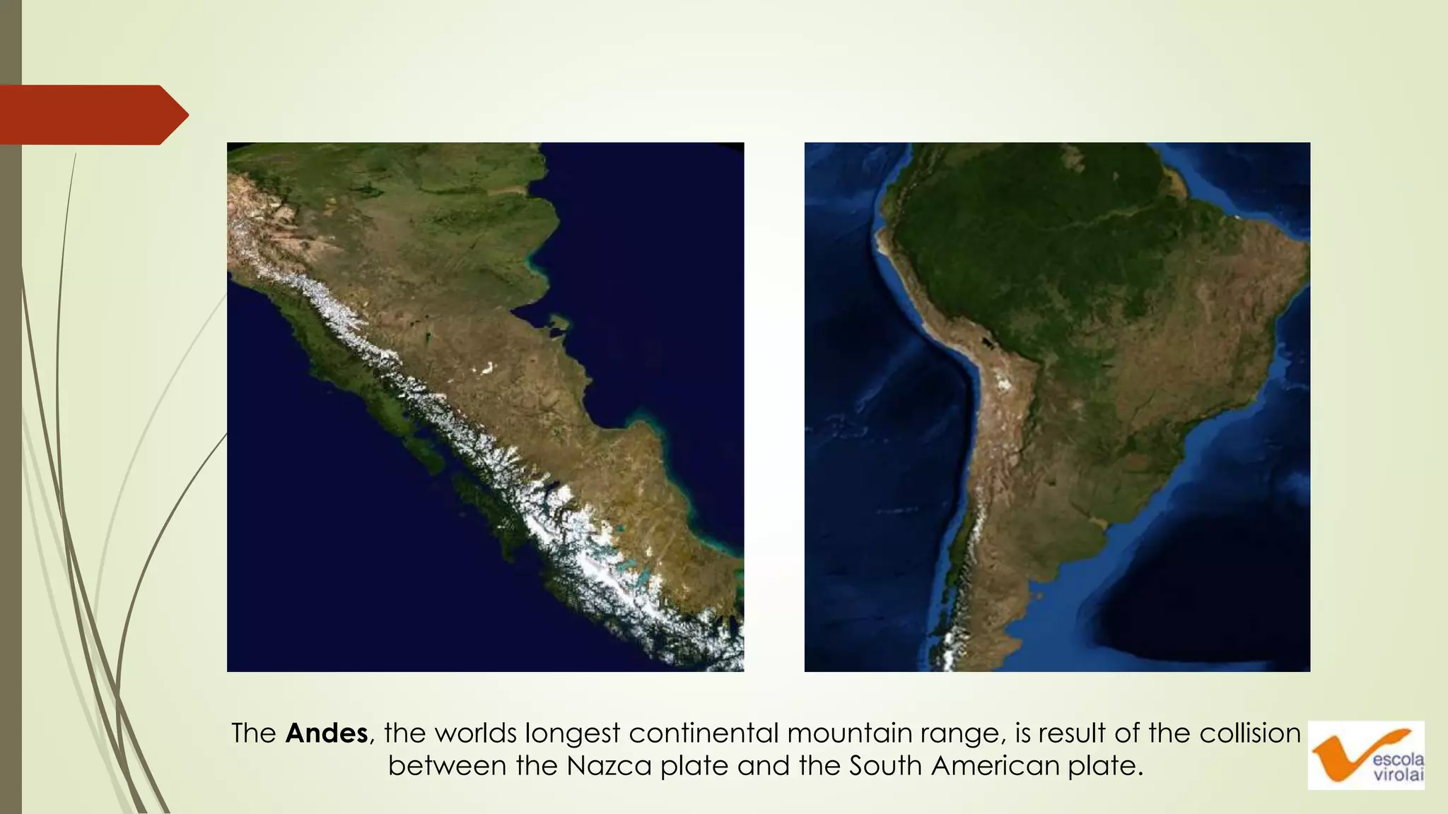
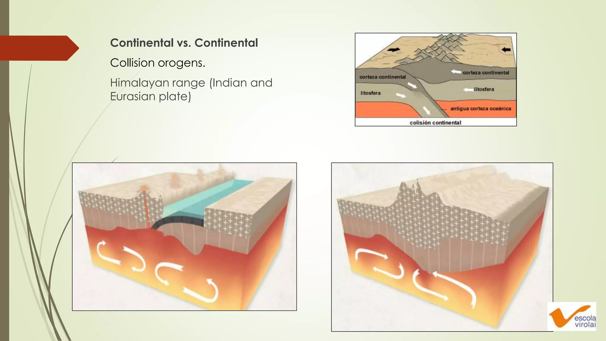
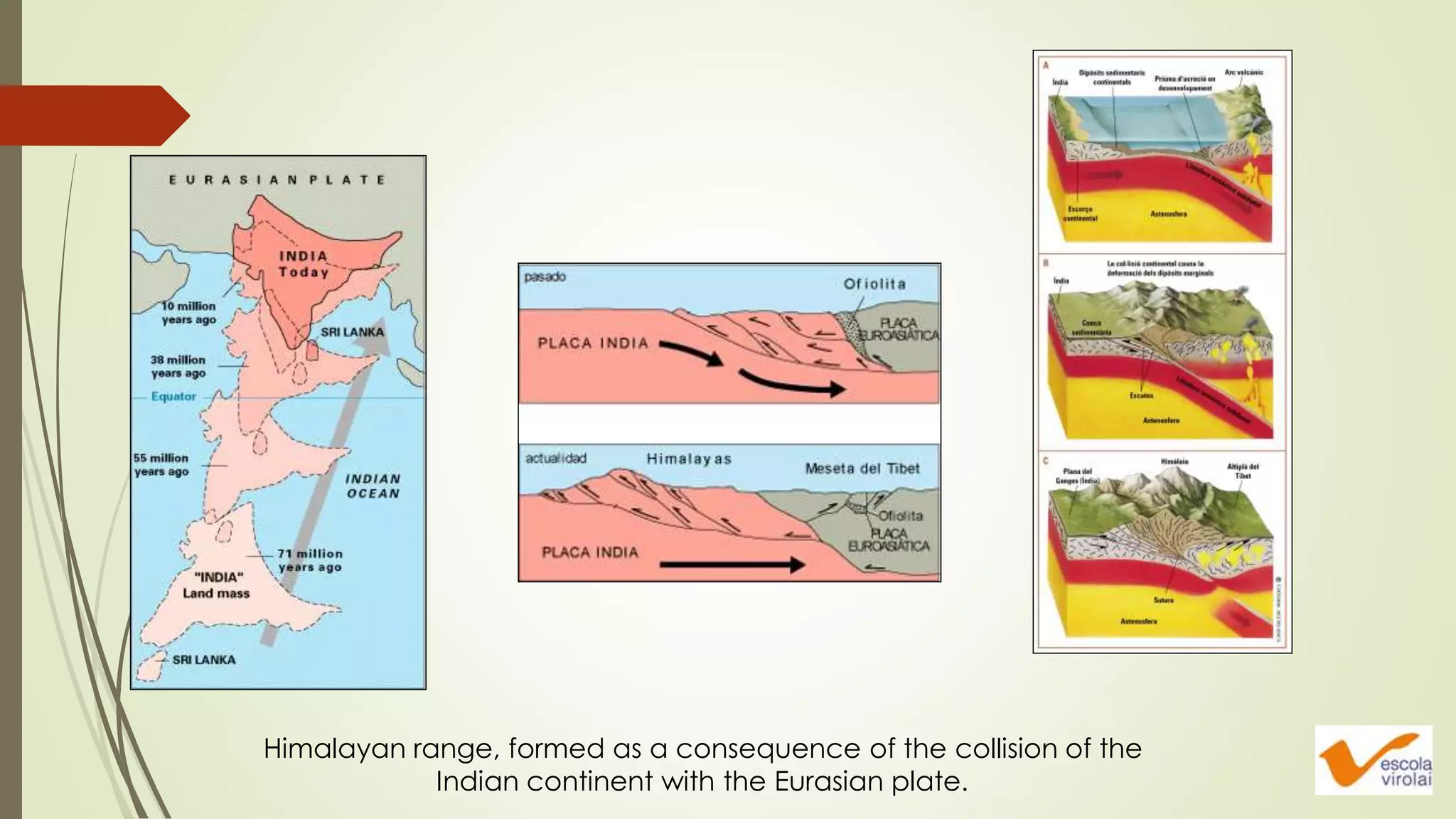
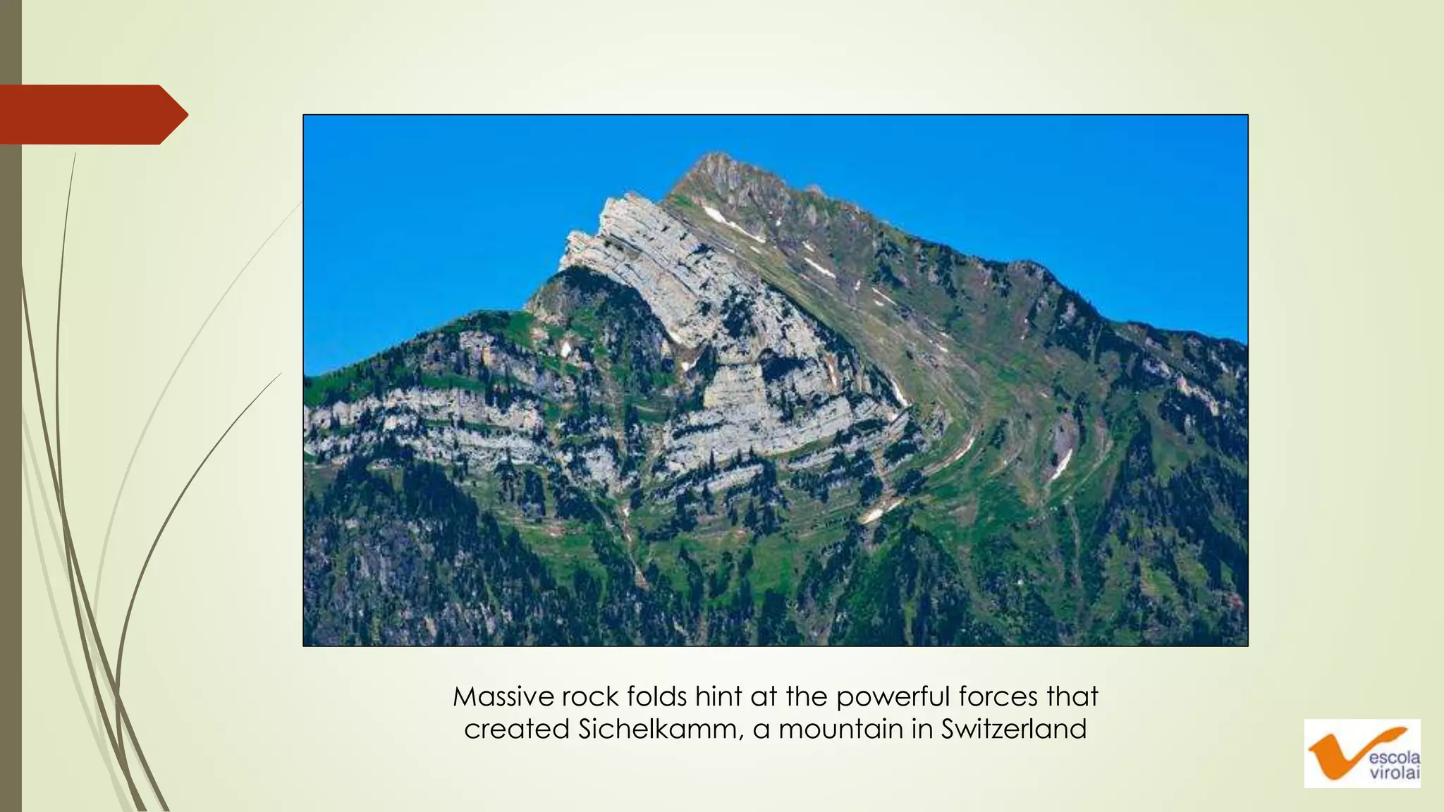
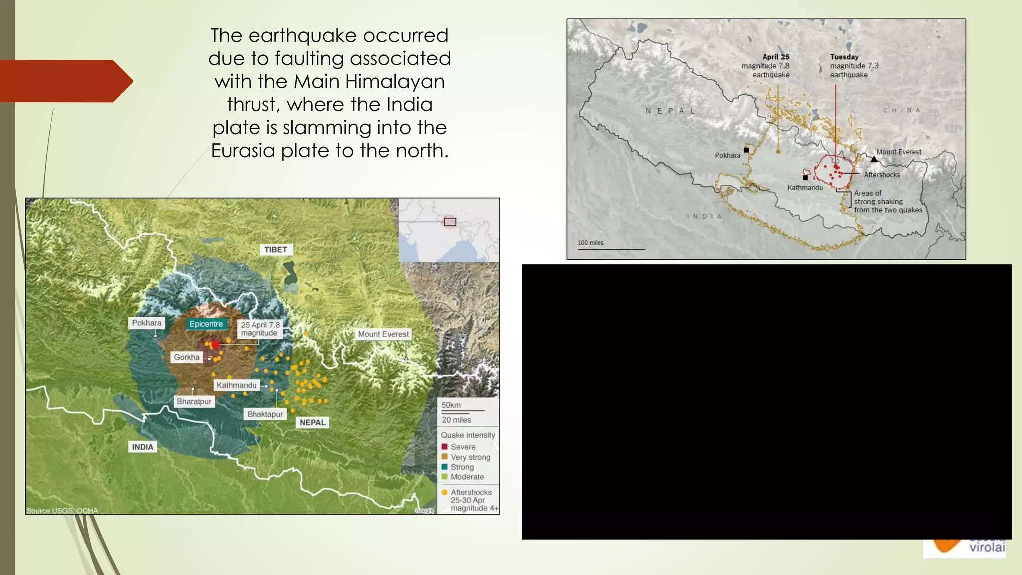
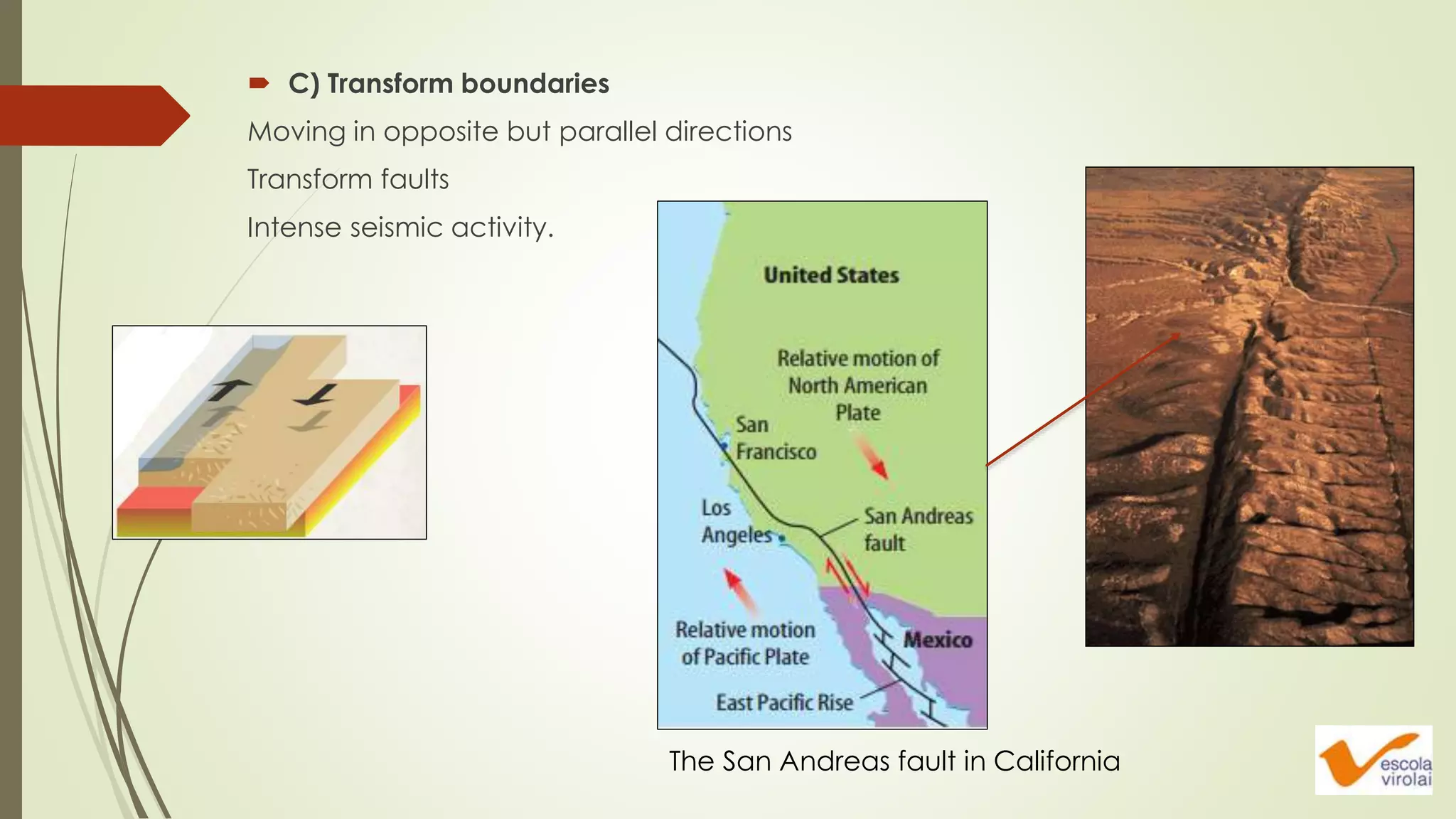
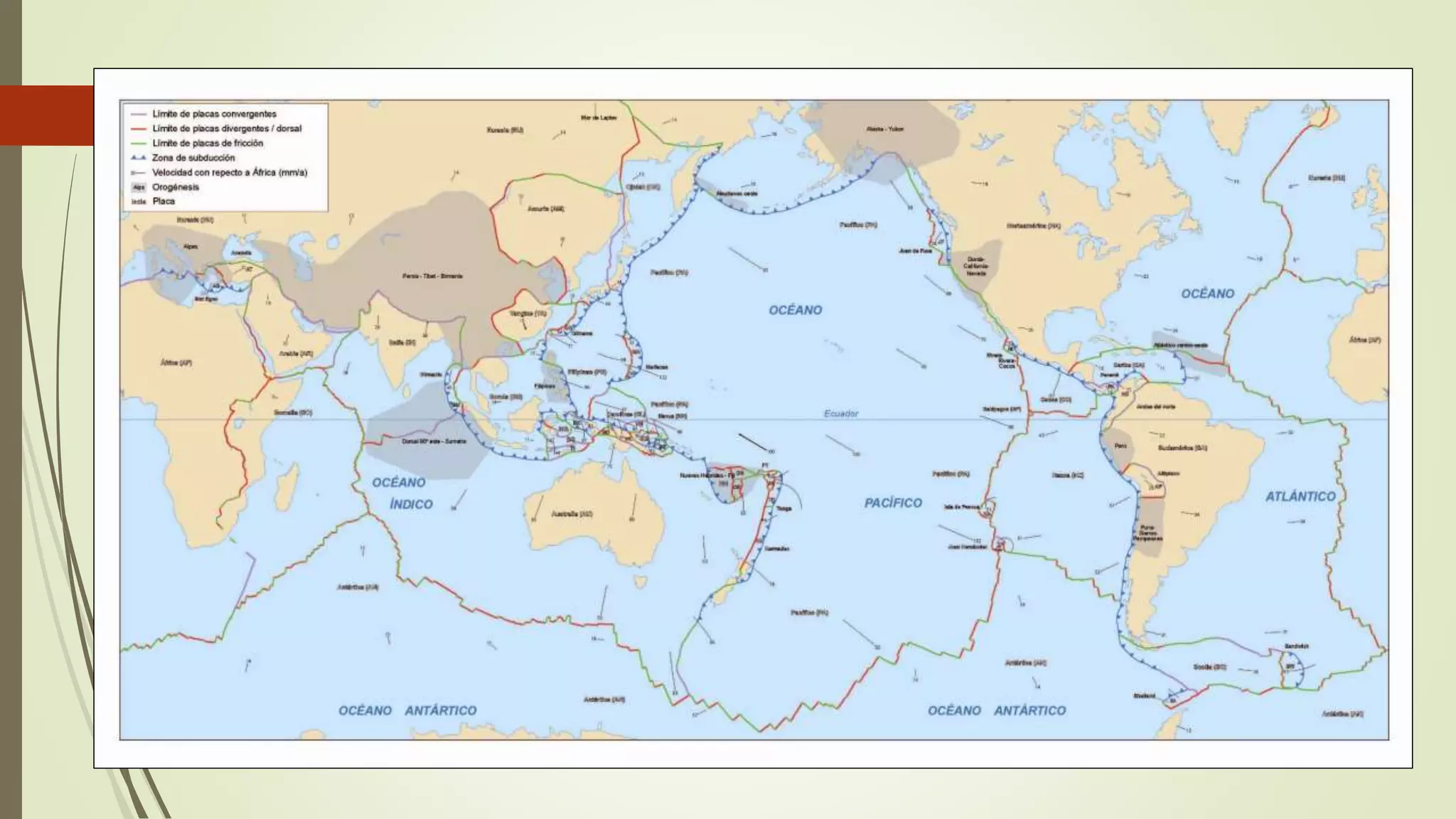
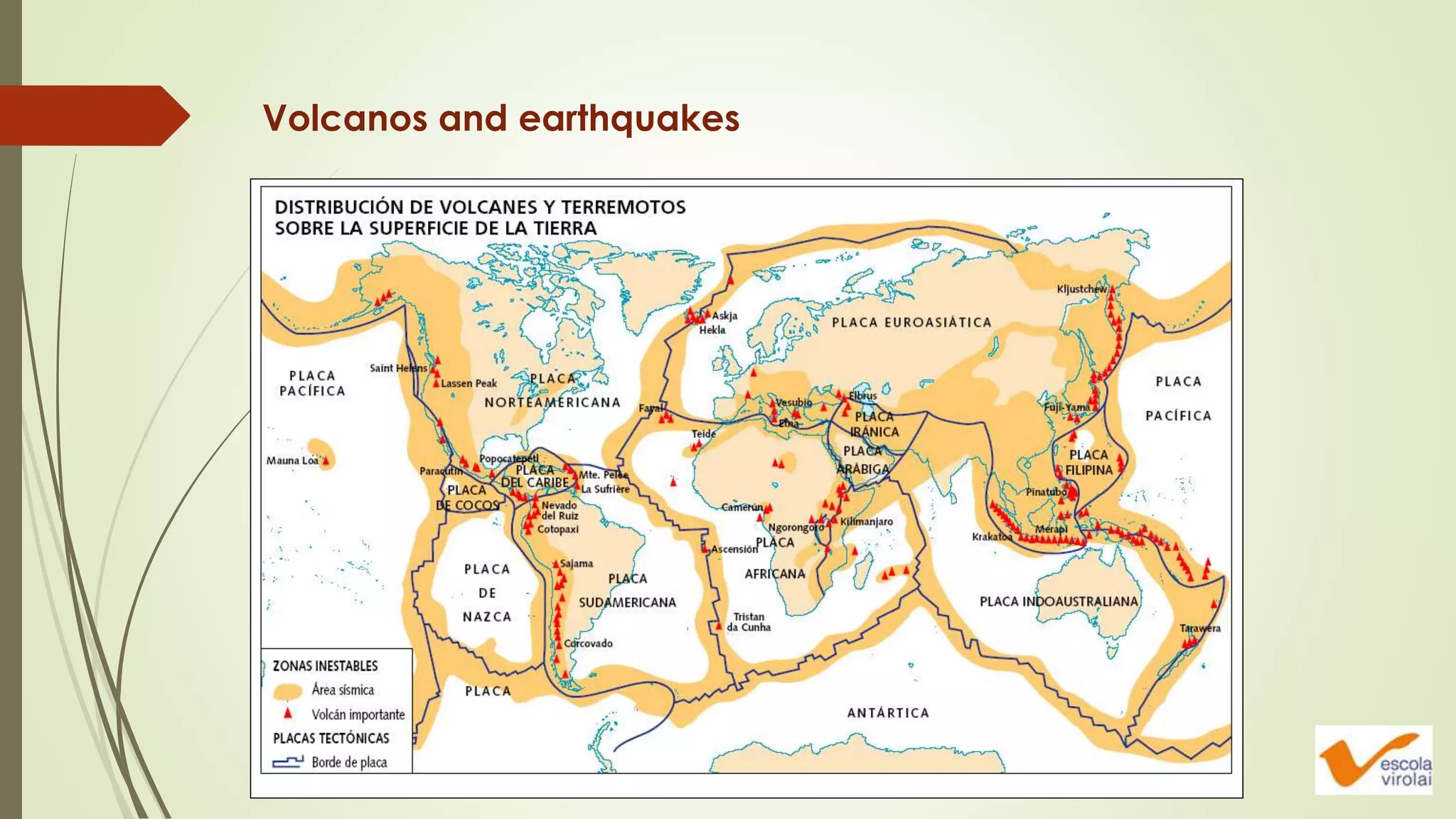
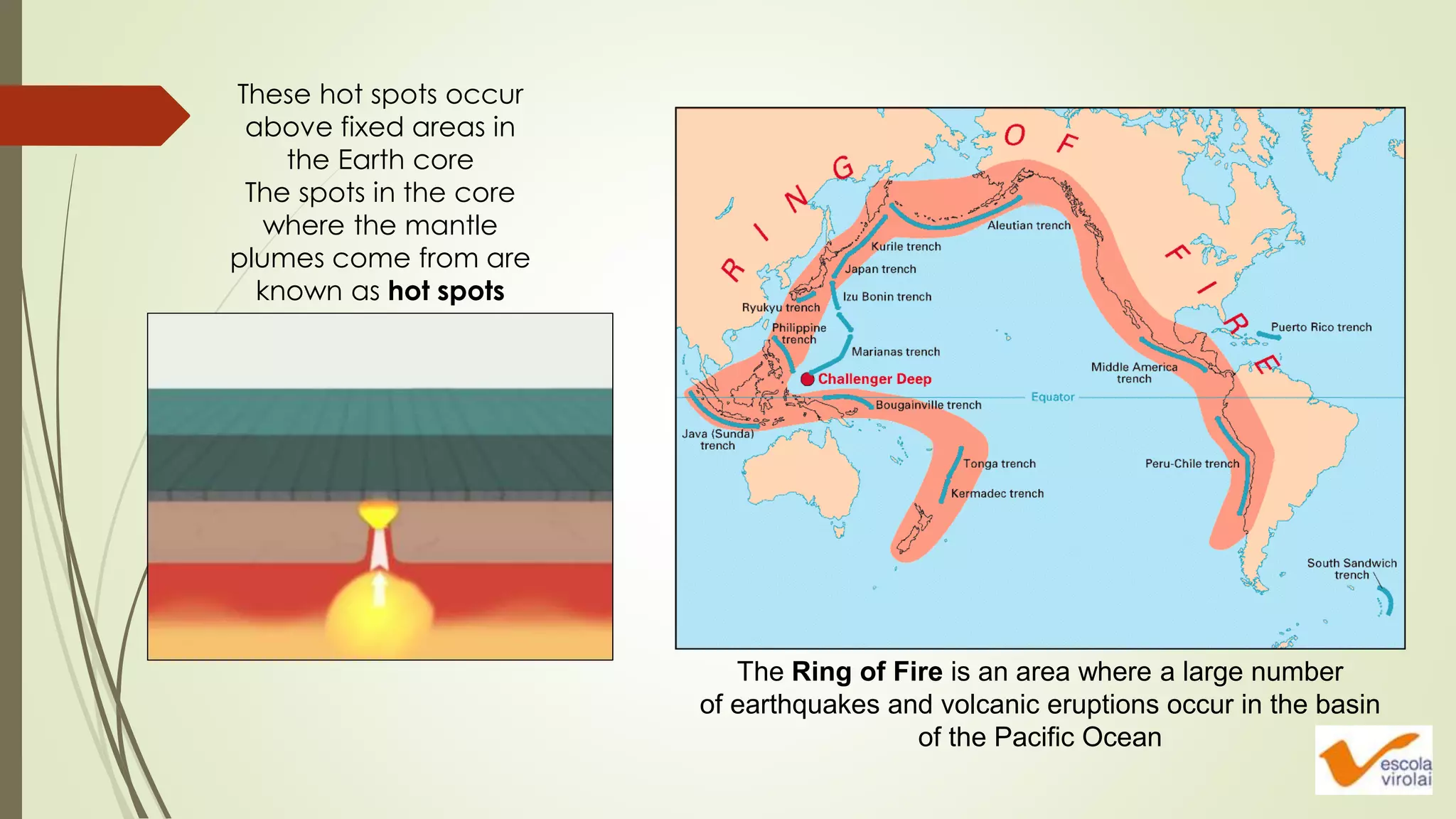
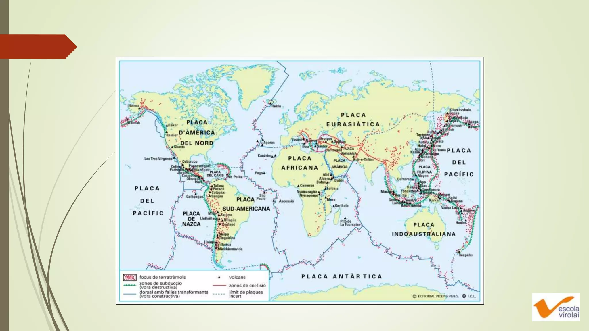
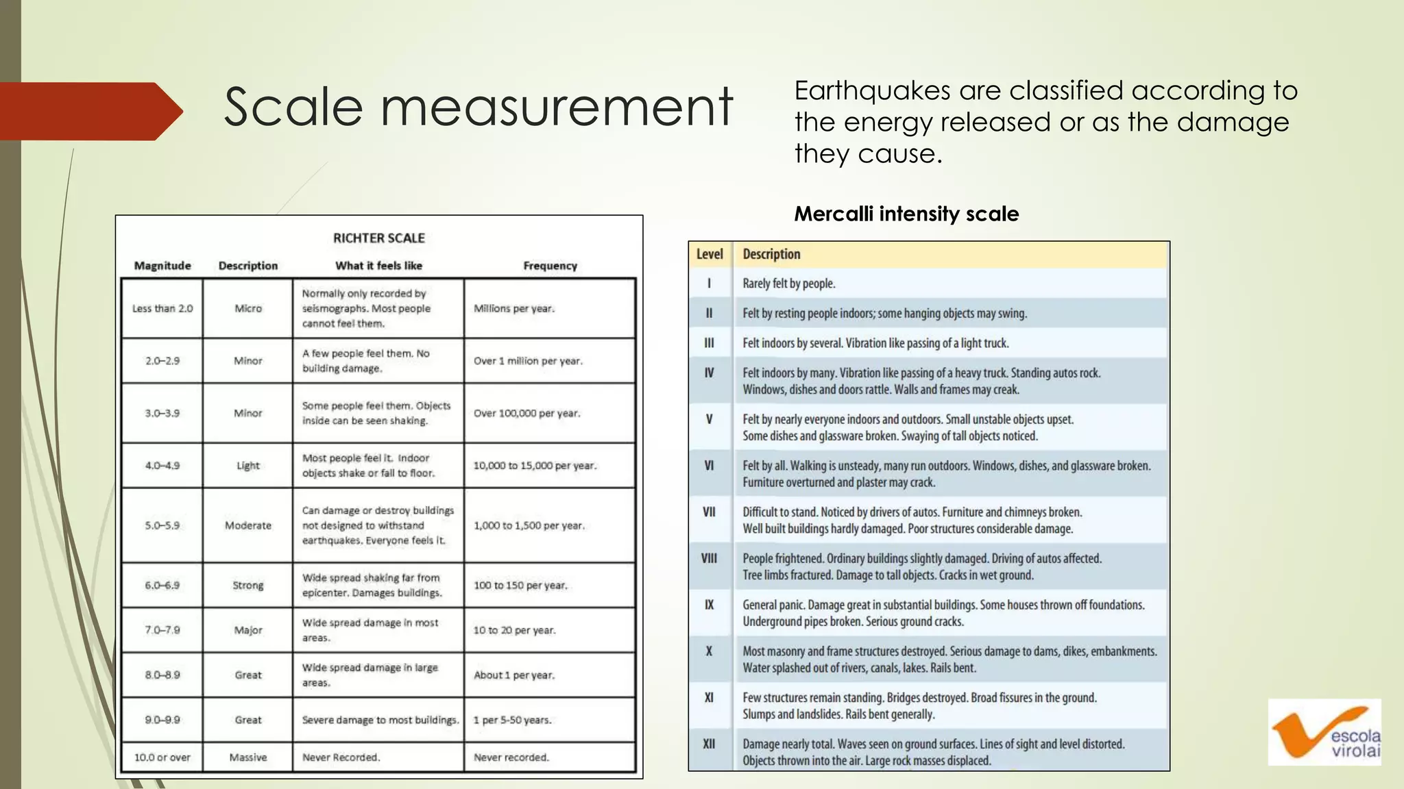
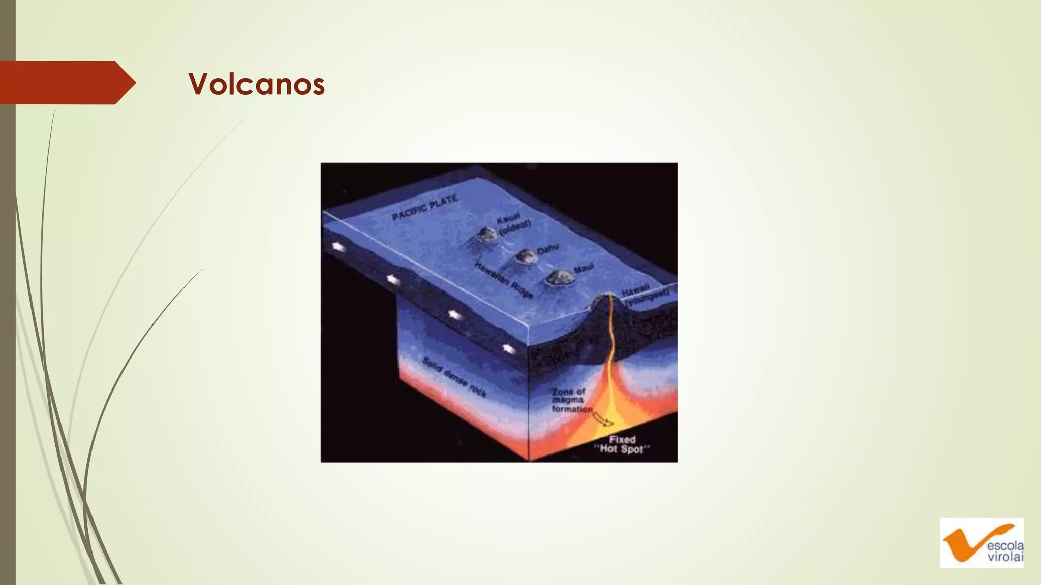
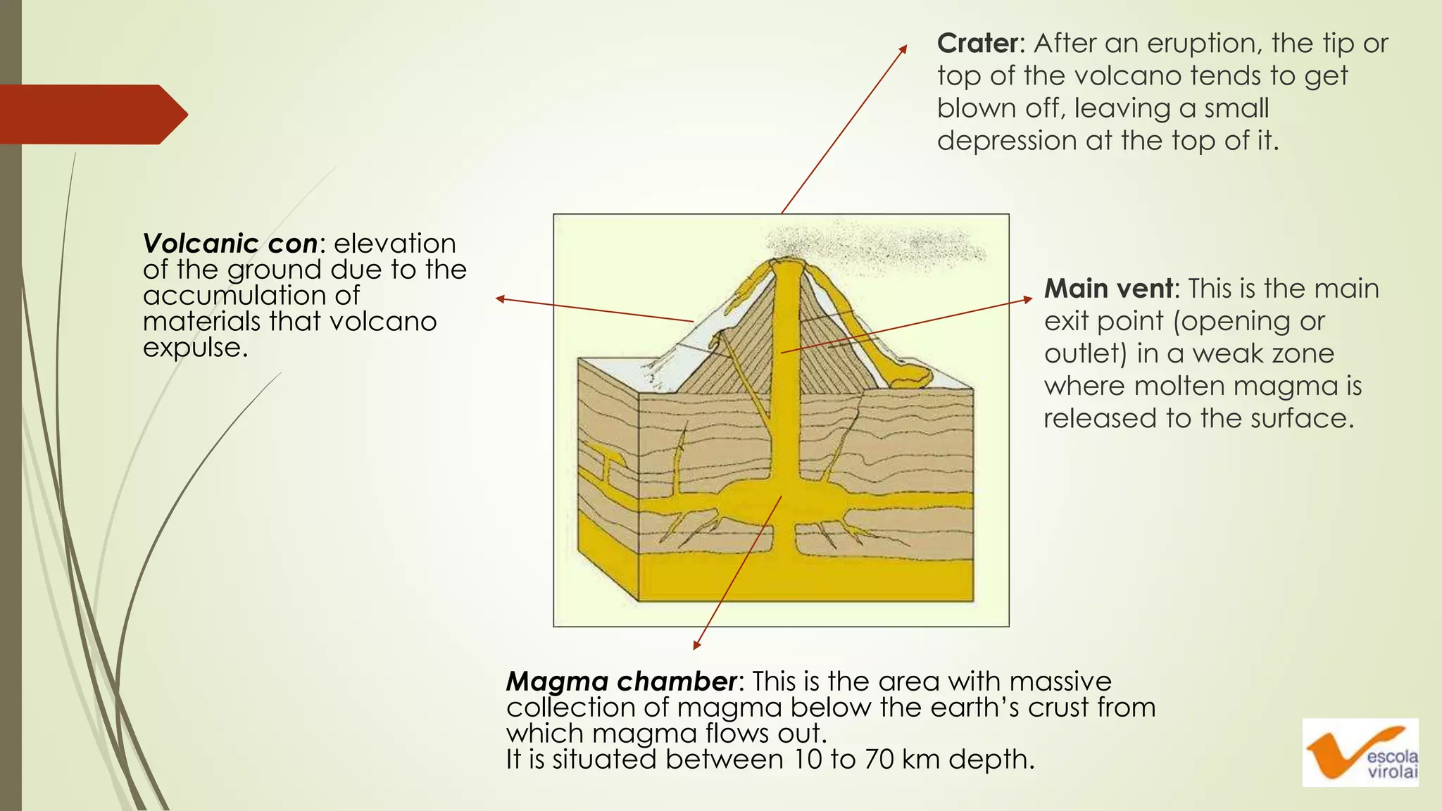
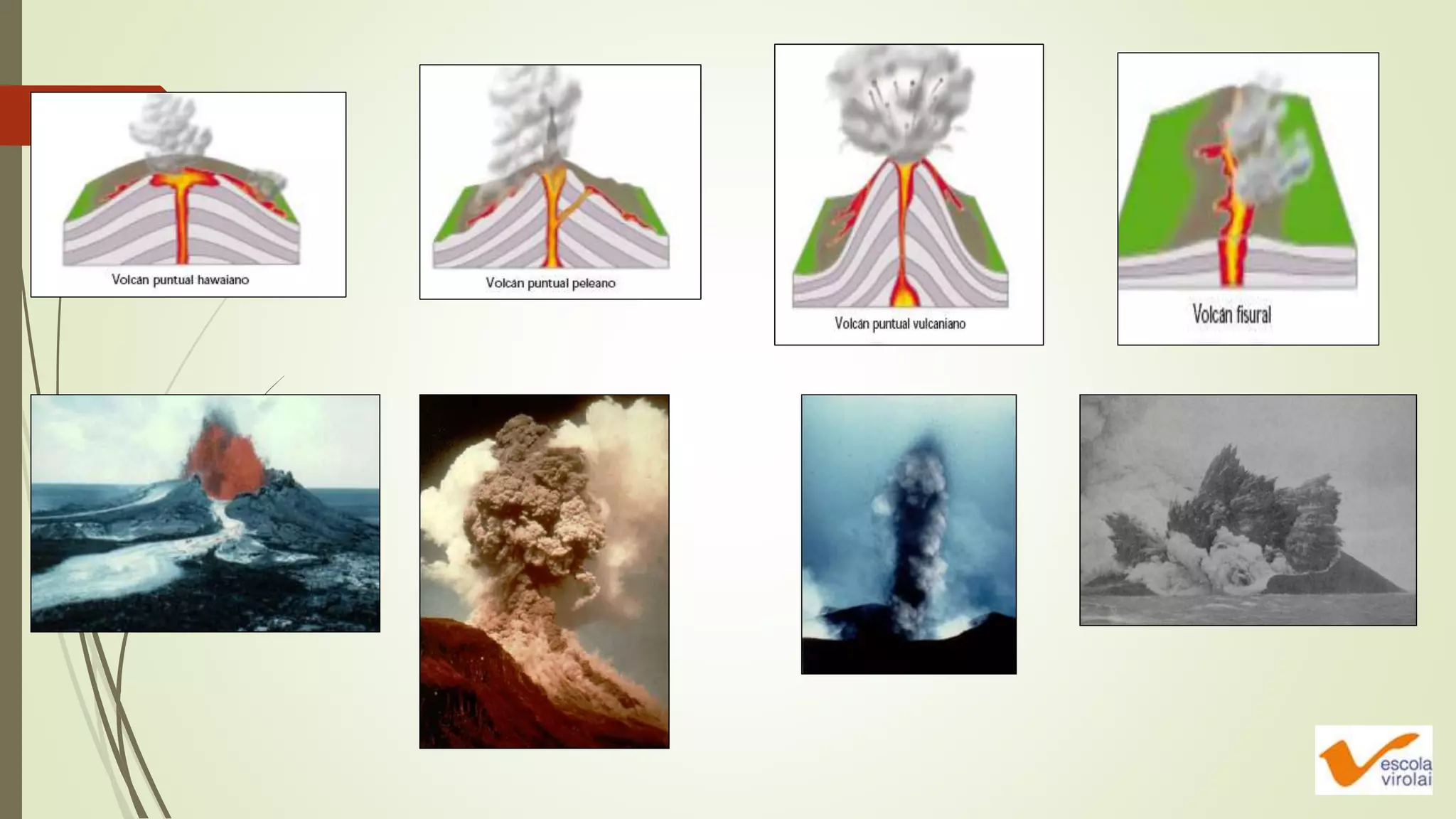
The internal processes in
the Earth
Biology and geology
4º ESO
Escola Virolai
How is the Earth? Is it static?
More seismicity
Why are these
countries more
affected by
earthquakes and
volcano activity?
CONTINENTAL DRIFT
CONTINENTAL DRIFT
Alfred Wegener proposed the hypothesis that the present continents
come from the fragmentation of an older supercontinent, which he
called Pangea in 1912.
Alfred Wegener (1880-1930)
 GEOGRAPHICAL EVIDENCE
 GEOLOGICAL EVIDENCE
 BIOLOGICAL AND PALEONTOLOGICAL EVIDENCE
 PALEOCLIMATIC EVIDENCE
His theory is based on a series of evidences:
 GEOGRAPHICAL EVIDENCE
Some continents like Africa
and South America have
complementary shapes
that fit like pieces of a
puzzle.
 GEOLOGICAL EVIDENCE
There are similarities between the geological formations of the same age
in different continents when we approach their limits.
1 432
5 6
7
 BIOLOGICAL AND PALEONTOLOGICAL EVIDENCE
The presence of these
residual groups or identical
fossils in continents separated
by oceans is difficult to
explain without considering
the continents being linked in
the past
We can find a lot of fossils of ringless tress in places that today
are located at very high latitudes such as northern Europe
 PALEOCLIMATIC EVIDENCE
The apparition of glacial deposits in
the old continent of Gondwana
indicates the position in which these
lands were long ago, much closer to
the South Pole.
 PALEOMAGNETISM
Igneous rocks contain magnetic minerals that line up with the Earth magnetic field
when the rock is formed by the cooling and solidification of magma.
The orientation of these minerals makes it possible for us to determine what their
latitude was when they were formed.
TECTONIC PLATES
 The theory of plate tectonics was formulated around 1970 by Tuzzo Wilson.
 The theory explains the movement of continents that Wegener announced, the
expansion of the oceans, the formation and destruction of continental and
oceanic crust, the location of large oceanic trenches and the formation of
large ridges.
 According to this theory, the outermost part of the Earth is constituted by rigid
plates that move one from each other. The movement of the plates is
explained by convection currents originated in the asthenosphere
TECTONIC PLATES
 The lithosphere, formed by the
uppermost solid layer of the mantle
and the crust, is not homogenous.
• 2 types of crust
- Oceanic crust (thin and dense)
- Continental crust (thicker and
lighter)
 The lithosphere is like a puzzle made up of various pieces (tectonic plates)
that fit together, floating adrift on an ocean of magma: the asthenosphere.
 Two movements of these plates:
• Vertical movements (due to their weight)
• Horizontal movements
 The lithosphere is divided in tectonic plates and can contain
• Only oceanic crust (like the Pacific plate)
• Combination of oceanic and continental crust (most cases)
In the interior of the asthenosphere there are magmatic currents.
The differences of temperature at different depths cause the movement.
The convection currents caused by the
Earth inner heat are responsible for the
movement of the tectonic plates
Take a look at the plate boundaries,
where the most spectacular geological
phenomenae take place.
Geological phenomena
Mountain ranges and
island arcs.
Ocean trenches.
Ocean ridges.
The distribution of
volcanos and
earthquakes.
PLATES BOUNDARIES
A plate is connected with the one next to through a plate boundary, which can be of three types:
• Divergent or constructive boundaries
• Convergent or destructive boundaries
• Transform boundaries
PLATES BOUNDARIES
 A) Divergent or constructive boundaries: surface taken
divergent directions; amounting material solidifies
becoming new lithosphere. The relief that forms is called
mid-ocean ridge.
- Areas with intense
seismic and volcanic
activity and high
thermal flux
- Magma continuously
bubbles up from the
asthenosphere
- Mid-ocean ridges are
the places where
oceans grow
Transform faults
 B) Convergent or destructive boundaries: the
places where the convection currents push one
plate against another, making them collide.
Oceanic vs. Oceanic
One is subducted under the other
creating a subduction zone.
Causes major volcanic activity that
produces an island arc on the
subducting zone.
Islands of Japan and New Zealand
Oceanic vs. Continental
The oceanic lithosphere is thinner and
denser than the continental one.
What is formed is a long pericontinental
mountain range, like the Andes.
The Andes, the worlds longest continental mountain range, is result of the collision
between the Nazca plate and the South American plate.
Continental vs. Continental
Collision orogens.
Himalayan range (Indian and
Eurasian plate)
Himalayan range, formed as a consequence of the collision of the
Indian continent with the Eurasian plate.
Massive rock folds hint at the powerful forces that
created Sichelkamm, a mountain in Switzerland
Nepal's Earthquake
The earthquake occurred
due to faulting associated
with the Main Himalayan
thrust, where the India
plate is slamming into the
Eurasia plate to the north.
 C) Transform boundaries
Moving in opposite but parallel directions
Transform faults
Intense seismic activity.
The San Andreas fault in California
EARTHQUAKES AND
VOLCANOS
Volcanos and earthquakes
These hot spots occur
above fixed areas in
the Earth core
The spots in the core
where the mantle
plumes come from are
known as hot spots
The Ring of Fire is an area where a large number
of earthquakes and volcanic eruptions occur in the basin
of the Pacific Ocean
Earthquakes
The tensions that create the convection currents on
the rocks of the lithosphere may reach break.
The fracture produces a vibration of the ground, an
earthquake.
They are continuously produced, though most are
barely noticeable.
But sometimes the movement is so violent that it
damaged buildings, bridges ... and large cracks
opened in the ground.
Earthquake waves travel out in all directions from a
point: the focus, or point of origin.
The point on Earth’s surface directly above the focus:
the epicenter.
Earthquake waves move out from the focus in all
directions, like a sphere of waves.
Longitudinal/Primary waves: the most quicker
waves. By solid and liquid.
Transverse/Secondary waves. More slower.
Just by solids
Surface waves R and L: by the terrestre
Surface.
SEISMIC WAVES. Waves that propagate through the interior
of the Earth transporting energy from earthquakes
P waves
S waves
L and R waves
Scale measurement Earthquakes are classified according to
the energy released or as the damage
they cause.
Mercalli intensity scale
Volcanos
Volcanic con: elevation
of the ground due to the
accumulation of
materials that volcano
expulse.
Magma chamber: This is the area with massive
collection of magma below the earth’s crust from
which magma flows out.
It is situated between 10 to 70 km depth.
Main vent: This is the main
exit point (opening or
outlet) in a weak zone
where molten magma is
released to the surface.
Crater: After an eruption, the tip or
top of the volcano tends to get
blown off, leaving a small
depression at the top of it.
Ppt 4 eso the internal processes in the earth (1)

Ppt 4 eso the internal processes in the earth (1)

  • 1.
    The internal processesin the Earth Biology and geology 4º ESO Escola Virolai
  • 3.
    How is theEarth? Is it static?
  • 4.
    More seismicity Why arethese countries more affected by earthquakes and volcano activity?
  • 5.
  • 6.
    CONTINENTAL DRIFT Alfred Wegenerproposed the hypothesis that the present continents come from the fragmentation of an older supercontinent, which he called Pangea in 1912. Alfred Wegener (1880-1930)
  • 8.
     GEOGRAPHICAL EVIDENCE GEOLOGICAL EVIDENCE  BIOLOGICAL AND PALEONTOLOGICAL EVIDENCE  PALEOCLIMATIC EVIDENCE His theory is based on a series of evidences:
  • 9.
     GEOGRAPHICAL EVIDENCE Somecontinents like Africa and South America have complementary shapes that fit like pieces of a puzzle.
  • 10.
     GEOLOGICAL EVIDENCE Thereare similarities between the geological formations of the same age in different continents when we approach their limits.
  • 11.
  • 12.
     BIOLOGICAL ANDPALEONTOLOGICAL EVIDENCE The presence of these residual groups or identical fossils in continents separated by oceans is difficult to explain without considering the continents being linked in the past
  • 14.
    We can finda lot of fossils of ringless tress in places that today are located at very high latitudes such as northern Europe
  • 15.
     PALEOCLIMATIC EVIDENCE Theapparition of glacial deposits in the old continent of Gondwana indicates the position in which these lands were long ago, much closer to the South Pole.
  • 17.
     PALEOMAGNETISM Igneous rockscontain magnetic minerals that line up with the Earth magnetic field when the rock is formed by the cooling and solidification of magma. The orientation of these minerals makes it possible for us to determine what their latitude was when they were formed.
  • 18.
  • 19.
     The theoryof plate tectonics was formulated around 1970 by Tuzzo Wilson.  The theory explains the movement of continents that Wegener announced, the expansion of the oceans, the formation and destruction of continental and oceanic crust, the location of large oceanic trenches and the formation of large ridges.  According to this theory, the outermost part of the Earth is constituted by rigid plates that move one from each other. The movement of the plates is explained by convection currents originated in the asthenosphere TECTONIC PLATES
  • 22.
     The lithosphere,formed by the uppermost solid layer of the mantle and the crust, is not homogenous. • 2 types of crust - Oceanic crust (thin and dense) - Continental crust (thicker and lighter)
  • 23.
     The lithosphereis like a puzzle made up of various pieces (tectonic plates) that fit together, floating adrift on an ocean of magma: the asthenosphere.  Two movements of these plates: • Vertical movements (due to their weight) • Horizontal movements  The lithosphere is divided in tectonic plates and can contain • Only oceanic crust (like the Pacific plate) • Combination of oceanic and continental crust (most cases)
  • 24.
    In the interiorof the asthenosphere there are magmatic currents. The differences of temperature at different depths cause the movement. The convection currents caused by the Earth inner heat are responsible for the movement of the tectonic plates Take a look at the plate boundaries, where the most spectacular geological phenomenae take place.
  • 25.
    Geological phenomena Mountain rangesand island arcs. Ocean trenches. Ocean ridges. The distribution of volcanos and earthquakes.
  • 26.
  • 27.
    A plate isconnected with the one next to through a plate boundary, which can be of three types: • Divergent or constructive boundaries • Convergent or destructive boundaries • Transform boundaries PLATES BOUNDARIES
  • 29.
     A) Divergentor constructive boundaries: surface taken divergent directions; amounting material solidifies becoming new lithosphere. The relief that forms is called mid-ocean ridge.
  • 30.
    - Areas withintense seismic and volcanic activity and high thermal flux - Magma continuously bubbles up from the asthenosphere - Mid-ocean ridges are the places where oceans grow Transform faults
  • 31.
     B) Convergentor destructive boundaries: the places where the convection currents push one plate against another, making them collide.
  • 33.
    Oceanic vs. Oceanic Oneis subducted under the other creating a subduction zone. Causes major volcanic activity that produces an island arc on the subducting zone. Islands of Japan and New Zealand
  • 34.
    Oceanic vs. Continental Theoceanic lithosphere is thinner and denser than the continental one. What is formed is a long pericontinental mountain range, like the Andes.
  • 35.
    The Andes, theworlds longest continental mountain range, is result of the collision between the Nazca plate and the South American plate.
  • 36.
    Continental vs. Continental Collisionorogens. Himalayan range (Indian and Eurasian plate)
  • 37.
    Himalayan range, formedas a consequence of the collision of the Indian continent with the Eurasian plate.
  • 38.
    Massive rock foldshint at the powerful forces that created Sichelkamm, a mountain in Switzerland
  • 39.
  • 40.
    The earthquake occurred dueto faulting associated with the Main Himalayan thrust, where the India plate is slamming into the Eurasia plate to the north.
  • 41.
     C) Transformboundaries Moving in opposite but parallel directions Transform faults Intense seismic activity. The San Andreas fault in California
  • 43.
  • 44.
  • 45.
    These hot spotsoccur above fixed areas in the Earth core The spots in the core where the mantle plumes come from are known as hot spots The Ring of Fire is an area where a large number of earthquakes and volcanic eruptions occur in the basin of the Pacific Ocean
  • 47.
    Earthquakes The tensions thatcreate the convection currents on the rocks of the lithosphere may reach break. The fracture produces a vibration of the ground, an earthquake. They are continuously produced, though most are barely noticeable. But sometimes the movement is so violent that it damaged buildings, bridges ... and large cracks opened in the ground.
  • 48.
    Earthquake waves travelout in all directions from a point: the focus, or point of origin. The point on Earth’s surface directly above the focus: the epicenter. Earthquake waves move out from the focus in all directions, like a sphere of waves.
  • 49.
    Longitudinal/Primary waves: themost quicker waves. By solid and liquid. Transverse/Secondary waves. More slower. Just by solids Surface waves R and L: by the terrestre Surface. SEISMIC WAVES. Waves that propagate through the interior of the Earth transporting energy from earthquakes P waves S waves L and R waves
  • 51.
    Scale measurement Earthquakesare classified according to the energy released or as the damage they cause. Mercalli intensity scale
  • 52.
  • 53.
    Volcanic con: elevation ofthe ground due to the accumulation of materials that volcano expulse. Magma chamber: This is the area with massive collection of magma below the earth’s crust from which magma flows out. It is situated between 10 to 70 km depth. Main vent: This is the main exit point (opening or outlet) in a weak zone where molten magma is released to the surface. Crater: After an eruption, the tip or top of the volcano tends to get blown off, leaving a small depression at the top of it.