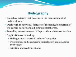
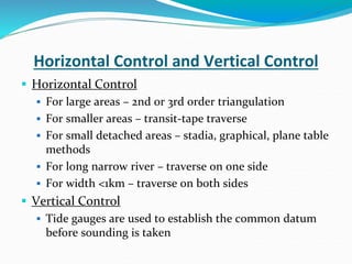
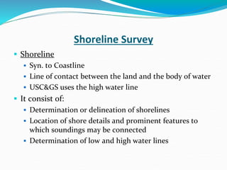
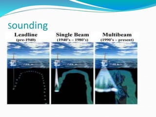
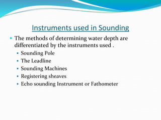
The document summarizes key aspects of hydrographic surveys. It discusses controlling horizontal and vertical positions, measuring depths through sounding, and producing charts. Soundings are taken using various instruments and referenced to tidal datums. Depths are plotted on charts along with shorelines, depth contours, and navigational features. Hydrographic surveys provide critical data for safe navigation and engineering projects.
Hydrographic survey is the survey of physical features present underwater.
This slide briefs you about the definition of the survey, its application, use, etc. It also discusses the sounding process used in the hydrographic survey.
Hydrographic surveying or bathymetric surveying is the survey of physical features present underwater. It is the science of measuring all factors beneath water that affect all the marine activities like dredging, marine constructions, offshore drilling etc.
In this report, I shall discuss the importance and applications of hydrographic surveying, the devices used for the hydrographic survivor, how he uses them, and how do they work.
Course Contents:
Introduction; Linear measurements; Analysis and adjustment of measurements, Survey methods: coordinate systems, bearings, horizontal control, traversing, triangulation, detail surveying; Orientation and position; Areas and volumes; Setting out; Curve ranging; Global Positioning system (GPS); Photogrammetry.
Definition of Surveying
Objects of Surveying
Uses of Surveying
Primary Divisions of Surveying
Principles of Surveying
List of Classification of Surveying
Definitions : Plan and Map, scales :Plain Scale and Diagonal Scale,
Edm is a surveying instrument used to measure the distance electronically. This Surveying Instrument is used in triangulation to measure the length of Base line because more accuracy is required to measure the length of base line.
Reconnaissance for Hydrographic Survey ProjectNzar Braim
Reconnaissance for Hydrographic Survey Project
The system is able to withstand the harsh environment of the nearshore and acquire beach profile information across the surf zone. This paper describes the system and results of a comparison in Myrtle Beach, S.C., between surveys collected over a 3- day period by the personal watercraft system and by a similar system mounted aboard a traditional coastal survey vessel.
The bathymetric measurements for the personal watercraft-mounted echosounder surveying system display mean repetitive differences of 6 cm.
This workshop is an introductory course in Hydrographic surveying.
It is designed for surveyors, engineers, survey technicians, dredge operators, and hydrographers.
The course focuses on theoretical principles of hydrographic surveying, project description, operation, and map production.
Methods of Shore Observations for Horizontal position FixingNzar Braim
This report is about the methods of observations of the shore for fixing the horizontal
control position, I will try to explain the hydrographic engineering science within its
advantages and applications and the most common methods used in hydrography
briefly.
We knew that the depths of the water bodies at various points and will be changed
and unstable so Depths are determined by making sounding which is determining the
depth of water from the stationary boat and the positions of sounding can be determined
either from the boat from shore or both of them.
If we want to make a survey Project or let's say if a surveyor wants to make a survey
project for hydrographic surveying and observation for this project so he needs
many processes many preparations many techniques many tools equipment and
So For establishing horizontal control and vertical control points, we have many
methods either offshore or onshore or both I mean from a boat or shore or both
consequently, I wrote a report about this important t subject and In this report I
mention all methods and explain the three applicable and using methods that have
been used in hydrographic surveying and also mention which method is good or
better than the other and the advantages and disadvantages of these methods.At the end
my aim for preparing this report is to show the importance of hydrographic surveying
and how these methods can be used and all require and need for these methods and
also mention all steps, all equations that must be used for these methods.
Finally most important point I should mention it is a co-ordinated system or finding the
coordinates .the surveyor deals with the coordinates, so we make all these processes,
learning all methods, equations, formulas, steps, establishing control points, all above
just for one purpose which is finding the or calculating coordinate, and the most
the important thing in coordinate is accuracy, avoiding errors and uncertainty.
Hydrographic surveying
It is the branch of surveying which deals with water bodies e.g. Lake, river etc.
The usual fundamental principles of surveying and levelling are adopted for acquiring data for determination of :
Water volume
Rate of flow
To determine the shape of the area underlying the water surface etc.
Student information management system project report ii.pdfKamal Acharya
Our project explains about the student management. This project mainly explains the various actions related to student details. This project shows some ease in adding, editing and deleting the student details. It also provides a less time consuming process for viewing, adding, editing and deleting the marks of the students.
Final project report on grocery store management system..pdfKamal Acharya
In today’s fast-changing business environment, it’s extremely important to be able to respond to client needs in the most effective and timely manner. If your customers wish to see your business online and have instant access to your products or services.
Online Grocery Store is an e-commerce website, which retails various grocery products. This project allows viewing various products available enables registered users to purchase desired products instantly using Paytm, UPI payment processor (Instant Pay) and also can place order by using Cash on Delivery (Pay Later) option. This project provides an easy access to Administrators and Managers to view orders placed using Pay Later and Instant Pay options.
In order to develop an e-commerce website, a number of Technologies must be studied and understood. These include multi-tiered architecture, server and client-side scripting techniques, implementation technologies, programming language (such as PHP, HTML, CSS, JavaScript) and MySQL relational databases. This is a project with the objective to develop a basic website where a consumer is provided with a shopping cart website and also to know about the technologies used to develop such a website.
This document will discuss each of the underlying technologies to create and implement an e- commerce website.
About
Indigenized remote control interface card suitable for MAFI system CCR equipment. Compatible for IDM8000 CCR. Backplane mounted serial and TCP/Ethernet communication module for CCR remote access. IDM 8000 CCR remote control on serial and TCP protocol.
• Remote control: Parallel or serial interface.
• Compatible with MAFI CCR system.
• Compatible with IDM8000 CCR.
• Compatible with Backplane mount serial communication.
• Compatible with commercial and Defence aviation CCR system.
• Remote control system for accessing CCR and allied system over serial or TCP.
• Indigenized local Support/presence in India.
• Easy in configuration using DIP switches.
Technical Specifications
Indigenized remote control interface card suitable for MAFI system CCR equipment. Compatible for IDM8000 CCR. Backplane mounted serial and TCP/Ethernet communication module for CCR remote access. IDM 8000 CCR remote control on serial and TCP protocol.
Key Features
Indigenized remote control interface card suitable for MAFI system CCR equipment. Compatible for IDM8000 CCR. Backplane mounted serial and TCP/Ethernet communication module for CCR remote access. IDM 8000 CCR remote control on serial and TCP protocol.
• Remote control: Parallel or serial interface
• Compatible with MAFI CCR system
• Copatiable with IDM8000 CCR
• Compatible with Backplane mount serial communication.
• Compatible with commercial and Defence aviation CCR system.
• Remote control system for accessing CCR and allied system over serial or TCP.
• Indigenized local Support/presence in India.
Application
• Remote control: Parallel or serial interface.
• Compatible with MAFI CCR system.
• Compatible with IDM8000 CCR.
• Compatible with Backplane mount serial communication.
• Compatible with commercial and Defence aviation CCR system.
• Remote control system for accessing CCR and allied system over serial or TCP.
• Indigenized local Support/presence in India.
• Easy in configuration using DIP switches.
Overview of the fundamental roles in Hydropower generation and the components involved in wider Electrical Engineering.
This paper presents the design and construction of hydroelectric dams from the hydrologist’s survey of the valley before construction, all aspects and involved disciplines, fluid dynamics, structural engineering, generation and mains frequency regulation to the very transmission of power through the network in the United Kingdom.
Author: Robbie Edward Sayers
Collaborators and co editors: Charlie Sims and Connor Healey.
(C) 2024 Robbie E. Sayers
Water scarcity is the lack of fresh water resources to meet the standard water demand. There are two type of water scarcity. One is physical. The other is economic water scarcity.
1. Hydrographic Survey
STRUCTURE
Introduction
Horizontal & Veticle control
Sounding
Hydrography &
Cartography
Terms used in Hydrography
Prepared for
Department of Civil Engineering
L.D. college of Engineering
Ahmedabad
2. Hydrography
Branch of science that deals with the measurement of
bodies of water
Deals with the physical features of the navigable portion of
the earth’s surface and adjoining coastal areas.
Sounding –measurement of depth below the water surface
Applications of sounding:
Making nautical charts for safety of navigation
Development and engineering projects such as piers, dams
and bridges
Scientific and academic studies
3. Horizontal Control and Vertical Control
Horizontal Control
For large areas – 2nd or 3rd order triangulation
For smaller areas – transit-tape traverse
For small detached areas – stadia, graphical, plane table
methods
For long narrow river – traverse on one side
For width <1km – traverse on both sides
Vertical Control
Tide gauges are used to establish the common datum
before sounding is taken
4. Shoreline Survey
Shoreline
Syn. to Coastline
Line of contact between the land and the body of water
USC&GS uses the high water line
It consist of:
Determination or delineation of shorelines
Location of shore details and prominent features to
which soundings may be connected
Determination of low and high water lines
6. Methods of Locating Sounding
From the shore
Location by Cross-Rope
Location by two angles from the shore
Location by Range and One angle from the shore
From the boat
Location by two angle from the boat
Location by Range and One angle from the boat
From both the shore and the boat
Location by One angle from the shore and from the boat
Location by Range and Time Intervals of the boat
Location by Intersecting Ranges
Location by Tacheometric Observations
7. Sounding Lines
Systems of Sounding Lines
Parallel straight lines –< open coasts
Radiating lines –< small bays and islets
Circular curves or arcs –< isolated shoal
Spacing of Sounding Lines
Factors: the scale of the survey, depth of water, proximity to
shore, character of submarine relief, importance of the region
Scale Ordinary Spacing Closest Spacing
1:10,000 50-60 25-30
1:20,000 100-125 50-60
1:40,000 200-250 100-125
1:80,000 400-500 200-250
1:120,000 600-750 300-375
9. Instruments used in Sounding
The methods of determining water depth are
differentiated by the instruments used .
Sounding Pole
The Leadline
Sounding Machines
Registering sheaves
Echo sounding Instrument or Fathometer
10. Echo Sounding
Distance is measured by multiplying half the time(t)
from the signal's outgoing pulse to its return by the
speed of sound(S) in the water, which is
approximately 1.5 kilometres per second.
D=0.5(t)*S
It takes in to account the factors of temperature,
pressure and salinity to calculate the actual sound
speed.
11. Reduction of Sounding
The reduced sounding are the reduced levels of the
submarine surface in terms of the adopted datum
A correction equal to the difference of level between
the actual water level(gauge reading) and the
datum(MLW/MLLW) is applied to the observed
soundings.
13. Hydrography and Cartography
Cartography – science and art of the production of maps
and charts
Nautical charts-< polyconic projection
Instruments used in the preparation of Nautical Charts
3-arm protractor
Hairspring divider
Spacing divider
Proportional divider
Meter Bar
Opisometer/Map measure
Beam Compass
14. The Nautical Chart
A nautical chart is a graphic representation of a
maritime area and adjacent coastal regions.
Datums of a Nautical Chart
Horizontal Datum
Vertical Datum
Atlantic Ocean – Mean Low Water
Pacific Ocean – Mean Lower Low Water
15. Nautical Chart
The Nautical chart or hydrographic map should
contain the following information
Datum used
High, mean, low water lines
Soundings
Line of equal interpolated from the soundings called
depth curves
Conventional symbols
All safety devices such as lighthouse, buoys etc.
Complete border information
16. Plotting of Soundings
Soundings can be plotted in 3 ways
Mechanical Solution
By tracing paper
By Station Pointer
Graphical Solution
Method 1
Method 2
Analytical Solution
17. Other Essential in Hydrography
The Sextant
An instrument used to measure the angle between any
two visible objects.
The Boat sheet/Hydrographic sheet
The Wire drag
A device used to detect obstructions such as boulders
and ledges. These obstructions should be plotted in the
Navigational charts.
18. Common Terms used in Hydrography
Marginal continental
features
Deep Sea Depression
& Deep Sea Elevations
Bank
Continental shelf
Continental slope
Insular shelf
Insular slope
Basin
Deep
Depression
Depth
Foredeep
Trench
Plateadu
Ridge
Seamount
Swell
19. Common Terms used in Hydrography
Embayments Coastal Features
Bay
Bright
Cove
Harbor
Inlet
Gulf
Cape
Coast
High-water Line
Island
Islet
Low-water line
Point
20. Common Terms used in Hydrography
Streams Submarine Elevations
Bayou
Brook and Run
Creek
Lagoon
River
Slough
Caldron
Canyon
Seavalley
Valley
Bank
Crest
Dome Knoll
Ledge
Pinnacle
Reef
Shoal
Spur