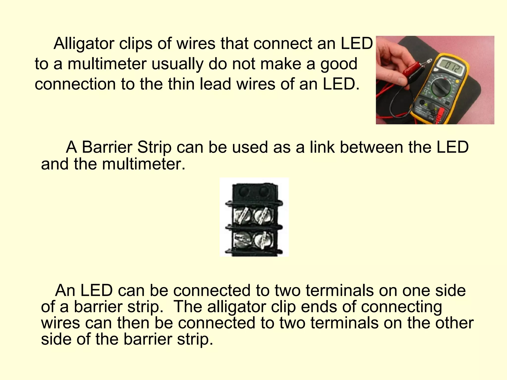
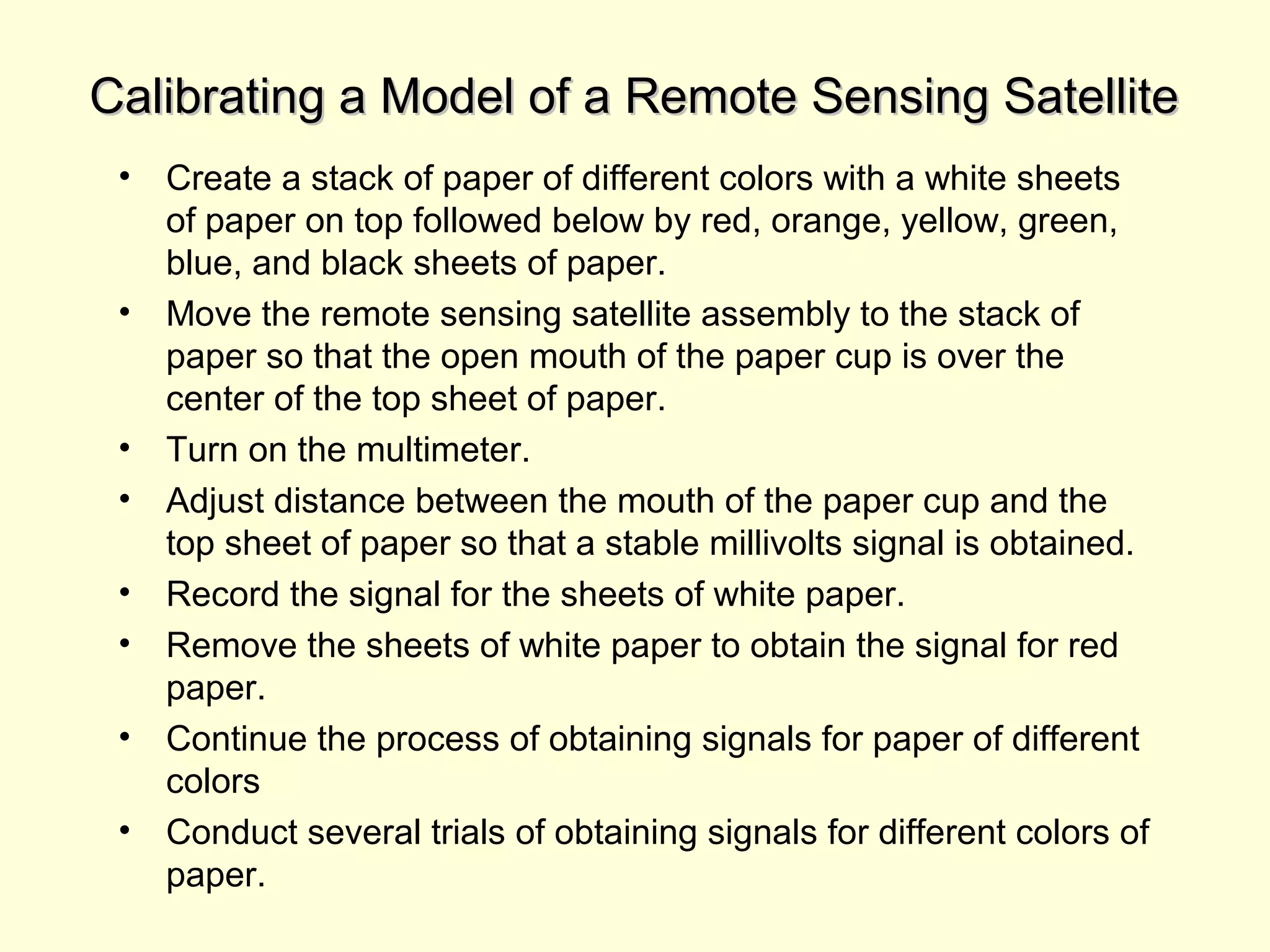
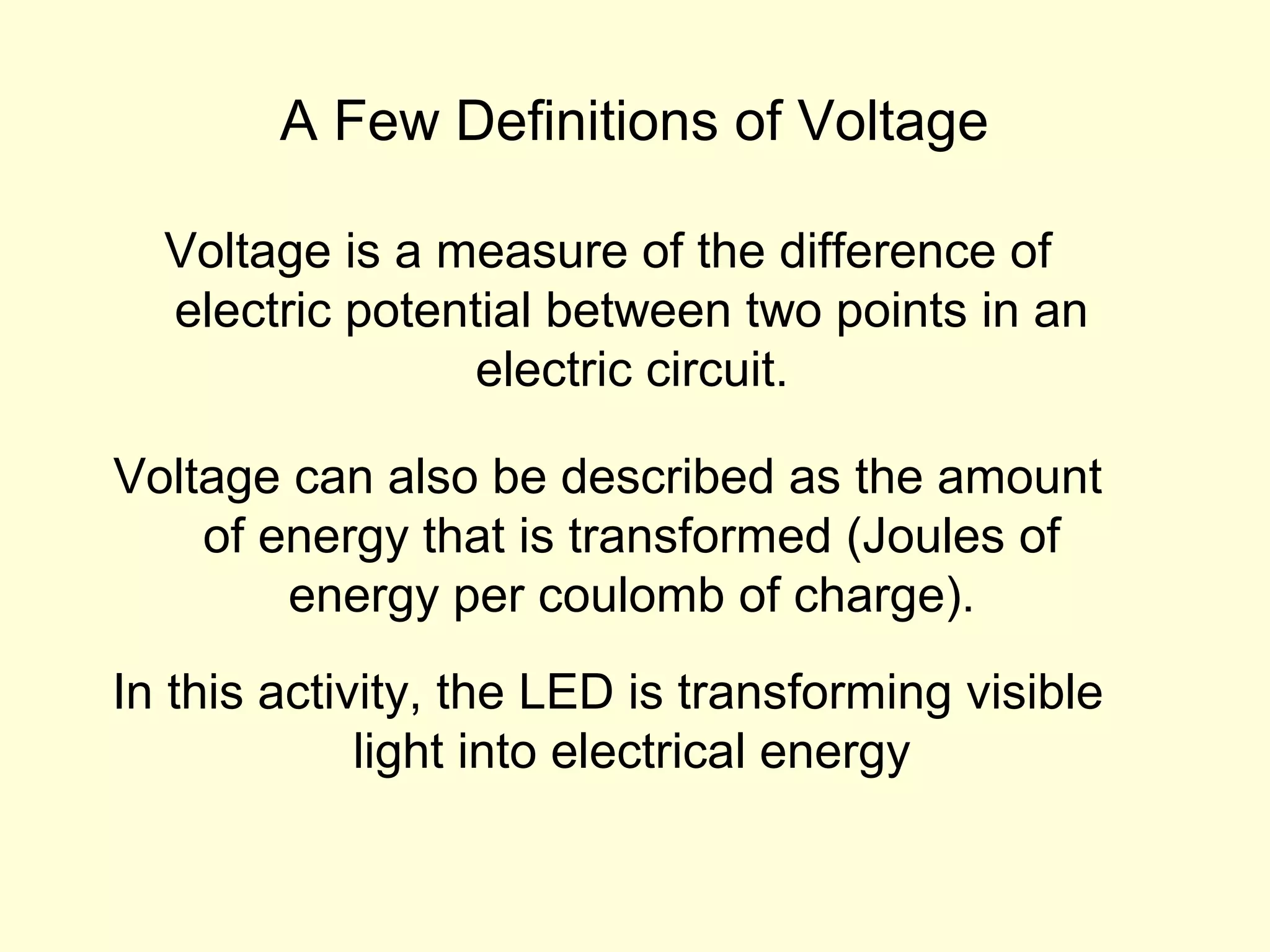
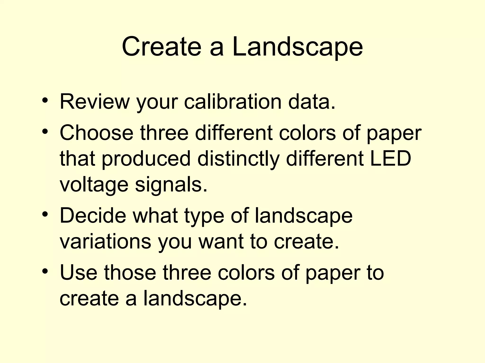
Download to read offline


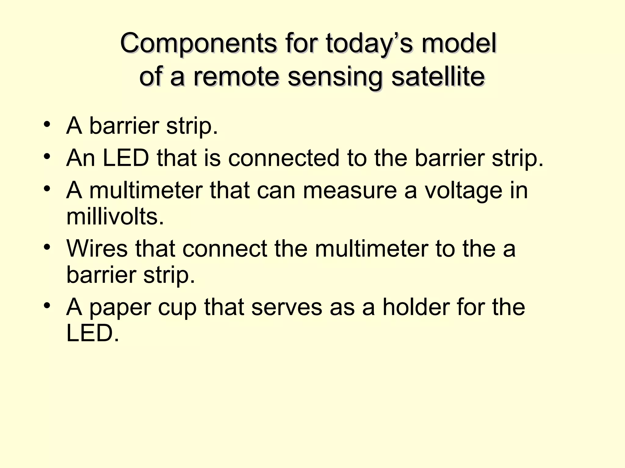

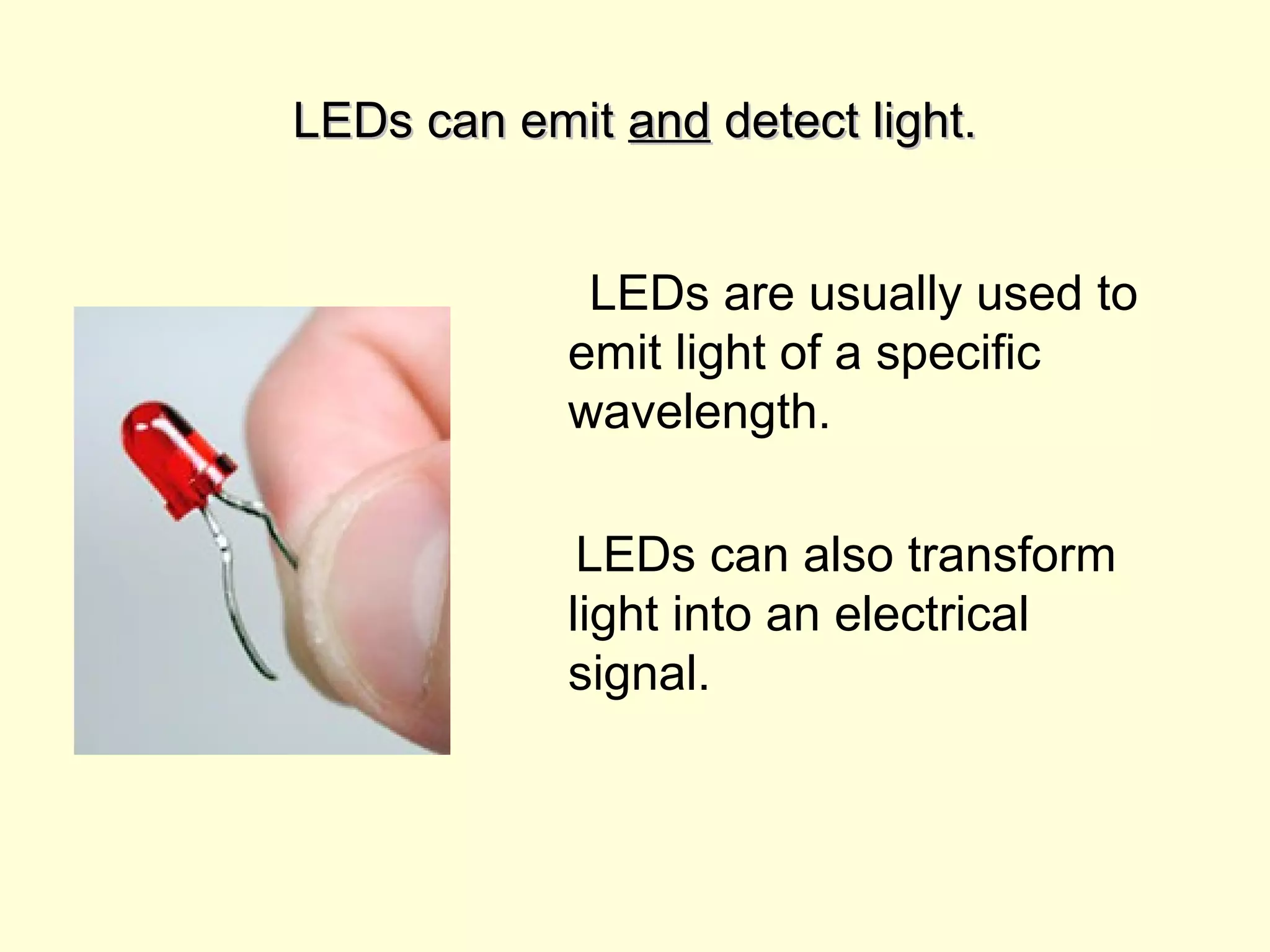


Radar and satellites use remote sensing to transform electromagnetic radiation into electrical signals. Meteorologists use radar to detect precipitation by analyzing radio wave reflection off raindrops, snowflakes, etc. Different reflection amounts are transformed into false color images representing precipitation rates and types. Similarly, satellites detect sea ice changes by how radio waves scatter. The document then describes assembling a model remote sensing satellite using an LED, barrier strip, and multimeter to detect light intensities from different paper colors and create a false color landscape image.