Downloaded 100 times

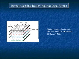
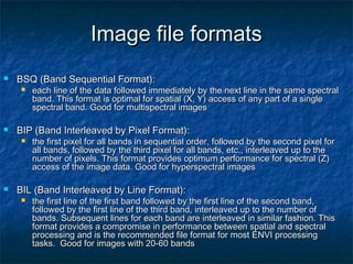
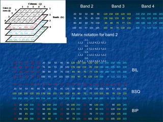

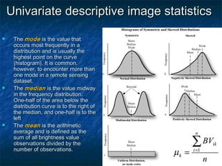
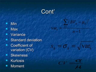
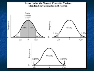
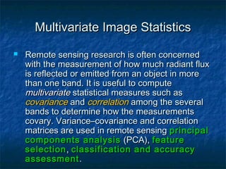
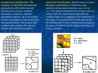
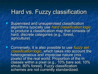
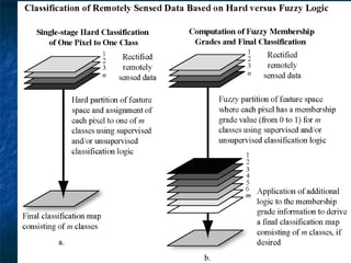
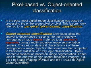

This document discusses remote sensing raster data formats and image processing. It introduces three common raster data formats: band sequential (BSQ), band interleaved by pixel (BIP), and band interleaved by line (BIL). It then provides examples and explanations of how data is organized for each format. The document also discusses image quality issues like clouds, noise, and describes common image processing techniques like radiometric and geometric correction, enhancement, and classification. Univariate and multivariate image statistics are introduced for analyzing remote sensing images.