Powerpoint presentation on Hydrographic Surveying..
It's include the all basic information on Hydrographic survey which can be useful in learning and as an imp. points for exam
Waves are never ending dynamic surfaces created by the action of wind on ocean surfaces. Waves are undulations of the surface layers of bodies of sea waters. Large bodies of water are almost constantly in motion. Ocean surface are never calm and smooth.They are uneven, irregular, rough and restless. Sea waves are defined as undulations of seawater characterized by unique features. Waves are moving energy patterns. They travel along the interface between ocean and the atmosphere.
1. Ground Water Occurrence
2. Types of Aquifers
3. Aquifer Parameters
4. Darcy’s Law
5. Measurement of Coefficient of Permeability of Soil
6. Types of Wells
7. Well Construction
8. Well Development
Brief introduction to the topic on Oceanography. Anyone who have interested to study the basic of oceanography may be refer to this slide.
for me information kindly refer to the text book
"Essentials of Oceanography" Alan P. Trujillo Harold V. Thurman
(Eleventh Edition)
By Md. Rezaul Hasan, Md. Shamsuddin, Md. Sohel Masud, Dr. AFM Afzal Hossain (Institute of Water Modelling)
Revitalizing the Ganges Coastal Zone Conference
21-23 October 2014, Dhaka, Bangladesh
http://waterandfood.org/ganges-conference/
Hydrology is the scientific study of the movement, distribution, and quality of water on Earth and other planets, including the water cycle, water resources and environmental watershed sustainability.
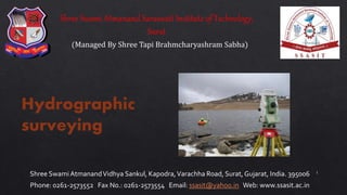
Hydrographic surveying
It is the branch of surveying which deals with water bodies e.g. Lake, river etc.
The usual fundamental principles of surveying and levelling are adopted for acquiring data for determination of :
Water volume
Rate of flow
To determine the shape of the area underlying the water surface etc.
Brief introduction to the topic on Oceanography. Anyone who have interested to study the basic of oceanography may be refer to this slide.
for me information kindly refer to the text book
"Essentials of Oceanography" Alan P. Trujillo Harold V. Thurman
(Eleventh Edition)
By Md. Rezaul Hasan, Md. Shamsuddin, Md. Sohel Masud, Dr. AFM Afzal Hossain (Institute of Water Modelling)
Revitalizing the Ganges Coastal Zone Conference
21-23 October 2014, Dhaka, Bangladesh
http://waterandfood.org/ganges-conference/
Hydrology is the scientific study of the movement, distribution, and quality of water on Earth and other planets, including the water cycle, water resources and environmental watershed sustainability.
Hydrographic surveying
It is the branch of surveying which deals with water bodies e.g. Lake, river etc.
The usual fundamental principles of surveying and levelling are adopted for acquiring data for determination of :
Water volume
Rate of flow
To determine the shape of the area underlying the water surface etc.
Myanmar Engineers are experiencing a transition between traditional way of development and sustainable development approaches. For that reason, a 12 week course on Dredging Engineering has been created and delivered free of charge. This is the third lecture.
This is a lecture given graduate students at various universities in India and abroad. so this will be useful to students and academicians all over the world
Explore the innovative world of trenchless pipe repair with our comprehensive guide, "The Benefits and Techniques of Trenchless Pipe Repair." This document delves into the modern methods of repairing underground pipes without the need for extensive excavation, highlighting the numerous advantages and the latest techniques used in the industry.
Learn about the cost savings, reduced environmental impact, and minimal disruption associated with trenchless technology. Discover detailed explanations of popular techniques such as pipe bursting, cured-in-place pipe (CIPP) lining, and directional drilling. Understand how these methods can be applied to various types of infrastructure, from residential plumbing to large-scale municipal systems.
Ideal for homeowners, contractors, engineers, and anyone interested in modern plumbing solutions, this guide provides valuable insights into why trenchless pipe repair is becoming the preferred choice for pipe rehabilitation. Stay informed about the latest advancements and best practices in the field.
Student information management system project report ii.pdfKamal Acharya
Our project explains about the student management. This project mainly explains the various actions related to student details. This project shows some ease in adding, editing and deleting the student details. It also provides a less time consuming process for viewing, adding, editing and deleting the marks of the students.
NO1 Uk best vashikaran specialist in delhi vashikaran baba near me online vas...Amil Baba Dawood bangali
Contact with Dawood Bhai Just call on +92322-6382012 and we'll help you. We'll solve all your problems within 12 to 24 hours and with 101% guarantee and with astrology systematic. If you want to take any personal or professional advice then also you can call us on +92322-6382012 , ONLINE LOVE PROBLEM & Other all types of Daily Life Problem's.Then CALL or WHATSAPP us on +92322-6382012 and Get all these problems solutions here by Amil Baba DAWOOD BANGALI
#vashikaranspecialist #astrologer #palmistry #amliyaat #taweez #manpasandshadi #horoscope #spiritual #lovelife #lovespell #marriagespell#aamilbabainpakistan #amilbabainkarachi #powerfullblackmagicspell #kalajadumantarspecialist #realamilbaba #AmilbabainPakistan #astrologerincanada #astrologerindubai #lovespellsmaster #kalajaduspecialist #lovespellsthatwork #aamilbabainlahore#blackmagicformarriage #aamilbaba #kalajadu #kalailam #taweez #wazifaexpert #jadumantar #vashikaranspecialist #astrologer #palmistry #amliyaat #taweez #manpasandshadi #horoscope #spiritual #lovelife #lovespell #marriagespell#aamilbabainpakistan #amilbabainkarachi #powerfullblackmagicspell #kalajadumantarspecialist #realamilbaba #AmilbabainPakistan #astrologerincanada #astrologerindubai #lovespellsmaster #kalajaduspecialist #lovespellsthatwork #aamilbabainlahore #blackmagicforlove #blackmagicformarriage #aamilbaba #kalajadu #kalailam #taweez #wazifaexpert #jadumantar #vashikaranspecialist #astrologer #palmistry #amliyaat #taweez #manpasandshadi #horoscope #spiritual #lovelife #lovespell #marriagespell#aamilbabainpakistan #amilbabainkarachi #powerfullblackmagicspell #kalajadumantarspecialist #realamilbaba #AmilbabainPakistan #astrologerincanada #astrologerindubai #lovespellsmaster #kalajaduspecialist #lovespellsthatwork #aamilbabainlahore #Amilbabainuk #amilbabainspain #amilbabaindubai #Amilbabainnorway #amilbabainkrachi #amilbabainlahore #amilbabaingujranwalan #amilbabainislamabad
About
Indigenized remote control interface card suitable for MAFI system CCR equipment. Compatible for IDM8000 CCR. Backplane mounted serial and TCP/Ethernet communication module for CCR remote access. IDM 8000 CCR remote control on serial and TCP protocol.
• Remote control: Parallel or serial interface.
• Compatible with MAFI CCR system.
• Compatible with IDM8000 CCR.
• Compatible with Backplane mount serial communication.
• Compatible with commercial and Defence aviation CCR system.
• Remote control system for accessing CCR and allied system over serial or TCP.
• Indigenized local Support/presence in India.
• Easy in configuration using DIP switches.
Technical Specifications
Indigenized remote control interface card suitable for MAFI system CCR equipment. Compatible for IDM8000 CCR. Backplane mounted serial and TCP/Ethernet communication module for CCR remote access. IDM 8000 CCR remote control on serial and TCP protocol.
Key Features
Indigenized remote control interface card suitable for MAFI system CCR equipment. Compatible for IDM8000 CCR. Backplane mounted serial and TCP/Ethernet communication module for CCR remote access. IDM 8000 CCR remote control on serial and TCP protocol.
• Remote control: Parallel or serial interface
• Compatible with MAFI CCR system
• Copatiable with IDM8000 CCR
• Compatible with Backplane mount serial communication.
• Compatible with commercial and Defence aviation CCR system.
• Remote control system for accessing CCR and allied system over serial or TCP.
• Indigenized local Support/presence in India.
Application
• Remote control: Parallel or serial interface.
• Compatible with MAFI CCR system.
• Compatible with IDM8000 CCR.
• Compatible with Backplane mount serial communication.
• Compatible with commercial and Defence aviation CCR system.
• Remote control system for accessing CCR and allied system over serial or TCP.
• Indigenized local Support/presence in India.
• Easy in configuration using DIP switches.
Cosmetic shop management system project report.pdfKamal Acharya
Buying new cosmetic products is difficult. It can even be scary for those who have sensitive skin and are prone to skin trouble. The information needed to alleviate this problem is on the back of each product, but it's thought to interpret those ingredient lists unless you have a background in chemistry.
Instead of buying and hoping for the best, we can use data science to help us predict which products may be good fits for us. It includes various function programs to do the above mentioned tasks.
Data file handling has been effectively used in the program.
The automated cosmetic shop management system should deal with the automation of general workflow and administration process of the shop. The main processes of the system focus on customer's request where the system is able to search the most appropriate products and deliver it to the customers. It should help the employees to quickly identify the list of cosmetic product that have reached the minimum quantity and also keep a track of expired date for each cosmetic product. It should help the employees to find the rack number in which the product is placed.It is also Faster and more efficient way.
3. Introduction
Purpose
Horizontal Control and Vertical Control
Shoreline Survey
Tides
Tide gauges
Sounding
Reduction of Sounding
Methods of Locating Sounding
Plotting of Soundings
Contents
3
4.
5. 71% of the Earth surface is covered with water, yet only
about 10% of the seafloor has been surveyed by echo
sounders at a resolution of 1 minute or better.
6. 6
It is the branch of surveying which deals with water bodies e.g. Lake, river etc.
The usual fundamental principles of surveying and levelling are adopted for acquiring data for determination
of :
1. Water volume
2. Rate of flow
3. To determine the shape of the area underlying the water surface etc.
7. 7
1. To determine the quantities of subaqueous excavations.
2. Measure areas subjected to scouring or silting in harbours or docks
3. Locate rocks and other objects such as buoys, lights etc to aid safe navigation
4. To prepare navigation charts exhibiting the depths available for navigation
5. Control floods, and to plan water supply and storage from rivers.
6. To develop water resources for power, irrigation and recreation
7. Used for controlling and planning of engineering projects like bridge,dams,tunnels,reservoirs,harbours etc.
8. To determine mean sea level and observation of tides.
9. For the measurement of discharge of rivers.
10. For the determination of shore lines.
8.
9.
10.
11. 11
1. These are periodical variations in the water surface of oceans due to the
attraction of celestial bodies.
2. The principal tide producing agents are the sun and moon, of which
moon is more powerful tide producer.
3. Tides produced by unbalanced attracting forces between the moon and
earth are known as lunar tide.
4. Tides produced by unbalanced attracting forces between the sun and
earth are known as solar tides.
5. Since the sun and moon act simultaneously, the lunar and solar tides are
superimposed.
12. 12
1. At new moon, the sun and moon have the same celestial longitude and cross
a meridian of earth at the same instant.
2. The three bodies are in one plane.
3. The high water level of the resulting tide is above the average, whereas the
low water level is below the average.
4. The tide is known as spring tide of new moon.
5. Same is the case for full moon.
6. In about 7.5 days when the moon is in quadrature, the crest of lunar tide co-
incides with the trough of a solar tide.
7. High water level is below the average, whereas low water level is above the
average.
8. Such a tide is known as neap tide of the first quarter/third quarter.
14. 𝒉 = 𝒉 𝟎 + 𝒚𝒄𝒐𝒔(𝟏𝟖𝟎°
𝒕
𝑻
)
h is height of water level at time of sounding
𝒉 𝟎 is mean sea level
𝒕 is time between high tide and
time of sounding
𝑻 is time between high tide and
low tide
𝒚 is rise of tide above MSL
1. These are used to determine the exact water surface
level.
2. The movement of tides during the time soundings are
made.
3. The gauges are read at regular intervals, varying from
10m to 30 min
15. 15
1. These gauges may be non-registering or self
registering types.
2. Non registering types requires an observer to
record the water level.
a) Staff gauge.
b) Float gauge
c) Weight gauge
16. 16
1. The process of determining depths below the water surface is called sounding.
2. Sounding is analogous to levelling on land.
3. The reduced level of any point on the bottom of a water body is obtained by
subtracting the sounding from the mean sea level.
4. The sounding points should be selected keeping in mind that all the important
irregularities are recorded.
5. The soundings are thus made along a series of straight lines at right angles to the
shoreline.
6. The spacing between the sounding lines and between the sounding points depends
upon the nature of submarine surface as well as on the object of the survey.
7. Usually Spacing between sounding lines is kept 30 m and spacing between sounding
points is kept 7.5m to 15 m.
17. 17
1. Preparation of accurate charts for navigation.
2. Determination of the quantities of the material to be filled.
3. Obtaining information for design of breakwaters, sea wells
etc.
18. 18
Instrument for sounding
Indirect method
1. Sounding Boat
2. Sounding rods
3. Lead lines
4. Sounding machines
Eco-meter or Fathometer
Direct method
19. 19
1. Sounding boat :
• The sounding operation is
carried out from a flat bottom
boat of low draft.
• The boats are generally
provided with opening, called
wells through which soundings
are taken.
• The motor should have
adequate control both for low
speed and for rough waters
20. 20
2. Sounding rod or pole
• These are made of strong well seasoned timber
usually 5 to 10 cm in diameter and 5 to 8 m in
length.
• The sounding rods consists of two or three lengths
screwed together so that unnecessary length may be
removed when not required in shallow water.
• A lead shoe of sufficient weight is fitted at the
bottom to keep the rod vertical in flowing water, and
to avoid sinking in mud or sand.
• The graduations on the rod are marked from bottom
upwards.
• Thus, the reading corresponding to the water
surface, is directly the depth of water.
21. 21
3. Lead line
• It consists of a graduated line or chain to which a lead is
attached.
• Under ordinary tension, when wet, the line should not
change its length.
• Every one feet of the lead is marked with a cloth.
• The mass of the lead is generally between 5 to 10 kg,
depending upon the strength of current and depth of
water.
• A correction is required to be applied to the measured
length to get the true depth when using lead line.
• Due to drag, the measured length will be greater than the
true depth.
22. 22
4. Weddell’s Sounding machine
• When there is a lot of sounding work, some
form of sounding machine attached to
sounding line is used.
• Weddell’s hand driven machine consists of
a cast iron casing carrying on a spindle gun
metal barrel.
• A lead weight (8kg) carried at the end of a
flexible wire cord attached to the barrel,
can be lowered at a desirable rate, the
speed of the drum being controlled by a
brake.
• The spindle is connected through gears to
two reading dials.
23. Echo sounding machine / Fathometer
Where the depth of water is too much, an echo sounding machine
known as fathometer is used.
• It measures the depth below the boat on which it is installed.
• It works on the property echo property.
• It consists of a transmitter and a receiving oscillator, recorder
unit and a power unit.
• The sound waves emitted at the surface of the water are
recorded back after these return from the underwater surface
Since the velocity of sound waves in water is known, the distance
travelled by sound waves can be calculated.
D = ½ V t
This method is very accurate and can be used in strong winds.
It is more sensitive than other methods, and produces continuous
record in the form of curves when boat is in motion
24. 24
1. It is more accurate than the lead line.
2. It can be used in strong currents or streams.
3. It is more sensitive than the lead line method.
4. It can be used on days, or in any weather, when the ordinary lead line method
would be impossible.
5. It is much more rapid in use than the ordinary method
Advantages of Fathometer :