SlideShare a Scribd company logo
1 of 9
Beneath the Surface:
Navigating the Depths with
Hydrographic Surveys
Introduction
Have you ever wondered how ships, submarines,
and even underwater pipelines safely navigate the
vast oceans and rivers of our world? The answer lies
in a fascinating field known as hydrographic
surveying.
In this blog, we'll dive into the world of hydrographic
survey services, shedding light on what they are,
why they are important, and how they work. So,
let's set sail on this informative journey to uncover
the secrets of hydrographic surveying in a simple
and engaging way.
What is Hydrographic Surveying?
Hydrographic surveying is the science of measuring and describing the underwater features of bodies of
water, such as oceans, rivers, lakes, and reservoirs.
The primary purpose of hydrographic surveys is to create accurate and detailed charts or maps of the
seafloor and riverbed, including information about water depth, submerged objects, and the shape of the
seabed.
Why Are Hydrographic Survey Services
Important?
Safe Navigation: One of the most critical aspects of hydrographic
surveys is ensuring safe navigation. Accurate charts help ships, boats,
and submarines navigate through waters without running aground or
colliding with submerged hazards.
Environmental Protection: Hydrographic surveys are vital for
environmental conservation. They help monitor and protect sensitive
ecosystems by identifying potential impacts from human activities like
dredging or construction.
Infrastructure Development: Hydrographic surveys are
essential for the planning and construction of maritime
infrastructure, such as ports, bridges, and underwater
pipelines. Precise data ensures that structures are built
safely and efficiently.
Resource Management: Many industries, like fisheries
and offshore energy, rely on hydrographic data to
manage their resources effectively. It helps in
determining fishing zones and optimal locations for oil
and gas exploration.
How Do Hydrographic Survey Services Work?
Equipment: Hydrographic surveyors use specialized equipment like sonar systems, multibeam echo
sounders, and GPS to gather data. These tools emit sound waves that bounce off the seabed and return to
the surface, allowing for depth measurement and mapping.
Data Collection: A survey vessel or boat is equipped with these instruments, and it travels systematically
across the survey area, collecting data points. Advanced technology enables the creation of highly detailed
three-dimensional maps.
Data Processing: Once the data is collected, it undergoes extensive processing. This includes removing
noise and correcting for tides, water temperature, and other factors that can affect accuracy.
Chart Creation: The processed data is then used to create navigational charts or maps. These charts
include contour lines, depth soundings, and information about underwater features like wrecks or rock
formations.
Conclusion
Hydrographic survey services play a vital role in ensuring the
safety of maritime navigation, protecting the environment,
and supporting various industries. By accurately mapping the
underwater world, surveyors enable us to explore and utilize
our planet's waterways more efficiently and sustainably.
Next time you embark on a cruise, send cargo across the
ocean, or even go fishing, remember that hydrographic
surveying is working behind the scenes to make your journey
safe and smooth. It's a fascinating field that quietly but
significantly impacts our lives in countless ways. So, let's give
credit to the unsung heroes of the deep – hydrographic
surveyors!
Contact Us
ADDRESS: 209, 2ND FLOOR - APRICOT TOWER,
P.O. BOX : 238544, DUBAI SILICON OASIS,
DUBAI - UNITED ARAB EMIRATES.
: info@falconsurveyme.com
: +97143271414
: http://www.falconsurveyme.com/
Thank You

More Related Content

Similar to Beneath the Surface: Navigating the Depths with Hydrographic Surveys

Presentation of Introduction to basics of SONAR.pptx
Presentation of Introduction to basics of SONAR.pptxPresentation of Introduction to basics of SONAR.pptx
Presentation of Introduction to basics of SONAR.pptxasadmohammedjmu
 
Hydrography is the branch of applied science which deals with the measurement...
Hydrography is the branch of applied science which deals with the measurement...Hydrography is the branch of applied science which deals with the measurement...
Hydrography is the branch of applied science which deals with the measurement...Hafez Ahmad
 
Hydrographic surveys related to the mapping of
Hydrographic surveys related to the mapping ofHydrographic surveys related to the mapping of
Hydrographic surveys related to the mapping ofTotal Hydrographic Survey
 
Underwater imaging
Underwater imagingUnderwater imaging
Underwater imagingAndrewJBaker
 
Hydrographic Surveyor | Functions, Roles and Responsibilities
Hydrographic Surveyor | Functions, Roles and ResponsibilitiesHydrographic Surveyor | Functions, Roles and Responsibilities
Hydrographic Surveyor | Functions, Roles and ResponsibilitiesArc Surveying & Mapping, Inc.
 
Hazard Detection and Debris Clearance - Total Hydrographic
Hazard Detection and Debris Clearance - Total HydrographicHazard Detection and Debris Clearance - Total Hydrographic
Hazard Detection and Debris Clearance - Total HydrographicTotal Hydrographic Survey
 
Hydrographic Surveying By Jithin Jose
Hydrographic Surveying  By Jithin JoseHydrographic Surveying  By Jithin Jose
Hydrographic Surveying By Jithin JoseJithin Jose
 
The Nippon foundation -GEBCO seabed 2030
The Nippon foundation -GEBCO seabed 2030The Nippon foundation -GEBCO seabed 2030
The Nippon foundation -GEBCO seabed 2030Abdul Saleem K
 
Marine Cartography as a Management Tool
Marine Cartography as a Management ToolMarine Cartography as a Management Tool
Marine Cartography as a Management ToolEsri
 
Presentation on routing services copy
Presentation  on routing services   copyPresentation  on routing services   copy
Presentation on routing services copydevendra jhajhra
 
Hydrography : Tools & Techniques
Hydrography : Tools & TechniquesHydrography : Tools & Techniques
Hydrography : Tools & TechniquesAbdul Alim Kamran
 
Hydrography :Sounding Instrument
Hydrography :Sounding InstrumentHydrography :Sounding Instrument
Hydrography :Sounding Instrumentpmevada
 
Mapping The Abyss: bathymetric Lidar Drones for Underwater Topography
Mapping The Abyss: bathymetric Lidar Drones for Underwater TopographyMapping The Abyss: bathymetric Lidar Drones for Underwater Topography
Mapping The Abyss: bathymetric Lidar Drones for Underwater Topographyfalconsurveyme
 
Hydrography Midterm Reviewer
Hydrography Midterm ReviewerHydrography Midterm Reviewer
Hydrography Midterm Reviewersorbi
 

Similar to Beneath the Surface: Navigating the Depths with Hydrographic Surveys (20)

Presentation of Introduction to basics of SONAR.pptx
Presentation of Introduction to basics of SONAR.pptxPresentation of Introduction to basics of SONAR.pptx
Presentation of Introduction to basics of SONAR.pptx
 
Hydrography is the branch of applied science which deals with the measurement...
Hydrography is the branch of applied science which deals with the measurement...Hydrography is the branch of applied science which deals with the measurement...
Hydrography is the branch of applied science which deals with the measurement...
 
Bathymetric and hydrographic survey
Bathymetric and hydrographic surveyBathymetric and hydrographic survey
Bathymetric and hydrographic survey
 
Hydrographic survey companies
Hydrographic survey companiesHydrographic survey companies
Hydrographic survey companies
 
Hydrographic surveys related to the mapping of
Hydrographic surveys related to the mapping ofHydrographic surveys related to the mapping of
Hydrographic surveys related to the mapping of
 
Underwater imaging
Underwater imagingUnderwater imaging
Underwater imaging
 
Hydrographic Surveyor | Functions, Roles and Responsibilities
Hydrographic Surveyor | Functions, Roles and ResponsibilitiesHydrographic Surveyor | Functions, Roles and Responsibilities
Hydrographic Surveyor | Functions, Roles and Responsibilities
 
How We Conduct Bathymetric Surveys?
How We Conduct Bathymetric Surveys?How We Conduct Bathymetric Surveys?
How We Conduct Bathymetric Surveys?
 
Hazard Detection and Debris Clearance - Total Hydrographic
Hazard Detection and Debris Clearance - Total HydrographicHazard Detection and Debris Clearance - Total Hydrographic
Hazard Detection and Debris Clearance - Total Hydrographic
 
Hydrographic Surveying By Jithin Jose
Hydrographic Surveying  By Jithin JoseHydrographic Surveying  By Jithin Jose
Hydrographic Surveying By Jithin Jose
 
The Nippon foundation -GEBCO seabed 2030
The Nippon foundation -GEBCO seabed 2030The Nippon foundation -GEBCO seabed 2030
The Nippon foundation -GEBCO seabed 2030
 
Hydrographicsurveying
HydrographicsurveyingHydrographicsurveying
Hydrographicsurveying
 
Marine Cartography as a Management Tool
Marine Cartography as a Management ToolMarine Cartography as a Management Tool
Marine Cartography as a Management Tool
 
Hydrographic Survey
Hydrographic SurveyHydrographic Survey
Hydrographic Survey
 
Presentation on routing services copy
Presentation  on routing services   copyPresentation  on routing services   copy
Presentation on routing services copy
 
Hydrography : Tools & Techniques
Hydrography : Tools & TechniquesHydrography : Tools & Techniques
Hydrography : Tools & Techniques
 
multibeam
multibeammultibeam
multibeam
 
Hydrography :Sounding Instrument
Hydrography :Sounding InstrumentHydrography :Sounding Instrument
Hydrography :Sounding Instrument
 
Mapping The Abyss: bathymetric Lidar Drones for Underwater Topography
Mapping The Abyss: bathymetric Lidar Drones for Underwater TopographyMapping The Abyss: bathymetric Lidar Drones for Underwater Topography
Mapping The Abyss: bathymetric Lidar Drones for Underwater Topography
 
Hydrography Midterm Reviewer
Hydrography Midterm ReviewerHydrography Midterm Reviewer
Hydrography Midterm Reviewer
 

More from falconsurveyme

Navigating Storms: How Hydrographic Services Shield Coastal Communities from ...
Navigating Storms: How Hydrographic Services Shield Coastal Communities from ...Navigating Storms: How Hydrographic Services Shield Coastal Communities from ...
Navigating Storms: How Hydrographic Services Shield Coastal Communities from ...falconsurveyme
 
Unlocking Precision: How 3d laser scanning survey Revolutionizes Land Surveying
Unlocking Precision: How 3d laser scanning survey Revolutionizes Land SurveyingUnlocking Precision: How 3d laser scanning survey Revolutionizes Land Surveying
Unlocking Precision: How 3d laser scanning survey Revolutionizes Land Surveyingfalconsurveyme
 
Drone Detectives: Bathymetric Lidar Solving Mysteries of Submerged Structures
Drone Detectives: Bathymetric Lidar Solving Mysteries of Submerged StructuresDrone Detectives: Bathymetric Lidar Solving Mysteries of Submerged Structures
Drone Detectives: Bathymetric Lidar Solving Mysteries of Submerged Structuresfalconsurveyme
 
Exploring the Depths: Applications of Bathymetric Lidar Drones in Marine Rese...
Exploring the Depths: Applications of Bathymetric Lidar Drones in Marine Rese...Exploring the Depths: Applications of Bathymetric Lidar Drones in Marine Rese...
Exploring the Depths: Applications of Bathymetric Lidar Drones in Marine Rese...falconsurveyme
 
Using 3D Laser Scanning for Historic Preservation and Restoration
Using 3D Laser Scanning for Historic Preservation and Restoration Using 3D Laser Scanning for Historic Preservation and Restoration
Using 3D Laser Scanning for Historic Preservation and Restoration falconsurveyme
 
Revolutionizing Construction: BIM and 3D Laser Scanning
Revolutionizing Construction: BIM and 3D Laser Scanning Revolutionizing Construction: BIM and 3D Laser Scanning
Revolutionizing Construction: BIM and 3D Laser Scanning falconsurveyme
 
Revolutionizing Surveying: The Power of 3D Laser Scanning Services​.pptx
Revolutionizing Surveying: The Power of 3D Laser Scanning Services​.pptxRevolutionizing Surveying: The Power of 3D Laser Scanning Services​.pptx
Revolutionizing Surveying: The Power of 3D Laser Scanning Services​.pptxfalconsurveyme
 
The Backbone of Infrastructure Understanding Underground Services​.pptx
The Backbone of Infrastructure Understanding Underground Services​.pptxThe Backbone of Infrastructure Understanding Underground Services​.pptx
The Backbone of Infrastructure Understanding Underground Services​.pptxfalconsurveyme
 
Revolutionize Your Projects with Falcon Survey's 3D Laser Scanning Survey Ser...
Revolutionize Your Projects with Falcon Survey's 3D Laser Scanning Survey Ser...Revolutionize Your Projects with Falcon Survey's 3D Laser Scanning Survey Ser...
Revolutionize Your Projects with Falcon Survey's 3D Laser Scanning Survey Ser...falconsurveyme
 
Drone Mapping Services Revolutionizing the Future of Surveying and Mapping.pptx
Drone Mapping Services Revolutionizing the Future of Surveying and Mapping.pptxDrone Mapping Services Revolutionizing the Future of Surveying and Mapping.pptx
Drone Mapping Services Revolutionizing the Future of Surveying and Mapping.pptxfalconsurveyme
 
Bathymetric Drone Surveys in Dubai Falcon Survey’s Cost-Effective and Accurat...
Bathymetric Drone Surveys in Dubai Falcon Survey’s Cost-Effective and Accurat...Bathymetric Drone Surveys in Dubai Falcon Survey’s Cost-Effective and Accurat...
Bathymetric Drone Surveys in Dubai Falcon Survey’s Cost-Effective and Accurat...falconsurveyme
 
Geotechnical Survey Offshore Understanding the Importance of Soil Investigati...
Geotechnical Survey Offshore Understanding the Importance of Soil Investigati...Geotechnical Survey Offshore Understanding the Importance of Soil Investigati...
Geotechnical Survey Offshore Understanding the Importance of Soil Investigati...falconsurveyme
 
Exploring the Depths: The Advantages and Types of Bathymetric Survey
Exploring the Depths:  The Advantages and Types of Bathymetric SurveyExploring the Depths:  The Advantages and Types of Bathymetric Survey
Exploring the Depths: The Advantages and Types of Bathymetric Surveyfalconsurveyme
 
7 Benefits of Using Remote Sensing & GIS in Agriculture.pptx
7 Benefits of Using Remote Sensing & GIS in Agriculture.pptx7 Benefits of Using Remote Sensing & GIS in Agriculture.pptx
7 Benefits of Using Remote Sensing & GIS in Agriculture.pptxfalconsurveyme
 
7 Types of Land Surveying & the Tools Required for Each.pptx
7 Types of Land Surveying & the Tools Required for Each.pptx7 Types of Land Surveying & the Tools Required for Each.pptx
7 Types of Land Surveying & the Tools Required for Each.pptxfalconsurveyme
 
The Future of Land Surveying: 4 Ways Land Surveying is Changing
The Future of Land Surveying: 4 Ways Land Surveying is ChangingThe Future of Land Surveying: 4 Ways Land Surveying is Changing
The Future of Land Surveying: 4 Ways Land Surveying is Changingfalconsurveyme
 
Gate Level Simulation Is Increasing Trend
Gate Level Simulation Is Increasing TrendGate Level Simulation Is Increasing Trend
Gate Level Simulation Is Increasing Trendfalconsurveyme
 

More from falconsurveyme (17)

Navigating Storms: How Hydrographic Services Shield Coastal Communities from ...
Navigating Storms: How Hydrographic Services Shield Coastal Communities from ...Navigating Storms: How Hydrographic Services Shield Coastal Communities from ...
Navigating Storms: How Hydrographic Services Shield Coastal Communities from ...
 
Unlocking Precision: How 3d laser scanning survey Revolutionizes Land Surveying
Unlocking Precision: How 3d laser scanning survey Revolutionizes Land SurveyingUnlocking Precision: How 3d laser scanning survey Revolutionizes Land Surveying
Unlocking Precision: How 3d laser scanning survey Revolutionizes Land Surveying
 
Drone Detectives: Bathymetric Lidar Solving Mysteries of Submerged Structures
Drone Detectives: Bathymetric Lidar Solving Mysteries of Submerged StructuresDrone Detectives: Bathymetric Lidar Solving Mysteries of Submerged Structures
Drone Detectives: Bathymetric Lidar Solving Mysteries of Submerged Structures
 
Exploring the Depths: Applications of Bathymetric Lidar Drones in Marine Rese...
Exploring the Depths: Applications of Bathymetric Lidar Drones in Marine Rese...Exploring the Depths: Applications of Bathymetric Lidar Drones in Marine Rese...
Exploring the Depths: Applications of Bathymetric Lidar Drones in Marine Rese...
 
Using 3D Laser Scanning for Historic Preservation and Restoration
Using 3D Laser Scanning for Historic Preservation and Restoration Using 3D Laser Scanning for Historic Preservation and Restoration
Using 3D Laser Scanning for Historic Preservation and Restoration
 
Revolutionizing Construction: BIM and 3D Laser Scanning
Revolutionizing Construction: BIM and 3D Laser Scanning Revolutionizing Construction: BIM and 3D Laser Scanning
Revolutionizing Construction: BIM and 3D Laser Scanning
 
Revolutionizing Surveying: The Power of 3D Laser Scanning Services​.pptx
Revolutionizing Surveying: The Power of 3D Laser Scanning Services​.pptxRevolutionizing Surveying: The Power of 3D Laser Scanning Services​.pptx
Revolutionizing Surveying: The Power of 3D Laser Scanning Services​.pptx
 
The Backbone of Infrastructure Understanding Underground Services​.pptx
The Backbone of Infrastructure Understanding Underground Services​.pptxThe Backbone of Infrastructure Understanding Underground Services​.pptx
The Backbone of Infrastructure Understanding Underground Services​.pptx
 
Revolutionize Your Projects with Falcon Survey's 3D Laser Scanning Survey Ser...
Revolutionize Your Projects with Falcon Survey's 3D Laser Scanning Survey Ser...Revolutionize Your Projects with Falcon Survey's 3D Laser Scanning Survey Ser...
Revolutionize Your Projects with Falcon Survey's 3D Laser Scanning Survey Ser...
 
Drone Mapping Services Revolutionizing the Future of Surveying and Mapping.pptx
Drone Mapping Services Revolutionizing the Future of Surveying and Mapping.pptxDrone Mapping Services Revolutionizing the Future of Surveying and Mapping.pptx
Drone Mapping Services Revolutionizing the Future of Surveying and Mapping.pptx
 
Bathymetric Drone Surveys in Dubai Falcon Survey’s Cost-Effective and Accurat...
Bathymetric Drone Surveys in Dubai Falcon Survey’s Cost-Effective and Accurat...Bathymetric Drone Surveys in Dubai Falcon Survey’s Cost-Effective and Accurat...
Bathymetric Drone Surveys in Dubai Falcon Survey’s Cost-Effective and Accurat...
 
Geotechnical Survey Offshore Understanding the Importance of Soil Investigati...
Geotechnical Survey Offshore Understanding the Importance of Soil Investigati...Geotechnical Survey Offshore Understanding the Importance of Soil Investigati...
Geotechnical Survey Offshore Understanding the Importance of Soil Investigati...
 
Exploring the Depths: The Advantages and Types of Bathymetric Survey
Exploring the Depths:  The Advantages and Types of Bathymetric SurveyExploring the Depths:  The Advantages and Types of Bathymetric Survey
Exploring the Depths: The Advantages and Types of Bathymetric Survey
 
7 Benefits of Using Remote Sensing & GIS in Agriculture.pptx
7 Benefits of Using Remote Sensing & GIS in Agriculture.pptx7 Benefits of Using Remote Sensing & GIS in Agriculture.pptx
7 Benefits of Using Remote Sensing & GIS in Agriculture.pptx
 
7 Types of Land Surveying & the Tools Required for Each.pptx
7 Types of Land Surveying & the Tools Required for Each.pptx7 Types of Land Surveying & the Tools Required for Each.pptx
7 Types of Land Surveying & the Tools Required for Each.pptx
 
The Future of Land Surveying: 4 Ways Land Surveying is Changing
The Future of Land Surveying: 4 Ways Land Surveying is ChangingThe Future of Land Surveying: 4 Ways Land Surveying is Changing
The Future of Land Surveying: 4 Ways Land Surveying is Changing
 
Gate Level Simulation Is Increasing Trend
Gate Level Simulation Is Increasing TrendGate Level Simulation Is Increasing Trend
Gate Level Simulation Is Increasing Trend
 

Recently uploaded

Transcript: New from BookNet Canada for 2024: BNC BiblioShare - Tech Forum 2024
Transcript: New from BookNet Canada for 2024: BNC BiblioShare - Tech Forum 2024Transcript: New from BookNet Canada for 2024: BNC BiblioShare - Tech Forum 2024
Transcript: New from BookNet Canada for 2024: BNC BiblioShare - Tech Forum 2024BookNet Canada
 
Unleash Your Potential - Namagunga Girls Coding Club
Unleash Your Potential - Namagunga Girls Coding ClubUnleash Your Potential - Namagunga Girls Coding Club
Unleash Your Potential - Namagunga Girls Coding ClubKalema Edgar
 
Unblocking The Main Thread Solving ANRs and Frozen Frames
Unblocking The Main Thread Solving ANRs and Frozen FramesUnblocking The Main Thread Solving ANRs and Frozen Frames
Unblocking The Main Thread Solving ANRs and Frozen FramesSinan KOZAK
 
Pigging Solutions in Pet Food Manufacturing
Pigging Solutions in Pet Food ManufacturingPigging Solutions in Pet Food Manufacturing
Pigging Solutions in Pet Food ManufacturingPigging Solutions
 
08448380779 Call Girls In Diplomatic Enclave Women Seeking Men
08448380779 Call Girls In Diplomatic Enclave Women Seeking Men08448380779 Call Girls In Diplomatic Enclave Women Seeking Men
08448380779 Call Girls In Diplomatic Enclave Women Seeking MenDelhi Call girls
 
Tech-Forward - Achieving Business Readiness For Copilot in Microsoft 365
Tech-Forward - Achieving Business Readiness For Copilot in Microsoft 365Tech-Forward - Achieving Business Readiness For Copilot in Microsoft 365
Tech-Forward - Achieving Business Readiness For Copilot in Microsoft 3652toLead Limited
 
My Hashitalk Indonesia April 2024 Presentation
My Hashitalk Indonesia April 2024 PresentationMy Hashitalk Indonesia April 2024 Presentation
My Hashitalk Indonesia April 2024 PresentationRidwan Fadjar
 
How to convert PDF to text with Nanonets
How to convert PDF to text with NanonetsHow to convert PDF to text with Nanonets
How to convert PDF to text with Nanonetsnaman860154
 
Automating Business Process via MuleSoft Composer | Bangalore MuleSoft Meetup...
Automating Business Process via MuleSoft Composer | Bangalore MuleSoft Meetup...Automating Business Process via MuleSoft Composer | Bangalore MuleSoft Meetup...
Automating Business Process via MuleSoft Composer | Bangalore MuleSoft Meetup...shyamraj55
 
Enhancing Worker Digital Experience: A Hands-on Workshop for Partners
Enhancing Worker Digital Experience: A Hands-on Workshop for PartnersEnhancing Worker Digital Experience: A Hands-on Workshop for Partners
Enhancing Worker Digital Experience: A Hands-on Workshop for PartnersThousandEyes
 
Connect Wave/ connectwave Pitch Deck Presentation
Connect Wave/ connectwave Pitch Deck PresentationConnect Wave/ connectwave Pitch Deck Presentation
Connect Wave/ connectwave Pitch Deck PresentationSlibray Presentation
 
Understanding the Laravel MVC Architecture
Understanding the Laravel MVC ArchitectureUnderstanding the Laravel MVC Architecture
Understanding the Laravel MVC ArchitecturePixlogix Infotech
 
Key Features Of Token Development (1).pptx
Key  Features Of Token  Development (1).pptxKey  Features Of Token  Development (1).pptx
Key Features Of Token Development (1).pptxLBM Solutions
 
Human Factors of XR: Using Human Factors to Design XR Systems
Human Factors of XR: Using Human Factors to Design XR SystemsHuman Factors of XR: Using Human Factors to Design XR Systems
Human Factors of XR: Using Human Factors to Design XR SystemsMark Billinghurst
 
SIEMENS: RAPUNZEL – A Tale About Knowledge Graph
SIEMENS: RAPUNZEL – A Tale About Knowledge GraphSIEMENS: RAPUNZEL – A Tale About Knowledge Graph
SIEMENS: RAPUNZEL – A Tale About Knowledge GraphNeo4j
 
CloudStudio User manual (basic edition):
CloudStudio User manual (basic edition):CloudStudio User manual (basic edition):
CloudStudio User manual (basic edition):comworks
 
APIForce Zurich 5 April Automation LPDG
APIForce Zurich 5 April  Automation LPDGAPIForce Zurich 5 April  Automation LPDG
APIForce Zurich 5 April Automation LPDGMarianaLemus7
 
Presentation on how to chat with PDF using ChatGPT code interpreter
Presentation on how to chat with PDF using ChatGPT code interpreterPresentation on how to chat with PDF using ChatGPT code interpreter
Presentation on how to chat with PDF using ChatGPT code interpreternaman860154
 
AI as an Interface for Commercial Buildings
AI as an Interface for Commercial BuildingsAI as an Interface for Commercial Buildings
AI as an Interface for Commercial BuildingsMemoori
 
Injustice - Developers Among Us (SciFiDevCon 2024)
Injustice - Developers Among Us (SciFiDevCon 2024)Injustice - Developers Among Us (SciFiDevCon 2024)
Injustice - Developers Among Us (SciFiDevCon 2024)Allon Mureinik
 

Recently uploaded (20)

Transcript: New from BookNet Canada for 2024: BNC BiblioShare - Tech Forum 2024
Transcript: New from BookNet Canada for 2024: BNC BiblioShare - Tech Forum 2024Transcript: New from BookNet Canada for 2024: BNC BiblioShare - Tech Forum 2024
Transcript: New from BookNet Canada for 2024: BNC BiblioShare - Tech Forum 2024
 
Unleash Your Potential - Namagunga Girls Coding Club
Unleash Your Potential - Namagunga Girls Coding ClubUnleash Your Potential - Namagunga Girls Coding Club
Unleash Your Potential - Namagunga Girls Coding Club
 
Unblocking The Main Thread Solving ANRs and Frozen Frames
Unblocking The Main Thread Solving ANRs and Frozen FramesUnblocking The Main Thread Solving ANRs and Frozen Frames
Unblocking The Main Thread Solving ANRs and Frozen Frames
 
Pigging Solutions in Pet Food Manufacturing
Pigging Solutions in Pet Food ManufacturingPigging Solutions in Pet Food Manufacturing
Pigging Solutions in Pet Food Manufacturing
 
08448380779 Call Girls In Diplomatic Enclave Women Seeking Men
08448380779 Call Girls In Diplomatic Enclave Women Seeking Men08448380779 Call Girls In Diplomatic Enclave Women Seeking Men
08448380779 Call Girls In Diplomatic Enclave Women Seeking Men
 
Tech-Forward - Achieving Business Readiness For Copilot in Microsoft 365
Tech-Forward - Achieving Business Readiness For Copilot in Microsoft 365Tech-Forward - Achieving Business Readiness For Copilot in Microsoft 365
Tech-Forward - Achieving Business Readiness For Copilot in Microsoft 365
 
My Hashitalk Indonesia April 2024 Presentation
My Hashitalk Indonesia April 2024 PresentationMy Hashitalk Indonesia April 2024 Presentation
My Hashitalk Indonesia April 2024 Presentation
 
How to convert PDF to text with Nanonets
How to convert PDF to text with NanonetsHow to convert PDF to text with Nanonets
How to convert PDF to text with Nanonets
 
Automating Business Process via MuleSoft Composer | Bangalore MuleSoft Meetup...
Automating Business Process via MuleSoft Composer | Bangalore MuleSoft Meetup...Automating Business Process via MuleSoft Composer | Bangalore MuleSoft Meetup...
Automating Business Process via MuleSoft Composer | Bangalore MuleSoft Meetup...
 
Enhancing Worker Digital Experience: A Hands-on Workshop for Partners
Enhancing Worker Digital Experience: A Hands-on Workshop for PartnersEnhancing Worker Digital Experience: A Hands-on Workshop for Partners
Enhancing Worker Digital Experience: A Hands-on Workshop for Partners
 
Connect Wave/ connectwave Pitch Deck Presentation
Connect Wave/ connectwave Pitch Deck PresentationConnect Wave/ connectwave Pitch Deck Presentation
Connect Wave/ connectwave Pitch Deck Presentation
 
Understanding the Laravel MVC Architecture
Understanding the Laravel MVC ArchitectureUnderstanding the Laravel MVC Architecture
Understanding the Laravel MVC Architecture
 
Key Features Of Token Development (1).pptx
Key  Features Of Token  Development (1).pptxKey  Features Of Token  Development (1).pptx
Key Features Of Token Development (1).pptx
 
Human Factors of XR: Using Human Factors to Design XR Systems
Human Factors of XR: Using Human Factors to Design XR SystemsHuman Factors of XR: Using Human Factors to Design XR Systems
Human Factors of XR: Using Human Factors to Design XR Systems
 
SIEMENS: RAPUNZEL – A Tale About Knowledge Graph
SIEMENS: RAPUNZEL – A Tale About Knowledge GraphSIEMENS: RAPUNZEL – A Tale About Knowledge Graph
SIEMENS: RAPUNZEL – A Tale About Knowledge Graph
 
CloudStudio User manual (basic edition):
CloudStudio User manual (basic edition):CloudStudio User manual (basic edition):
CloudStudio User manual (basic edition):
 
APIForce Zurich 5 April Automation LPDG
APIForce Zurich 5 April  Automation LPDGAPIForce Zurich 5 April  Automation LPDG
APIForce Zurich 5 April Automation LPDG
 
Presentation on how to chat with PDF using ChatGPT code interpreter
Presentation on how to chat with PDF using ChatGPT code interpreterPresentation on how to chat with PDF using ChatGPT code interpreter
Presentation on how to chat with PDF using ChatGPT code interpreter
 
AI as an Interface for Commercial Buildings
AI as an Interface for Commercial BuildingsAI as an Interface for Commercial Buildings
AI as an Interface for Commercial Buildings
 
Injustice - Developers Among Us (SciFiDevCon 2024)
Injustice - Developers Among Us (SciFiDevCon 2024)Injustice - Developers Among Us (SciFiDevCon 2024)
Injustice - Developers Among Us (SciFiDevCon 2024)
 

Beneath the Surface: Navigating the Depths with Hydrographic Surveys

  • 1. Beneath the Surface: Navigating the Depths with Hydrographic Surveys
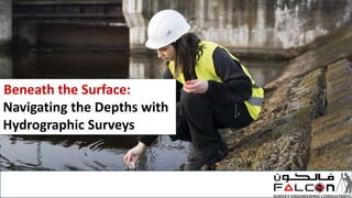
  • 2. Introduction Have you ever wondered how ships, submarines, and even underwater pipelines safely navigate the vast oceans and rivers of our world? The answer lies in a fascinating field known as hydrographic surveying. In this blog, we'll dive into the world of hydrographic survey services, shedding light on what they are, why they are important, and how they work. So, let's set sail on this informative journey to uncover the secrets of hydrographic surveying in a simple and engaging way.
  • 3. What is Hydrographic Surveying? Hydrographic surveying is the science of measuring and describing the underwater features of bodies of water, such as oceans, rivers, lakes, and reservoirs. The primary purpose of hydrographic surveys is to create accurate and detailed charts or maps of the seafloor and riverbed, including information about water depth, submerged objects, and the shape of the seabed.
  • 4. Why Are Hydrographic Survey Services Important? Safe Navigation: One of the most critical aspects of hydrographic surveys is ensuring safe navigation. Accurate charts help ships, boats, and submarines navigate through waters without running aground or colliding with submerged hazards. Environmental Protection: Hydrographic surveys are vital for environmental conservation. They help monitor and protect sensitive ecosystems by identifying potential impacts from human activities like dredging or construction.
  • 5. Infrastructure Development: Hydrographic surveys are essential for the planning and construction of maritime infrastructure, such as ports, bridges, and underwater pipelines. Precise data ensures that structures are built safely and efficiently. Resource Management: Many industries, like fisheries and offshore energy, rely on hydrographic data to manage their resources effectively. It helps in determining fishing zones and optimal locations for oil and gas exploration.
  • 6. How Do Hydrographic Survey Services Work? Equipment: Hydrographic surveyors use specialized equipment like sonar systems, multibeam echo sounders, and GPS to gather data. These tools emit sound waves that bounce off the seabed and return to the surface, allowing for depth measurement and mapping. Data Collection: A survey vessel or boat is equipped with these instruments, and it travels systematically across the survey area, collecting data points. Advanced technology enables the creation of highly detailed three-dimensional maps. Data Processing: Once the data is collected, it undergoes extensive processing. This includes removing noise and correcting for tides, water temperature, and other factors that can affect accuracy. Chart Creation: The processed data is then used to create navigational charts or maps. These charts include contour lines, depth soundings, and information about underwater features like wrecks or rock formations.
  • 7. Conclusion Hydrographic survey services play a vital role in ensuring the safety of maritime navigation, protecting the environment, and supporting various industries. By accurately mapping the underwater world, surveyors enable us to explore and utilize our planet's waterways more efficiently and sustainably. Next time you embark on a cruise, send cargo across the ocean, or even go fishing, remember that hydrographic surveying is working behind the scenes to make your journey safe and smooth. It's a fascinating field that quietly but significantly impacts our lives in countless ways. So, let's give credit to the unsung heroes of the deep – hydrographic surveyors!
  • 8. Contact Us ADDRESS: 209, 2ND FLOOR - APRICOT TOWER, P.O. BOX : 238544, DUBAI SILICON OASIS, DUBAI - UNITED ARAB EMIRATES. : info@falconsurveyme.com : +97143271414 : http://www.falconsurveyme.com/