

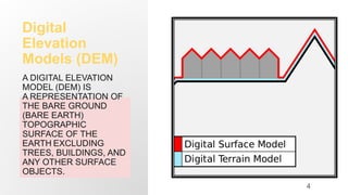


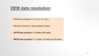

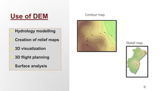
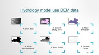


Digital elevation models (DEMs) represent the bare earth topographic surface digitally. The document discusses DEMs, including what they are, common data sources like SRTM and NED with their resolutions, and applications like estimating elevation and slope, determining drainage networks and watersheds, and using DEMs in hydrological modeling. DEMs are frequently used in terrain analysis, hydrology modeling, creating relief maps and contour maps, and 3D visualization and flight planning.


![Human Reproduction [ Reproductive System ] Notes @irfanullah_mehar Irfanullah...](https://cdn.slidesharecdn.com/ss_thumbnails/humanreproductionreproductivesystemnotesirfanullahmeharirfanullahmeharjanantantra-260111172350-56e85778-thumbnail.jpg?width=640&height=640&fit=bounds)


