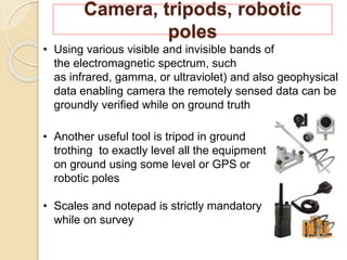
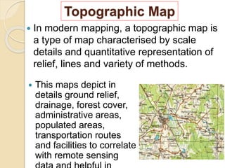
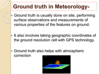
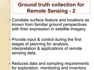
Contents-
 What is Ground Truth ?
 Ground truth collection for remote
sensing.
 Sources of ground truth.
 Ground trothing steps.
 GPS, Workflow of GPS, Radiometer,
Camera and tools, toposheets.
 Realisation of ground truth.
 Conclusion & References.
What is “Ground Truth” ?
 "Ground truth" is a term used in various
fields to refer to information provided by
direct observation (i.e. empirical evidence)
as opposed to information provided by
inference.
 This term is used in statistics and machine
learning that means checking the results of
machine learning for accuracy against the
real world.
 "Ground truth" is a term borrowed from
meteorology for independent confirmation
at a site for information obtained by remote
sensing
Ground truth collection for
Remote sensing -1
 Ground truth is simply observations or
measurements made at or near the
surface of the earth in support of the air or
spaced based remote sensing survey.
 It may also be referred to as ancillary data
or reference data.
 Ground truth may be consist of several
types of data acquired before, during and
after an image acquisition.
Sources of Ground Truth-
 Field observation.
 In situ spectral measurements.
 Aerial reconnaissance and
photography.
 Descriptive reports.
 Inventory tallies.
 Maps.
 Satellite data with various heights.
 Collect physical samples for laboratory
analysis of phenomena detected from
remote sensing data.
 Acquire supplementary non-remote
sensing data for interpretive model
analysis or for integration into Geographic
Information System.
 Develop standard sets of spectral
signatures by using ground based
instruments.
 Measure spectral and other physical
properties needed to stipulate
characteristics and parameters pertinent to
Ground trothing steps-
GPS(Global Positioning System)
 The GPS (Global Positioning
System) is a "constellation" of
approximately 30 well-
spaced satellites that orbit the
Earth and make it possible for
people with ground receivers to
pinpoint their geographic location.
 Using GPS device while ground truth data
collection, can help to determine real-time
location with acquired data that can be merged
both one and relate that actually the collected
data and located data being the same one or
not!
How does GPS work?
 There are three parts to a GPS system: a constellation
of between 24 and 32 solar-powered satellites orbiting
the earth in orbits at an altitude of approximately 20000
km, a master control station and four control and
monitoring stations and GPS receivers.
 The satellites sends microwave signals to a receiver,
these signals to work out ones precise distance from
each of the four satellites and then triangulates ones
exact position on the planet to the nearest based on
these distances.
Radiometer
 A new field radiometer has been developed
as a ground truth equipment for the optical
sensor. As a result of the preliminary
investigation, it has been shown that the
radiometer worked sufficiently well with
enough reliability in spectral measurements.
 Reliability of the radiometer was tested by comparing
the measurement results to the spectra obtained by the
high-resolution spectroradiometer over the same
targets. Using a radiometer the EMR radiation over a
ground can be trothed with sensed data.
Camera, tripods, robotic
poles
• Using various visible and invisible bands of
the electromagnetic spectrum, such
as infrared, gamma, or ultraviolet) and also geophysical
data enabling camera the remotely sensed data can be
groundly verified while on ground truth
• Another useful tool is tripod in ground
trothing to exactly level all the equipment
on ground using some level or GPS or
robotic poles
• Scales and notepad is strictly mandatory
while on survey
Topographic Map
 In modern mapping, a topographic map is
a type of map characterised by scale
details and quantitative representation of
relief, lines and variety of methods.
 This maps depict in
details ground relief,
drainage, forest cover,
administrative areas,
populated areas,
transportation routes
and facilities to correlate
with remote sensing
Ground truth in Meteorology-
 Ground truth is usually done on site, performing
surface observations and measurements of
various properties of the features on ground.
 It also involves taking geographic coordinates of
the ground resolution cell with GPS technology.
 Ground truth also helps with atmospheric
correction
Ground truth collection for
Remote Sensing - 2
 Correlate surface feature and locations as
known from familiar ground perspectives
with their expression in satellite imagery.
 Provide input & control during the first
stages of planning for analysis,
interpretation & applications of remote
sensing data.
 Reduces data and sampling requirements
for exploration, monitoring and inventory
Contd…
 Select test areas for aircraft and other
multistage support missions.
 Identify classes established by
unsupervised classifications.
 Select and categories training sites for
supervised classifications.
 Verify accuracy of classifications by using
quantitative statistical techniques.
 Obtain quantitative estimates relevant to
class distributions
Ground truth and realisation-
 Download of Data-
Choose a most convenient data to study.
 Area of workflow-
Choose experimental ground.
 Data acquisition-
Handle GPS, Radiometer, Scale and tableting
with valid information on ground zero.
 Digitization-
By classification, georeferencing and spectral
studies.
 Results-
Realisation and validation of data with on spot
Behind the “Ground Truth”
 It’s a fact that ‘Remote sensing is non
sense without ground truth’. From every
purpose of data validation its hardly
recommend to ground truth all the
remotely sensed data for best ever
result.
 Errors of commission and Errors of
omission- Ground truthing ensures that the
error matrices have a higher accuracy
percentage than would be the case if no pixels
were ground trothed. The process of ground
truthing helps to ensure that the pixel is
Conclusions-
 More specifically, ground truth may refer to a process in which
a pixel on a satellite image is compared to what is there in reality (at
the present time) in order to verify the contents of the pixel on the
image.
 In the case of a classified image, it allows supervised classification
to help determine the accuracy of the classification performed by
the remote sensing software and therefore minimize errors in the
classification such as errors of commission and errors of omission.
 Ground truth is usually done on site, performing surface
observations and measurements of various properties of the
features of the ground resolution cells that are being studied on the
remotely sensed digital image. It also involves taking geographic
coordinates of the ground resolution cell with GPS technology and
comparing those with the coordinates of the pixel being studied
provided by the remote sensing software to understand and analyse
Reference-
 Wikipedia.org
 Physics.org
 Remote sensing of the environment by
J. R. Jensen
Thanks for paying your
valuable attention…

Commonly used ground truth equipments

  • 2.
    Contents-  What isGround Truth ?  Ground truth collection for remote sensing.  Sources of ground truth.  Ground trothing steps.  GPS, Workflow of GPS, Radiometer, Camera and tools, toposheets.  Realisation of ground truth.  Conclusion & References.
  • 3.
    What is “GroundTruth” ?  "Ground truth" is a term used in various fields to refer to information provided by direct observation (i.e. empirical evidence) as opposed to information provided by inference.  This term is used in statistics and machine learning that means checking the results of machine learning for accuracy against the real world.  "Ground truth" is a term borrowed from meteorology for independent confirmation at a site for information obtained by remote sensing
  • 4.
    Ground truth collectionfor Remote sensing -1  Ground truth is simply observations or measurements made at or near the surface of the earth in support of the air or spaced based remote sensing survey.  It may also be referred to as ancillary data or reference data.  Ground truth may be consist of several types of data acquired before, during and after an image acquisition.
  • 5.
    Sources of GroundTruth-  Field observation.  In situ spectral measurements.  Aerial reconnaissance and photography.  Descriptive reports.  Inventory tallies.  Maps.  Satellite data with various heights.
  • 6.
     Collect physicalsamples for laboratory analysis of phenomena detected from remote sensing data.  Acquire supplementary non-remote sensing data for interpretive model analysis or for integration into Geographic Information System.  Develop standard sets of spectral signatures by using ground based instruments.  Measure spectral and other physical properties needed to stipulate characteristics and parameters pertinent to Ground trothing steps-
  • 7.
    GPS(Global Positioning System) The GPS (Global Positioning System) is a "constellation" of approximately 30 well- spaced satellites that orbit the Earth and make it possible for people with ground receivers to pinpoint their geographic location.  Using GPS device while ground truth data collection, can help to determine real-time location with acquired data that can be merged both one and relate that actually the collected data and located data being the same one or not!
  • 8.
    How does GPSwork?  There are three parts to a GPS system: a constellation of between 24 and 32 solar-powered satellites orbiting the earth in orbits at an altitude of approximately 20000 km, a master control station and four control and monitoring stations and GPS receivers.  The satellites sends microwave signals to a receiver, these signals to work out ones precise distance from each of the four satellites and then triangulates ones exact position on the planet to the nearest based on these distances.
  • 9.
    Radiometer  A newfield radiometer has been developed as a ground truth equipment for the optical sensor. As a result of the preliminary investigation, it has been shown that the radiometer worked sufficiently well with enough reliability in spectral measurements.  Reliability of the radiometer was tested by comparing the measurement results to the spectra obtained by the high-resolution spectroradiometer over the same targets. Using a radiometer the EMR radiation over a ground can be trothed with sensed data.
  • 10.
    Camera, tripods, robotic poles •Using various visible and invisible bands of the electromagnetic spectrum, such as infrared, gamma, or ultraviolet) and also geophysical data enabling camera the remotely sensed data can be groundly verified while on ground truth • Another useful tool is tripod in ground trothing to exactly level all the equipment on ground using some level or GPS or robotic poles • Scales and notepad is strictly mandatory while on survey
  • 11.
    Topographic Map  Inmodern mapping, a topographic map is a type of map characterised by scale details and quantitative representation of relief, lines and variety of methods.  This maps depict in details ground relief, drainage, forest cover, administrative areas, populated areas, transportation routes and facilities to correlate with remote sensing
  • 12.
    Ground truth inMeteorology-  Ground truth is usually done on site, performing surface observations and measurements of various properties of the features on ground.  It also involves taking geographic coordinates of the ground resolution cell with GPS technology.  Ground truth also helps with atmospheric correction
  • 13.
    Ground truth collectionfor Remote Sensing - 2  Correlate surface feature and locations as known from familiar ground perspectives with their expression in satellite imagery.  Provide input & control during the first stages of planning for analysis, interpretation & applications of remote sensing data.  Reduces data and sampling requirements for exploration, monitoring and inventory
  • 14.
    Contd…  Select testareas for aircraft and other multistage support missions.  Identify classes established by unsupervised classifications.  Select and categories training sites for supervised classifications.  Verify accuracy of classifications by using quantitative statistical techniques.  Obtain quantitative estimates relevant to class distributions
  • 15.
    Ground truth andrealisation-  Download of Data- Choose a most convenient data to study.  Area of workflow- Choose experimental ground.  Data acquisition- Handle GPS, Radiometer, Scale and tableting with valid information on ground zero.  Digitization- By classification, georeferencing and spectral studies.  Results- Realisation and validation of data with on spot
  • 16.
    Behind the “GroundTruth”  It’s a fact that ‘Remote sensing is non sense without ground truth’. From every purpose of data validation its hardly recommend to ground truth all the remotely sensed data for best ever result.  Errors of commission and Errors of omission- Ground truthing ensures that the error matrices have a higher accuracy percentage than would be the case if no pixels were ground trothed. The process of ground truthing helps to ensure that the pixel is
  • 17.
    Conclusions-  More specifically,ground truth may refer to a process in which a pixel on a satellite image is compared to what is there in reality (at the present time) in order to verify the contents of the pixel on the image.  In the case of a classified image, it allows supervised classification to help determine the accuracy of the classification performed by the remote sensing software and therefore minimize errors in the classification such as errors of commission and errors of omission.  Ground truth is usually done on site, performing surface observations and measurements of various properties of the features of the ground resolution cells that are being studied on the remotely sensed digital image. It also involves taking geographic coordinates of the ground resolution cell with GPS technology and comparing those with the coordinates of the pixel being studied provided by the remote sensing software to understand and analyse
  • 18.
    Reference-  Wikipedia.org  Physics.org Remote sensing of the environment by J. R. Jensen
  • 19.
    Thanks for payingyour valuable attention…